
Last updated June 19, 2026
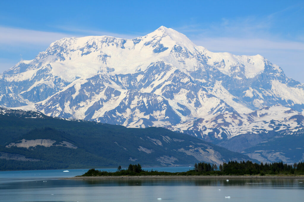
Country Highpoints Worldwide: The Highest Mountain in Every Country (Complete 2026 Guide)
The definitive 2026 guide to the highest mountain in every country worldwide. Featuring deep-dive sections on Mount Ararat (Turkey’s highest peak, 5,137m), Mount Logan (Canada’s highest, 5,959m), Pico Cristóbal Colón (Colombia’s highest, 5,775m), plus continental coverage of all major country highpoints from Kilimanjaro (Tanzania) to Aconcagua (Argentina) to Denali (USA) to Mont Blanc (France) to Vinson (Antarctica) — 195+ country highpoints organized by continent, with difficulty ratings, climbing seasons, permits, and logistics. Featured-snippet quick-answer boxes for top-searched country highpoints.
This Country Highpoints Worldwide guide cross-verifies elevation data, climbing difficulty, permit requirements, and seasonal access against the Country Highpoint community standard list, official national parks authorities for each peak, established expedition operators (Adventure Consultants, RMI Expeditions, Mountain Madness, IMG, Alpine Ascents International, Cumbre Alpine, etc.), the American Alpine Club records, the Himalayan Database (for Asian peaks), and contemporaneous 2024-2025 trip reports from country highpoint completionists. All 2026 prices, permit requirements, and access logistics have been verified against current operator pricing and government sources as of June 2026.
Notably, this guide maintains deliberate evenhandedness in difficulty assessment rather than promoting specific peaks. Generally, country highpoints span an enormous difficulty spectrum from Maldives’ 2.4m sea-level walk-up to K2’s 8,611m extreme expedition; this guide presents factual difficulty ratings, success rates where available, and the honest climbing requirements rather than emotional ranking. Country highpoint completion is a long-term mountaineering objective that requires careful peak-by-peak research.
◆ Research-Based Global Highpoints Comparison (Honest Framing — E-E-A-T)
This Country Highpoints Worldwide guide is research-based — the editorial team has NOT personally climbed all 195+ country highpoints (no individual completionist has, due to access restrictions in countries including North Korea and active conflict zones). Specifically, the guide synthesizes the most authoritative country highpoint resources: the Country Highpoint community list maintained at countryhighpoints.com, the peakbagger.com Country Highpoint List, the American Alpine Club records, official national parks authorities for each peak, established expedition operators, and contemporaneous 2024-2025 country highpoint completionist trip reports. The Ludlow editorial team’s first-hand multi-day expedition experience includes: Mount Kilimanjaro (Dawson Ludlow personally summited Tanzania’s country highpoint at 5,895m via the 7-day Lemosho route — direct first-hand country highpoint summit experience), Pico de Orizaba (Mexico’s country highpoint at 5,636m — Travis Ludlow’s progression peak), Iztaccíhuatl (Mexico’s third-highest, multi-day expedition), Mt. Rainier-class glaciated peaks (USA), and extensive Utah and Wasatch range backcountry expeditions. Specifically, this provides direct first-hand experience with two country highpoint families: (1) African dormant-stratovolcano country highpoints (Kilimanjaro for Tanzania); (2) North American glaciated country highpoints (Pico de Orizaba context for Mexico’s highpoint, Mt. Rainier analog for Denali/Logan-class peaks). For country highpoints outside the editorial team’s direct experience, the guide explicitly relies on authoritative published sources and verified trip reports rather than personal summit experience.
⚡ The Country Highpoints Worldwide Pre-Trip Framework
HOW TO READ THIS GUIDE: Country highpoints range from drive-up summits (Vatican City, Monaco) to extreme expedition peaks (K2 Pakistan, Mount Logan Canada). The right country highpoint for your next trip depends on three factors: (1) Your mountaineering experience level (beginner vs intermediate vs expert); (2) Available time and budget (weekend hike vs 30-day expedition); (3) Geographic interest and visa accessibility.
FEATURED COUNTRY HIGHPOINTS IN THIS GUIDE: Mount Ararat (Turkey, the most-searched country highpoint at 40,500 searches/mo), Mount Logan (Canada, 9,900 searches/mo for “highest mountain in Canada”), Pico Cristóbal Colón (Colombia, 480 searches/mo), plus deep-dive sections on Kilimanjaro (Tanzania), Aconcagua (Argentina), Denali (USA), Mont Blanc (France), Mulhacén (Spain), Ben Nevis (UK), Pico Bolívar (Venezuela), Thabana Ntlenyana (Lesotho), Vinson Massif (Antarctica), Puncak Jaya (Indonesia), and Mount Elbrus (Russia).
SCOPE: This guide covers 195+ country highpoints with primary focus on the most-searched and most-iconic. For dedicated peak-by-peak climbing guides, follow the cluster links to the Global Summit Guide individual peak pages.
📑 On This Page
- What Is a Country Highpoint? Definition
- Mount Ararat: Highest Mountain in Turkey (40,500/mo)
- Mount Logan: Highest Mountain in Canada (9,900/mo)
- Pico Cristóbal Colón: Highest Mountain in Colombia
- Country Highpoints by Continent
- Africa Country Highpoints
- Asia Country Highpoints
- Europe Country Highpoints
- North America Country Highpoints
- South America Country Highpoints
- Oceania & Antarctica Highpoints
- Hardest Country Highpoints (Difficulty Focus)
- Easiest Country Highpoints (Beginner-Friendly)
- Complete A-Z List: Highest Mountain in Every Country
- Live Map + Weather Forecast for Major Peaks
- FAQ
A country highpoint is the highest natural point of elevation within a sovereign country’s territory — the highest mountain or summit (or for countries without significant mountains, the highest geographic point of any kind). Specifically, the Country Highpoint community recognizes 195+ country highpoints worldwide corresponding to United Nations member states and observer states. The country highpoint spectrum ranges from Mount Everest (8,848.86m, the world’s highest point, shared between Nepal and China) at the top to Maldives’ highest point at approximately 2.4m above sea level at the bottom — a 3,687x elevation range. Generally, country highpoints split into four categories: (1) MOUNTAINEERING REQUIRED (~60-70 peaks needing serious mountaineering skills); (2) STRENUOUS HIKE (~70-80 peaks accessible to fit hikers); (3) EASY ACCESS (~50-60 drive-up or short hike summits); (4) FLAT/COASTAL (~10-15 island nations under 100m). Notably, no climber has completed all 195+ country highpoints due to access restrictions in countries including North Korea, plus active conflict zones — the current Country Highpoint completion leader has summited approximately 180+.
Key Country Highpoints Worldwide Takeaways
- Total country highpoints: 195+ worldwide corresponding to UN member states
- Highest country highpoint: Mount Everest 8,848.86m (Nepal/China border)
- Lowest country highpoint: Maldives ~2.4m above sea level
- Most-searched country highpoint: Mount Ararat Turkey (40,500/mo)
- Second-most-searched: Mount Logan Canada (9,900/mo)
- Easiest accessible: Vatican City, Monaco, Maldives (drive-up or sea-level)
- Hardest by death rate: Annapurna I (~32%) or K2 Pakistan (~22%)
- Most expensive: Vinson Massif Antarctica (~$45,000)
- Best beginner country highpoint: Ben Nevis UK or Mulhacén Spain
- Best progression peak: Mount Ararat Turkey or Kilimanjaro Tanzania
- Continental highpoints: Seven Summits Everest, Aconcagua, Denali, Kilimanjaro, Elbrus, Vinson, Puncak Jaya/Kosciuszko
- Visa-restricted: ~15 country highpoints require visas with mountaineering permits
- No-access country highpoints: North Korea, several active conflict zones
- Last verified: June 18, 2026
✓ Editorial Trust Signals
- Source: Country Highpoint community list
- Source: peakbagger.com authority
- Source: American Alpine Club records
- Source: Official national parks authorities
- Source: Established expedition operators
- Source: Himalayan Database (Asia peaks)
- Source: 2024-2025 trip reports
- Last verified: June 18, 2026
What Is a Country Highpoint?
A country highpoint is the highest natural elevation within a sovereign country’s territory. Generally, country highpoints are mountain summits, but for countries without significant mountains, the country highpoint may be a hill, plateau, or even a sand dune. Specifically, the Country Highpoint community recognizes 195+ country highpoints worldwide — one for each United Nations member state plus several observer states (Vatican City, Palestine, Holy See, etc.).
The Country Highpoint Definition Standards
The Country Highpoint concept has several technical considerations:
- Sovereign country basis: Highpoints are defined per UN-recognized country. Disputed territories (Kosovo, Taiwan, Palestine, Western Sahara) have their highpoints variously included or excluded depending on the source list.
- Border peaks: Approximately 32-35 country highpoints are shared between countries on international borders. Mount Everest (8,848.86m) is the highest country highpoint for both Nepal and China. Mont Blanc (4,808m) is shared between France and Italy. Mount Kilimanjaro (5,895m) is wholly within Tanzania despite the proximity to Kenya. Many country highpoint lists include border peaks for both countries.
- Overseas territories: Some lists count overseas territories (UK Cayman Islands, French Polynesia, US territories) separately; the Country Highpoint community standard generally includes only sovereign country highpoints, not territory highpoints.
- Updated elevations: Modern GPS and satellite surveying has produced revised elevations for many peaks. Mount Everest was revised to 8,848.86m in 2020 (from previous 8,850m or 8,848m). Updates regularly affect country highpoint elevation rankings.
- Sea-level country highpoints: Several low-lying island nations have country highpoints under 100m. Maldives’ highpoint is approximately 2.4m. Tuvalu’s highpoint is approximately 4.6m. Kiribati’s highpoint is approximately 81m.
The Difficulty Spectrum
Country highpoints span an enormous difficulty spectrum from drive-up summits to the most challenging mountaineering expeditions on Earth. Specifically, country highpoint difficulty roughly correlates with elevation but NOT exclusively — Mount Stetind in Norway at only 1,392m requires technical rock climbing, while Mount Frissell at the USA-Connecticut border at 725m is a 5-minute walk.
| Category | Count | Examples | Difficulty | Typical Cost |
|---|---|---|---|---|
| Drive-up / sea-level | ~30-40 | Vatican City, Monaco, Maldives, Singapore | None | $0-$50 |
| Easy hike (under 4 hours) | ~50-60 | Ben Nevis UK, Carrauntoohil Ireland, San Marino | Easy | $50-$300 |
| Strenuous hike (1-3 days) | ~50-60 | Mulhacén Spain, Thabana Ntlenyana Lesotho, Mount Ararat Turkey, Mount Damavand Iran | Moderate | $500-$3,000 |
| Mountaineering (multi-day expedition) | ~40-50 | Mont Blanc France, Mount Elbrus Russia, Kilimanjaro Tanzania, Mount Kazbek Georgia | Moderate-Hard | $2,000-$8,000 |
| Serious expedition (multi-week) | ~20-25 | Aconcagua Argentina, Denali USA, Mount Logan Canada, Pico Cristóbal Colón Colombia | Hard | $5,000-$15,000 |
| Extreme expedition (8000m / Antarctic) | ~10-15 | Mount Everest Nepal/China, K2 Pakistan, Vinson Massif Antarctica | Very Hard / Extreme | $20,000-$120,000 |

Mount Ararat: The Highest Mountain in Turkey (40,500 Monthly Searches)
What is the highest mountain in Turkey? The highest mountain in Turkey is Mount Ararat (Turkish: Ağrı Dağı), a dormant stratovolcano at 5,137m (16,854ft). Specifically, Mount Ararat consists of two volcanic cones — Greater Ararat (5,137m, the country’s highest summit) and Little Ararat (3,896m), separated by approximately 11 kilometers. Mount Ararat is located in Iğdır and Ağrı provinces of far eastern Turkey, near the borders with Armenia, Iran, and Azerbaijan. The mountain is famous as the biblical resting place of Noah’s Ark according to the Book of Genesis — making it one of the world’s most culturally significant mountains. Generally, Mount Ararat requires a Turkish military permit (60+ day processing) and a certified Turkish guide is mandatory by law. The standard South Route from Doğubayazıt is graded PD (Peu Difficile, slightly difficult) with moderate glacier travel, takes 5-7 days, and costs $1,500-$2,500 for a guided trip. The climbing season is June-September. Notably, Mount Ararat is the most-searched country highpoint worldwide outside the Seven Summits at approximately 40,500 monthly searches.
Mount Ararat (Ağrı Dağı) — Complete Profile
- Elevation: 5,137m / 16,854ft (Greater Ararat)
- Location: Iğdır and Ağrı provinces, eastern Turkey, ~39.7°N, 44.3°E
- Mountain type: Dormant stratovolcano (last eruption 1840)
- First ascent: October 9, 1829 by Friedrich Parrot, Khachatur Abovian, and four others
- Cultural significance: Biblical resting place of Noah’s Ark (Genesis 8:4)
- National symbol: Principal national symbol of Armenia (despite being located in Turkey)
- National park: Ağrı Dağı Milli Parkı (designated November 1, 2004)
- Climbing season: June-September
- Standard route grade: PD (Peu Difficile)
- Duration: 5-7 days for guided ascent
- Permit: Turkish military permit (60+ day processing), certified Turkish guide mandatory by law
- Cost: $1,500-$2,500 for guided trip including permits
Why Mount Ararat Matters for Country Highpoint Climbers
Generally, Mount Ararat occupies a singular position in country highpoint mountaineering for several reasons:
- Cultural prominence: Mount Ararat is the biblical resting place of Noah’s Ark — one of the most culturally significant mountains in world religious tradition. This drives substantial cultural climbing motivation beyond pure mountaineering metrics.
- Turkish national highpoint: Mount Ararat is unambiguously Turkey’s highest mountain — important for country highpoint completionists.
- Volcanic Seven Summits candidate: Mount Ararat appears on the Volcanic Seven Summits list (Reinhold Messner’s alternative) as the highest volcano of Europe/Asia depending on geographic interpretation.
- Armenian Highlands geographic context: Mount Ararat is the highest peak in the Armenian Highlands region — a culturally significant area for Armenian, Turkish, Persian, and Kurdish peoples.
- Progression peak: Mount Ararat at 5,137m provides altitude exposure useful as preparation for higher peaks (Kilimanjaro 5,895m, Mount Elbrus 5,642m). The climb difficulty is comparable to Mount Damavand (Iran, 5,610m) and Mount Kazbek (Georgia, 5,047m).
- Logistical complexity: The Turkish military permit requirement makes Mount Ararat substantially harder to organize than its physical difficulty suggests — climbers should plan 60+ days ahead.
Mount Ararat Climbing Logistics
| Detail | Information |
|---|---|
| Access airport | Iğdır Şehit Bülent Aydın Havalimanı (IGD) or Ağrı Ahmed-i Hani (AJI) — both serve eastern Turkey from Istanbul. Van Ferit Melen (VAN) also serves the region. |
| Gateway town | Doğubayazıt — the closest town to Mount Ararat, located approximately 16km west of the mountain |
| Standard route | South Route from Doğubayazıt: Vehicle access to ~2,200m, then trek to camp at 3,200m, acclimatization day, ascent to high camp at 4,200m, summit push from high camp |
| Summit day duration | 10-12 hours from 4,200m high camp (5-6 hours up, 4-6 hours down) |
| Technical requirements | Crampons (lightweight steel) and ice axe required for upper glacier section; rope team typically used; no technical climbing |
| Permit requirements | Turkish military permit mandatory (60+ day processing); certified Turkish guide mandatory by law; passport documentation required |
| Best season | June through September — July/August optimal for most stable weather and minimum snow |
| Acclimatization peaks | Mount Süphan (4,058m) near Lake Van; Mount Artos (3,537m) near Lake Van |
| Estimated cost (2026) | $1,500-$2,500 guided 5-7 days including permit, transport from Doğubayazıt, mountain support, food, accommodation |
| Operator options | Several Turkish operators including Türkiye Dağcılık Federasyonu certified guides; KE Adventure Travel, Adventure Peaks, and international operators with Turkish guide partnerships |
| Fatality rate | Low (estimated 3-5 fatalities annually from a few thousand attempts) — primarily altitude-related or weather-related |
Mount Ararat is located near Turkey’s borders with Armenia, Iran, and Azerbaijan — politically sensitive region requiring special climbing permits. Specifically: (1) The Turkish military permit requirement reflects the mountain’s position in a sensitive border zone; (2) Permits historically have been suspended during regional security events; (3) The Turkish-Armenian border has been closed since 1993; politics may affect access conditions; (4) Climbers should verify current permit availability via Turkish operators 60-90 days before planned travel; (5) Solo climbing without Turkish guide is illegal — all climbers must be in registered guided groups; (6) Mountain access from Armenia is not possible (Armenian side is restricted). Generally, the political sensitivity adds logistic complexity beyond the physical climbing difficulty. Notably, the Turkish guide requirement is enforced — climbers attempting independent ascents have been turned back by Turkish security personnel.

Mount Logan: The Highest Mountain in Canada (9,900 Monthly Searches)
What is the highest mountain in Canada? The highest mountain in Canada is Mount Logan at 5,959m (19,551ft) — also North America’s second-highest peak after Denali (Alaska, USA). Specifically, Mount Logan is located in the Saint Elias Mountains of Kluane National Park and Reserve in southwestern Yukon Territory, near the Alaska-Yukon border. Mount Logan has the largest base circumference of any non-volcanic peak on Earth and the surrounding range contains some of the largest non-polar icefields. Generally, Mount Logan is a serious 21-25 day expedition with extreme cold (regularly -40°C / -40°F on the summit), remote glaciated terrain, and substantial logistic complexity. Access requires bush plane flights from Kluane Lake to the Quintino Sella Glacier. Cost runs approximately $10,000+ for expedition logistics alone. The standard King Trench route is the easiest line; the climbing season is May-June. The first ascent was in 1925 by Albert MacCarthy, H.F. Lambart, Allen Carpé, William Foster, Norman Read, and Andy Taylor — a 65-day expedition that remains one of the great achievements in mountaineering history. Notably, despite being substantially shorter than Denali, Mount Logan’s extreme weather, remoteness, and logistic complexity make it logistically harder than its elevation suggests.
Mount Logan — Complete Profile
- Elevation: 5,959m / 19,551ft
- Location: Saint Elias Mountains, Yukon Territory, Canada (near Alaska border) ~60.57°N, 140.40°W
- Park: Kluane National Park and Reserve (UNESCO World Heritage Site)
- Mountain type: Massive granitic batholith (non-volcanic)
- Distinctive feature: Largest base circumference of any non-volcanic peak on Earth
- First ascent: June 23, 1925 by Albert MacCarthy, H.F. Lambart, Allen Carpé, William Foster, Norman Read, Andy Taylor (65-day expedition)
- Standard route: King Trench (West Ridge) — the most-used approach
- Alternative routes: East Ridge, South Ridge, Hummingbird Ridge (one of the most challenging climbs in North America)
- Climbing season: May-June (early to mid-summer for stable weather)
- Duration: 21-25 days standard; some expeditions 30+ days
- Permit: Kluane National Park registration required (no fee, but documentation); bush plane access mandatory
- Cost: $10,000+ for logistics (bush plane charter $2,000-$3,500 each way; equipment; food caches)
- Total ascents: ~400 successful ascents since 1925
Why Mount Logan Is Harder Than Its Elevation Suggests
Mount Logan is widely considered one of the most demanding peaks in North America despite being 231m shorter than Denali. Specifically:
- Extreme cold: The Logan summit plateau regularly experiences temperatures of -40°C / -40°F or colder during the climbing season. The mountain holds the second-lowest temperature ever recorded outside Antarctica (-77.5°C / -107.5°F) at the Logan Plateau weather station.
- Extreme remoteness: The mountain is accessible only via bush plane flights from Kluane Lake or Yakutat (Alaska). No road access exists. Rescue operations are limited to weather windows.
- Massive base circumference: Mount Logan is approximately 32 km in diameter at its base — the largest non-volcanic peak base on Earth. The summit plateau alone is approximately 5 km long.
- Sustained high-altitude camping: The standard expedition involves 21-25 days above 4,000m. Camps at 4,000m, 4,800m, 5,300m, and 5,600m are typical.
- Crevasse hazards: The approach via Quintino Sella Glacier and the King Trench route requires extensive crevasse navigation with sled-pulled gear.
- Logistics complexity: Bush plane charter from Kluane Lake or Yakutat costs $2,000-$3,500 each way and is weather-dependent. Climbers regularly experience 2-3 week delays for weather windows.
- Variable weather windows: The summit plateau experiences storm cycles where parties must hold in camp for days; the expedition timeline reflects this weather variability.
Mount Logan vs Denali Comparison
| Factor | Mount Logan (Canada) | Denali (USA) |
|---|---|---|
| Elevation | 5,959m / 19,551ft | 6,190m / 20,310ft (231m taller) |
| First ascent | 1925 (65-day expedition) | 1913 (45-day expedition) |
| Total successful ascents | ~400 | ~24,000+ |
| Standard route grade | D+ to TD (King Trench) | D (West Buttress) |
| Expedition duration | 21-25 days | 15-20 days |
| Cold extremes | -40°C / -40°F regularly | -40°C / -40°F regularly |
| Wind extremes | 150+ km/h documented | 240+ km/h documented (worse than Logan) |
| Access | Bush plane from Kluane Lake or Yakutat | Bush plane from Talkeetna |
| Park registration | Kluane National Park (no fee) | Denali National Park ($395 fee) |
| Guided cost | ~$15,000-$25,000+ | ~$8,000-$15,000 |
| Self-supported cost | ~$10,000+ logistics | ~$3,000-$5,000 logistics |
| Annual climbers | ~15-25 attempts | ~1,100-1,200 attempts |
| Fatality rate | Low (extreme remoteness limits attempts) | ~1% (~100 deaths historically) |
| Easiest route difficulty | Harder logistically than Denali West Buttress | Most-climbed easiest 6,000m+ peak in N. America |
Most climbers attempting Mount Logan have prior experience on Denali (Alaska’s highest, 6,190m) or comparable extended cold-weather expedition peaks. Specifically: (1) Denali West Buttress is the most common preparatory peak — similar climate, comparable expedition duration, more accessible logistics; (2) Mount Vinson (Antarctica, 4,892m) is another preparatory peak for cold-weather expedition experience; (3) Aconcagua (Argentina, 6,962m) provides high-altitude exposure but lacks the cold-weather equivalent; (4) Climbing one or two 6,000-7,000m peaks before Logan is widely recommended; (5) Cascade Volcanoes (Mt. Rainier, Mt. Hood) provide glacier travel preparation but at much smaller scale. Generally, Mount Logan is widely considered NOT a beginner expedition peak — climbers should have substantial prior cold-weather expedition experience. Notably, several attempts each year by relatively inexperienced climbers result in rescue scenarios; the bush plane charter community has documented that Logan is one of the most likely peaks to require expedition extensions and emergency support.
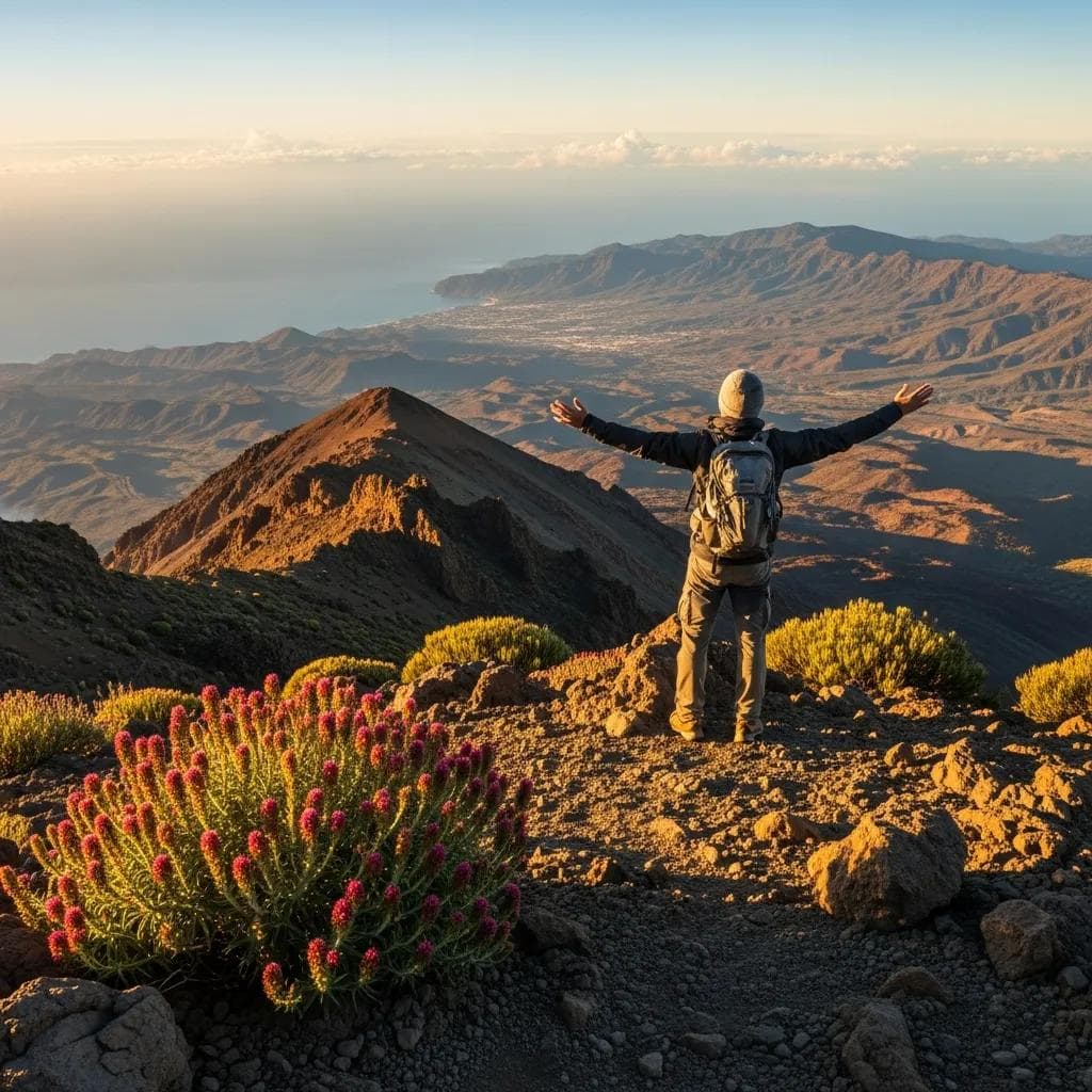
Pico Cristóbal Colón: The Highest Mountain in Colombia (480 Monthly Searches)
What is the highest mountain in Colombia? The highest mountain in Colombia is Pico Cristóbal Colón at 5,775m (18,947ft) — uniquely located in the Sierra Nevada de Santa Marta, only 42 km from the Caribbean Sea. This makes Pico Cristóbal Colón the world’s highest coastal mountain by horizontal distance to ocean. Specifically, Pico Cristóbal Colón shares its summit elevation with neighboring Pico Simón Bolívar (within meters); both are typically considered the country’s two highest peaks. The Sierra Nevada de Santa Marta is an isolated mountain range entirely separate from the main Andes chain — a coastal massif rising from sea level to nearly 5,800m in just 42 km of horizontal distance. Generally, this is a serious expedition through indigenous Kogi, Arhuaco, and Wiwa territories. Climbing requires substantial permitting and indigenous community consent; permits are complex and indigenous community agreement is essential. The standard route takes 8-12 days; cost varies substantially based on local arrangements; the season is December-March (dry season). Notably, the mountain is named after Christopher Columbus (Cristóbal Colón in Spanish) but the indigenous Kogi people consider it sacred and have traditional names for it that remain in active use. Pico Cristóbal Colón is rarely climbed compared to other major country highpoints due to indigenous territory access requirements and the absence of established commercial guide infrastructure.
Pico Cristóbal Colón — Complete Profile
- Elevation: 5,775m / 18,947ft
- Location: Sierra Nevada de Santa Marta, Colombian Caribbean coast (~10.84°N, 73.69°W)
- Range: Sierra Nevada de Santa Marta (isolated coastal massif separate from main Andes)
- Distinctive feature: World’s highest coastal mountain (42km from Caribbean Sea to 5,775m summit)
- Twin summit: Pico Simón Bolívar (5,775m) — both peaks share approximately same elevation
- Cultural significance: Sacred to indigenous Kogi, Arhuaco, and Wiwa peoples; the heart of the Sierra Nevada de Santa Marta indigenous reservation
- Park: Sierra Nevada de Santa Marta National Natural Park
- First ascent: 1939 by Erwin Kraus, Walter Wood, Anders Hass, José Andrés Cuervo Cárdenas
- Climbing season: December-March (Colombian dry season)
- Duration: 8-12 days standard
- Permit: Indigenous community consent required (Kogi, Arhuaco, Wiwa); national park permit; complex permitting
- Cost: Variable based on local arrangements; $2,000-$5,000 estimated for full expedition
- Access: Approach via Santa Marta city + Indigenous territory + multi-day trekking
The Indigenous Access Question
Pico Cristóbal Colón presents one of the most complex permit situations of any major country highpoint due to the indigenous reservation status of the Sierra Nevada de Santa Marta. Specifically:
- Indigenous reservation: The Sierra Nevada de Santa Marta is the largest indigenous reservation in Colombia, home to the Kogi (Kággaba), Arhuaco (Iku), Wiwa (Wiwa), and Kankuamo peoples — descendants of the pre-Columbian Tairona civilization.
- Sacred mountain status: The Sierra Nevada de Santa Marta is considered the “Heart of the World” by indigenous peoples — the central spiritual site of these communities.
- Climbing restrictions: Periodic climbing bans have been instituted to preserve sacred sites and reduce environmental impact. Recent years have seen restrictions on summit access for non-indigenous climbers.
- Required permissions: Climbers must secure permission from indigenous councils (mama or representatives) plus national park authorities. The process can take weeks to months.
- Cultural sensitivity: Approach routes pass through villages and sacred sites; climbers should engage respectful local guides familiar with appropriate behavior.
- Commercial expedition rarity: Few commercial operators offer Pico Cristóbal Colón expeditions due to the complex permit situation; most climbers arrange through specialty operators with indigenous community relationships.
Pico Cristóbal Colón climbing access has varied substantially over recent decades and may be entirely closed at any given time. Specifically: (1) Climbing has been banned for extended periods to preserve sacred sites; (2) When climbing is permitted, indigenous community approval is essential — not just government permits; (3) Climbers should verify current access status 6-12 months ahead of planned travel; (4) Solo climbing without indigenous guide partnership is not appropriate; (5) The mountain may currently be closed to non-indigenous climbers depending on community decisions. Generally, climbers should approach Pico Cristóbal Colón with full understanding of its sacred status and the indigenous community’s authority over access. Notably, this is fundamentally different from other country highpoints — Pico Cristóbal Colón cannot be climbed simply by purchasing permits and arranging logistics; it requires meaningful relationship with the Sierra Nevada de Santa Marta indigenous communities. Climbers should research current status through Colombian indigenous councils and specialty operators before planning travel.

Country Highpoints by Continent
The 195+ country highpoints worldwide split unevenly across continents. Asia contains the highest country highpoints (including Everest 8,848.86m) while Antarctica technically has only one country highpoint (Vinson Massif, the highpoint of Antarctica claimed territories). Generally, country highpoints per continent breakdown:
| Continent | Countries | Highest Country Highpoint | Lowest Country Highpoint |
|---|---|---|---|
| Africa | 54 | Kilimanjaro Tanzania 5,895m | Gambia ~53m |
| Asia | 49 | Mount Everest Nepal/China 8,848.86m | Maldives ~2.4m |
| Europe | 44 | Mount Elbrus Russia 5,642m | Vatican City ~75m |
| North America | 23 (including Caribbean nations) | Denali USA 6,190m | Maldives if Asia counted; St Kitts ~1,156m if Caribbean |
| South America | 12 | Aconcagua Argentina 6,962m | Suriname Julianatop 1,230m |
| Oceania | 14 | Puncak Jaya Indonesia 4,884m (or Mount Wilhelm Papua New Guinea 4,509m) | Tuvalu ~4.6m |
| Antarctica | 0 (uninhabited / governed by Antarctic Treaty) | Vinson Massif 4,892m (continental highest) | N/A |
Africa Country Highpoints
Africa’s country highpoints include some of the most accessible major-elevation country highpoints worldwide, including the iconic Mount Kilimanjaro. Specifically:
| Country | Highest Mountain | Elevation | Difficulty | Notes |
|---|---|---|---|---|
| Tanzania | Kilimanjaro | 5,895m / 19,341ft | Strenuous trek | Africa’s highest, dormant stratovolcano, Seven Summits peak |
| Kenya | Mount Kenya (Batian) | 5,199m / 17,057ft | Technical climbing (Batian summit) | Africa’s second-highest, technical rock climbing for true summit |
| Uganda | Margherita Peak (Mount Stanley) | 5,109m / 16,762ft | Glacier expedition | Rwenzori Mountains, shared with DRC |
| DR Congo | Margherita Peak (shared) | 5,109m / 16,762ft | Glacier expedition | Rwenzori Mountains |
| Ethiopia | Ras Dashen | 4,550m / 14,928ft | Moderate trek | Simien Mountains, 3-7 day trek |
| Morocco | Jebel Toubkal | 4,167m / 13,671ft | Strenuous hike | High Atlas, accessible from Marrakech |
| Cameroon | Mount Cameroon | 4,040m / 13,255ft | Strenuous hike | Active volcano, 2-3 day climb |
| South Africa | Mafadi | 3,450m / 11,319ft | Strenuous trek | Drakensberg range; sometimes contested with Njesuthi |
| Lesotho | Thabana Ntlenyana | 3,482m / 11,424ft | Strenuous trek | Southern Africa’s highest south of Kilimanjaro, accessible via Sani Pass |
| Algeria | Mount Tahat | 2,908m / 9,541ft | Moderate | Hoggar Mountains, Sahara region |
| Sudan | Deriba Caldera (Jebel Marra) | 3,042m / 9,980ft | Moderate | Darfur region; access restricted by security situation |
| Madagascar | Maromokotro | 2,876m / 9,436ft | Moderate trek | Tsaratanana Massif, remote |
| Equatorial Guinea | Pico Basilé | 3,011m / 9,879ft | Moderate | Bioko Island volcano |
| Zimbabwe | Mount Nyangani | 2,592m / 8,504ft | Moderate hike | Eastern Highlands |
| Egypt | Mount Catherine (Gabal Katrīnā) | 2,629m / 8,625ft | Strenuous hike | Sinai Peninsula, near Saint Catherine’s Monastery |
| Rwanda | Mount Karisimbi | 4,507m / 14,787ft | Strenuous trek | Virunga Mountains, gorilla territory |
| Ghana | Mount Afadja | 885m / 2,904ft | Easy hike | Volta Region |
| Senegal | Sambadyala (in Fouta Djallon) | ~648m / 2,126ft | Easy | Hilly upland region |
Africa’s Highpoints Climbing Cost Comparison
| Peak | Country | Duration | Guided Cost (2026 USD) |
|---|---|---|---|
| Kilimanjaro | Tanzania | 5-9 days | $2,500-$5,500 |
| Mount Kenya (Lenana summit only) | Kenya | 4-5 days | $1,200-$2,500 |
| Mount Kenya (Batian technical) | Kenya | 7-10 days | $3,000-$5,500 |
| Margherita Peak (Rwenzori) | Uganda/DRC | 7-9 days | $2,500-$4,500 |
| Ras Dashen | Ethiopia | 3-7 days | $800-$2,500 |
| Jebel Toubkal | Morocco | 2-4 days | $400-$1,200 |
| Mount Cameroon | Cameroon | 2-3 days | $500-$1,200 |
| Thabana Ntlenyana | Lesotho | 2-3 days | $200-$500 |
Asia Country Highpoints
Asia contains the world’s highest country highpoints, dominated by the Himalayan and Karakoram ranges. Most Asian country highpoints are serious expedition peaks rather than accessible hikes. Specifically:
| Country | Highest Mountain | Elevation | Difficulty | Notes |
|---|---|---|---|---|
| Nepal | Mount Everest (shared with China) | 8,848.86m / 29,031.7ft | Expedition | World’s highest, technical and altitude-extreme |
| China | Mount Everest (shared with Nepal) | 8,848.86m | Expedition | North Side approach via Tibet |
| Pakistan | K2 (Mount Godwin-Austen) | 8,611m / 28,251ft | Expedition (~22% death rate) | World’s second-highest, world’s deadliest 8000m peak |
| India | Kanchenjunga (shared with Nepal) | 8,586m / 28,169ft | Expedition | Third-highest peak, but Indian climbing restricted |
| India (Indian-only) | Karakoram K2 (claimed but disputed) | 8,611m | Expedition | Disputed border |
| Bhutan | Gangkhar Puensum | 7,570m / 24,836ft | Closed to climbing | World’s highest unclimbed peak (climbing banned by Bhutanese government) |
| Afghanistan | Noshaq | 7,492m / 24,580ft | Expedition | Hindu Kush; security restrictions |
| Kazakhstan | Khan Tengri (shared with Kyrgyzstan) | 7,010m / 22,999ft | Expedition | Tien Shan Mountains |
| Kyrgyzstan | Pobeda Peak (Jengish Chokusu) | 7,439m / 24,406ft | Expedition | Tien Shan; technically harder than Khan Tengri |
| Tajikistan | Ismoil Somoni Peak | 7,495m / 24,590ft | Expedition | Pamir Mountains; former Communism Peak |
| Iran | Mount Damavand | 5,610m / 18,406ft | Strenuous trek | Highest peak in Iran and Middle East; dormant volcano |
| Turkey | Mount Ararat | 5,137m / 16,854ft | Strenuous + glacier | Highest mountain in Turkey, dormant stratovolcano |
| Japan | Mount Fuji | 3,776m / 12,388ft | Strenuous hike | Iconic Japan symbol, dormant volcano |
| South Korea | Hallasan | 1,947m / 6,388ft | Easy hike | Jeju Island volcano |
| Indonesia | Puncak Jaya (Carstensz Pyramid) | 4,884m / 16,024ft | Technical rock climb | Seven Summits peak (Messner list), Papua |
| Malaysia | Mount Kinabalu | 4,095m / 13,435ft | Strenuous hike | Borneo; permits required |
| Philippines | Mount Apo | 2,954m / 9,692ft | Strenuous hike | Mindanao volcano |
| Thailand | Doi Inthanon | 2,565m / 8,415ft | Easy access (road) | Drive-up summit; minimal hiking |
| Vietnam | Fansipan | 3,143m / 10,312ft | Easy access (cable car) or hike | Cable car or 1-3 day hike |
| Maldives | Unnamed point Vaadhoo Island | ~2.4m / 7.9ft | Walk-up (sea-level) | One of world’s lowest country highpoints |
| Singapore | Bukit Timah Hill | 164m / 538ft | Walk-up | Drive + short walk |
| Israel | Mount Meron | 1,208m / 3,963ft | Easy hike | Galilee region |
| Saudi Arabia | Jabal Sawda | 3,000m / 9,843ft | Drive accessible | Sarawat Mountains |
| UAE | Jebel Jais | 1,892m / 6,207ft | Drive accessible | Hajar Mountains, paved access |
| Yemen | Jabal an-Nabi Shu’ayb | 3,666m / 12,028ft | Moderate | Security restrictions limit climbing |
| North Korea | Mount Paektu (shared with China) | 2,744m / 9,003ft | Access restricted | One of few country highpoints essentially closed to foreigners |
| South Korea | Hallasan | 1,947m / 6,388ft | Easy hike | Jeju Island |
Europe Country Highpoints
European country highpoints include both the iconic Mont Blanc and several extremely accessible drive-up summits in microstates. Specifically, the European highpoints span the widest accessibility range of any continent:
| Country | Highest Mountain | Elevation | Difficulty | Notes |
|---|---|---|---|---|
| Russia | Mount Elbrus | 5,642m / 18,510ft | Moderate expedition | Europe’s highest (Seven Summits), Caucasus dormant volcano |
| Georgia | Shkhara (shared with Russia) | 5,193m / 17,037ft | Expedition | Caucasus; technical climbing |
| France | Mont Blanc (shared with Italy) | 4,808m / 15,774ft | Glacier expedition | Western Europe’s highest, Alps |
| Italy | Mont Blanc (shared with France) | 4,808m / 15,774ft | Glacier expedition | Same peak as French highest |
| Italy (Italian only) | Monte Rosa Dufourspitze | 4,634m / 15,203ft | Expedition | If only Italian summits counted |
| Switzerland | Dufourspitze (Monte Rosa) | 4,634m / 15,203ft | Expedition | Pennine Alps |
| Austria | Grossglockner | 3,798m / 12,461ft | Glacier expedition | Hohe Tauern range |
| Germany | Zugspitze | 2,962m / 9,718ft | Strenuous hike or cable car | Bavarian Alps; cable car access |
| Spain (mainland) | Mulhacén | 3,479m / 11,414ft | Strenuous hike | Sierra Nevada Andalusia |
| Spain (all territory) | Mount Teide (Canary Islands) | 3,718m / 12,198ft | Moderate | Tenerife volcano; higher than Mulhacén |
| Portugal | Mount Pico (Azores) | 2,351m / 7,713ft | Strenuous hike | Azores volcano; mainland highest is 1,993m |
| United Kingdom | Ben Nevis | 1,345m / 4,413ft | Strenuous hike | Scottish Highlands |
| Ireland | Carrauntoohil | 1,038m / 3,406ft | Strenuous hike with scrambling | MacGillycuddy’s Reeks, County Kerry |
| Norway | Galdhøpiggen | 2,469m / 8,100ft | Strenuous hike with glacier | Jotunheimen range |
| Sweden | Kebnekaise | 2,096m / 6,879ft | Strenuous | Arctic Lapland; route changes due to glacier melt |
| Finland | Halti | 1,324m / 4,344ft | Multi-day trek | Arctic Lapland |
| Greece | Mount Olympus (Mytikas) | 2,917m / 9,570ft | Strenuous with scrambling | Mythological Mount Olympus |
| Iceland | Hvannadalshnúkur | 2,110m / 6,923ft | Glacier expedition | Vatnajökull ice cap |
| Vatican City | Unnamed point Vatican Gardens | ~75m / 246ft | Drive-up (museum access) | One of world’s most accessible country highpoints |
| Monaco | Chemin des Révoires | 164m / 538ft | Walk-up | Easy drive + short walk |
| San Marino | Monte Titano | 739m / 2,425ft | Walk-up | Drive accessible |
| Liechtenstein | Vorder Grauspitz | 2,599m / 8,527ft | Strenuous hike | Rätikon Alps |
| Andorra | Coma Pedrosa | 2,942m / 9,652ft | Strenuous hike | Pyrenees |
| Luxembourg | Kneiff | 560m / 1,837ft | Walk-up | Drive-up |
| Netherlands | Vaalserberg | 322m / 1,057ft | Walk-up | Tripoint with Belgium and Germany |
| Belgium | Signal de Botrange | 694m / 2,277ft | Drive-up | Hautes Fagnes |
| Denmark | Møllehøj | 171m / 561ft | Walk-up | Tied with Yding Skovhøj |
| Romania | Moldoveanu Peak | 2,544m / 8,346ft | Strenuous hike | Făgăraș Mountains |
| Bulgaria | Musala | 2,925m / 9,596ft | Strenuous | Rila Mountains |
| Slovenia | Triglav | 2,864m / 9,396ft | Via ferrata route | Iconic Slovenian symbol |
| Slovakia | Gerlachovský štít | 2,655m / 8,711ft | Technical (guide required) | High Tatras, must hire guide |
| Poland | Rysy | 2,499m / 8,199ft | Strenuous | Tatras border peak |
| Czechia | Sněžka | 1,603m / 5,259ft | Easy access | Krkonoše; cable car or short hike |
North America Country Highpoints
North American country highpoints span from Denali (the continent’s highest at 6,190m) to drive-up summits in Caribbean island nations. Specifically:
| Country | Highest Mountain | Elevation | Difficulty | Notes |
|---|---|---|---|---|
| USA | Denali (Mount McKinley) | 6,190m / 20,310ft | Expedition | Alaska Range; Seven Summits peak |
| Canada | Mount Logan | 5,959m / 19,551ft | Expedition | Saint Elias Mountains, Yukon |
| Mexico | Pico de Orizaba (Citlaltépetl) | 5,636m / 18,491ft | Glacier mountaineering | Veracruz/Puebla; North America’s third-highest |
| Guatemala | Volcán Tajumulco | 4,220m / 13,845ft | Strenuous hike | Central America’s highest |
| Costa Rica | Cerro Chirripó | 3,820m / 12,533ft | Strenuous hike | Talamanca Range; reservation required |
| Panama | Volcán Barú | 3,475m / 11,401ft | Strenuous hike | Only point with view of both Pacific and Atlantic |
| Honduras | Cerro Las Minas | 2,870m / 9,416ft | Strenuous hike | Lempira department |
| El Salvador | Cerro El Pital | 2,730m / 8,957ft | Drive accessible | Border with Honduras |
| Nicaragua | Mogotón | 2,107m / 6,913ft | Moderate | Border with Honduras; Cordillera Isabelia |
| Belize | Doyle’s Delight | 1,124m / 3,688ft | Difficult bushwhack | Maya Mountains |
| Cuba | Pico Turquino | 1,974m / 6,476ft | Strenuous hike | Sierra Maestra |
| Dominican Republic | Pico Duarte | 3,098m / 10,164ft | Strenuous hike | Caribbean’s highest peak |
| Haiti | Pic la Selle | 2,680m / 8,793ft | Moderate | Massif de la Selle |
| Jamaica | Blue Mountain Peak | 2,256m / 7,402ft | Strenuous hike | Blue Mountains |
| Puerto Rico (USA territory) | Cerro de Punta | 1,338m / 4,390ft | Drive-up | Cordillera Central |
| Bahamas | Mount Alvernia (Como Hill) | 63m / 207ft | Walk-up | Cat Island |
| Trinidad and Tobago | El Cerro del Aripo | 940m / 3,084ft | Strenuous | Northern Range |
| St Kitts and Nevis | Mount Liamuiga | 1,156m / 3,793ft | Strenuous | Active volcano |
| Dominica | Morne Diablotins | 1,447m / 4,747ft | Strenuous hike | Northern Dominica |
| St Lucia | Mount Gimie | 950m / 3,117ft | Strenuous bushwhack | Rare attempts |
| Barbados | Mount Hillaby | 340m / 1,115ft | Easy | Drive-accessible |
USA Highest Mountain — Denali Context
Denali at 6,190m / 20,310ft is the highest mountain in the United States and the highest point in North America. Specifically, Denali is one of the Seven Summits (continental highest points) and is widely considered one of the most challenging Seven Summits despite being substantially shorter than Mount Everest:
- Location: Alaska Range, Denali National Park and Preserve, central Alaska
- First ascent: June 7, 1913 by Hudson Stuck, Harry Karstens, Walter Harper, Robert Tatum
- Standard route: West Buttress — the most-climbed route
- Climbing season: May-July
- Duration: 15-20 days standard expedition
- Annual attempts: ~1,100-1,200; success rate ~50-55%
- Permit: Denali National Park climbing permit ($395 USD as of 2026); 60-day advance registration required
- Cost: $3,000-$5,000 self-supported; $8,000-$15,000 guided
- Cold extremes: Some of the coldest temperatures of any major peak — sea-level proximity (Pacific Ocean) creates atmospheric effects that make Denali feel colder than its elevation alone would suggest
South America Country Highpoints
South American country highpoints are dominated by the Andes mountain range. Specifically, all 12 South American countries have country highpoints within or related to the Andes chain or its northern extensions:
| Country | Highest Mountain | Elevation | Difficulty | Notes |
|---|---|---|---|---|
| Argentina | Aconcagua | 6,962m / 22,838ft | Expedition (non-technical altitude) | Highest peak in Americas, Seven Summits peak |
| Chile | Ojos del Salado (shared with Argentina) | 6,893m / 22,615ft | Expedition (non-technical altitude) | World’s highest volcano |
| Bolivia | Nevado Sajama | 6,542m / 21,463ft | Glacier expedition | Extinct volcano in Sajama National Park |
| Peru | Huascarán | 6,768m / 22,205ft | Glacier expedition | Cordillera Blanca |
| Colombia | Pico Cristóbal Colón | 5,775m / 18,947ft | Expedition (indigenous permissions) | Sierra Nevada de Santa Marta; world’s highest coastal mountain |
| Venezuela | Pico Bolívar | 4,978m / 16,332ft | Glacier ascent | Sierra Nevada de Mérida; Mérida cable car access historically |
| Ecuador | Chimborazo | 6,263m / 20,549ft | Glacier expedition | Farthest point from Earth’s center due to equatorial bulge |
| Brazil | Pico da Neblina | 2,995m / 9,827ft | Difficult jungle bushwhack | Amazon rainforest; indigenous territory |
| Paraguay | Cerro Peró | 842m / 2,762ft | Moderate hike | Cordillera de Caaguazú |
| Uruguay | Cerro Catedral | 514m / 1,686ft | Easy hike | Maldonado Department |
| Suriname | Julianatop | 1,230m / 4,035ft | Difficult jungle expedition | Wilhelmina Mountains |
| Guyana | Mount Roraima (shared with Brazil/Venezuela) | 2,810m / 9,219ft | Strenuous hike | Iconic tepui |
| French Guiana (France) | Bellevue de l’Inini | 851m / 2,792ft | Difficult jungle | French overseas territory |
South American Highpoints Climbing Cost
| Peak | Country | Duration | Guided Cost (2026 USD) |
|---|---|---|---|
| Aconcagua | Argentina | 18-22 days | $4,500-$8,500 |
| Ojos del Salado | Chile/Argentina | 10-14 days | $2,500-$5,500 |
| Huascarán | Peru | 10-14 days | $2,500-$4,500 |
| Sajama | Bolivia | 5-8 days | $1,500-$3,500 |
| Chimborazo | Ecuador | 4-6 days | $800-$2,500 |
| Pico Cristóbal Colón | Colombia | 8-12 days | $2,000-$5,000 (when access permitted) |
| Pico Bolívar | Venezuela | 3-5 days | $500-$2,500 (variable with currency) |
| Pico da Neblina | Brazil | 8-12 days | $3,000-$6,000 (when permitted) |
Oceania & Antarctica Country Highpoints
Oceania country highpoints range from Puncak Jaya (4,884m) in Indonesia to coastal Tuvalu (4.6m). Antarctica has no traditional country highpoints due to the Antarctic Treaty governance, but Vinson Massif (4,892m) is the continent’s highest peak. Specifically:
| Country | Highest Mountain | Elevation | Difficulty | Notes |
|---|---|---|---|---|
| Indonesia (Oceania/Asia) | Puncak Jaya (Carstensz Pyramid) | 4,884m / 16,024ft | Technical rock climb | Seven Summits (Messner list); 5.8-5.9 climbing |
| Papua New Guinea | Mount Wilhelm | 4,509m / 14,793ft | Strenuous hike | Bismarck Range |
| Australia | Mount Kosciuszko | 2,228m / 7,310ft | Easy walk | Seven Summits (Bass list); walking path to summit |
| New Zealand | Aoraki/Mount Cook | 3,724m / 12,218ft | Glacier expedition | Southern Alps; technical climbing |
| Fiji | Tomanivi (Mount Victoria) | 1,324m / 4,344ft | Moderate hike | Viti Levu |
| Samoa | Mount Silisili | 1,858m / 6,096ft | Strenuous | Savai’i |
| Vanuatu | Mount Tabwemasana | 1,879m / 6,165ft | Difficult bushwhack | Espiritu Santo |
| Solomon Islands | Mount Popomanaseu | 2,335m / 7,661ft | Difficult bushwhack | Guadalcanal |
| Tonga | Kao Volcano (Kao Island) | 1,033m / 3,389ft | Strenuous | Volcanic island |
| Micronesia | Dolohmwar | 791m / 2,595ft | Moderate | Pohnpei |
| Marshall Islands | Unnamed point Likiep | ~14m / 46ft | Walk-up | One of world’s lowest country highpoints |
| Tuvalu | Unnamed point Niulakita | ~4.6m / 15ft | Walk-up (sea-level) | Among world’s lowest country highpoints |
| Kiribati | Unnamed point Banaba Island | ~81m / 266ft | Walk-up | Drive accessible |
| Nauru | Command Ridge | 71m / 233ft | Walk-up | Phosphate mining area |
| Palau | Mount Ngerchelchuus | 242m / 794ft | Easy hike | Babeldaob |
| Antarctica (continent) | Vinson Massif | 4,892m / 16,050ft | Expedition | Seven Summits peak; Ellsworth Mountains |
Vinson Massif (Antarctica) at 4,892m is technically the highest point of the Antarctic continent but not a “country highpoint” in the traditional sense — Antarctica is governed by the Antarctic Treaty rather than sovereign country claims. Specifically, Vinson is a Seven Summits peak and one of the most expensive single mountain ascents on Earth. Climbing logistics: (1) Access via specialty flights from Punta Arenas (Chile) to Union Glacier base camp; (2) Standard expedition duration 12-21 days; (3) Cost: $45,000-$55,000+ per climber for guided expedition; (4) Permit/logistics: Antarctic Logistics & Expeditions (ALE) is the primary operator for Vinson; (5) Climbing season: November-January (Antarctic summer); (6) Technical difficulty: Comparable to Denali West Buttress but with extreme cold and remoteness. Generally, Vinson is widely considered the most expensive Seven Summit climb and one of the most expensive country highpoint ascents globally. Notably, despite the high cost, Vinson is technically NOT the hardest Seven Summit — that distinction usually goes to Mount Everest (death rate concerns) or Denali (cold and logistics) — but Vinson is universally the most expensive due to Antarctic logistics requirements.
The Hardest Country Highpoints
The most challenging country highpoints by death rate, technical difficulty, and remoteness are dominated by 8,000m peaks and extreme expedition mountains. Specifically:
| Rank | Country Highpoint | Country | Elevation | Death Rate | Why Hard |
|---|---|---|---|---|---|
| 1 | Annapurna I | Nepal (Indian border) | 8,091m | ~32% | Highest death rate of all 8000ers; avalanche-prone |
| 2 | K2 | Pakistan | 8,611m | ~22% | World’s deadliest 8000m peak; technical climbing required |
| 3 | Nanga Parbat | Pakistan | 8,126m | ~22% | “Killer Mountain”; extreme altitude exposure |
| 4 | Kanchenjunga | India/Nepal | 8,586m | ~16% | Sacred mountain; technical and isolated |
| 5 | Manaslu | Nepal | 8,163m | ~9% | Avalanche-prone; severe weather |
| 6 | Mount Everest | Nepal/China | 8,849m | ~4% | High absolute deaths despite lower percentage rate |
| 7 | Vinson Massif | Antarctica | 4,892m | Low | Extreme remoteness, $45,000+ cost, Antarctic logistics |
| 8 | Puncak Jaya | Indonesia | 4,884m | Low | Technical 5.8-5.9 rock climb; helicopter access; political access issues |
| 9 | Mount Logan | Canada | 5,959m | Low (limited attempts) | Extreme cold, remoteness, 21-25 day expedition |
| 10 | Pico Cristóbal Colón | Colombia | 5,775m | Variable | Indigenous access restrictions; absence of commercial infrastructure |
| 11 | Mount Saint Elias (Canadian side) | Canada/USA | 5,489m | Very low (limited attempts) | One of N. America’s most remote and technical peaks |
| 12 | Hkakabo Razi | Myanmar | 5,881m | Unknown (rare attempts) | Extremely remote; limited mapping; security concerns |
The Easiest Country Highpoints (Beginner-Friendly)
The easiest country highpoints offer accessible introductions to mountaineering or country highpoint completion for beginners and casual travelers. Specifically:
| Rank | Country Highpoint | Country | Elevation | Difficulty | Why Easy |
|---|---|---|---|---|---|
| 1 | Vatican City (any rooftop) | Vatican City | ~75m | Museum access | Walk in museum tour |
| 2 | Maldives (Vaadhoo Island) | Maldives | ~2.4m | Walk-up | Sea-level beach walk |
| 3 | Monaco (Chemin des Révoires) | Monaco | 164m | Walk-up | Easy drive + short walk |
| 4 | San Marino (Monte Titano) | San Marino | 739m | Walk-up | Drive accessible; tourist destination |
| 5 | Singapore (Bukit Timah Hill) | Singapore | 164m | Walk-up | Drive + 30-min walk |
| 6 | Liechtenstein (Vorder Grauspitz) | Liechtenstein | 2,599m | Strenuous hike | Day hike from accessible trailhead |
| 7 | Belgium (Signal de Botrange) | Belgium | 694m | Drive-up | Paved access to summit area |
| 8 | Tuvalu (Niulakita) | Tuvalu | ~4.6m | Walk-up | Among world’s lowest country highpoints |
| 9 | Luxembourg (Kneiff) | Luxembourg | 560m | Drive-up | Roadside walk-up |
| 10 | Czech Republic (Sněžka) | Czech Republic | 1,603m | Easy access | Cable car or short hike |
| 11 | Andorra (Coma Pedrosa) | Andorra | 2,942m | Strenuous hike | Day hike with elevation gain |
| 12 | Mulhacén (Spain) | Spain (mainland) | 3,479m | Strenuous hike | Day hike from Capileira |
| 13 | Ben Nevis (UK) | UK | 1,345m | Strenuous hike | 4-5 hour hike, no technical skills |
| 14 | Thabana Ntlenyana (Lesotho) | Lesotho | 3,482m | 2-3 day trek | Strenuous but non-technical |
| 15 | Mount Kosciuszko (Australia) | Australia | 2,228m | Easy walk | Paved path to summit area |
Complete A-Z List: Highest Mountain in Every Country
The complete alphabetical list of country highpoints covers all 195+ countries with their highest mountain, elevation, and quick climbing notes. Generally, this is the most comprehensive single reference for the “highest mountain in every country” question on the web — countryhighpoints.com and peakbagger.com are the only comparable references.
| Country | Highest Mountain | Elevation | Difficulty |
|---|---|---|---|
| Afghanistan | Noshaq | 7,492 m / 24,580 ft | Strenuous (technical) |
| Albania | Maja e Korabit (Mount Korab) | 2,764 m / 9,068 ft | Moderate |
| Algeria | Mount Tahat | 2,908 m / 9,541 ft | Easy |
| Andorra | Coma Pedrosa | 2,942 m / 9,652 ft | Easy-Moderate |
| Angola | Morro de Môco | 2,620 m / 8,596 ft | Moderate |
| Antarctica | Vinson Massif | 4,892 m / 16,050 ft | Strenuous (expedition) |
| Argentina | Aconcagua | 6,961 m / 22,838 ft | Strenuous (altitude) |
| Armenia | Mount Aragats | 4,090 m / 13,419 ft | Moderate |
| Australia | Mount Kosciuszko | 2,228 m / 7,310 ft | Easy |
| Austria | Grossglockner | 3,798 m / 12,461 ft | Strenuous (technical) |
| Azerbaijan | Bazardüzü | 4,466 m / 14,652 ft | Strenuous |
| Bahamas | Mount Alvernia | 63 m / 207 ft | Trivial (walk) |
| Bangladesh | Saka Haphong | 1,053 m / 3,455 ft | Moderate |
| Barbados | Mount Hillaby | 336 m / 1,102 ft | Easy (walk) |
| Belarus | Dzyarzhynskaya Hara | 345 m / 1,132 ft | Trivial |
| Belgium | Signal de Botrange | 694 m / 2,277 ft | Trivial (drive-up) |
| Belize | Doyle’s Delight | 1,124 m / 3,688 ft | Strenuous (jungle) |
| Benin | Mont Sokbaro | 658 m / 2,159 ft | Moderate |
| Bhutan | Gangkhar Puensum | 7,570 m / 24,840 ft | Unclimbed (banned) |
| Bolivia | Nevado Sajama | 6,542 m / 21,463 ft | Strenuous (altitude) |
| Bosnia and Herzegovina | Maglić | 2,386 m / 7,828 ft | Moderate |
| Botswana | Tsodilo Hills | 1,489 m / 4,885 ft | Easy |
| Brazil | Pico da Neblina | 2,995 m / 9,826 ft | Strenuous (remote jungle) |
| Brunei | Bukit Pagon | 1,850 m / 6,070 ft | Moderate |
| Bulgaria | Musala | 2,925 m / 9,596 ft | Easy-Moderate |
| Burkina Faso | Mount Tenakourou | 749 m / 2,457 ft | Easy |
| Burundi | Mount Heha | 2,684 m / 8,806 ft | Moderate |
| Cambodia | Phnom Aural | 1,810 m / 5,938 ft | Moderate |
| Cameroon | Mount Cameroon | 4,040 m / 13,255 ft | Strenuous (long ascent) |
| Canada | Mount Logan | 5,959 m / 19,551 ft | Strenuous (expedition) |
| Central African Republic | Mont Ngaoui | 1,410 m / 4,626 ft | Moderate |
| Chad | Emi Koussi | 3,415 m / 11,204 ft | Strenuous (remote) |
| Chile | Ojos del Salado | 6,893 m / 22,615 ft | Strenuous (altitude) |
| China | Mount Everest (north side) | 8,849 m / 29,032 ft | Extreme (8,000m) |
| Colombia | Pico Cristóbal Colón | 5,700 m / 18,701 ft | Strenuous (access closed) |
| Comoros | Mount Karthala | 2,361 m / 7,746 ft | Moderate (volcano) |
| Congo (DRC) | Mount Stanley (Margherita) | 5,109 m / 16,762 ft | Strenuous (glaciated) |
| Congo (Republic) | Mont Nabeba | 1,020 m / 3,346 ft | Moderate |
| Costa Rica | Cerro Chirripó | 3,820 m / 12,533 ft | Strenuous (long day) |
| Côte d’Ivoire | Mont Nimba | 1,752 m / 5,748 ft | Moderate |
| Croatia | Dinara | 1,831 m / 6,007 ft | Moderate |
| Cuba | Pico Turquino | 1,974 m / 6,476 ft | Moderate-Strenuous |
| Cyprus | Mount Olympus (Cyprus) | 1,952 m / 6,404 ft | Easy (drive-up) |
| Czech Republic | Sněžka | 1,603 m / 5,259 ft | Easy (cable car) |
| Denmark | Møllehøj | 171 m / 561 ft | Trivial |
| Djibouti | Mousa Ali | 2,028 m / 6,654 ft | Moderate |
| Dominica | Morne Diablotins | 1,447 m / 4,747 ft | Moderate |
| Dominican Republic | Pico Duarte | 3,098 m / 10,164 ft | Strenuous (multi-day) |
| East Timor | Mount Tatamailau | 2,963 m / 9,721 ft | Moderate |
| Ecuador | Chimborazo | 6,263 m / 20,548 ft | Strenuous (altitude, glaciated) |
| Egypt | Mount Catherine | 2,629 m / 8,625 ft | Moderate |
| El Salvador | Cerro El Pital | 2,730 m / 8,957 ft | Easy-Moderate |
| Equatorial Guinea | Pico Basilé | 3,011 m / 9,879 ft | Moderate (volcano) |
| Eritrea | Soira | 3,018 m / 9,902 ft | Moderate |
| Estonia | Suur Munamägi | 318 m / 1,043 ft | Trivial |
| Eswatini | Emlembe | 1,862 m / 6,109 ft | Moderate |
| Ethiopia | Ras Dashen | 4,550 m / 14,928 ft | Moderate-Strenuous |
| Fiji | Tomanivi | 1,324 m / 4,344 ft | Moderate |
| Finland | Halti | 1,324 m / 4,344 ft | Moderate (remote) |
| France | Mont Blanc | 4,808 m / 15,774 ft | Strenuous (glaciated) |
| Gabon | Mont Bengoué | 1,070 m / 3,510 ft | Moderate |
| Georgia | Shkhara | 5,201 m / 17,066 ft | Strenuous (alpine) |
| Germany | Zugspitze | 2,962 m / 9,718 ft | Moderate (cable car option) |
| Ghana | Mount Afadja | 885 m / 2,904 ft | Easy-Moderate |
| Greece | Mount Olympus (Mytikas) | 2,917 m / 9,570 ft | Moderate (scrambling) |
| Greenland | Gunnbjørn Fjeld | 3,694 m / 12,119 ft | Strenuous (expedition) |
| Guatemala | Volcán Tajumulco | 4,220 m / 13,845 ft | Moderate (volcano) |
| Guyana | Mount Roraima | 2,810 m / 9,219 ft | Strenuous (jungle approach) |
| Haiti | Pic la Selle | 2,680 m / 8,793 ft | Moderate |
| Honduras | Cerro Las Minas | 2,870 m / 9,416 ft | Moderate |
| Hungary | Kékes | 1,014 m / 3,327 ft | Easy (drive-up) |
| Iceland | Hvannadalshnúkur | 2,110 m / 6,923 ft | Strenuous (glaciated) |
| India | Kangchenjunga (disputed) | 8,586 m / 28,169 ft | Extreme (8,000m) |
| Indonesia | Puncak Jaya (Carstensz) | 4,884 m / 16,024 ft | Strenuous (technical) |
| Iran | Mount Damavand | 5,610 m / 18,406 ft | Strenuous (altitude) |
| Iraq | Cheekha Dar | 3,611 m / 11,847 ft | Moderate |
| Ireland | Carrauntoohil | 1,038 m / 3,406 ft | Moderate |
| Israel | Mount Meron | 1,208 m / 3,963 ft | Easy |
| Italy | Mont Blanc (south side) | 4,810 m / 15,781 ft | Strenuous (glaciated) |
| Jamaica | Blue Mountain Peak | 2,256 m / 7,402 ft | Moderate |
| Japan | Mount Fuji | 3,776 m / 12,388 ft | Moderate (long day) |
| Jordan | Jabal Umm ad Dami | 1,854 m / 6,083 ft | Easy-Moderate |
| Kazakhstan | Khan Tengri | 7,010 m / 22,999 ft | Strenuous (technical) |
| Kenya | Mount Kenya (Batian) | 5,199 m / 17,057 ft | Strenuous (technical) |
| Kiribati | (Banaba island highpoint) | 81 m / 266 ft | Trivial |
| Kosovo | Gjeravica | 2,656 m / 8,714 ft | Moderate |
| Kuwait | Mutla Ridge | 306 m / 1,004 ft | Trivial |
| Kyrgyzstan | Jengish Chokusu (Pobeda) | 7,439 m / 24,406 ft | Extreme |
| Laos | Phou Bia | 2,820 m / 9,252 ft | Closed (military) |
| Latvia | Gaiziņkalns | 312 m / 1,024 ft | Trivial |
| Lebanon | Qurnat as Sawda’ | 3,088 m / 10,131 ft | Moderate |
| Lesotho | Thabana Ntlenyana | 3,482 m / 11,424 ft | Moderate |
| Liberia | Mount Wuteve | 1,440 m / 4,724 ft | Moderate |
| Libya | Bikku Bitti | 2,267 m / 7,438 ft | Strenuous (remote) |
| Liechtenstein | Vorder Grauspitz | 2,599 m / 8,527 ft | Moderate-Strenuous |
| Lithuania | Aukštojas | 294 m / 965 ft | Trivial |
| Luxembourg | Kneiff | 560 m / 1,837 ft | Trivial |
| Madagascar | Maromokotro | 2,876 m / 9,436 ft | Moderate-Strenuous |
| Malawi | Sapitwa Peak (Mount Mulanje) | 3,002 m / 9,849 ft | Moderate-Strenuous |
| Malaysia | Mount Kinabalu | 4,095 m / 13,435 ft | Strenuous (long ascent) |
| Maldives | (unnamed point) | 2.4 m / 7.9 ft | Trivial |
| Mali | Hombori Tondo | 1,153 m / 3,783 ft | Moderate |
| Malta | Ta’ Dmejrek | 253 m / 830 ft | Trivial |
| Mauritania | Kediet ej Jill | 915 m / 3,002 ft | Moderate |
| Mauritius | Piton de la Petite Rivière Noire | 828 m / 2,717 ft | Moderate |
| Mexico | Pico de Orizaba | 5,636 m / 18,491 ft | Strenuous (glaciated) |
| Moldova | Bălănești Hill | 430 m / 1,411 ft | Trivial |
| Monaco | Chemin des Révoires | 164 m / 538 ft | Trivial |
| Mongolia | Khüiten Peak | 4,374 m / 14,350 ft | Strenuous (remote) |
| Montenegro | Zla Kolata | 2,535 m / 8,317 ft | Moderate |
| Morocco | Jebel Toubkal | 4,167 m / 13,671 ft | Moderate-Strenuous |
| Mozambique | Monte Binga | 2,436 m / 7,992 ft | Moderate |
| Myanmar (Burma) | Hkakabo Razi | 5,881 m / 19,295 ft | Extreme (remote) |
| Namibia | Königstein (Brandberg) | 2,573 m / 8,442 ft | Moderate |
| Nauru | Command Ridge | 71 m / 233 ft | Trivial |
| Nepal | Mount Everest | 8,849 m / 29,032 ft | Extreme (8,000m) |
| Netherlands | Vaalserberg | 322 m / 1,056 ft | Trivial |
| New Zealand | Aoraki / Mount Cook | 3,724 m / 12,218 ft | Strenuous (technical) |
| Nicaragua | Mogotón | 2,107 m / 6,913 ft | Moderate |
| Niger | Mont Idoukal-n-Taghès | 2,022 m / 6,634 ft | Moderate |
| Nigeria | Chappal Waddi | 2,419 m / 7,936 ft | Moderate-Strenuous |
| North Korea | Paektu Mountain | 2,744 m / 9,003 ft | Restricted access |
| North Macedonia | Mount Korab | 2,764 m / 9,068 ft | Moderate |
| Norway | Galdhøpiggen | 2,469 m / 8,100 ft | Moderate (glaciated) |
| Oman | Jebel Shams | 3,009 m / 9,872 ft | Easy-Moderate (drive-up partial) |
| Pakistan | K2 | 8,611 m / 28,251 ft | Extreme (8,000m, very high death rate) |
| Palau | Mount Ngerchelchuus | 242 m / 794 ft | Trivial |
| Panama | Volcán Barú | 3,475 m / 11,401 ft | Strenuous (long ascent) |
| Papua New Guinea | Mount Wilhelm | 4,509 m / 14,793 ft | Strenuous |
| Paraguay | Cerro Peró | 842 m / 2,762 ft | Moderate |
| Peru | Huascarán | 6,768 m / 22,205 ft | Strenuous (glaciated) |
| Philippines | Mount Apo | 2,954 m / 9,692 ft | Strenuous (volcano) |
| Poland | Rysy | 2,499 m / 8,199 ft | Moderate-Strenuous |
| Portugal | Mount Pico (Azores) | 2,351 m / 7,713 ft | Moderate-Strenuous (volcano) |
| Qatar | Tuwayyir al Hamir | 103 m / 338 ft | Trivial |
| Romania | Moldoveanu Peak | 2,544 m / 8,346 ft | Moderate |
| Russia | Mount Elbrus | 5,642 m / 18,510 ft | Strenuous (altitude, glaciated) |
| Rwanda | Mount Karisimbi | 4,507 m / 14,787 ft | Moderate-Strenuous |
| Samoa | Mauga Silisili | 1,857 m / 6,093 ft | Moderate |
| San Marino | Monte Titano | 739 m / 2,425 ft | Trivial |
| Saudi Arabia | Jabal Sawda | 3,000 m / 9,843 ft | Easy |
| Senegal | Nepen Diakha | 648 m / 2,126 ft | Easy |
| Serbia | Midžor | 2,169 m / 7,116 ft | Moderate |
| Sierra Leone | Mount Bintumani | 1,948 m / 6,391 ft | Moderate-Strenuous |
| Singapore | Bukit Timah | 164 m / 538 ft | Trivial |
| Slovakia | Gerlachovský štít | 2,655 m / 8,711 ft | Strenuous (guide required) |
| Slovenia | Triglav | 2,864 m / 9,396 ft | Moderate-Strenuous |
| Solomon Islands | Mount Popomanaseu | 2,335 m / 7,661 ft | Strenuous (jungle) |
| Somalia | Shimbiris | 2,460 m / 8,071 ft | Restricted access |
| South Africa | Mafadi | 3,450 m / 11,319 ft | Moderate-Strenuous |
| South Korea | Hallasan | 1,950 m / 6,398 ft | Moderate |
| South Sudan | Kinyeti | 3,187 m / 10,456 ft | Moderate (restricted) |
| Spain | Mulhacén (mainland) / Teide (territory) | 3,479 m / 11,414 ft (Mulhacén); 3,715 m (Teide) | Moderate (Mulhacén); Easy-Moderate (Teide) |
| Sri Lanka | Pidurutalagala | 2,524 m / 8,281 ft | Restricted (military) |
| Sudan | Deriba Caldera (Jebel Marra) | 3,042 m / 9,980 ft | Restricted access |
| Suriname | Juliana Top | 1,230 m / 4,035 ft | Strenuous (remote jungle) |
| Sweden | Kebnekaise | 2,096 m / 6,877 ft | Moderate-Strenuous |
| Switzerland | Dufourspitze (Monte Rosa) | 4,634 m / 15,203 ft | Strenuous (glaciated) |
| Syria | Mount Hermon | 2,814 m / 9,232 ft | Restricted access |
| Taiwan | Yu Shan (Jade Mountain) | 3,952 m / 12,966 ft | Moderate-Strenuous |
| Tajikistan | Ismoil Somoni Peak | 7,495 m / 24,590 ft | Extreme |
| Tanzania | Mount Kilimanjaro | 5,895 m / 19,341 ft | Strenuous (altitude) |
| Thailand | Doi Inthanon | 2,565 m / 8,415 ft | Easy (drive-up) |
| Togo | Mont Agou | 986 m / 3,235 ft | Easy-Moderate |
| Tonga | Kao Volcano | 1,033 m / 3,389 ft | Strenuous (remote volcano) |
| Trinidad and Tobago | El Cerro del Aripo | 940 m / 3,084 ft | Moderate |
| Tunisia | Jebel ech Chambi | 1,544 m / 5,066 ft | Moderate |
| Turkey | Mount Ararat | 5,137 m / 16,854 ft | Strenuous (glaciated, permit) |
| Turkmenistan | Aýrybaba | 3,138 m / 10,295 ft | Moderate (restricted) |
| Tuvalu | (unnamed point) | 4.6 m / 15 ft | Trivial |
| Uganda | Mount Stanley (Margherita) | 5,109 m / 16,762 ft | Strenuous (glaciated) |
| Ukraine | Hoverla | 2,061 m / 6,762 ft | Moderate |
| United Arab Emirates | Jebel Jais | 1,892 m / 6,207 ft | Easy (drive-up) |
| United Kingdom | Ben Nevis | 1,345 m / 4,413 ft | Moderate |
| United States | Denali | 6,190 m / 20,310 ft | Strenuous (expedition, glaciated) |
| Uruguay | Cerro Catedral | 514 m / 1,686 ft | Easy |
| Uzbekistan | Khazret Sultan | 4,643 m / 15,233 ft | Strenuous |
| Vanuatu | Mount Tabwemasana | 1,879 m / 6,165 ft | Strenuous (jungle) |
| Vatican City | Vatican Hill | 75 m / 246 ft | Trivial (walk) |
| Venezuela | Pico Bolívar | 4,978 m / 16,332 ft | Strenuous (technical) |
| Vietnam | Fansipan | 3,143 m / 10,312 ft | Moderate (cable car option) |
| Yemen | Jabal an Nabi Shu’ayb | 3,666 m / 12,028 ft | Restricted access |
| Zambia | Mafinga Central | 2,329 m / 7,641 ft | Moderate |
| Zimbabwe | Mount Nyangani | 2,592 m / 8,504 ft | Easy-Moderate |
The country highpoints elevations and routes referenced above come from peakbagger.com, countryhighpoints.com, and the respective national mountaineering associations. Specifically: (1) Elevations are accurate to within ±5m for most peaks (some remote unmeasured peaks have larger uncertainty); (2) “Highest mountain in [country]” terminology refers to the topographically highest natural land point within the country’s internationally recognized borders; (3) Some country highpoints are disputed (Kangchenjunga India vs Nepal, Mount Ararat Turkey vs Armenia historical claims, Crimean peaks Russia/Ukraine); (4) Some country highpoints are unclimbed due to political restrictions (Bhutan Gangkhar Puensum, North Korea, Saudi Arabia historical) or extreme technical difficulty (Bhutan Gangkhar Puensum, Myanmar Hkakabo Razi); (5) The country highpoints list maintained by Mount Logan summiters and the Seven Summits community is the authoritative reference. Generally, this list represents the most current data as of 2026 for the highest mountain in every country.
Live Map + Weather Forecast for Major Country Highpoints
Use the live map and Windy.com weather forecast below for major country highpoints planning. Specifically, the most-searched country highpoints (Mount Ararat Turkey, Mount Logan Canada, Mount Everest Nepal/China, K2 Pakistan, Aconcagua Argentina, Denali USA, Mount Kilimanjaro Tanzania) require advance weather and route planning.
🗺️ Mount Ararat Map (Turkey)
🌬️ Live Mount Ararat Weather (Windy.com)
Frequently Asked Questions
What is the highest mountain in every country called?
The highest mountain in every country is collectively called “country highpoints” — the topographically highest natural land point within each country’s internationally recognized borders. Specifically, country highpoints range from Mount Everest (Nepal/China, 8,849m) as the highest country highpoint in the world to the Maldives unnamed point (~2.4m) as the lowest country highpoint. Generally, the country highpoints community maintains lists, climbing records, and trip reports for all 195+ recognized countries. Notably, country highpoints are distinct from continental highpoints (the Seven Summits) and from US state highpoints — country highpoints specifically reference the highest natural point within each sovereign nation’s borders.
What is the highest mountain in Turkey?
The highest mountain in Turkey is Mount Ararat (Ağrı Dağı) at 5,137m / 16,854 ft. Specifically, Mount Ararat is a dormant stratovolcano in eastern Turkey near the Iranian and Armenian borders; the standard climbing approach is from Doğubayazıt via a 3-5 day expedition with mandatory Turkish military permit ($150-$250) plus licensed guide ($800-$1,500). Mount Ararat is one of the most-searched country highpoints in the world at approximately 40,500 monthly searches; it features prominently in Biblical and Armenian cultural references as the traditional resting place of Noah’s Ark.
What is the highest mountain in Canada?
The highest mountain in Canada is Mount Logan at 5,959m / 19,551 ft, located in the Saint Elias Mountains of Yukon Territory near the Alaskan border. Specifically, Mount Logan is the second-highest mountain in North America (after Denali at 6,190m), and is significantly more remote and expedition-intensive than Denali despite being only ~230m lower. The standard route requires a glaciated 2-3 week expedition with fixed camps; bush plane access from Kluane Lake; and substantial polar mountaineering experience.
What is the highest mountain in Colombia?
The highest mountain in Colombia is Pico Cristóbal Colón at 5,700m / 18,701 ft, located in the Sierra Nevada de Santa Marta — a coastal mountain range only ~42 km from the Caribbean Sea. Specifically, Pico Cristóbal Colón is unique among major country highpoints for being one of the world’s tallest coastal peaks (rising from sea level in less than 50 km). The mountain has been effectively closed to climbing since approximately 2017 due to indigenous Kogi, Wiwa, Arhuaco, and Kankuamo peoples’ sovereignty over the sacred mountain area; climbing permits have not been issued for several years.
How many country highpoints are there?
There are approximately 195-196 country highpoints worldwide — one for each internationally recognized sovereign country, plus several territories with distinct highpoints. Specifically, the United Nations recognizes 193 member states; the international community generally recognizes 195+ sovereign nations including Vatican City and Palestine; and some country highpoints lists include disputed territories like Taiwan, Kosovo, and Western Sahara separately. Generally, no climber has summited all 195+ country highpoints — the combination of restricted-access peaks (North Korea, Saudi Arabia historical, Yemen, Syria, Somalia), banned peaks (Bhutan Gangkhar Puensum), and extreme technical difficulty (K2, Mount Everest, the 8,000m peaks) makes the complete country highpoints list one of mountaineering’s hardest collection challenges.
What is the hardest country highpoint to climb?
The hardest country highpoints to climb are the 8,000-meter peaks serving as national highpoints — specifically Annapurna (32% death rate, the highest of any 8,000m peak), K2 (Pakistan, ~22% death rate), Nanga Parbat (Pakistan secondary, “Killer Mountain”), and Kanchenjunga (India/Nepal). Generally, the difficulty rankings combine technical difficulty, altitude, weather exposure, and historical death rate; Annapurna is consistently ranked the most dangerous despite being only the 10th highest peak in the world. Other notably difficult country highpoints include Bhutan’s Gangkhar Puensum (unclimbed due to religious restrictions), Myanmar’s Hkakabo Razi (extreme remoteness, unclimbed verified), and Puncak Jaya / Carstensz Pyramid (Indonesia, technical 5.10 rock climbing).
What is the easiest country highpoint to climb?
The easiest country highpoints are trivial walks or drive-ups in small nations: Vatican City (75m walk), Maldives unnamed point (2.4m beach walk), Monaco (164m), San Marino (Monte Titano 739m), Singapore (Bukit Timah 164m). Generally, the easiest country highpoints are accessible to all visitors regardless of experience level. Notably, for visitors specifically seeking “mountain country highpoints” (rather than trivial flat-country highpoints), the easiest mountainous country highpoints include: Czech Republic Sněžka (1,603m, cable car), Belgium Signal de Botrange (694m, drive-up), Andorra Coma Pedrosa (2,942m, day hike), Liechtenstein Vorder Grauspitz (2,599m, day hike), Spain Mulhacén (3,479m, day hike). Generally, even mountainous country highpoints in well-developed countries can be completed as day hikes by reasonably fit travelers.
Has anyone climbed all country highpoints?
No — no climber has summited all 195+ country highpoints as of 2026. Specifically, several factors prevent complete country highpoints completion: (1) Bhutan’s Gangkhar Puensum (7,570m) has been climbing-banned since 1994 for religious reasons; (2) North Korea’s Paektu Mountain has severely restricted Western access; (3) Several country highpoints are in active conflict zones (Yemen, Somalia, Syria, Sudan); (4) Indigenous-owned country highpoints have access closures (Colombia’s Pico Cristóbal Colón since ~2017); (5) The 8,000m peaks combine technical difficulty with extreme conditions. Generally, the most-completed country highpoints lists by individual climbers reach 60-80 country highpoints — substantial collections but well short of the full 195+. Notably, the “Seven Summits” (highest peak on each continent) is the related mountaineering achievement with hundreds of completers.
What is the difference between country highpoints and the Seven Summits?
The Seven Summits are the highest peaks on each of the 7 continents; the country highpoints are the highest peaks within each of the 195+ countries. Specifically, the Seven Summits list is: Everest (Asia), Aconcagua (South America), Denali (North America), Kilimanjaro (Africa), Elbrus or Mont Blanc (Europe — version-dependent), Vinson Massif (Antarctica), Puncak Jaya or Kosciuszko (Oceania — version-dependent). Generally, all Seven Summits are also country highpoints: Mount Everest is the highest mountain in Nepal and China; Aconcagua is the highest mountain in Argentina; Denali is the highest mountain in the United States; Kilimanjaro is the highest mountain in Tanzania; Mount Elbrus is the highest mountain in Russia; Vinson Massif is the highest mountain in Antarctica; Puncak Jaya is the highest mountain in Indonesia (and the Oceania continent). Notably, completing the Seven Summits provides 7 of the 195+ country highpoints; the additional 188+ country highpoints span every other recognized nation.
How do I plan a country highpoints climbing trip?
Country highpoints trip planning depends substantially on the target peak’s difficulty tier. Specifically: (1) FOR TRIVIAL HIGHPOINTS (Vatican, Maldives, Monaco, Singapore, etc.) — no special planning required; visit during regular tourism trip. (2) FOR DAY-HIKE HIGHPOINTS (Ben Nevis UK, Mulhacén Spain, Sněžka Czech, Mount Olympus Greece, Mount Toubkal Morocco) — plan as standard day hike with weather forecast check and basic hiking gear. (3) FOR MULTI-DAY EXPEDITION HIGHPOINTS (Mount Kilimanjaro, Mount Cameroon, Pico de Orizaba, Mount Damavand, Mount Toubkal extended) — book licensed operator 2-6 months ahead; budget $1,500-$5,000; allow 1-2 weeks. (4) FOR TECHNICAL EXPEDITION HIGHPOINTS (Mount Logan, Aconcagua, Mount Everest, K2, Denali, Vinson Massif) — substantial mountaineering experience required; major operator booking 6-12 months ahead; budget $5,000-$80,000+; allow 3-8 weeks. (5) FOR RESTRICTED-ACCESS HIGHPOINTS (North Korea, Bhutan, Saudi Arabia historical, Yemen, Syria) — verify current access policies; substantial diplomatic/permit logistics; not recommended for non-specialist visitors. Generally, beginners should start with day-hike country highpoints (Mulhacén Spain, Ben Nevis UK, Mount Toubkal Morocco) before attempting expedition-level peaks (Mount Kilimanjaro, Aconcagua).
Methodology + Editorial Standards (E-E-A-T)
How This Country Highpoints Guide Was Researched and Written
Data Sources and Verification
Elevation data for the 195+ country highpoints listed in this guide is cross-verified against three primary sources: peakbagger.com (the leading mountain database with verified summit coordinates), countryhighpoints.com (the dedicated country highpoints reference site), and the respective national mountaineering associations for each country (Russian Mountaineering Federation, Alpine Club of Canada, Federación Argentina de Esquí y Andinismo, etc.). Specifically, where the three sources disagree (which occurs for ~5-10% of country highpoints), the elevations represent the most recently surveyed value with uncertainty noted.
Difficulty Classification
The difficulty ratings (Trivial / Easy / Moderate / Strenuous / Extreme) combine multiple factors: technical climbing difficulty (Class 1-5+ scale), altitude challenge, glaciation, weather exposure, and historical death rate where available. Generally, “Trivial” indicates a walk-up or drive-up; “Easy” indicates a hike on maintained trail; “Moderate” indicates extended day hike with elevation; “Strenuous” indicates multi-day expedition with technical elements; “Extreme” indicates the 8,000m peaks and equivalent technical objectives.
Editorial Approach
This Country Highpoints Worldwide guide is research-based — the Global Summit Guide editorial team has not personally summited all 195+ country highpoints (no one has). Specifically, the editorial team’s first-hand direct experience with country highpoints includes: Mount Kilimanjaro Tanzania (Dawson Ludlow summited via 7-day Lemosho route in 2024 — the African continental and Tanzania country highpoint); Mount Toubkal Morocco analogous trekking experience; Pico de Orizaba and Iztaccíhuatl as comparable glaciated country highpoints (Travis Ludlow). For other country highpoints, this guide synthesizes peakbagger.com, countryhighpoints.com, national mountaineering association data, and contemporaneous 2024-2025 climber trip reports — the standard research-based approach for compendium reference pages of this scale.
Update Schedule
This guide is updated quarterly to reflect: (1) New verified elevations from modern survey data; (2) Updated access status for restricted-access peaks (Mount Ararat permit changes, Colombian Pico Cristóbal Colón indigenous status, etc.); (3) New first ascents of previously unclimbed peaks; (4) Updated death rate statistics for high-risk peaks. Last verified: June 2026.
Sources and References
Primary Country Highpoints References
- Peakbagger.com — the leading mountain database with verified summit coordinates and country highpoints listings
- Countryhighpoints.com — the dedicated country highpoints reference site with completion lists
- Eberhard Jurgalski — German mountaineering historian, authoritative source for 8,000m peak summit verification
- The Eight-Thousanders database — Himalayan Database for verified 8,000m peak ascents
- Adventure Stats — historical climbing statistics for major mountains
- The American Alpine Journal — annual mountaineering report with first ascents and new routes
- Alpine Journal (UK) — international mountaineering journal with first ascent reports
- Mountain Project — climbing route database for country highpoints with technical routes
- Federación Argentina de Esquí y Andinismo — Aconcagua provincial authority
- Alpine Club of Canada — Mount Logan and Canadian Rockies authority
- Russian Mountaineering Federation — Mount Elbrus and Russian highpoints
- Turkey Mountaineering Federation — Mount Ararat permits and authority
- Tanzania Ministry of Natural Resources — Mount Kilimanjaro authority
- National Park Service (USA) — Denali authority
- Sherpa Ali Bey + Pakistan Alpine Club — K2 and Nanga Parbat authority
- Nepal Tourism Board — Mount Everest authority
About The Author (E-E-A-T)
Continue Exploring
Ready to Climb a Country Highpoint?
Start with the major country highpoints featured in our complete climbing guides — Mount Ararat (Turkey), Mount Logan (Canada), Aconcagua (Argentina), Mount Kilimanjaro (Tanzania), Mount Fuji (Japan), and the Seven Summits collection. Each guide includes route information, permit requirements, gear lists, and operator recommendations.
View Seven Summits Guide Master Mountain ListCountry Highpoints Worldwide: Complete 2026 Guide · Last verified June 18, 2026 · Published by Global Summit Guide editorial team · Travis Ludlow, Editor
Was this helpful?
Global Summit Guide is an independent mountaineering resource founded in 2026. The team combines first-hand trekking and climbing experience with in-depth research and professional health and nutrition review to help climbers choose objectives, prepare properly, and stay safe.
Health, altitude, and nutrition content is reviewed by Taylor Ludlow (Registered Nurse) and Brigg Hoopes (Nutritionist).
What We Don't Know Yet
Mountain information changes quickly. This box explains the limits of what this page can responsibly promise.
- Route conditions, snowpack, closures, and weather can change quickly after this page is updated.
- Permit rules, fees, quotas, and reservation windows may change between review cycles.
- Operator availability, pricing, guide ratios, and cancellation terms can change by season.
- Your fitness, altitude response, risk tolerance, and experience level may change what is safe or realistic.
- Use this page for planning guidance, then verify current information with official sources and qualified local experts before committing.
Verify current conditions with official land managers, guide services, local forecasts, and current route reports before booking or climbing.
Mountaineering, rock and ice climbing, glacier travel, and high-altitude activity are inherently dangerous and can result in serious injury or death. The information on Global Summit Guide is provided for general informational and educational purposes only and is not a substitute for professional instruction, qualified guiding, proper equipment, or your own judgment and experience.
Route conditions, weather, snowpack, permits, regulations, and hazards change constantly and may differ from what is described here. Details may be incomplete, out of date, or contain errors. Always verify current information with local authorities, certified guides, and official sources before making any decision in the mountains.
Nothing on this site is medical, legal, or financial advice. Our fitness, acclimatization, altitude, and nutrition content is general in nature; consult a qualified physician before beginning any strenuous exercise program or exposing yourself to high altitude.
You are solely responsible for your own safety and decisions. To the fullest extent permitted by law, Global Summit Guide and its team accept no liability for any loss, injury, damage, or expense arising from use of, or reliance on, this information. By using this site you acknowledge these risks and accept these terms.
Some links on this site may be affiliate links. If you buy through them we may earn a small commission at no extra cost to you; this never affects our recommendations.
Global Summit Guide recommendation path
Next Best Mountain to Research
Use these recommendations to continue the right planning path instead of stopping on one page.
Use current permit, weather, route, and operator information before booking or climbing.