web analytics

Tag: West Buttress route

  • Denali West Buttress Conditions 2026: NPS Permits, Camps, Weather Windows & Recent Climber Reports

    Home · Mountains · Denali · West Buttress Conditions

    Denali West Buttress Conditions 2026: NPS Permits, Camps, Weather Windows & Recent Climber Reports

    Everything you need to know about climbing North America’s highest peak via the West Buttress route in the active 2026 season. NPS permit costs, camp progression from Kahiltna Glacier base camp to 14 Camp and High Camp, current weather windows, recent ranger station reports, and 2026 regulations for the standard route used by 90% of Denali climbers.

    20,310 ft
    Summit Elevation (6,190m)
    May 1
    2026 Season Active
    $450
    2026 NPS Permit (Adult)
    18-24
    Expedition Days (Typical)
    2026 Climbing Season Active May 1 – July 15 · NPS Permit $450 Adult / $350 Under 24 · 60-Day Pre-Registration Required · West Buttress Standard Route · Denali Full Guide →
    Last updated May 24, 2026 — verified for the active 2026 climbing season (May 1 – July 15)

    If you’re planning to climb Denali via the West Buttress this season, you need to understand the current state of the mountain. The 2026 season is currently active. NPS rangers are in their high camps. Several patrols are working the Kahiltna Glacier and the 14,200-foot camp. Climbers are flying in daily from Talkeetna. The peak window opens now and runs through late June. This page covers everything from current NPS permit costs to camp-by-camp conditions, weather patterns, and what climbers should know before flying onto the Kahiltna.

    The 2026 Denali season runs May 1 through approximately July 15. Peak conditions on the West Buttress fall between mid-May and late June, when daylight reaches 20+ hours, temperatures are warmest by Alaska Range standards, and stable high-pressure systems produce the most reliable summit windows. NPS registration for the 2026 season opened January 1, 2026, with the mandatory 60-day pre-registration period enforced strictly. Climbers without permits cannot fly into the Kahiltna Glacier base camp.

    The West Buttress is the standard route on Denali, used by approximately 90% of climbers. The route is technically moderate by world mountaineering standards but the cold, altitude, and self-sufficient logistics make it genuinely difficult. Climbers haul approximately 100-120 pounds of gear, food, and fuel for the entire expedition. The route uses six camps from base camp at 7,200 feet to High Camp at 17,200 feet, with the summit at 20,310 feet (6,190 m).

    Denali West Buttress Live Conditions Snapshot

    Here’s the current state of the West Buttress route as of May 24, 2026, verified against NPS field reports, Talkeetna Ranger Station updates, and recent climber communications.

    2026 Season Status — Updated May 24, 2026

    Climbing Season
    Active. May 1 – July 15, 2026. Peak conditions mid-May to late June. NPS rangers patrolling 14 Camp and 17 Camp.
    Active
    NPS Permit Fee 2026
    $450 USD adults (25+) / $350 USD climbers 24 and under. Plus $15 park entrance fee. Combined total $465 adult.
    Required
    60-Day Pre-Registration
    Mandatory. Two-step process: Pay.gov fee payment + email Special Use Permit application. Non-refundable after Feb 15.
    Required
    Walter Harper Ranger Station
    Mandatory pre-climb orientation in Talkeetna. Climbers pick up Clean Mountain Can (CMC) and receive current conditions briefing.
    Operating
    Bush Plane Access
    K2 Aviation, Talkeetna Air Taxi, Sheldon Air Service flying climbers to Kahiltna Glacier (7,200 ft). Weather-dependent.
    Active
    14 Camp (14,200 ft)
    NPS ranger camp established. Medical tent operational. Standard waypoint for acclimatization. Cell coverage limited but functional.
    Operational
    Fixed Lines (Headwall)
    Installed annually between 14 Camp and 16,200-foot ridge. Critical infrastructure. Verify status with NPS rangers at 14 Camp.
    Installed
    17 Camp / High Camp (17,200 ft)
    Wind-exposed launch point for summit day. Temperatures -30 to 0°F. Most exposed camp on the route.
    Open
    CMC Waste Management
    Mandatory. All climbers issued Clean Mountain Cans at Talkeetna. Human waste packed out from all camps above 14,200 ft.
    Required
    Solo Climbing
    Permitted but strongly discouraged by NPS. Solo climbers face additional scrutiny and required experience verification.
    Discouraged

    Daily NPS updates during the season. The Walter Harper Talkeetna Ranger Station maintains an automated statistics phone line at (907) 733-9127 with current registration numbers and climbing statistics. NPS Field Reports publish updates from patrol rangers at 14 Camp and the high camps. MountainWeather.com aggregates the 7K and 14K weather station telemetry, NWS Denali Climbing Forecasts, and FAA webcam feeds. Climbers should monitor all three sources before flying into the Kahiltna and again before any summit attempt.

    Denali Location & Kahiltna Glacier Live Weather

    Denali sits in the Alaska Range, approximately 150 miles north of Anchorage and 100 miles west of Fairbanks. The West Buttress route begins at the Kahiltna Glacier Base Camp (7,200 ft), reached only by bush plane from Talkeetna (358 ft). Summit coordinates: 63.0692°N, 151.0070°W. The mountain straddles Denali National Park and Preserve, a 6-million-acre wilderness larger than the state of New Hampshire.

    Talkeetna Temp
    Loading…
    Wind
    Conditions
    Tomorrow

    Live weather data from Open-Meteo at Talkeetna (358 ft / 109m), the bush-plane departure point. Kahiltna Glacier (7,200 ft) typically runs 20-30°F colder than Talkeetna. Summit-day temperatures at 20,310 ft average -30 to -40°F with wind chill below -60°F not uncommon. Always cross-reference with the NPS Denali Climbing Forecast and MountainWeather.com before flying in.

    Denali West Buttress At a Glance

    Summit elevation20,310 ft (6,190 m) — North America’s highest peak; one of the Seven Summits
    LocationDenali National Park and Preserve, Alaska Range, Alaska, USA
    Coordinates63.0692°N, 151.0070°W
    RouteWest Buttress — standard route, ~90% of all Denali climbers
    Technical gradeAlaska Grade 2; moderate glacier and snow climbing with sustained altitude and cold exposure
    Total distance~13 miles horizontal; 13,500 ft vertical gain from base camp to summit
    Camps6: Base Camp 7,200 ft → 7,800 → 9,500 → 11,000 → 14,200 (14 Camp) → 17,200 (High Camp) → Summit
    2026 climbing seasonMay 1 – July 15, 2026 (peak: mid-May to late June)
    NPS permit fee 2026$450 USD adults (25+) / $350 USD climbers 24 and under
    Park entrance fee$15 USD per person, valid 7 days
    Combined 2026 fees$465 USD adult / $365 USD under 24
    Registration deadline60 days before climb start; non-refundable after Feb 15
    Expedition length18-24 days from Talkeetna to summit and back
    ApproachTalkeetna → Kahiltna Glacier via bush plane (K2 Aviation, Talkeetna Air Taxi, Sheldon Air Service)
    2026 guided cost$12,900-$19,000 USD (NPS-authorized concessions only)
    Authorized guide concessions7 federally-licensed companies on Denali
    Summit success rate~50% average (range: 28-60%+ by season and weather)
    Guided success rate55-70% typical; better than independent climber average
    Summit-day temperatures-30 to -40°F with wind chill below -60°F not uncommon
    Critical hazardsCrevasses on Kahiltna, Windy Corner, Headwall fixed lines, Autobahn, Denali Pass, Summit Ridge
    Waste managementClean Mountain Cans (CMCs) mandatory; all waste packed out
    Self-sufficient~100-120 lbs of gear, food, fuel per climber for the expedition
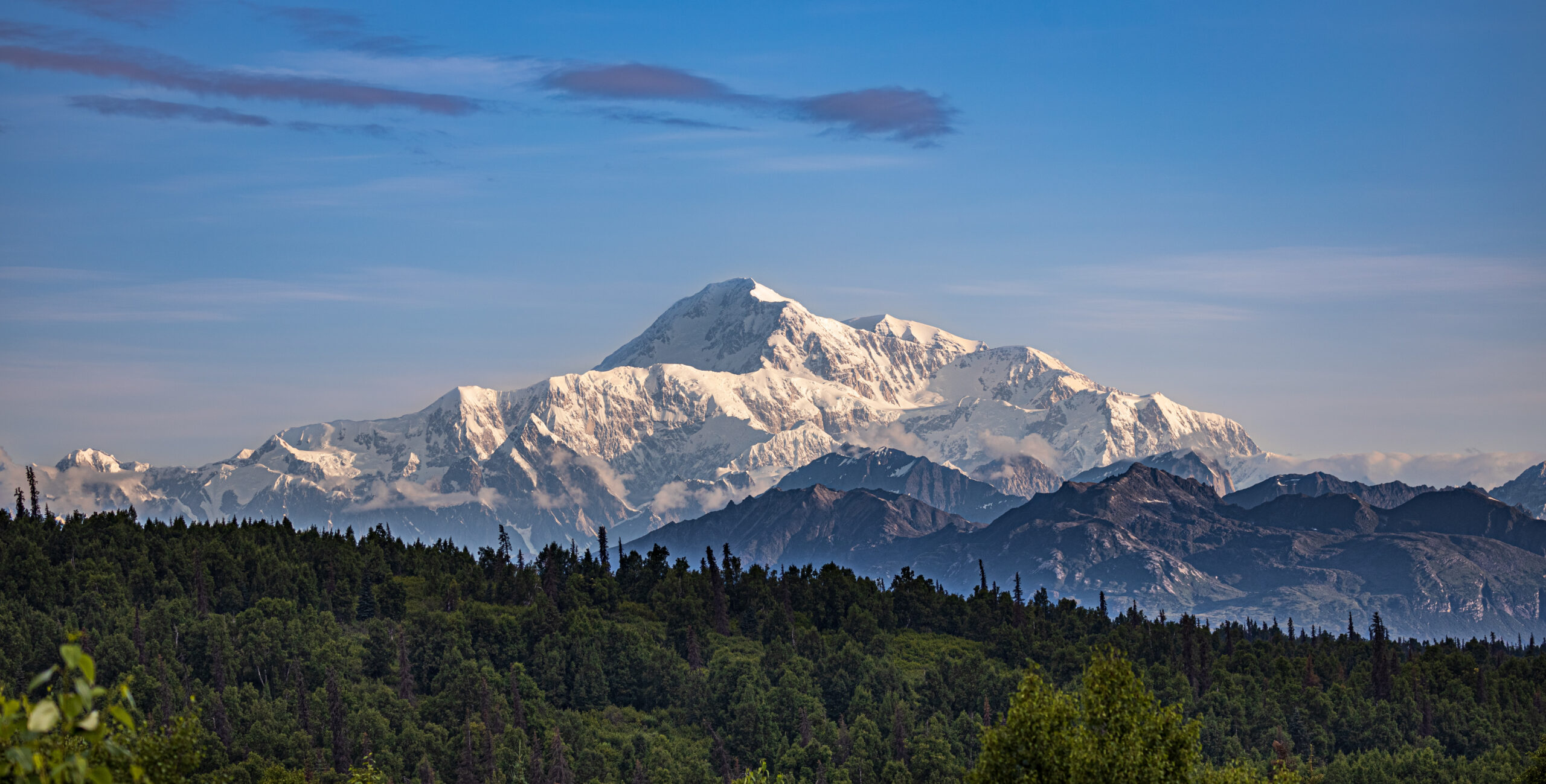
    Denali West Buttress route showing the 20310 foot summit of North America highest peak with Kahiltna Glacier base camp and the climbing route through 14 Camp and High Camp during the active 2026 season
    Denali’s West Buttress route — the standard path used by approximately 90% of climbers attempting North America’s highest peak. The route covers 13 miles horizontal and 13,500 feet of vertical gain through six camps from Kahiltna Glacier Base Camp at 7,200 ft to High Camp at 17,200 ft. The 2026 climbing season is currently active from May 1 through July 15.

    The West Buttress Camp Progression: 7,200 ft to Summit

    The West Buttress uses six camps over 13 miles of horizontal distance, gaining 13,500 vertical feet from the Kahiltna Glacier base camp to the summit. Most expeditions use a carry-and-cache pattern — moving gear progressively higher while climbers acclimatize, sleeping low and carrying high. Here’s the standard camp-by-camp breakdown for the 2026 season.

    CampElevationDistance from BCTypical StayKey Feature
    Base Camp7,200 ft (2,195 m)0 mi1-2 nightsBush plane landing on Kahiltna Glacier
    Camp 1 (Ski Hill)7,800 ft (2,378 m)~4 mi1 nightBase of Ski Hill climb; sled hauling
    Camp 2 (Kahiltna Pass)9,500 ft (2,896 m)~5 mi0-1 night (often skipped)Base of Kahiltna Pass climb
    Camp 3 (Motorcycle Hill)11,000 ft (3,353 m)~7 mi1-2 nightsLast camp before upper mountain
    14 Camp (Genet Basin)14,200 ft (4,328 m)~9 mi4-7 nightsNPS ranger camp + medical tent
    17 Camp (High Camp)17,200 ft (5,242 m)~11 mi1-3 nightsSummit launching point; wind-exposed
    Summit20,310 ft (6,190 m)~13 miSummit day onlyAutobahn → Denali Pass → Summit Ridge

    Below: detailed camp-by-camp breakdown with what to expect at each stop.

    Base Camp — Kahiltna Glacier

    7,200 ft (2,195 m) · ~2-3 days here at start

    The Kahiltna Glacier Base Camp sits at 7,200 feet at the base of the southwest fork of the Kahiltna. Bush planes from Talkeetna (K2 Aviation, Talkeetna Air Taxi, Sheldon Air Service) land here on skis. The base camp has a small NPS ranger presence and a base camp manager who coordinates incoming and outgoing flights. Climbers cache equipment, organize sleds, and prepare for the haul up the glacier. Most teams spend 1-2 nights here before starting the climb. Weather at base camp can shift rapidly — incoming flights are weather-dependent and can delay arrivals by days.

    Camp 1 — Ski Hill

    7,800 ft (2,378 m) · ~4 miles from Base Camp

    Camp 1 sits at the base of “Ski Hill,” a steeper section of the Kahiltna Glacier. The hike from Base Camp follows the southeast fork down to the main Kahiltna Glacier and then up — paradoxically, you lose 1,000 feet from base camp before climbing back up to Camp 1. Climbers haul approximately 60 pounds per person on sleds plus 40-50 pounds in packs. Crevasse risk is high in this section; teams travel roped up at all times.

    Camp 2 — Kahiltna Pass Base

    9,500 ft (2,896 m) · ~5 miles from Base Camp

    Camp 2 sits at the base of Kahiltna Pass, the major climb to the upper mountain. Some teams skip this camp and continue directly to Camp 3 at 11,000 feet. The decision depends on team strength and acclimatization needs. Crevasse risk remains high. Weather windows for this section are reliable in May-June.

    Camp 3 — Motorcycle Hill

    11,000 ft (3,353 m) · ~7 miles from Base Camp

    Camp 3 sits at 11,000 feet just above the steep “Motorcycle Hill” climb. This is the last camp before the major terrain change to the upper mountain. Climbers cache food and equipment here for the descent. Most teams spend 1-2 nights at Camp 3 for acclimatization before continuing. The view from Camp 3 toward Mount Foraker and the Kahiltna becomes one of the route’s iconic visual moments.

    Camp 4 — 14 Camp (Genet Basin)

    14,200 ft (4,328 m) · ~9 miles from Base Camp · NPS ranger camp

    The 14,200-foot camp — commonly called “14 Camp” or “Genet Basin” — is the main acclimatization camp on Denali. The NPS Talkeetna rangers establish a patrol camp here each season with a medical tent, weather station, and emergency communications. Climbers typically spend 4-7 days here for acclimatization, weather waits, and equipment preparation for the upper mountain. 14 Camp has a small wall of snow blocks around individual tent sites for wind protection. Cell coverage is limited but functional with the right networks. Temperatures at 14 Camp range from -20 to 10°F during the climbing season.

    The Headwall & Fixed Lines

    14,200 ft → 16,200 ft · Fixed ropes installed annually

    The Headwall is the steep section between 14 Camp and the West Buttress ridge at 16,200 feet. NPS rangers install fixed ropes here at the start of each season for safety. This is the most technical section of the West Buttress route — 40-45 degree snow and ice with significant exposure. Climbers clip into the fixed lines with ascenders for protection. The Headwall typically takes 4-6 hours to climb from 14 Camp. Most teams do a carry day to High Camp first, then move and sleep at High Camp on a subsequent day.

    Camp 5 — 17 Camp / High Camp

    17,200 ft (5,242 m) · ~11 miles from Base Camp · Summit launching point

    The 17,200-foot camp is the highest established camp on the West Buttress route. Climbers typically spend 1-3 nights here before summit day, waiting for a weather window. High Camp is significantly more wind-exposed than 14 Camp, with sustained winds frequently above 40 mph. Temperatures range from -30 to 0°F. Tent placements are bounded by snow walls for wind protection. Most teams launch their summit attempt from High Camp at 04:00-06:00 depending on weather forecasts.

    Summit Day — Autobahn, Denali Pass, Summit Ridge

    17,200 ft → 20,310 ft · 3,110 ft gain on summit day

    Summit day from High Camp covers several distinct sections. First, the “Autobahn” — a 40-degree slope traverse from 17,200 to 18,200 feet that has been the site of multiple historical fatalities due to climbers sliding on hard snow without crampons engaged. Next, Denali Pass at 18,200 feet, the saddle between the South and North summits of Denali. From Denali Pass, the route ascends gradually to the Football Field at 19,500 feet, then up the final Summit Ridge to the South Summit (the true summit) at 20,310 feet. Total summit day is typically 10-14 hours round trip.

    Denali West Buttress Headwall fixed lines climbing from 14 Camp at 14200 feet to the West Buttress ridge at 16200 feet showing the steep snow and ice section during 2026 climbing season
    The Headwall fixed lines — the most technical section of the West Buttress route. NPS rangers install fixed ropes between 14 Camp (14,200 ft) and the West Buttress ridge (16,200 ft) at the start of each season. Climbers clip into the fixed lines with ascenders for safety on the 40-45 degree snow and ice slope. The Headwall typically takes 4-6 hours to climb from 14 Camp.

    Critical Hazards on the West Buttress

    Despite being the standard route, the West Buttress has multiple dangerous sections that contribute to Denali’s overall fatality history. Climbers should understand each before attempting the route.

    HazardElevationRisk LevelPrimary DangerMitigation
    Kahiltna Crevasses7,200-11,000 ftHighHidden crevasse fallsRope team travel; crevasse rescue gear
    Windy Corner12,500-13,500 ftHigh60+ mph winds; frostbiteCross in morning calm before afternoon winds
    Headwall Fixed Lines14,200-16,200 ftModerateFalls on 40-45° snow/iceProper ascender technique; back up fixed rope
    The Autobahn17,200-18,200 ftCriticalFatal slides on hard snowCrampons engaged; ice axe self-arrest ready
    Denali Pass18,200 ftCritical100+ mph storm windsWeather window discipline; turn back early
    Football Field19,500 ftHighWhiteout disorientationGPS waypoints; team navigation protocols
    Summit Ridge19,500-20,310 ftHighCornice exposure; fallsStay climber’s right of corniced edge
    Frostbite (all camps)14,200+ ftCriticalTissue loss on hands/feetVapor barrier liners; expedition mittens; hand warmers

    Kahiltna Glacier Crevasses

    The Kahiltna Glacier has extensive crevasse fields, particularly in the lower sections between Base Camp and Camp 3. Climbers must travel roped up at all times on the glacier. Late-season climbers (late June, July) face more open crevasses as snow bridges deteriorate from warming temperatures. The 2025 season saw two crevasse rescue events on the Kahiltna; the patterns continue in 2026.

    Windy Corner

    Windy Corner is a notorious wind-channel section between 12,500 and 13,500 feet on the climb from Camp 3 to 14 Camp. Wind speeds frequently exceed 60 mph here, and the section has limited shelter. Climbers traversing Windy Corner in bad weather face exposure that has caused multiple frostbite injuries in recent seasons. Most teams aim to cross Windy Corner in early morning calm before afternoon winds build.

    The Headwall & Fixed Lines

    The Headwall fixed ropes are critical safety infrastructure but require active management. Climbers must clip ascenders correctly, manage rope drag, and avoid creating bottlenecks. The 2025 season saw several falls on the Headwall, most without serious injury due to the fixed line catch. Always back up the fixed rope when conditions allow.

    The Autobahn

    The Autobahn is the traverse from 17,200 to 18,200 feet, named for the dangerous “fast slide” potential. The route crosses a 40-degree snow slope with significant exposure below. Climbers must keep crampons engaged and ice axe in proper self-arrest position. Multiple Denali fatalities have occurred here when climbers slipped on hard wind-packed snow. The section is short — typically 30-45 minutes — but demands focus throughout.

    Denali Pass and the Football Field

    Denali Pass at 18,200 feet sits in a wind tunnel between the South and North summits. Wind speeds here can reach 100+ mph in storm conditions. Multiple climbers have died at or near Denali Pass when caught in unexpected weather changes. The Football Field at 19,500 feet is a broad snow plateau where teams typically pause before the final summit ridge. Weather decisions made here are critical — climbers who continue in marginal weather face descent challenges as conditions deteriorate.

    Summit Ridge

    The final Summit Ridge from the Football Field to the South Summit is exposed on both sides with significant drop-offs. The ridge is typically corniced, requiring careful navigation to stay on the safe (climber’s right) side. Wind exposure here is severe — even on calm summit days, sustained winds of 30-50 mph are common. The final 200-300 feet to the summit demand focus and quick movement.

    Frostbite is the most common Denali injury. The combination of severe cold (-30 to -40°F summit day), high wind, and the inability to safely remove gloves at altitude makes frostbite the leading injury on Denali. The NPS reports frostbite cases nearly every season — most on hands and feet during summit day or descent. Vapor barrier liners in boots, expedition mittens (not gloves) above 14 Camp, and chemical hand warmers as backup are essential. Multiple climbers have lost fingers or toes to Denali frostbite. This is a real risk, not a theoretical one.

    2026 NPS Permits & Registration

    Denali permits are issued by the National Park Service through a strict 60-day pre-registration system. Here’s the current 2026 process.

    2026 Permit Costs

    FeeAdult (25+)Climbers 24 & Under
    Mountaineering Special Use Fee$450 USD$350 USD
    Denali NP Entrance Fee$15 USD$15 USD
    Combined 2026 total$465 USD$365 USD

    Two-Step Registration Process

    The 2026 registration is a two-step process per the current NPS protocol:

    1. Pay.gov fee payment: Pay the Mountaineering Special Use Fee through the official Pay.gov website. The fee is non-refundable after February 15 of your climbing year.
    2. Special Use Permit Application: Submit the Application for Special Use Permit via email to the Talkeetna Ranger Station, including detailed climbing experience, proposed route, group member information, and emergency contacts.

    Both steps must be completed at least 60 days before your intended climb start date. The 60-day rule is strict — climbers attempting to register inside the 60-day window are typically declined. The pre-registration period exists so NPS mountaineering rangers can review applications, contact climbers for any clarifications, and ensure all climbers are properly prepared before they fly into the Kahiltna.

    Walter Harper Talkeetna Ranger Station

    All Denali climbers must check in at the Walter Harper Talkeetna Ranger Station before flying in. The station is named after Walter Harper, the first person to reach the summit of Denali in 1913. Climbers receive a pre-climb orientation, current conditions briefing, and their Clean Mountain Can (CMC) for waste management. The orientation typically takes 30-60 minutes and covers route-specific hazards, current weather patterns, and emergency protocols.

    Guided vs. Independent Climbing

    The NPS authorizes seven mountain guide concessions for Denali. Guided expeditions handle the entire registration and logistics process, including fee payment, permit submission, and pre-climb orientation. Independent climbers complete all steps themselves but pay the same fees. The 2026 guided expedition costs run $12,900-$19,000 USD for the standard 18-24 day West Buttress program. Major operators include RMI Expeditions, International Mountain Guides (IMG), Alpine Ascents International, Mountain Trip, and Mountain Madness.

    Denali Talkeetna bush plane K2 Aviation flight over the Alaska Range delivering 2026 climbers to Kahiltna Glacier base camp at 7200 feet for the West Buttress route ascent
    Bush plane access to Denali — the only way onto the West Buttress route. K2 Aviation, Talkeetna Air Taxi, and Sheldon Air Service fly climbers from Talkeetna (358 ft) to the Kahiltna Glacier base camp (7,200 ft) in approximately 45 minutes. Flights are weather-dependent — climbers should plan 1-3 days of buffer in Talkeetna for flight delays, particularly early in the May season when storms commonly ground bush planes.

    2026 Climbing Season Month-by-Month Conditions

    PeriodConditionsDaylightClimber VolumeBest For
    Late AprilCold; firm snow; minimal crevasses; some rangers arriving~17 hoursMinimal (~50 on mountain)Experienced cold-weather climbers; quiet route
    Early MayStable cold; building climber volume; rangers establish camps~18 hoursBuilding (~200)Cold-tolerant climbers; first season window
    Mid-MayPeak window opens; warmer days; reliable weather~19 hoursHeavy (~400-600)Most climbers; established weather patterns
    Late May – Early JunePrime conditions; longest daylight; warmer camps~20+ hoursMaximum (~600-800)Standard guided expedition window
    Mid-JunePeak window continuing; warmer base camp~20+ hoursMaximum (~600-800)Optimal balance of conditions and crowds
    Late June – Early JulyCrevasses opening; warmer weather; reduced firm snow~20 hoursHeavy (~400-500)Late-season climbers willing to accept softer conditions
    Mid-JulySeason closing; rangers departing; significant crevasses~19 hoursReducing (~100-200)End of season; experienced teams only

    Late May – Mid June 2026: The Sweet Spot

    The May 25 – June 15 window represents the optimal Denali climbing conditions. Daylight reaches its maximum (20+ hours of usable light), temperatures are warmest by Alaska Range standards, weather windows open more frequently than at any other point in the season, and the trail through 14 Camp is well-established by NPS rangers and earlier climbers. Most major guided expeditions schedule departures in this window.

    Mid-June – Early July 2026: Late Window

    Late June and early July offer continued strong conditions but with developing concerns. Crevasses on the lower Kahiltna Glacier open as snow bridges weaken. Temperatures warm enough to make heavy expedition clothing uncomfortable on the lower mountain. The headwall fixed lines see significant wear. NPS ranger patrols begin transitioning out of 14 Camp by July 5-10.

    Mid-July: Season Closing

    By mid-July, the climbing season is effectively over. Most operators have completed their final summit windows. NPS ranger camps are being dismantled. Climbers attempting July ascents face deteriorating snow conditions, increased crevasse exposure, and reduced infrastructure. The official permitting season extends through July 15, but very few climbers attempt summits in the final two weeks.

    Recent Denali Trip Reports & NPS Ranger Updates

    NPS rangers publish field reports throughout the Denali climbing season. These provide ground-truth context for climbers planning trips. Here’s a synthesis of recent patterns relevant to 2026 planning.

    2025 Season Summary

    The 2025 Denali climbing season ran from April 28 (first NPS patrol assembling) through July 12. Total registered climbers: approximately 1,100. Summit success rate for the season: approximately 52%, slightly above the long-term average. The May 24 – June 10 window produced the highest concentration of summits, with several reliable weather windows of 24-72 hours each.

    2025 Ranger Reports — Key Patterns

    • Early May 2025: First NPS West Buttress patrol assembled in Talkeetna on April 28. Rangers reported variable snow conditions with crusts on solar slopes and dry cold snow on north faces.
    • Mid-May 2025: Fixed lines on the Headwall installed by NPS patrols. Trail through Kahiltna established. Crevasse bridges intact.
    • Late May 2025: Upper mountain reported “busy” with approximately 100 climbers ascending to High Camp on multiple days. Fixed line steps improving with use.
    • June 2025: Multiple weather windows produced strong summit numbers. Several frostbite incidents reported on summit day, particularly hands and toes.
    • July 2025: Season winding down. Final NPS patrols departing 14 Camp. Crevasses on Kahiltna opening significantly.

    2026 Pre-Season Observations

    The 2026 NPS season opened with rangers arriving in Talkeetna in late April. The first West Buttress patrol assembled in early May with rangers and VIPs (Volunteers in Park) packing for their upcoming climb. Initial flights to the Kahiltna Glacier began in early May as weather permitted. Climbers booked for early-May start dates faced typical weather delays in Talkeetna; one to three days of waiting for flyable conditions is standard.

    Independent Climber Notes from 2025

    • Cell coverage at 14 Camp: Limited but functional on Verizon and AT&T. Useful for non-emergency communication.
    • Garmin InReach: The standard satellite communicator on Denali. Battery life is the limiting factor at cold temperatures — keep devices warm in inner pockets.
    • Bush plane reliability: K2 Aviation, Talkeetna Air Taxi, and Sheldon Air Service are the primary operators. All three are reliable when weather allows. Plan 1-3 days of buffer in Talkeetna for flight delays.
    • Food caching: Climbers cache food and fuel at each camp for the descent. Cache locations should be marked clearly with wands and GPS coordinates.
    • Equipment failures: The cold breaks gear that performs fine in lower-altitude conditions. Test stoves, sleeping bags, and fuel systems in cold conditions before traveling to Alaska.
    Denali 14 Camp at 14200 feet showing the NPS ranger station Genet Basin tent platforms snow walls and climbers acclimatizing during 2026 climbing season on the West Buttress route
    14 Camp at 14,200 ft (Genet Basin) — the main acclimatization camp on Denali’s West Buttress route. The NPS Talkeetna rangers maintain a patrol camp here with a medical tent, weather station, and emergency communications. Climbers typically spend 4-7 days at 14 Camp acclimatizing before pushing to High Camp at 17,200 ft.

    Required Gear for 2026 Denali West Buttress

    Denali demands the most extensive personal equipment list of any standard climbing route on Earth. Cold, altitude, and self-sufficient logistics make every gear choice consequential. Most guided operators provide group equipment (tents, stoves, ropes); climbers bring their own personal gear.

    Footwear

    ItemSpec / ExampleNotes
    Double mountaineering bootsLa Sportiva G2 SM, Scarpa Phantom 8000, Millet Everest Summit GTX-40°F rated; built-in gaiter
    OverbootsForty Below or similarWarmth multiplier for summit day
    Crampons12-point steelSemi-automatic or step-in binding
    Camp bootiesInsulated down bootiesFor camp evenings
    Expedition socksWool or wool-synthetic blend5-6 pairs minimum
    Liner socksThin syntheticBlister prevention
    Vapor barrier linersRBH Designs or similarReduces sweat → frostbite

    Clothing System

    LayerItemRating / Notes
    BaseTop and bottom (merino or synthetic)2-3 sets
    MidFleece or wool topMid-weight
    Active insulationSynthetic insulated jacket (Patagonia DAS Parka)Working layer for climbing
    Heavy insulationDown parka800-fill, -40°F minimum
    Insulated pantsDown pantsCamp and summit day
    Hardshell jacketGore-Tex ProGenerous cut for layering
    Hardshell pantsFull side-zipFor crampon transitions
    Soft shell pantsSchoeller or similarLower mountain wear
    Hat / balaclava / buffWool or syntheticFrostbite protection
    Gloves (3 pairs)Liner + insulated + expedition mittensMittens -40°F rated
    Chemical warmersHand + toe warmers10-15 pairs minimum

    Technical Equipment

    ItemSpecPurpose
    Ice axe60-70cm general mountaineeringSelf-arrest; cramponing
    Climbing harnessAdjustable leg loopsRope team travel
    HelmetClimbing-ratedRequired on the route
    Ascenders / jumarsPetzl Ascension or similarHeadwall fixed lines
    Trekking polesAdjustable, 3-sectionGlacier travel
    Climbing rope60m half rope per teamUsually group equipment
    Carabiners5-6 locking + 5-6 non-lockingAnchor + rope work
    Prusik cord6mm × 2 lengthsCrevasse self-rescue
    Slings / runners3-4 60cm + 2-3 120cmAnchor building
    Belay deviceATC-Guide or similarRope work
    Snow pickets24″ aluminum2-3 per team (shared)

    Hauling, Camp & Sleeping

    ItemSpecNotes
    Pulk / sledParis Expedition or customFor 60+ lb hauls on lower glacier
    Sled riggingRope + carabiners + drag strapsAttaches sled to harness
    Expedition backpack90-100LUpper mountain (above 14 Camp)
    4-season tentThe North Face VE-25 or similarUsually group equipment
    Sleeping bag-40°F rated (WM Puma, FF Snowy Owl)800+ fill down
    Sleeping pads (2)Closed-cell foam + inflatable insulatedCritical insulation from ground
    StoveWhite gas (MSR XGK EX)Group equipment
    Fuel~0.5 liters per person per dayPlan for 9-12L per climber
    Snow shovel + sawAluminum shovel; collapsible sawBuilding wind walls
    Water bottles (3L total)Insulated NalgenesBladder hoses freeze unreliably
    Wide-mouth pee bottle1L NalgeneTent use during cold nights

    Personal Safety & Required NPS Equipment

    ItemSpecNotes
    Clean Mountain Can (CMC)Issued at Talkeetna Ranger StationNPS mandatory waste pack-out
    Biodegradable bagsProvided with CMCNPS issued
    Headlamp + spare batteriesLithium batteries for cold2 spare battery sets minimum
    Glacier glasses (Cat 4)+ backup pairUV at altitude is severe
    GogglesStorm-ratedWhiteout + summit ridge
    Sunscreen + lip balmSPF 50+ with SPF lip balmReapply throughout day
    First aid kitBlister care, ibuprofen, electrolytes, AMS medsCustomize to team needs
    Diamox / acetazolamide250mg twice daily (typical)Discuss with doctor
    Satellite communicatorGarmin InReach or sat phoneCell signal limited above BC
    NPS Permit + Park Entrance receiptPrint + digital copiesVerify at base camp
    Travel insuranceHigh-altitude rescue coverageHeli-evac coverage essential
    Cash (USD)$200-500Tips, fuel surcharges, emergencies
    Denali expedition gear and equipment laid out at Kahiltna Glacier Base Camp 7200 feet including pulk sleds expedition tents climbing harnesses crampons ice axes and Clean Mountain Cans for the 2026 West Buttress climbing season
    Denali expedition gear staged at Kahiltna Glacier Base Camp (7,200 ft). Climbers haul approximately 100-120 pounds of gear, food, and fuel for the entire 18-24 day expedition. Group equipment (tents, stoves, ropes) is typically split among team members. The pulk sled is essential for the lower-glacier hauls before climbers transition to backpack-only loads above 14 Camp.

    2026 Booking Strategy

    Denali expeditions have a unique booking timeline driven by the 60-day NPS pre-registration rule and the limited authorized guide concessions.

    For Remaining 2026 Season (May-July)

    If you haven’t booked yet for the 2026 season, your options are limited:

    • May 2026 departures: Likely fully booked with authorized guide concessions. NPS 60-day rule eliminates last-minute registrations.
    • Early June 2026: Limited availability with some guide services. Independent climbers can still register if exactly 60 days from start date.
    • Late June 2026: Some availability remaining. Late-season conditions but still within climbing window.
    • Early July 2026: End-of-season departures available. Higher weather risk; reduced infrastructure.

    For 2027 Booking

    Climbers planning 2027 Denali expeditions should:

    • July-September 2026: Research authorized guide concessions, compare itineraries and pricing
    • October 2026: Make initial bookings with deposits to guide services
    • January 2027: NPS registration opens January 1; complete Pay.gov fee payment
    • February 2027: Submit Special Use Permit application; non-refundable after Feb 15
    • March 2027: Complete training requirements; verify gear; book travel to Anchorage
    • May 2027: Travel to Talkeetna for orientation and climb

    The 7 Authorized Guide Concessions

    NPS authorizes seven mountain guide companies to operate on Denali. Climbers wanting guided expeditions must use one of these. The standard list includes RMI Expeditions, International Mountain Guides (IMG), Alpine Ascents International, Mountain Trip, Mountain Madness, NOLS, and AAI/American Alpine Institute. Each operates under specific NPS permits with established itineraries and guide ratios. Independent climbers can climb without a guide service but handle all logistics themselves.

    Denali summit day climbing the Autobahn traverse from High Camp 17200 feet toward Denali Pass with crampons ice axe and expedition gear in -30 degree temperatures during 2026 season
    Summit day on Denali — the Autobahn traverse from High Camp (17,200 ft) toward Denali Pass at 18,200 ft. The 40-degree snow slope has been the site of multiple historical fatalities when climbers slipped without crampons properly engaged. Summit-day temperatures average -30 to -40°F with wind chill below -60°F not uncommon during the 2026 climbing season.

    Frequently Asked Questions About Denali West Buttress Conditions

    When is the 2026 Denali climbing season?

    The 2026 Denali climbing season is currently active, running from approximately May 1 through July 15, 2026. Peak conditions on the West Buttress route fall between mid-May and late June, when daylight is maximum (up to 20+ hours), temperatures are warmest by Alaska Range standards, and stable high-pressure systems produce the most reliable summit windows. NPS registration for the 2026 season opened January 1, 2026, with climbers required to register at least 60 days before their planned start date.

    How much does the Denali permit cost in 2026?

    The 2026 Denali mountaineering permit costs $450 USD for climbers aged 25 and older, or $350 USD for climbers aged 24 and younger. This is the NPS Mountaineering Special Use Fee paid through Pay.gov when you register. Additionally, the Denali National Park entrance fee is $15 per person, valid for 7 days. Combined fees total $465 for adult climbers in 2026. The fee is non-refundable after February 15 of your climbing year. Guided expedition prices range from $12,900 to $19,000 USD for the standard 18-24 day West Buttress program.

    What is the camp progression on the Denali West Buttress route?

    The Denali West Buttress route uses six camps over approximately 13 miles of horizontal distance and 13,500 feet of vertical gain. Camp 1 is the Kahiltna Glacier Base Camp at 7,200 feet, reached by bush plane from Talkeetna. The standard progression then runs to Camp 2 at 7,800 feet (Ski Hill), Camp 3 at 9,500 feet, Camp 4 at 11,000 feet, Camp 5 at 14,200 feet (commonly called 14 Camp), and Camp 6 at 17,200 feet (High Camp). The summit at 20,310 feet sits 3,110 feet above High Camp via the Autobahn, Denali Pass, and Summit Ridge.

    What are current Denali West Buttress weather conditions?

    Base camp temperatures in late May range from -10 to 25°F. The 14,200-foot camp typically runs -20 to 10°F. The 17,200-foot High Camp ranges from -30 to 0°F with significant wind. Summit-day temperatures average -30 to -40°F with wind chill below -60°F not uncommon. Weather windows on Denali open every 5-10 days during the climbing season, lasting 24-72 hours each. The NPS posts daily weather observations from 7K and 14K weather stations. Climbers should have 5-7 days of weather buffer built into their itinerary.

    What is the Denali summit success rate?

    The long-term average across all Denali climbers is approximately 50%, but individual seasons range from 28% (poor weather years) to over 60% (excellent weather years). Guided expeditions typically achieve higher success rates of 55-70% due to experienced leaders, established camp infrastructure, and better weather decision-making. Independent climbers average 35-45% success. The biggest factors in summit success are weather windows, acclimatization quality, and team fitness. Compressed 14-16 day attempts produce lower summit rates than the standard 18-24 day expeditions.

    How long does a Denali expedition take?

    A standard Denali West Buttress expedition runs 18-24 days from Talkeetna to summit and back. Bush flight from Talkeetna to Kahiltna Glacier base camp takes 1-2 days due to weather windows. The climb itself uses a carry-and-cache pattern: 2-4 days from base camp to 14 Camp, 4-7 days at 14 Camp for acclimatization, 1-2 days to High Camp, 1-3 days at High Camp waiting for weather, summit day, and 2-4 days descent back to base camp. Some experienced climbers complete the route in 14-16 days, but this compresses acclimatization and reduces success rates.

    Can I climb Denali without a guide in 2026?

    Yes, independent climbing is permitted on Denali. Unlike some peaks where solo or unguided climbing is banned, Denali allows independent climbers. However, you must complete the full NPS registration process (60-day advance, Pay.gov fee payment, Special Use Permit application), attend the Walter Harper Talkeetna Ranger Station orientation, and follow all NPS regulations including CMC waste management. Solo climbers face additional scrutiny and may need to demonstrate prior high-altitude experience. The NPS strongly discourages solo climbing due to the rescue and self-rescue challenges. Most climbers travel in teams of 2-4 minimum.

    What is the most dangerous part of the West Buttress route?

    Multiple sections of the West Buttress have caused fatalities. The Autobahn — the 40-degree snow traverse from 17,200 to 18,200 feet — has been the site of multiple climber slides resulting in deaths. Denali Pass and the Football Field at 18,200-19,500 feet sit in a wind tunnel where multiple climbers have died caught in unexpected storms. The Kahiltna Glacier crevasses cause injuries throughout the season. The Headwall fixed lines see falls but rarely fatalities. Frostbite is the most common Denali injury due to summit-day cold. Statistically, the Autobahn and Denali Pass area produce the most fatalities per climber-day exposed.

    What fitness do I need to climb Denali?

    Denali demands more sustained fitness than virtually any other guided peak. The standard benchmark: capable of carrying 60-100 pounds for 8-10 hours per day for multiple consecutive days, with strong recovery overnight. Aerobic capacity should support sustained effort at altitude. Most climbers train for 6-12 months before Denali with heavy backpack hikes, weighted stair climbing, and progressive endurance work. Beyond aerobic fitness, climbers need cold tolerance, mental resilience for sustained discomfort, and prior glacier travel experience. Most guide services require climbers to demonstrate prior high-altitude experience (Mount Rainier, Aconcagua, or equivalent) before accepting Denali clients.

    Where do I fly into for Denali?

    The primary airport is Ted Stevens Anchorage International Airport (ANC). From Anchorage, climbers typically drive 2 hours north to Talkeetna, where the Walter Harper Talkeetna Ranger Station and bush plane operators are located. Some climbers fly from Anchorage to Talkeetna via small aircraft instead of driving. From Talkeetna, bush planes operated by K2 Aviation, Talkeetna Air Taxi, and Sheldon Air Service fly climbers to the Kahiltna Glacier base camp at 7,200 feet. The bush plane flight takes approximately 45 minutes and is the only access to the West Buttress route.

    Denali Planning Resources

    Sources & Further Reading

    • National Park Service — Denali National Park & Preserve mountaineering page (nps.gov/dena)
    • Walter Harper Talkeetna Ranger Station — official 2026 climbing registration and conditions
    • Pay.gov — Denali Climbing Registration Form
    • NPS Denali Dispatches — 2025 season field reports and ranger updates
    • Mountain Trip — 2026 pre-trip information and NPS fee documentation
    • RMI Expeditions — Denali permitting regulations and 2025-2026 program details
    • International Mountain Guides (IMGD) — 2026 NPS fee structure and West Buttress program
    • Explore-Share — Denali climbing facts, routes, climate, equipment overview
    • U.S. Highpoint Guide — Denali camp progression and route details
    • Ian Taylor Trekking — 2026 24-day Denali expedition program
    • MesoWest — 7K and 14K weather station telemetry
    • National Weather Service Denali Climbing Forecast
    • MountainWeather.com — Denali weather aggregator
    • FAA webcams — Kahiltna Glacier visibility monitoring
    • Wikipedia — Denali, West Buttress route references

    Last updated: May 24, 2026. Next scheduled update: June 30, 2026 (mid-season conditions verification).

    Planning a 2026 Denali Expedition?

    For the full Denali expedition guide including training plans, complete gear lists, cost breakdowns, and route comparisons, see our pillar guide.

    Read the Full Denali Guide →

    Was this helpful?

    Yes
    No
    Thanks for your feedback!
  • Aconcagua vs Denali: which should you climb after your first 6,000m peak?

    Aconcagua vs Denali: Which Should You Climb After Your First 6,000m Peak? (2026) | Global Summit Guide :root{–pine:#0a1929;–forest:#122a44;–gold:#d4913a;–gold-light:#f5e4c8;–denali-mid:#2e5986;–denali-light:#e8eef5;–ready:#2d6e4e;–caution:#b86a15;–danger:#a83a2b;–stone:#485460;–cream:#fafaf7;–mist:#dde5ee;–snow:#f4f6f9;–aconc:#c97a2b;–denali:#3a6080} *{margin:0;padding:0;box-sizing:border-box} body{font-family:’Outfit’,-apple-system,sans-serif;font-weight:400;color:var(–pine);background:var(–cream);line-height:1.7;font-size:17px} .container{max-width:1200px;margin:0 auto;padding:0 24px} .hero{background:linear-gradient(135deg,var(–pine) 0%,var(–forest) 100%);color:#ffffff;padding:80px 0 60px;position:relative;overflow:hidden} .hero::before{content:”;position:absolute;top:0;right:0;width:380px;height:100%;background:radial-gradient(circle at 70% 30%,rgba(212,145,58,0.15) 0%,transparent 60%)} .eyebrow{font-size:13px;letter-spacing:3px;text-transform:uppercase;color:var(–gold);font-weight:600;margin-bottom:20px;display:inline-flex;align-items:center;gap:14px} .eyebrow::before{content:”;width:42px;height:1px;background:var(–gold)} h1{font-family:’DM Serif Display’,Georgia,serif;font-size:58px;line-height:1.05;font-weight:400;letter-spacing:-0.01em;margin-bottom:30px;max-width:900px;color:#ffffff} h1 .italic{font-style:italic;color:var(–gold)} .hero h1{color:#ffffff}.hero .eyebrow{color:var(–gold)} .byline{display:grid;grid-template-columns:auto 1fr auto;gap:36px;align-items:center;padding-top:32px;border-top:1px solid rgba(255,255,255,0.15);max-width:900px;color:#ffffff} .byline-item{display:flex;flex-direction:column;gap:2px} .byline-label{font-size:11px;letter-spacing:2px;text-transform:uppercase;color:rgba(255,255,255,0.7);font-weight:500} .byline-value{font-size:15px;color:#ffffff;font-weight:500} .hero .byline-label{color:rgba(255,255,255,0.7)}.hero .byline-value{color:#ffffff} .hero-stats{display:grid;grid-template-columns:repeat(4,1fr);gap:0;margin-top:48px;max-width:900px;border-top:1px solid rgba(255,255,255,0.1)} .hero-stat{padding:24px 20px 0;border-right:1px solid rgba(255,255,255,0.1)} .hero-stat:last-child{border-right:none} .hero-stat-num{font-family:’DM Serif Display’,Georgia,serif;font-size:32px;color:var(–gold);font-style:italic;line-height:1;margin-bottom:4px} .hero-stat-label{font-size:11px;letter-spacing:1.5px;text-transform:uppercase;color:rgba(255,255,255,0.75);font-weight:500} .hero .hero-stat-num{color:var(–gold)}.hero .hero-stat-label{color:rgba(255,255,255,0.75)} .hub-strip{background:var(–gold-light);padding:18px 0;border-bottom:1px solid rgba(10,25,41,0.08)} .hub-strip-inner{display:flex;align-items:center;gap:20px;flex-wrap:wrap;font-size:15px} .hub-star{color:var(–gold);font-size:20px} .hub-strip-label{font-size:12px;letter-spacing:2px;text-transform:uppercase;color:var(–stone);font-weight:600} .hub-strip-text{flex:1;min-width:220px;color:var(–pine)} .hub-btn{background:var(–pine);color:#ffffff;padding:10px 22px;border-radius:4px;text-decoration:none;font-weight:600;font-size:14px;letter-spacing:0.5px} .main{display:grid;grid-template-columns:1fr 300px;gap:56px;padding:64px 0 96px} article{min-width:0} h2{font-family:’DM Serif Display’,Georgia,serif;font-size:36px;line-height:1.2;font-weight:400;color:var(–pine);margin:52px 0 22px} h2 .italic{font-style:italic;color:var(–gold)}h2:first-child{margin-top:0} h3{font-family:’DM Serif Display’,Georgia,serif;font-size:24px;line-height:1.3;font-weight:400;color:var(–pine);margin:32px 0 14px} h4{font-size:17px;font-weight:600;color:var(–pine);margin:22px 0 10px} p{margin-bottom:18px;color:#1f2e40} .lead{font-size:20px;line-height:1.55;color:#263849;font-weight:400;margin-bottom:30px;padding-bottom:30px;border-bottom:1px solid var(–mist)} article ul,article ol{margin:0 0 20px 24px}article li{margin-bottom:8px} article a{color:var(–denali-mid);text-decoration:underline;text-decoration-color:rgba(46,89,134,0.3);text-underline-offset:3px} article a:hover{color:var(–gold)} article strong{font-weight:600;color:var(–pine)} .h2h-grid{display:grid;grid-template-columns:1fr auto 1fr;gap:0;margin:30px 0;background:#fff;border:1px solid var(–mist);border-radius:12px;overflow:hidden;box-shadow:0 1px 3px rgba(10,25,41,0.04)} .h2h-side{padding:28px 26px} .h2h-aconc{background:linear-gradient(135deg,#fff8ee,#fff);border-right:1px solid var(–mist)} .h2h-denali{background:linear-gradient(135deg,#eef2f7,#fff)} .h2h-vs{display:flex;align-items:center;justify-content:center;width:80px;background:var(–pine);color:var(–gold);font-family:’DM Serif Display’,Georgia,serif;font-style:italic;font-size:30px} .h2h-label{font-size:10.5px;letter-spacing:2px;text-transform:uppercase;font-weight:600;margin-bottom:6px} .h2h-aconc .h2h-label{color:var(–aconc)}.h2h-denali .h2h-label{color:var(–denali)} .h2h-side h3{font-family:’DM Serif Display’,Georgia,serif;font-size:28px;font-weight:400;color:var(–pine);margin:0 0 4px;line-height:1.15} .h2h-region{font-size:13px;color:var(–stone);margin-bottom:14px;font-style:italic} .h2h-stats{display:grid;grid-template-columns:1fr 1fr;gap:10px 16px;margin-bottom:14px} .h2h-stat-label{font-size:10.5px;letter-spacing:1.5px;text-transform:uppercase;color:var(–stone);font-weight:600} .h2h-stat-val{font-family:’DM Serif Display’,Georgia,serif;font-style:italic;font-size:18px;color:var(–pine);font-weight:400;line-height:1.2} .h2h-stat-val strong{font-style:normal;color:var(–gold);font-weight:500} .h2h-tagline{font-size:13.5px;color:#2a3a4d;line-height:1.55;padding-top:14px;border-top:1px dashed var(–mist);margin:0} .crit-card{background:#fff;border:1px solid var(–mist);border-radius:10px;margin:22px 0;overflow:hidden;box-shadow:0 1px 3px rgba(10,25,41,0.04)} .crit-header{background:linear-gradient(135deg,var(–pine),var(–forest));color:#fff;padding:18px 26px;display:grid;grid-template-columns:auto 1fr auto;gap:18px;align-items:center} .crit-roman{font-family:’DM Serif Display’,Georgia,serif;font-style:italic;font-size:24px;color:var(–gold);line-height:1} .crit-title{font-family:’DM Serif Display’,Georgia,serif;font-size:22px;font-weight:400;margin:0;color:#fff} .crit-winner{background:var(–gold);color:var(–pine);padding:6px 14px;border-radius:20px;font-size:11px;letter-spacing:1.5px;text-transform:uppercase;font-weight:600;white-space:nowrap} .crit-body{display:grid;grid-template-columns:1fr 1fr;gap:0} .crit-side{padding:22px 26px} .crit-side-aconc{background:#fff7ee;border-right:1px solid var(–mist)} .crit-side-denali{background:#eef2f7} .crit-side-name{font-size:11px;letter-spacing:2px;text-transform:uppercase;font-weight:600;margin-bottom:8px} .crit-side-aconc .crit-side-name{color:var(–aconc)}.crit-side-denali .crit-side-name{color:var(–denali)} .crit-side p{font-size:14.5px;color:#2a3a4d;margin:0;line-height:1.55} .matrix-card{background:#fff;border:1px solid var(–mist);border-radius:10px;padding:22px 26px;margin-bottom:14px;display:grid;grid-template-columns:1fr auto;gap:24px;align-items:center;box-shadow:0 1px 3px rgba(10,25,41,0.04);border-left:4px solid var(–mist)} .matrix-card.pick-aconc{border-left-color:var(–aconc)} .matrix-card.pick-denali{border-left-color:var(–denali)} .matrix-card.pick-either{border-left-color:var(–ready)} .matrix-q h4{font-family:’DM Serif Display’,Georgia,serif;font-size:18px;font-weight:400;color:var(–pine);margin:0 0 4px;line-height:1.3} .matrix-q p{font-size:14px;color:#2a3a4d;margin:0;line-height:1.55} .matrix-pick{font-family:’DM Serif Display’,Georgia,serif;font-style:italic;font-size:18px;color:var(–gold);text-align:right;line-height:1.2;white-space:nowrap} .matrix-pick span{display:block;font-size:10px;letter-spacing:1.5px;text-transform:uppercase;color:var(–stone);font-style:normal;font-weight:600;margin-bottom:2px} .compare-table{width:100%;border-collapse:collapse;margin:24px 0;font-size:14.5px;background:#fff;border-radius:8px;overflow:hidden;box-shadow:0 1px 3px rgba(10,25,41,0.04)} .compare-table th{background:var(–pine);color:var(–gold);padding:14px 16px;text-align:left;font-size:12px;letter-spacing:1.5px;text-transform:uppercase;font-weight:600} .compare-table td{padding:13px 16px;border-bottom:1px solid var(–mist);color:#1f2e40} .compare-table tr:nth-child(even) td{background:var(–snow)} .compare-table td:first-child{font-weight:600;color:var(–pine)} .verdict-block{background:linear-gradient(135deg,var(–pine),var(–forest));color:#fff;border-radius:12px;padding:36px 40px;margin:36px 0;position:relative;overflow:hidden} .verdict-block::before{content:’★’;position:absolute;top:-20px;right:24px;font-size:140px;color:rgba(212,145,58,0.15);line-height:1} .verdict-eyebrow{font-size:11px;letter-spacing:3px;text-transform:uppercase;color:var(–gold);font-weight:600;margin-bottom:12px} .verdict-block h3{font-family:’DM Serif Display’,Georgia,serif;font-size:26px;font-weight:400;color:#fff;margin:0 0 12px;line-height:1.2} .verdict-block p{color:rgba(255,255,255,0.92);font-size:15.5px;margin:0;line-height:1.65} .guide-cta{background:linear-gradient(135deg,var(–pine),var(–forest));color:#ffffff;padding:40px 44px;border-radius:10px;margin:40px 0;position:relative;overflow:hidden} .guide-cta::before{content:’★’;position:absolute;top:-20px;right:24px;font-size:140px;color:rgba(212,145,58,0.15);line-height:1} .guide-cta-eyebrow{font-size:11px;letter-spacing:3px;text-transform:uppercase;color:var(–gold);font-weight:600;margin-bottom:12px} .guide-cta h3{font-family:’DM Serif Display’,Georgia,serif;font-size:28px;font-weight:400;color:#fff;margin:0 0 12px;line-height:1.2} .guide-cta p{color:rgba(255,255,255,0.85);font-size:15px;margin-bottom:18px} .guide-cta-btn{display:inline-block;background:var(–gold);color:var(–pine);padding:12px 28px;border-radius:4px;text-decoration:none;font-weight:600;font-size:14px;letter-spacing:0.5px} .guide-cta-btn:hover{background:#fff} .sidebar{min-width:0}.sidebar-sticky{position:sticky;top:24px} .facts-box{background:var(–pine);color:#ffffff;border-radius:10px;padding:26px;margin-bottom:24px} .facts-box .eyebrow{color:var(–gold);margin-bottom:16px;font-size:11px} .facts-box .eyebrow::before{background:var(–gold)} .facts-box h4{font-family:’DM Serif Display’,Georgia,serif;font-size:20px;color:#ffffff;font-weight:400;margin-bottom:14px;line-height:1.3} .facts-list{list-style:none;margin:0;padding:0} .facts-list li{padding:10px 0;border-bottom:1px solid rgba(255,255,255,0.1);font-size:14px;display:flex;justify-content:space-between;gap:14px;color:rgba(255,255,255,0.95)} .facts-list li:last-child{border-bottom:none} .facts-list .fact-label{color:rgba(255,255,255,0.65);font-size:12.5px} .facts-list .fact-val{color:var(–gold);font-weight:500;text-align:right;font-style:italic;font-family:’DM Serif Display’,Georgia,serif;font-size:14.5px} .toc-box{background:#fff;border:1px solid var(–mist);border-radius:10px;padding:24px;margin-bottom:24px;box-shadow:0 1px 3px rgba(10,25,41,0.04)} .toc-box h4{font-family:’DM Serif Display’,Georgia,serif;font-size:18px;font-weight:400;margin:0 0 14px;color:var(–pine)} .toc-list{list-style:none;margin:0;padding:0} .toc-list li{padding:8px 0;border-bottom:1px solid var(–mist);font-size:14px} .toc-list li:last-child{border-bottom:none} .toc-list a{color:var(–pine);text-decoration:none;display:block} .toc-list a:hover{color:var(–gold)} .toc-num{color:var(–gold);font-style:italic;font-family:’DM Serif Display’,Georgia,serif;margin-right:8px} .sidebar-cta{background:var(–gold-light);border:1px solid rgba(212,145,58,0.3);border-radius:10px;padding:24px} .sidebar-cta-label{font-size:10px;letter-spacing:2px;text-transform:uppercase;color:var(–caution);font-weight:600;margin-bottom:10px} .sidebar-cta h4{font-family:’DM Serif Display’,Georgia,serif;font-size:20px;font-weight:400;margin-bottom:10px;color:var(–pine);line-height:1.3} .sidebar-cta p{font-size:13.5px;color:#4a3520;margin-bottom:14px;line-height:1.5} .sidebar-cta a{display:inline-block;background:var(–pine);color:#ffffff;padding:10px 18px;border-radius:4px;text-decoration:none;font-weight:600;font-size:13px} .faq-section{background:var(–snow);padding:64px 0;margin-top:64px;border-top:1px solid var(–mist)} .faq-wrap{max-width:1200px;margin:0 auto;padding:0 24px} .faq-wrap h2{margin-top:0;margin-bottom:30px} .faq-item{background:#fff;border:1px solid var(–mist);border-radius:8px;padding:24px 28px;margin-bottom:14px} .faq-item h3{font-size:18px;font-family:’Outfit’,sans-serif;font-weight:600;color:var(–pine);margin:0 0 10px} .faq-item p{font-size:15px;color:#2a3a4d;margin:0} .meta-footer{padding:40px 0;background:var(–pine);color:rgba(255,255,255,0.6);font-size:13px;text-align:center} .meta-footer a{color:var(–gold);text-decoration:none} @media(max-width:960px){ h1{font-size:42px}h2{font-size:28px} .main{grid-template-columns:1fr;gap:40px;padding:48px 0} .hero-stats{grid-template-columns:repeat(2,1fr)} .hero-stat{border-bottom:1px solid rgba(255,255,255,0.1);padding-bottom:14px;padding-top:18px} .byline{grid-template-columns:1fr;gap:14px} .h2h-grid{grid-template-columns:1fr}.h2h-vs{width:100%;height:50px;font-size:22px} .h2h-aconc{border-right:none;border-bottom:1px solid var(–mist)} .crit-body{grid-template-columns:1fr}.crit-side-aconc{border-right:none;border-bottom:1px solid var(–mist)} .matrix-card{grid-template-columns:1fr;gap:14px}.matrix-pick{text-align:left} .sidebar-sticky{position:static} } {“@context”:”https://schema.org”,”@type”:”Article”,”headline”:”Aconcagua vs Denali: Which Should You Climb After Your First 6,000m Peak? (2026)”,”description”:”Aconcagua vs Denali compared. Altitude, technical difficulty, weather, cost, and the right climb for second-stage 7-Summits progression.”,”image”:”https://globalsummitguide.com/wp-content/uploads/aconcagua-vs-denali-hero.jpg”,”author”:{“@type”:”Organization”,”name”:”Global Summit Guide Editorial Team”,”url”:”https://globalsummitguide.com/about/”},”publisher”:{“@type”:”Organization”,”name”:”Global Summit Guide”,”logo”:{“@type”:”ImageObject”,”url”:”https://globalsummitguide.com/wp-content/uploads/gsg-logo.png”}},”datePublished”:”2026-04-26T10:00:00+00:00″,”dateModified”:”2026-04-26T10:00:00+00:00″,”mainEntityOfPage”:{“@type”:”WebPage”,”@id”:”https://globalsummitguide.com/aconcagua-vs-denali-which-next/”}} {“@context”:”https://schema.org”,”@type”:”FAQPage”,”mainEntity”:[{“@type”:”Question”,”name”:”Should I climb Aconcagua or Denali first?”,”acceptedAnswer”:{“@type”:”Answer”,”text”:”For most climbers, Aconcagua first. It teaches altitude tolerance up to 6,961m without requiring crevasse rescue, sled hauling, or technical glacier travel. Denali demands all of those skills plus 21+ days at sustained cold of -30F to -40F.”}},{“@type”:”Question”,”name”:”Is Denali harder than Aconcagua?”,”acceptedAnswer”:{“@type”:”Answer”,”text”:”Yes, in nearly every measurable way except summit altitude. Denali tops out at 6,194m versus Aconcagua’s 6,961m, but Denali sits at 63 degrees north which makes its weather, cold, and altitude effects dramatically harsher.”}},{“@type”:”Question”,”name”:”What is the success rate on Denali?”,”acceptedAnswer”:{“@type”:”Answer”,”text”:”Denali success rates run 50-60% across all climbers, with quality guided expeditions reaching 65-75%. The numbers are higher than Aconcagua’s 30-40%, which surprises climbers who think Denali is harder.”}},{“@type”:”Question”,”name”:”How much does Denali cost?”,”acceptedAnswer”:{“@type”:”Answer”,”text”:”A guided Denali expedition runs 8,500 to 12,500 USD with major outfitters. Total trip cost typically runs 12,000 to 16,000 USD when flights, the 405 USD National Park permit, gear, and tipping are added.”}},{“@type”:”Question”,”name”:”Do I need glacier travel skills for Denali?”,”acceptedAnswer”:{“@type”:”Answer”,”text”:”Yes. Denali requires confident roped glacier travel, crevasse rescue (Z-pulley systems, prusik ascending, ice axe arrest), and team self-rescue protocols. Most quality operators require demonstrated competence before accepting registration.”}},{“@type”:”Question”,”name”:”What does the typical climber do between Aconcagua and Denali?”,”acceptedAnswer”:{“@type”:”Answer”,”text”:”The most common bridging step is Mount Rainier in Washington for glacier school and a guided summit. Many climbers also build mileage on Cascade volcanoes (Hood, Adams, Baker). The bridge takes 8-12 months and 3,000 to 5,000 USD.”}},{“@type”:”Question”,”name”:”How long is each climb?”,”acceptedAnswer”:{“@type”:”Answer”,”text”:”Aconcagua expeditions run 18-21 days on the mountain with 21-26 days door-to-door. Denali runs 18-21 days on the mountain but requires a flight to Talkeetna and a glacier landing on the Kahiltna, plus weather hold days that can extend the trip by 5-10 days. Total Denali trip length: 24-32 days.”}}]}
    Versus & Decision Guides / 7 Summits

    Aconcagua vs Denali: Which Peak to Climb After Your First 6,000m?

    6,961m
    Aconcagua
    6,194m
    Denali
    2 climbs
    Often paired
    2026
    Updated
    Part of the Master Guide This decision guide is part of our comprehensive 7-Summits and mountaineering reference. Visit the Hub →

    After Kilimanjaro and a first 6,000m peak, the next decision in a 7-Summits progression is Aconcagua or Denali. The two mountains feel similar in a list. Both are non-technical by their standard routes. Both are roughly 18-21 day expeditions. Both require serious cold-weather skills. The reality is that they are different climbs with different demands, and the right one depends on what you’ve already done and where you want to end up. We summited Aconcagua in January 2024 with a team of four. Three of those climbers went on to attempt Denali. Two summited. The difference between the two mountains turned out to be larger than the planning literature had prepared us for. The full peak-by-peak progression context lives in our Seven Summits guide, with foundational decision criteria in our master mountaineering hub.

    Head to head at a glance

    Peak A

    Aconcagua

    Argentina · Andes · Highest in Americas
    Summit
    6,961m
    Trip length
    18-21 days
    Success rate
    50-60%
    Cost guided
    $5.5-9.5K
    Tech grade
    Trek
    Best season
    Dec-Feb

    The altitude exam. A long, exposed, cold trek that tests whether your body works above 6,000m for three weeks.

    VS
    Peak B

    Denali

    Alaska · Sub-arctic · Highest in N. America
    Summit
    6,194m
    Trip length
    18-21 days
    Success rate
    65-75%
    Cost guided
    $8.5-12.5K
    Tech grade
    Glacier
    Best season
    May-Jul

    The expedition exam. Sub-arctic cold, glacier travel, sled hauling, and full self-support from a Kahiltna landing.

    The honest reality: these are not equivalent peaks

    The full 7-Summits sequencing rationale lives in our master mountaineering hub. Aconcagua and Denali get bracketed together because they sit near each other on a 7-Summits checklist. They are next to each other in altitude. They are both standard-route non-technical. They both run roughly three weeks. Looking at it that way, they look like substitutes. They are not. Aconcagua is a high-altitude trek with cold weather and self-supported expedition logistics. Denali is a sub-arctic mountaineering expedition that happens to have an altitude challenge. The skills and conditions overlap by maybe 40 percent.

    Six axes of comparison

    I.

    Altitude exposure

    Aconcagua higher
    Aconcagua

    Higher summit at 6,961m. Climbers spend 5-7 nights above 5,000m, multiple nights at 5,500m+. The altitude challenge is the dominant difficulty. Symptom progression detailed in our altitude sickness guide.

    Denali

    Lower summit at 6,194m, but Denali sits at 63 degrees north. The “physiological altitude” feels closer to 7,300m due to atmospheric thickness changes near the poles. Three to four nights at 5,200m to 5,700m.

    II.

    Technical demand

    Denali harder
    Aconcagua

    Non-technical Normal Route. Confident crampon use on the Canaleta and ice axe self-arrest skills required, but no rope work, no glacier travel, no crevasse exposure. Most climbers can prepare adequately on Cascade volcanoes.

    Denali

    Technical glacier travel from the Kahiltna landing onward. Roped travel, crevasse rescue skills, sled hauling, snow anchor construction. Real mountaineering skills. Most operators require demonstrated competence before accepting climbers.

    III.

    Cold and weather

    Denali colder
    Aconcagua

    Cold at high camps reaches -25°C to -30°C. Summit night windchill commonly -35°C. Famous Viento Blanco can shut the mountain down for 3-5 days. Detailed in our frostbite prevention guide.

    Denali

    Sustained cold of -30°F to -40°F (-34°C to -40°C) at high camps. Summit-night windchill can reach -60°F to -80°F. The Alaska Range generates its own weather; teams commonly hold for 7-10 days at 14,000-foot camp waiting for windows.

    IV.

    Self-support requirements

    Denali heavier
    Aconcagua

    Mules carry duffels to Plaza de Mulas at 4,300m. Above base camp, climbers carry 35-50 lb in coordinated team rotations. Camps are pre-built or shared with other teams. Operator dining tents at base camp.

    Denali

    Climbers haul sleds from the Kahiltna landing strip at 7,200 feet. All gear, food, fuel, and waste carried up and down by the team. No outside support above the landing. The expedition is more self-supported than any other 7-Summit.

    V.

    Cost

    Denali costlier
    Aconcagua

    Guided expeditions run 5,500 to 9,500 USD. Permit fees during high season run 800-1,000 USD. Total trip cost from a North American departure typically lands at 9,500-13,000 USD. Cost framework in our mountain climbing costs reference.

    Denali

    Guided expeditions run 8,500 to 12,500 USD. National Park permit is 405 USD. Total trip cost typically lands at 12,000-16,000 USD. Gear delta from an Aconcagua kit is modest but technical climbing gear adds 600-1,200 USD.

    VI.

    What it teaches

    Different skills
    Aconcagua

    Tolerance to sustained altitude above 6,000m. Self-supported high-camp logistics. Cold-weather camp craft. Weather decision-making. Whether your body works at expedition altitudes for 3 weeks at a time.

    Denali

    Sub-arctic survival skills. Glacier travel, crevasse rescue, sled hauling. Multi-week cold tolerance. Storm-bound camp psychology. Whether you have the skills and durability for the most demanding non-Himalayan mountaineering.

    Side by side at full detail

    Climbers approaching this decision benefit from reading both peaks’ detailed planning guides side by side. The master mountaineering hub indexes them.

    FactorAconcaguaDenali
    Summit altitude6,961m / 22,838 ft6,194m / 20,310 ft
    Latitude effectTropical Andes (-32° S)Sub-arctic (63° N)
    Trip length on mountain18-21 days18-21 days, often 24+ with weather holds
    Total trip from N. America21-26 days24-32 days
    Technical demandCrampons, ice axe, no ropeRoped glacier, crevasse rescue, sled, anchors
    Cold range at high camps-25°C to -30°C-34°C to -40°C
    Self-support levelMules to base camp, climbers carry aboveSleds from landing, full self-support
    Success rate (guided)50-60%65-75%
    Cost (guided)$5,500-9,500$8,500-12,500
    Total trip cost$9,500-13,000$12,000-16,000
    Best seasonDecember to FebruaryMay to early July
    Required prior experienceKilimanjaro or 5,000m+ peakGlacier school + 5,000m+ peak

    Five reader profiles

    You’ve done Kilimanjaro and one 5,000m peak

    You need altitude tolerance proven before adding glacier travel and sub-arctic cold. Aconcagua first, Mount Rainier glacier school in between, then Denali 12-18 months later.

    PickAconcagua

    You have extensive Cascade volcano and glacier experience

    Even with strong technical skills, the altitude variable above 6,000m is real and unproven. Aconcagua gives you that data point before Denali adds back the technical layer.

    LeanAconcagua

    You’re committed to the full 7-Summits including Everest

    Both, in this order: Aconcagua first, then Denali, then Everest. Each peak builds the specific skill the next one requires. The chain is optimal.

    PickBoth

    You have limited time and want to do one of the two

    Aconcagua. The cost is lower, technical prerequisites smaller, and success probability with a quality operator is reasonable. Denali requires a year of preparatory work for climbers without prior glacier experience.

    PickAconcagua

    You want to be tested at the highest level of non-Himalayan mountaineering

    Denali. With proper preparation. The mountain is harder, colder, and more demanding than any 7-Summit short of Everest. Required gear at the highest end of any non-Himalayan expedition. See our complete gear list and boots guide.

    PickDenali
    ★ The honest verdict

    Aconcagua first for 75% of climbers

    The altitude exam comes before the expedition exam. Aconcagua proves your body works at 6,961m, which is the largest unknown variable in the 7-Summits progression past Kilimanjaro. Denali after, with a Mount Rainier glacier school in between. The full progression framework lives in the master mountaineering hub. The other 25 percent are climbers with significant existing winter mountaineering experience who can credibly skip Aconcagua, and climbers who specifically want the Denali experience as their next major climb.

    What climbing each peak feels like

    Aconcagua feels like a long, exposed, cold hike that gradually reveals itself as a real mountain. The first ten days are a slow grind through acclimatization rotations. Summit night is a 12-hour test of altitude tolerance and willpower. The Canaleta in the final 200m is the hardest single hour. Cold injury risk is real but manageable with proper kit covered in our layering systems guide. Most failed climbs come from compressed schedules, weather windows that close, or climbers who pushed too fast in early rotations and never recovered. Our January 2024 Aconcagua trip report covers the actual day-by-day reality, with the most common failure pattern in our Camp 2 mistake guide.

    Denali feels like an Arctic expedition that happens to climb a mountain. You drag a 60-pound sled for the first week. You build snow walls around your tents because the wind comes in fast and stays for days. You sleep at camps that disappear under fresh snow overnight. The summit ridge is exposed and serious. The cold is the thing climbers underestimate most consistently. Most failed Denali climbs come from weather windows, frostbite forcing turn-around, or teams running out of time after extended camp holds. The acclimatization framework that ties Aconcagua, Denali, and Everest together is foundational reading.

    Continue your research

    Detailed peak-specific guides for both mountains: our Aconcagua routes guide and our Denali climbing guide. Our broader 7-Summits planning context is in the Seven Summits guide. The introductory comparison for first-time climbers is our Kilimanjaro vs Aconcagua guide. The bigger climb path toward Everest is laid out in our Everest climbing guide, with Everest cost detail in our Everest cost breakdown and route comparison in our South Col vs North Ridge guide.

    ★ Master Resource

    Get the complete 7-Summits planning framework

    Operator selection, training timelines, gear lists, permit logistics, and the full 7-Summits progression in one hub.

    Visit the Master Hub →

    Common questions about Aconcagua vs Denali

    Should I climb Aconcagua or Denali first?

    For most climbers, Aconcagua first. It teaches altitude tolerance up to 6,961m without requiring crevasse rescue, sled hauling, or technical glacier travel. Denali demands all of those skills plus 21+ days at sustained cold of -30°F to -40°F. Climbers who do Aconcagua first arrive at Denali with the altitude tolerance already proven.

    Is Denali harder than Aconcagua?

    Yes, in nearly every measurable way except summit altitude. Denali tops out at 6,194m versus Aconcagua’s 6,961m, but Denali sits at 63 degrees north which makes its weather, cold, and altitude effects dramatically harsher. Denali requires technical glacier travel, crevasse rescue skills, sled hauling between camps, and tolerance for sustained -30°F to -40°F cold.

    What’s the success rate on Denali?

    Denali success rates run 50-60% across all climbers, with quality guided expeditions reaching 65-75%. The numbers are higher than Aconcagua’s 30-40%, which surprises climbers who think Denali is harder. The reason is route discipline. Most Denali expeditions take 18-21 days with extensive acclimatization, while many Aconcagua climbers compress their itinerary and fail.

    How much does Denali cost?

    A guided Denali expedition runs 8,500 to 12,500 USD. Add 1,500 to 2,500 USD in flights to Anchorage and Talkeetna, the 405 USD National Park permit, gear costs, and tipping. Total trip cost typically runs 12,000 to 16,000 USD. The cost is roughly 30-40% above a comparable Aconcagua expedition.

    Do I need glacier travel skills for Denali?

    Yes. Denali requires confident roped glacier travel, crevasse rescue (Z-pulley systems, prusik ascending, ice axe arrest), and team self-rescue protocols. Most quality operators require demonstrated competence via prior expeditions or accredited training courses before accepting registration.

    What does the typical climber do between Aconcagua and Denali?

    The most common bridging step is Mount Rainier in Washington for glacier school and a guided summit. Many climbers also build mileage on Cascade volcanoes (Hood, Adams, Baker). The bridge takes 8-12 months and 3,000 to 5,000 USD.

    How long is each climb?

    Aconcagua expeditions run 18-21 days on the mountain with 21-26 days door-to-door. Denali runs 18-21 days on the mountain but requires a flight to Talkeetna and a glacier landing on the Kahiltna, plus weather hold days that can extend the trip by 5-10 days. Total Denali trip length: 24-32 days.

    Was this helpful?

    Yes
    No
    Thanks for your feedback!
  • Aconcagua Routes: Complete Guide to All Major Climbing Routes

    Aconcagua Routes: Complete Guide to All Major Climbing Lines (2026) | Global Summit Guide
    Cluster 07 · Seven Summits · Updated April 2026

    Aconcagua Routes: Complete Guide to All Major Climbing Lines

    The definitive 2026 guide to Aconcagua’s five major routes — from the non-technical Normal Route via Plaza de Mulas to the Polish Glacier Direct, the 360 Traverse, and the world-class South Face. Everything you need to choose the right line to South America’s 22,838-foot summit in the heart of the Argentine Andes.

    22,838 ft
    Summit
    elevation
    5
    Major
    routes
    15–22
    Expedition
    days
    ~50%
    Summit
    success
    Global Summit Guide A guide in Cluster 07 · Seven Summits View master hub →

    Aconcagua is the highest mountain in the Americas and the Southern Hemisphere, rising to 22,838 feet in the Argentine Andes. It’s the second of the Seven Summits by altitude and one of the most accessible — no technical climbing required on the Normal Route, straightforward mule support, and a well-established expedition infrastructure. But route choice matters. A climber who picks the wrong line will find themselves either bored on a trade route or overwhelmed on technical terrain far beyond their capabilities. This guide walks through all five major routes — the Normal via Plaza de Mulas, the Polish Glacier Direct, the Falso de los Polacos (360 Traverse), the Guanacos Valley, and the legendary South Face — with enough detail to make an informed choice for your expedition.

    How this guide was built

    Route data verified against Aconcagua Provincial Park Authority official records and American Alpine Club expedition reports. Cost figures confirmed with Grajales Expeditions, Aconcagua Express, Fernando Grajales Expeditions, Alpine Ascents International, and Inka Expeditions (2026 rates). Technical route descriptions sourced from R. J. Secor’s Aconcagua: A Climbing Guide (current edition) and the American Alpine Club archives. Historical first-ascent data from The American Alpine Journal. Reviewed by practicing Mendoza mountain guides with 2025 season experience. Fact-check date: April 19, 2026.

    Aconcagua Overview: The Sentinel of the Andes

    Located in Mendoza Province of western Argentina, Aconcagua sits in the Aconcagua Provincial Park, protected since 1983. The mountain is the highest peak outside of Asia — significantly taller than Denali (20,310 ft), Mt. Kilimanjaro (19,341 ft), and every other Seven Summit except Everest. Its relatively accessible Normal Route has made it the “gateway to high-altitude mountaineering” for thousands of climbers preparing for Denali, Everest, or other major expeditions.

    Key Aconcagua facts

    • Summit elevation: 22,838 feet (6,962 meters)
    • Prominence: 22,841 feet — 2nd highest prominence in the world after Everest
    • Location: Mendoza Province, Argentina (Andes Range)
    • Name meaning: Disputed origin — possibly “Stone Sentinel” (Quechua: Ackon Cahuak) or “White Sentinel” (Aymara)
    • First ascent: January 14, 1897 — Matthias Zurbriggen (Swiss guide) via the Normal Route
    • Classification: Non-volcanic sedimentary peak (not a volcano, despite myth)
    • Access city: Mendoza (~2 hours from park entrance)
    • Climbing season: November 15 through March 15 (Southern Hemisphere summer)
    • Peak month: January (best weather probability)
    • Annual attempts: ~3,500-4,500 registered climbers
    • Summit success rate: ~40-60% across all routes and climbers
    Why Aconcagua as a 7SS progression peak

    Aconcagua is widely considered the perfect preparation peak for Denali and Everest. The altitude (nearly 23,000 ft) provides authentic high-altitude experience, the expedition length (15-22 days) matches larger expeditions, and the logistics (mules, base camps, high camps) teach expedition systems. Non-technical terrain means climbers focus on altitude physiology and weather patience rather than technical skills — the exact skills needed for Denali, Everest, or Vinson. See our Seven Summits for beginners guide for the full progression framework.


    The Five Major Routes

    Aconcagua has many established lines, but five major routes account for essentially all ascents. Ranked from least to most technical:

    01
    The Standard · 75-80% of Climbers

    Normal Route (Ruta Normal / Plaza de Mulas)

    Horcones Valley approach · Non-technical · Most infrastructure
    Non-Tech
    Grade

    The classic since the 1897 first ascent by Matthias Zurbriggen. Approach via the Horcones Valley from Puente del Inca, base camp at Plaza de Mulas (14,270 ft), three high camps, summit via the Canaleta couloir. No technical climbing required — just high-altitude hiking on scree, rock, and occasional snow. The infrastructure at Plaza de Mulas is extensive: medical tent, mess tents, showers, internet. Mule support to base camp eliminates the need to haul heavy loads on the approach.

    Why most climbers choose it: The combination of non-technical terrain, strong mule and base camp infrastructure, and proven guiding networks makes the Normal Route the clear choice for first-time Aconcagua climbers. The downside is crowds — January on the Normal Route can feel like a line of people on the mountain. Summit day is long (10-14 hours) and the Canaleta couloir at the end is psychologically brutal.

    Distance RT~55 km
    Duration15-20 days
    Base Camp14,270 ft
    TechnicalNon-technical
    Mule support Full infrastructure Most guided services
    02
    Popular Alternative · Scenic Two-Valley

    Falso de los Polacos (360 Traverse / Polish Traverse)

    Vacas Valley approach · Traverse to Normal Route · Better acclimatization
    F+/PD
    Grade

    The “false Polish” is the smart alternative to the Normal Route. Approaches via the more remote and scenic Vacas Valley to Plaza Argentina base camp (13,775 ft), climbs the east side establishing intermediate camps, then traverses around the mountain’s south-east flank to join the Normal Route at Nido de Condores (Camp 2), continuing to the summit. Technically non-technical throughout most sections, with moderate scrambling on the traverse section.

    Why climbers love it: The two-valley approach provides dramatically better acclimatization than the direct Normal Route. Vacas Valley is less-trafficked than Horcones, offering genuine wilderness experience. The traverse itself is a highlight — circling Aconcagua’s mass while climbing provides stunning views and isolation. Joins the Normal Route for the summit push, giving the best of both worlds. Downside: longer (80+ km total), more days, slightly more complex logistics. Approximately 10-15% of climbers choose this route.

    Distance RT~80 km
    Duration18-21 days
    Base Camp13,775 ft
    TechnicalModerate
    Two-valley approach Best acclimatization Quieter trails
    03
    Technical · 1934 First Ascent · Rarely Climbed

    Polish Glacier Direct (Glaciar de los Polacos)

    Vacas Valley · Direct ice ascent · Requires alpine skills
    PD+/AD
    Grade

    Named after the 1934 Polish expedition (Ostrowski, Osiecki, Daszynski, Karpinski) that made the first ascent via this line. Approaches via Vacas Valley like the Falso de los Polacos, but instead of traversing around to Normal Route, climbs directly up the east face via the Polish Glacier. Sustained ice climbing on 45-60° slopes, ice-screw protection required, roped team ascent throughout.

    Current status: Significant glacier retreat over recent decades has exposed more bare ice and rock on the direct line. Modern attempts face variable conditions year to year. Now climbed by fewer than 5% of Aconcagua climbers — most “Polish route” ascents today are actually the Falso de los Polacos traverse. True Polish Glacier Direct is reserved for experienced alpine climbers with ice climbing background. Exceptional aesthetic line with sustained technical interest, but requires the full complement of alpine ice skills.

    Distance RT~80 km
    Duration18-22 days
    Base Camp13,775 ft
    TechnicalAlpine ice
    Ice climbing required Roped team Experts only
    04
    Remote · Wilderness Alternative

    Guanacos Valley Route

    East-side approach · Plaza Guanacos · Longest expedition
    PD
    Grade

    The Guanacos Valley approach sees fewer than 2-3% of Aconcagua climbers annually. Approach via Guanacos Valley from the east, base camp at Plaza Guanacos (approximately 13,500 ft), then traverses to join either the Polish Glacier area or the Normal Route. The most wilderness-feeling approach on the mountain, with minimal infrastructure and genuine solitude.

    Why consider it: For climbers who want the Aconcagua experience without the crowds, Guanacos Valley offers something Horcones and Vacas cannot — a truly remote approach with minimal human presence. The trade-offs are significant: longer approach (20-24 days total), reduced mule support options, limited rescue response, and increased self-reliance requirements. Best for experienced expedition climbers comfortable with minimal infrastructure. Named for the guanacos (South American camelids related to llamas) that inhabit the valley.

    Distance RT~95 km
    Duration20-24 days
    Base Camp~13,500 ft
    TechnicalModerate
    Remote wilderness Limited infrastructure Experienced teams
    05
    Elite Alpine Wall · 9,000+ ft Big Wall

    South Face (Pared Sur)

    Multi-day big wall · Technical alpine · World-class objective
    ED1+
    Grade

    Aconcagua’s South Face is a world-class alpine big-wall climb with over 9,000 feet of vertical relief — one of the great alpine faces on Earth. Multiple established lines including the French Route (1954 first ascent), Messner Route (1974), Central Route, and several more technical variations. Requires full big-wall alpine skills: ice climbing to WI5, mixed climbing, multi-day bivouacs, extreme weather tolerance.

    Reserved for world-class alpinists only: The South Face is attempted by perhaps 5-15 climbers per year, with success rates of 20-40% in good seasons and effectively 0% in bad conditions. Multiple fatalities occur annually on this face. The French Route is the most popular line (seven-eight days typical), but all South Face routes demand exceptional technical ability, physical endurance, and weather tolerance. This is not a route for Seven Summits seekers — it’s a standalone alpine objective pursued for its own sake by professional mountaineers. For reference and historical context rather than practical planning.

    Vertical9,000+ ft
    Duration7-15 days
    GradeWI5, M
    TechnicalExtreme alpine
    Elite alpinists only Multi-day bivouac Ice/mixed climbing

    Route Comparison at a Glance

    RouteApproachBase CampDaysTechnicalClimber %
    Normal RouteHorcones ValleyPlaza de Mulas15-20Non-technical75-80%
    Falso de los PolacosVacas ValleyPlaza Argentina18-21Moderate10-15%
    Polish Glacier DirectVacas ValleyPlaza Argentina18-22Alpine ice< 5%
    Guanacos ValleyGuanacos ValleyPlaza Guanacos20-24Moderate2-3%
    South FaceHorcones ValleyPlaza Francia7-15Extreme alpine< 1%

    Normal Route: The Standard Camp Sequence

    Since 75-80% of climbers choose the Normal Route, understanding its progression is essential. Here’s the camp-by-camp structure:

    0
    Day 4 · Park Entry

    Confluencia (Acclimatization Camp)

    Intermediate approach camp. Mandatory medical check here. Beautiful setting at the confluence of streams. Acclimatization hike to Plaza Francia viewpoint recommended before proceeding.

    11,000 ft
    Elevation
    1
    Day 5-7 · Base Camp

    Plaza de Mulas (Base Camp)

    The main base camp. Extensive infrastructure — medical tent, dining tents, showers, internet. Rest 2-3 days for acclimatization. Mules bring duffel bags here.

    14,270 ft
    Elevation
    2
    Day 8-10 · Cache and Move

    Camp Canada

    First high camp above base camp. Typically cache gear day 8, sleep at base. Move to Camp Canada day 9-10. Acclimatization key — often return to base for sleep after cache.

    16,400 ft
    Elevation
    3
    Day 11-13 · Second High Camp

    Nido de Condores (“Condor’s Nest”)

    Larger flat area named for the condors that soar here. Key acclimatization camp. Where Falso de los Polacos route joins the Normal Route. Often windy.

    17,700 ft
    Elevation
    4
    Day 13-15 · High Camp

    Camp Berlin / Colera (High Camp)

    Final camp before summit. Camp Berlin is the classic; Colera is slightly higher and less sheltered. Summit attempts launch from here. Very cold, often windy.

    19,350 ft
    Elevation
    Summit Day · 10-14 Hours

    Aconcagua Summit via Canaleta

    Final push from Camp Berlin/Colera. The infamous Canaleta couloir is the final 1,000 ft — loose scree at altitude that takes 2-4 hours of exhausted ascent. Summit plateau with memorial cross.

    22,838 ft
    Summit
    The Canaleta: Aconcagua’s psychological breaking point

    The final section of the Normal Route is the Canaleta couloir — a 1,000 ft vertical chute of loose scree, rubble, and rock that climbers ascend in the final 2-4 hours of summit day. After 8-10 hours of climbing already, at 22,000+ feet, the Canaleta is where many climbers turn around. Each step causes loose material to slide back, creating the feeling of climbing an escalator going the wrong direction. The psychological challenge often exceeds the physical. Most successful summits involve climbers committing to the Canaleta with the knowledge that it will be brutal and slow — and then simply continuing, one step at a time. Expect to stop every 20-30 steps for breath. This is not a section to push through quickly; it’s a section to outlast.


    Permits and Logistics

    Park permits (mandatory)

    • Obtained in Mendoza: Provincial offices process all permits.
    • Season pricing: Varies significantly by date. High season (Dec 15 – Jan 31) ~$900-$1,100 for foreigners; mid-season ~$600-$800; low season ~$400-$500.
    • Requirements: Passport, proof of climbing insurance, medical certificate from some operators.
    • Duration: Permits valid for specific date range — register for expedition length.
    • Processing time: Same-day if you go in person; online applications take longer.

    Mule support

    • Purpose: Transport duffel bags from park entrance to base camp and return.
    • Cost: $600-$900 per climber for full round-trip service.
    • Weight allowance: Typically 20-25 kg per duffel, one duffel per climber.
    • Essential: Without mule support, climbers must carry everything — impractical for most.
    • Operators: Many Mendoza outfitters coordinate mule logistics.

    Base camp services

    • Plaza de Mulas infrastructure: Multiple operators run services from basic (tent and food) to full-service (heated dining, showers, medical).
    • Meal options: Self-catering or purchased meals. Many climbers buy meal packages for $300-$800 over 3-5 day base camp stay.
    • Medical support: Base camp medical tent with doctor. Emergency oxygen available. Helicopter rescue if needed.
    • Communications: Satellite internet at base camps. Limited phone coverage.

    Choosing Your Route: Decision Framework

    • First-time Aconcagua climber? → Normal Route. The infrastructure, established paths, and proven success patterns make this the right choice.
    • Experience with 5,000+ m peaks? → Consider Falso de los Polacos for a more interesting approach and better acclimatization.
    • Strong ice climbing background? → Polish Glacier Direct offers genuine technical challenge unique among 7SS peaks.
    • Want wilderness over infrastructure? → Guanacos Valley provides solitude but requires self-sufficiency.
    • World-class alpinist seeking elite objective? → South Face — but this isn’t about Seven Summits, it’s about alpinism.

    For the vast majority of climbers, the decision is Normal vs. Falso de los Polacos. Both deliver the summit via non-technical terrain; the choice depends on whether you prioritize efficiency (Normal) or scenic variety and acclimatization quality (Falso de los Polacos).


    Aconcagua Routes FAQ: Your Common Questions Answered

    What is the easiest route up Aconcagua?

    The easiest route up Aconcagua is the Normal Route (also called the Ruta Normal or Plaza de Mulas route), which ascends the mountain’s northwest side and sees approximately 75-80% of all summit attempts. Normal Route details: (1) Approach via Horcones Valley from Puente del Inca (~9,200 ft). (2) Base camp at Plaza de Mulas at 14,270 ft. (3) Three high camps: Camp 1 Canada (16,400 ft), Camp 2 Nido de Condores (17,700 ft), Camp 3 Berlin/Colera (19,350 ft). (4) Summit day from Camp 3 via Canaleta couloir to the summit. (5) Distance: approximately 55 km round trip from park entrance. (6) Total elevation gain: 13,600 ft from park entrance. (7) Technical rating: Non-technical (no ropes, crampons, or ice axes needed except in adverse conditions). Why it’s the ‘easiest’: (8) Non-technical throughout — just high-altitude hiking. (9) Established infrastructure — base camp with medical tent, mess tent, showers. (10) Mule support available to Plaza de Mulas — reduces pack weight significantly. (11) Well-marked route with no route-finding challenges. (12) Most guided services use this route. (13) Rescue response fastest on Normal Route. However, ‘easiest’ is relative — Aconcagua is still a 22,838-foot peak with ~50% success rate. Main difficulty: altitude effects, weather, and the brutal Canaleta couloir on summit day. For comparison, the Polish Glacier Direct is significantly harder (requires ropes and ice climbing), while the 360 Traverse via Falso de los Polacos offers a scenic alternative through two valleys with intermediate difficulty.

    What are the main routes on Aconcagua?

    Aconcagua has five main climbing routes, ranging from the non-technical Normal Route to the world-class South Face. Major routes overview: (1) Normal Route (Ruta Normal / Plaza de Mulas): The standard. 75-80% of climbers. Non-technical, northwest approach via Horcones Valley. Base camp Plaza de Mulas (14,270 ft). Summit via Canaleta couloir. Duration: 15-20 days. (2) Polish Glacier Direct (Ruta Glaciar de los Polacos): Technical variation ascending the Polish Glacier directly. Requires roped glacier travel, ice climbing skills. Approach via Vacas Valley to Plaza Argentina base camp (13,775 ft). Now rarely climbed due to glacier retreat creating exposed ice. Duration: 18-22 days. (3) Falso de los Polacos (360 Traverse/Polish Traverse): Most popular alternative. Approach via Vacas Valley and Plaza Argentina, traverse around the mountain, join Normal Route at Camp 2 Nido. Moderate technical demands but longer approach. Advantage: scenic variety and acclimatization hike across both valleys. Duration: 18-21 days. (4) Guanacos Valley Route: Less-traveled variation. Approach via Guanacos Valley (east side), base camp Plaza Guanacos. Connects to Polish Glacier area or traverses around to Normal Route. More remote, fewer climbers. Duration: 20-24 days. (5) South Face (Pared Sur): World-class alpine wall climb. Over 9,000 feet of vertical relief. Multiple established lines (French Route, Messner Route, Central Route). Requires multi-day big-wall climbing. Reserved for experienced alpinists only. Duration: 7-15 days depending on line. Route selection factors: (6) Experience level — Normal or 360 for most climbers. (7) Time available — Normal shortest, Guanacos longest. (8) Technical skill — Polish Glacier Direct and South Face require significant expertise. (9) Crowds — Normal busiest, Guanacos quietest. (10) Acclimatization — longer routes (360, Guanacos) offer better acclimatization through approach days.

    How much does it cost to climb Aconcagua?

    Climbing Aconcagua costs $4,000-$8,000 for the park permit and mountain expenses, or $4,500-$7,000 for a fully guided expedition. Total budgets vary widely based on independent vs. guided approach. Park permit (mandatory, 2026 rates approximate): (1) High season (Dec 15 – Jan 31): Approximately $900-$1,100 USD for foreigners. (2) Mid season (early Dec or Feb): Approximately $600-$800 USD. (3) Low season (Nov or early Mar): Approximately $400-$500 USD. (4) Argentine residents pay significantly less. (5) Permits obtained in Mendoza at provincial offices. Mule support and logistics: (6) Standard mule service to Plaza de Mulas and back: $600-$900 per climber for duffel transport. (7) Additional mule support for return: included in round-trip pricing. (8) Mules are the standard — essential for carrying group gear to base camp. Base camp services: (9) Plaza de Mulas base camp: Meals and facilities from major operators $600-$1,200 for 3-5 days. (10) Shared accommodations, heated dining tents, hot showers, internet. (11) Medical services available. Guided expedition costs: (12) Full-service guided: $4,500-$7,000 USD including permit, mules, base camp, guides, meals. (13) Major operators: Alpine Ascents International, Grajales Expeditions, Aconcagua Express, Fernando Grajales Expeditions. (14) Budget operators: $3,500-$4,500 for basic support. Independent climbing costs: (15) Park permit: $400-$1,100 (season dependent). (16) Mules: $600-$900. (17) Base camp services a la carte: $300-$800. (18) Food supplies (bought in Mendoza): $200-$400. (19) Travel to Mendoza from Buenos Aires or neighboring: $400-$800. (20) Hotel in Mendoza before/after: $300-$500. Personal gear: (21) Complete high-altitude gear: $2,000-$4,000 if buying new. Many items can be rented in Mendoza. Total budget ranges: Guided expedition: $6,000-$9,000 including international flights. Independent climber: $3,500-$6,000 plus flights. Most climbers budget $7,000-$8,000 for a fully-supported Aconcagua expedition including flight from North America. See our complete mountain climbing costs guide.

    When is the best time to climb Aconcagua?

    The best time to climb Aconcagua is December through February (Southern Hemisphere summer), with the peak season being mid-December through January. Monthly breakdown: (1) November: Early season. Cold temperatures, possible snow on routes. Most expeditions haven’t started. Limited infrastructure at base camps. (2) Early December: Shoulder season beginning. Warming temperatures, snow melting. Quieter trails. Less crowded base camps. Park permits at mid-season rates. (3) Late December: Peak season begins. Holiday period brings significant climber traffic. Weather generally stable. Base camp infrastructure fully operational. (4) January: Peak month. Warmest temperatures, longest daylight, best weather probability. Most climbers on mountain. Summit success rates highest. (5) February: Late peak season. Temperatures cooling slightly, fewer climbers. Often good weather windows. Locals’ favorite month. (6) Early March: Season ending. Colder temperatures returning. Base camp services winding down. Weather less stable. Why peak season: (7) Temperature range: Base camp 30-50°F, summit -15 to -5°F (lower than Denali but more typical of high-altitude climbing). (8) Weather stability: Summer high pressure creates more predictable weather patterns. (9) Snow conditions: Generally stable, less avalanche risk than shoulder seasons. (10) Infrastructure: All services operating — mules, base camps, medical support, guides. (11) Rescue response: Better helicopter and ranger response during peak season. The notorious ‘viento blanco’: (12) ‘White wind’ is Aconcagua’s signature weather hazard — sustained high winds (80-120 mph) that can develop rapidly even in peak season. (13) Forces climbers to pin down in camps for 2-5 days. (14) Can scrub summit attempts entirely. Most climbers plan 18-22 day expeditions to allow 2-3 summit windows. Summit-day conditions: (15) Weather-dependent. (16) Ideal summit days: clear skies, minimal wind, temperatures -20 to -5°F. (17) Summit success correlates strongly with weather patience — rushing through marginal conditions fails expeditions.

    What is the Polish Glacier route on Aconcagua?

    The Polish Glacier route (Ruta Glaciar de los Polacos) is a technical ice-climbing variation on Aconcagua’s east face, named after the 1934 Polish expedition that first ascended it. Route overview: (1) Approach: Vacas Valley (east side approach, longer than Horcones). (2) Base camp: Plaza Argentina at 13,775 feet. (3) Three high camps: Camp 1 (16,100 ft), Camp 2 (18,500 ft), Camp 3 (19,700 ft). (4) Summit via direct ascent of the Polish Glacier — sustained ice climbing. (5) Distance: Approximately 80 km round trip. (6) Total elevation gain: 13,638 ft from park entrance. (7) Technical rating: Alpine PD+ to AD, moderate ice climbing required. (8) Duration: 18-22 days typical. Current Polish Glacier status: (9) Significant glacier retreat over past decades has exposed more ice and rock on the direct line. (10) Modern Polish Glacier Direct sees relatively few climbers compared to historical. (11) Most ‘Polish’ climbers actually use the Falso de los Polacos (false/fake Polish) — a traverse variation. Polish Glacier Direct (true route): (12) Requires roped team climbing. (13) Ice screws for protection on steeper sections. (14) Crampons and ice tools essential. (15) Experience with alpine ice climbing required. (16) Ice conditions variable year to year — some seasons better than others. (17) Seen primarily by experienced alpinists seeking technical challenge. Falso de los Polacos (popular alternative): (18) Approaches via Vacas Valley like true Polish route. (19) Instead of climbing Polish Glacier directly, traverses around base to reach Normal Route. (20) Joins Normal Route at Nido de Condores (Camp 2). (21) Continues to summit via Normal Route. (22) Popularity reason: ‘false Polish’ delivers a two-valley experience, better acclimatization, and moderate technical demands while summiting via the standard route. Most climbers today who hear ‘Polish route’ mean the Falso de los Polacos, which is technically a Normal Route summit with an alternative approach.

    How long does it take to climb Aconcagua?

    Most Aconcagua expeditions take 15-21 days total, including travel to Mendoza, park permits, approach, climb, and descent. Typical timeline breakdown: Mendoza and preparation: (1) Day 1-2: Arrive Mendoza, obtain park permit, equipment check, gear rental if needed. (2) Day 3: Travel to Penitentes or Puente del Inca, expedition briefing. Approach and base camp: (3) Day 4: Trek into park, sleep at Confluencia (11,000 ft). Acclimatization day. (4) Day 5: Continue to base camp — Plaza de Mulas (Normal Route) or Plaza Argentina (360 Traverse). Mules transport duffel bags. (5) Days 6-7: Rest, acclimatize at base camp. Short acclimatization hikes. Climbing phase (8-12 days depending on route): (6) Day 8-9: Move to Camp 1 or Canada. Typically cache-and-return method for acclimatization. (7) Days 10-11: Rest day and move to Camp 2 (Nido de Condores). (8) Days 12-13: Rest, move to Camp 3 (Berlin/Colera). (9) Day 14-15: Summit attempt day. 10-14 hours round trip from Camp 3. Summit window may require waiting. Descent: (10) Days 15-16: Descend to base camp, pack out. (11) Day 17: Hike out of park to Puente del Inca. (12) Day 18: Return to Mendoza. Travel home: (13) Day 19: Rest in Mendoza. (14) Day 20-21: International flights home. Factors affecting timeline: (15) Weather: Summit attempts often delayed 2-5 days by weather. (16) Acclimatization: Individual response varies. (17) Fitness level: Strong climbers move faster. (18) Route choice: Normal Route faster than 360 Traverse or Guanacos Valley. (19) Weather windows: Multiple attempts possible on 21-day schedules; risk of bailing on 15-day. Conservative planning: Budget 18-21 days total for guided, 20-24 days for self-guided. Time pressure is the most common reason climbers fail — rushing acclimatization or attempting summit in marginal weather leads to failure or worse. Built-in buffer days are essential.

    Do you need a guide to climb Aconcagua?

    Guides are not legally required to climb Aconcagua, but approximately 70-80% of climbers use guide services due to the mountain’s altitude, remoteness, and weather challenges. Guide decision factors: When guides are essential: (1) First expedition peak above 15,000 ft. (2) No prior high-altitude climbing experience above 18,000 ft. (3) Limited Spanish language skills. (4) Solo climber without partners. (5) Short time window that requires efficient logistics. (6) Preference for safety infrastructure. When independent climbing is feasible: (7) Multiple expeditions above 17,000 ft completed. (8) Strong Spanish language skills or experienced partner. (9) Pre-formed team of 3-6 with complementary skills. (10) Previous experience with permit logistics in Argentina. (11) Comfort with self-supported high-altitude planning. Major Aconcagua guide services: (12) Alpine Ascents International (AAI) — Large American guide service, English-speaking. (13) Grajales Expeditions — Historic Mendoza-based operator, highly regarded. (14) Aconcagua Express — Specialized in 360 traverse routes. (15) Inka Expeditions — Established Mendoza operator. (16) Mountain Madness — American operator with Argentine infrastructure. (17) Amigos Aconcagua — Budget-friendly Argentine operator. What guide services provide: (18) Park permit coordination (complex Argentine bureaucracy). (19) Transfers from Mendoza to park entrance. (20) Mule support coordination. (21) Base camp services at Plaza de Mulas or Plaza Argentina. (22) All meals during expedition. (23) Group gear (tents, stoves, medical kit). (24) English-speaking guides (foreign clients). (25) Weather interpretation and summit timing decisions. (26) Emergency response coordination. Independent climber requirements: (27) Handle permit application in Mendoza. (28) Arrange mule transport directly. (29) Book base camp services separately. (30) Organize all food and supplies. (31) Weather forecasting capability. (32) Emergency communication equipment. (33) Self-rescue capability. Cost-benefit: Guided expedition adds approximately $3,000-$5,000 over independent. For first-time Aconcagua climbers, this pays back through higher summit success rates (70-80% guided vs. 40-55% independent), safety, and streamlined logistics in a non-English environment. Experienced mountaineers who have done Denali-equivalent trips save significant money going independent. See our Aconcagua trip report for real expedition experience.

    What is the summit success rate on Aconcagua?

    The summit success rate on Aconcagua is approximately 40-60% across all climbers, varying significantly by route, season, and guide status. Success rate breakdown: Overall statistics: (1) Normal Route: 45-55% average summit success. (2) Falso de los Polacos (360 Traverse): 50-60% success. (3) Polish Glacier Direct: 30-45% success (technical route, weather-sensitive). (4) Guanacos Valley: 40-50%. (5) South Face: Highly variable, typically 20-40% in good seasons. By approach type: (6) Guided expeditions: 65-75% average success. (7) Independent climbers: 40-55% average success. (8) Solo climbers (no partners/guides): 30-45% success. Main reasons for failure: (9) Weather (30-35% of failures): Viento blanco (white wind) forces retreat. (10) Altitude illness (25%): AMS, HAPE, or HACE symptoms. (11) Physical fitness/exhaustion (15%): Underestimating demands. (12) Insufficient time (10%): Not enough days for proper acclimatization or weather windows. (13) Equipment failure (5%): Cold-weather gear inadequacy. (14) Injury (5%): Falls, frostbite. (15) Other (5-10%): Stomach issues, group dynamics, personal reasons. Factors affecting success: (16) Acclimatization strategy — Longer expeditions (18+ days) have higher success than shorter ones. (17) Time of season — January typically has best weather patterns. (18) Route choice — Normal Route easier than Polish/Guanacos alternatives. (19) Prior altitude experience — Climbers with 5,000+ m experience succeed more often. (20) Weather patience — Willingness to wait for good conditions boosts success dramatically. (21) Team fitness — Group must move at pace of slowest capable member. Summit day itself: (22) Turning around before summit is common (30-40% of summit-day attempts fail). (23) Canaleta couloir is the psychological breaking point for many — the final 1,000 ft of vertical scree ascent takes 2-4 hours at altitude. (24) Weather can change mid-summit-day forcing retreat. (25) Cognitive impairment at altitude leads to poor decision-making on summit ridge. Compared to other Seven Summits: Aconcagua success rate is roughly similar to Denali (50% range), better than Everest (~35% all climbers), worse than Kilimanjaro (70-80%), better than Vinson (60-70% due to extreme selection of climbers). Budget expedition time for 2-3 summit attempts to maximize success probability.


    Authoritative Sources & Further Reading

    Content reflects authoritative Aconcagua mountaineering sources:

    • Aconcagua Provincial Park Authority — aconcagua.mendoza.gov.ar — Official park management and permit information
    • R. J. Secor, Aconcagua: A Climbing Guide — Definitive English-language route guide
    • American Alpine Journal — Expedition reports and first-ascent history
    • American Alpine Club — Accident reports and historical data
    • Grajales Expeditions — 40+ year history of Aconcagua operations
    • Fernando Grajales Expeditions — Original Aconcagua outfitter
    • Servicio Meteorológico Nacional (Argentina) — Weather forecasting
    • Guide services: Alpine Ascents International, Mountain Madness, Inka Expeditions, Aconcagua Express, Amigos Aconcagua
    Published: March 7, 2026
    Last updated: April 19, 2026
    Next review: July 2026
    Part of the Global Summit Guide

    Back to the Master Hub

    This guide is one of 71 across 12 thematic clusters on Global Summit Guide. The master hub organizes every guide by experience tier, specific peak, skill area, and region.

    View the Hub →

    Was this helpful?

    Yes
    No
    Thanks for your feedback!
  • Denali Climbing Guide: Complete Expedition Planning for North America’s Highest PeakDenali Climbing Guide

    Denali Climbing Guide 2026: Complete Expedition Planning for 20,310 ft | Global Summit Guide
    Cluster 07 · Seven Summits · Updated April 2026

    Denali Climbing Guide: Complete Expedition Planning for North America’s Highest Peak

    The definitive 2026 guide to climbing Denali — all routes, permits, costs, camps, weather, and gear for the 20,310-foot subarctic summit. From the West Buttress classic to the Cassin Ridge technical route, everything you need to plan your Alaskan expedition to the coldest mountain in the Seven Summits.

    20,310 ft
    Summit
    elevation
    18–24
    Expedition
    days
    ~50%
    Summit
    success
    $395
    NPS permit
    2026
    Global Summit Guide A guide in Cluster 07 · Seven Summits View master hub →

    Denali is the cold, committing, self-supported crown of the Seven Summits. At 20,310 feet, it’s not the highest peak on the list — Everest is 9,000 feet taller — but its subarctic location at 63° North creates thin-air effects making it feel like a 22,000+ ft mountain. Climbers haul their own gear, food, and fuel up glaciers and ridges in temperatures that can drop to -40°F even in peak season. This is the mountain that kills Everest aspirants who skipped the “easier” peaks — and produces the most complete expedition mountaineers on Earth. If you can climb Denali self-supported, you can climb almost anywhere. This guide covers everything: routes, permits, costs, timeline, gear, and what makes Alaska’s Great One uniquely challenging.

    How this guide was built

    Expedition data verified against National Park Service Denali Mountaineering official records, Talkeetna Ranger Station annual reports, and American Alpine Club accident databases. Cost figures confirmed with Alaska Mountaineering & Hiking, Alpine Ascents International, RMI Expeditions, and Mountain Trip (2026 rates). Route descriptions verified against Colby Coombs’s Denali’s West Buttress guidebook and updated USGS topographic data. Weather and climatology references drawn from National Weather Service Alaska and the University of Alaska Geophysical Institute. Reviewed by practicing Alaska mountain guides with 2025 season experience. Fact-check date: April 19, 2026.

    Denali Overview: The Great One

    Denali (formerly Mount McKinley) is North America’s highest mountain and the third of the Seven Summits by base-to-summit relief. Located in the Alaska Range 130 miles north of Anchorage, the peak rises dramatically from the surrounding lowlands — its 18,000-foot base-to-summit rise is actually greater than Everest’s 12,000-foot rise from its plateau base.

    Key Denali facts

    • Summit elevation: 20,310 feet (6,190 meters)
    • Prominence: 20,156 feet — 3rd highest in the world
    • Base-to-summit rise: ~18,000 feet (greater than Everest)
    • Location: Alaska Range, Denali National Park, Alaska, USA
    • Name meaning: “The Great One” in Koyukon Athabascan
    • Official name: Restored to “Denali” by Secretarial Order 2015 (formerly Mount McKinley)
    • First ascent: June 7, 1913 — Hudson Stuck, Harry Karstens, Walter Harper, Robert Tatum (Muldrow/Harper Glacier route)
    • First West Buttress ascent: 1951 — Bradford Washburn led the first-ever ascent of what became the standard route
    • Climbing season: April 15 through approximately July 15
    • Annual climbers: ~1,200 attempts per year
    • Summit success rate: ~50% across all attempts (varies by year and route)
    Why Denali is harder than it looks

    At 63° North latitude, Denali’s atmosphere is significantly thinner than equivalent-elevation peaks at lower latitudes. The Earth’s rotation creates a bulge at the equator, making atmospheric layers thicker there — and much thinner near the poles. Result: Denali’s 20,310-foot summit feels more like 22,000-23,000 feet at Himalayan latitudes. Combined with -40°F temperatures and self-supported expedition style, this creates a mountain that consistently ranks among the hardest Seven Summits to complete. See our Seven Summits guide for comparative context.


    Denali Routes: From Classic to Expert

    Denali has multiple established climbing routes, but approximately 90% of all climbers use the West Buttress. Other routes are largely the domain of experienced expedition climbers.

    The Classic · 90% of Climbers

    West Buttress

    16.8 mi · 13,110 ft gain · Grade Alaska 2

    Bradford Washburn’s 1951 first-ascent route, now the standard. Non-technical glacier climb with fixed lines on the Headwall. 18-21 days expedition length. The most-climbed 20,000+ foot route in North America.

    Historic North Approach

    Muldrow/Harper Glacier

    ~40 mi approach · Grade Alaska 3

    The original 1913 first-ascent route (Stuck, Karstens, Harper, Tatum). Begins at Wonder Lake and traverses from north, requiring long approach and more remote logistics. Sees 5-10 expeditions per year. Requires experience and self-sufficiency.

    Elite Technical Route

    Cassin Ridge

    ~2 mi technical · Grade Alaska 5 · 65° ice

    Italian first-ascent 1961 — regarded as one of world’s premier alpine climbs. Sustained 65° ice climbing on the south face with minimal escape options. Typically 8-12 days of technical climbing. Only expert alpinists attempt this. Approximately 5-10 ascents per year.

    Intermediate Technical

    West Rib

    Variable · Grade Alaska 4

    Technical ridge climb offering middle ground between West Buttress and Cassin. Requires ice climbing and mixed terrain skills. Sees 10-30 ascents per year. Good progression step for climbers seeking more technical Denali experience.

    Other notable routes include the Messner Couloir (elegant line up south face, technical), Orient Express (south buttress variation), and Pioneer Ridge (rarely climbed north approach).


    The West Buttress Expedition: Camp by Camp

    Since the West Buttress dominates Denali climbing, understanding its standard camp sequence is essential. Here’s what a typical expedition looks like:

    0
    Starting Point

    Kahiltna Base Camp

    Arrival via ski plane from Talkeetna. Mandatory NPS check-in. Home of base camp manager, radio equipment, weather observations. Sleep here 1-2 nights before climbing.

    7,200 ft
    Elevation
    1
    Day 2-3 of Expedition

    Camp 1 (Ski Hill)

    First move above base camp. Ski Hill approach, relatively gentle grade. Sled-hauling begins. Typically 5-6 miles with cache-and-carry method. First night on route.

    7,800 ft
    Elevation
    2
    Day 5-7 of Expedition

    Camp 2 (Kahiltna Pass)

    Above Ski Hill and Motorcycle Hill. Route through Polo Field. Frequently windy. Last significant sled-hauling camp; gear transitions to backpacks above.

    11,200 ft
    Elevation
    3
    Day 8-11 of Expedition

    Camp 3 (“The 14 Camp”)

    The social hub of Denali. NPS medical tent, ranger presence, multiple expedition teams. Rest day(s) here for acclimatization. Windy Corner ascent precedes this camp.

    14,200 ft
    Elevation
    4
    Day 12-16 of Expedition

    High Camp (17,200 ft)

    Above the fixed-line Headwall and Washburn’s Thumb. Final camp. Summit attempts launched from here. Weather often forces multiple rest days. Most climbing fatalities occur between High Camp and summit.

    17,200 ft
    Elevation
    Summit Day · 12-16 Hours

    Denali Summit

    From High Camp via Denali Pass, Football Field, Pig Hill, and Summit Ridge. Round trip typically 12-16 hours. Cold and windy with dangerous Denali Pass traverse section.

    20,310 ft
    Summit
    The Headwall between Camp 2 and Camp 3

    The section between Camp 2 (11,200 ft) and Camp 3 (14,200 ft) includes Windy Corner and the fixed-line Headwall — a 50-60° ice slope protected by NPS-installed fixed rope. Climbers use ascenders (jumars) to ascend this section safely. This is where many expeditions experience their first significant altitude effects. Sled-hauling transitions to backpack-only above here. Weather at this elevation can change rapidly, and teams sometimes spend 2-3 days waiting for good conditions before continuing up.


    Typical Denali Expedition Timeline

    Most Denali expeditions run 18-24 days total. Here’s what a typical 21-day timeline looks like:

    Day 1

    Arrive Anchorage

    Fly into Ted Stevens Anchorage International Airport. Meet team, buy last-minute supplies, gear check with local outfitters if renting.

    Day 2

    Transfer to Talkeetna

    2-hour drive north via Parks Highway. Settle into Talkeetna, meet guides, organize expedition food and personal gear. Dinner in town.

    Day 3

    NPS Ranger Briefing

    Mandatory check-in at Talkeetna Ranger Station. Current route conditions, weather briefing, safety protocol review, waste management training (Clean Mountain Can distribution).

    Day 4

    Fly to Kahiltna Base Camp

    Ski plane departure from Talkeetna via Talkeetna Air Taxi, K2 Aviation, or Sheldon Air Service. 40-minute flight over the Alaska Range. Arrive at 7,200 ft base camp. Organize gear, rest.

    Days 5-7

    Move to Camp 1 & 2

    Double-carry method: Day 5 cache gear at Camp 1, return to Base. Day 6 move to Camp 1 with remaining gear. Day 7 cache gear at Camp 2, return to Camp 1. Acclimatization begins.

    Days 8-11

    Windy Corner to Camp 3

    Ascend Motorcycle Hill and Windy Corner with backpacks. Cache at Camp 3 (14 Camp). Return to Camp 2 for sleep. Move to Camp 3. Rest and acclimatize at 14,200 ft.

    Days 12-14

    The Headwall to High Camp

    Ascend fixed-line Headwall with ascenders. Cache at 17,200 ft High Camp. Return to Camp 3 for sleep. Day 14 move to High Camp. Weather delays likely.

    Days 15-18

    Summit Window

    Rest days at High Camp awaiting weather window. Most expeditions have 1-3 summit attempt opportunities. Summit day is 12-16 hours round trip via Denali Pass, Football Field, and Summit Ridge.

    Days 19-20

    Descent to Base Camp

    Fast descent — typically 2 days from High Camp to Kahiltna Base Camp. Teams pack out all gear and waste. Radio Talkeetna Air Taxi for pickup.

    Day 21

    Flight Out & Return

    Fly back to Talkeetna, check out with rangers, return waste containers. Shower, celebratory meal, transfer to Anchorage. Fly home.


    Denali Cost Breakdown: 2026 Budget Planning

    Denali expeditions cost $5,000-$18,000 depending on approach. The choice between guided and independent is the single largest cost factor.

    Approach 1

    Guided Expedition

    $12,000–$18,000
    • Guide service$9,000–$15,000
    • NPS permit$395
    • Air taxi to Base$1,200
    • Personal gear$2,500–$5,000
    • Travel to Anchorage$500–$1,500
    • Guide tips (~18%)$1,800–$2,700
    • Insurance$400–$700
    • Lodging/meals$500–$1,000
    Approach 2

    Independent Climbing

    $5,000–$10,000
    • NPS permit$395
    • Air taxi to Base$1,200
    • Personal gear$4,000–$7,000
    • Group gear (rented)$800–$1,500
    • Expedition food$300–$500
    • Fuel & supplies$200–$400
    • Travel to Anchorage$500–$1,500
    • Insurance$300–$500
    • Lodging/meals$400–$800

    For comparison with other Seven Summits peaks, see our complete mountain climbing costs guide. Denali is typically the second or third most expensive 7SS peak after Everest and Vinson, primarily due to the self-supported nature requiring complete personal gear purchase.


    When to Climb Denali: Narrow Seasonal Window

    PeriodTemperatureClimber trafficRecommended for
    Mid-April – Early May-40°F to -70°FVery few (5-10 teams)Experienced expedition climbers only
    Mid-May – Early June-20°F to -50°FModerate (50-100 at any time)Experienced teams wanting fewer crowds
    June (peak season)-10°F to -40°FPeak (100-300 at any time)First-time Denali climbers, guided teams
    Early July0°F to -30°FModerate (declining)Late-season experienced teams
    Mid-July onwardVariable, melt beginsVery few (season closing)Not recommended for general climbers

    June is the universal peak month — most guide services operate this window, fixed lines are well-established by rangers, and summit day weather windows occur most frequently. Expect 18-24 hours of daylight during peak season due to subarctic latitude, which significantly reduces summit-day stress despite temperature extremes.


    Preparing for Denali: Minimum Prerequisites

    Technical skills required

    • Glacier travel: Roped travel with team, crevasse identification, proper rope management techniques.
    • Crevasse rescue: Both self-rescue and team rescue procedures. Prusik system, hauling systems (C-pulley, Z-pulley).
    • Fixed-line climbing: Use of ascender/jumar on fixed ropes (essential for Headwall).
    • Winter camping: Extended winter camping in extreme cold (-30°F or below overnight).
    • Sled hauling: Experience hauling sleds on glacier terrain. Essential for lower mountain.
    • Self-rescue: Individual capability to arrest falls, ascend rope, manage equipment.
    • Navigation: Compass, GPS, map reading in whiteout conditions.

    Recommended prior climbs

    • Mount Rainier (14,411 ft): The classic Denali prep peak. Similar glacier travel skills, comparable altitude exposure.
    • Baker, Shuksan, Eldorado (Washington): Multi-day glacier mountaineering.
    • Aconcagua (22,838 ft): Altitude comparable to Denali summit. Different style but tests physical endurance.
    • Mt. Elbrus (18,510 ft): Good altitude exposure with glacier terrain.
    • Alaska peaks before Denali: Matanuska Glacier courses, Mt. Marathon training.

    Physical training (6-9 months before)

    • Aerobic base: 4-5 cardio sessions weekly, 45-90 minutes each. Progressive overload.
    • Weighted pack hiking: Regular 10+ mile hikes with 50-70 lb pack, building over months.
    • Strength training: Leg strength (squats, lunges, step-ups) and core (stability, planks).
    • Altitude simulation: If possible, weekend trips to 10,000+ ft. Altitude tents (hypoxic) for acclimatization.
    • Sled-pull training: Pull tires or weighted sleds on pavement to simulate sled-hauling.
    • Cold exposure: Accustom to winter camping, wet-cold conditions.

    See our complete high altitude training program for detailed periodized training principles applicable to Denali preparation.


    Denali Safety Considerations

    • Altitude illness: AMS affects most climbers above 14,000 ft. HAPE and HACE risks above 17,000 ft. Descend immediately if serious symptoms develop. See our altitude sickness guide.
    • Frostbite: Most common at extremities (fingers, toes, nose, ears). Temperatures at -40°F with wind create frostbite risk in minutes. See our frostbite guide.
    • Crevasse falls: Always travel roped on glacier. Crevasse rescue capability essential.
    • Avalanches: Possible on various route sections. Listen to ranger advisories.
    • Weather: Temperature can drop 40°F in hours. Storms produce 100+ mph winds. Carry storm-ready gear always.
    • Denali Pass: Dangerous wind-exposed traverse between High Camp and Football Field. Most summit-day fatalities occur here on descent.
    • Exhaustion: Summit day is 12-16 hours at altitude. Physical collapse on descent is serious risk.
    • Communications: Satellite phone or inReach essential. Cell coverage effectively zero on mountain.
    The Denali Pass descent

    The Denali Pass traverse between High Camp and Football Field is responsible for more summit-day fatalities than any other section of the route. On descent, exhausted climbers returning from the summit cross this exposed, wind-blasted section in deteriorating condition. Combined with 45° slope angles, afternoon weather changes, and altitude-induced cognitive impairment, fatal falls have occurred here multiple times. Never rush this descent. Rope up if conditions warrant. Accept slower pace. If exhausted, sit at the bottom of Football Field and rest rather than pushing blindly forward. The summit is won on descent, not on ascent.


    Denali FAQ: Your Common Questions Answered

    How hard is it to climb Denali?

    Denali is one of the most challenging Seven Summits peaks despite not being the highest. The difficulty comes from extreme cold, self-supported expedition style, and variable weather rather than technical climbing. Key difficulty factors: (1) Summit elevation: 20,310 feet (6,190 m) — North America’s highest point, significant altitude effects. (2) Self-supported expedition: Unlike Everest or Aconcagua, climbers haul all gear, food, and fuel themselves — no porters, no mules. (3) Extreme cold: Summit temperatures regularly drop to -40°F even in peak season. Summit winds 60-100 mph common. (4) Subarctic latitude: At 63° North, Denali sits far closer to the pole than any other Seven Summits peak — creating thinner atmosphere effect where 20,310 ft feels like 22,000+ ft elsewhere. (5) Expedition length: 18-24 days typical, significantly longer than most 7SS peaks. (6) Weather windows: Limited summit days — many expeditions wait 1-2 weeks for suitable conditions. (7) Physical demand: Carrying 50-80 lb packs with 40-60 lb sleds (double-carrying technique) requires exceptional fitness. (8) Technical skills required: Glacier travel, crevasse rescue, fixed-line climbing, winter camping, sled hauling. Success rate: Approximately 50-60% of climbers who attempt Denali reach the summit. Main reasons for non-summit: weather (40% of failures), altitude illness (25%), physical fitness issues (15%), frostbite/injury (10%), other (10%). Most difficult Seven Summit after Everest — considerably harder than Aconcagua, Elbrus, Kilimanjaro, or Carstensz/Kosciuszko. Preparation recommendation: minimum 2 years of expedition mountaineering experience, including at least one 5,000+ m peak and winter camping skills.

    How much does it cost to climb Denali?

    Climbing Denali costs $5,000-$12,000 for independent climbers and $9,000-$15,000 for guided expeditions. Complete cost breakdown for 2026: Permits and fees: (1) NPS Denali permit: $395 per person (2026 rate). (2) Required 60-day advance registration. (3) Talkeetna check-in mandatory for briefing. Guide service fees (if guided): (4) Full-service guided expedition: $9,000-$12,000 for standard West Buttress. (5) Premium outfitters (Alpine Ascents, RMI, Mountain Trip, AAI): $11,000-$15,000. (6) Includes: guides, group gear, group food, meals in Talkeetna, flight in/out. Flights and transport: (7) International/domestic flight to Anchorage: $500-$1,500. (8) Anchorage to Talkeetna transport: $100-$200. (9) Talkeetna Air Taxi glacier flight to Kahiltna Base Camp: $1,000-$1,200 round trip. Personal gear and food: (10) Complete expedition gear (if buying new): $4,000-$7,000. Sleeping bags, down parka, plastic boots, glacier glasses, crampons, ice axe, sleds, tents, ropes. (11) Renting some items (boots, tents, ropes): $800-$1,500. (12) 3 weeks of expedition food: $300-$500 if self-provisioning. (13) Personal items: fuel canisters, cooking supplies, emergency gear: $200-$400. Insurance: (14) Mandatory for guided services: travel/medical/evacuation insurance: $200-$500. (15) Recommended Global Rescue or similar expedition evacuation: $400-$700. Miscellaneous: (16) Lodging in Anchorage and Talkeetna (5-7 nights): $500-$1,000. (17) Meals before/after expedition: $150-$300. (18) Tips for guides (15-20%): $1,500-$2,500. Total ranges: Self-guided/independent: $5,000-$8,000. Fully guided: $12,000-$18,000 including all gear and tips. Most climbers budget $10,000-$14,000 for a fully-supported guided Denali expedition with personal gear. See our complete mountain climbing costs guide for comparison pricing.

    When is the best time to climb Denali?

    The best time to climb Denali is May through mid-July, with peak season being June — approximately 80% of summit attempts happen between late May and early July. Monthly breakdown: (1) April-early May: Early season. Cold temperatures still very harsh, limited established camps. Few climbers. Not recommended for first-time Denali attempts. (2) Mid-May to early June: Classic early season. Cold but manageable, lighter crowds, good snow conditions. Daylight 18-20 hours. Recommended for experienced climbers. (3) June: Peak climbing season. Warmest temperatures, most climbers on mountain (100-300 at once on West Buttress), best weather probability. Daylight 20-22 hours. Fixed lines established by rangers and climbers. Most commercial guide services operate this month. (4) Early July: Late season. Warming temperatures, crevasses beginning to open, fewer crowds. Good for experienced climbers. (5) Mid-July onward: Climbing season officially ends approximately July 15. Snow conditions deteriorate rapidly, crevasses become treacherous, guided services cease. Why June dominates: (6) Temperature range: Summit -10°F to -40°F in June vs. -40°F to -70°F in April/May. (7) Daylight: 24-hour daylight above Arctic Circle effect — reduces summit stress. (8) Snow stability: Consolidated snowpack from winter, before summer melt destabilizes glaciers. (9) Established routes: Fixed lines, wands, and trail established by early climbers reduce navigation burden. (10) Weather windows: More frequent good-weather periods than early/late season. Weather forecasting: (11) Check National Weather Service Alaska forecasts. (12) Outfitters provide daily weather briefings from Base Camp. (13) Satellite weather reports received at camps from Anchorage meteorologists. (14) Summit-day weather window typically 24-48 hours, occurring 5-8 times per month in June. Plan for 3 weeks on mountain minimum — weather can delay summit bids significantly.

    What is the West Buttress route on Denali?

    The West Buttress is Denali’s most popular climbing route — approximately 90% of all Denali ascents use this route. Developed by Bradford Washburn in 1951, it’s considered the ‘classic’ Denali ascent. West Buttress route overview: (1) Total distance: Approximately 16.8 miles one-way from Kahiltna Base Camp (7,200 ft) to summit (20,310 ft). (2) Total elevation gain: 13,110 feet from base camp to summit. (3) Starting point: Kahiltna Base Camp at 7,200 ft (accessed by ski plane from Talkeetna). (4) Expedition duration: 18-21 days typical, including cache and rest days. (5) Camp sequence: Base Camp → Camp 1 (7,800 ft) → Camp 2 (11,200 ft) → Camp 3 (14,200 ft, ‘the 14 camp’ — medical tent location) → High Camp (17,200 ft) → Summit. (6) Key features: Ski Hill, Motorcycle Hill, Squirrel Hill, Polo Field, Windy Corner, Washburn’s Thumb, Denali Pass, Football Field, Pig Hill, Summit Ridge. Technical climbing requirements: (7) Glacier travel with rope team — mandatory crevasse rescue capability. (8) Fixed lines on Headwall between Camp 2 and Camp 3. (9) Denali Pass traverse — dangerous windy section between High Camp and summit. (10) Summit Ridge — narrow corniced ridge. Cache-and-carry technique: (11) Climbers typically ‘double-carry’ loads — carry gear up to next camp, return to lower camp, sleep, then move up with remaining gear. Effectively hiking each section twice. (12) Creates acclimatization benefit. (13) Sled hauling below 11,000 ft; backpacks above. Alternative Denali routes: (14) Muldrow/Harper: Traditional north approach, longer and less-climbed. (15) Cassin Ridge: Technical ridge climb, expert only. (16) West Rib: Intermediate technical route. (17) Messner Couloir, Orient Express: Technical variations. For most climbers, West Buttress remains the standard route and the subject of nearly all commercial expeditions.

    Do you need a permit to climb Denali?

    Yes, a mandatory permit is required to climb Denali or Mount Foraker. The National Park Service operates a strict registration system requiring 60-day advance application. Permit details for 2026: (1) Permit cost: $395 per climber. (2) Registration deadline: 60 days before climb start date. (3) Application: Online via NPS Denali Mountaineering website. (4) Required information: Climbing experience, team members, route selection, emergency contacts. (5) Check-in required: All climbers must check in at Talkeetna Ranger Station for mandatory briefing before expedition. Why advance registration: (6) NPS tracks climbers for safety and rescue coordination. (7) Ranger patrols and guide station supplies are planned based on registrations. (8) Search and rescue operations funded partially through permit fees. (9) Expedition educational briefings prepare climbers for specific hazards. Permit regulations: (10) Climbing party must be minimum 2 people (safety requirement for roped glacier travel). (11) Adults only: All climbers must be 18+. (12) Solo climbing prohibited on Denali and Foraker. (13) Climbing season typically April 15 through July 15. Additional requirements: (14) Clean Mountain Can: Human waste carry-out mandatory using approved containers. (15) Waste bag returns required at Talkeetna. (16) Leave No Trace principles strictly enforced. (17) Satellite communication device required (satellite phone or reliable alternative). Check-in briefing covers: (18) Recent route conditions. (19) Weather patterns for expedition period. (20) Safety protocols. (21) Rescue procedures. (22) Environmental ethics. (23) Waste management requirements. Talkeetna Ranger Station contact: Open late April through mid-July. Permit applications are available at www.nps.gov/dena/planyourvisit/mountaineering.htm. Guided climbers typically have permits arranged by their outfitter; independent climbers handle permits themselves.

    How long does it take to climb Denali?

    Most Denali expeditions take 18-24 days from arrival in Talkeetna to return, with time on the mountain itself typically 14-21 days. Typical expedition timeline: Pre-expedition (Anchorage/Talkeetna): (1) Day 1: Arrive Anchorage. (2) Day 2: Transfer to Talkeetna, meet team, check gear. (3) Day 3: Ranger briefing, final gear check, food organization. Mountain approach: (4) Day 4: Weather permitting — fly to Kahiltna Base Camp at 7,200 ft. (5) Day 4-5: Weather delays common at this stage. Climbing phase (14-18 days on mountain): (6) Days 5-6: Move to Camp 1 (7,800 ft). Usually two carries — cache and move. (7) Days 7-9: Move to Camp 2 (11,200 ft). Establish camp and cache for next move. (8) Days 10-12: Move to Camp 3 at 14,200 ft (‘the 14 Camp’). Medical tent location. Rest and acclimatization day. (9) Days 13-16: Move to High Camp at 17,200 ft. Weather delays common. Acclimatization and summit prep. (10) Day 17-19: Summit attempt. Approximately 12-16 hour summit day. If unsuccessful, rest at High Camp and retry. (11) Days 20-21: Descent to Base Camp. Fast — typically 2-3 days from summit down. (12) Day 22: Flight out to Talkeetna. (13) Day 23-24: Travel home. Factors affecting timeline: (14) Weather: Major delays at multiple stages. 5-10 weather days typical. (15) Acclimatization: Individual response varies significantly. (16) Fitness: Strong climbers move faster between camps. (17) Route conditions: Snow/ice/wind affect pace. (18) Summit attempts: Most teams get 1-2 summit attempt opportunities per expedition. Conservative planning: Budget 21-28 days total expedition time including travel. Many climbers allow 24-day window. Faster ‘speed climbers’ complete in 14-15 days but require perfect conditions and exceptional fitness. Fastest recorded Denali West Buttress: approximately 11 hours 48 minutes round-trip from base camp (Kilian Jornet, 2014).

    What gear do you need to climb Denali?

    Denali requires complete expedition mountaineering gear optimized for subarctic temperatures and self-supported glacier travel. The comprehensive gear list divides into essential categories. Footwear: (1) Double plastic boots or modern insulated mountaineering boots rated for -40°F (La Sportiva Olympus Mons, Scarpa Phantom 8000). (2) Overboots for summit day. (3) Insulated camp booties. (4) Vapor barrier socks. Clothing (layering system): (5) Base layer: Merino wool long underwear (top and bottom). (6) Insulation: Synthetic puffy jacket and pants. (7) Expedition down parka and down pants (-40°F rated). (8) Hard shell: Gore-Tex pants and jacket. (9) Softshell pants for day climbing. (10) Balaclava, face mask, neck gaiter. (11) 2-3 pairs expedition gloves and mitts. Technical climbing gear: (12) 12-point steel crampons (front points essential). (13) Mountaineering ice axe (55-60 cm). (14) Climbing harness with adjustable leg loops for fully clothed use. (15) Locking and non-locking carabiners (6-8). (16) Ascender (for fixed lines on Headwall). (17) Ice screws (if team lead). (18) Prusik cords for crevasse rescue. (19) Two ropes per team (8-9mm, 50m). Camping and sleeping: (20) -40°F rated expedition sleeping bag. (21) Vapor barrier liner. (22) Full-length sleeping pad + foam backup. (23) Expedition 4-season tent rated for high winds. (24) Snow stakes, snow anchors. (25) Kitchen kit for high-altitude cooking. Transport and load-carrying: (26) Expedition backpack (80+ liters). (27) Sled (pulk) with traces and harness. (28) Dry bags for food and fuel. (29) Ski poles. Safety and navigation: (30) Glacier glasses (category 4 UV protection). (31) Goggles for wind/storm. (32) Avalanche transceiver, probe, shovel. (33) GPS, compass, map. (34) Satellite phone or inReach device. (35) First aid kit including altitude medications. Food and fuel: (36) 3 weeks of expedition food (freeze-dried meals, bars, nuts). (37) White gas fuel (12-14 liters per climber). (38) Stoves rated for subarctic conditions. Specialty items: (39) Clean Mountain Can (required waste carry-out). (40) Urine bottle. (41) Sunscreen (SPF 50+). (42) Lip balm (SPF). (43) Headlamp with extra batteries. Renting strategy: Many climbers rent high-cost items (tents, ropes, sleds) from Alaska Mountaineering & Hiking in Anchorage — reduces total gear budget by $1,500-$2,500. See our complete mountain gear list.

    Do I need a guide to climb Denali?

    While guides are not legally required for Denali, they are strongly recommended unless climbers have significant prior expedition mountaineering experience. Approximately 60-70% of Denali climbers use guide services. When guides are essential: (1) First expedition peak above 15,000 ft. (2) No prior glacier travel experience. (3) Never done winter camping in extreme cold (-30°F or below). (4) No crevasse rescue training. (5) Solo trip without pre-formed climbing team. When independent climbing is feasible: (6) Multiple expedition peaks completed (Aconcagua, Elbrus, Denali-comparable peaks). (7) Extensive glacier travel experience in Alaska, Canada, or similar. (8) Pre-formed team of 4-6 with complementary skills. (9) Winter mountaineering and subarctic camping proficiency. (10) Cash budget savings of $5,000-$8,000 vs. guided service. Major Denali guide services: (11) Alpine Ascents International (AAI) — Concession holder, extensive experience. (12) Rainier Mountaineering Inc. (RMI) — Largest guide service, structured programs. (13) Mountain Trip — Alaska-focused, personalized approach. (14) American Alpine Institute (AAI) — Skills-focused expeditions. (15) International Mountain Guides (IMG) — Global expedition operator. What guide services provide: (16) Technical instruction on glacier travel, crevasse rescue, fixed-line climbing. (17) Pre-expedition gear check and advice. (18) Group gear (tents, stoves, ropes, medical kit). (19) Meals during climb (simplified planning). (20) Emergency response coordination. (21) Daily weather briefings. (22) Strategic decision-making on summit timing. (23) Recent route condition intelligence. Independent climber requirements: (24) Every piece of gear, food, and fuel planning. (25) Weather interpretation capability. (26) Permit and logistics management. (27) Emergency self-rescue capability. (28) Communication equipment. Cost-benefit analysis: Guided expedition adds approximately $6,000-$9,000 over independent. For first-time expedition climbers, this investment pays back through higher summit success rates (65-75% guided vs. 45-55% independent), safety, and learning. Experienced mountaineers save significant money going independent if they have the skills. Many Denali climbers guide their first expedition, then return independently on subsequent climbs.


    Authoritative Sources & Further Reading

    Content reflects authoritative Alaska mountaineering sources:

    • National Park Service Denali — nps.gov/dena — Official mountaineering program and statistics
    • Talkeetna Ranger Station — 907-733-2231 — Season reports and conditions
    • American Alpine Club — americanalpineclub.org — Accident reports and historical data
    • Colby Coombs, Denali’s West Buttress: A Climber’s Guide — The standard route reference
    • Washburn & Roberts, Mount McKinley: The Conquest of Denali — Historical first ascents
    • National Weather Service Alaska — weather.gov/anchorage — Mountain forecasts
    • University of Alaska Geophysical Institute — Denali climate research
    • Guide services: Alpine Ascents, RMI Expeditions, Mountain Trip, American Alpine Institute, International Mountain Guides
    Published: March 6, 2026
    Last updated: April 19, 2026
    Next review: July 2026
    Part of the Global Summit Guide

    Back to the Master Hub

    This guide is one of 71 across 12 thematic clusters on Global Summit Guide. The master hub organizes every guide by experience tier, specific peak, skill area, and region.

    View the Hub →

    Was this helpful?

    Yes
    No
    Thanks for your feedback!
  • Language »