web analytics

Tag: colorado 14ers

  • 20 Greatest Mountains in the USA for Climbers (2026)

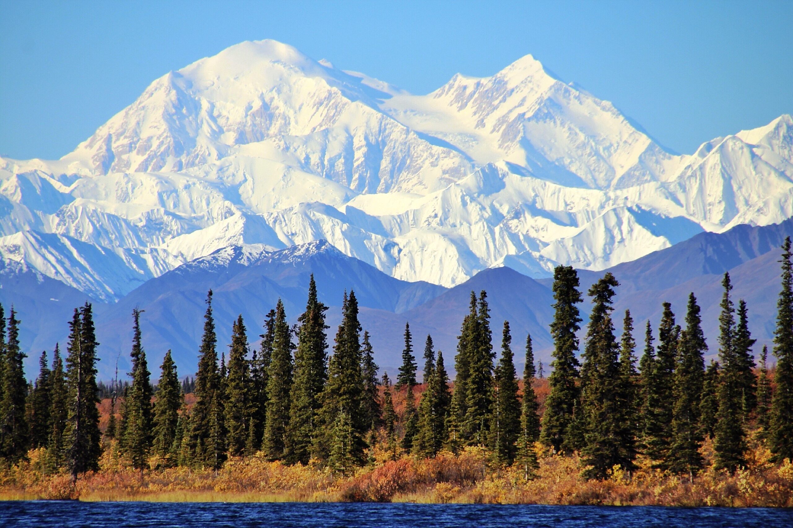
    Denali in the Alaska Range, the highest summit in North America
    Global Summit Guide · American mountaineering · Independent editorial ranking

    20 Greatest Mountains in the USA: Ranked for Climbers.

    The defining climbs of American mountaineering—from Denali’s expedition ice to Rainier’s glaciers, Whitney’s altitude, Grand Teton’s alpine rock and the walls of Yosemite. Compare all 20, explore their real locations on the map and choose the right next challenge.

    20 ranked US objectives6-factor editorial scoringGlacier · Rock · Snow · High-altitude hikingUpdated October 2026
    The Verdict · Read This First

    Which Are America’s Greatest Mountains for Climbers?

    Denali is our #1 American mountaineering objective because its glacier expedition, elevation and commitment represent the highest overall test of US expedition climbing. Mount Rainier ranks #2 as the country’s premier glacier-training mountain; Mount Whitney ranks #3 for its lower-48 high-point status and accessible altitude; Grand Teton ranks #4 as an iconic technical alpine-rock ascent.

    Important: “greatest” is an editorial climbing judgment—not an objective measurement of beauty or danger, and not a list of the 20 tallest mountains. Our six-factor scoring preserves this page’s existing rankings. We include El Capitan explicitly as a defining climbing objective, not a topographically independent mountain.

    Denali#1 · Expedition mountaineering
    Rainier#2 · Glacier skills
    Whitney#3 · High-altitude progression
    Grand Teton#4 · Alpine rock
    Climber-first Ranking · 2026 Edition

    The 20 Greatest US Mountain Objectives at a Glance.

    The ranking is based on climbing significance (25 points), history and culture (20), transferable climbing skills (20), stature and presence (15), route quality (10) and progression value (10). Scores express editorial judgment, not measured danger or a claim that every climber will agree.

    RankMountain / ObjectiveWhereSummit / landmark elevationPrimary climbing styleEditorial score
    1Denali
    America’s defining expedition mountain
    Alaska20,310 ftGlacier expedition97/100
    2Mount Rainier
    The national glacier classroom
    Washington14,410 ftGlacier mountaineering94/100
    3Mount Whitney
    The lower-48 altitude gateway
    California14,505 ftAltitude hiking / alpine rock88/100
    4Grand Teton
    America’s alpine-rock icon
    Wyoming13,775 ftAlpine rock87/100
    5Mount Hood
    The approachable—but serious—snow climb
    Oregon11,249 ftSteep snow / volcanic84/100
    6Longs Peak
    A Colorado test of exposure
    Colorado14,259 ftExposed scrambling82/100
    7Mount Washington
    The eastern weather classroom
    New Hampshire6,288 ftSevere-weather alpine81/100
    8Mount Shasta
    The bridge from hiking to snow climbing
    California14,179 ftSnow and volcanic80/100
    9Mount Saint Elias
    Immense relief from sea to summit
    Alaska / Yukon18,008 ftRemote expedition79/100
    10Mount Foraker
    An elite Alaska Range challenge
    Alaska17,400 ftAdvanced alpine expedition78/100
    11El Capitan
    America’s definitive big wall
    California7,573 ftBig-wall rock77/100
    12Half Dome
    A Yosemite icon for many styles
    California8,839 ftCables hike / technical rock75/100
    13Mount Baker
    A rope-team glacier apprenticeship
    Washington10,781 ftGlacier mountaineering74/100
    14Mount Adams
    Cascade altitude and endurance
    Washington12,281 ftLong volcanic snow climb72/100
    15Mount Elbert
    Rockies high point
    Colorado14,440 ftHigh-altitude hiking70/100
    16Pikes Peak
    The mountain that inspired America
    Colorado14,115 ftLong hike / public-access summit68/100
    17Mauna Kea
    Pacific volcanic and cultural scale
    Hawaiʻi13,803 ftHigh volcano / sacred summit67/100
    18Mount Katahdin
    The Appalachian Trail terminus
    Maine5,269 ftExposed ridge hiking66/100
    19Humphreys Peak
    Southwest high-point ambition
    Arizona12,633 ftAlpine hiking64/100
    20Kings Peak
    The High Uintas wilderness objective
    Utah13,528 ftWilderness backpacking62/100
    How to read the table: The position is editorial, not based on elevation. The El Capitan figure describes the landmark’s rim elevation, not the height of its vertical face. Elevations use commonly published reference figures and may vary slightly between surveys. Map markers represent approximate summit or objective positions, not routes or current conditions.
    Interactive USA Climbing Atlas

    Put All 20 Mountain Objectives on the Map.

    Select the Lower 48, Alaska or Hawaiʻi, or zoom out to see the full geographic spread. Tap any gold pin to see its editorial rank, climbing style and the link to its guide. The map uses real OpenStreetMap tiles, with a noninteractive fallback if map scripts are blocked.

    Choose a Ranked Objective

    Explore by Mountain.

    Click a mountain to center the map and see its position. Use the table for the full 20-objective comparison.

    The map will become interactive when loaded.

    Map caveat: These pins are geographical reference points only. They are not trailheads, GPS tracks, summit approach directions or safety recommendations. Confirm permitted access and route conditions with the relevant land manager.

    The Essential American Climbing Mountains

    Why These Ten Mountains Lead the Ranking.

    For US mountaineering, skill progression matters more than simply collecting a taller summit. These profiles explain each mountain’s place in the ranking—and what a climber actually learns there.

    Denali in Alaska, an authentic photograph of this ranked mountain
    #1 · 97/100 editorial score

    Denali

    20,310 ft · Alaska · Glacier expedition

    The summit is North America’s highest point, but height alone does not explain its place at #1. Denali demands a multiweek glacier expedition, heavy carries, self-sufficiency and sustained decisions in severe cold.

    What it develops: Roped glacier travel, crevasse rescue, load hauling and high-camp logistics. A long mountain, not a quick summit outing.

    Typical planning window: May–early July. Exact safe timing changes each season.
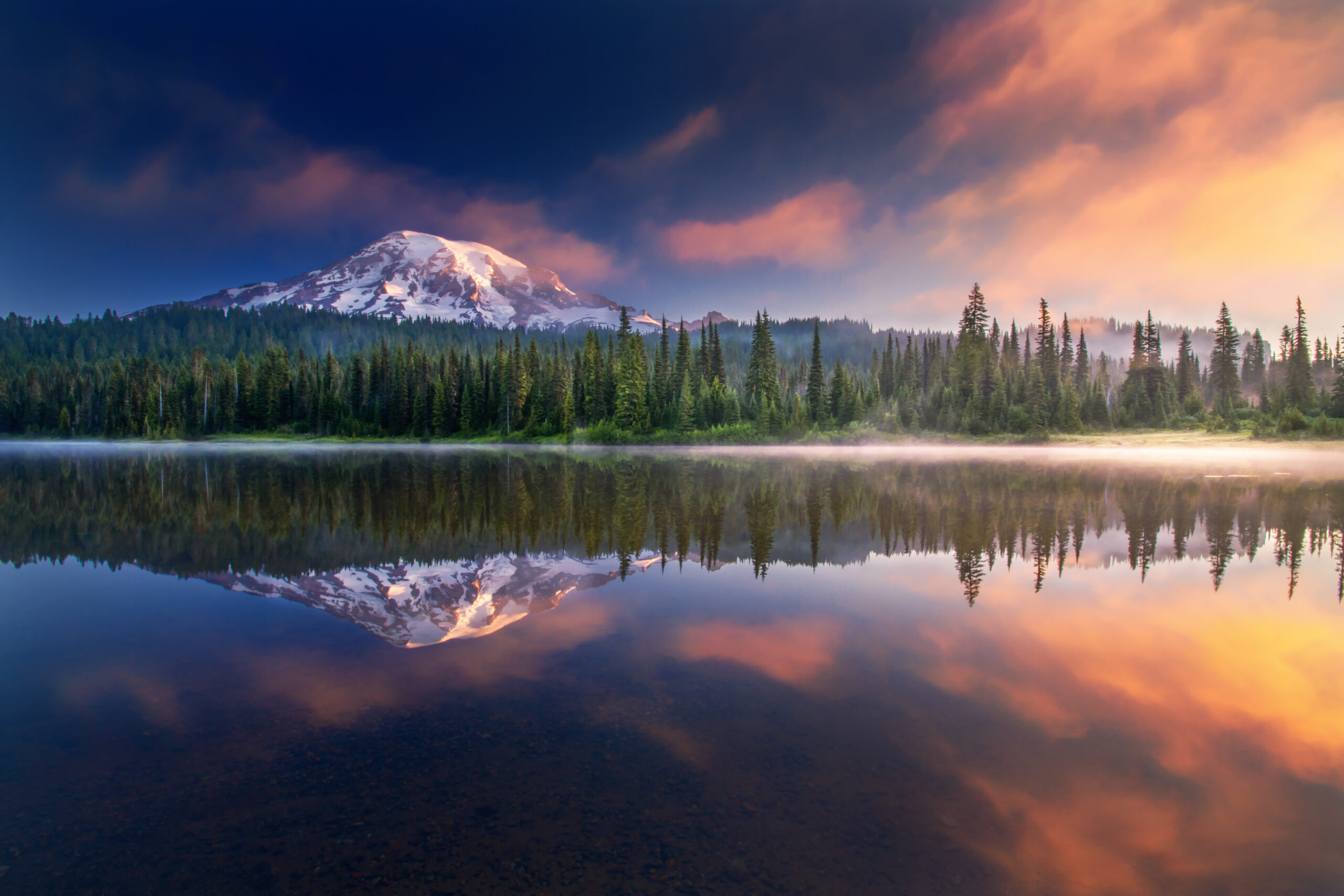
    Mount Rainier in Washington, an authentic photograph of this ranked mountain
    #2 · 94/100 editorial score

    Mount Rainier

    14,410 ft · Washington · Glacier mountaineering

    Rainier offers an unusually complete glaciated-mountain education within a few days: rope teams, crevasses, route changes, altitude, snow bridges and alpine timing.

    What it develops: A cornerstone goal for climbers graduating from snow travel into true glacier systems; standard summit routes remain technical.

    Typical planning window: May–July. Exact safe timing changes each season.
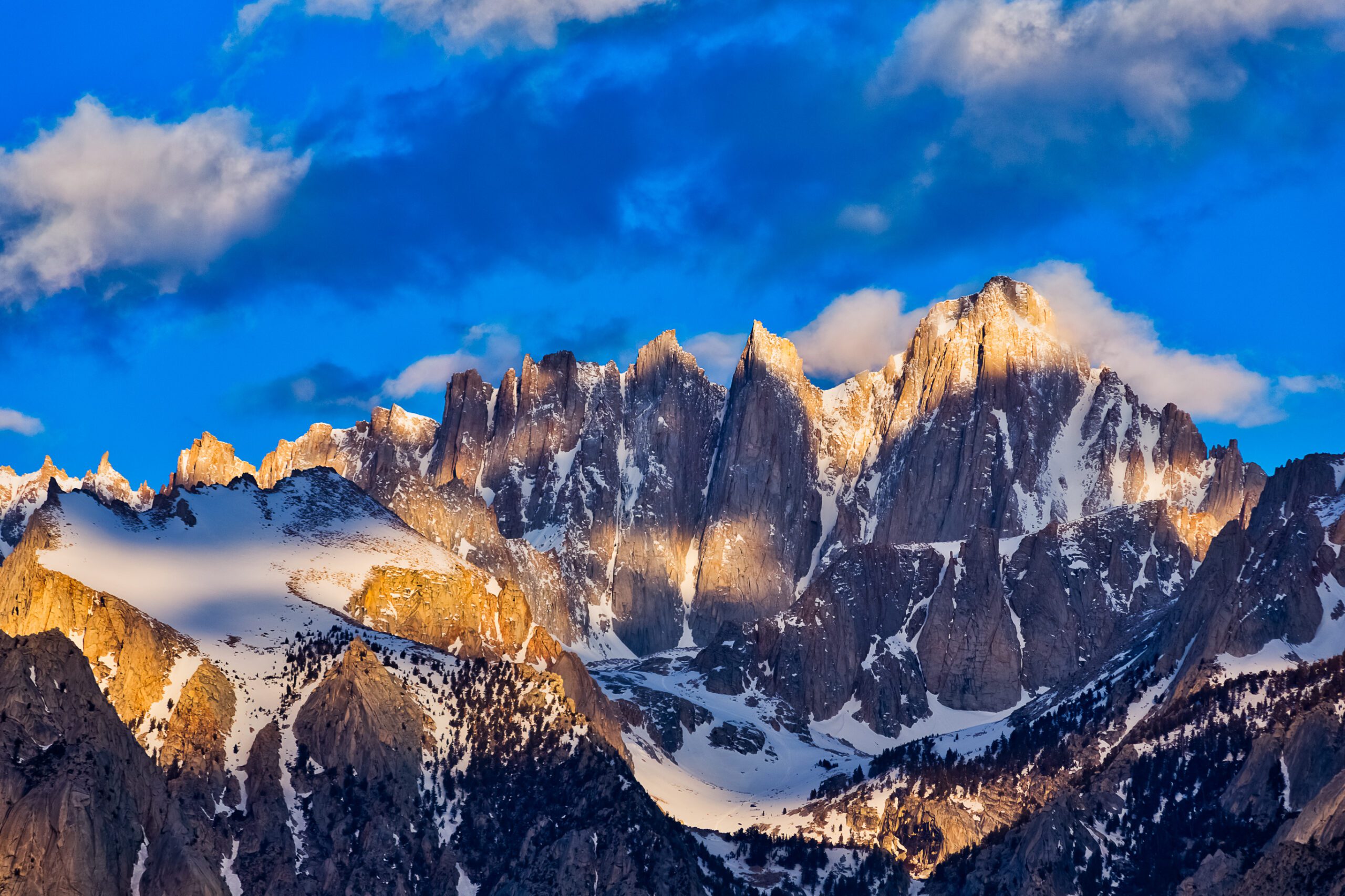
    Mount Whitney in California, an authentic photograph of this ranked mountain
    #3 · 88/100 editorial score

    Mount Whitney

    14,505 ft · California · Altitude hiking / alpine rock

    Whitney is the highest summit in the contiguous United States. Its popular trail lets ambitious hikers test altitude, pacing and endurance without claiming they have completed a technical climb.

    What it develops: The Mountaineer’s Route and east-face rock lines add much harder alternatives; permit and snow conditions change the experience.

    Typical planning window: July–September. Exact safe timing changes each season.
    Grand Teton in Wyoming, an authentic photograph of this ranked mountain
    #4 · 87/100 editorial score

    Grand Teton

    13,775 ft · Wyoming · Alpine rock

    The Grand rises abruptly above Jackson Hole. Its classic Exum and Owen–Spalding routes convert rock technique into a genuine mountain day where exposure, weather and route finding matter.

    What it develops: Technical scrambling or roped rock, efficient movement, rappelling judgment and rapid response to thunderstorms.

    Typical planning window: July–September. Exact safe timing changes each season.
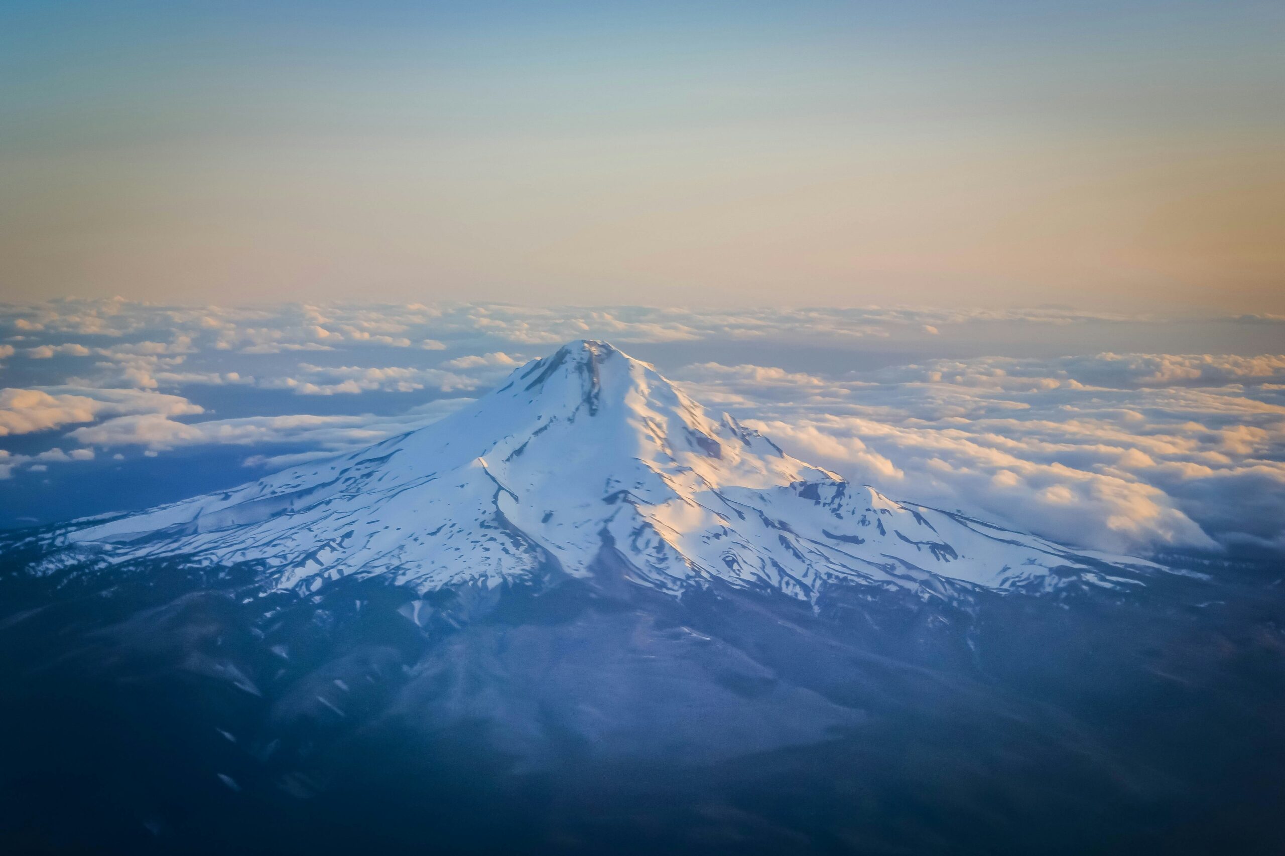
    Mount Hood in Oregon, an authentic photograph of this ranked mountain
    #5 · 84/100 editorial score

    Mount Hood

    11,249 ft · Oregon · Steep snow / volcanic

    Hood can seem accessible because trailheads are close to Portland and the south-side route is popular. Steep summit terrain, falling ice and fast-changing conditions are why it belongs among America’s essential mountaineering objectives.

    What it develops: Crampon movement, ice-axe arrest, steep-snow judgment and early starts; route choice is conditions-dependent.

    Typical planning window: Spring–early summer. Exact safe timing changes each season.
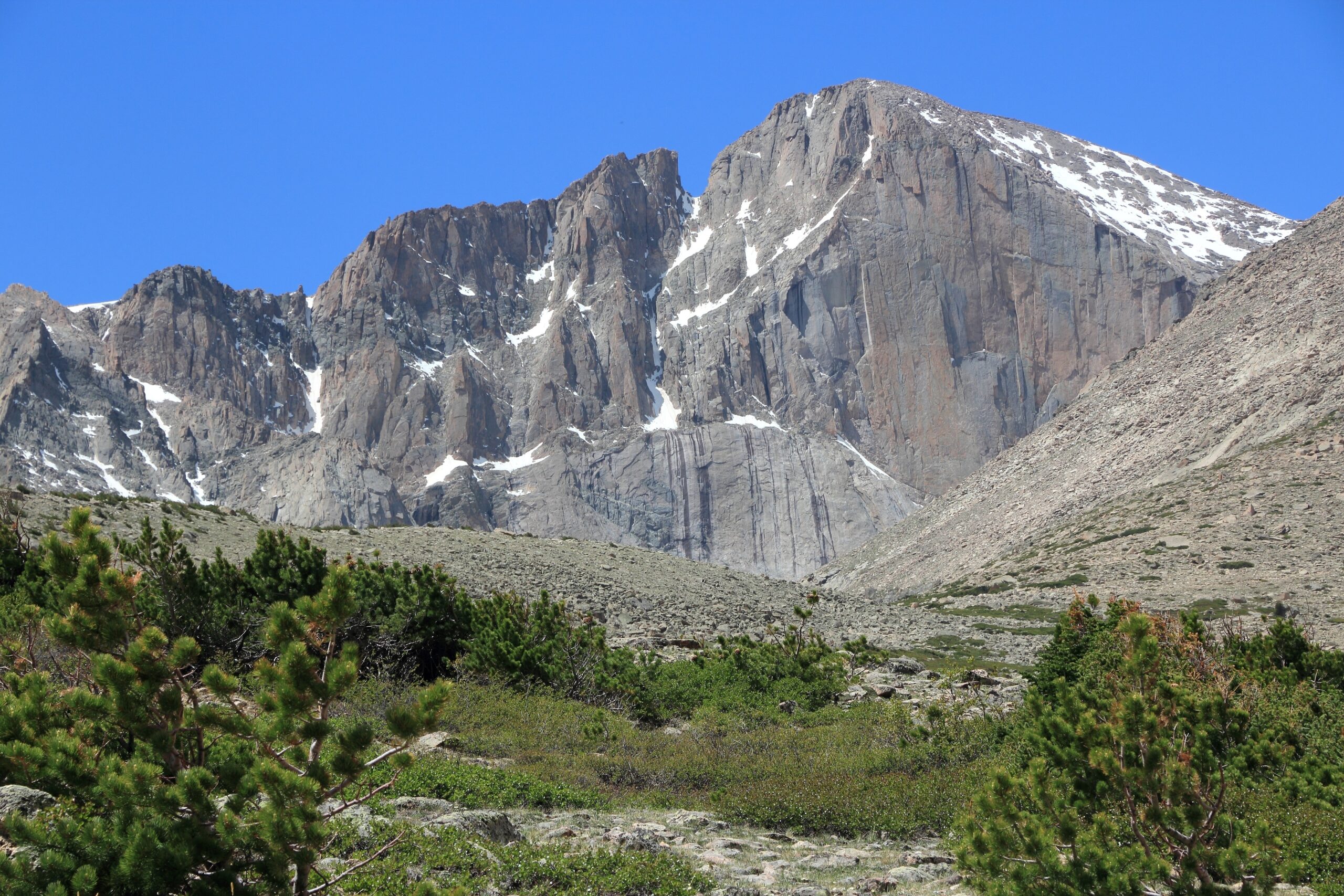
    Longs Peak in Colorado, an authentic photograph of this ranked mountain
    #6 · 82/100 editorial score

    Longs Peak

    14,259 ft · Colorado · Exposed scrambling

    Longs is not a casual walk-up despite its famous Keyhole Route. Broad alpine terrain, ledges, a long summit day and Colorado’s afternoon weather force climbers to value decisions over summit fever.

    What it develops: Third-class exposure, movement on slabs, altitude pacing and conservative turnaround times.

    Typical planning window: July–September. Exact safe timing changes each season.

    Mount Washington in New Hampshire, an authentic photograph of this ranked mountain
    #7 · 81/100 editorial score

    Mount Washington

    6,288 ft · New Hampshire · Severe-weather alpine

    Its low elevation hides an outsized lesson: weather governs risk. The Presidential Range has long taught American climbers that winter wind, whiteouts and cold can be harder than altitude.

    What it develops: Route choice, layered clothing, navigation, wind assessment and, in winter, full mountaineering preparation.

    Typical planning window: Summer / expert winter. Exact safe timing changes each season.
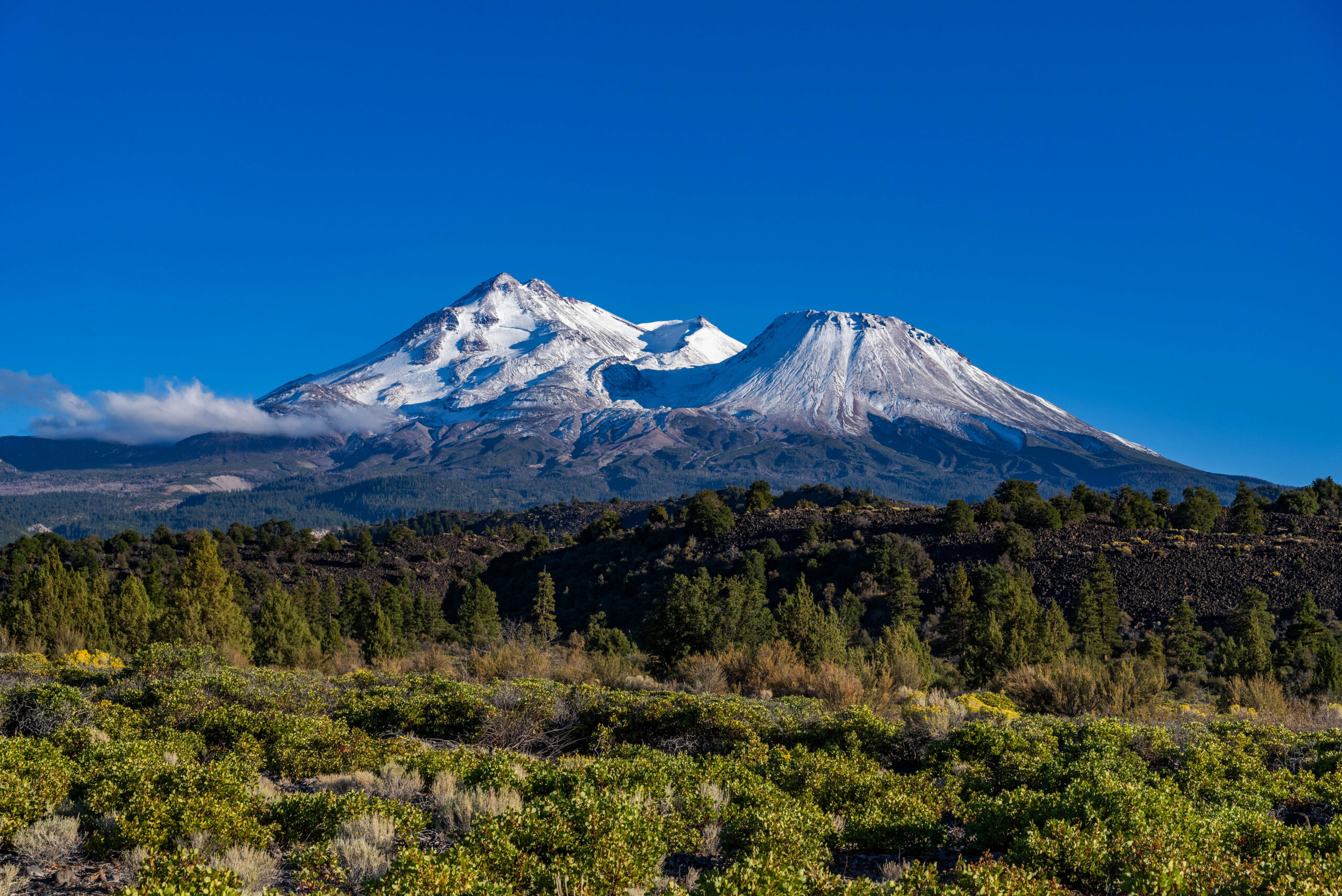
    Mount Shasta in California, an authentic photograph of this ranked mountain
    #8 · 80/100 editorial score

    Mount Shasta

    14,179 ft · California · Snow and volcanic

    A huge independent volcano with classic snow routes, Shasta is one of the best-known places to convert basic hiking fitness into snow and ice-axe proficiency—when avalanche and rockfall hazards are properly evaluated.

    What it develops: Crampon technique, arrest practice, snow timing and avalanche awareness; not a beginner-only mountain.

    Typical planning window: May–July. Exact safe timing changes each season.
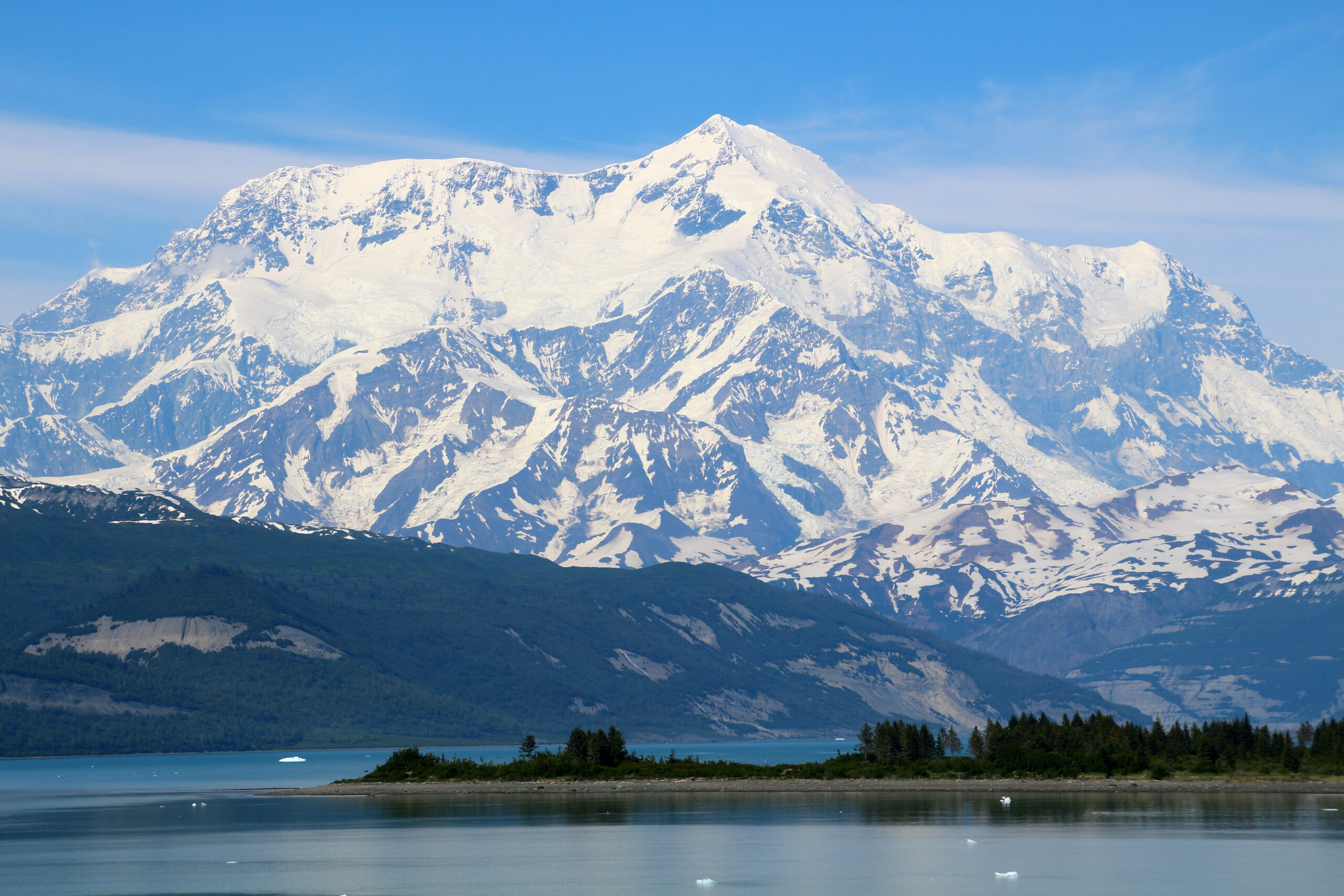
    Mount Saint Elias in Alaska / Yukon, an authentic photograph of this ranked mountain
    #9 · 79/100 editorial score

    Mount Saint Elias

    18,008 ft · Alaska / Yukon · Remote expedition

    Near the Gulf of Alaska, Saint Elias rises with astonishing vertical relief and weather exposure. Few American summit objectives demand this level of access planning and expedition tolerance.

    What it develops: Remote glacier logistics, very high consequence decisions, advanced expedition competency. The summit lies on the Alaska–Yukon international boundary.

    Typical planning window: Late spring–summer. Exact safe timing changes each season.
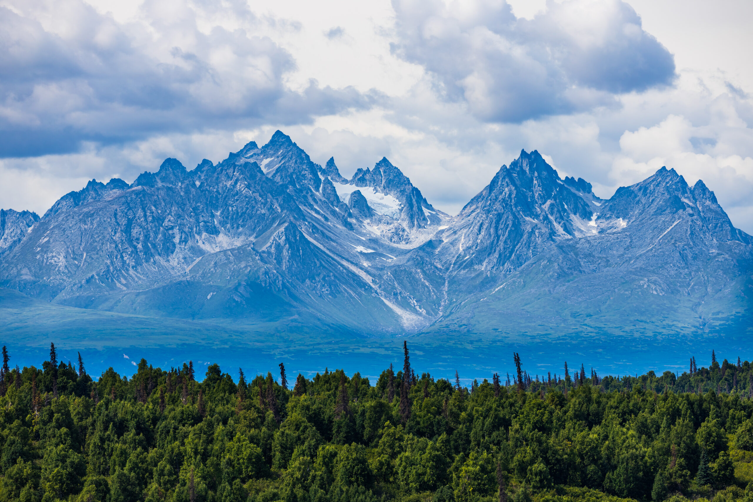
    Mount Foraker in Alaska, an authentic photograph of this ranked mountain
    #10 · 78/100 editorial score

    Mount Foraker

    17,400 ft · Alaska · Advanced alpine expedition

    Foraker stands close to Denali yet is a different undertaking: technically complex routes and remote glacier approaches make it a natural long-term ambition for very experienced teams.

    What it develops: Expert ice and mixed technique, self-reliant expedition judgment and major storm contingencies.

    Typical planning window: May–early July. Exact safe timing changes each season.
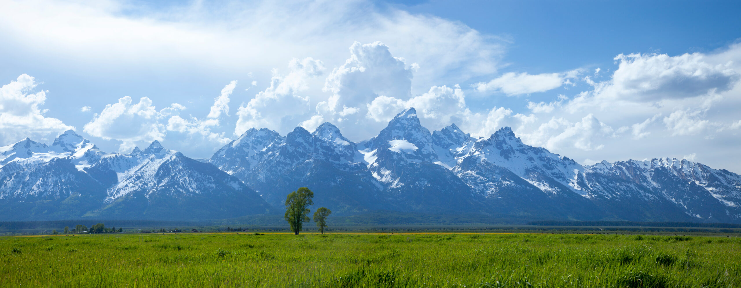
    Panorama of the real Grand Teton range in Wyoming, including the prominent Grand Teton summit
    The Ranking Is About Different Skills

    From Rainier’s Glacier Rope Teams to Grand Teton’s Alpine Rock.

    No single objective represents every part of American climbing. A strong progression often combines snow, rock, altitude and judgment—rather than moving in a straight line to higher and higher peaks.

    Rounding Out America’s Climbing Story

    Ranks 11–20: Big Walls, Glaciers, State High Points and Wilderness.

    These ten illustrate why the best US mountaineering objectives extend beyond technical alpine summits. Big-wall climbing, long wilderness hikes and regional traditions all shaped the American climbing landscape.

    #11 · 7,573 ft · 77/100

    El Capitan

    El Capitan is a rock formation rather than a separate high-prominence mountain. It belongs here because American climbing cannot be ranked honestly without its defining big-wall routes.

    Browse US mountain guides →
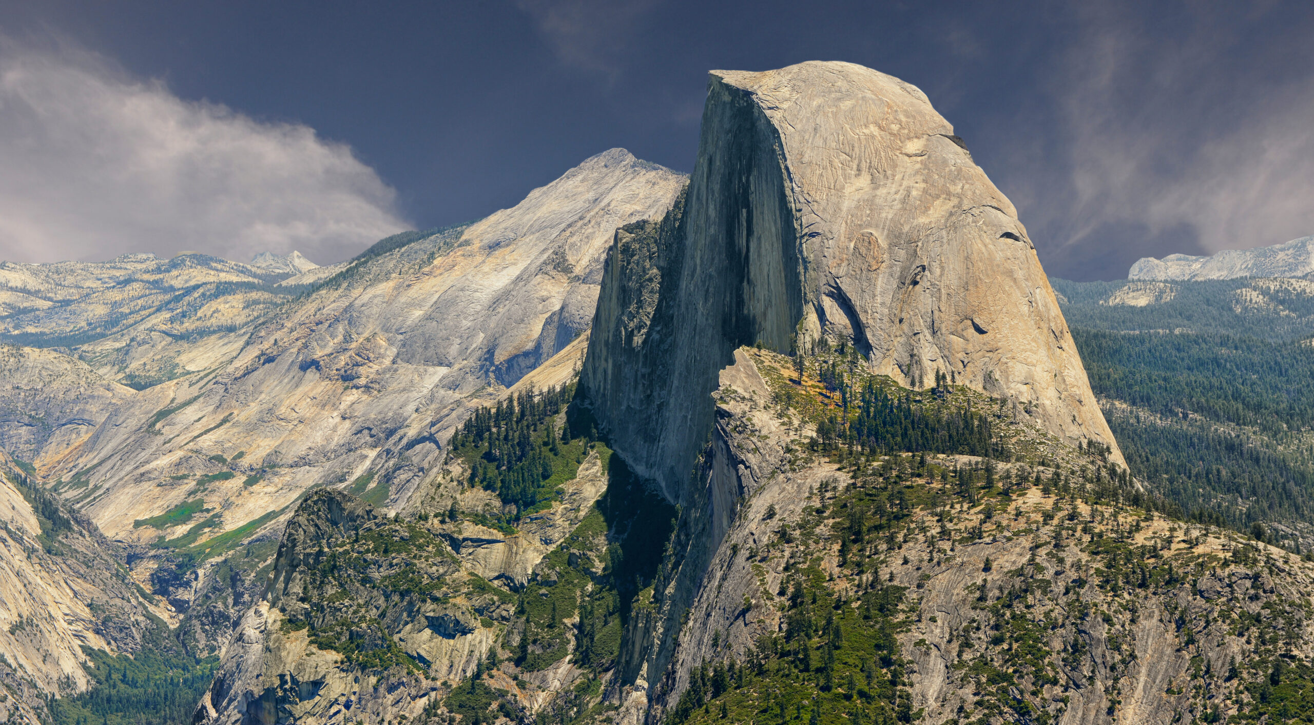
    Actual Half Dome in California
    #12 · 8,839 ft · 75/100

    Half Dome

    The Half Dome cables route and the classic technical face routes are very different undertakings. Both have helped define the American idea of Yosemite adventure.

    Read the Mountain Guide →
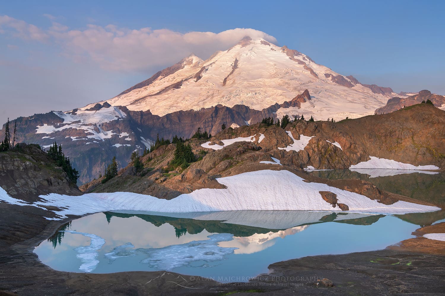
    Actual Mount Baker in Washington
    #13 · 10,781 ft · 74/100

    Mount Baker

    Baker combines a large glacial environment with routes commonly used in mountaineering courses. It is an excellent learning mountain only with the required instruction and competent companions.

    Read the Mountain Guide →
    #14 · 12,281 ft · 72/100

    Mount Adams

    Adams provides a long Cascade snow ascent without being a substitute for glacier training. The south-side route is a natural step for skilled hikers developing snow competence.

    Read the Mountain Guide →
    Actual Mount Elbert in Colorado
    #15 · 14,440 ft · 70/100

    Mount Elbert

    Elbert is Colorado’s and the Rocky Mountains’ high point. Summer hiking routes make it an accessible altitude and endurance test rather than a technical mountaineering benchmark.

    Read the Mountain Guide →
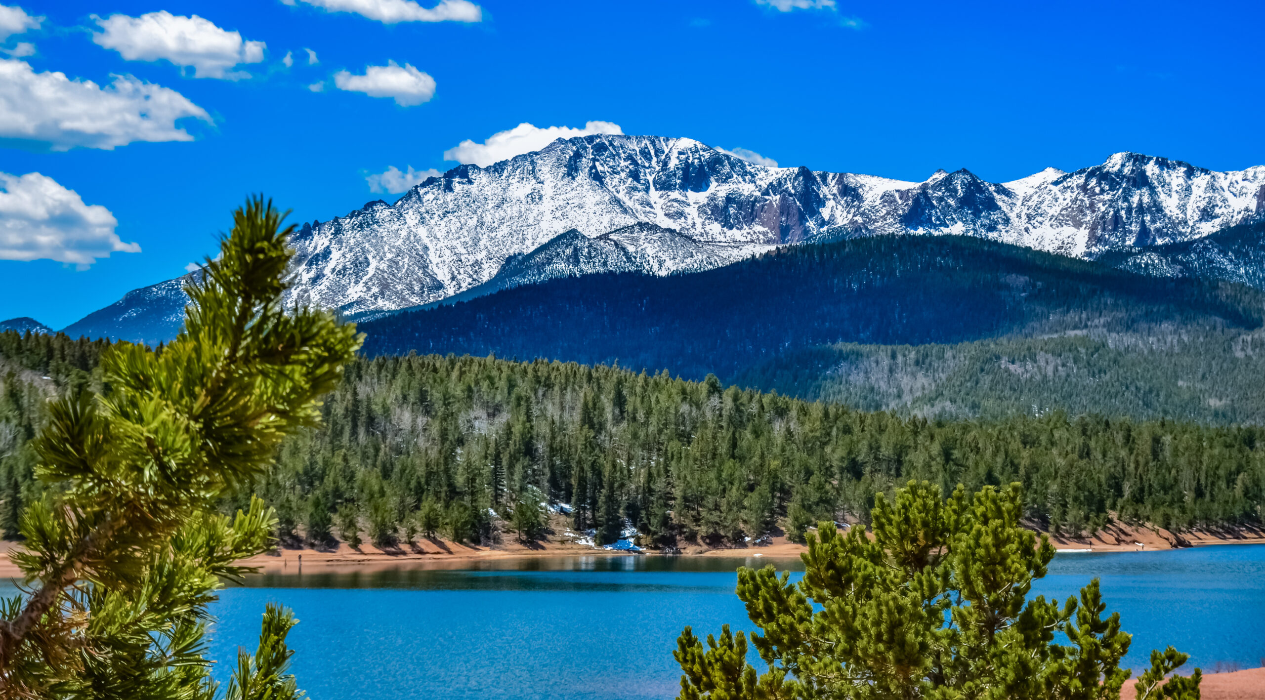
    Actual Pikes Peak in Colorado
    #16 · 14,115 ft · 68/100

    Pikes Peak

    Its road and railway do not reduce the challenge of climbing by foot. Pikes Peak is a touchstone of American mountain culture and a substantial ascent by the Barr Trail.

    Read the Mountain Guide →
    Actual Mauna Kea in Hawaiʻi
    #17 · 13,803 ft · 67/100

    Mauna Kea

    Measured from its submarine base, Mauna Kea is among Earth’s most imposing volcanic mountains. It is also a sacred landscape; respectful access decisions take precedence over a summit checkbox.

    Read the Mountain Guide →
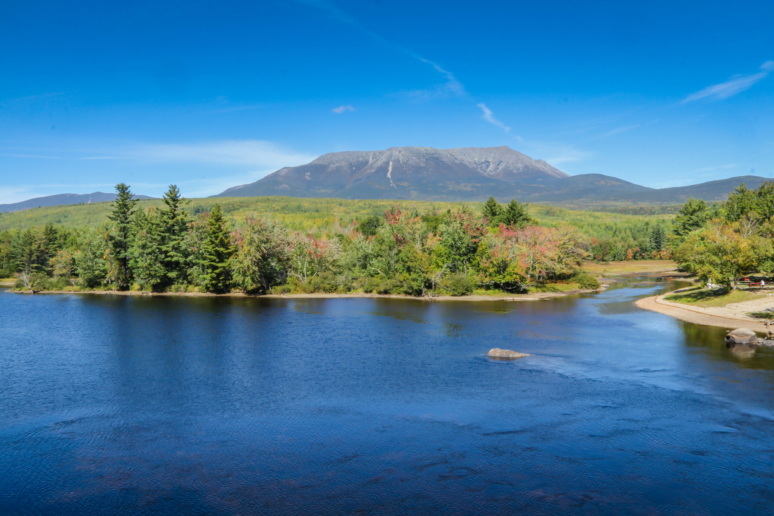
    Actual Mount Katahdin in Maine
    #18 · 5,269 ft · 66/100

    Mount Katahdin

    Katahdin’s Knife Edge, weather and dramatic prominence above the Maine forest make it a true Eastern challenge and the symbolic northern end of the Appalachian Trail.

    Browse US mountain guides →
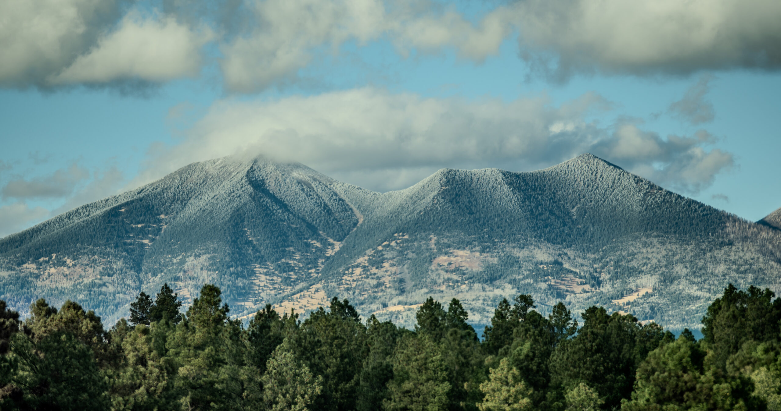
    Actual Humphreys Peak in Arizona
    #19 · 12,633 ft · 64/100

    Humphreys Peak

    Humphreys rises above Flagstaff in the San Francisco Peaks. It rewards high-country hiking skills and adds a different Southwestern mountain environment to an otherwise glacier-heavy list.

    Browse US mountain guides →
    Actual Kings Peak in Utah
    #20 · 13,528 ft · 62/100

    Kings Peak

    Utah’s high point asks for a long approach through the High Uintas, often making the backpacking and wilderness decision-making as important as the summit scramble.

    Read the Mountain Guide →
    A deliberate exception: El Capitan.

    El Capitan (#11) is a sheer granite wall in Yosemite, not a separate major summit in the same way Denali or Rainier is. We retain it because the page explicitly ranks America’s most significant climbing objectives. That distinction prevents a misleading geological comparison.

    What a Simple Top 20 List Cannot Explain

    Four Close Calls—and Why We Ranked Them This Way.

    #2 vs #3 · Glacier versus altitude

    Why Rainier Beats Whitney.

    Whitney is slightly higher, but Rainier requires rope-team and crevasse skills on its standard glacier routes. We place more weight on transferable mountaineering technique than altitude alone.

    Whitney vs. Rainier comparison →
    #3 vs #4 · Broad influence versus technical purity

    Why Whitney Beats Grand Teton.

    Grand Teton is the stronger technical rock climb. Whitney’s position reflects national recognition, its lower-48 high-point status and its role as an attainable altitude goal for ambitious hikers.

    Explore Grand Teton routes →
    #7 · New Hampshire

    Why Mount Washington Ranks So High.

    At 6,288 feet, Mount Washington would rank low by height. Alpine storms and severe winter conditions have shaped generations of eastern climbers. Weather judgment is mountaineering skill.

    Read mountain-weather skills →
    #11 · Yosemite

    Why El Capitan Counts.

    A climbers’ ranking should account for the rise of American big-wall culture. We classify El Capitan clearly as a rock-climbing objective, not pretend its rim is an independent high mountain.

    Compare Yosemite objectives →
    Choose the Right First, Next or Long-Term Summit

    Your US Mountaineering Progression Should Follow Skills.

    A mountain can be easy in dry summer conditions and dangerous in winter. Use this as a decision pathway, not a substitute for training, current route information or professional instruction.

    Stage 1 · Hiking & altitude

    Build the Base.

    Mount Elbert, Whitney’s summer trail or Kings Peak help develop pacing, backpacking, navigation and altitude awareness.

    Start with Mount Elbert →
    Stage 2 · Snow competency

    Earn the Snow Skills.

    Hood, Shasta and Adams reward climbers who have already learned crampon use, self-arrest, avalanche awareness and the right conditions.

    Explore Shasta →
    Stage 3 · Technical systems

    Glacier and Rock.

    Mount Baker and Rainier build glacier fundamentals; Grand Teton adds serious alpine rock, route finding and efficient transitions.

    What to Climb Before Rainier →
    Stage 4 · Long commitment

    Expedition Readiness.

    Denali demands physical volume, cold-camp systems, crevasse rescue and long-term expedition judgment, not merely one successful summit.

    Build Your Denali Plan →
    Rock specialist track

    The Yosemite to Teton Route.

    Multi-pitch competence, anchors, rope handling and movement on real rock lead toward technical Grand Teton routes and elite big-wall ambitions.

    Study the Grand Teton →
    Eastern mountains track

    Learn Weather the Hard Way—Safely.

    Develop navigation and decision-making on Katahdin and New England terrain before attempting winter Mount Washington with appropriate training.

    Mount Washington Guide →
    Different Mountain Regions, Different Strengths

    The United States Has More Than One Kind of Mountaineering.

    Alaska Range

    Denali and Foraker are expedition-scale mountains: travel, camps, crevasses, cold and self-reliance dominate the experience. Saint Elias adds remarkable coastal relief and extreme remoteness.

    Explore Alaska climbing →

    Cascades

    Rainier, Baker, Hood and Adams make the Pacific Northwest America’s premier classroom for volcanic snow ascents and glacier technique, with dramatically different hazards on each mountain.

    Explore Cascade volcanoes →

    High Sierra & Yosemite

    Whitney offers high-altitude objectives while Grand Teton—not in the Sierra—offers its own brand of alpine rock. El Capitan and Half Dome in Yosemite represent the technical-wall and iconic-hiking ends of the spectrum.

    Explore California mountains →

    Rockies, Appalachians, Hawaii & Southwest

    Elbert, Longs and Pikes Peak anchor Colorado; Washington and Katahdin teach eastern judgment; Humphreys, Kings Peak and Mauna Kea broaden the story across deserts, wilderness and volcanic Pacific landscapes.

    Browse American mountain ranges →

    A Visual Sampler: Different American Mountain Personalities

    Half Dome granite monolith in Yosemite National Park, California
    Half Dome · Yosemite granite and dramatic mountain routes
    Mount Katahdin in Baxter State Park, Maine
    Katahdin · Maine’s exposed northeastern mountain terrain
    Real Mauna Kea summit area on the Island of Hawaiʻi
    Mauna Kea · Hawaiian volcanic summit landscape
    Practical US Climbing Planning

    Seasons and Costs: Do Not Plan These as the Same Kind of Trip.

    Below are illustrative planning ranges from the previous editorial guide—not current operator price quotes. Flights, permits, specialist equipment and guide fees can materially change total cost. Check each current land manager’s rules and current conditions before reserving.

    Trip typeExample objectivesIllustrative budgetWhat drives the cost
    Self-guided summer high hikeElbert, Whitney, Kings Peak$100–$500Travel, permit, camping, food and equipment already owned
    Colorado alpine weekendElbert, Longs Peak$200–$700Lodging, transport, trailhead logistics and gear gaps
    Intro guided snow climbHood, Shasta, Baker$800–$1,800Instruction, group size, equipment and duration
    Guided glacier or alpine rockRainier, Grand Teton$1,800–$3,500Guiding ratio, number of days and skills training
    Major Alaska expeditionDenali$9,000–$25,000+Air transport, guides, glacier access, weather buffers and gear
    Remote advanced expeditionSaint Elias, Foraker$15,000–$30,000+Charter access, specialist support and contingency plans
    Typical seasonal planning windows

    Alaska: late spring–early summer for classic Denali season. Cascades: late spring to mid-summer for many snow and glacier routes. Colorado/Tetons/Sierra: predominantly summer for dry-route objectives. Eastern peaks: summer hiking differs sharply from winter mountaineering.

    What can override the calendar?

    Storms, heat, snow bridge stability, rockfall, avalanche conditions, wildfire restrictions, permits and closures. Always consult official park/forest updates, mountain weather, and qualified local guides if needed. Neither this ranking nor its map is real-time hazard reporting.

    Equipment Changes with Terrain

    Mountaineering Equipment Is Specific to the Objective.

    Snow & Volcano

    Appropriate traction, helmet, ice axe and trained self-arrest skills may be necessary on Hood, Shasta and Adams. Snow conditions change what is required.

    Microspikes vs. crampons →

    Glacier

    Rainier, Baker and Denali demand more than a pair of crampons: roped travel, crevasse-rescue skills and partner competence are central.

    How to use an ice axe →

    Rock & Ridge

    Grand Teton, El Capitan and Half Dome require very different systems—from scrambling or permitted cables to advanced roped climbing.

    Study technical Grand Teton routes →
    Advertisement / affiliate disclosure — Global Summit Guide may earn a commission on qualifying purchases at no extra cost to youBackcountry outdoor equipment — affiliate advertisement

    Mediavine Journey display advertising remains managed automatically by the site; this article does not insert or imitate Journey ad units. To add GSG Gear Ads later, use a separate WordPress Shortcode block outside this Custom HTML block.

    Transparent Editorial Method

    How Global Summit Guide Ranked America’s Greatest Climbs.

    We preserved the six-part ranking and scores from this article’s prior edition. We did not manufacture a scientific danger score or claim to have climbed every mountain. The scoring favors importance to US climbing, skill transfer and enduring routes rather than Instagram popularity.

    25 pointsAmerican climbing significance
    20 pointsHistory and cultural importance
    20 pointsSkill-development value
    15 pointsStature, relief and visual presence
    10 pointsRoute quality and variety
    10 pointsClimbing progression value

    Editorial boundary: these are comparative judgments, not measured probabilities of death, difficulty grades or claims that conditions are currently safe. The page distinguishes ordinary hiking lines, glacier routes, alpine rock and exceptional objectives—an essential distinction when the same mountain name can refer to very different climbs.

    Our elevation references draw primarily from the relevant federal agencies and conventional published mountain descriptions. For example, the National Park Service confirms Denali at 20,310 ft, Mount Rainier at 14,410 ft, and Mount Whitney at 14,505 ft. Some older topographic maps show different values because survey standards changed.

    Photo verification:

    The mountain photographs on this page were chosen from the Global Summit Guide media library using source titles identifying the depicted destination. No photo of one named mountain is reused as another. Photo licensing is governed by the site’s existing media assets.

    Frequently Asked Climbing Questions

    US Mountaineering FAQ.

    What is the best mountain to climb in the United States?

    There is no single best mountain for everyone. Our editorial #1 is Denali for an experienced expedition climber. For glacier-skill development, Rainier or Mount Baker are stronger targets with appropriate instruction. For ambitious hikers, summer Mount Elbert or Mount Whitney may be more suitable.

    What is the highest mountain in the USA?

    Denali in Alaska is the highest mountain in the United States and North America, at 20,310 feet (6,190 meters). Some current federal publications use Mount McKinley as its official name; this climbing guide retains the name Denali used widely in mountaineering.

    What is the hardest mountain in America to climb?

    Difficulty depends on the exact route, weather and climber experience. Remote high-altitude objectives such as Denali, Mount Foraker and Mount Saint Elias can involve exceptional commitment, while El Capitan routes require advanced rock-climbing ability. A single mountain-wide difficulty rating is misleading.

    Is Mount Whitney harder than Mount Rainier?

    On their commonly used standard summer routes, Mount Rainier requires technical glacier travel and snow safety systems while the Mount Whitney Trail is normally a high-altitude hiking route. Whitney can be physically demanding and winter or technical routes are substantially more serious.

    Is Mount Rainier good for beginner mountaineers?

    Rainier is not a beginner hike. It can be an early major glacier-climbing goal when climbers have trained in crampon movement, rope teams and crevasse rescue, often through a qualified mountaineering course or guide.

    Why does the list include El Capitan?

    This is a ranking for climbers, not a geological list of independent summits. El Capitan is a famous granite big-wall climbing objective, so it belongs in American climbing history even though it is not a separate major mountain in the topographic sense.

    Where is the best mountaineering in the United States?

    Alaska excels in large glacier expeditions; Washington and Oregon in volcano and glacier routes; Wyoming in alpine rock; California in high Sierra objectives and Yosemite walls; Colorado in high-altitude peakbagging; New Hampshire and Maine in severe-weather and exposed-ridge skills.

    Can I use the map as a mountain route map?

    No. The map locates mountains approximately. It does not plot trailheads, climbing lines, crevasses, avalanche terrain, private land boundaries, access restrictions or current conditions. Use official maps and current land-manager information for navigation.

    Mount Rainier in Washington under clear skies, representing the next skill-based climbing goal
    The Best Mountain Is the One You Are Ready For

    Choose a Climb That Builds Your Next Skill.

    Use the editorial ranking as inspiration, the interactive map as context and the mountain guides for route-specific research. Your next summit should fit your training, weather window, partners and risk tolerance.

    Was this helpful?

    Yes
    No
    Thanks for your feedback!
  • How Many 14ers Are in Colorado? 58 Named Peaks + Full List

    Colorado Rocky Mountains and a high alpine landscape representing Colorado's fourteeners
    Colorado · Fourteeners · Current Count & List

    How Many 14ers Are in Colorado? 58 Named, 53 Ranked

    Colorado has 58 named fourteeners. Of those, 53 are ranked under the 300-foot prominence convention used by 14ers.com, while the Colorado Mountain Club uses a 54-peak minimum for its official list-completer program. Get the answer first, then see the five named-but-unranked peaks and the complete current 58-peak list.

    58 named peaks verified53 ranked peaksCMC 54 standard checkedCurrent LiDAR-based elevations

    Updated August 24, 2026 · Count cross-check: 14ers.com + Colorado Mountain Club + Colorado Geological Survey

    58Named 14ers
    53Ranked 14ers
    54CMC completer minimum
    7Range groups
    The direct answer

    Colorado has 58 named 14ers. The 53 and 54 counts answer different questions.

    For the broad question “How many 14ers are in Colorado?” the clearest answer is 58 named peaks above 14,000 feet. 14ers.com currently ranks 53 peaks using its 300-foot prominence convention. Separately, the Colorado Mountain Club requires a 54-peak minimum for its official Summit Completer recognition. Treat those as three labeled list conventions—not competing claims about how many mountains physically exist.

    58 meansNamed peaks above 14,000 ft
    53 means300+ ft prominence / ranked
    54 meansCMC completer minimum
    5 meansNamed but currently unranked
    Do not mix list systems. The current 14ers.com page shows 58 named peaks, 53 ranked peaks and five named peaks below its ranking threshold. The Colorado Mountain Club maintains its own 54-peak completer tradition. This guide reports each source on its own terms instead of trying to turn them into one universal “official” list.
    One state · three useful numbers

    Why Colorado 14er Counts Are 53, 54 or 58

    Most conflicting answers are not really conflicts. They are using different definitions of what belongs on a completion list.

    Most useful public answer

    58 Named 14ers

    14ers.com currently states that Colorado is home to 58 named peaks above 14,000 feet. This is the cleanest answer to the broad search query “how many 14ers are in Colorado?”

    See the complete 58 →
    Topographic / ranked list

    53 Ranked 14ers

    Colorado’s long-used ranking convention requires at least 300 feet of prominence. Fifty-three of the 58 named summits currently meet that threshold.

    See the five that do not →
    Colorado Mountain Club

    54-Peak Completer Standard

    The CMC says 54 fourteeners are required for its official list-completer recognition, while also accepting people who pursue larger lists such as 55 or 58 after completing the minimum.

    Which number should you use? →

    The practical rule

    If you are writing a trivia answer, travel guide or general Colorado mountain article, say 58 named 14ers and immediately add that 53 are ranked. If you are talking about CMC completer recognition, say 54 minimum. That wording resolves the ambiguity instead of pretending one tradition has erased the others.

    The five-peak difference

    The Five Named Colorado 14ers That Are Not Ranked

    These summits are on the 58 named-peak list but do not currently meet the 300-foot prominence threshold used for ranking.

    PeakElevationProminenceRange
    Mount Cameron14,248 ft152 ftMosquito Range
    El Diente Peak14,175 ft264 ftSan Juan Mountains
    Challenger Point14,086 ft264 ftSangre de Cristo
    North Eolus14,042 ft212 ftSan Juan Mountains
    Conundrum Peak14,037 ft225 ftElk Mountains

    This is where many older pages are now wrong. North Maroon Peak used to appear on many unranked lists, while Challenger Point sometimes appeared as ranked. Current 14ers.com data reverses that older pairing: North Maroon is ranked, and Challenger is one of the five named-but-unranked peaks.

    The total still remains 53 ranked + 5 named/unranked = 58 named peaks.

    Colorado high mountain terrain in the Rocky Mountains representing the state's fourteeners
    The list is simple once the rule is visible

    58 named summits. 53 ranked peaks. Five named summits below 300 feet of prominence.

    The key is not choosing a favorite number. It is telling readers which definition each number represents.

    Corrected distribution

    Colorado’s 58 Named 14ers by Mountain Range

    The current 58-peak distribution is seven range groups. This corrects an older version of this page that misplaced several Mosquito Range peaks in the Front Range.

    RangeNamed 14ersHighestElevationCount detail
    Sawatch Range15Mount Elbert14,438 ft15 ranked
    San Juan Mountains14Uncompahgre Peak14,318 ft12 ranked + 2 named/unranked
    Sangre de Cristo10Blanca Peak14,350 ft9 ranked + Challenger Point
    Elk Mountains7Castle Peak14,274 ft6 ranked + Conundrum Peak
    Front Range6Grays Peak14,275 ft6 ranked
    Mosquito Range5Mount Lincoln14,293 ft4 ranked + Mount Cameron
    Tenmile Range1Quandary Peak14,272 ft1 ranked
    Range-count check: 15 + 14 + 10 + 7 + 6 + 5 + 1 = 58. The Sawatch Range has the largest concentration. The Front Range has six named 14ers in this grouping—not nine.
    Current named-peak inventory

    Complete List of All 58 Colorado 14ers

    Sorted from highest to lowest using the current elevations displayed by 14ers.com. Five rows are marked “Named / unranked.”

    #PeakElevationRangeStatus
    1Mount Elbert14,438 ftSawatch RangeRanked
    2Mount Massive14,427 ftSawatch RangeRanked
    3Mount Harvard14,424 ftSawatch RangeRanked
    4Blanca Peak14,350 ftSangre de CristoRanked
    5La Plata Peak14,344 ftSawatch RangeRanked
    6Uncompahgre Peak14,318 ftSan Juan MountainsRanked
    7Crestone Peak14,299 ftSangre de CristoRanked
    8Mount Lincoln14,293 ftMosquito RangeRanked
    9Grays Peak14,275 ftFront RangeRanked
    10Castle Peak14,274 ftElk MountainsRanked
    11Quandary Peak14,272 ftTenmile RangeRanked
    12Torreys Peak14,272 ftFront RangeRanked
    13Mount Antero14,271 ftSawatch RangeRanked
    14Mount Blue Sky14,268 ftFront RangeRanked
    15Longs Peak14,259 ftFront RangeRanked
    16Mount Wilson14,256 ftSan Juan MountainsRanked
    17Mount Cameron14,248 ftMosquito RangeNamed / unranked
    18Mount Shavano14,230 ftSawatch RangeRanked
    19Mount Belford14,202 ftSawatch RangeRanked
    20Mount Princeton14,200 ftSawatch RangeRanked
    21Mount Yale14,200 ftSawatch RangeRanked
    22Crestone Needle14,196 ftSangre de CristoRanked
    23Mount Bross14,178 ftMosquito RangeRanked
    24El Diente Peak14,175 ftSan Juan MountainsNamed / unranked
    25Kit Carson Peak14,167 ftSangre de CristoRanked
    26Maroon Peak14,163 ftElk MountainsRanked
    27Mount Oxford14,158 ftSawatch RangeRanked
    28Tabeguache Peak14,158 ftSawatch RangeRanked
    29Mount Sneffels14,155 ftSan Juan MountainsRanked
    30Mount Democrat14,154 ftMosquito RangeRanked
    31Capitol Peak14,138 ftElk MountainsRanked
    32Pikes Peak14,109 ftFront RangeRanked
    33Snowmass Mountain14,105 ftElk MountainsRanked
    34Windom Peak14,089 ftSan Juan MountainsRanked
    35Mount Eolus14,087 ftSan Juan MountainsRanked
    36Challenger Point14,086 ftSangre de CristoNamed / unranked
    37Mount Columbia14,075 ftSawatch RangeRanked
    38Missouri Mountain14,071 ftSawatch RangeRanked
    39Humboldt Peak14,068 ftSangre de CristoRanked
    40Mount Bierstadt14,066 ftFront RangeRanked
    41Sunlight Peak14,061 ftSan Juan MountainsRanked
    42Handies Peak14,058 ftSan Juan MountainsRanked
    43Ellingwood Point14,057 ftSangre de CristoRanked
    44Mount Lindsey14,055 ftSangre de CristoRanked
    45Culebra Peak14,053 ftSangre de CristoRanked
    46Mount Sherman14,043 ftMosquito RangeRanked
    47North Eolus14,042 ftSan Juan MountainsNamed / unranked
    48Little Bear Peak14,041 ftSangre de CristoRanked
    49Redcloud Peak14,037 ftSan Juan MountainsRanked
    50Conundrum Peak14,037 ftElk MountainsNamed / unranked
    51Pyramid Peak14,029 ftElk MountainsRanked
    52San Luis Peak14,023 ftSan Juan MountainsRanked
    53North Maroon Peak14,022 ftElk MountainsRanked
    54Wetterhorn Peak14,021 ftSan Juan MountainsRanked
    55Wilson Peak14,021 ftSan Juan MountainsRanked
    56Mount of the Holy Cross14,007 ftSawatch RangeRanked
    57Huron Peak14,006 ftSawatch RangeRanked
    58Sunshine Peak14,004 ftSan Juan MountainsRanked

    Showing all 58 named Colorado 14ers.

    Elevation note: this table intentionally follows the current elevation values displayed by 14ers.com. Older USGS-era lists and legacy articles often differ by a few feet—for example, Mount Elbert is commonly quoted as 14,440 feet, while the current 14ers.com list displays 14,438 feet.
    Why older lists do not always match

    Survey Data and List Traditions Can Change the Details Without Changing the Broad Answer

    Elevation, prominence and list-completion traditions are separate layers. That is why older guidebooks can show different elevations or different “must-climb” sets.

    Colorado 14er data spans decades of map elevations, survey revisions, LiDAR work and climbing-community conventions. You will still see familiar legacy numbers such as Mount Elbert at 14,440 feet, while the current 14ers.com list displays 14,438 feet.

    For the current broad count, the sources are unusually consistent: 14ers.com and the Colorado Geological Survey both state that Colorado has 58 named peaks above 14,000 feet. 14ers.com separately displays 53 ranked peaks under its prominence convention. The Colorado Mountain Club maintains a 54-peak completer standard rooted in its own climbing tradition.

    That is why this page labels 58 named / 53 ranked / 54 CMC minimum rather than calling any one of those numbers the only valid answer in every context.

    Longs Peak in Rocky Mountain National Park, one of Colorado's ranked fourteeners
    Counting is not climbing

    This page answers the list question. The Colorado 14ers master guide owns route planning.

    That separation keeps search intent clean: use this page for the count, rankings and current inventory; use the master guide to choose which mountain to climb next.

    Use the right number

    Which Colorado 14er List Should You Use?

    The best answer depends on what you are actually trying to do.

    General question

    Use 58

    For “How many 14ers are in Colorado?” or “Give me the complete named list,” 58 is the clearest answer. Add the 53-ranked note to prevent confusion.

    Topographic ranking

    Use 53

    For prominence-based peak ranking, independent-summit comparisons and a strict 300-foot rule, use the 53 currently ranked peaks.

    CMC completion

    Use 54 Minimum

    If your goal is Colorado Mountain Club list-completer recognition, use the CMC’s own current standard and verify its rules before submitting a completion.

    Planning to climb them?

    Do not use this count page as a route guide. Move to the Colorado 14ers master guide for progression, route difficulty, season, access and trip planning. That page and this one should support each other rather than compete for the same intent.

    Climber Journey · Choose → Prepare → Plan

    The Count Is Reference Data. Your Next Decision Is Which 14er Fits You.

    If this is your first Colorado 14er, move from the number to mountain selection: choose a route class you already understand, check altitude readiness, then verify weather, access and permits on the mountain-specific page. If you are collecting the full list, use the Colorado 14ers master guide for progression rather than treating all 58 peaks as interchangeable checkboxes.

    Dream→Choose→Prepare→Plan→Book→Climb
    Data methodology

    Sources & How This List Was Audited

    The rebuild separates named-peak count, topographic ranking and club-completion rules so each source is used for what it actually governs.

    Primary sources checked August 24, 2026

    Editorial rule: when older map elevations or older prominence classifications disagree with the current list, this page labels the current source and explains the change rather than silently mixing generations of data.

    Colorado 14er count questions

    Frequently Asked Questions

    Short answers designed to match the exact questions searchers ask about the Colorado fourteener count.

    How many 14ers are in Colorado?

    Colorado has 58 named peaks above 14,000 feet on the widely used 14ers.com named-peak list. Of those, 53 currently satisfy Colorado's commonly used 300-foot prominence rule and are ranked.

    Why do some lists say Colorado has 53 14ers?

    The 53 count includes only ranked peaks with at least 300 feet of topographic prominence above the connecting saddle to a higher peak. Five named 14ers on the 58-peak list fall below that threshold.

    Why does the Colorado Mountain Club use 54?

    The Colorado Mountain Club currently recognizes 54 fourteeners as the minimum required for its official list-completer recognition. It also accepts climbers who pursue larger lists such as 55 or 58, provided the 54-peak minimum is completed.

    What are the five unranked Colorado 14ers?

    The current five named but unranked 14ers on 14ers.com are Mount Cameron, El Diente Peak, Challenger Point, North Eolus and Conundrum Peak.

    Is North Maroon Peak a ranked 14er?

    Yes. Current 14ers.com data ranks North Maroon Peak at number 48 of 53. LiDAR-based prominence work changed its status from older lists that treated it as unranked.

    What is the highest 14er in Colorado?

    Mount Elbert is Colorado's highest 14er. The current 14ers.com LiDAR-based list displays it at 14,438 feet; older maps and guides often show 14,440 feet.

    What is the lowest ranked 14er in Colorado?

    Sunshine Peak is currently the lowest of Colorado's 53 ranked 14ers on the 14ers.com list, displayed at 14,004 feet.

    How many Colorado mountain ranges contain named 14ers?

    Using the range groupings shown by 14ers.com, the 58 named peaks are spread across seven groups: Sawatch, San Juan, Sangre de Cristo, Elk, Front, Mosquito and Tenmile.

    58 is the answer. Choosing is the next step.

    Know the Count. Then Pick the 14er That Fits Your Current Level.

    Use this URL as the reference for 58 named, 53 ranked and the 54-peak CMC standard. For difficulty, progression and route planning, move to the Colorado 14ers master guide and save the right objective in My Climb.

    US peaks · Colorado 14ers

    Colorado’s 14ers: The Complete Peakbagging Cluster

    The full 14er list is the starting point. Compare the range, go deeper on the marquee peaks, or set it in the wider hiking picture.

    Was this helpful?

    Yes
    No
    Thanks for your feedback!
  • Mountains near Denver: a hiker’s guide to the Front Range and closest peaks

    Mountains Near Denver: The Hiker’s Guide to the Front Range and Closest Peaks | Global Summit Guide
    Regional Guides / Colorado

    Mountains near Denver: a hiker’s guide to the Front Range and closest peaks

    14,265 ft
    Mount Evans / Blue Sky
    ~75 min
    Closest 14er drive
    200 mi
    Front Range length
    10+
    14ers within 2 hrs
    ★ Part of the Colorado mountains series This Denver-area guide supports our best mountains near Denver master guide and our complete Colorado 14ers guide. Master guide →

    Denver sits at 5,280 feet, calls itself the Mile High City, and looks out on roughly 200 miles of Front Range mountains visible on most clear days. That kind of access is unusual — no other major US city has dozens of named peaks, multiple 14ers, and a national park all within a two-hour drive. This guide answers the questions Denver-area hikers and visitors actually ask: which mountains can you see from the city, what is the closest 14er, where do you start if you are new to Colorado peaks, and what are the best day-hike objectives within 2 hours of downtown. For the deeper deep-dive on individual peaks, see our best mountains near Denver master guide and our complete Colorado 14ers guide.

    What mountains can you see from Denver

    On any clear day, the western horizon from Denver shows a continuous wall of mountains stretching from north to south, technically the Front Range of the Rocky Mountains. From downtown you can identify roughly 30 named peaks if you know what you are looking for. The most prominent visible peaks, north to south:

    The best Denver-area viewpoints for seeing the mountains are Lookout Mountain in Golden (a 30-minute drive from downtown that puts you directly above the city looking west), Sloan Lake just northwest of downtown, Mount Falcon Park, and the upper floors of downtown buildings facing west. The clearest viewing days are typically after weather systems pass through and clear the air, particularly the morning after rain or snow when haze drops to near zero.

    The viewing reality from downtown

    The peaks visible from Denver are not as close as they look. Mount Evans appears to loom right over the city but is actually 35 miles west. Longs Peak is 50 miles northwest. The apparent closeness is an optical effect of the dry mountain air and the height of the peaks above the surrounding terrain. The mountains are real, they are accessible, but they take 1 to 2 hours of driving to actually reach.

    The closest mountains to Denver

    Different definitions of “closest” produce different answers. If you mean closest named mountain by drive time, Lookout Mountain wins. If you mean closest meaningful mountain experience, the foothills peaks west of Golden and Evergreen are 30-45 minutes from downtown. If you mean closest 14er (peak above 14,000 feet), Mount Bierstadt and Mount Evans tie at roughly 75 minutes. Here are the closest peaks in each category:

    1

    Lookout Mountain (Golden)

    The closest named mountain · Drive-up via Lariat Loop · Easy walking trails · Buffalo Bill Museum and grave site at summit
    7,377 ft
    ~30 minutes from downtown
    2

    Mount Falcon Park

    The closest hiking-only mountain · Multi-trail park · 3-7 mile loops · Castle ruins and Denver views
    7,851 ft
    ~35 minutes from downtown
    3

    Bergen Peak

    The closest substantial summit · 9.4 mile round trip · 1,900 ft gain · Real mountain feel close to the city
    9,708 ft
    ~45 minutes from downtown
    4

    Chief Mountain

    Short summit hike with big views · 3 mile round trip · 985 ft gain · Excellent intro to higher altitude
    11,709 ft
    ~1 hour from downtown
    5

    Mount Bierstadt

    The closest 14er · 7 mile round trip from Guanella Pass · 2,850 ft gain · The standard Denver-area first 14er
    14,065 ft
    ~75 minutes from downtown
    6

    Mount Evans / Mount Blue Sky

    Closest 14er by car · Drive-up to ~14,130 ft via Mount Evans Scenic Byway · Final 100 ft on foot · Seasonal road (May-September)
    14,265 ft
    ~75 minutes from downtown

    The 14ers closest to Denver

    Colorado has 58 named peaks above 14,000 feet (or 53 depending on which counting convention you use). Most are far from Denver — the highest concentrations are in the Sawatch Range to the southwest near Leadville (Mount Elbert, Mount Massive, and others) and in the San Juan Range to the southwest near Lake City and Silverton. But several 14ers are within 1.5 to 2 hours of Denver and are the natural targets for Denver-based hikers building toward bigger objectives. The complete framework is in our Colorado 14ers guide.

    14erElevationDrive from DenverDifficultyNotes
    Mount Bierstadt14,065 ft~75 minClass 2 (easy)The classic Denver first 14er
    Mount Evans / Blue Sky14,265 ft~75 minClass 1 (drive-up)Drive to ~14,130 ft, walk last 100 ft
    Grays Peak14,278 ft~90 minClass 1 (easy)Often combined with Torreys
    Torreys Peak14,267 ft~90 minClass 2 (moderate)Combined Grays+Torreys = single day
    Longs Peak14,259 ft~1.5 hrClass 3 (hard)The Keyhole Route, technical
    Pikes Peak14,115 ft~1.5 hrClass 1 (drive/cog)Drive, cog railway, or 13 mi trail
    Quandary Peak14,265 ft~1.75 hrClass 1 (easy)Near Breckenridge
    Mount Sherman14,036 ft~2 hrClass 2 (easy)One of Colorado’s easiest 14ers
    The standard Denver 14er progression

    Most Denver-area hikers build a Colorado 14er progression in this order: Mount Bierstadt (easy, accessible, classic first 14er) → Grays + Torreys (combo hike, two 14ers in one day) → Quandary Peak (easy class 1, near Breckenridge) → Longs Peak (the technical graduation peak with class 3 scrambling). This sequence builds altitude tolerance, navigation skills, and confidence on increasingly committing terrain across a single hiking season.

    The best day hikes not requiring 14er commitment

    Not every Denver-area mountain experience needs to be a 14er. The Front Range has dozens of excellent day hikes that deliver real mountain experience without the altitude exposure, distance, or technical commitment of 14er routes. These work well for visitors with limited time, hikers building fitness, families, and anyone wanting a meaningful mountain day without the full 14er undertaking.

    1

    Bear Peak (Boulder)

    5.5 mile loop · 2,500 ft gain · One of Boulder’s iconic summits · 360-degree views of Front Range
    8,461 ft
    ~45 min from Denver
    2

    Royal Arch (Boulder Flatirons)

    3.4 mile round trip · 1,400 ft gain · Natural sandstone arch and iconic Flatirons views
    6,920 ft
    ~45 min from Denver
    3

    Devils Head Lookout

    2.8 mile round trip · 940 ft gain · Last manned fire lookout in Colorado · Views from 9,748 ft
    9,748 ft
    ~1 hour from Denver
    4

    Mount Sanitas (Boulder)

    3.1 mile loop · 1,300 ft gain · Boulder’s most popular workout hike · Mountain views without long drive
    6,863 ft
    ~45 min from Denver
    5

    Twin Sisters Peaks (RMNP)

    7.4 mile round trip · 2,500 ft gain · Spectacular views of Longs Peak · Best Longs Peak viewing summit
    11,428 ft
    ~1.75 hr from Denver
    6

    St. Mary’s Glacier

    2 mile round trip · 700 ft gain · Year-round small glacier · Photogenic alpine lake at the base
    10,800 ft
    ~1 hour from Denver

    When to hike mountains near Denver

    Colorado mountain hiking is genuinely four-season but with sharp seasonal patterns. Understanding the seasons saves you wasted trips and improves your odds of finding the conditions you want.

    SeasonConditionsWhat’s openWhat to watch
    March – AprilFoothills clear, high country snowyFoothills, lower trailsMud season, road closures above 9,000 ft
    MaySnow lingers high, foothills greenLower 14ers, foothillsPostholing on high trails, lingering ice
    JuneSnow recedes, wildflowers startMost 14ers accessible mid-monthLingering snow on north-facing
    JulyPeak seasonEverything openAfternoon thunderstorms (start early!)
    AugustPeak season continuesEverything openMonsoon thunderstorms, crowds
    SeptemberStable weather, aspens turnEverything open, fewer crowdsFirst storms typically late month
    OctoberFirst snow, transitionalFoothills, some 14ersRoad closures begin (Mount Evans road)
    November – FebruaryWinter, snow on high trailsFoothills snowshoeing, lower trailsAvalanche risk on high terrain

    The single most important seasonal pattern is the afternoon thunderstorm that builds almost daily during July and August. Front Range 14ers and high peaks routinely produce lightning storms starting around 1 PM through 4 PM. Standard protocol is to start summit attempts at 4-6 AM and be off the high terrain by noon. Climbers and hikers who ignore this pattern have been struck by lightning every season. The mountain weather framework is in our mountain weather guide.

    Getting to the mountains from Denver

    DestinationRouteDrive timeBest for
    Golden / Lookout MountainUS-6 or I-70 W to Exit 256~30 minQuick scenic drive, families
    Idaho Springs / Mount Evans areaI-70 W to Exit 240~45 minMount Evans road access
    Georgetown / Guanella PassI-70 W to Exit 228~75 minMount Bierstadt, Grays, Torreys
    Estes Park / RMNPUS-36 NW via Lyons~90 minLongs Peak, RMNP, Twin Sisters
    Pikes Peak / Colorado SpringsI-25 S~90 minPikes Peak, Manitou Incline
    Boulder Flatirons / Bear PeakUS-36 N~45 minBoulder hiking
    Breckenridge / QuandaryI-70 W to Exit 203~1.75 hrQuandary, Tenmile Range
    Aspen / Maroon Bells (further)I-70 W to CO-82~3.5 hrIconic photos, weekend trips

    I-70 west is the primary mountain corridor and gets congested on weekend mornings during summer and ski season. The local saying is “leave Denver by 5 AM or stay home” for weekend 14er trips. Returning to Denver Sunday afternoon eastbound on I-70 routinely takes 2-3 times the normal drive time due to weekend traffic. Many Denver hikers do Friday afternoon or early Saturday morning trips to avoid the worst congestion.

    The altitude reality for visitors

    Denver altitude affects visitors more than people expect

    Denver sits at 5,280 feet, which is meaningfully above sea level. Visitors arriving from coastal cities may feel mild altitude effects in Denver itself — headache, fatigue, shortness of breath on stairs. The 14ers and high peaks above Denver are at 11,000 to 14,300 feet, which is genuinely high altitude where altitude sickness becomes a real concern. Visitors planning a 14er attempt within their first 2-3 days in Colorado are at meaningfully higher risk of altitude sickness than acclimated locals. The altitude framework is in our altitude sickness guide.

    Practical altitude planning for visitors:

    • Day 1-2 in Colorado: stay below 9,000 ft. Drink water aggressively, avoid alcohol, walk around Denver and adjust.
    • Day 3-4: try a moderate altitude hike (Chief Mountain at 11,709 ft, or Twin Sisters at 11,428 ft) to test how your body responds.
    • Day 5+: 14er attempts become reasonable if you have not experienced altitude symptoms at moderate altitude.
    • Critical: if you feel headache, nausea, fatigue, or dizziness at moderate altitude, descend. Going higher will make it worse, not better. The acclimatization framework is in our altitude acclimatization explainer.

    What to wear and bring on Front Range hikes

    Colorado mountain weather changes fast. A warm sunny morning at the trailhead can be snow, hail, and lightning at the summit two hours later. The standard 10 essentials apply, but a few items matter more in Colorado than in other ranges:

    • Layers, not bulk: a base layer, mid-layer (fleece or puffy), and waterproof shell handle nearly all Colorado mountain weather. Pack all three even on hot July mornings.
    • Sun protection: Colorado sun at altitude burns fast. SPF 30+ sunscreen, sunglasses, and a brimmed hat are not optional.
    • Water: dry air at altitude dehydrates you faster than you notice. Carry 2-3 liters for any 14er day, more for longer hikes.
    • Trekking poles: the descents from 14ers destroy knees. Poles take 20-30% of the impact load off your knees.
    • Microspikes or crampons (off-season): from October through June, snow and ice on north-facing slopes persists. The framework for which to use is in our snow travel gear guide.
    • Headlamp: for early starts and unexpected late descents. Even on summer day hikes.
    • First aid kit: small but real — Band-Aids, ibuprofen, electrolytes, blister treatment.

    Safety in the Colorado mountains honest assessment

    The Colorado Front Range is generally safe for prepared hikers but produces several mountain-related deaths every year. The most common causes:

    1. Lightning strikes on exposed ridges during afternoon thunderstorms (Longs Peak, Mount Evans, Bierstadt, Grays/Torreys).
    2. Falls on steep technical terrain (Longs Peak Keyhole Route, off-trail scrambling).
    3. Hypothermia from unexpected weather (summer climbers caught in snow storms).
    4. Getting lost after dark on descents when fatigue compounds navigation errors.
    5. Altitude sickness escalating to high-altitude pulmonary edema (HAPE) or cerebral edema (HACE) in extreme cases.

    The five rules that prevent most Colorado mountain incidents:

    1. Start early — 4-6 AM trailhead departures for 14ers, off summit by noon.
    2. Check weather — Mountain-Forecast.com and NOAA point forecasts for specific peaks.
    3. Tell someone your plan — leave detailed plan with someone who will alert authorities if you do not check in.
    4. Turn around when needed — the mountain will be there next weekend. Bad weather, sickness, or fatigue all mean turn around.
    5. Carry the gear — water, layers, headlamp, first aid. Even on “easy” hikes.

    Where Front Range hiking fits in the broader progression

    For climbers building toward bigger mountains, the Colorado Front Range serves a specific and valuable role. The 14ers between Denver and Colorado Springs are accessible enough to climb several in a single hiking season, varied enough to build different skill sets (class 1 walking on Mount Evans, class 2 trails on Bierstadt, class 3 scrambling on Longs Peak), and altitude-rich enough to build genuine acclimatization tolerance. The standard progression that includes Colorado 14ers as a step:

    1. Build base fitness: Front Range day hikes, foothill peaks, and shorter trail running.
    2. First 14er: Mount Bierstadt as the introduction to 14,000-foot terrain.
    3. Build the 14er portfolio: Grays + Torreys, Quandary, Mount Sherman as additional easier 14ers.
    4. Technical 14er graduation: Longs Peak via the Keyhole Route — the standard “hardest accessible” 14er from Denver.
    5. Beyond Colorado: Rainier as the introduction to true expedition climbing. Framework in our Rainier progression plan.
    6. Major peaks: Denali and Aconcagua as the next-step expedition mountains.

    This progression works because Colorado 14ers build the foundational skills nearly any North American mountaineer needs: altitude tolerance, navigation, weather decision-making, multi-hour endurance, and confidence on increasingly committing terrain. Climbers who complete several Colorado 14ers are well-positioned for the broader Cascade and Alaska Range progression. The full framework is in our best mountains near Denver master guide and the broader Colorado-specific detail is in our Colorado 14ers guide.

    ★ Master Denver Mountains Guide

    The full Front Range climbing framework

    Detailed peak profiles, route guides, seasonal recommendations, and the complete Colorado 14ers progression from beginner to expert.

    Read the master guide →

    The bottom line on mountains near Denver

    Denver sits at the eastern edge of one of the most accessible high-altitude mountain regions in the United States. The Front Range stretches 200 miles north to south along the city’s western horizon, with dozens of named peaks, multiple 14ers, and Rocky Mountain National Park all within 1 to 2 hours of downtown. The closest 14er is Mount Bierstadt at roughly 75 minutes drive. The most accessible drive-up 14er is Mount Evans / Mount Blue Sky via the seasonal scenic byway. The technical graduation peak is Longs Peak with its class 3 Keyhole Route. Most Denver-area hikers progress from foothill day hikes through easier 14ers to harder objectives across multiple hiking seasons, building the foundation for bigger climbing objectives outside Colorado. Whether you are a Denver local building your local hiking portfolio or a visitor wanting one great mountain day, the Front Range has the right peak for nearly any fitness level. The full peak-by-peak detail is in our best mountains near Denver master guide, with the complete Colorado 14ers framework in our Colorado 14ers guide.

    Frequently asked questions

    What mountains can you see from Denver?

    From Denver you can see roughly 200 miles of the Front Range of the Rocky Mountains stretching north to south along the western horizon. The most prominent visible peaks are Longs Peak (14,259 ft) to the northwest in Rocky Mountain National Park, Mount Evans (14,265 ft, recently renamed Mount Blue Sky) directly west, Pikes Peak (14,115 ft) to the south near Colorado Springs, and Mount Bierstadt (14,065 ft) adjacent to Mount Evans. On a clear day you can identify dozens of named peaks from downtown Denver, with the best viewpoints being elevated locations like Lookout Mountain in Golden or Sloan Lake.

    What is the closest mountain to Denver?

    Lookout Mountain in Golden is the closest named mountain to Denver, at roughly 7,377 feet elevation and only 30 minutes drive from downtown. For a more substantial mountain, Mount Falcon at 7,851 feet and Bergen Peak at 9,708 feet are both within 45 minutes of Denver. The closest 14er (peak above 14,000 feet) is Mount Bierstadt at roughly 1 hour and 15 minutes drive from Denver via I-70 to Guanella Pass. Mount Evans (Mount Blue Sky) is similar distance via the Mount Evans Scenic Byway when seasonally open.

    What is the closest 14er to Denver?

    Mount Bierstadt at 14,065 feet is the closest 14er to Denver by drive time, taking roughly 1 hour and 15 minutes via I-70 west to Georgetown and then south on Guanella Pass Road. Mount Evans (Mount Blue Sky) at 14,265 feet is similar distance via the Mount Evans Scenic Byway when seasonally open (typically late May through September). Both peaks have established hiking trails and are climbable in a day from Denver. Grays Peak and Torreys Peak (both 14,278 ft and 14,267 ft respectively) are about 1.5 hours from Denver and can be combined in a single hike.

    How far are the mountains from Denver?

    The foothills of the Front Range begin roughly 15 to 30 minutes drive west of Denver, with Lookout Mountain in Golden at 30 minutes from downtown. The first 14ers (peaks above 14,000 feet) are 1 to 1.5 hours drive west via I-70. Rocky Mountain National Park (Longs Peak) is approximately 1.5 hours drive northwest. Pikes Peak near Colorado Springs is about 1.5 hours south. Most of the named Front Range mountains visible from Denver are within a 1 to 2 hour drive, making Denver one of the most mountain-accessible major US cities.

    What are the best mountains to climb near Denver?

    The best mountains to climb near Denver depend on your fitness and experience. For beginners, Mount Falcon (7,851 ft), Bergen Peak (9,708 ft), and Chief Mountain (11,709 ft) offer accessible day hikes. For experienced hikers seeking 14er objectives, Mount Bierstadt (14,065 ft) is the most accessible 14er near Denver, followed by Mount Evans/Blue Sky (14,265 ft), Grays and Torreys Peaks (combined 14er day at 14,278 and 14,267 ft), and Longs Peak (14,259 ft, the hardest of the close-to-Denver 14ers with class 3 climbing on the Keyhole Route).

    Can you see the mountains from downtown Denver?

    Yes, you can clearly see the Front Range mountains from downtown Denver on most days. The mountains run north-south along the entire western horizon and are visible from elevated locations like the upper floors of downtown buildings, Sloan Lake just northwest of downtown, and any westward-facing street with clear sight lines. The best viewing days are after weather systems clear the air, typically the day after rain or snow. The mountains appear roughly 30 to 60 miles away depending on which peaks you are looking at, with Mount Evans/Blue Sky being the most prominent from downtown views.

    What is the Front Range of Colorado?

    The Front Range is the easternmost range of the Rocky Mountains in Colorado, running approximately 200 miles north-south along the eastern edge of the Rockies adjacent to the high plains. The range is named for being the first mountains travelers encounter coming from the east. The Front Range includes Rocky Mountain National Park in the north, the peaks west of Denver including Mount Evans and Bierstadt, the Mount Evans wilderness, and Pikes Peak to the south near Colorado Springs. Multiple 14ers (peaks above 14,000 feet) are located in the Front Range, all accessible within 2 hours of Denver.

    Was this helpful?

    Yes
    No
    Thanks for your feedback!
Language »