
Last updated September 12, 2026
Best Mountains Near Denver: 15 Peaks Within 2 Hours
Denver gives hikers an unusually broad progression within about two hours of the city: low foothills for an easy half day, short high-altitude 13ers from Loveland Pass, first-time 14ers such as Bierstadt, and serious alpine objectives such as Longs Peak. Compare all 15 by drive time, route, distance, elevation gain, technical class, access and season before choosing your day.
The best Denver mountain depends on what you want the day to teach you.
Pick Mount Falcon or Mount Galbraith for a close foothills workout. Choose Chief Mountain or Mount Sniktau for your first taste of high elevation. Mount Bierstadt is the most natural first 14er. Grays and Torreys give you a classic two-summit day. Longs Peak is a major Class 3 progression objective rather than a beginner 14er.
- Closest useful workout: Mount Falcon.
- Best quick altitude hike: Mount Sniktau.
- Best first 14er: Mount Bierstadt.
- Best two-for-one: Grays + Torreys.
- Best serious progression: Longs Peak.
- Best non-hiking summit experience: Pikes Peak.
Summit Road Closure
As of September 8, 2026, vehicles can reach Mount Goliath and Summit Lake, but State Highway 5 is closed from Summit Lake to the summit. Do not plan the old drive-to-the-top experience.
RMNP Timed Entry
Longs is inside the 2026 RMNP timed-entry system from 9 AM to 2 PM through October 12. Typical alpine starts before 9 AM avoid the timed-entry reservation window, but park entrance rules still apply.
Parking Can Change Your Mileage
Roadside parking near the upper Stevens Gulch trailhead is prohibited. If the upper lot is full, you may have to start substantially lower and add road mileage.
15 Mountains Near Denver Compared
Drive times assume normal off-peak traffic from central Denver. Route mileage and gain are planning values and can change with trailhead choice, parking and current access.
| Mountain | Drive | Standard trailhead | RT distance | Gain | Moving time | Class / surface | Permit / parking | Best season | Primary turnaround trigger |
|---|---|---|---|---|---|---|---|---|---|
| Mount Bierstadt | ~1.5 hr | Guanella Pass | ~7.25 mi | ~2,850 ft | 4–7 hr | Class 2 | No quota summit permit; park only in designated areas. | Jul–Sep | Thunder building before summit ridge or worsening altitude symptoms. |
| Grays Peak | ~1.5 hr | Stevens Gulch | ~7.5 mi | ~3,000 ft | 4–7 hr | Class 1 | No hiking permit; upper parking is limited and roadside parking is prohibited. | Jul–Sep | Storm development or not reaching upper ridge early enough. |
| Torreys Peak | ~1.5 hr | Stevens Gulch | ~8.25 mi with Grays | ~3,600 ft combo | 5–8 hr | Class 1 standard combo | Same parking constraint as Grays. | Jul–Sep | Skip the second summit if clouds or fatigue are building. |
| Mount Blue Sky | ~1.5 hr | Summit Lake | ~5.5 mi | ~2,000 ft | 3–5 hr | Class 2 | Vehicle reservation required for Summit Lake access. Current summit-road closure changes logistics. | Summer | Road/access closure, snow, wind or afternoon storms. |
| Longs Peak | ~1.75–2 hr | Longs Peak Trailhead | ~14.5 mi | ~5,100 ft | 10–15 hr | Class 3 | RMNP entrance required; timed entry applies 9 AM–2 PM in season. | Jul–Sep | Late arrival at Keyhole, wet rock, storms, wind or poor visibility. |
| Pikes Peak | ~2 hr | Barr Trail / Manitou Springs | ~26 mi hiking RT | ~7,400 ft | 12–16+ hr RT | Class 1 trail | Hiking and highway access are separate; driving requires highway admission and seasonal timed entry. | Jun–Sep | Missed summit timing, storms, altitude symptoms or no safe descent plan. |
| Mount Sniktau | ~1 hr | Loveland Pass | ~4 mi | ~1,600 ft | 2–4 hr | Class 1 ridge hike | No normal hiking permit; limited pass parking. | Jul–Sep | Strong wind, thunder or unexpected altitude response. |
| Grizzly Peak | ~1 hr | Loveland Pass | ~5–6 mi | ~2,000+ ft | 3–5 hr | Class 2 ridge | No normal permit; parking limited at Loveland Pass. | Jul–Sep | Weather or fatigue before committing to repeated ridge gain. |
| Square Top Mountain | ~1.5 hr | Guanella Pass | ~7 mi | ~2,400 ft | 4–6 hr | Class 2 | No quota permit; designated Guanella Pass parking only. | Jul–Sep | Thunderstorms or poor visibility on the broad alpine route. |
| Cupid | ~1 hr | Loveland Pass | ~3 mi | ~1,300 ft | 1.5–3 hr | Class 1 | No normal permit; limited high-pass parking. | Jul–Sep | Wind, lightning or altitude symptoms. |
| Mount Falcon | ~25–35 min | Morrison or West TH | ~4–8 mi options | Up to ~2,000 ft | 2–4 hr | Natural-surface trail | Jeffco Open Space; designated trailhead parking. | Most of year | Heat, thunderstorms or icy trail conditions. |
| Lookout Mountain | ~25 min | Lookout Mountain Preserve | ~2–4 mi options | Variable | 1–2 hr | Foothills trail | Jeffco / Denver Mountain Parks access; designated parking. | Year-round | Ice, mud, lightning or park closure. |
| Mount Galbraith | ~30 min | Mount Galbraith TH | ~4–5 mi | ~1,000 ft | 2–3 hr | Steep rocky hiking | Hiker-only Jeffco park; designated lot. | Most of year | Heat, ice or deteriorating foothills weather. |
| Chief Mountain | ~45–60 min | CO 103 | ~3 mi | ~1,000 ft | 1.5–3 hr | Mountain trail | No normal hiking permit; check roadside/trailhead restrictions. | Jun–Oct | Thunder, wind or snow/ice beyond your equipment. |
| Bergen Peak | ~45–60 min | Elk Meadow Stagecoach TH | ~9.4 mi RT | ~2,100 ft | 4–6 hr | Strenuous trail hike | Jeffco Open Space; verify current trailhead alerts. | May–Oct | Weather, fatigue or seasonal trail restrictions. |
Do not choose from elevation alone.
Mount Sniktau reaches more than 13,000 feet in a short hike because Loveland Pass starts near 12,000 feet. Longs Peak is only about 1,000 feet taller but requires roughly 14.5 miles, 5,100 feet of gain, exposed Class 3 scrambling and a far larger weather commitment. Trailhead elevation can make a route short without making altitude easy.
Which Denver Mountain Fits Your Experience?
A good progression changes one variable at a time: distance, altitude, scrambling or remoteness rather than all four at once.
Foothills Workout
Mount Falcon, Mount Galbraith or Lookout Mountain. These are close enough for a half day and useful for visitors who have just arrived in Denver.
Chief or Sniktau
Get above treeline without committing to a full 14er day. Sniktau is particularly useful for learning how your body responds near 13,000 feet.
Mount Bierstadt
Shorter than most major 14er routes, simple navigation and relatively low technical complexity make Bierstadt the clearest first 14er in this group.
Grays + Torreys
The standard combination is about 8.25 miles with roughly 3,600 feet of gain and stays on straightforward terrain.
Longs Peak
Save Longs until long 14er days, exposure and Class 2 terrain already feel comfortable. The Keyhole is a real Class 3 progression.
Pikes Peak
Drive, Cog Railway or hike. This is the most flexible summit experience in the group when not everyone wants to hike a 14er.
Square Top
A high 13er opposite Bierstadt that gives you alpine altitude without joining the busiest first-14er route.
Bergen Peak
Roughly 2,100 feet of climbing on a Front Range trail without having to plan a 4 AM 14er start.
14ers Near Denver
These six cover almost the complete Front Range progression from first 14er to exposed Class 3 climbing.
1. Mount Bierstadt
Bierstadt earns its beginner reputation because the West Slopes route is comparatively short, easy to navigate and technically modest. The final talus still requires hands occasionally, and the summit remains high enough that altitude and lightning are serious considerations.
Compare Bierstadt with all Colorado 14ers →2. Grays Peak
The standard North Slopes route stays on trail and has low technical difficulty. The catch is access: the upper Stevens Gulch parking lot is limited, the road is rough, and roadside parking is prohibited.
Open Colorado 14ers planning →3. Torreys Peak
Torreys is usually climbed with Grays. The combined standard route is one of Colorado’s most efficient two-summit days: summit Grays, drop to the saddle, climb Torreys and descend through Stevens Gulch.
Compare the Grays-Torreys day →4. Mount Blue Sky
The West Ridge from Summit Lake is a short but genuine alpine hike. As of September 8, 2026 the road above Summit Lake is closed to the summit, which removes the old drive-to-the-top option for the current operating period.
Check current Mount Blue Sky access →5. Longs Peak
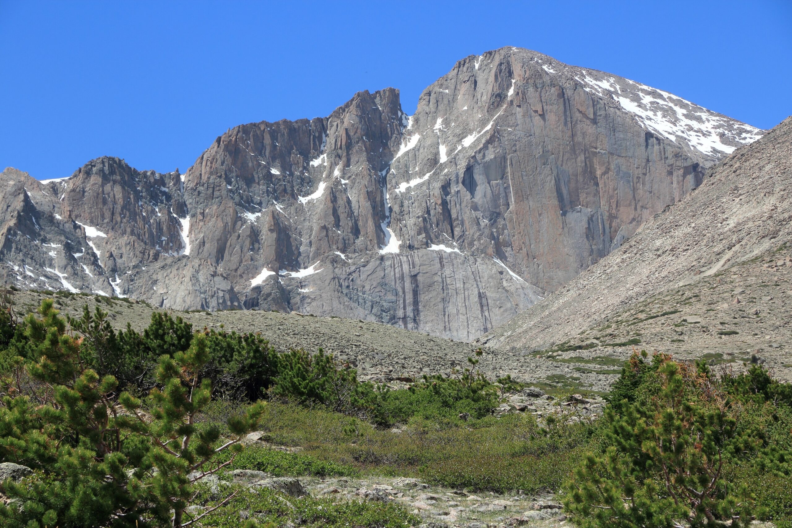
Longs is fundamentally different from Bierstadt or Grays. Beyond the Keyhole, the route crosses exposed scrambling terrain where route finding, dry rock, speed and comfort with consequence matter. A very early alpine start is standard.
Open the Longs Peak guide →6. Pikes Peak
Pikes can be a giant hiking day, a highway summit visit or a Cog Railway trip. The Barr Trail is technically easy but physically huge. If driving, the highway currently requires a $2 timed-entry permit per vehicle during the main summer window, plus normal highway admission.
Open the Pikes Peak guide →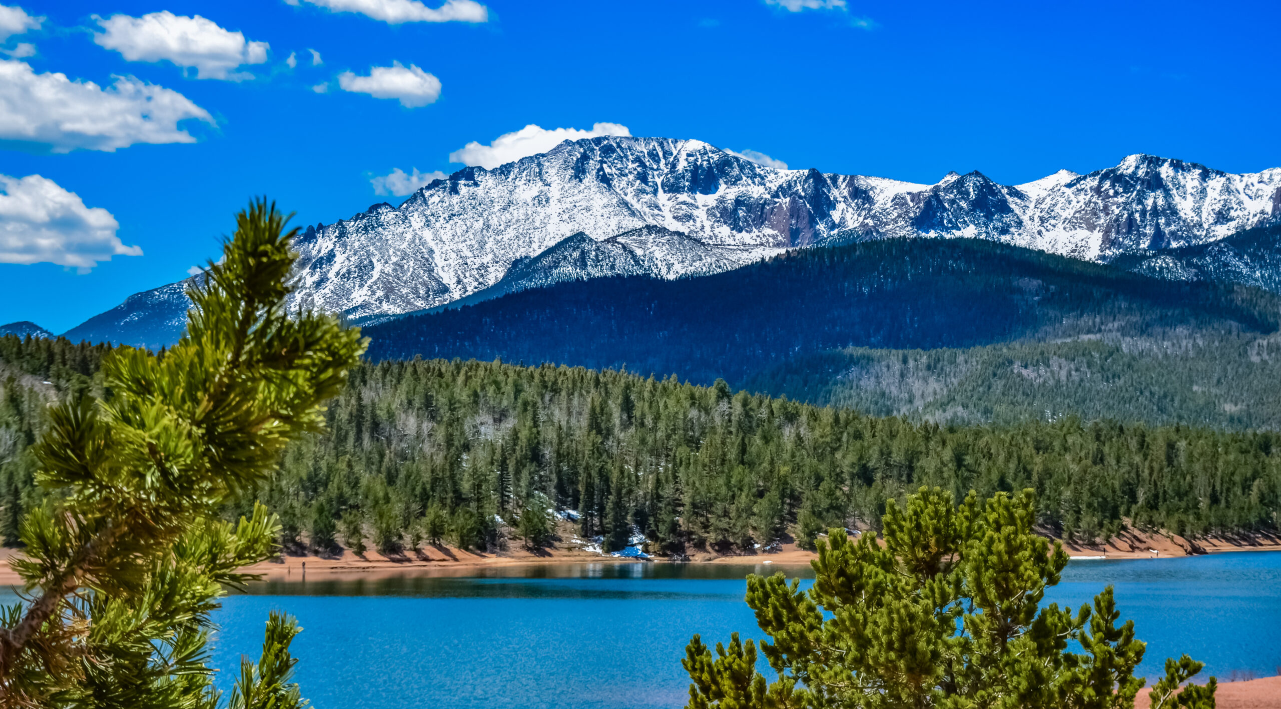
Denver Is High. The Trailheads Are Much Higher.
Landing at 5,280 feet does not make you acclimatized for a 12,000-foot trailhead or a 14,000-foot summit. A short high-altitude route can feel harder than a longer foothills hike because your body has far less oxygen available.
Best 13ers Near Denver
Loveland Pass creates unusually efficient access to 13,000-foot terrain, but the high starting elevation makes acclimatization important.
Mount Sniktau
A short, exposed alpine ridge from Loveland Pass. Sniktau is one of the best places near Denver to learn how you handle 12,000– 13,000 feet without committing to a full 14er.
Grizzly Peak
Continue beyond the easier Loveland Pass objectives into a longer ridge day with more cumulative climbing and stronger weather exposure.
Square Top Mountain
Across Guanella Pass from Bierstadt, Square Top is one of the strongest choices for hikers who want a high alpine summit with fewer people than the standard first-14er crowd.
Cupid
Cupid can be a short standalone summit or part of a longer Loveland Pass ridge day. Its value is efficiency: high altitude without a huge mileage commitment.
Best Foothills Mountains Near Denver
These are the useful choices when you have only half a day, have just arrived from lower elevation or when the high peaks are holding snow.
Mount Falcon
The Morrison-side Castle Trail gives you a real climbing workout with roughly 2,000 feet of gain, while the west trailhead allows easier route combinations.
Lookout Mountain
A simple Golden-area choice when scenery matters more than summit statistics. Combine the preserve trails with the overlooks and other Lookout Mountain attractions.
Mount Galbraith
Jeffco describes Mount Galbraith as a hiker-only park with nearly five miles of steep rocky trails. It is one of the best close-in hikes for getting a mountain feel without I-70.
Chief Mountain
Short mileage combined with an 11,000-foot summit makes Chief a useful bridge between low foothills and high-alpine objectives.
Bergen Peak
Jeffco’s Stagecoach route to Bergen Peak gives you a substantial training hike without the logistical burden or altitude of a 13er or 14er.
Six Checks for Any Front Range Mountain Day
Access rules differ dramatically between a Jeffco foothills park, a Forest Service trailhead and Rocky Mountain National Park.
Several mountains have multiple routes, and the trailhead can change mileage, technical class and permit requirements.
Grays/Torreys is the clearest example: full upper parking can add significant road mileage to an otherwise moderate route.
Mount Blue Sky, RMNP and Pikes Peak vehicle access all use systems that differ from ordinary hiking permits.
Denver weather is not a useful substitute for the forecast at 12,000–14,000 feet.
Lightning, wind, wet rock and worsening altitude symptoms should beat a summit goal.
A 90-minute trailhead can become a very different proposition during summer weekend or ski-season traffic.
The storm rule matters more than the ranking.
Colorado’s high peaks are exposed to fast summer thunderstorm development. Start early enough that your plan puts you below the most exposed terrain before afternoon convection builds. If thunder is audible, the summit decision is already over.
Check the Land Manager Before You Drive
Current access information belongs to the managing agency. Route guides should help interpret it, not replace it.
High peaks
- Mount Blue Sky Recreation Area — current road status and vehicle reservations.
- Rocky Mountain National Park — Longs Peak timed-entry requirements.
- U.S. Forest Service — Guanella Pass, Grays/Torreys and Front Range trailheads.
- 14ers.com — current route descriptions and reported conditions.
Foothills & visitor access
- Jefferson County Open Space — Mount Falcon, Mount Galbraith, Lookout-area trails and alerts.
- Pikes Peak current visitor information — highway schedule, fees and current vehicle reservation rules.
- Global Summit Guide mountain weather — turn the forecast into a go/no-go decision.
- Altitude acclimatization — plan the move from Denver elevation to a 13er or 14er.
Verification date: September 12, 2026
The Mount Blue Sky road restriction, 2026 Rocky Mountain National Park timed-entry window and current major route figures were rechecked for this rebuild. Access can still change after this date, especially because of weather, fire, construction and seasonal road closures.
Mountains Near Denver FAQ
What are the best mountains near Denver?
For a close workout, start with Mount Falcon or Mount Galbraith. For high altitude without a full 14er, try Mount Sniktau. Bierstadt is the best first 14er in this group, Grays and Torreys are the classic double, and Longs Peak is the serious Class 3 progression objective.
What is the closest 14er to Denver?
Bierstadt, Grays, Torreys and Mount Blue Sky all sit in roughly the 60-road-mile range depending on exact route and trailhead. Bierstadt via Guanella Pass is usually the simplest first summit choice.
What is the easiest 14er near Denver?
Mount Bierstadt is usually the clearest first-14er choice: roughly 7.25 miles round trip, 2,850 feet of gain and Class 2 terrain on the standard West Slopes route.
Can you currently drive all the way up Mount Blue Sky?
No. As of September 8, 2026 the road is closed between Summit Lake and the summit. Current vehicle reservations provide access to the lower Mount Blue Sky corridor including Summit Lake.
Do I need a timed-entry reservation for Longs Peak?
In 2026, the Longs Peak area is subject to RMNP’s general timed entry between 9 AM and 2 PM from May 22 through October 12. Most climbers enter much earlier than 9 AM. Normal park entrance requirements still apply.
Which mountains near Denver are good for acclimatization?
Begin with a foothills outing such as Mount Falcon, then consider Chief Mountain or Mount Sniktau. This creates a more gradual progression from Denver’s 5,280 feet toward 12,000–14,000-foot terrain.
When is the best time to hike Denver-area 14ers?
July through September is the main snow-free hiking season in a normal year. Conditions vary substantially by snowpack and early autumn storms, and summer afternoon thunderstorms make early starts standard.
Selection & Difficulty Method
This is a Denver-access list, not a ranking of Colorado’s greatest mountains overall.
Selection criteria
- Reasonable day-trip access from Denver.
- A useful range from foothills through 14ers.
- A recognizable summit or meaningful progression objective.
- Established public access under normal conditions.
- Enough variety to serve beginners through experienced scramblers.
Important limitations
- Drive times can change dramatically with traffic.
- Snow changes technical difficulty.
- Road closures change effective route distance.
- Current permits and reservations can change annually.
- This page does not replace a route-specific map or forecast.
Turn the Denver Shortlist Into a Mountain Progression
Use this page to choose the objective. Then move into the Colorado hub, route-specific mountain guides, difficulty framework and altitude/weather planning before the trailhead.
Was this helpful?
🏔Related peaks nearby
🧭Explore & compare
Global Summit Guide is an independent mountaineering resource founded in 2026. The team combines first-hand trekking and climbing experience with in-depth research and professional health and nutrition review to help climbers choose objectives, prepare properly, and stay safe.
Health, altitude, and nutrition content is reviewed by Taylor Ludlow (Registered Nurse) and Brigg Hoopes (Nutritionist).
What We Don't Know Yet
Mountain information changes quickly. This box explains the limits of what this page can responsibly promise.
- Route conditions, snowpack, closures, and weather can change quickly after this page is updated.
- Permit rules, fees, quotas, and reservation windows may change between review cycles.
- Operator availability, pricing, guide ratios, and cancellation terms can change by season.
- Your fitness, altitude response, risk tolerance, and experience level may change what is safe or realistic.
- Use this page for planning guidance, then verify current information with official sources and qualified local experts before committing.
Verify current conditions with official land managers, guide services, local forecasts, and current route reports before booking or climbing.
Mountaineering, rock and ice climbing, glacier travel, and high-altitude activity are inherently dangerous and can result in serious injury or death. The information on Global Summit Guide is provided for general informational and educational purposes only and is not a substitute for professional instruction, qualified guiding, proper equipment, or your own judgment and experience.
Route conditions, weather, snowpack, permits, regulations, and hazards change constantly and may differ from what is described here. Details may be incomplete, out of date, or contain errors. Always verify current information with local authorities, certified guides, and official sources before making any decision in the mountains.
Nothing on this site is medical, legal, or financial advice. Our fitness, acclimatization, altitude, and nutrition content is general in nature; consult a qualified physician before beginning any strenuous exercise program or exposing yourself to high altitude.
You are solely responsible for your own safety and decisions. To the fullest extent permitted by law, Global Summit Guide and its team accept no liability for any loss, injury, damage, or expense arising from use of, or reliance on, this information. By using this site you acknowledge these risks and accept these terms.
Some links on this site may be affiliate links. If you buy through them we may earn a small commission at no extra cost to you; this never affects our recommendations.
Global Summit Guide recommendation path
Next Best Mountain to Research
Use these recommendations to continue the right planning path instead of stopping on one page.
Use current permit, weather, route, and operator information before booking or climbing.
Search Flights, Hotels & Rental Cars
Have the mountain or destination picked? Use Expedia to compare the flights, lodging and rental cars that fit your actual trip dates. For mountain travel, consider arriving early enough for delays and adding a buffer night after the climb before a fixed flight home.
Compare current flight, hotel and car options.
Affiliate disclosure: Global Summit Guide may earn a commission if you book through this link, at no additional cost to you.