
Last updated October 3, 2026


Ama Dablam vs Matterhorn: Two Icons. Two Very Different Tests.
Ama Dablam is often called the “Matterhorn of the Himalayas,” but the nickname describes appearance better than climbing style. Ama Dablam is a multi-week, high-altitude Himalayan expedition with fixed lines, camps and technical climbing above 6,000 metres. The Matterhorn is a lower but extraordinarily fast-moving Alpine ridge climb where route-finding, transitions and descent efficiency determine whether the day works.
Ama Dablam Is the Bigger Expedition. The Matterhorn Demands Faster Alpine Efficiency.
Ama Dablam reaches 6,812 metres—approximately 2,334 metres higher than the Matterhorn. That changes almost everything: acclimatization, cold management, sleeping altitude, expedition duration, high camps and how technical mistakes feel when the climber is functioning in severe hypoxia.
The Matterhorn’s Hörnli Ridge is dramatically lower, but the standard climb compresses the technical problem into a fast Alpine summit day. Climbers must follow complicated ridge terrain efficiently, change between rock and crampon movement without delay and descend the same exposed mountain while tired.
The comparison therefore is not simply “which mountain is harder?” Ama Dablam is the more demanding expedition system and altitude objective. The Matterhorn is a powerful test of rapid route-finding, exposed scrambling and climbing, transitions and downclimbing. A climber can be strong for one and still have meaningful gaps for the other.
Ama Dablam vs Matterhorn at a Glance
Their silhouettes invite comparison. Their normal-route demands make the differences much more useful than the similarities.
| Factor | Ama Dablam | Matterhorn |
|---|---|---|
| Elevation | 6,812 m / 22,349 ft | 4,478 m / 14,692 ft |
| Location | Khumbu, Nepal | Switzerland / Italy |
| Normal route | South West Ridge | Hörnli Ridge from Zermatt |
| Current GSG grade | TD | AD+ |
| Main technical character | Fixed ropes, exposed rock, mixed terrain, steep snow and ice at very high altitude | Sustained exposed ridge movement, route-finding, rock, fixed features, crampon sections and downclimbing |
| Altitude burden | Major | Meaningful but far lower |
| Acclimatization | Multi-day Khumbu approach plus rotations | Arrive acclimatized from prior Alpine objectives |
| Climbing style | Expedition + fixed-line technical climbing | Fast guided or independent Alpine ridge climbing |
| High camps | Multiple high-camp system; exact use varies by team | Hörnli Hut start; no expedition camp chain |
| Normal-route pacing | Multi-day summit strategy | Approximately 4 hr up + 4 hr down current ZERMATTERS benchmark |
| Guide model | Expedition team with Sherpa / guide support depending on program | Current ZERMATTERS standard: 1 climber per guide |
| Primary season | Autumn Oct–Nov; spring also possible | Mid-July to mid-September when conditions permit |
| Biggest mistake | Underestimating technical climbing at altitude | Moving too slowly—especially on descent |
Why Is Ama Dablam Called the “Matterhorn of the Himalayas”?
It is an aesthetic comparison, not a route-grade shortcut.
The Himalayan Pyramid
Ama Dablam’s narrow ridges, steep faces and hanging summit glacier create one of the most recognizable silhouettes in the Himalaya.
That shape has encouraged the Matterhorn analogy for decades, but Ama Dablam adds more than two vertical kilometres of altitude plus Himalayan expedition logistics.
The Original Alpine Icon
The Matterhorn’s near-symmetrical pyramidal form above Zermatt has made it one of mountaineering’s defining images.
The normal Hörnli Ridge is much lower than Ama Dablam, but its sustained route-finding and descent demand rapid technical efficiency.

Camp 2 Shows Why Ama Dablam Is More Than a High Rock Climb.
Climbers live inside the technical route. Camps, fixed ropes, high-altitude exposure and repeated movement through consequential terrain make the climb an expedition system, not simply a long summit day.
The Normal Routes Solve Different Problems.
Ama Dablam stretches technical climbing across a high-altitude expedition. The Matterhorn compresses the problem into a rapid Alpine ascent and descent.
Ama Dablam
Matterhorn

The Matterhorn Rewards Speed Without Rushing.
The goal is not reckless movement. It is eliminating wasted time: clean route-finding, efficient transitions, confident footwork and controlled downclimbing before weather or fatigue catches up.
“Harder” Depends on Which Skill You Are Testing.
Elevation, technical movement, route-finding, expedition systems and descent efficiency should be separated instead of compressed into one rating.
Ama Dablam
The 2,334-metre elevation difference transforms cold, recovery, sleep, pace and decision-making.
Ama Dablam
Climbers must integrate acclimatization, fixed ropes, camps, equipment and multiple days high on the mountain.
Matterhorn
Being technically capable is not enough if the climber loses time finding the efficient line.
Matterhorn
The descent demands fast, controlled reversal of terrain already climbed on the way up.
Ama Dablam
Himalayan altitude creates a far more demanding cold-management and insulation problem.
Both
Rope systems, crampons and changing terrain reward practiced movement rather than improvisation.
Similar Categories of Gear—Very Different Systems.
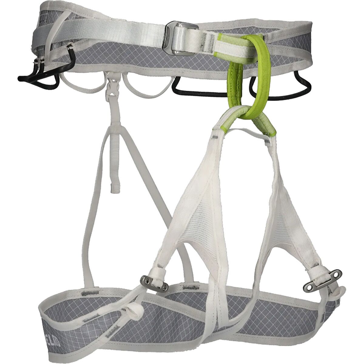
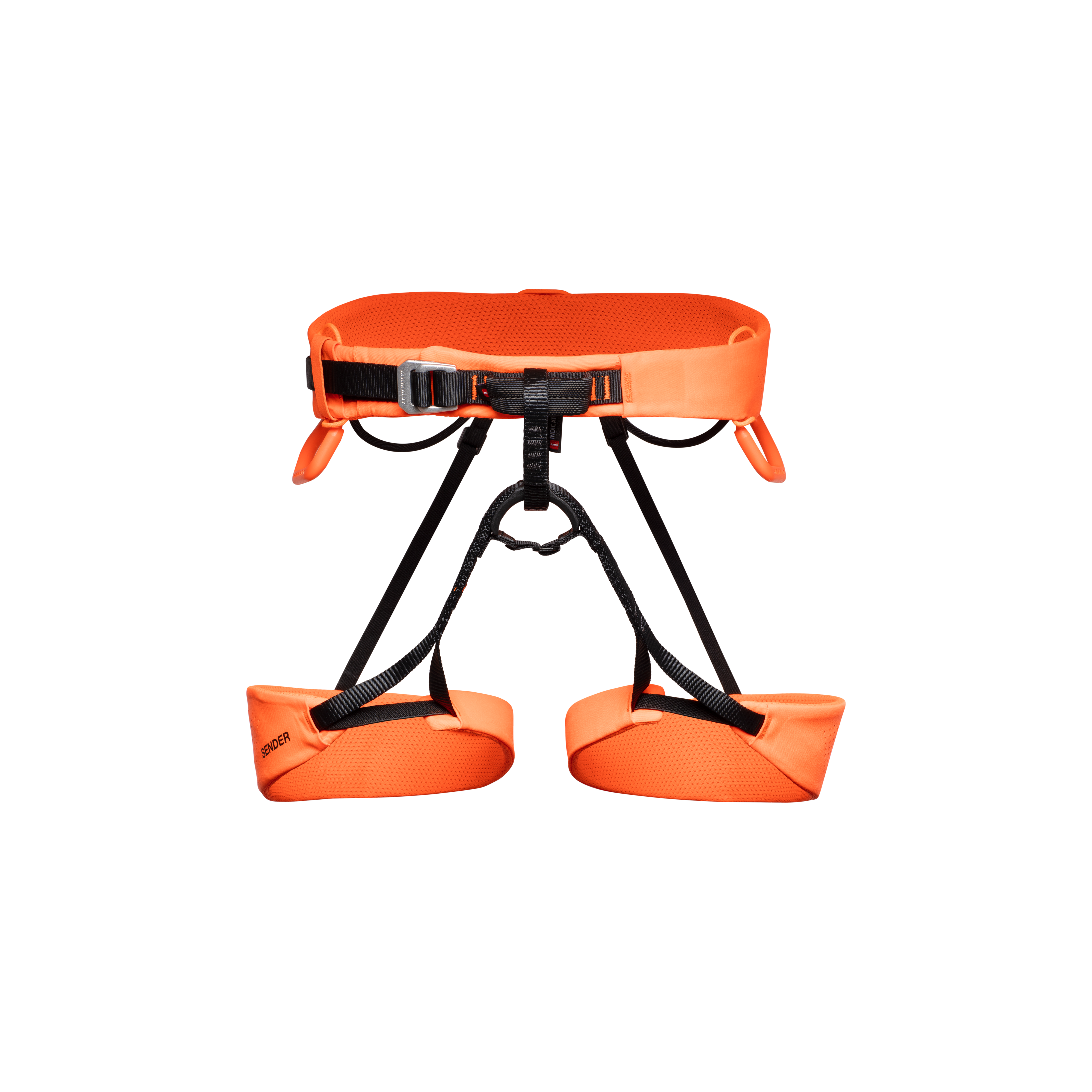
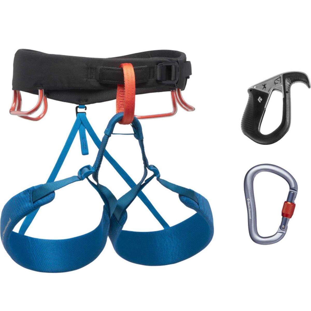
Boots, crampons, harnesses and helmets appear on both objectives. That does not mean the same equipment setup is appropriate for both.
Expedition Technical System
- High-altitude mountaineering boots appropriate to expected cold.
- Steel crampons compatible with the selected boots.
- Harness worn for prolonged fixed-line travel.
- Helmet for technical ridge terrain.
- Ascender / jumar system for fixed ropes.
- Rappel / belay equipment specified by the operator.
- Ice axe or tools according to current route strategy.
- Expedition-level hand and insulation systems.
Fast Alpine System
- Technical mountaineering boots that climb efficiently.
- Crampons ready for rapid transitions.
- Helmet for exposed rock and falling-object risk.
- Harness and rope system appropriate to the guide or rope team.
- Ice axe where required by current upper-mountain conditions.
- Compact layers that support fast movement.
- Equipment selected for efficiency rather than expedition living.
Technical Alpine Gear
Compare current mountaineering boots, crampons, harnesses and helmets after identifying the equipment system your route and guide actually require.
Technical Alpine Gear

Ama Dablam Starts Days Before You Reach the Mountain.
The trek through the Khumbu is part of the climbing strategy. Sleeping elevations rise gradually, and many programs add further acclimatization before committing to the South West Ridge.
Altitude Is the Biggest Difference Between These Mountains.
The technical comparison matters only after the climber accounts for a 2,334-metre elevation gap.
6,812 m / 22,349 ft
Technical movement takes place at elevations where aerobic capacity is sharply reduced, sleep is harder, recovery is slower and ordinary tasks consume more energy.
Climbers need an itinerary that treats acclimatization as part of the route rather than as spare time before climbing.
4,478 m / 14,692 ft
Altitude still matters and climbers should arrive properly acclimatized, but the physiological challenge is in a different category from Ama Dablam.
That lower elevation allows the Matterhorn’s challenge to concentrate more heavily on movement speed and technical efficiency.
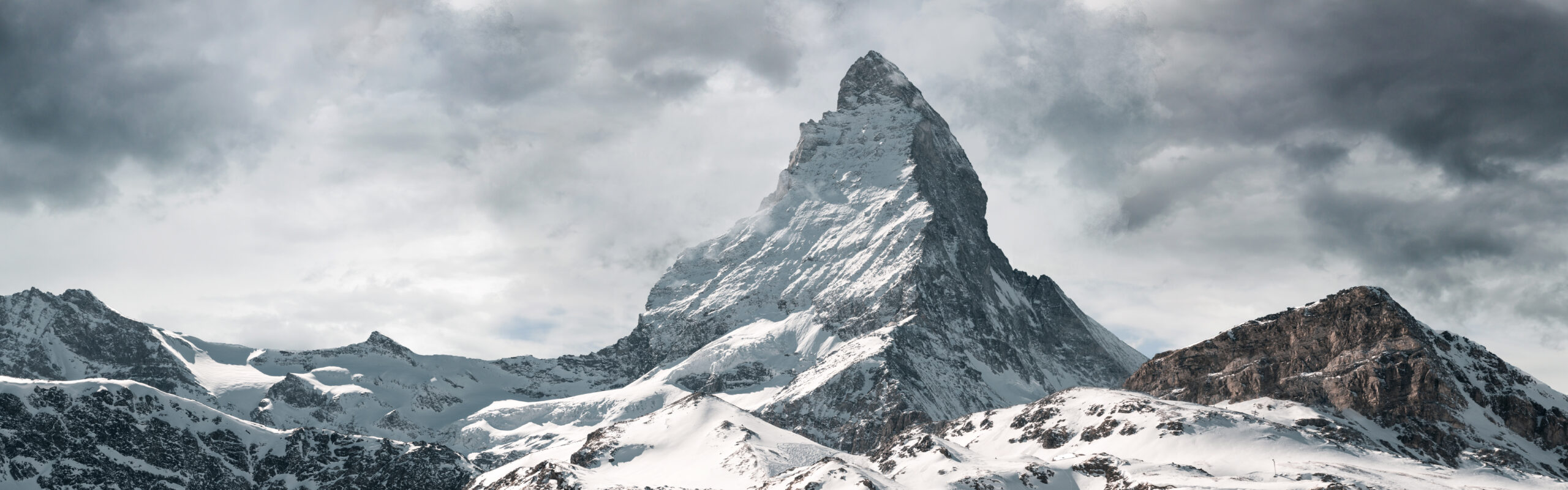
The Matterhorn’s Clock Starts at the Hut.
ZERMATTERS currently uses approximately four hours from the Hörnli Hut to the summit and another four hours back. That benchmark illustrates why technical speed is a safety skill, not a competitive goal.
Both Mountains Punish Climbers Who Train Only for the Ascent.
The descent exposes different weaknesses on each mountain.
Technical Systems While Exhausted
The summit does not end the fixed-line problem. Climbers reverse steep snow, mixed and rock terrain, use rappel systems and continue down through high camps while altitude and fatigue accumulate.
The key is familiarity. Hardware transitions should not become puzzles at 6,000 metres.
Reverse the Whole Route Quickly
The Hörnli Ridge is not a summit-and-walk-off climb. Climbers reverse the same complex ridge, often downclimbing sections that felt much simpler on ascent.
ZERMATTERS’ equal four-hour ascent and descent benchmarks make the point clearly: the descent deserves half of the day’s plan.
Khumbu Expedition vs Zermatt Alpine Objective
Geography shapes logistics almost as much as terrain.
Ama Dablam
Accessed through the Himalayan trekking and expedition corridor east of Kathmandu, with acclimatization built into the approach.
Matterhorn
Zermatt provides immediate Alpine infrastructure, while the Hörnli Hut places climbers directly beneath the standard ridge.
The Calendar Difference Is Almost as Important as the Altitude Difference.
One objective is built around expedition acclimatization. The other is built around a narrow weather-and-conditions window for one exceptionally efficient summit day.
| Planning Factor | Ama Dablam | Matterhorn |
|---|---|---|
| Primary season | Autumn October–November; spring also used | Mid-July to mid-September when route conditions permit |
| Trip structure | Multi-week expedition | Alpine climbing trip with acclimatization days |
| Current operator example | Current traditional programs can approach four weeks when acclimatization and contingency are included | Current guided Hörnli summit day benchmark is about eight hours |
| Weather buffer | Expedition contingency is built around changing Himalayan windows | Allow extra days in Zermatt because one storm can take the route out of condition |
| Acclimatization | Integral part of the expedition | Should largely be completed before summit day |
The Matterhorn Removes Expedition Logistics—but Not Preparation.
Zermatt makes access simple compared with the Khumbu. The climb itself remains unforgiving of weak acclimatization, slow movement, poor route-finding or an inefficient descent.
Ama Dablam Is an Expedition Purchase. The Matterhorn Is an Alpine Guiding Purchase.
Headline prices become misleading when the products themselves are fundamentally different.
Many Moving Parts
- Nepal expedition permit and administration.
- Kathmandu and Khumbu logistics.
- Domestic mountain access.
- Base Camp infrastructure.
- High-altitude staff and guide structure.
- High camps and route support.
- Expedition-specific equipment.
- Insurance and rescue planning.
- Multiple weeks of meals and lodging.
- Contingency for weather and itinerary changes.
A Shorter Alpine Structure
- Travel to Switzerland / Zermatt.
- Acclimatization climbs before the attempt.
- Hörnli Hut reservation.
- 1:1 guide if climbing with the local guided model.
- Technical equipment.
- Weather buffer in Zermatt.
- Insurance appropriate to technical mountaineering.
Compare current operator and guide inclusions rather than assuming that the lower headline quote is the better value. The two mountains sell fundamentally different types of support.
Deep Recovery · 3 How to Choose an Expedition Operator Compare staffing, guide ratios, inclusions, contingency, rescue planning and communication rather than headline price alone.Ama Dablam Adds Altitude to Skills That Should Already Be Familiar.
Fixed-line movement, exposed climbing, rappelling, crampon technique and technical judgment should not be first-time skills on this mountain. Altitude makes familiar systems harder—it does not create extra room to learn them.
Choose the Gap You Actually Need to Close.
The Matterhorn and Ama Dablam can both belong in a technical-mountaineering progression without one being a mandatory prerequisite for the other.
You Need to Prove Fast Alpine Movement.
- You already climb confidently on exposed Alpine rock.
- You are comfortable moving in mountain boots.
- Crampon transitions are routine.
- You can follow complex terrain without constant pauses.
- You descend technical ground as confidently as you ascend it.
- You are already acclimatized to Alpine 4,000-metre terrain.
You Need a Technical Himalayan Expedition.
- You already have strong rock, snow and ice fundamentals.
- You have meaningful experience around 6,000 metres.
- Fixed-line ascender and rappel systems are automatic.
- You tolerate sustained exposure well.
- You understand multi-week expedition pacing.
- You want technical Himalayan experience before larger objectives.
A Famous Summit Is Not a Skill Certificate.
Finishing the Matterhorn does not automatically create high-altitude expedition competence. Finishing Ama Dablam does not automatically create the route-finding speed expected on the Hörnli Ridge. Evaluate the skills demonstrated, not just the mountain name.
Two Iconic Peaks From Two Different Mountaineering Eras
The Matterhorn became a symbol of nineteenth-century Alpine exploration. Ama Dablam belongs to the later era of Himalayan technical mountaineering.
Matterhorn
Edward Whymper’s party made the first ascent via the Hörnli side. Four members of the seven-person party died in a fall during the descent, a reminder that the mountain’s descent has been central to its history from the beginning.
Ama Dablam
Mike Gill, Barry Bishop, Mike Ward and Wally Romanes made the first ascent by the South West Ridge during the wider Silver Hut expedition period. The same ridge remains the mountain’s standard climbing line.
Frequently Asked Questions
Is Ama Dablam harder than the Matterhorn?
Which is higher, Ama Dablam or the Matterhorn?
Why is Ama Dablam called the Matterhorn of the Himalayas?
What is the normal route on Ama Dablam?
What is the normal route on the Matterhorn?
How long does it take to climb the Matterhorn?
How long does an Ama Dablam expedition take?
Should I climb the Matterhorn before Ama Dablam?
Does Ama Dablam prepare you for the Matterhorn?
Which mountain requires more acclimatization?
Which mountain is more expensive?
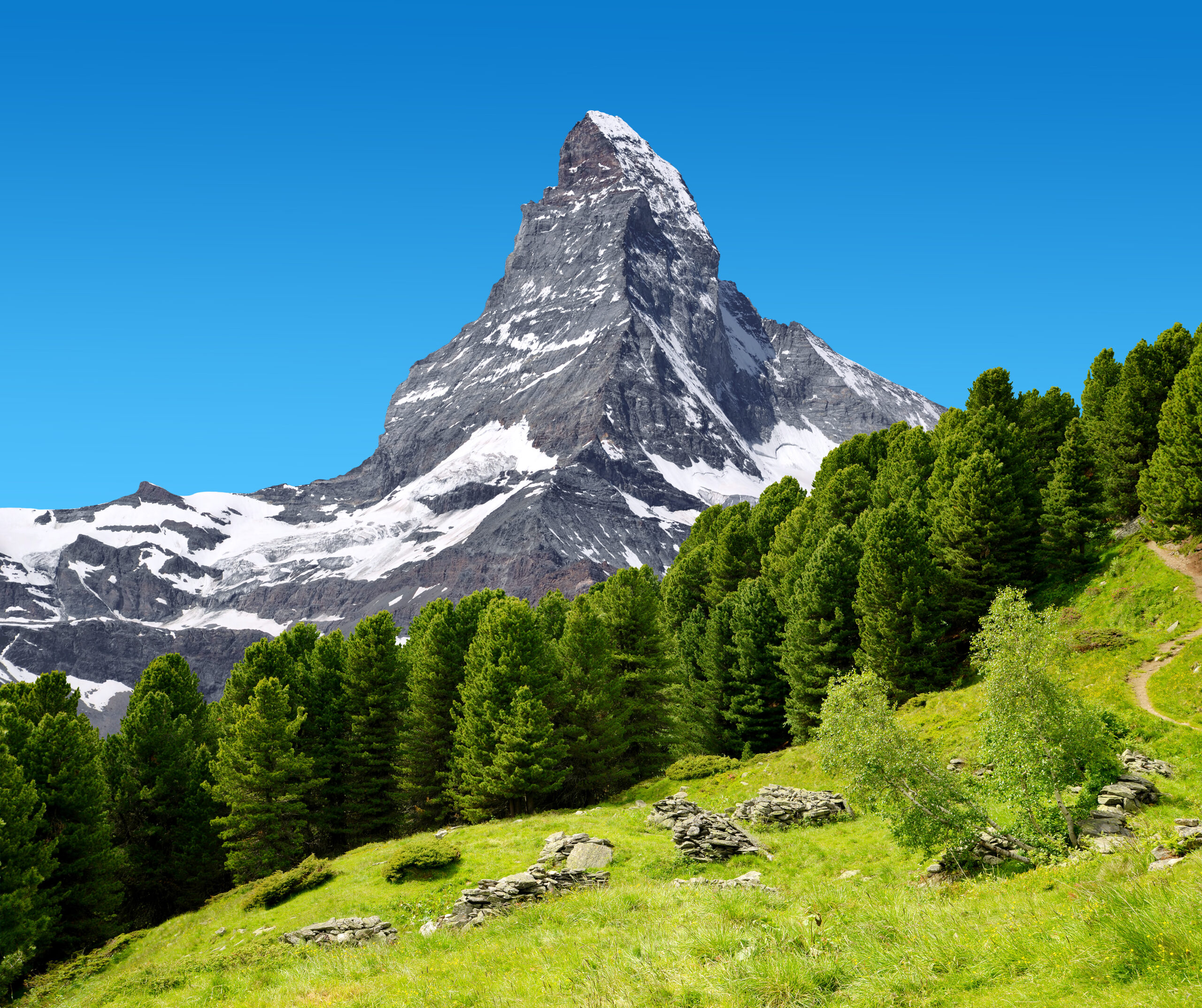
Ama Dablam Tests the Expedition Climber. The Matterhorn Tests the Efficient Alpinist.
Ama Dablam adds serious altitude, fixed-line systems, high camps and Himalayan expedition logistics to technical climbing. The Matterhorn removes much of that logistical complexity and replaces it with a brutally simple requirement: move accurately, continuously and efficiently up—and then back down. Choose the mountain that matches the skills you have already proved and the ones you need to develop next.
Was this helpful?
🏔Related peaks nearby
🧭Explore & compare
Global Summit Guide is an independent mountaineering resource founded in 2026. The team combines first-hand trekking and climbing experience with in-depth research and professional health and nutrition review to help climbers choose objectives, prepare properly, and stay safe.
Health, altitude, and nutrition content is reviewed by Taylor Ludlow (Registered Nurse) and Brigg Hoopes (Nutritionist).
What We Don't Know Yet
Mountain information changes quickly. This box explains the limits of what this page can responsibly promise.
- Comparisons simplify complex decisions; the better mountain depends on current conditions, skills, timing, budget, and risk tolerance.
- Visa, passport, vaccination, border, insurance, and local transportation rules may change before your trip.
- Route conditions, snowpack, closures, and weather can change quickly after this page is updated.
- Permit rules, fees, quotas, and reservation windows may change between review cycles.
- Operator availability, pricing, guide ratios, and cancellation terms can change by season.
Verify current conditions with official land managers, guide services, local forecasts, and current route reports before booking or climbing.
Mountaineering, rock and ice climbing, glacier travel, and high-altitude activity are inherently dangerous and can result in serious injury or death. The information on Global Summit Guide is provided for general informational and educational purposes only and is not a substitute for professional instruction, qualified guiding, proper equipment, or your own judgment and experience.
Route conditions, weather, snowpack, permits, regulations, and hazards change constantly and may differ from what is described here. Details may be incomplete, out of date, or contain errors. Always verify current information with local authorities, certified guides, and official sources before making any decision in the mountains.
Nothing on this site is medical, legal, or financial advice. Our fitness, acclimatization, altitude, and nutrition content is general in nature; consult a qualified physician before beginning any strenuous exercise program or exposing yourself to high altitude.
You are solely responsible for your own safety and decisions. To the fullest extent permitted by law, Global Summit Guide and its team accept no liability for any loss, injury, damage, or expense arising from use of, or reliance on, this information. By using this site you acknowledge these risks and accept these terms.
Some links on this site may be affiliate links. If you buy through them we may earn a small commission at no extra cost to you; this never affects our recommendations.
Global Summit Guide recommendation path
Next Best Mountain to Research
Use these recommendations to continue the right planning path instead of stopping on one page.
Use current permit, weather, route, and operator information before booking or climbing.