The greatest mountains in the USA: a climber’s ranking of the 10 best American peaks
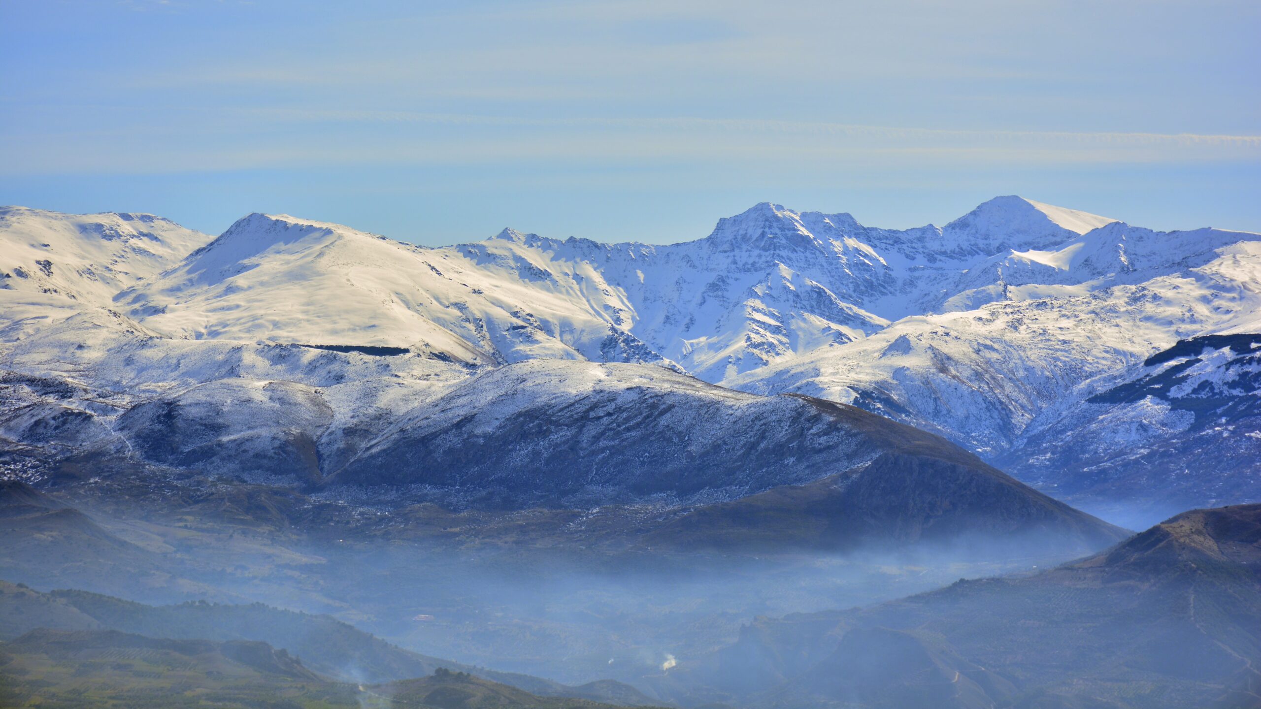
The United States contains some of the most varied and dramatic mountain terrain in the world — from Alaska’s massive Denali at 6,190 meters to Hawaii’s Mauna Kea (taller than Everest if measured from the seafloor), through the Cascade volcanoes, the Rocky Mountain 14ers, the Sierra Nevada, the Tetons, and the dramatic peaks of the Northeast. Picking the “greatest” American mountains depends on which axis you measure — height, climbing significance, cultural importance, or sheer drama. This ranking covers the 10 mountains that consistently appear on US climbers’ lifetime lists, with honest assessment of why each one matters and how it fits in the broader American mountaineering landscape. For broader context see our best mountains in the USA master guide.
How these peaks were ranked honest criteria
“Greatest” is a contested word when applied to American mountains. A peak’s greatness depends on which axis you weight most heavily:
- Highest: Denali wins by 1,800+ meters over the next-highest US peak.
- Most-climbed: Mount Whitney (~30K annual summits) and Mount Rainier (~10K) dominate.
- Most photographed: The Grand Teton and Mount Rainier compete with Half Dome and El Capitan.
- Most technically demanding: The Cassin Ridge on Denali, the north faces of the Tetons, and high-altitude routes in the Alaska Range.
- Most historically significant: Mount McKinley/Denali first ascent, Mount Whitney for the lower 48, and the iconic Yosemite walls.
- Most extreme weather: Mount Washington holds the official US record for the highest non-tornado wind speed at sea level.
- Most culturally important: Mount Rushmore (literally carved with presidents), the Grand Canyon, and the Tetons in popular imagination.
The ranking below uses a composite — peaks that consistently appear on serious US climbers’ lifetime lists, with explanations of what makes each one matter. The order is approximately by overall climbing significance rather than strict elevation. For climbers focused specifically on peak-bagging, the Colorado 14ers and Utah peaks provide structured project lists that complement this ranking.
The crown peaks the absolute icons
Denali
Denali (formerly Mount McKinley) is the highest mountain in the United States and the highest peak in North America. The mountain rises 5,500+ meters from its base in the Alaska Range — one of the largest base-to-summit vertical relief profiles on Earth, larger than Everest’s relief from base camp to summit. The standard West Buttress route involves three weeks of glacier expedition climbing at high latitude, severe cold (the coldest mountain in the Seven Summits despite not being the highest), and significant logistics requirements.
Denali requires real mountaineering skill including glacier travel, rope team management, and cold-weather expedition camping. Most climbers train for several years before attempting Denali, typically through structured progressions on smaller Cascade volcanoes, Aconcagua, or Mexican volcanoes. The full Denali framework is in our Denali climbing guide, with the training framework in our Denali progression plan and route detail in our Denali route comparison. The peak-vs-peak framework against other major mountains is in our Aconcagua vs Denali and Rainier vs Denali comparisons.
Mount Rainier
Mount Rainier is the most iconic Cascade volcano and the most-climbed major glaciated peak in the contiguous United States. The mountain dominates the Seattle/Tacoma skyline from 80 miles away and contains more glacier ice than all other Cascade volcanoes combined. The standard Disappointment Cleaver and Emmons Glacier routes are graded glacier mountaineering with serious crevasse hazard, requiring full rope team protocols and proper crampon technique.
Rainier is the standard training mountain for climbers preparing for Denali, Aconcagua, and Himalayan expeditions. Approximately 10,000 climbers attempt the summit each year with summit success rates around 50%. The mountain is the proving ground for nearly every serious American mountaineer. The full Rainier framework is in our Rainier progression plan, with the comparison against Denali in our Rainier vs Denali analysis. The broader Cascade volcano context is also where many climbers begin their American mountaineering progression.
The iconic peaks recognized worldwide
Mount Whitney
Mount Whitney is the highest peak in the contiguous 48 states and the standard “first big mountain” for many California-based hikers. The standard Whitney Trail is a 22-mile round-trip day hike that gains 6,100 feet of elevation — long and demanding but technically class 1 walking. Approximately 30,000 climbers attempt the summit each year via the standard trail, with the technical Mountaineers Route adding a class 3 option for more experienced climbers.
Whitney requires a permit during the high season (May 1 – November 1) with a competitive lottery system. The standard route can be completed in a single day by fit hikers; many climbers prefer a two-day trip with an overnight at Trail Camp. Whitney is part of the Sierra Nevada peak-bagging tradition that includes peaks like Mount Russell, Mount Muir, and the rest of the California 14ers. The Six Pack of Peaks framework in Southern California is a natural training progression — the detailed plan is in our Six Pack of Peaks guide.
The Grand Teton
The Grand Teton is the highest peak in the Teton Range and one of the most visually iconic mountains in the United States. The dramatic granite spires rising directly from Jackson Hole produce one of the most photographed mountain landscapes in North America. Unlike most US peaks which are accessed via long approach hikes, the Tetons rise vertically from the valley floor with the Grand Teton summit accessible by routes ranging from class 4 walking-and-scrambling to expert technical climbing.
The standard Owen-Spalding route involves a 14-mile round trip with class 4 scrambling and a short technical summit pitch. Most climbers complete it in 2-3 days with overnight camps. The Exum Ridge offers a class 5.5 alternative for technical climbers. The Tetons sit in the broader Wyoming high country and provide some of the best alpine rock climbing in the United States.
Mount Hood
Mount Hood is the highest peak in Oregon and one of the most-climbed major glaciated peaks in the United States, with 10,000 to 15,000 annual climbing attempts. The mountain is visible from Portland and dominates the Oregon skyline. The standard South Side route via the Hogsback is an accessible introduction to glaciated mountaineering with manageable approach times and reliable infrastructure (the Timberline Lodge ski area provides high-elevation starting access).
Hood requires real mountaineering skills including crampons, ice axe, glacier travel, and avalanche awareness. The route involves crossing the Bergschrund and ascending the Hogsback to the summit. Most climbing accidents on Hood happen on the descent when climbers fatigue and conditions change. The full snow travel context for Hood-style climbs is in our microspikes vs crampons decision guide and our ice axe techniques guide.
The classic peaks deep American mountaineering
Longs Peak
Longs Peak is the only 14er in Rocky Mountain National Park and one of the most iconic Colorado peaks. The Keyhole Route is class 3 scrambling on exposed rock with several genuinely committing sections — the Ledges, the Trough, the Narrows, and the Homestretch. The summit attempt is a long 15-mile round-trip day hike with 5,000 feet of elevation gain. Most climbers start before 3 AM to beat afternoon thunderstorms.
Longs Peak has killed approximately 60 climbers in recorded history — high among US 14ers due to the technical scrambling at high altitude combined with weather exposure. The peak is widely considered one of the most rewarding 14ers in Colorado for climbers seeking real mountaineering character rather than walk-up summits. The full Colorado 14ers framework is in our Colorado 14ers guide.
Mount Washington
Mount Washington is the highest peak in the Northeast and one of the most dangerous mountains in the United States despite its modest elevation. The mountain holds the official US record for the highest non-tornado wind speed at sea level (231 mph in 1934) and one of the most extreme weather profiles in the country. Approximately 150 climbers have died on Washington since 1849 — a remarkably high count for a peak that can technically be hiked in a single day.
The mountain’s deceptive accessibility (an auto road climbs to the summit) hides the genuine danger of its weather. Summer hikers regularly die from hypothermia in unexpected storms. Winter climbing on Washington is some of the most extreme weather mountaineering in the Lower 48. The Presidential Range traverse including Washington and adjacent peaks is one of the most committing extended climbing routes in the eastern United States.
Mount Shasta
Mount Shasta is the largest stratovolcano in the contiguous US by volume and one of the most striking peaks in California. Rising dramatically from the surrounding plains in Northern California, Shasta is visible from over 100 miles away and contains seven named glaciers on its upper mountain. The standard Avalanche Gulch route is a long but non-technical glacier climb requiring crampons, ice axe, and basic mountaineering skills.
Shasta is widely used as a training peak for Rainier and Denali. The summit can be completed in a single very long day from the trailhead or as a two-day climb with a high camp at Helen Lake. Climbers must navigate variable snow conditions, occasional crevasses on certain routes, and afternoon sun on the south-facing standard route. The mountain sits at the northern edge of California where the Cascade volcanoes meet the Klamath ranges.
Alpine technical peaks advanced objectives
Mount Saint Elias
Mount Saint Elias is the second-highest peak in the United States and one of the most remote and demanding climbing objectives anywhere in North America. The mountain straddles the Alaska-Yukon border in the Saint Elias Range and rises directly from the Pacific Ocean to its 5,489-meter summit — the largest vertical relief from sea level of any peak in the world. The standard route involves serious glacier travel, severe weather, and weeks of expedition committment.
Saint Elias is climbed by far fewer parties than Denali and represents the next step beyond Denali for serious American alpinists. The mountain’s combination of remote access, severe weather, and technical climbing makes it one of the few peaks in the lower 48 + Alaska zone that compares to Himalayan or Karakoram objectives. Most climbers who pursue Saint Elias have completed Denali first and seek the mountain as a step toward 8000-meter peaks.
Mount Foraker
Mount Foraker is Denali’s neighbor in the Alaska Range and the third-highest peak in the United States. The mountain rises adjacent to Denali and is often visible from Denali climbers’ high camps, but is dramatically less climbed. Foraker requires technical alpine climbing on its standard Sultana Ridge route — significantly harder than Denali’s West Buttress. Most climbers attempting Foraker have completed multiple Alaska Range expeditions first.
Foraker represents the technical alpine character of Alaska Range climbing beyond the relatively non-technical Denali standard route. The mountain has killed several elite climbers and is considered among the most demanding peaks in the contiguous US + Alaska region. The Mooses Tooth, Mount Hunter, and other Alaska Range peaks form a portfolio of advanced alpine objectives that natural progression follows Foraker climbing.
All 10 peaks at a glance
| Rank | Peak | State | Elevation | Character |
|---|---|---|---|---|
| 1 | Denali | Alaska | 6,190 m | The crown — highest in North America |
| 2 | Mount Rainier | Washington | 4,392 m | Most iconic Cascade volcano, training peak |
| 3 | Mount Whitney | California | 4,421 m | Highest in lower 48, walking trail |
| 4 | Grand Teton | Wyoming | 4,199 m | Most photographed, granite spire |
| 5 | Mount Hood | Oregon | 3,429 m | Most-climbed glaciated peak |
| 6 | Longs Peak | Colorado | 4,346 m | Iconic Colorado 14er, class 3 |
| 7 | Mount Washington | New Hampshire | 1,917 m | Most extreme weather in lower 48 |
| 8 | Mount Shasta | California | 4,322 m | Largest Cascade volcano by volume |
| 9 | Mount Saint Elias | Alaska/Yukon | 5,489 m | Largest sea-level relief on Earth |
| 10 | Mount Foraker | Alaska | 5,304 m | Technical Alaska Range alpine |
Several iconic American peaks didn’t make the top 10 ranking but deserve mention: Mount Elbert in Colorado (the highest 14er in the lower 48), Pikes Peak in Colorado (the most-visited mountain), Mount St. Helens in Washington (the famous erupted volcano), Half Dome in Yosemite (the granite icon), Mount Mansfield in Vermont (the highest Eastern peak outside New Hampshire), Mauna Kea in Hawaii (the tallest mountain in the world if measured from seafloor), and the Mount Kineo in Maine. Each could legitimately make a top 15 list. The full peak-by-peak detail is in our best mountains in the USA master guide.
USA mountains by region where to find each character
| Region | Character | Highest peak | Key climbing destinations |
|---|---|---|---|
| Alaska Range | Expedition mountaineering, glaciated, remote | Denali 6,190 m | Denali, Foraker, Hunter, Mooses Tooth |
| Cascade Range | Glaciated volcanoes, accessible from Seattle/Portland | Mount Rainier 4,392 m | Rainier, Baker, Hood, Adams, Shasta |
| Sierra Nevada | Granite peaks, hiking and technical climbing | Mount Whitney 4,421 m | Whitney, Half Dome, El Capitan, Yosemite peaks |
| Rocky Mountains | Non-technical to class 4 mountaineering, 14ers tradition | Mount Elbert 4,401 m | Longs Peak, Pikes Peak, Maroon Bells, Colorado 14ers |
| Teton Range | Granite spires, alpine rock climbing | Grand Teton 4,199 m | Grand Teton, Middle Teton, South Teton, Mount Owen |
| Wasatch / Uinta (Utah) | Diverse Wasatch + remote Uinta high country | Kings Peak 4,123 m | Kings Peak, Mount Timpanogos, Mount Nebo |
| White Mountains (NH) | Extreme weather at modest elevation | Mount Washington 1,917 m | Washington, Adams, Jefferson, Madison, Lafayette |
| Adirondacks (NY) | Non-technical hiking, 46er tradition | Mount Marcy 1,629 m | Marcy, Algonquin, Haystack, the 46 high peaks |
| Smoky Mountains | Forested southern Appalachian | Clingmans Dome 2,025 m | Clingmans Dome, Le Conte, Mount Cammerer |
| Brooks Range (Alaska) | Wilderness Arctic mountaineering | Mount Isto 2,761 m | Remote peaks, limited climber traffic |
The regional diversity in American mountaineering is unmatched globally. A single climber building experience across the Cascades (glaciated volcanoes), Rockies (non-technical to class 4 14ers), Sierras (granite peaks), Tetons (alpine spires), and Alaska Range (expedition mountaineering) develops a portfolio of skills that transfers to nearly any mountain range in the world. The full regional context for several of these areas is covered in our supporting guides: Best Mountains Near Denver, Best Mountains in Utah, SoCal Six Pack of Peaks, and Colorado 14ers.
A US climbing progression how climbers approach American peaks
For climbers building toward serious American mountaineering, the typical progression spans 5-10 years and follows a recognizable pattern:
- Year 1 — Local hiking peaks: state high points, local 14ers/13ers, day hikes building fitness and altitude experience.
- Year 2 — Introduction to mountaineering: Mount Whitney (lower 48 high point), Mount St. Helens, or the easier Cascade peaks. Acquire crampons and ice axe; learn basic technique.
- Year 3 — First glaciated peak: Mount Hood, Mount Adams, or Mount Baker. Learn rope team travel and serious glacier protocols.
- Year 4 — Major glaciated objective: Mount Rainier as the standard “test piece” before bigger objectives. Most climbers attempt Rainier 2-3 times across multiple seasons.
- Year 5 — International or major US: Aconcagua, Cotopaxi, Mexican volcanoes, or the harder Cascade objectives like Mount Shasta and Mount Olympus.
- Year 6+ — Expedition mountaineering: Denali as the standard major American expedition objective. Builds toward 7,000-meter peaks abroad.
- Advanced — Technical American alpine: the Tetons technical routes, Alaska Range objectives beyond Denali, Yosemite big wall climbing, advanced Sierra Nevada alpine.
Few countries in the world contain the full mountaineering range from class 1 walking trails to expedition-level technical alpine within their borders. American climbers can build a complete career — from first 14er to major expedition — without leaving the United States. This isn’t quite true of any other country except maybe Russia (with the Caucasus + Altai + Kamchatka combination) or China (with its dramatic range). For most US climbers, this regional diversity makes serious mountaineering more accessible than equivalent international objectives.
Cost framework for US mountaineering honest budgeting
| Trip type | Typical cost (USD) | Notes |
|---|---|---|
| Mount Whitney day hike (self-guided) | $100-$300 | Permit + accommodations |
| Colorado 14er weekend (self-guided) | $200-$500 | Lodging + transport + gear |
| Mount Hood guided climb (3 days) | $800-$1,500 | 2-day course or guided summit |
| Mount Rainier guided climb (4 days) | $1,500-$2,500 | RMI, Mountain Madness, or Alpine Ascents |
| Grand Teton guided climb (4 days) | $1,800-$2,800 | Exum Mountain Guides or Jackson Hole Mountain Guides |
| Mount Shasta guided climb (3 days) | $900-$1,500 | Multiple operators available |
| Denali expedition (3 weeks) | $8,000-$15,000 | RMI, IMG, or Mountain Trip |
| Mount Saint Elias expedition | $15,000-$30,000+ | Few operators; mostly private expeditions |
US peaks are dramatically cheaper than equivalent international objectives because of easier logistics and lower permit costs. Denali is probably the best value among major peaks: $8K-$15K for a 6,190-meter expedition compared to $25K-$40K for similar-altitude Himalayan peaks like Cho Oyu. The full cost framework for major peaks is in our Aconcagua cost breakdown and seven summits cost guide for comparison.
When to climb US mountains seasonal framework
| Region | Best season | Avoid |
|---|---|---|
| Cascade volcanoes | May-July (firm snow, longer days) | Late August (rotten snow, crevasses open) |
| Sierra Nevada peaks | July-September (snow cleared) | Winter (avalanche risk, technical) |
| Colorado 14ers | July-September (dry summer) | Afternoon thunderstorms – start early |
| Grand Teton | July-September (rock dry) | Spring/early summer (still snow on routes) |
| Denali / Alaska Range | May-July (24-hour daylight) | August-April (cold, dark, severe weather) |
| Mount Washington / NE | June-September hiking; Jan-Mar winter mountaineering | April-May (rotten snow transitional) |
| Utah / Wasatch | July-September high country | Winter for non-skiers |
| Mount Hood | May-July (firm snow) | Late summer (rotten snow, glacier issues) |
The complete US mountaineering framework
Detailed peak profiles, route guides, costs, and the broader American climbing context.
Master guide →The bottom line on the greatest mountains in the USA
The United States contains some of the most varied mountain terrain in the world, spanning class 1 walking trails to expedition-level technical alpine within a single country. The 10 mountains that consistently appear on serious US climbers’ lifetime lists are Denali (the crown peak), Mount Rainier (the training mountain), Mount Whitney (the lower 48 high point), the Grand Teton (the granite icon), Mount Hood (most-climbed glaciated peak), Longs Peak (the iconic Colorado 14er), Mount Washington (extreme weather at modest elevation), Mount Shasta (largest Cascade volcano), Mount Saint Elias (largest sea-level relief), and Mount Foraker (technical Alaska Range). These peaks span the full range of American climbing experience and provide a progression from beginner-accessible day hikes to advanced expedition mountaineering. The natural climbing progression — from local 14ers and state high points through Cascade volcanoes to Denali — provides world-class preparation for international objectives. American mountains are also dramatically cheaper than equivalent international peaks due to easier logistics and lower permit costs. For climbers building toward serious mountaineering, the US offers everything from the Six Pack of Peaks in Southern California to the Alaska Range — without leaving the country. The full peak-by-peak framework is in our best mountains in the USA master guide, with detailed regional coverage in our Colorado 14ers guide, Utah mountains guide, Denver area mountains, and Six Pack of Peaks.
Frequently asked questions
What is the highest mountain in the United States?
Denali in Alaska is the highest mountain in the United States at 6,190 meters (20,310 feet). Denali is also the highest peak in North America and one of the Seven Summits. The mountain was formerly named Mount McKinley but was officially renamed Denali (its traditional Koyukon name) in 2015. Mount Elbert in Colorado at 4,401 meters is the highest peak in the contiguous 48 states. Mauna Kea in Hawaii is technically taller than Denali when measured from its base on the ocean floor (10,210 m total), but Denali is the highest by elevation above sea level.
What are the most famous mountains in America?
The most famous mountains in America include Denali (the highest, in Alaska), Mount Rainier (the most iconic Cascade volcano), Mount Whitney (the highest in the contiguous 48 states), the Grand Teton (the most iconic Wyoming peak), Mount Hood (the most-climbed glaciated peak), Longs Peak in Colorado, Mount Washington in New Hampshire (the most extreme weather), Pikes Peak in Colorado, Half Dome in Yosemite, and El Capitan in Yosemite. These peaks define American mountaineering and represent the range of climbing experiences available in the United States.
What is the most climbed mountain in the USA?
Mount Rainier in Washington State is among the most-climbed major glaciated peaks in the USA, with approximately 10,000 climbing attempts annually on its standard routes. For non-technical hiking objectives, Mount Whitney has approximately 30,000 successful summits per year. Mount Hood in Oregon sees 10,000 to 15,000 annual climbing attempts. The most-climbed mountain by total visitor numbers (including non-climbing tourists) is likely Pikes Peak in Colorado due to the cog railway and toll road providing access to the summit. By climbing route attempts requiring mountaineering skill, Mount Rainier leads.
What is the best mountain to climb in the USA for beginners?
The best beginner mountain in the USA depends on the climber’s location and goals. For non-technical fitness hiking, Mount Whitney in California offers the highest summit in the lower 48 via a permitted day hike. For introduction to glaciated mountaineering, Mount Hood in Oregon and Mount St Helens in Washington provide accessible objectives with proper instruction. For a multi-mountain progression, the Six Pack of Peaks challenge in Southern California offers structured difficulty progression. For the Eastern US, Mount Washington in New Hampshire provides serious alpine experience at lower elevation. Most climbers start with state high points or local 13ers/14ers before progressing to glaciated peaks.
How dangerous are mountains in the USA?
Mountain danger in the USA varies dramatically by peak and conditions. Mount Washington in New Hampshire has approximately 150 recorded fatalities since 1849, ranking it among the most dangerous mountains relative to its modest elevation. Mount Rainier has approximately 80 fatalities and Denali has approximately 100. By absolute numbers, Mount Hood and Mount Rainier have the highest annual fatality counts due to high climber numbers. By relative danger, peaks with severe weather exposure like Mount Washington and remote Alaskan peaks have higher per-climber fatality rates. The hardest mountains to climb framework with empirical safety data is in our most dangerous mountains analysis.
How much does it cost to climb mountains in the USA?
Costs vary widely by peak. Day hikes like Mount Whitney cost approximately 100-300 USD including permits and accommodation. Mount Hood and Mount Rainier guided climbs cost 1,500 to 3,500 USD for 3-4 day expeditions. Denali expeditions cost 8,000 to 15,000 USD for the full 3-week climb including permits, guide service, and transport. National park entrance fees apply at most major US peak destinations. The full cost framework for major US peaks varies dramatically based on whether the climb is self-guided, guided commercially, or part of a larger expedition. US peaks generally cost less than equivalent international objectives in the Alps or Andes due to easier logistics.
What states have the best mountains for climbing?
The best states for mountain climbing in the USA are Alaska (Denali and the Alaska Range), Washington (Mount Rainier and the Cascade volcanoes), Colorado (the 58 fourteeners and dramatic Rocky Mountain peaks), California (Mount Whitney, the Sierra Nevada, and Mount Shasta), Wyoming (the Grand Teton range), Oregon (Mount Hood, Mount Jefferson, the Cascade peaks), Montana (Glacier National Park and the Beartooth Range), Utah (the Wasatch and Uinta ranges), New Hampshire (Mount Washington and the White Mountains), and Arizona (the San Francisco Peaks including Humphreys Peak). Each state offers distinct climbing character ranging from non-technical hiking to serious mountaineering.