
Last updated July 1, 2026
Mulhacén: How to Climb Spain’s Highest Peak
At 3,479 m (11,414 ft), Mulhacén is the highest mountain in mainland Spain and the Iberian Peninsula — yet it’s one of Europe’s most accessible big summits: a non-technical Class 1-2 hike in summer, no permit, reachable in a single day from Granada. This is the complete 2026 guide to all four routes, the seasons, gear, and logistics.
Mulhacén (3,479 m) is Spain’s highest mainland peak and one of Europe’s most accessible 3,000ers — a non-technical summer hike needing no permit, no ropes, and no climbing experience, summitable in a single day via the Capileira shuttle bus. In winter (Nov-May) it becomes a serious mountaineering objective requiring crampons, ice axe, and alpine skills.
📑 On This Page
What Is Mulhacén?
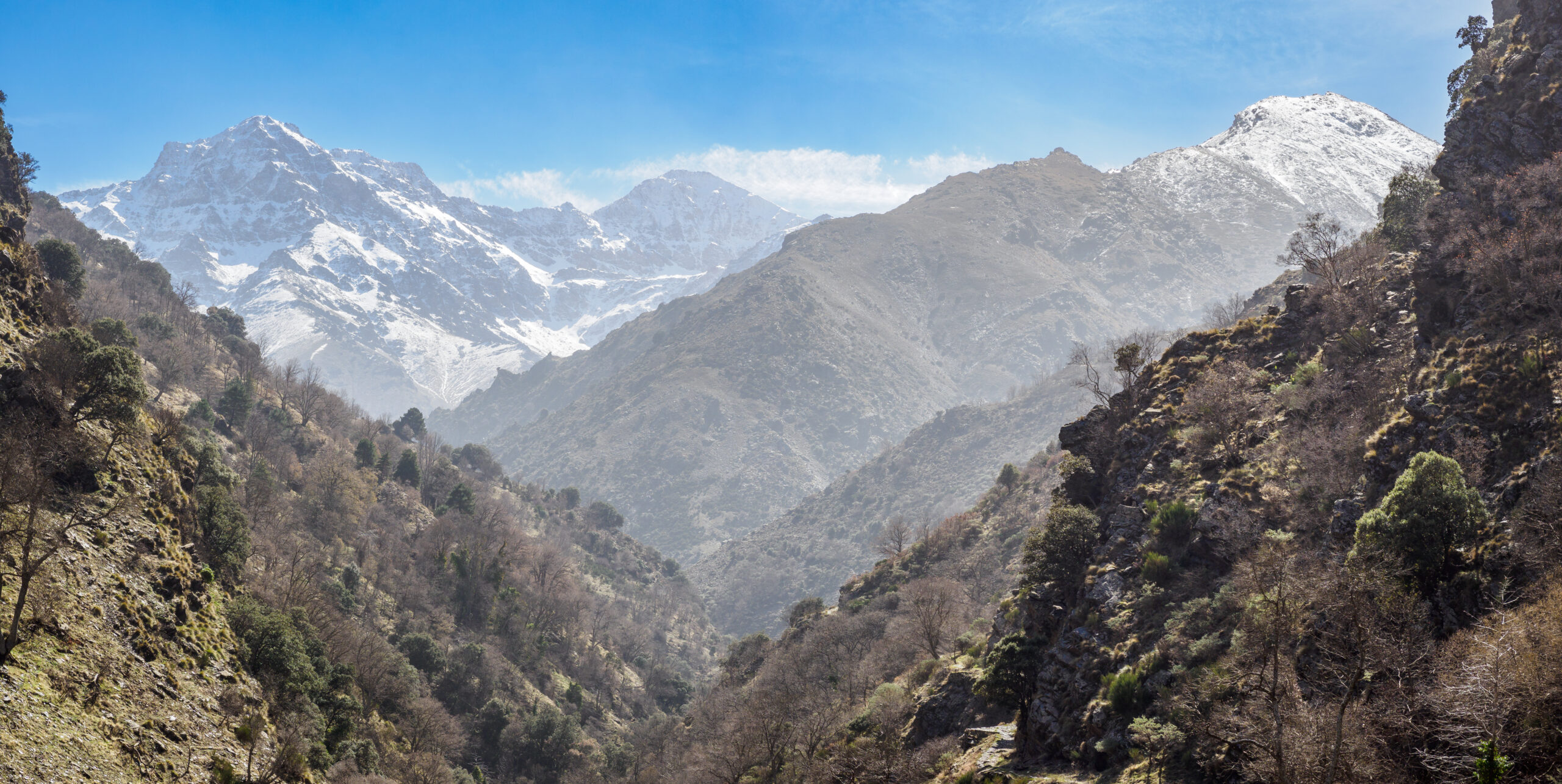
Mulhacén is the highest mountain in mainland Spain and the entire Iberian Peninsula — a 3,479 m (11,414 ft) summit in the Sierra Nevada National Park of Andalusia, southern Spain. It’s also the highest peak in Western Europe outside the Alps, exceeded in all of Spain only by Mount Teide (3,718 m) on Tenerife in the Canary Islands, which is geographically part of Africa. The mountain is named after Abu l-Hasan Ali, the 23rd Nasrid Sultan of Granada, whose tomb is said to lie on the peak.
What makes Mulhacén unique is the pairing of real altitude with genuine accessibility. Mont Blanc and the Matterhorn demand guides, huts, and technical skill; Mulhacén is hikeable by anyone with the fitness for a long day out. The Sierra Nevada — Spain’s largest national park at 86,000+ hectares — holds 22 peaks over 3,000 m, and Mulhacén crowns them all, visible from Granada and the Alhambra 40 km away, snow-capped against the city in winter.
Find Hotels, Flights & Trips for the World’s Best Hiking Destinations
The Global Summit Guide Travel Shop on Expedia — curated for outdoor adventurers, mountaineers, and serious hikers. Patagonia to the Alps. Nepal to the Rockies. Curated lodging for every region we cover.
Explore Travel Shop on Expedia →(1) No permits. A rare advantage over Mont Blanc, the Matterhorn, or Aconcagua — free access to all four routes, year-round. (2) Winter is a different mountain. From November to May the hiking routes become winter-mountaineering objectives needing crampons, ice axe, and alpine experience.
Location, Map & Weather
Mulhacén sits at roughly 37.0539°N, 3.3119°W in the Sierra Nevada National Park — about 40 km southeast of Granada and just 35 km from the Mediterranean at Motril. The surrounding range holds 22 peaks over 3,000 m, including Pico Veleta (3,396 m), Spain’s second-highest mainland summit.
Centered on Mulhacén (37.0539°N, 3.3119°W), showing the Sierra Nevada range, neighboring peaks (Pico Veleta, Alcazaba), gateway villages (Capileira, Trevélez), and the cities of Granada and Motril.
Live Windy.com visualization — surface temperature by default; toggle wind, precipitation, and elevation layers. Summit conditions at 3,479 m typically run 15-20°C cooler than the valleys, with far higher wind exposure.
3,479 m summit plus mid-elevation forecasts — essential for Sierra Nevada day trips, since summit weather differs sharply from valley conditions.
Spain’s official meteorological service (Agencia Estatal de Meteorología) issues mountain bulletins for the Sierra Nevada each morning in season.
Above 3,000 m, afternoon thunderstorms build almost daily in summer — typically forming between noon and 3 PM as ground heat drives convection. Lightning above the tree line is the leading weather-related cause of fatalities on Sierra Nevada peaks, and no gear or skill offsets it. The universal Mulhacén rule: start by 6-7 AM, summit by noon, descend immediately. Check the AEMET mountain bulletin before you set out.
How Long Does It Take?
Climbing Mulhacén takes 4-12 hours total, depending entirely on the route. The shortest is Alto del Chorrillo via the Capileira summer shuttle bus — a 2-3 hour climb from the 2,700 m drop-off. Fitness matters: fit hikers finish Alto del Chorrillo in under 4 hours, while less-fit walkers may need 6+.
| Route | Start | Vertical gain | Up | Down | Total |
|---|---|---|---|---|---|
| Alto del Chorrillo | 2,700 m | 780 m | 2-3 hr | 1.5-2 hr | 4-5 hr |
| Hoya del Portillo | 2,145 m | 1,317 m | 4-7 hr | 3-5 hr | 7-12 hr |
| Hoya de la Mora (+ Veleta) | 2,500 m | 1,200 m | 5-6 hr | 3-4 hr | 8-10 hr |
| Trevélez / Siete Lagunas | 1,476 m | ~2,000 m | Day 1: 4-5 hr | Day 2: 4-6 hr | 2 days |
Is Mulhacén Difficult?
Not technically — in summer it’s a non-technical Class 1-2 hike with no ropes or climbing skills once the routes are snow-free. The challenge comes from three things, not technique:
(1) Altitude — 3,479 m affects unacclimatized hikers, especially those flying into Granada (~700 m) and summiting within 1-2 days; headaches and reduced performance are common above 3,000 m. (2) Duration — even the short route is 4-5 hours of sustained effort at altitude; the long routes are 7-10. (3) Season — Nov-May turns it into a winter climb.
| Route | Summer (Jun-Oct) | Winter (Nov-May) |
|---|---|---|
| Alto del Chorrillo | Easy hike (Class 1) | Moderate winter (crampons + axe) |
| Hoya del Portillo | Moderate-strenuous (Class 1-2) | Difficult winter (full mountaineering) |
| Hoya de la Mora | Strenuous (Class 1-2) | Difficult winter |
| Trevélez / Siete Lagunas | Strenuous 2-day (Class 1-2) | Very difficult winter |
| North Face routes | Technical mixed (Alpine F-D) | Technical mixed (Alpine D-TD) |
November-May, snow extends below 2,000 m, the Hoya del Portillo road closes, and the shuttle bus stops. Winter climbers need crampons, an ice axe with self-arrest, a winter layering system, avalanche awareness, and low-visibility navigation. The technical North Face routes are winter mixed climbs for alpinists — not the hiking routes in this guide. See our crampons guide and ice axe guide.
Can You Do It in One Day?
Yes — most hikers summit Mulhacén in a single day. The optimal one-day plan is the Alto del Chorrillo route via the Capileira summer shuttle bus: the bus lifts you to 2,700 m, leaving just 780 m of gain and a 4-5 hour round trip — with time to beat the afternoon storms. Fit hikers also do Hoya del Portillo (7-12 hr) and Hoya de la Mora with Veleta (8-10 hr) in a day. Book the shuttle 1-2 days ahead at the Capileira tourist office in peak season (July-August).
The 4 Routes
Four standard routes reach the summit, each suited to different fitness, time, and style. Grades are for summer; all become harder in winter.
| Route | Start | Gain | Distance | Time | Difficulty |
|---|---|---|---|---|---|
| 1. Alto del Chorrillo | 2,700 m | 780 m | ~9 km RT | 4-5 hr | ★ Easy |
| 2. Hoya del Portillo | 2,145 m | 1,317 m | 27.8 km RT | 7-12 hr | ★★ Moderate |
| 3. Hoya de la Mora | 2,500 m | 1,200 m+ | ~22 km RT | 8-10 hr | ★★ Moderate |
| 4. Trevélez / Siete Lagunas | 1,476 m | ~2,000 m | ~30 km RT | 2 days | ★★★ Strenuous |
Alto del Chorrillo — the easiest route
The shortest and easiest path — the summer shuttle bus carries you from Capileira village to the Mirador de Trevélez at 2,700 m, turning what would be a 12-hour day into a manageable 4-5 hour outing. From the drop-off, a well-marked trail climbs the South Ridge through alpine tundra with no technical sections, reaching the summit cross in 2-3 hours. Descend the same way and catch the fixed-time afternoon return shuttle.
Access: Capileira National Park shuttle bus (summer only, ~July-Sept), ~€10-15 each way, booked ahead at the Capileira tourist office. Best for: beginners, limited time, families, single-day attempts.
Hoya del Portillo — the standard route
The most popular independent route, and the classic southern approach. From the parking area, follow the car-free dirt road ~8 km to Alto del Chorrillo (2,727 m), then continue up the South Ridge over Mulhacén II (3,362 m) to the main summit. Total gain is 1,317 m over 13.9 km one way — long, but non-technical throughout.
Access: drive the National Park road from Capileira to the Hoya del Portillo trailhead (2,145 m); no reservation needed. Best for: fit hikers wanting the classic experience without the shuttle; own-vehicle trips.
Hoya de la Mora — via Pico Veleta
The classic northern approach, famous for passing Pico Veleta (3,396 m, Spain’s second-highest mainland peak) en route — letting you bag two of Spain’s top three summits in one long day. From Hoya de la Mora the trail follows ski-slope roads to Veleta, then a high ridge east into the Caldera basin and up to Mulhacén. Return the same way, or descend the West Ridge past the Caldera refuge for a circuit.
Access: drive 45 min from Granada up the highest paved road in Europe to the Sierra Nevada Ski Station (Pradollano); park at Albergue Universitario (2,550 m). A summer shuttle runs on to Posiciones del Veleta (3,100 m). Best for: peak-baggers wanting both Mulhacén and Veleta.
Trevélez via Siete Lagunas — the 2-day route
The most strenuous and most beautiful option — ~2,000 m of gain over 30 km, usually split across two days with a camp at the Siete Lagunas (Seven Lakes) basin. Day 1 climbs from Trevélez to the lakes at ~2,900 m (4-5 hr, 1,400 m). Camp among the seven alpine tarns below Mulhacén’s southeast face. Day 2 tops out in 2-3 hours, then descends to Trevélez — one of Spain’s finest high-altitude overnights.
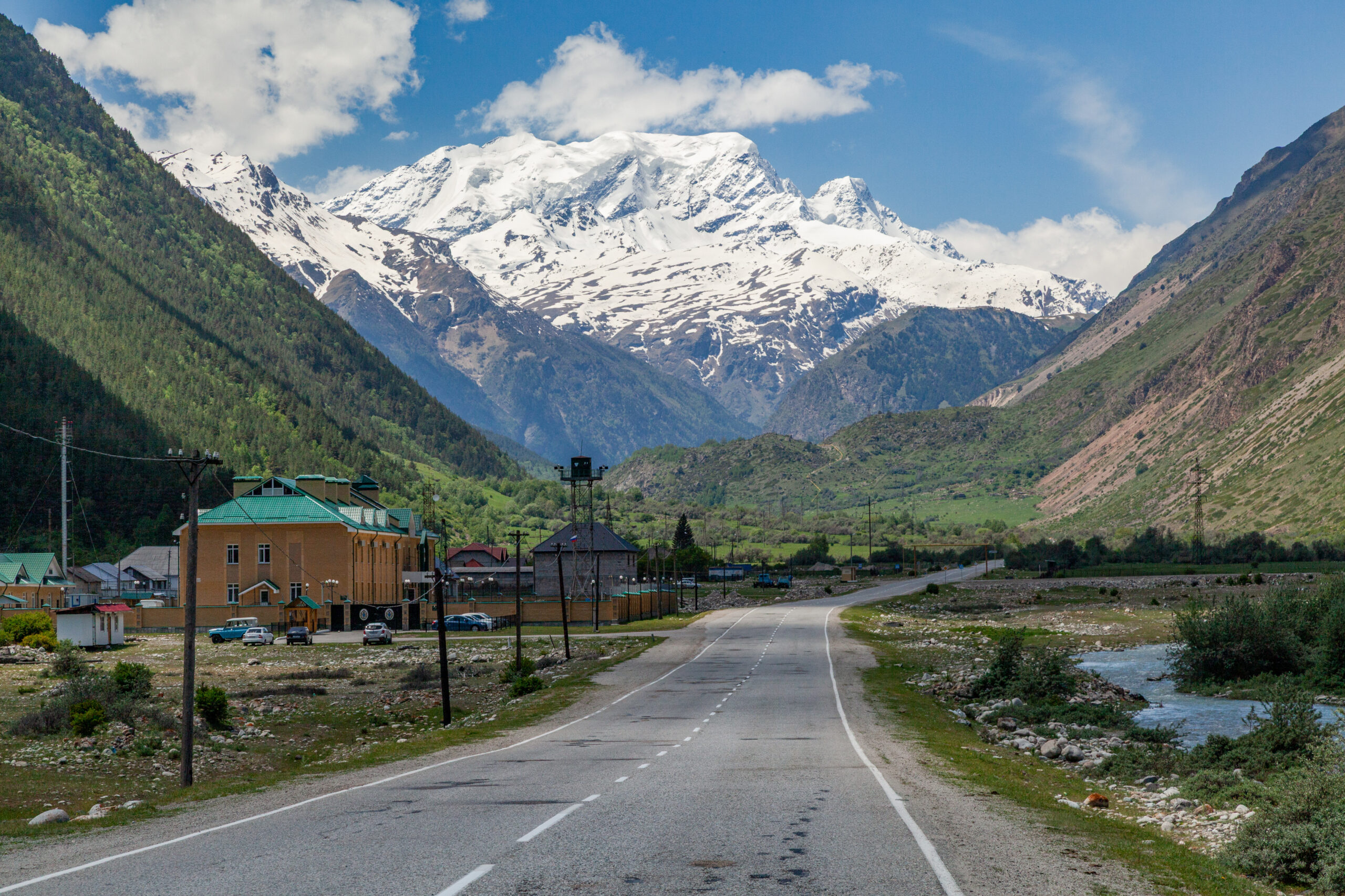
Access: drive to Trevélez (the highest village in Spain, 1,476 m) via the A-348 and A-4132 through Pampaneira and Capileira. Best for: strong hikers wanting the most scenic, immersive line and a high-camp night.
Best Time to Climb
The best window is June through October, when the standard routes are generally snow-free and weather is most stable. September is often the best month overall — stable, cooler, and quieter.
| Season | Conditions | Recommendation |
|---|---|---|
| Dec-Feb (winter) | Deep snow, ice, full winter | Winter mountaineering only — crampons, axe, alpine experience |
| Mar-May (spring) | Snow above 2,500 m, melting | Mixed — crampons often needed; Portillo road may be closed |
| June | Patchy snow above 3,000 m | Possible — check conditions; crampons may still help |
| Jul-Aug (peak) | Snow-free; afternoon storms | Prime season — start by 6-7 AM, summit by noon |
| September | Most stable, cooler, quiet | Often the best month overall |
| October | Cool, clear; early snow possible | Possible — late-season risk, check conditions |
| November | Winter returning | Transitional — winter gear often required |
Permits & Access
Spain imposes no climbing permit and no park fee on Mulhacén or any Sierra Nevada peak — free access, year-round. That’s a real advantage over Mont Blanc (hut booking), the Matterhorn (Hörnli booking + 1:1 guide), or Aconcagua (€700-1,100 permit). The only booking is the optional Capileira summer shuttle bus — a transport reservation, not a permit. See how rare that is in our worldwide permit-cost guide.
| Item | Required? | Details |
|---|---|---|
| Climbing permit | No | Free access year-round |
| National park fee | No | Free entry |
| Guide | No | Optional — recommended for beginners or winter |
| Capileira shuttle bus | If using Alto del Chorrillo | ~€10-15; book at the Capileira tourist office |
| Refuge booking | If overnight | Poqueira, Albergue Universitario — book online |
| Camping | Allowed (with limits) | Wild camping permitted; Siete Lagunas popular |
Gear Required
Summer (June-October): mid-weight waterproof hiking boots (or trail runners for fit hikers on the short routes); 2-3 L of water (there’s no water on most routes); sun protection (sunglasses are essential at altitude, plus high-SPF, hat, long sleeves); a base + insulating + waterproof-shell layer system (the summit runs 15-20°C cooler than the valleys); GPS app plus paper map and compass; headlamp, first-aid kit, whistle, emergency bivy; 3,000+ calories of food.
Winter (November-May) adds: 10-12-point steel crampons matched to B1/B2 mountaineering boots; a mountaineering ice axe (50-65 cm); a helmet for exposed terrain; a down jacket and heavy layers (summit can hit -15°C or colder); and, for avalanche terrain, transceiver, probe, and shovel. See the microspikes vs crampons guide and ice axe guide.
Mulhacén vs Pico Veleta
Mulhacén (3,479 m) and Pico Veleta (3,396 m) are the two highest peaks of the Sierra Nevada — both non-technical Class 1-2 summer hikes, and often climbed together.
| Comparison | Mulhacén | Pico Veleta |
|---|---|---|
| Elevation | 3,479 m / 11,414 ft | 3,396 m / 11,142 ft |
| Rank in Spain | 1st (mainland) | 4th (mainland) |
| Summer difficulty | Class 1-2 hike | Class 1 hike |
| Access | Sustained hike | Cable car reaches near summit |
| Permits | None | None |
| Crowds | Moderate (dedicated hikers) | Higher (cable-car tourists) |
Ambitious hikers climb both in one day via Hoya de la Mora: start at the ski station (2,500 m), top Pico Veleta first (3,396 m), traverse the high ridge east, then summit Mulhacén (3,479 m) — 8-10 hours for both of Spain’s top mainland 3,000ers. The summer cable car to Posiciones del Veleta shortens the day considerably.
Accommodation & Logistics
| Base | Distance to trailhead | Best for |
|---|---|---|
| Granada | 45 min to Hoya de la Mora; 1.5 hr to Capileira | City amenities, combine with the Alhambra |
| Capileira | 30 min to Hoya del Portillo; shuttle-bus start | Most popular southern gateway; Alpujarras charm |
| Trevélez | Direct start for Siete Lagunas | Highest village in Spain (1,476 m); famous jamón |
| Pampaneira | 30 min to the Capileira shuttle | Whitewashed Alpujarran village |
| Pradollano (ski station) | Direct to Hoya de la Mora | Hotel-style base for the northern route |
Mountain refuges: Refugio de Poqueira (2,500 m, guarded, meals + bunks) for multi-day circuits; Albergue Universitario (2,550 m, hostel with meals and Wi-Fi) at Hoya de la Mora; the basic Caldera refuge for traverses; and wild camping at Siete Lagunas for the 2-day Trevélez route. Nearest airports are Granada and Málaga.
Mulhacén FAQ
How high is Mulhacén?
3,479 m (11,414 ft) – the highest mountain in mainland Spain and the whole Iberian Peninsula, and the highest in Western Europe outside the Alps. In all of Spain, only Mount Teide (3,718 m) on Tenerife is higher, and it sits on the Canary Islands, geographically part of Africa.
Do you need a permit to climb Mulhacén?
No. Spain requires no climbing permit or park fee for Mulhacén or any Sierra Nevada peak – free access year-round. The only reservation is the optional Capileira summer shuttle bus (~€10-15 each way), which is a transport booking, not a permit.
Is Mulhacén difficult to climb?
In summer, no – it’s a non-technical Class 1-2 hike, no ropes or climbing skills needed once snow-free. The difficulty is altitude, duration, and season. From November to May it becomes a winter mountaineering objective needing crampons, ice axe, and alpine experience.
Can you climb Mulhacén in one day?
Yes – most people summit in a day. The easiest one-day option is Alto del Chorrillo via the Capileira shuttle bus: it reaches 2,700 m, leaving 780 m of gain and a 4-5 hour round trip. Fit hikers also do Hoya del Portillo and Hoya de la Mora with Veleta in a day.
What is the best route up Mulhacén?
For the easiest day, Alto del Chorrillo via the shuttle bus. For the classic southern hike, Hoya del Portillo. To bag Veleta too, Hoya de la Mora. For an immersive overnight, the 2-day Trevélez via Siete Lagunas. First-timers should pick Alto del Chorrillo or Hoya del Portillo by fitness.
What is the best time to climb Mulhacén?
June-October, snow-free and stable; September is often best. July-August is prime but brings near-daily afternoon thunderstorms, so start by 6-7 AM and summit before noon. November-May is full winter mountaineering, and the shuttle bus doesn’t run.
How does Mulhacén compare to Pico Veleta?
Mulhacén (3,479 m) is 83 m taller than Veleta (3,396 m). Both are non-technical hikes; Veleta is more accessible (cable car near the summit) and busier, while Mulhacén is the prestige summit as Spain’s mainland highpoint. A high ridge links them, so many climb both in one day.
Where is Mulhacén and how do you get there?
In the Sierra Nevada National Park, Andalusia, ~40 km southeast of Granada (1.5 hr to the Alpujarras trailheads, 45 min to the ski station). Gateway villages: Capileira (shuttle start), Trevélez (highest in Spain), Pampaneira. Nearest airports: Granada and Málaga.
Methodology & Sources
How this guide is built.
- Research-based (honest framing). Mulhacén is outside our team’s direct climbing experience; route data, distances, timings, and access synthesize authoritative published sources rather than a first-hand summit account.
- Sources: Sierra Nevada National Park (Junta de Andalucía); Andalucia.com regional guides; Sierra Nevada Guides UK; Trek Sierra Nevada; Hiking Iberia; the Capileira tourist office (shuttle authority); AEMET; Mountain-Forecast.
- 2026 verified; shuttle-bus dates, refuge status, and access can change – confirm at the Capileira tourist office before driving to a trailhead. Editor: Travis Ludlow. Safety review: Dawson Ludlow (WFA). Last updated July 3, 2026; next review before the 2027 season.
About Global Summit Guide
Plan Your Mulhacén Climb
One of Europe’s most accessible major peaks — no permit, modest logistics, non-technical in summer. Pick your route by fitness, climb June-October, book the shuttle ahead, and start early to beat the storms.
Detailed route comparison → Find Granada hotels on Expedia →Disclosure: affiliate links to Expedia — same price as direct booking; Global Summit Guide may earn a small commission.
Was this helpful?
🏔Related peaks nearby
🧭Explore & compare
Global Summit Guide is an independent mountaineering resource founded in 2026. The team combines first-hand trekking and climbing experience with in-depth research and professional health and nutrition review to help climbers choose objectives, prepare properly, and stay safe.
Health, altitude, and nutrition content is reviewed by Taylor Ludlow (Registered Nurse) and Brigg Hoopes (Nutritionist).
What We Don't Know Yet
Mountain information changes quickly. This box explains the limits of what this page can responsibly promise.
- Permit availability, reservation windows, quotas, and official fee rules may change after this page is updated.
- Weather, snowpack, avalanche risk, road access, and route conditions can change quickly and may be different on your climbing dates.
- Route conditions, trailhead access, crevasse exposure, stream crossings, and rescue access may vary from published planning guidance.
- Gear requirements can change by season, route variation, weather window, personal cold tolerance, and guide-service requirements.
- Fitness and altitude response vary by person; no guide, itinerary, or training plan can guarantee acclimatization or summit success.
Verify current conditions with official land managers, guide services, local forecasts, and current route reports before booking or climbing.
Part of this Global Summit Guide cluster
Explore the complete Mountains guide for more context, routes, planning links, and related resources.
Mountaineering, rock and ice climbing, glacier travel, and high-altitude activity are inherently dangerous and can result in serious injury or death. The information on Global Summit Guide is provided for general informational and educational purposes only and is not a substitute for professional instruction, qualified guiding, proper equipment, or your own judgment and experience.
Route conditions, weather, snowpack, permits, regulations, and hazards change constantly and may differ from what is described here. Details may be incomplete, out of date, or contain errors. Always verify current information with local authorities, certified guides, and official sources before making any decision in the mountains.
Nothing on this site is medical, legal, or financial advice. Our fitness, acclimatization, altitude, and nutrition content is general in nature; consult a qualified physician before beginning any strenuous exercise program or exposing yourself to high altitude.
You are solely responsible for your own safety and decisions. To the fullest extent permitted by law, Global Summit Guide and its team accept no liability for any loss, injury, damage, or expense arising from use of, or reliance on, this information. By using this site you acknowledge these risks and accept these terms.
Some links on this site may be affiliate links. If you buy through them we may earn a small commission at no extra cost to you; this never affects our recommendations.
Global Summit Guide recommendation path
Next Best Mountain to Research
Use these recommendations to continue the right planning path instead of stopping on one page.
Use current permit, weather, route, and operator information before booking or climbing.