
Last updated September 19, 2026
Cotopaxi Climbing Guide: Route, Permits, Cost & Acclimatization
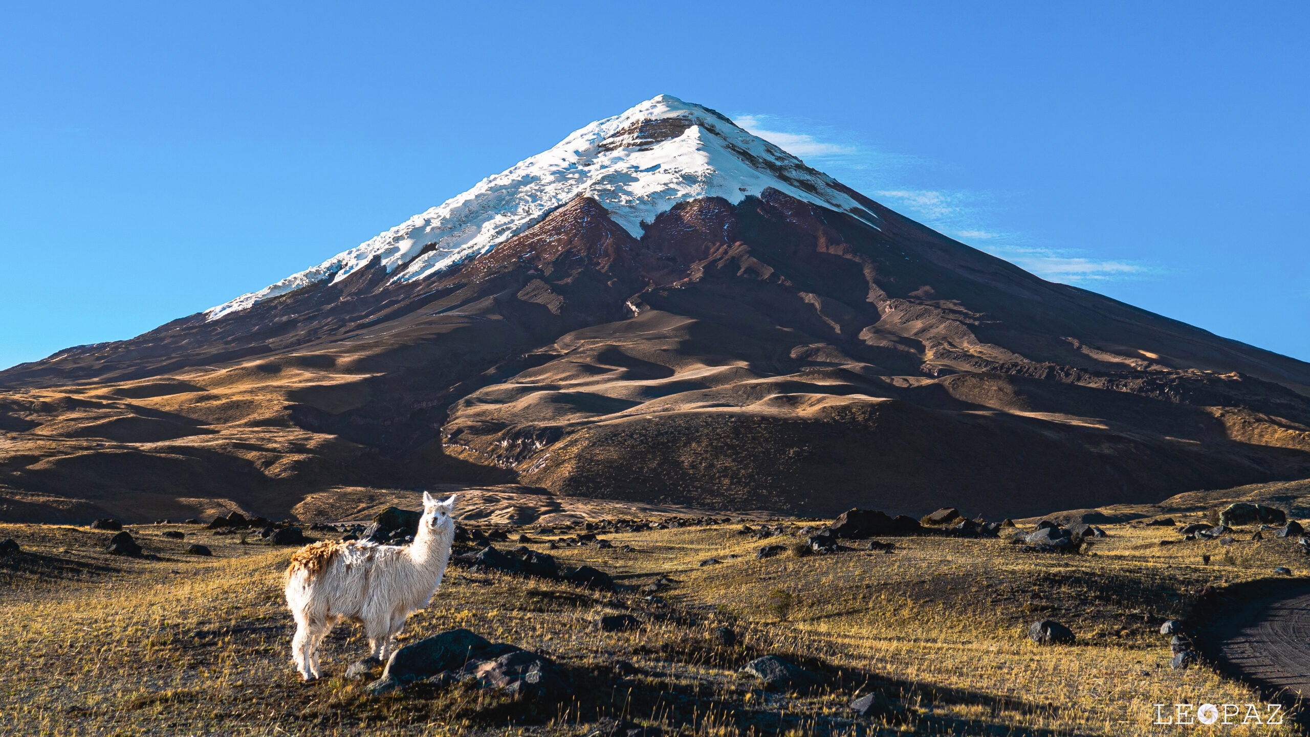
Cotopaxi is Ecuador’s second-highest mountain and one of the most accessible major glacier climbs in the Andes. The Normal Route rises from Refugio José Ribas onto a crevassed glacier to the 5,897 m crater rim. The climb is structured and commonly guided—but altitude, glacier change and an active volcano make it a real mountaineering objective, not a high hike.
Can You Climb Cotopaxi Now?
Commercial summit programs are operating in 2026, but access remains controlled by official volcanic monitoring and park permissions. Cotopaxi is an active stratovolcano, yet “active” does not mean it is currently erupting. Ecuador’s Instituto Geofísico says the most recent eruptive process occurred in 2022–2023. As of September 2026, internal and surface activity is classified as low, with no change.
That status can change. Climbers should check IG-EPN and confirm park access with their licensed operator before paying nonrefundable travel costs and again immediately before the climb.
Current volcano status · September 2026
Active volcano · relative calm · low activity, no change. IG-EPN continues 24/7 monitoring. The 2022–2023 episode included gas and ash emissions; current monitoring focuses on detecting any renewed changes in seismicity, deformation, gas, thermal or hydrothermal indicators.
Cotopaxi Climb Planner
Quito Makes Cotopaxi Logistically Easy—and Physiologically Deceptive
The mountain is close to Ecuador’s capital, but a short drive does not remove the need to acclimatize between Quito’s ~2,850 m and a 5,897 m summit.
Quito · Iliniza Norte · Cotopaxi · Chimborazo
This map shows the altitude-progression corridor. Upper-mountain markers are for orientation only.
Cotopaxi Is Best as a First Guided Glacier Volcano—Not a First Mountain
The mountain rewards climbers who already have mountain fitness and altitude discipline, then adds roped glacier travel in a highly structured setting.
Strong Hiker Moving Into Mountaineering
You already handle long mountain days, cold starts and sustained uphill effort, and you want formal exposure to crampons, rope-team travel and glaciated terrain.
Climber Building Toward Chimborazo
Cotopaxi adds high-altitude glacier experience before a higher Ecuador objective and fits naturally into the country’s altitude ladder.
Fly In and Summit Two Days Later
A two-day operator package is a summit module, not a universal acclimatization plan. Low-elevation arrivals should usually build altitude before the refuge night.
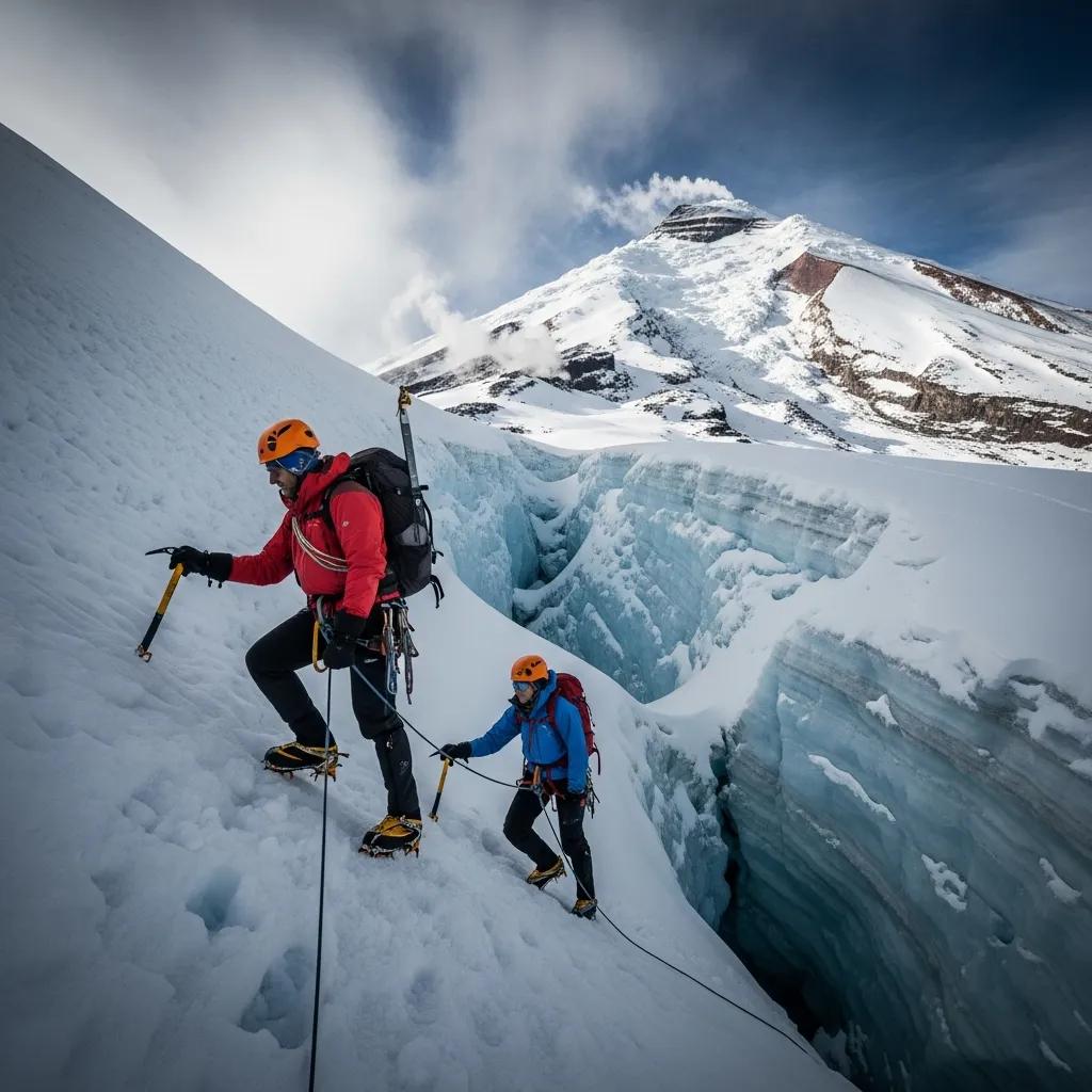
The Normal Route Is Structured—but the Glacier Is Not Static.
Crevasses open, snow bridges change and glacier recession can move the preferred line from one season to the next. Current guide knowledge matters more than memorizing a fixed track.
Cotopaxi Normal Route: José Ribas Refuge to the Crater Rim
Most guided teams use the north-side Normal Route. Its broad structure is stable; the exact glacier line is not.
Drive High, Then Hike to José Ribas
Operators drive through Cotopaxi National Park toward the upper parking area, then walk to Refugio José Ribas near 4,800 m. The afternoon is for rest, equipment checks and final route/volcano briefings.
Rock and Moraine to the Glacier
Teams normally leave around midnight or shortly after. The lower route begins on volcanic terrain before climbers rope up and transition to crampons on the glacier.
Crevasses, Snow Bridges and Route Changes
The upper climb is genuine glacier travel. The line is established around current crevasse patterns and surface conditions rather than one permanently correct GPX track.
Crater Rim at 5,897 m
The summit lies on the rim of an active volcanic crater. Gas exposure is one reason current park rules include volcanic-safety equipment and why teams should not linger unnecessarily where gas could accumulate.

Why “Beginner Glacier Climb” Can Be Misleading
Cotopaxi is introductory relative to harder glaciated peaks. That does not mean the hazards are introductory.
| Hazard | Why it matters | What manages it |
|---|---|---|
| Altitude | 5,897 m is extreme altitude. A short climb does not reduce physiological stress. | Staged acclimatization, conservative pacing and willingness to descend. |
| Crevasses | The glacier is active and the exact route changes. | Roped travel, current local route knowledge and proper equipment. |
| Volcanic activity | Access can change if monitoring detects renewed unrest. | IG-EPN monitoring, park controls, evacuation planning and current verification. |
| Weather | Wind, snow and poor visibility can transform a straightforward route. | Early timing, forecast discipline and turnaround decisions. |
| Fatigue on descent | Most incidents are not prevented by reaching the summit. | Reserve energy, descend efficiently and protect attention after sunrise. |
Technical simplicity does not cancel objective hazard.
The strongest reason to choose Cotopaxi is that guiding, refuge access and local route knowledge make serious glacier terrain more structured. That is different from saying the mountain itself is easy.
For Most Low-Elevation Arrivals, Build 5–8 Days Before the Summit Attempt
Quito gives you an excellent starting altitude. It does not make you Cotopaxi-ready overnight.
| Day | Example objective | Purpose |
|---|---|---|
| 1 | Arrive Quito ~2,850 m | Sleep high, hydrate, recover from travel. |
| 2 | Easy Quito / moderate walk | Let the first altitude exposure settle. |
| 3 | Rucu Pichincha or comparable 4,000–4,700 m hike | First meaningful altitude test. |
| 4 | Recovery or moderate acclimatization peak | Add exposure without excessive fatigue. |
| 5 | Iliniza Norte or comparable ~5,000 m objective | Test performance above 5,000 m. |
| 6 | Rest / transfer / gear check | Arrive at Cotopaxi recovered. |
| 7–8 | Refuge / summit cycle | Apply the altitude preparation rather than using Cotopaxi to create it. |
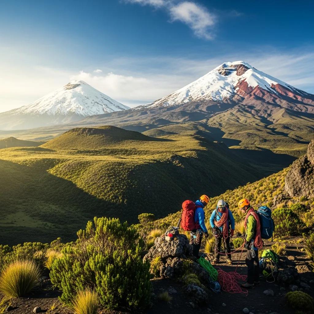
You Can Build Altitude in Steps Without Leaving the Same Mountain Corridor.
Quito, Rucu Pichincha, Iliniza Norte, Cayambe, Cotopaxi and Chimborazo create one of the most efficient high-altitude progressions in the Americas.
Cotopaxi Summit Access Is Managed, Not Casual
The latest official summit-access document located for this guide sets out operator/club quotas, lodging reservation, SIB registration, guide credentials and volcanic-safety requirements.
What climbers should expect
- Authorized climb slot / quota coordinated with the protected-area administration.
- Accommodation reservation for the summit cycle.
- SIB registration in Ecuador’s protected-area visitor system.
- Certified guide credentials for operator-led climbs.
- Required mountain and volcanic-safety equipment specified by current rules.
- Entry/exit registration by the guide or group leader.
Most international climbers should use a licensed operator that handles these requirements. Do not rely on an old blog post for park hours, fees or summit-access paperwork.

June–September Is the Primary Climbing Window, but Cotopaxi Is Climbed Year-Round
Equatorial weather is less about a four-season model and more about precipitation, wind, cloud, glacier surface and daily timing.
June–September
Generally drier conditions and more reliable pre-dawn glacier surfaces make this the main climbing period in the current GSG weather guide.
December–January
Another commonly used period for Ecuador volcano programs, though day-to-day conditions still control summit decisions.
Verify the Glacier
Snow coverage, crevasse patterns and wind matter more than a generic “best month” label. Ask what the guide encountered on the most recent climb.
Do Not Compare a Two-Day Summit Module With a Ten-Day Acclimatization Program
The headline number means little until you know whether acclimatization, hotels, transport, technical equipment and contingency days are included.
| Program type | Who it fits | What should be clear before booking |
|---|---|---|
| Short 2-day summit module | Already acclimatized and technically prepared climbers | Guide ratio, transport, technical gear, refuge, summit slot, fallback policy. |
| 4–6 day local progression | Climbers who need some in-country acclimatization | Prep peaks, recovery days, lodging and whether Cotopaxi is the first high glacier day. |
| 7–12 day Ecuador program | Low-elevation arrivals and climbers combining multiple volcanoes | Full altitude ladder, sequencing, guide continuity and closure substitutes. |
Use the operator page for current published prices.
The dedicated comparison tracks current programs across local and international companies. That is more reliable than hard-coding one “Cotopaxi cost” into the mountain guide when products range from short summit modules to full Ecuador expeditions.

Cotopaxi and Chimborazo Are Better Treated as a Progression Than as Rivals.
Cotopaxi gives you a 5,897 m glacier climb. Chimborazo raises the physiological and summit-day load above 6,200 m. Most climbers benefit from solving the lower objective first.
Cotopaxi vs. Chimborazo
The better question is usually “Which comes first?” rather than “Which one wins?”
| Factor | Cotopaxi | Chimborazo |
|---|---|---|
| Elevation | 5,897 m | 6,263 m |
| Main challenge | Glacier systems + altitude | More altitude + longer summit workload + changing glacier terrain |
| Best role | First major Ecuador glacier volcano / acclimatization climb | Higher capstone objective |
| Volcanic status | Active and monitored | Not currently erupting |
| Planning question | Are you acclimatized enough before the summit cycle? | Did your Ecuador progression leave enough recovery for 6,263 m? |
Cotopaxi National Park Is Still Worth the Day Trip
The park can be visited without a summit objective, but high elevation still matters.
Limpiopungo Lagoon
High páramo scenery and one of the classic ground-level views of Cotopaxi. It is a much gentler objective than hiking to the refuge.
José Ribas Refuge Hike
The upper parking area gives non-climbers access to a short but very high hike toward the refuge. Treat 4,800 m seriously even when the distance is short.
Use the Park Before a Climb
A park visit can introduce the terrain and altitude, but one afternoon at high elevation does not replace several nights of staged acclimatization.

A Strong Seven-Day Cotopaxi Skeleton
This is a planning framework, not a fixed prescription. Recent altitude exposure and individual response can justify a longer or shorter schedule.
Quito
Sleep at altitude, recover from travel, walk lightly and prepare equipment.
Rucu Pichincha
First substantial hike above 4,000 m. Treat how you feel afterward as useful data.
Recovery
Easy day or a moderate lower objective. Do not stack maximal effort every day.
Iliniza Norte
Useful 5,000 m-class altitude test without repeating Cotopaxi’s glacier summit day.
Refuge Cycle
Transfer, final gear and permit checks, short rest, early sleep.
Summit + Descent
Midnight start, glacier ascent, summit attempt and complete descent while the team still has margin.
Cotopaxi Climbing FAQ
Short answers to the main climb-planning questions.
Is Cotopaxi erupting in 2026?
No current source used here describes an ongoing eruption in 2026. IG-EPN says the most recent eruptive process occurred in 2022–2023 and currently classifies Cotopaxi’s internal and surface activity as low, with no change. It remains an active volcano under continuous monitoring.
Can you climb Cotopaxi right now?
Commercial climbs are operating in 2026, but summit access remains subject to Cotopaxi National Park permissions and official volcanic monitoring. Verify access with IG-EPN and your licensed operator before travel.
How hard is Cotopaxi?
The Normal Route is generally introductory glaciated mountaineering rather than a technically advanced climb. The serious factors are extreme altitude, crevasses, changing glacier conditions, weather and volcanic hazard.
Do I need a guide to climb Cotopaxi?
Current summit-access procedures are structured around authorized operators or recognized mountain clubs, with certified guide credentials required for operator-led climbs. Most international climbers should use a licensed Ecuadorian operator that handles the park process.
How many days should I acclimatize for Cotopaxi?
For many climbers arriving from low elevation, 5–8 days in Ecuador before or including the summit cycle is a practical framework. Recently acclimatized climbers may be able to compress that schedule.
What is the best time to climb Cotopaxi?
June through September is the primary window in the current Global Summit Guide weather guide, with December and January another commonly used period. Current glacier and wind conditions matter more than the calendar alone.
Should I climb Cotopaxi or Chimborazo first?
For most climbers attempting both on one Ecuador trip, Cotopaxi makes more sense first because it provides a lower but still substantial glacier climb before the 6,263 m Chimborazo objective.
Can I visit Cotopaxi without climbing?
Yes. Cotopaxi National Park includes Limpiopungo Lagoon, páramo scenery and the high refuge approach. Non-climbers still need to respect altitude and current park access rules.
Volcanic Status Comes From IG-EPN; Summit Rules Come From Ecuador’s Protected-Area Authorities
The master guide separates stable mountain facts from fast-changing access, activity, price and glacier information.
What changes fastest
Volcanic activity, glacier line, summit quotas, refuge arrangements, park fees and operator prices can all change faster than the mountain’s basic route description. Check those items close to departure.
Routes, Safety, Acclimatization, Operators & Ecuador Progression
Use the master guide for the whole mountain, then move into the page that owns your next planning question.

Arrive Acclimatized. Verify the Volcano. Follow the Current Glacier.
Cotopaxi is at its best when the easy logistics are used to support disciplined preparation—not to compress it away.
Was this helpful?
🏔Related peaks nearby
🧭Explore & compare
Global Summit Guide is an independent mountaineering resource founded in 2026. The team combines first-hand trekking and climbing experience with in-depth research and professional health and nutrition review to help climbers choose objectives, prepare properly, and stay safe.
Health, altitude, and nutrition content is reviewed by Taylor Ludlow (Registered Nurse) and Brigg Hoopes (Nutritionist).
What We Don't Know Yet
Mountain information changes quickly. This box explains the limits of what this page can responsibly promise.
- Route conditions, trailhead access, crevasse exposure, stream crossings, and rescue access may vary from published planning guidance.
- Total trip cost can change with flights, lodging, guide pricing, permits, gear rentals, transportation, and exchange rates.
- Visa, passport, vaccination, border, insurance, and local transportation rules may change before your trip.
Verify current conditions with official land managers, guide services, local forecasts, and current route reports before booking or climbing.
Mountaineering, rock and ice climbing, glacier travel, and high-altitude activity are inherently dangerous and can result in serious injury or death. The information on Global Summit Guide is provided for general informational and educational purposes only and is not a substitute for professional instruction, qualified guiding, proper equipment, or your own judgment and experience.
Route conditions, weather, snowpack, permits, regulations, and hazards change constantly and may differ from what is described here. Details may be incomplete, out of date, or contain errors. Always verify current information with local authorities, certified guides, and official sources before making any decision in the mountains.
Nothing on this site is medical, legal, or financial advice. Our fitness, acclimatization, altitude, and nutrition content is general in nature; consult a qualified physician before beginning any strenuous exercise program or exposing yourself to high altitude.
You are solely responsible for your own safety and decisions. To the fullest extent permitted by law, Global Summit Guide and its team accept no liability for any loss, injury, damage, or expense arising from use of, or reliance on, this information. By using this site you acknowledge these risks and accept these terms.
Some links on this site may be affiliate links. If you buy through them we may earn a small commission at no extra cost to you; this never affects our recommendations.
Global Summit Guide recommendation path
Next Best Mountain to Research
Use these recommendations to continue the right planning path instead of stopping on one page.
Use current permit, weather, route, and operator information before booking or climbing.
Explore Travel Options for Your Destination
Once your mountain, dates and route are taking shape, compare flights, hotels and other travel options that fit the trip.
Affiliate link. We may earn a commission at no additional cost to you.