
Last updated September 15, 2026
Weisshorn Climbing Guide: East Ridge, Routes & Difficulty
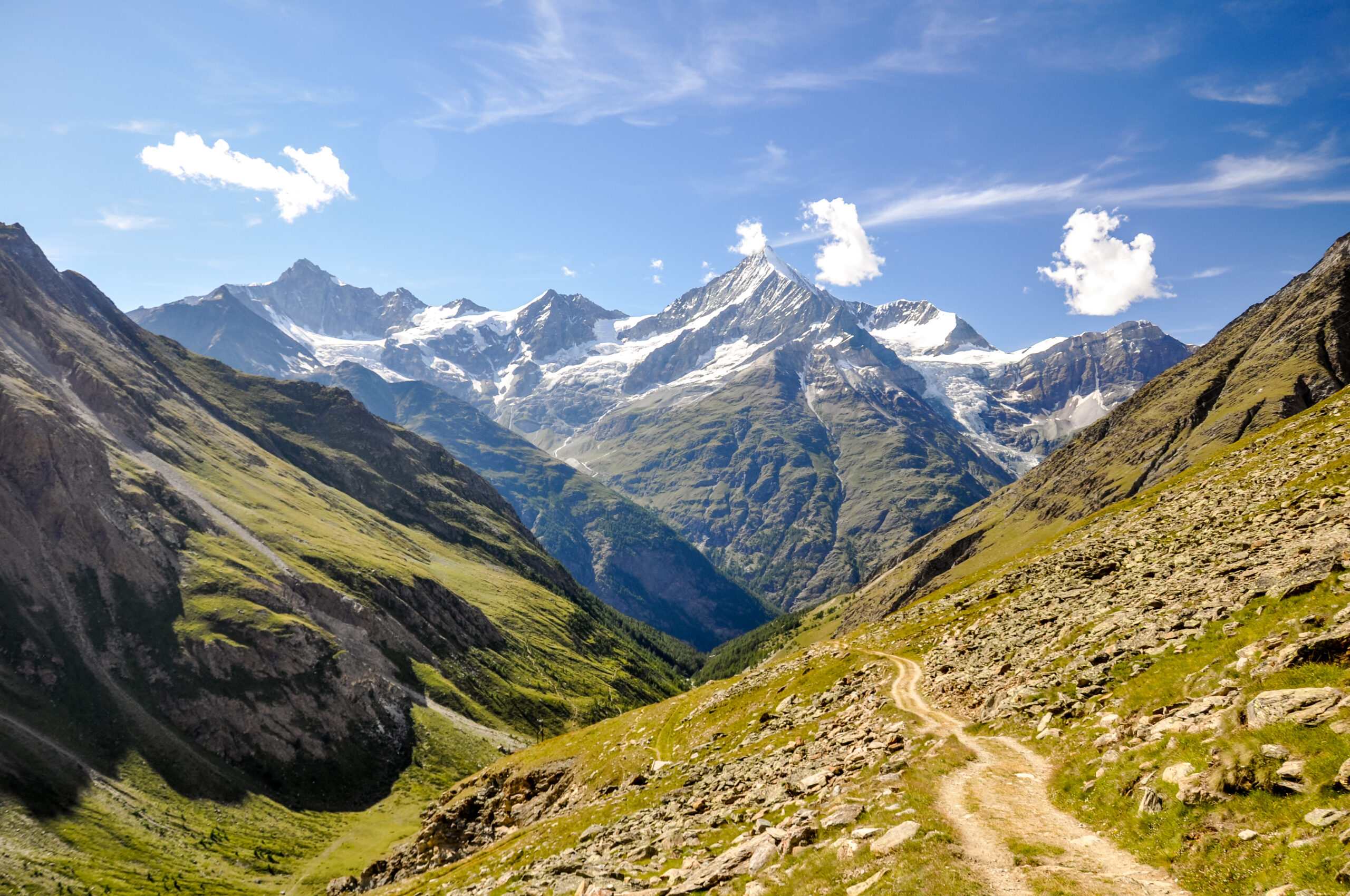
Weisshorn is not an introductory Alpine 4,000er. Its normal East Ridge from Weisshornhütte is graded AD by the Swiss Alpine Club, with 1,570 metres of ascent from the hut and a published ascent time of 7–8 hours. The North Ridge raises the commitment further, while the Schaligrat is a D-grade objective reached from a remote high bivouac. The mountain belongs late in an Alpine progression, after glacier systems, exposed ridge movement and long technical descents are already familiar.
What does climbing Weisshorn actually involve?
The standard ascent uses the East Ridge, or Ostgrat, from Weisshornhütte. The Swiss Alpine Club currently grades the route AD and lists 7–8 hours of ascent with 1,570 metres of height gain.
Before that climbing even begins, the normal hut approach from Randa at roughly 1,407 metres to Weisshornhütte at 2,932 metres requires about 4 hours 30 minutes and 1,540 metres of ascent. SAC describes it as a full valley-to-hut approach with no cable-car shortcut.
That combination explains Weisshorn better than a single grade does. Climbers need endurance for the approach, glacier competence, efficient mixed and ridge movement, route-finding, and enough reserve to reverse the technical terrain after the summit.
From Weisshornhütte above Randa.
Serious alpine terrain rather than an introductory glacier summit.
SAC time from Weisshornhütte to the summit; descent is additional.
Reaching the summit is only half of the technical problem.
The three main Weisshorn ridge objectives
The SAC Route Portal provides a much cleaner comparison than the old page’s unsourced route-use percentages.
| Route | Starting point | SAC grade | SAC ascent | Height gain | Best fit |
|---|---|---|---|---|---|
| East Ridge / Ostgrat | Weisshornhütte · 2,932 m | AD | 7–8 h | 1,570 m | Standard Weisshorn objective for experienced alpinists |
| North Ridge | Cabane de Tracuit · 3,256 m | AD+ | 8–9 h | 1,370 m | Longer ridge objective and major step beyond the normal route |
| SW Ridge / Schaligrat | Schalijochbiwak · 3,786 m | D | 5–6 h | 730 m | Highly experienced technical alpinists |
Three valleys, three high starts, three very different climbs
Weisshorn should be planned from the valley and hut outward, not from the summit downward.
East Ridge: the route most climbers should evaluate first
“Normal route” describes route convention, not beginner difficulty.
Randa → Weisshornhütte
SAC lists the normal hut approach as T2, 4:30 hours and 1,540 metres of ascent. The trail climbs from the Mattertal through larch forest and alpine terrain to the small hut at 2,932 m.
There is no lift-assisted shortcut. The approach is part of the physical cost of the climb and should be included in trip design rather than treated as a warm-up.
AD / 7–8 hours ascent
SAC lists the East Ridge at AD, with approximately 1,570 metres of ascent from Weisshornhütte.
Expect an alpine combination rather than one isolated crux: glacier movement, rock and snow, route transitions, exposed ridge terrain and a long technical descent.
AD is only the first line of the Weisshorn difficulty story.
The East Ridge starts after a 1,540-metre hut approach, then gains another 1,570 metres to the summit. Efficient movement matters because everything climbed on the way up still has to be solved on the descent.
North Ridge: longer, harder and built around the Tracuit side
The North Ridge is not simply the East Ridge approached from another valley.
AD+ with an 8–9 hour SAC ascent time
SAC currently lists the North Ridge from Cabane de Tracuit at AD+, with about 1,370 metres of ascent and 8–9 hours.
The route uses the long northern ridge system shared with Bishorn and the Weisshornjoch. SAC notes that the ridge can be gained near Weisshornjoch without necessarily traversing the exact Bishorn summit, although the time saving is small.
The North Ridge makes sense for climbers specifically seeking the ridge itself—not simply those unable to reserve Weisshornhütte.
3,256 m on the Zinal side.
A material technical step above the normal East Ridge.
Published route time before descent.
Schaligrat: the D-grade southwest ridge
The climbing is only part of the problem. Reaching the bivouac has become increasingly condition-dependent.
D / 5–6 h
SAC lists the southwest ridge from Schalijochbiwak at D, with 730 metres of ascent and a published climbing time of 5–6 hours.
Schalijochbiwak · 3,786 m
The SAC shelter has eight sleeping places and is unstaffed. This is a high bivouac, not a conventional staffed Alpine hut.
Condition-dependent
SAC warns that eastern access is not always possible as snow and ice melt, while western approaches have also become increasingly difficult.
The hut determines the route architecture
Weisshorn’s three principal ridges begin from different high bases. Reserve and approach accordingly.
| High base | Elevation | Capacity | Primary use | Current planning note |
|---|---|---|---|---|
| Weisshornhütte SAC | 2,932 m | 31 beds | East Ridge normal route | Staffed June–September according to current SAC listing. |
| Cabane de Tracuit CAS | 3,256 m | 116 beds | North Ridge / Bishorn side | Larger high hut above Zinal; confirm current reservation and operating status. |
| Schalijochbiwak SAC | 3,786 m | 8 beds | Schaligrat | Unstaffed shelter; access is a serious alpine objective in its own right. |
Weisshorn is difficult because the problems keep changing
Route grade describes technical difficulty. It does not summarize the complete risk environment.
Sustained ridge movement
Weisshorn is not defined by one short crux. Long exposed ridge sections reward climbers who can maintain efficient, controlled movement for hours.
Rock, snow and glacier systems
Changing terrain increases transition demands. Crampon, rope and rock-climbing systems must already be familiar rather than learned during the climb.
The technical day continues after the summit
Fatigue, warming snow, changing weather and slower down-climbing can increase the cost of mistakes late in the day.
Approaches move over time
SAC specifically notes that glacier condition can alter the feasibility and difficulty of approaches near Schalijoch.
Warming and unstable terrain
Rockfall exposure can change rapidly with temperature, snow cover and freeze-thaw conditions. Current local information matters more than an old route description.
Long exposure to change
A long alpine route creates more time for wind, cloud, precipitation and temperature changes to affect the team.
Use turnaround gates instead of chasing a published summit time
A universal clock time is weaker than a pre-agreed team decision based on pace, conditions and descent reserve.
Do not assume the lost time can be recovered higher on more technical terrain.
Reassess the route instead of forcing the itinerary because the hut and guide are already booked.
Weisshorn gives few easy exits once committed to the upper ridge.
That problem normally compounds with altitude and fatigue rather than improving.
Summit ambition should never consume the physical and daylight margin needed to reverse the route.
Local professional judgment and current conditions outrank an online itinerary or historic schedule.
The best month is the month when your route is in condition
The old page was too confident about fixed “sweet spots.” Weisshorn is better treated as a conditions-led objective.
Early-season snow
Weisshornhütte is normally staffed beginning in June, but residual snow and route condition can vary substantially. Verify the actual route before travel.
Main Alpine period
Long daylight and staffed huts make this the obvious planning core, but warm periods can also worsen rockfall or glacier conditions.
Potential late-season windows
Weisshornhütte remains listed as staffed through September, but colder storms and fresh snow can quickly change exposed ridge conditions.
Who should climb Weisshorn?
The route should confirm existing Alpine skill, not introduce it.
| Skill | Why it matters | Ready looks like |
|---|---|---|
| Long Alpine endurance | Large hut approach plus 1,570 m of summit ascent | You can still move precisely after several thousand vertical feet. |
| Glacier travel | Glaciated approaches and changing snow/ice terrain | Rope-team and crevasse systems are established skills. |
| Exposed climbing | AD ridge terrain cannot be reduced to hiking fitness | Exposure does not materially slow decision-making or movement. |
| Mixed terrain | Rock, snow and ice can occur in one route | Transitions are familiar and efficient. |
| Technical descent | The route must be reversed after the summit | Down-climbing and descent systems remain controlled when tired. |
| Turnaround discipline | A long ridge punishes late decisions | You can abandon the summit while the descent margin is still strong. |
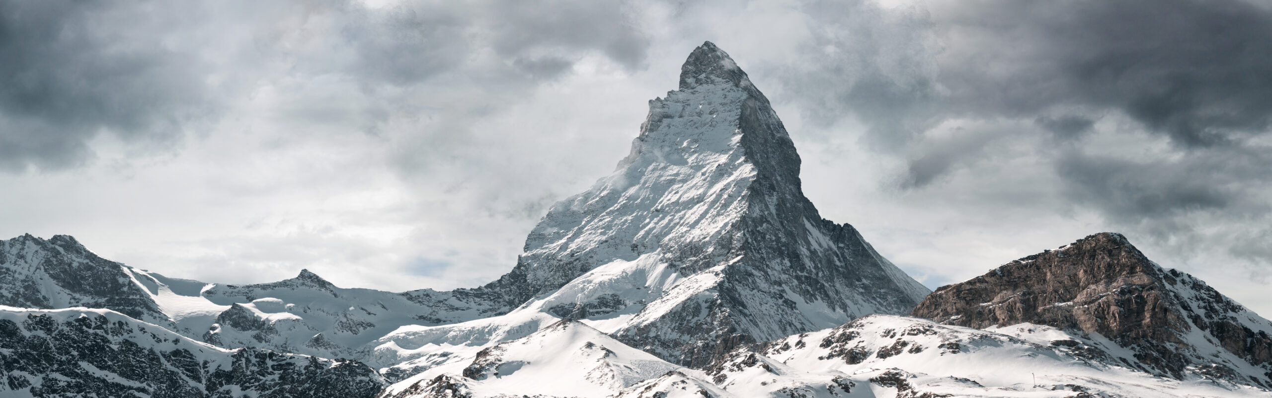
Matterhorn and Weisshorn may share an AD label, but they are not interchangeable climbs.
Use prior mountains to build the exact weakness that Weisshorn will expose: glacier systems, endurance, exposed ridge movement, technical descent and efficiency at altitude.
Where Weisshorn fits
There is no mandatory sequence, but climbers should arrive with experience from multiple terrain systems.
Gran Paradiso
A much more appropriate place to establish hut rhythm, glacier movement and a first 4,000-metre summit.
Gran Paradiso guide →Dufourspitze
A major high-Alpine objective with long glacier travel and a more substantial summit finish.
Dufourspitze guide →Matterhorn
A different style of serious climbing that tests speed, route-finding and sustained exposed movement.
Matterhorn guide →Use the Swiss Alpine Club for the route facts
Current route conditions still need direct confirmation immediately before the climb.
SAC Weisshorn Route Portal
Current grades and published ascent times for East Ridge, North Ridge, Schaligrat, Younggrat and West Face.
Open SAC Weisshorn routes →SAC Weisshornhütte
Hut elevation, capacity, operating months and the official Randa approach.
Open Weisshornhütte →SAC Schalijochbiwak
Current access routes, condition warnings, capacity and the D-grade Schaligrat listing.
Open Schalijochbiwak →SAC Cabane de Tracuit
Hut information for Bishorn and Weisshorn’s North Ridge side.
Open Cabane de Tracuit →Weisshorn climbing questions
Short answers based on the same route definitions used in the guide above.
How difficult is Weisshorn?
SAC grades the normal East Ridge AD with 7–8 hours of ascent and 1,570 metres of height gain from Weisshornhütte. The route requires experienced alpine movement rather than introductory 4,000-metre skills.
What is the normal route on Weisshorn?
The East Ridge, or Ostgrat, from Weisshornhütte above Randa. It is the logical route for most experienced climbers evaluating Weisshorn for the first time.
How long does it take to climb Weisshorn?
SAC publishes 7–8 hours of ascent for the East Ridge from Weisshornhütte. That is not a round-trip time. Descent duration depends on team speed, route and conditions, so climbers should use the plan supplied by their guide or current route source rather than a universal total.
How long is the hike to Weisshornhütte?
SAC lists the normal Randa approach at about 4 hours 30 minutes with 1,540 metres of ascent. The hut sits at 2,932 metres and has 31 sleeping places.
What are the main Weisshorn routes?
The normal East Ridge is AD. The North Ridge from Cabane de Tracuit is AD+. The southwest ridge, or Schaligrat, from Schalijochbiwak is D. SAC also lists the Younggrat and West Face at higher grades.
Is Weisshorn harder than Matterhorn?
The comparison is more useful by terrain than by one label. Weisshorn combines a very large approach, 1,570 metres of summit ascent from the hut and a long mixed alpine ridge. Matterhorn demands extremely efficient exposed rock and mixed movement. Climbers should evaluate the skill systems rather than assume the matching AD label makes the mountains equivalent.
When is the best season for Weisshorn?
Summer is the normal planning period. SAC currently lists Weisshornhütte as staffed from June through September. The actual climbing window should be chosen from current snow, glacier, rock and weather conditions.
Build toward Weisshorn through the right Alpine skills
Weisshorn belongs inside a progression of glacier travel, altitude, exposed climbing and long technical descents.
Was this helpful?
🏔Related peaks nearby
🧭Explore & compare
Global Summit Guide is an independent mountaineering resource founded in 2026. The team combines first-hand trekking and climbing experience with in-depth research and professional health and nutrition review to help climbers choose objectives, prepare properly, and stay safe.
Health, altitude, and nutrition content is reviewed by Taylor Ludlow (Registered Nurse) and Brigg Hoopes (Nutritionist).
What We Don't Know Yet
Mountain information changes quickly. This box explains the limits of what this page can responsibly promise.
- Route conditions, trailhead access, crevasse exposure, stream crossings, and rescue access may vary from published planning guidance.
- Visa, passport, vaccination, border, insurance, and local transportation rules may change before your trip.
- Route conditions, snowpack, closures, and weather can change quickly after this page is updated.
- Permit rules, fees, quotas, and reservation windows may change between review cycles.
- Operator availability, pricing, guide ratios, and cancellation terms can change by season.
Verify current conditions with official land managers, guide services, local forecasts, and current route reports before booking or climbing.
Mountaineering, rock and ice climbing, glacier travel, and high-altitude activity are inherently dangerous and can result in serious injury or death. The information on Global Summit Guide is provided for general informational and educational purposes only and is not a substitute for professional instruction, qualified guiding, proper equipment, or your own judgment and experience.
Route conditions, weather, snowpack, permits, regulations, and hazards change constantly and may differ from what is described here. Details may be incomplete, out of date, or contain errors. Always verify current information with local authorities, certified guides, and official sources before making any decision in the mountains.
Nothing on this site is medical, legal, or financial advice. Our fitness, acclimatization, altitude, and nutrition content is general in nature; consult a qualified physician before beginning any strenuous exercise program or exposing yourself to high altitude.
You are solely responsible for your own safety and decisions. To the fullest extent permitted by law, Global Summit Guide and its team accept no liability for any loss, injury, damage, or expense arising from use of, or reliance on, this information. By using this site you acknowledge these risks and accept these terms.
Some links on this site may be affiliate links. If you buy through them we may earn a small commission at no extra cost to you; this never affects our recommendations.
Global Summit Guide recommendation path
Next Best Mountain to Research
Use these recommendations to continue the right planning path instead of stopping on one page.
Use current permit, weather, route, and operator information before booking or climbing.
Explore Travel Options for Your Destination
Once your mountain, dates and route are taking shape, compare flights, hotels and other travel options that fit the trip.
Affiliate link. We may earn a commission at no additional cost to you.