
Schreckhorn routes guide: southwest ridge, southeast variation, and historic lines
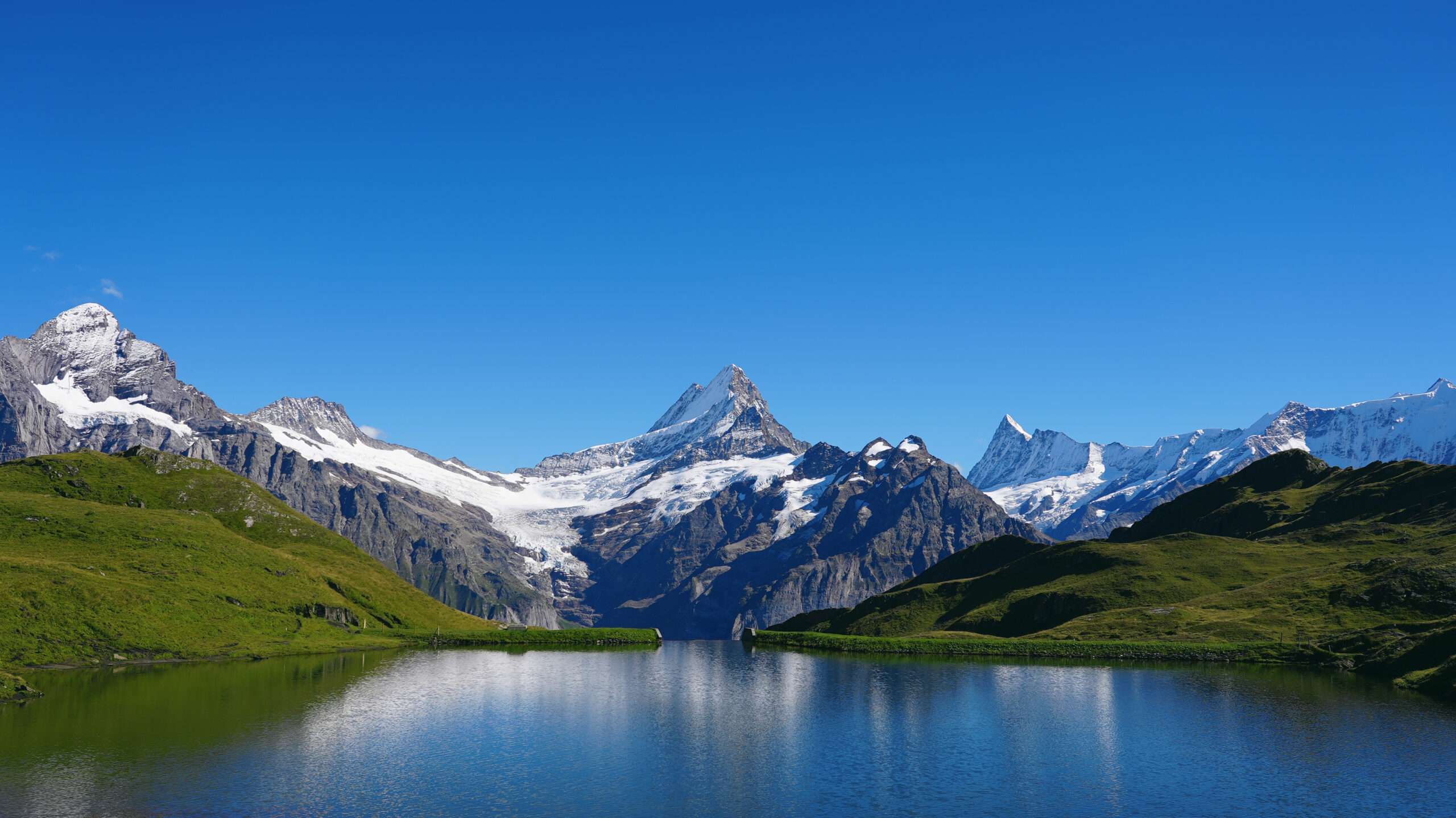
The Schreckhorn (4,078 m) is widely regarded as the most demanding “normal route” of any 4000-meter peak in the Alps. The Southwest Ridge — the standard line since 1902 — combines a long glacier approach, a committing bergschrund crossing, and sustained Grade III–IV rock climbing on excellent gneiss high on the summit pyramid. This guide breaks down every major route on the mountain: the Southwest Ridge normal route, the Southeast Ridge variation, and the historic Schrecksattel approach. For the full mountain overview, see the Schreckhorn climbing guide.
Route overview at a glance
Three routes account for nearly all modern ascents of the Schreckhorn. One is the established normal route, one is a respected variation that avoids the most rockfall-prone terrain, and one is the historic line that today’s climbers should not attempt due to changing conditions.
| Route | Grade | Type | Hut | Summit day | Status |
|---|---|---|---|---|---|
| Southwest Ridge | AD+ | Mixed (glacier + rock) | Schreckhorn Hut | 9–12 hrs RT | Normal route |
| Southeast Ridge variation | AD | Couloir + rock ridge | Schreckhorn Hut | 10–13 hrs RT | Preferred by some guides |
| Schrecksattel (historic) | AD/D | Snow/ice couloir | Schreckhorn Hut | — | Not recommended |
| Freudenschreck (technical rock) | 6a+ | Rock climbing (11 pitches) | Schreckhorn Hut | Variable | Specialist route only |
The Southwest Ridge was first climbed on July 26, 1902 by John Wicks, Edward Bradby, and Claude Wilson — climbing without local guides, a notable choice at the time. Their line replaced the original 1861 Schrecksattel route opened by Leslie Stephen and has been the established normal route for over 120 years. The exceptional rock quality on the upper ridge is the main reason it has remained the standard despite being technically harder than the historic line.
Understanding the alpine grades AD, AD+, and what they mean
The Schreckhorn’s routes are graded using the French alpine system (UIAA/French overall grades), which combines technical difficulty, sustained nature, objective hazards, and commitment into a single rating. For climbers more familiar with rock-only grades or American systems, here’s the reference:
French alpine grade scale (overall difficulty)
- FFacile — easy. Glacier walking, no technical climbing. Most “easy” 4000ers like Allalinhorn.
- PDPeu Difficile — moderate. Some technical sections, short rock passages up to Grade II. Mont Blanc, Breithorn.
- ADAssez Difficile — fairly difficult. Sustained Grade III rock, steep snow/ice, real route-finding demands. Matterhorn Hörnli.
- AD+Upper AD — sustained Grade III–IV climbing, more committing, longer technical sections. Schreckhorn Southwest Ridge.
- DDifficile — difficult. Sustained Grade IV+, often serious commitment. Eiger Mittellegi Ridge.
- TDTrès Difficile — very difficult. Sustained Grade V, often big-wall character. Eiger North Face.
The Schreckhorn’s AD+ rating means the mountain sits at the upper boundary of “fairly difficult” — climbers comfortable on the Matterhorn Hörnli Ridge (AD) will find the Schreckhorn meaningfully harder due to longer sustained technical sections, more route-finding, and a more committing bergschrund crossing.
The Southwest Ridge normal route
Southwest Ridge — the established normal
What the route involves
From the Schreckhorn Hut at 2,520 m, the route begins before dawn (typically 3:00–4:00 AM departure). Climbers cross the Oberes Eismeer briefly before beginning the steep ascent of the Schreckfirn glacier. The glacier travel is straightforward but requires roped technique due to crevasses, especially in mid-to-late season.
At approximately 3,400 m the route reaches the bergschrund — often the technical crux for many parties depending on the year’s conditions. From there, the route ascends a series of steep snow and rock steps onto the southwest ridge proper.
The upper ridge delivers what the Schreckhorn is famous for: sustained Grade III–IV rock climbing on excellent gneiss, with steep pitches, significant exposure, and continuous route-finding. The crux pitches are immediately below the summit pyramid. The rock quality is exceptional throughout — one of the reasons this route became the standard despite its difficulty.
Why it’s harder than it looks on paper
AD+ is a deceptive grade. The Schreckhorn’s Southwest Ridge isn’t technically harder than many AD routes climbers may have done elsewhere — what makes it demanding is the combination of factors: a long approach with significant elevation gain, sustained technical climbing rather than short crux pitches, real exposure, and the need to move efficiently for 9–12 hours. Parties that get tired late in the day face the descent on the same terrain in reverse, often with deteriorating conditions.
The Southeast Ridge variation an alternative line
Southeast Ridge — the rockfall-avoiding alternative
What makes this variation different
The Southeast Ridge variation follows the Southwest Ridge approach up the Schreckfirn glacier to roughly 3,400 m. From there, climbers traverse left (north) toward a distinct couloir leading up to the southeast ridge. This requires a bergschrund crossing — often involving a short rappel of approximately 20 m onto the rock below.
Once on the southeast ridge, the climbing becomes a pleasure: roughly 100 m of moderate climbing reaches the ridge crest, then sustained simul-climbing on fine rock leads to the southwest summit. From the southwest summit, an easy walk reaches the main summit.
Why some guides prefer this variation
The main argument for the Southeast variation is rockfall avoidance. The Schrecksattel area on the standard route is exposed to stones falling from above, particularly later in the morning as the sun loosens debris. The Southeast variation’s couloir is more sheltered and the rock above is more stable. The trade-off is the bergschrund crossing, which is more committing than on the standard line.
The Schreckhorn’s standard route passes through several rockfall-prone zones, particularly in the lower Schreckfirn and below the Schrecksattel. Helicopter rescues for climbers struck by rockfall are not uncommon during peak summer months. Early starts (3:00 AM or earlier) significantly reduce risk by clearing rockfall zones before sun-loosening begins. Helmets are non-negotiable on either route.
The historic Schrecksattel route why it’s no longer climbed
Schrecksattel couloir — the original 1861 line
The historic significance
Leslie Stephen’s first ascent on August 4, 1861 followed a steep couloir on the southwest side of the mountain leading to the Schrecksattel notch. For roughly fifty years this was the primary route on the mountain. The line was opened during the golden age of alpinism and is part of the Schreckhorn’s climbing heritage.
Why it’s no longer the standard
The couloir requires reliable firn (consolidated snow) conditions throughout its length. With warming temperatures over recent decades, the couloir now experiences earlier melt-out, more exposed loose rock, and significantly higher rockfall risk than when it was the standard route. Modern guides do not use this line, and parties attempting it today face conditions very different from the historical descriptions.
This route is included here for historical context only. Climbers seeking the Schreckhorn summit should plan on the Southwest Ridge or Southeast Ridge variation.
Freudenschreck the modern technical line
Freudenschreck — 11 pitches on the southwest pillar
For technical rock climbers only
Freudenschreck ascends the prominent pillar on the shoulder of the southwest ridge. It is a technical rock route rather than a general mountaineering objective — the difficulty is sustained at 5c–6a+ across 11 pitches. Belays are bolted, but intermediate protection must be placed using trad gear (cams 0.1–3 and a set of nuts).
From the top of the pillar, climbers join the most beautiful section of the normal Southwest Ridge to reach the main summit. Descent is by abseil down the route. This is a specialist line for parties with strong alpine rock skills — it should not be confused with the general mountaineering routes covered above.
The approach and Schreckhorn Hut getting to the start
Every standard route on the Schreckhorn begins at the Schreckhorn Hut at 2,520 m, owned by the Swiss Alpine Club (SAC). The approach is part of the climb and deserves its own planning.
| Stage | From | To | Time | Notes |
|---|---|---|---|---|
| Cable car | Grindelwald (1,034 m) | Pfingstegg (1,391 m) | ~6 min | Pfingsteggbahn — operates seasonally |
| Approach trail | Pfingstegg | Stieregg restaurant | 1.5 hrs | Well-marked, exposed in sections |
| Glacier section | Stieregg | Schreckhorn Hut (2,520 m) | 2.5–3.5 hrs | Marked path, some glacier travel late season |
| Total approach | Grindelwald | Schreckhorn Hut | 4–5 hrs | ~1,500 m elevation gain |
The hut sleeps approximately 80 climbers in dormitory bunks and serves half-board meals. The hut warden operates during the summer climbing season (typically late June through mid-September). Advance reservations are essential during July and August — the hut routinely fills weeks ahead during stable weather windows.
The current hut replaced the older Strahlegg Hut, which was destroyed by avalanche. The current location is more sheltered and serves as the launch point for both the Schreckhorn and the nearby Lauteraarhorn.
Picking the right route for your party honest guidance
Three practical questions determine which route makes sense for a given party:
Question 1: What’s your alpine rock comfort level?
The Southwest Ridge requires sustained moving on Grade III–IV rock with significant exposure for several hours. If your party isn’t comfortable moving efficiently on Grade III–IV terrain unroped or with running belays, the Schreckhorn isn’t the right objective yet. The Matterhorn Hörnli Ridge (AD) is a useful benchmark — climbers who found that route demanding should build experience on other AD routes before attempting the Schreckhorn.
Question 2: How concerned are you about rockfall?
The standard Southwest Ridge route passes through rockfall-exposed terrain in the lower portion. The Southeast Ridge variation avoids most of this at the cost of a more committing bergschrund crossing. Conservative parties — particularly those climbing in late season or in warmer years — may prefer the Southeast variation despite the harder start.
Question 3: Are you climbing with a guide or independently?
Guided ascents almost always use the Southwest Ridge, partly for familiarity and partly because guides typically have route-specific protocols developed over many seasons. Independent parties with strong alpine experience are the ones most likely to choose the Southeast variation. If you’re hiring a guide, the route choice is theirs to make based on conditions.
The Schreckhorn should not be approached as a first 4000-meter peak or even an early 4000-meter peak. Climbers attempting it should have prior experience on AD-grade routes (Matterhorn Hörnli, Mönch Southeast Ridge, or equivalent), comfortable simul-climbing skills, glacier travel competence, and the fitness to sustain technical climbing for 9+ hours. Several rescues occur each year on this mountain involving parties who underestimated the sustained nature of the climbing.
Seasonal route conditions how routes change through summer
| Period | Schreckfirn glacier | Rock conditions | Rockfall risk | Recommended route |
|---|---|---|---|---|
| Late June | Variable; possible verglas | Often snowy on ridge | Low (cold mornings) | Conditions-dependent |
| Early July | Good firn | Some snow patches | Low-moderate | Southwest Ridge |
| Late July – Mid Aug | Peak conditions | Dry rock | Moderate (warmest period) | Either, early start essential |
| Late August | Glacier becoming bare | Dry rock | Moderate-high | Southeast variation |
| Early September | More crevasses exposed | Possible early snow | Moderate | Conditions-dependent |
| Mid-Sept onward | First storms; verglas | Verglas on ridge | Low (cold) but icy | Season generally ends |
The bottom line on Schreckhorn routes
The Schreckhorn’s three viable routes serve different climbers. The Southwest Ridge at AD+ is the established normal — sustained Grade III–IV rock on excellent gneiss, 9–12 hours from the hut, and the line guided parties use almost universally. The Southeast Ridge variation at AD trades a more committing bergschrund crossing for avoidance of the standard route’s rockfall zones, and is favored by some independent parties especially in late-season conditions. The historic Schrecksattel route from 1861 is no longer climbed due to deteriorating snow and ice conditions and should be considered closed for practical purposes. The Freudenschreck route (6a+) is a specialist rock line for technical climbers, not a general mountaineering objective. Regardless of route, the Schreckhorn is the most demanding normal route on any 4000-meter peak in the Alps — the AD+ grade reflects sustained difficulty, real exposure, and a long summit day rather than short crux moves. Climbers approaching this mountain should have AD-grade experience on the Matterhorn Hörnli or equivalent objectives, strong glacier travel skills, and the fitness to climb efficiently for 9+ hours. Plan around stable 2–3 day weather windows in July or August, reserve the Schreckhorn Hut well in advance, and start the summit attempt before 4 AM regardless of route choice. For the full mountain context — gear, permits, training, and weather — return to the Schreckhorn climbing guide.
Other parts of the Schreckhorn guide
Routes is one of six topics covered in the full Schreckhorn climbing guide. Each sub-guide goes deep on one aspect of the climb.
Routes Guide
Southwest Ridge, Southeast variation, and historic lines — graded and explained.
Gear List
The complete packing checklist for the Southwest Ridge and Bernese Alps conditions.
iii.Permits, Fees & Cost
SAC hut fees, guide rates, cable car costs, and the full expedition budget.
iv.Training Plan
Multi-week conditioning program built around the route’s sustained technical demands.
v.Best Time & Weather
Season-by-season weather windows, summit-day conditions, and historical patterns.
vi.Difficulty & Safety
Rockfall zones, common turnaround scenarios, success rates, and rescue history.
Frequently asked questions
What is the normal route on the Schreckhorn?
The normal route on the Schreckhorn is the Southwest Ridge, graded AD+. It begins at the Schreckhorn Hut (2,520 m) above Grindelwald and ascends the Schreckfirn glacier to the southwest ridge, then follows sustained Grade III-IV rock climbing on gneiss to the 4,078-meter summit. First climbed on July 26, 1902 by John Wicks, Edward Bradby, and Claude Wilson, the Southwest Ridge replaced the original Schrecksattel couloir route which is now considered too dangerous due to rockfall. The Southwest Ridge is widely regarded as the most demanding normal route on any 4000-meter peak in the Alps.
How difficult is the Schreckhorn?
The Schreckhorn is one of the most difficult 4000-meter peaks in the Alps. The Southwest Ridge normal route is graded AD+ (Assez Difficile, upper end) with sustained Grade III-IV rock climbing on the upper ridge, glacier travel across the Schreckfirn, a bergschrund crossing, and significant exposure on the summit pyramid. Total elevation gain from the Schreckhorn Hut is approximately 1,550 meters and the round trip from the hut takes 9-12 hours for fit parties. The mountain demands strong rock climbing skills, glacier travel competence, and the ability to move efficiently on mixed terrain. It is not appropriate as a first 4000-meter peak.
How long does it take to climb the Schreckhorn?
A standard Schreckhorn ascent takes two days. Day one is the approach from Grindelwald, including the Pfingsteggbahn cable car and approximately 4-5 hours of hiking to the Schreckhorn Hut at 2,520 meters. Day two begins before dawn with the summit attempt via the Southwest Ridge, requiring 5-7 hours to the summit and 4-5 hours to descend back to the hut, for a total summit day of 9-12 hours. Many parties descend all the way to Grindelwald the same day, making day two extremely long. Three-day itineraries with a rest day at the hut are common for acclimatization or weather flexibility.
When is the best time to climb the Schreckhorn?
The best time to climb the Schreckhorn is July through early September, when the Schreckfirn glacier is in good condition and the rock on the Southwest Ridge is largely free of snow and verglas. Late June can have unstable snow and high rockfall risk in the couloir sections. Late September often sees the first autumn storms and shorter daylight windows. Within the season, stable high-pressure weather windows of 2-3 days are essential. The Schreckhorn’s exposed position means weather can change rapidly, and the long summit day requires reliable conditions throughout.
What is the difference between the Southwest Ridge and the Southeast Ridge variation?
The Southwest Ridge is the standard normal route, accessed by ascending the Schreckfirn glacier directly to the southwest side of the mountain. The Southeast Ridge variation traverses left from the upper Schreckfirn into a distinct couloir at approximately 3,400 meters, then climbs to the southeast ridge and follows it to the southwest summit before continuing to the main summit. Both routes are graded AD, but the Southeast variation involves a bergschrund rappel and more committed couloir terrain, while the Southwest Ridge has more sustained ridge climbing. Some experienced parties prefer the Southeast variation because it avoids the Schrecksattel rockfall zone entirely.
Where do you stay before climbing the Schreckhorn?
All standard ascents of the Schreckhorn use the Schreckhorn Hut at 2,520 meters as base camp. The hut is owned by the Swiss Alpine Club (SAC) and operated by a hut warden during the summer climbing season (typically late June through mid-September). The approach from Grindelwald takes 4-5 hours via the Pfingsteggbahn cable car and a well-marked trail. The hut sleeps approximately 80 climbers in dormitory bunks and serves half-board meals. Advance reservations are essential during peak season (July-August). The hut replaced the older Strahlegg Hut, which was destroyed by avalanche.