
Last updated September 12, 2026
Eiger Climbing Guide: Mittellegi Ridge, West Flank & North Face
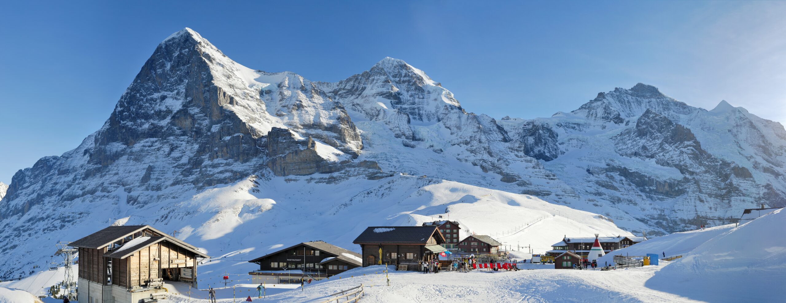
The Eiger has three very different planning problems. The Swiss Alpine Club lists the West Flank as the easiest normal route at AD, the Mittellegi Ridge as the most popular ascent at D, and the classic North Face as a separate extreme alpine objective. For most guided climbers, “climbing the Eiger” means the Mittellegi traverse—not the North Face.
Reviewed August 16, 2026 · Swiss Alpine Club + current Grindelwald/Jungfrau-region guide programs
What is the normal route on the Eiger?
The answer depends on whether you mean the easiest route or the most popular guided ascent. The Swiss Alpine Club identifies the West Flank as the easiest route and normal route at AD, with roughly 1,660 vertical meters of ascent from the Eigergletscher side.
SAC identifies the Mittellegi Ridge (northeast ridge) as the most popular and most frequently climbed ascent, grading it D and listing roughly 4–5 hours and 680 m of ascent from the Mittellegi Hut. Current local guide programs use the Eismeer railway station for the hut approach and then traverse the summit toward the Eigerjöcher and Jungfraujoch.
The North Face / Heckmair Route is not the normal guided Eiger experience. SAC notes that the classic North Face route is now climbed almost exclusively in the winter half of the year.
- Easiest / SAC normal route: West Flank · AD.
- Most popular ascent: Mittellegi Ridge · D.
- South Ridge: AD.
- Classic North Face: extreme alpine objective.
- Guided Mittellegi: typically a 1.5–2 day traverse.
- Best starting base: Grindelwald / Jungfrau Region.
Eiger Routes Compared
The route name changes the entire meaning of “climbing the Eiger.”
West Flank
AD · 6–8 h · ~1,660 m ascent. The easiest SAC-listed route to the summit, but still a long and exposed alpine climb.
Mittellegi Ridge
D · 4–5 h from hut · ~680 m ascent. The iconic guided traverse: exposed ridge climbing, fixed ropes, crampon terrain and a demanding descent toward Jungfraujoch.
South Ridge
AD · 5–6 h · ~650 m ascent. A serious alternative line and an important part of the descent/traverse system around the Eigerjöcher.
Do not use “Mittellegi = PD+/AD” as the planning grade.
The current Swiss Alpine Club route portal grades the northeast/Mittellegi Ridge D. That better matches the current local guide requirement for extensive mountaineering experience, efficient movement on exposed terrain and rock climbing around grade 4.
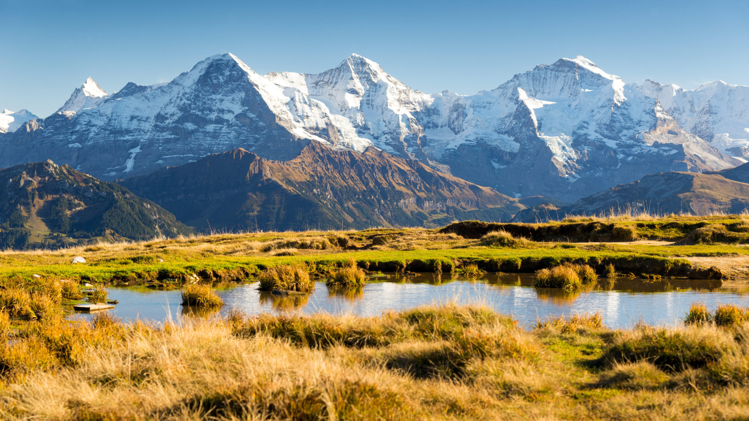
The Mittellegi Ridge is a D-grade alpine traverse, not a beginner ridge.
Current local guide programs require substantial prior mountaineering experience, comfort climbing around grade 4, surefootedness and the fitness to move for roughly nine hours with a pack.
What the Mittellegi Ridge Actually Involves
Fast, exposed movement matters more than raw strength.
| Component | Current planning picture |
|---|---|
| SAC grade | D |
| Ascent from hut | 4–5 h / ~680 m in the SAC portal; guided itineraries commonly allow a longer full summit/descent day |
| Terrain | Exposed rock ridge, fixed-rope sections, snow/firn and crampon movement depending on conditions |
| Guide-program requirement | Current local programs ask for extensive mountaineering experience and rock ability around grade 4 |
| Psychological demand | Continuous exposure with large drops on both sides of the ridge |
| Key success factor | Efficient movement, not stopping repeatedly on exposed technical terrain |
Eismeer Station to the Mittellegi Hut
The railway shortens the approach, but the hut access itself is still roped glacier and rock climbing.
Current local guide itinerary
A current Jungfrau-region guide program meets at Eismeer station on the Jungfrau Railway. From there the team ropes up, traverses the Challifirn and climbs rock bands to the Mittellegi Hut at 3,355 m.
The published itinerary gives roughly 1.5 km, +300 m / −150 m and about two hours. It describes a rock crux around grade 4 before the hut. The Mittellegi Hut itself is a small private hut of the Grindelwald mountain-guide association with roughly three dozen sleeping places including the bivouac capacity.
- Start: Eismeer station.
- Glacier: Challifirn crossing.
- Rock: technical approach to hut.
- Hut: Mittellegihütte · 3,355 m.
- Reservation: secure well in advance in high season.
Mittellegi Descent: Eigerjöcher to Jungfraujoch
The current guided traverse normally continues south rather than simply reversing to the hut.
The descent is another technical alpine route.
Current local guide itineraries descend from the Eiger summit over the northern and southern Eigerjoch, then continue toward the Mönchsjoch Hut and Jungfraujoch. The published guided summit/traverse day is approximately 6 km, +700 m / −550 m and 8–10 hours.
That is important because the live planning decision should not be built around the idea that the normal Mittellegi descent is simply the West Flank back to Eigergletscher station. Guides choose the exact descent according to route plan and current conditions.
- Plan energy for the descent, not just the summit.
- Expect rappels / lowering and exposed down-climbing.
- Crampons may stay on for snow/firn sections.
- Train for technical movement after several hours of concentration.
West Flank: The Eiger’s Easiest Route
“Easiest” is relative: SAC still grades it AD and lists a very large vertical day.
| West Flank factor | SAC route portal |
|---|---|
| Grade | AD |
| Ascent time | 6–8 h |
| Vertical ascent | ~1,660 m |
| Role | SAC normal/easiest route |
| Character | Long alpine snow/rock route with serious descent and condition sensitivity |
The West Flank deserves more respect than the old “moderate descent route” framing suggests. SAC specifically warns that all Eiger routes involve long, complicated and delicate descents and should be attempted only in good conditions by experienced alpinists.
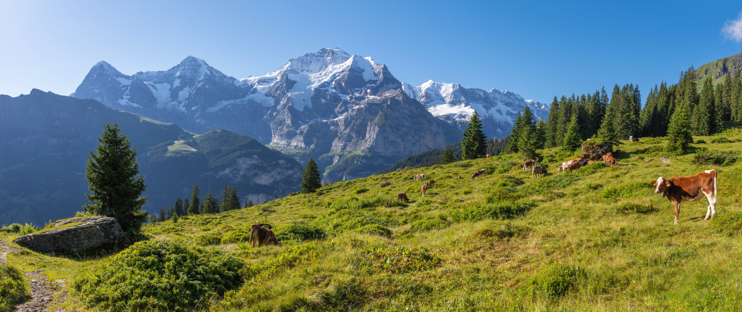
The North Face is not the next harder version of the Mittellegi Ridge.
The classic Heckmair line is an elite mixed alpine route with complex route-finding and condition-dependent objective hazard. SAC notes that it is now climbed almost exclusively in the winter half of the year.
Eiger North Face: The Heckmair Route
This page gives the context; a North Face attempt requires route-specific current information and a separate preparation standard.
Why winter conditions matter
SAC states that the classic North Face route is now climbed almost exclusively in the winter half-year. The reason is practical: frozen terrain can reduce the loose-rock and meltwater problems associated with warmer conditions, although winter brings severe cold, ice and short weather windows of its own.
Why it is not a normal guided product
The route demands high-level mixed-climbing experience, rapid route-finding and the ability to retreat or continue through a very large face. Climbers researching the North Face should not infer readiness from a successful Mittellegi ascent alone.
For dedicated guide-company research, see Eiger Operators.
How Hard Is the Eiger?
The summit is lower than the Matterhorn and Mont Blanc, but technical efficiency is the real filter.
| Skill | Why it matters on Mittellegi |
|---|---|
| Rock climbing | Current local programs expect competence around grade 4 in alpine footwear/combined terrain. |
| Exposure | The ridge is narrow and sustained; hesitation costs time and concentration. |
| Crampon technique | Snow/firn and mixed terrain can require crampons while still moving on rock. |
| Rope efficiency | Fixed ropes help at key sections, but the team still needs efficient short-rope and alpine movement. |
| Fitness | Current programs ask for roughly nine-hour days with a pack. |
| Descent skill | The traverse continues through technical terrain after the summit. |
The Eiger is not a first major alpine summit.
A climber should already be comfortable on exposed AD-level alpine terrain before using the Eiger as the next progression step. The current local guide requirement is more demanding than a simple “fit hiker with crampon experience” profile.
Best Time to Climb the Eiger
The Mittellegi Ridge and North Face should not share one generic “Eiger season.”
| Route | Typical planning window | Main condition concern |
|---|---|---|
| Mittellegi Ridge | July–September in current local guide programs | Snow/firn condition, storms, ridge icing, descent condition |
| West Flank | Summer alpine conditions | Snow cover, rockfall, visibility and descent condition |
| South Ridge | Summer alpine conditions | Mixed terrain and long descent |
| Classic North Face | Winter half-year according to SAC | Mixed-route formation, severe cold, avalanche/ice and weather window |
Check MeteoSwiss, SAC route warnings and the Grindelwald guide network close to the climb.
What Does a Guided Mittellegi Climb Cost?
Local guide-only packages can cost far less than international multi-day Alpine programs.
Current 2026 local examples
Current Jungfrau-region listings show a 1.5-day Mittellegi program from CHF 1,590 per guest and a separate two-day 2026 Mittellegi listing at CHF 1,890. Both exclude some guest costs such as rail, hut accommodation, snacks and technical-equipment rental.
Broader international Alpine packages can cost substantially more because they include acclimatization days, hotels, additional peaks and weather buffers. Compare exactly what is included rather than treating every “Eiger program” as the same product.
- Local 1.5-day example: CHF 1,590.
- Local 2-day example: CHF 1,890.
- Guest hut/rail may be extra.
- Technical equipment may be extra or rentable.
- Multi-day acclimatization packages cost more.
Compare current program structures on Eiger Operators.
Mittellegi Gear
Current local programs emphasize crampon-compatible boots, technical efficiency and a light pack.
Technical
- Crampon-compatible mountaineering boots.
- Crampons with anti-balling plates.
- Harness and helmet.
- Mountaineering ice axe.
- Guide/team rope system.
Clothing
- Weatherproof shell jacket and pants.
- Warm insulation layer.
- Light + warm gloves.
- Warm hat/headband.
- Category 3–4 sunglasses.
Pack
- 25–30 L technical pack.
- Headlamp.
- Water / thermos.
- High-energy summit food.
- Hut liner and minimal overnight kit.
Who Should Climb the Mittellegi Ridge?
Use prior technical Alpine objectives to prove pace, exposure tolerance and crampon-on-rock efficiency.
Good signs you are ready
- Several successful AD-level Alpine climbs.
- Comfort climbing exposed rock in mountain boots.
- Efficient crampon use on snow, firn and mixed rock.
- Ability to move for 8–10 technical hours.
- Calm movement on narrow ridges without freezing.
Reasons to build more experience first
- Your only mountaineering experience is non-technical snow hiking.
- You have never climbed exposed rock in boots.
- You need frequent rests on technical terrain.
- You are uncomfortable descending on rope systems.
- You have not climbed at altitude recently.
Compare the progression with Matterhorn vs Eiger and the Greatest Alps Mountains Compared.
Eiger Climbing History in Brief
The mountain’s reputation comes from more than the North Face.
| Year | Milestone | Why it matters |
|---|---|---|
| 1858 | First ascent by Charles Barrington with Christian Almer and Peter Bohren | Established the West-side summit route. |
| 1921 | First Mittellegi Ridge ascent by Yuko Maki with Swiss guides | Created the route that became the most popular modern ascent. |
| 1924 | Original Mittellegi Hut built with financial support from Maki | Turned the ridge into a practical two-day Alpine objective. |
| 1938 | First ascent of the classic North Face | Established the Heckmair line and the Eiger’s worldwide North Face legend. |
Eiger & Bernese Alps Planning Library
Use this page for the mountain overview, then move to operators, comparisons and neighboring Alpine objectives.
Eiger Operators
Compare current local and international Mittellegi programs.
Compare guides → ComparisonMatterhorn vs Eiger
Compare the Hörnli and Mittellegi ridges and decide which belongs first.
Compare climbs → CollectorGreatest Alps Mountains
Place the Eiger among Mont Blanc, Matterhorn, Jungfrau and other Alpine classics.
Explore Alps → ProgressionMatterhorn Guide
A major exposed Alpine ridge and useful comparison objective.
Open Matterhorn → NearbyJungfrau Guide
Another major summit in the same Bernese Oberland massif.
Open Jungfrau → RegionBest Hikes in the Swiss Alps
Non-technical routes and acclimatization days in the wider region.
Explore hikes → ConditionsMountain Weather
Forecast interpretation and Alpine weather-window planning.
Plan weather → CompareMountain Comparisons
Direct peak-vs-peak decisions across the Global Summit Guide library.
Explore comparisons →Move From the Guide to a Specific Eiger Plan
The two most useful follow-ups are the operator comparison and the Matterhorn progression comparison.
Eiger Operators
Compare 1.5–2 day local Mittellegi programs against longer acclimatization packages.
Compare Eiger Operators →Matterhorn vs Eiger
Decide whether the Hörnli Ridge should come before the D-grade Mittellegi traverse in your Alpine progression.
Compare Matterhorn & Eiger →Eiger Climbing FAQ
The most important distinction is which route you mean.
What is the normal route on the Eiger?
The Swiss Alpine Club identifies the West Flank as the easiest normal route at AD. The Mittellegi Ridge is the most popular and most frequently climbed ascent and is graded D.
How hard is the Mittellegi Ridge?
SAC grades the Mittellegi Ridge D. Current local guide programs expect extensive mountaineering experience, efficient movement on exposed terrain, roughly grade-4 rock ability and fitness for about nine hours with a pack.
How long does the Mittellegi Ridge take?
SAC lists roughly 4–5 hours and 680 m of ascent from the Mittellegi Hut to the summit. Current guided itineraries allow about 8–10 hours for the full summit and descent/traverse day.
How do climbers reach the Mittellegi Hut?
Current local guide programs meet at Eismeer station on the Jungfrau Railway, cross the Challifirn and climb technical rock bands to the hut at 3,355 m. A current itinerary lists roughly two hours for the approach.
How do climbers descend after the Mittellegi Ridge?
Current guided traverses commonly continue over the Eigerjöcher toward the Mönchsjoch Hut and Jungfraujoch rather than simply descending the West Flank back to the starting station.
When is the best time for the Mittellegi Ridge?
Current local guide programs operate primarily July through September. Exact ridge, snow and descent conditions should be checked close to the climb.
When is the Eiger North Face climbed?
The Swiss Alpine Club says the classic Heckmair route is now climbed almost exclusively in the winter half of the year, when conditions can be more suitable for the mixed face.
How much does a guided Eiger climb cost?
Current 2026 local Mittellegi examples include CHF 1,590 for a 1.5-day program and CHF 1,890 for a two-day listing, with some guest hut, rail, food or equipment costs excluded. Longer acclimatization packages cost more.
Can a beginner climb the Eiger?
The Mittellegi Ridge is not a beginner route. A climber should already have substantial technical Alpine experience, efficient crampon use, exposed-ridge confidence and the fitness to move quickly for a long technical day.
How Global Summit Guide Evaluates the Eiger
Swiss route grades take priority over generic commercial labels; current guide programs are used for itinerary, preparation and price examples.
Primary route sources
- Swiss Alpine Club — Eiger route portal: current route hierarchy, grades, ascent times and SAC safety framing.
- Swiss Alpine Club — Mittellegi Hut: hut elevation and history.
- OUTDOOR — Eiger via Mittellegi: current Eismeer approach, guide requirements, itinerary, equipment and CHF 1,590 example.
- Bergschaft — Eiger Mittellegi 2026: current CHF 1,890 two-day listing.
- Jungfrau Railways — Eigergletscher station: current transport context.
What to verify before climbing
- Mittellegi Hut reservation and operating dates.
- Eismeer access arrangements with the guide/operator.
- Snow/firn condition on the ridge and Eigerjöcher descent.
- Wind, storms and freezing level.
- Current guide ratio, inclusions and cancellation policy.
- Whether your preparation climbs meet the guide’s technical standard.
Route conditions outrank the calendar.
The Eiger is unusually sensitive to snow, icing, rock condition and weather. A July booking does not guarantee a climb, and the correct route or descent can change with conditions.
West Flank for the Easiest Line. Mittellegi for the Classic Traverse. North Face for an Elite Objective.
The Eiger’s fame can blur three very different climbs. Start with the SAC route grade, then build the experience, guide plan and weather margin that the specific line demands.
Was this helpful?
🏔Related peaks nearby
🧭Explore & compare
Global Summit Guide is an independent mountaineering resource founded in 2026. The team combines first-hand trekking and climbing experience with in-depth research and professional health and nutrition review to help climbers choose objectives, prepare properly, and stay safe.
Health, altitude, and nutrition content is reviewed by Taylor Ludlow (Registered Nurse) and Brigg Hoopes (Nutritionist).
What We Don't Know Yet
Mountain information changes quickly. This box explains the limits of what this page can responsibly promise.
- Route conditions, trailhead access, crevasse exposure, stream crossings, and rescue access may vary from published planning guidance.
- Visa, passport, vaccination, border, insurance, and local transportation rules may change before your trip.
- Route conditions, snowpack, closures, and weather can change quickly after this page is updated.
- Permit rules, fees, quotas, and reservation windows may change between review cycles.
- Operator availability, pricing, guide ratios, and cancellation terms can change by season.
Verify current conditions with official land managers, guide services, local forecasts, and current route reports before booking or climbing.
Mountaineering, rock and ice climbing, glacier travel, and high-altitude activity are inherently dangerous and can result in serious injury or death. The information on Global Summit Guide is provided for general informational and educational purposes only and is not a substitute for professional instruction, qualified guiding, proper equipment, or your own judgment and experience.
Route conditions, weather, snowpack, permits, regulations, and hazards change constantly and may differ from what is described here. Details may be incomplete, out of date, or contain errors. Always verify current information with local authorities, certified guides, and official sources before making any decision in the mountains.
Nothing on this site is medical, legal, or financial advice. Our fitness, acclimatization, altitude, and nutrition content is general in nature; consult a qualified physician before beginning any strenuous exercise program or exposing yourself to high altitude.
You are solely responsible for your own safety and decisions. To the fullest extent permitted by law, Global Summit Guide and its team accept no liability for any loss, injury, damage, or expense arising from use of, or reliance on, this information. By using this site you acknowledge these risks and accept these terms.
Some links on this site may be affiliate links. If you buy through them we may earn a small commission at no extra cost to you; this never affects our recommendations.
Global Summit Guide recommendation path
Next Best Mountain to Research
Use these recommendations to continue the right planning path instead of stopping on one page.
Use current permit, weather, route, and operator information before booking or climbing.
Search Flights, Hotels & Rental Cars
Have the mountain or destination picked? Use Expedia to compare the flights, lodging and rental cars that fit your actual trip dates. For mountain travel, consider arriving early enough for delays and adding a buffer night after the climb before a fixed flight home.
Compare current flight, hotel and car options.
Affiliate disclosure: Global Summit Guide may earn a commission if you book through this link, at no additional cost to you.