
Last updated September 12, 2026
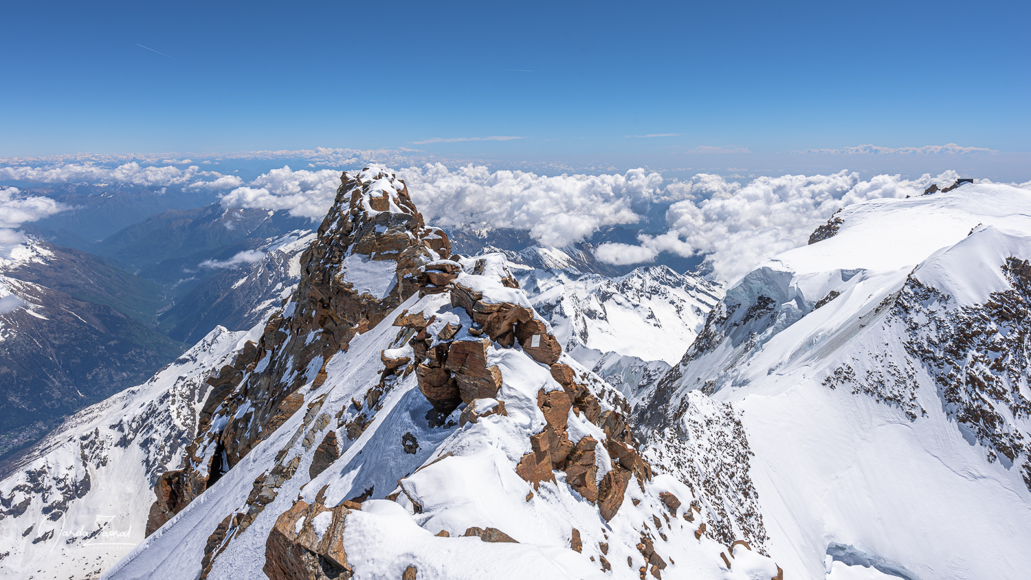
Dufourspitze (Monte Rosa): complete climbing guide
Plan the Swiss Normal Route from the Monte Rosa Hut: official difficulty, route stages, a realistic summit-day timeline, required experience, acclimatization, hazards, costs, season and the difference between climbing Dufourspitze and touring the wider Monte Rosa massif.
Dufourspitze is a long, technical high-alpine climb—not a beginner 4,000er.
Dufourspitze (4,634 m / 15,203 ft) is the highest point in Switzerland and the highest summit of the Monte Rosa massif. The Swiss Alpine Club grades the normal route from the Monte Rosa Hut AD− and lists about 1,750 meters of ascent with 7–8 hours to the summit. Local Zermatt guides commonly describe about six hours up and five hours back, so a practical planning figure is 10–12 hours hut-to-hut.
The route combines sustained crevassed-glacier travel with an exposed mixed West Ridge. Climbers should be well acclimatized, efficient with crampons, ice axe and rope, and comfortable moving on exposed rock, snow and ice. The usual summer window is June to mid-September, depending on conditions.
Dufourspitze route at a glance
The key planning facts before you book travel, a guide or a hut.
| Planning item | Swiss Normal Route | What it means |
|---|---|---|
| Summit | 4,634 m / 15,203 ft | Highest point in Switzerland; second-highest summit in the Alps after Mont Blanc. |
| Starting hut | Monte Rosa Hut, 2,883 m | Reached from Rotenboden by a demanding glacier-access route; the approach is part of the climb. |
| Official grade | AD− | A serious alpine route involving glacier hazards, exposure and mixed ridge climbing. |
| Ascent | About 1,750 m | A very large summit-day elevation gain at altitude. |
| Official ascent time | 7–8 hours | SAC estimate for ascent only; descent and delays must be added. |
| Practical hut-to-hut time | About 10–12 hours | Local guide timing is roughly six hours up and five hours down in normal conditions. |
| Guide ratio | Usually 1:1 or 1:2 | Small rope teams improve movement and risk management on the final ridge. |
| Typical season | June to mid-September | Actual dates depend on hut access, glacier bridges, snow cover, ridge conditions and weather. |
| Experience | Advanced high-alpine | Prior 4,000m acclimatization plus confident crampon, rope and exposed mixed-terrain movement. |
The Swiss Normal Route stage by stage
From the Monte Rosa Hut to Switzerland’s highest point.
Dufourspitze route profile
1. Monte Rosa Hut to the lower glacier
The day starts before dawn. Teams leave the hut roped and equipped for crevassed terrain. The initial navigation can be complicated in darkness, cloud or fresh snow, and the route changes as glacier geometry evolves. This is not a marked hiking trail.
2. The long glacier ascent
Most of the vertical gain comes before the final ridge. The glacier section rewards steady pacing and efficient rope work; unnecessary stops can turn an already long day into a late descent. The exposure is not limited to visible crevasses—snow bridges, changing tracks and poor visibility can all alter the risk.
3. Transition to the West Ridge
Near the saddle beneath the summit, the route changes character. Climbers move from glacier travel to steeper, exposed mixed terrain. Crampons may remain on rock, and the ability to climb accurately without wasting time becomes critical.
4. The final mixed ridge
The previous version overstated the vertical gain on this section. The challenge is not enormous vertical gain; it is the length, exposure and technical character of the ridge at very high altitude. Local guide descriptions reference climbing up to roughly UIAA grade III–IV depending on the exact line and conditions.
5. Descent to the hut
The summit is only the midpoint. Teams reverse the ridge and return through the glacier system while fatigue, warming snow and changing weather increase. ZERMATTERS estimates approximately five hours from the summit back to the Monte Rosa Hut, which is why the page should plan around an 11-hour day rather than a 6–8 hour round trip.
Dufourspitze route options
The normal route is only one way through the Monte Rosa massif.
Monte Rosa Hut, saddle and West Ridge
SAC grade: AD− · Ascent: 7–8 hours · Vertical gain: about 1,750 m.
This is the standard objective for most guided Dufourspitze climbers. Its seriousness comes from the combination of a huge glacier ascent, altitude, crevasse exposure and the mixed finishing ridge. It is the correct route to optimize this page around.
Capanna Margherita via Zumsteinspitze
SAC grade: AD · Ascent: about 3 hours and 300 m · Descent to Monte Rosa Hut: about 4–5 hours and 2,000 m.
This route can appear within a multi-day Monte Rosa traverse. It requires sleeping and moving at very high altitude and should not be confused with an easier one-day summit simply because the vertical ascent from the hut is smaller.
Cresta Rey from the Monte Rosa Hut
SAC grade: AD+ · Ascent: 7–8 hours · Vertical gain: about 1,770 m.
Cresta Rey is a more technical alternative for experienced alpinists. It should be planned through current SAC route information and a qualified local guide rather than summarized as merely another “open” commercial option.
A realistic Dufourspitze itinerary
Separate the minimum logistics from the preparation most climbers actually need.
Three-day minimum itinerary
Rail to Rotenboden, then the glacier-access route to the 2,883-meter hut. Eat, hydrate, prepare equipment and confirm the start time.
Alpine start, glacier ascent, West Ridge, summit and return to the hut. Plan approximately 10–12 hours hut-to-hut.
Descend only when the glacier approach is safe and transportation timing is workable.
Preferred five- or six-day plan
Gear check, route briefing and a low-intensity acclimatization walk.
Breithorn or another suitable 4,000m objective selected for current conditions and the climber’s experience.
Mixed movement, crampon efficiency, rope systems and an honest fitness assessment.
Travel to Rotenboden and complete the glacier approach without exhausting the team.
Dufourspitze via the Swiss Normal Route and return to the hut.
Use the day as a contingency rather than forcing the climb into the wrong conditions.
Are you ready for Dufourspitze?
A practical qualification check before paying for the trip.
Dufourspitze vs Mont Blanc
Which is harder depends on the kind of difficulty being compared.
| Factor | Dufourspitze normal route | Mont Blanc Goûter Route |
|---|---|---|
| Elevation | 4,634 m | Approximately 4,808 m; snow summit elevation varies |
| Technical character | More sustained mixed and exposed ridge climbing | Generally more straightforward climbing, but serious objective hazards |
| Official grade | AD− by SAC | Commonly described around PD/PD+ depending on source and conditions |
| Summit-day vertical | About 1,750 m from Monte Rosa Hut | Varies by hut and route plan |
| Glacier exposure | Long crevassed approach and summit glacier | Glacier travel plus route-specific hazards |
| Signature hazard | Crevasses, mixed ridge exposure and long descent | Grand Couloir rockfall, altitude, crowds and weather |
| Best first? | Usually later in an Alps progression | Often climbed earlier, but never “easy” |
Dufourspitze is usually the more technically demanding normal-route climb. Mont Blanc is higher and may be more punishing physiologically, while its Goûter Route has objective hazards that cannot be reduced to a grade. A climber who has reached Mont Blanc but has little mixed-ridge experience may still be underprepared for Dufourspitze.
Acclimatization and preparation peaks
Build altitude tolerance and verify technical readiness before the hut approach.
Breithorn
A useful first high point near Zermatt, but its normal route does not prove readiness for Dufourspitze’s mixed West Ridge.
Gran Paradiso
Useful for hut logistics, glacier travel and sustained movement above 4,000 m.
Mont Blanc
Builds altitude and long-day experience, but add a technical ridge day rather than treating it as complete preparation.
Breithorn Traverse
A better technical check than the Breithorn normal route because it tests exposure, rope management and mixed movement.
Riffelhorn training
Local guides use the Riffelhorn to assess and improve movement in mountain boots on exposed rock.
Acclimatization builder
Use the site tool to organize sleeping elevations and preparation days, then adjust the result with a guide.
Hazards and turnaround decisions
The most important risks by route section.
Glacier approach to the hut
All approaches to the Monte Rosa Hut cross glacier terrain. Changing access lines, exposed ice, ladders or fixed aids and crevasses can make the hut approach a serious day of its own.
Snow bridges and route finding
Warm temperatures, new snow and poor visibility can undermine the track. The safe line can change even within one week.
West Ridge conditions
Dry rock, verglas, unconsolidated snow and hard ice create very different versions of the same route.
Altitude and pace
Slow movement on the glacier can place the team on the ridge too late, when weather and snow conditions are deteriorating.
Descent fatigue
Many errors occur after the summit. The rope team must descend the mixed ridge and glacier without losing concentration.
Weather compression
A marginal forecast should not be “made to work” because hut reservations or flights are fixed. Build a reserve day into the trip.
Best time to climb and current conditions
Use seasonal patterns as a starting point—not a substitute for a local forecast.
| Period | Typical character | Planning concern |
|---|---|---|
| June | Early summer snow may cover more rock and crevasses. | Check hut access, snow bridges, avalanche history and whether the ridge has been climbed recently. |
| July | Long daylight and established tracks; generally popular. | Hut demand, thunderstorms, heat effects on glaciers and route congestion. |
| August | Often the busiest period, with mature seasonal conditions. | Warmth can weaken bridges and expose more ice or rock. |
| Early to mid-September | Potentially quieter with cooler mornings. | Shorter days, early storms, hut closing dates and fresh snow on the ridge. |
| Outside summer season | Ski mountaineering or winter-alpine conditions. | Requires a separate skill set, avalanche planning and current local expertise. |
Dufourspitze cost and logistics in 2026
Separate the guide fee from the actual cost of an adequately prepared trip.
| Item | Current planning reference | Notes |
|---|---|---|
| Local guide fee | From about CHF 1,550 | ZERMATTERS’ published Dufourspitze guide price; accommodation and transport are additional. |
| Monte Rosa Hut | About CHF 95 per person | Current local guide listing for overnight and half board; confirm directly for your date and membership status. |
| Zermatt–Rotenboden return rail | About CHF 106 | Current local guide listing; reductions may apply with Swiss rail passes. |
| Rental equipment | About CHF 50–70 | Local reference for basic rental items; boots and complete kits can cost more. |
| Preparation climb | Variable | Add guide, lift, hut and gear costs for a Breithorn Traverse, Riffelhorn day or another qualification climb. |
| Zermatt lodging | Variable | Budget for arrival, acclimatization, weather contingency and post-climb nights. |
| Insurance | Required planning item | Confirm alpine climbing, rescue, evacuation and altitude exclusions. |
A bare two-day guide booking is not the same thing as a complete trip. Once acclimatization, technical preparation, Zermatt lodging, hut nights, rail travel, equipment and contingency days are included, a realistic guided budget can be several thousand Swiss francs before international travel. Publish costs as planning ranges, not promises.
Planning the Zermatt portion of the trip?
Reserve flexible lodging around the climbing window, because the summit date can move with weather and conditions. Compare accommodations and transportation only after the guide and hut plan are clear.
Disclosure: the Expedia link is an affiliate link. Global Summit Guide may earn a commission at no extra cost to the traveler.
Compare Zermatt Travel Review Climbing InsuranceThe Monte Rosa Hut is part of the climb
Do not reduce the approach to a simple railway transfer and short walk.
2,883 meters
The modern SAC hut sleeps approximately 120 people and is a major base for the Monte Rosa massif.
Glacier terrain
The SAC warns that all approaches cross glaciers and require the relevant experience, equipment or a mountain guide.
Roughly 4–7 hours
Published access times vary by line, conditions and whether the trip is guided; plan it as a substantial alpine day.
Book early
Guide bookings do not always include accommodation, and the hut cannot be assumed available because a climbing date is open.
The crystalline new hut was developed with ETH Zurich and opened around 2009–2010. Its energy, water and wastewater systems made it a landmark in high-alpine building design. That story belongs on the page, but it should support—not precede—the practical climbing answer.
Dufourspitze, Monte Rosa and the Spaghetti Tour
Choose between one summit and a multi-day traverse of the massif.
The Monte Rosa massif contains a dense group of major 4,000-meter summits, including Dufourspitze, Nordend, Zumsteinspitze, Signalkuppe/Punta Gnifetti, Parrotspitze, Ludwigshöhe, Corno Nero, Balmenhorn, Vincent Pyramid and Punta Giordani. The exact count can vary with classification, but the planning distinction is simple: Dufourspitze is one summit; Monte Rosa is the mountain system.
Dufourspitze
Best for climbers whose primary goal is Switzerland’s highest point via the Swiss Normal Route.
Spaghetti Tour
A multi-day hut traverse that can combine several 4,000ers; exact peaks vary by program and conditions.
Capanna Margherita
Located on Signalkuppe/Punta Gnifetti at 4,554 m and often included in Italian-side traverse itineraries.
Before booking, ask for the written summit list, hut sequence, guide ratio and whether Dufourspitze is a guaranteed objective, a conditions-dependent option or not included at all.
Dufourspitze history
The first ascent and the mountain’s name—condensed so planning remains primary.
Charles Hudson, John Birkbeck, Edward Stevenson, Christopher Smyth and James Smyth reached the summit with guides Ulrich Lauener, Johann zum Taugwald and Matthäus zum Taugwald.
The summit was named for General Guillaume-Henri Dufour, the Swiss military leader and cartographer associated with the first accurate national map series.
The Swiss Alpine Club established a high base for routes in the massif.
The new crystalline hut became an internationally recognized example of sustainable high-alpine architecture.
The broader Monte Rosa name predates the Dufourspitze designation and refers to the glacier-covered massif rather than a pink-colored mountain. The distinction is useful for both historical accuracy and modern search intent.
Dufourspitze gear checklist
A normal high-alpine kit plus efficient mixed-ridge equipment.
Personal climbing equipment
- Rigid, crampon-compatible mountaineering boots
- Crampons with anti-balling plates
- Mountaineering ice axe
- Climbing harness and helmet
- Locking carabiner and guide-specified hardware
- 30–40 L alpine pack
- Headlamp with spare power
Clothing
- Moisture-managing base layers
- Mid-layer and insulated jacket
- Waterproof shell jacket and pants
- Warm gloves plus spare pair
- Beanie or headband
- Category 4 glacier glasses and goggles
- Sun protection and lip balm
Hut and nutrition
- Mandatory hut sleeping liner
- Water or insulated bottle
- High-energy food that can be eaten while moving
- Personal medication and compact first-aid items
- Identification, cash/card and reservation details
Guide/team equipment
- Appropriate glacier rope
- Crevasse-rescue system
- Navigation and communication tools
- Emergency and group first-aid equipment
- Any protection required by current ridge conditions
Dufourspitze FAQ
The questions most useful to climbers planning the Swiss Normal Route.
The Swiss Normal Route is graded AD− by the Swiss Alpine Club. It involves about 1,750 m of ascent, long crevassed-glacier travel and an exposed mixed West Ridge. The grade assumes normal conditions; hard ice, fresh snow or poor visibility can make it harder.
The SAC lists 7–8 hours for the ascent. ZERMATTERS describes approximately six hours up and five hours back to the hut, so plan roughly 10–12 hours hut-to-hut.
It should not be a climber’s first alpine or 4,000-meter summit. Prior acclimatization, crampon competence, glacier travel, exposed ridge movement and strong endurance are expected. A local guide may require a preparation climb.
Dufourspitze is generally more technical on its normal route because of the mixed West Ridge. Mont Blanc is higher and has its own major objective hazards. Climbers should compare skill demands rather than relying on a single “harder” label.
July and August are popular, but there is no universally best month. The better decision depends on current glacier bridges, ridge conditions, hut operations, weather and the climber’s acclimatization schedule.
As a current local reference, ZERMATTERS lists a CHF 1,550 guide fee for the Dufourspitze tour, with hut accommodation, railway travel and rental equipment charged separately. A complete acclimatized trip costs more.
A separate summit permit is not normally the controlling requirement. Climbers still need hut reservations, transportation, appropriate insurance, legal access and compliance with guide and local operating rules.
No. The SAC warns that every approach crosses glacier terrain and requires experience, equipment or a guide. Published approach times vary, but it should be treated as a substantial alpine day rather than a simple hike from the railway.
It is a multi-day traverse through the Monte Rosa massif using high huts and climbing several 4,000-meter summits. Dufourspitze may be included as an option, but itineraries vary; verify the exact summit list.
How this guide was built
- Route grade, ascent time and vertical gain: Swiss Alpine Club route portal.
- Local summit-day timing, season, guide ratio, current fee examples and equipment expectations: ZERMATTERS.
- Hut elevation, capacity, glacier-access warning and operating information: Swiss Alpine Club and the Monte Rosa Hut.
- Historical details: retained from the supplied Global Summit Guide page and condensed so they no longer displace the planning answer.
- Confidence: high for elevation and standard route data; medium for costs and seasonal logistics because they can change.
Primary references: SAC Dufourspitze routes · ZERMATTERS Dufourspitze tour · SAC Monte Rosa Hut · Monte Rosa Hut access.
Build the skills before committing to the summit
Dufourspitze rewards climbers who arrive acclimatized, technically efficient and prepared to turn around. Start with the Alps comparison and progression resources, then confirm the route, hut, conditions and guide plan directly in Zermatt.
Compare Alps Peaks Build a ProgressionWhat Does a Dufourspitze Climb Actually Cost?
The advertised guide fee is only one part of the trip. Hut accommodation, transportation, rental equipment, insurance, acclimatization and Zermatt lodging can all sit outside the headline price.
| Budget item | Current reference | Required? | What is included | What is not included / caution | Source checked |
|---|---|---|---|---|---|
| Separate summit permit | No separate summit fee identified | No standard summit-fee line appears in the SAC or ZERMATTERS normal-route planning information reviewed. | Normal route access remains subject to current protection provisions, hut access and local conditions. | Do not interpret this as unrestricted access under every condition. Always check SAC situation warnings and protection provisions. |
Swiss Alpine Club
Checked 12 Sep 2026 |
| ZERMATTERS Dufourspitze guide | From CHF 1,550 | Guiding is not presented here as a legal summit requirement, but is the realistic choice for climbers who do not independently possess the required glacier and mixed-ridge skills. | Private local / IFMGA-certified mountain-guide service for the Dufourspitze normal-route program; ZERMATTERS also handles the hut reservation process. | Hut nights, rail journey, rental equipment and insurance are explicitly additional. |
ZERMATTERS
Checked 12 Sep 2026 |
| Monte Rosa Hut — direct tariff | CHF 92 member CHF 116 non-member CHF 58 employed guide | Normally required for the standard two-day hut-based itinerary. | Half board, hiking tea and visitor tax. | Vegan meal supplement is CHF 10. Direct hut rates vary by membership category. |
Monte Rosa Hut
Checked 12 Sep 2026 |
| ZERMATTERS hut planning reference | CHF 95 per person | Applies to its published Dufourspitze booking example. | Overnight stay and half board. | ZERMATTERS states CHF 95 for both the client and mountain guide. This differs from the hut’s current direct tariff, so confirm the actual booking invoice rather than assuming either figure. |
ZERMATTERS
Checked 12 Sep 2026 |
| Zermatt–Rotenboden return rail | CHF 106 | Standard transportation reference for the ZERMATTERS itinerary. | Return railway journey in the published guide plan. | Reductions may apply with GA, Half-Fare Card or Swiss Travel Pass. Gornergrat pricing varies by product and season. |
ZERMATTERS
Checked 12 Sep 2026 |
| Rental climbing equipment | CHF 50–70 | Only if needed. | ZERMATTERS gives this as its current rental-equipment planning reference. | Do not assume this represents a complete personal mountaineering kit or correctly fitted boots. |
ZERMATTERS
Checked 12 Sep 2026 |
| Accident / evacuation insurance | Variable | Essential trip-planning item. | Depends entirely on the selected policy. | ZERMATTERS states that insurance is the participant’s responsibility and recommends valid accident and evacuation insurance. |
ZERMATTERS
Checked 12 Sep 2026 |
| Preparation / acclimatization climb | Optional but potentially substantial | Strongly relevant if the guide wants to assess rock, mixed or altitude readiness first. | Depends on the objective selected. | ZERMATTERS specifically recommends preparation such as the Breithorn Traverse or Riffelhorn. These are separate bookings. |
ZERMATTERS
Checked 12 Sep 2026 |
| Zermatt hotel / weather buffer | Variable | Usually part of a realistic trip, even though it is not part of the mountain-guide fee. | Depends on the lodging booked. | Add arrival, acclimatization, weather-reserve and post-climb nights separately. | Trip-specific Checked 12 Sep 2026 |
The CHF 1,550 Guide Price Is Not the Trip Price
Using ZERMATTERS’ own currently published add-ons gives a useful starting calculation. It still excludes insurance, Zermatt lodging, international transportation, meals outside the hut, acclimatization days and any separate preparation climb.
Current starting price for the guided Dufourspitze summit program.
CHF 1,550 guide + CHF 190 for two CHF 95 hut stays (client + guide) + CHF 106 client rail reference.
Still before Zermatt hotel nights, insurance, travel, food outside the hut or a preparation climb.
Why the hut numbers do not match exactly
ZERMATTERS currently tells Dufourspitze clients to budget CHF 95 per person for hut accommodation and half board for both the client and guide. The Monte Rosa Hut’s own direct tariff currently lists CHF 92 for an adult Alpine Club member, CHF 116 for an adult non-member and CHF 58 for an employed guide. Use the rate on the actual reservation or guide invoice; do not add both pricing systems together.
Finish the Dufourspitze Budget
The biggest budgeting mistake is booking the summit guide first and discovering later that acclimatization, hut, insurance and weather flexibility all sit outside the headline price.
Build the Route, Skills and Budget Together
Dufourspitze makes the most sense after the climber has already built altitude tolerance, glacier efficiency and exposed-ridge movement. Use the pages below to choose the right preparation and compare the next Alpine objectives.
Was this helpful?
🏔Related peaks nearby
🧭Explore & compare
Global Summit Guide is an independent mountaineering resource founded in 2026. The team combines first-hand trekking and climbing experience with in-depth research and professional health and nutrition review to help climbers choose objectives, prepare properly, and stay safe.
Health, altitude, and nutrition content is reviewed by Taylor Ludlow (Registered Nurse) and Brigg Hoopes (Nutritionist).
What We Don't Know Yet
Mountain information changes quickly. This box explains the limits of what this page can responsibly promise.
- Weather, snowpack, avalanche risk, road access, and route conditions can change quickly and may be different on your climbing dates.
- Route conditions, trailhead access, crevasse exposure, stream crossings, and rescue access may vary from published planning guidance.
- Total trip cost can change with flights, lodging, guide pricing, permits, gear rentals, transportation, and exchange rates.
- Gear requirements can change by season, route variation, weather window, personal cold tolerance, and guide-service requirements.
- Fitness and altitude response vary by person; no guide, itinerary, or training plan can guarantee acclimatization or summit success.
Verify current conditions with official land managers, guide services, local forecasts, and current route reports before booking or climbing.
Mountaineering, rock and ice climbing, glacier travel, and high-altitude activity are inherently dangerous and can result in serious injury or death. The information on Global Summit Guide is provided for general informational and educational purposes only and is not a substitute for professional instruction, qualified guiding, proper equipment, or your own judgment and experience.
Route conditions, weather, snowpack, permits, regulations, and hazards change constantly and may differ from what is described here. Details may be incomplete, out of date, or contain errors. Always verify current information with local authorities, certified guides, and official sources before making any decision in the mountains.
Nothing on this site is medical, legal, or financial advice. Our fitness, acclimatization, altitude, and nutrition content is general in nature; consult a qualified physician before beginning any strenuous exercise program or exposing yourself to high altitude.
You are solely responsible for your own safety and decisions. To the fullest extent permitted by law, Global Summit Guide and its team accept no liability for any loss, injury, damage, or expense arising from use of, or reliance on, this information. By using this site you acknowledge these risks and accept these terms.
Some links on this site may be affiliate links. If you buy through them we may earn a small commission at no extra cost to you; this never affects our recommendations.
Global Summit Guide recommendation path
Next Best Mountain to Research
Use these recommendations to continue the right planning path instead of stopping on one page.
Use current permit, weather, route, and operator information before booking or climbing.
Search Flights, Hotels & Rental Cars
Have the mountain or destination picked? Use Expedia to compare the flights, lodging and rental cars that fit your actual trip dates. For mountain travel, consider arriving early enough for delays and adding a buffer night after the climb before a fixed flight home.
Compare current flight, hotel and car options.
Affiliate disclosure: Global Summit Guide may earn a commission if you book through this link, at no additional cost to you.