17,400 ft (5,304 m) · Alaska Range · Denali National Park
Mount Foraker: Sultana, Denali’s Wife, and the range’s overshadowed giant
Foraker is the second-highest peak in the Alaska Range and the third-highest in the United States, yet it stands in Denali’s shadow and is climbed by very few. Its Dena’ina name, Sultana, means the woman; it is Denali’s Wife. This update covers the committing Sultana Ridge, the permit rules that do apply here, and an honest readiness view. Heights in feet (metres).
Research-based updateSafety and medical reviewReviewed each Alaska Range seasonOur team has not climbed Foraker
Jump to the Foraker planning resources and Alaska Range updates linked on this page.
Updated 27 July 2026 · Compiled by Travis Ludlow · Safety review by Dawson Ludlow · Medical review by Taylor Ludlow, RN
17,400 ftSummit (5,304 m)
2ndIn the Alaska Range
3rdHighest in the US
Sultana RidgeStandard (AK Grade 3)
May-JunSeason
KahiltnaBase glacier
By Travis Ludlow, Founder & Head of Research · Safety: Dawson Ludlow · Medical: Taylor Ludlow, RN
Expedition update · ~10 min read
Single-mountain expedition update, compiled from National Park Service registration rules, operator route information, and published alpine records. Our team has not climbed Mount Foraker; the only first-hand summit anyone on our team claims is Kilimanjaro. This is a planning briefing for experienced expedition climbers, not a how-to and not a substitute for training or a guide.
The range’s second giant, in the shadow of the first.
Foraker is the second-highest peak in the Alaska Range and third-highest in the US, but almost everyone drawn to the Kahiltna goes for Denali instead. Its standard route, the Sultana Ridge, is a long, corniced, committing climb with no easy way up, staged from the same glacier as Denali but with none of the crowds or support. It is a serious, quiet mountaineer’s peak.
Second-highest in the Alaska Range; third in the US.
A committing, self-supported alpine expedition on a big, quiet peak, staged from Denali’s own glacier.
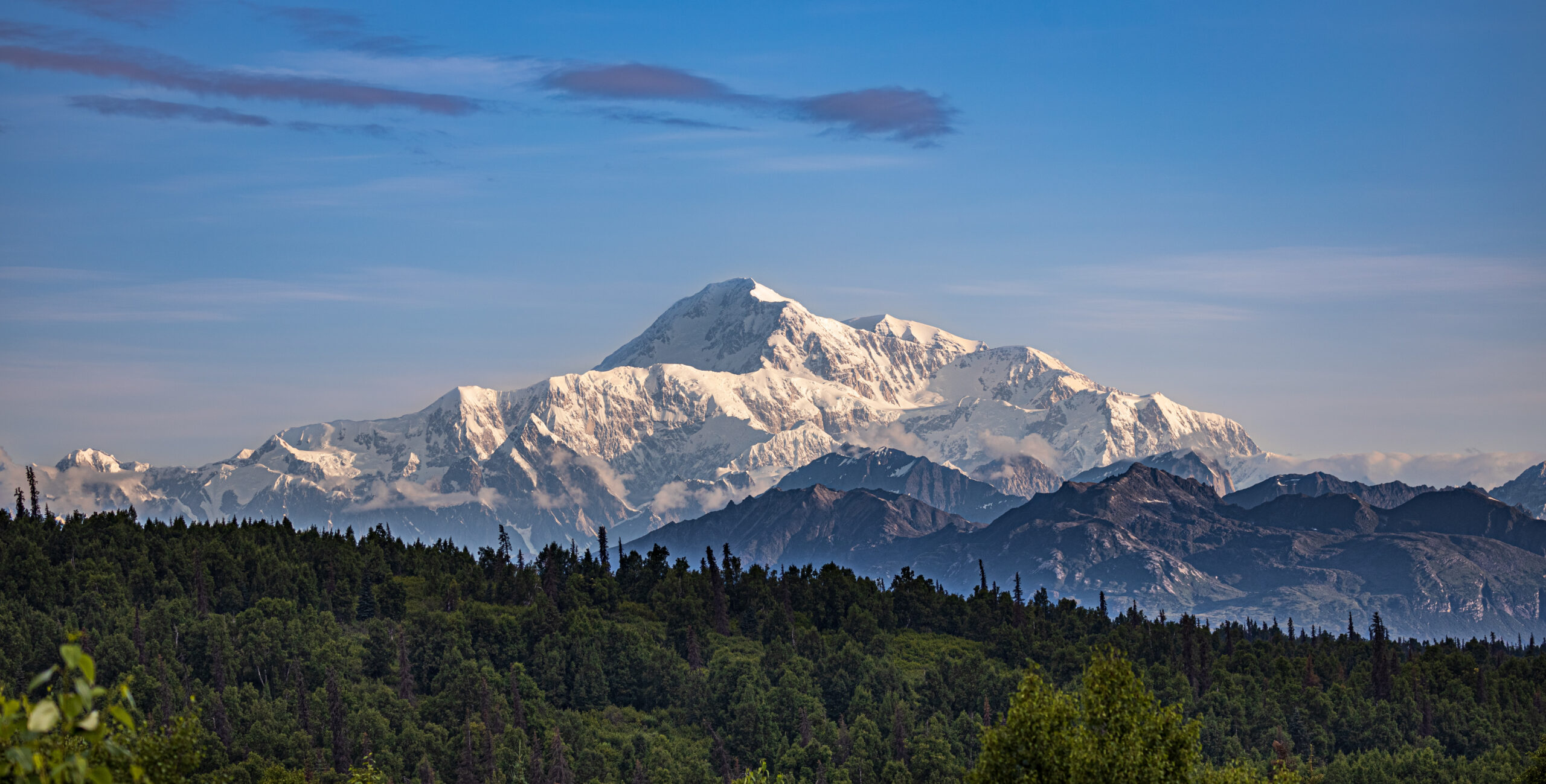
Mount Foraker rises to 17,400 ft about 14 miles southwest of Denali, above the Kahiltna Glacier, the second-highest peak in the Alaska Range and the third-highest in the United States. Climbers reach it the same way they reach Denali, by ski-plane from Talkeetna onto the Kahiltna, but there the similarity ends. Foraker has no trade route, no fixed lines, and no crowd: its standard line, the Sultana Ridge, is a long, corniced, committing climb around Alaska Grade 3.
Because it is overshadowed by its taller neighbour, Foraker sees only a handful of parties a year, and fewer summits. That quiet is part of its appeal and part of its seriousness: a team is truly on its own, negotiating miles of corniced ridge and long weather holds without support. For the full route, registration, and cost detail, see our Mount Foraker climb guide.
Sultana
Denali’s Wife, and the family of three
The Dena’ina names for these peaks tell a family story, and Foraker is its quiet, powerful centre.
In Dena’ina, Denali is the high one, the great parent of the range. Foraker is Sultana, the woman, also called Menlale, Denali’s Wife. Mount Hunter is Begguya, Denali’s Child. The three stand together above the Kahiltna Glacier, a family of peaks, and Foraker is the second-tallest of them, a giant in its own right that happens to live beside a larger one. We cover the others in our Denali and Hunter updates.
The English name came in 1899, when the mountain was named for an Ohio senator, Joseph Foraker, who never saw it. Among the ancient names of the range it is the newcomer, and many climbers prefer Sultana, which fits a peak so closely bound to its towering partner.
Second-highest, and almost alone
For the second-tallest peak in the Alaska Range, Foraker is strikingly empty. The crowds and the infrastructure gather on Denali, next door, while Sultana keeps its long corniced ridges and its silence. That is exactly why experienced expedition climbers seek it out, and exactly why it demands so much of them.
Honest self-assessment
Are you ready for Foraker?
Foraker is not a first big mountain. It rewards fully self-reliant expedition teams. These are the prerequisites.
Glacier and alpine skill
Rope, Ice, Cornice
You must be fluent on crevassed glaciers and steep, corniced snow and ice. This is a real alpine climb, not a walk-up.
One committing standard route, and a set of serious technical lines for expert teams.
The standard line
Sultana Ridge – the Southeast Ridge
The usual route on Foraker, reached from the Kahiltna Glacier. It is a long, corniced ridge climbed over several days, around Alaska Grade 3, committing and exposed, with real objective hazard. It is the most reasonable way up a mountain that has no easy route.
Long, heavily corniced ridge
Around Alaska Grade 3; committing
Reached from the Kahiltna Glacier
Multi-day, with real exposure
Best fit: experienced, self-supported expedition teams.The harder lines
Northeast and Talkeetna Ridges
Beyond the Sultana Ridge, Foraker holds harder, less-travelled lines, including the northeast and Talkeetna ridges and steeper faces. These are serious technical objectives for expert alpinists, climbed rarely, and well beyond the standard route in difficulty and commitment.
An overview of the standard route, from the Kahiltna to the south summit and back. For the full detail, see the climb guide.
Fly-in
Kahiltna Base ~7,200 ft
The ski-plane base camp shared with Denali and Hunter traffic.
The approach
Onto Foraker
Leave the Denali flow and cross toward Foraker’s own slopes.
Lower ridge
Gaining The Sultana
Climb onto the southeast, Sultana, ridge and its lower camps.
The corniced crest
Long And Exposed
Miles of corniced ridge, the defining character of the route.
High camp
Below The Summit
A committing high camp for the final push to the top.
South summit ~17,400 ft
The True Top
The higher of Foraker’s summits, the objective of the climb.
North summit
The Lower Top
A secondary summit along the mountain’s crest.
Descent
Reverse The Ridge
The long corniced ridge must be reversed; descent stays serious.
The cornices are the crux
Foraker’s difficulty is less about a single hard pitch and more about miles of long, corniced ridge at altitude. Judgment about where to move on that crest, and the patience to wait for the right conditions, matter more than raw technical grade.
How a trip runs
A Foraker expedition timeline
A Foraker attempt runs several weeks, most of it acclimatization, ridge climbing, and waiting out Alaska Range weather.
1
Talkeetna, register and fly
Complete the 60-day registration and fee, sort gear, and charter the ski-plane.
2
Fly to the Kahiltna Glacier
Land at the base camp near 7,200 ft and establish the expedition base.
3
Acclimatize and prepare
Skills, load carries, and acclimatization before committing to the ridge.
4
Gain the Sultana Ridge
Cross toward Foraker and climb onto the southeast ridge.
5
Climb the corniced crest
Work along the long, exposed, corniced ridge over several days.
6
Summit push
Take a settled window to reach the south summit and turn around promptly.
7
Descend the ridge
Reverse the committing ridge carefully back toward the glacier.
8
Fly out
Return to base camp and wait for the ski-plane window to Talkeetna.
Money and rules
Cost and the permit
Foraker is guided rarely and costs like a serious Alaska expedition, and unlike Hunter, the Denali permit rules apply.
Component
Figure
Note
Guided expedition
~$10,000-$15,000+
Committing and multi-week; few operators guide Foraker.
Registration and fee
Applies, like Denali
The 60-day pre-registration and mountaineering fee are required.
Ski-plane charter
Talkeetna to the Kahiltna
The bush flight onto the glacier, weather permitting.
Personal gear
Full expedition kit
Technical alpine and expedition gear for weeks of self-support.
Insurance
Remote-evacuation cover
Rescue is distant and weather-bound; verify remote cover.
The Denali rules apply to Foraker
Unlike neighbouring Mount Hunter, Foraker is covered by the same National Park Service requirements as Denali: climbers must register at least 60 days in advance and pay the special mountaineering fee through the Talkeetna ranger station. Confirm the current requirements and fees with Denali National Park before you plan.
Choosing a team
Choosing a Foraker guide
Few operators guide Foraker, so the right questions matter. Look for genuine experience on this peak, not just Denali.
Foraker experience
Not Just Denali
Ask how many times the guide has climbed Foraker itself.
Ratio
Tight On The Ridge
A close guide-to-client ratio matters on corniced, exposed ground.
Self-sufficiency
Built For No Support
Confirm the plan assumes full self-support, not trade-route help.
Weather buffer
Days For Holds
Ask how the itinerary absorbs long Alaska Range storm holds.
Screening
Right Experience
A serious operator checks your expedition record before accepting you.
Rescue reality
Remote And Slow
Understand that outside help is distant and never assured.
Foraker’s emptiness is its character and its risk. With almost no other teams on the mountain and no trade-route infrastructure, a party in trouble cannot count on neighbours or a quick rescue. Self-sufficiency, from crevasse fall to multi-day storm, is the price of the solitude.
The hazards
Difficulty and rarity
Foraker is hard for reasons that do not fit a single grade: length, cornices, weather, and the absence of any support.
Factor
What it is
How to treat it
Few ascents
A small, expert field
The second-highest range peak, yet rarely climbed.
Long corniced ridge
The defining hazard
Miles of exposed, cornice-laden crest to negotiate.
Avalanche and storms
Alaska Range weather
Loaded slopes and long storms shape every attempt.
No infrastructure
Self-support throughout
No fixed lines, camps, or crowds to fall back on.
Timing
Season and weather
Foraker is a spring climb, on the same calendar as Denali, and always at the mercy of Alaska Range weather.
Early May
Cold, Early
Colder, more stable snow, and very few teams.
Mid May-Jun
Prime
The core of the Alaska Range climbing window.
Late June
Warmer
Warmer and more hazardous as the snowpack changes.
Weather
The Deciding Factor
Storms and flight delays control every trip.
Winter
Extreme
Rare, elite ascents only, in brutal cold.
Live wind and weather for Mount Foraker. Source: Windy.com. For how to read a mountain forecast, see our weather guide.Mount Foraker, about 14 miles southwest of Denali, above the Kahiltna Glacier. Map: OpenStreetMap contributors.
History
A short history of Foraker
From a 1934 first ascent to a peak that remains quiet by choice of the crowds next door.
Mount Foraker was first climbed in 1934 by Charles Houston, T. Graham Brown, and Chychele Waterston, a committing early Alaska Range ascent at a time when the range was barely explored. The mountain took its English name in 1899, after the Ohio senator Joseph Foraker, though its Dena’ina name, Sultana, is far older.
In the decades since, Foraker has remained one of the quietest big peaks in North America, precisely because it stands beside Denali. Its long routes, serious commitment, and lack of a easy line keep the numbers low, and it endures as a prize for experienced expedition mountaineers who want a giant to themselves.
Keep planning
The Alaska cluster
Foraker sits in the Denali family and among the great Alaska and Yukon giants, with the glacier skills they all demand.
The questions climbers ask most about the difficulty, the name, the permit, and the season.
How high is Mount Foraker, and where is it?
Mount Foraker is 17,400 ft (5,304 m), the second-highest peak in the Alaska Range after Denali, and the third-highest mountain in the United States after Denali and Mount Saint Elias. It stands in Denali National Park, about 14 miles southwest of Denali, rising above the Kahiltna Glacier. Its Dena’ina name is Sultana, the woman, and it is widely known as Denali’s Wife.
Why is Foraker called Denali’s Wife?
Because of the local naming. In Dena’ina, Denali is the high one, the parent of the range; Foraker is Sultana, the woman, or Menlale, Denali’s Wife; and Mount Hunter is Begguya, Denali’s Child. The three form a family of peaks above the Kahiltna. The English name Foraker, given in 1899 after an Ohio senator, is the newcomer among them.
Is Foraker harder than Denali?
In the way that matters to a climber, yes. Denali is higher and far busier, with a trade route, fixed infrastructure in season, and ranger presence. Foraker has none of that: its routes are long, corniced, and committing, it is climbed by very few, and a party is on its own. It is not as technical as Mount Hunter’s hardest lines, but it is a serious, remote expedition that stands in Denali’s shadow.
What is the standard route?
The Sultana Ridge, the southeast ridge, is the usual line, reached from the Kahiltna Glacier. It is a long, corniced ridge climb, around Alaska Grade 3, committing and multi-day, with real exposure and objective hazard. Other lines, such as the northeast or Talkeetna Ridge, are harder still. None of Foraker’s routes is a straightforward climb.
Do the Denali permit rules apply to Foraker?
Yes. Unlike nearby Mount Hunter, Foraker is covered by the same National Park Service rules as Denali: climbers must register at least 60 days in advance and pay the special mountaineering fee, through the Talkeetna ranger station. Confirm the current requirements and fees with Denali National Park before you plan, as they are updated over time.
How do you get there, and when do people climb?
Access is the same as Denali: fly to Talkeetna, then take a ski-equipped bush plane onto the Kahiltna Glacier, and climb from there. The season is the Alaska Range spring, roughly May and June. Because Foraker is lower and quieter than Denali, it sees a tiny fraction of the traffic, and weather holds and self-sufficiency shape every trip.
How often is Foraker climbed?
Rarely, especially for the second-highest peak in the range. Most climbers drawn to the Kahiltna go for Denali, and Foraker’s length, commitment, and lack of a easy route keep its numbers low. In a typical season only a small number of parties attempt it, and fewer succeed. It is a peak for experienced expedition mountaineers, not a first big climb.
What experience do you need?
Solid glacier and technical alpine skills, prior expedition experience with self-support and storm camps, sound judgment on long corniced ridges, and the fitness for a committing multi-day climb at altitude. Foraker rewards teams that are fully self-reliant, because there is no trade-route infrastructure and no crowd to follow.
Transparency
How we built this update
What this page is based on, who reviewed it, and what we do not claim to know.
Sources
National Park Service, Denali National Park registration and mountaineering-fee rules.
Operator and guide-service route information for the Sultana Ridge.
Published alpine records for the 1934 first ascent and later routes.
Alaska Range guidebooks for grade, character, and hazard.
Our own Mount Foraker climb guide for the detailed route and cost.
Review and standards
Compiled by Travis Ludlow and reviewed for safety by Dawson Ludlow, our Climbing and Mountaineering Lead (Wilderness First Aid), whose highest first-hand summit is Kilimanjaro. Health and medical points were reviewed by Taylor Ludlow, RN. We do not fabricate summit experience, quotes, or credentials, and we say plainly when we are reporting rather than recounting.
What we do not claim to know
Conditions on Foraker change from year to year, and no web page can replace current route reports and a guide’s judgment. In particular:
Ridge conditions and cornice hazard vary by season; recent reports matter most.
Registration rules and fees change; confirm the current requirements with Denali National Park.
Guided pricing and availability shift with operators and dates.
Our team has not climbed Foraker, so we report official rules and records, not personal experience.
Global Summit Guide research
We compile mountain updates from official rules and published records, review them for safety and medical accuracy, and refresh them each season. We are transparent about what we have and have not climbed, and Foraker is a research-based briefing, not a personal account.
Disclosure: the Expedia link above is a sponsored affiliate link, and we may earn a commission at no extra cost to you. It is the only affiliate link on this page; our route, permit, and safety guidance is independent.
Denali West Buttress Conditions 2026: NPS Permits, Camps, Weather Windows & Recent Climber Reports
Everything you need to know about climbing North America’s highest peak via the West Buttress route in the active 2026 season. NPS permit costs, camp progression from Kahiltna Glacier base camp to 14 Camp and High Camp, current weather windows, recent ranger station reports, and 2026 regulations for the standard route used by 90% of Denali climbers.
20,310 ft
Summit Elevation (6,190m)
May 1
2026 Season Active
$450
2026 NPS Permit (Adult)
18-24
Expedition Days (Typical)
2026 Climbing Season Active May 1 – July 15 · NPS Permit $450 Adult / $350 Under 24 · 60-Day Pre-Registration Required · West Buttress Standard Route · Denali Full Guide →
Last updated May 24, 2026 — verified for the active 2026 climbing season (May 1 – July 15)
If you’re planning to climb Denali via the West Buttress this season, you need to understand the current state of the mountain. The 2026 season is currently active. NPS rangers are in their high camps. Several patrols are working the Kahiltna Glacier and the 14,200-foot camp. Climbers are flying in daily from Talkeetna. The peak window opens now and runs through late June. This page covers everything from current NPS permit costs to camp-by-camp conditions, weather patterns, and what climbers should know before flying onto the Kahiltna.
The 2026 Denali season runs May 1 through approximately July 15. Peak conditions on the West Buttress fall between mid-May and late June, when daylight reaches 20+ hours, temperatures are warmest by Alaska Range standards, and stable high-pressure systems produce the most reliable summit windows. NPS registration for the 2026 season opened January 1, 2026, with the mandatory 60-day pre-registration period enforced strictly. Climbers without permits cannot fly into the Kahiltna Glacier base camp.
The West Buttress is the standard route on Denali, used by approximately 90% of climbers. The route is technically moderate by world mountaineering standards but the cold, altitude, and self-sufficient logistics make it genuinely difficult. Climbers haul approximately 100-120 pounds of gear, food, and fuel for the entire expedition. The route uses six camps from base camp at 7,200 feet to High Camp at 17,200 feet, with the summit at 20,310 feet (6,190 m).
Denali West Buttress Live Conditions Snapshot
Here’s the current state of the West Buttress route as of May 24, 2026, verified against NPS field reports, Talkeetna Ranger Station updates, and recent climber communications.
2026 Season Status — Updated May 24, 2026
Climbing Season
Active. May 1 – July 15, 2026. Peak conditions mid-May to late June. NPS rangers patrolling 14 Camp and 17 Camp.
Active
NPS Permit Fee 2026
$450 USD adults (25+) / $350 USD climbers 24 and under. Plus $15 park entrance fee. Combined total $465 adult.
Required
60-Day Pre-Registration
Mandatory. Two-step process: Pay.gov fee payment + email Special Use Permit application. Non-refundable after Feb 15.
Required
Walter Harper Ranger Station
Mandatory pre-climb orientation in Talkeetna. Climbers pick up Clean Mountain Can (CMC) and receive current conditions briefing.
Operating
Bush Plane Access
K2 Aviation, Talkeetna Air Taxi, Sheldon Air Service flying climbers to Kahiltna Glacier (7,200 ft). Weather-dependent.
Active
14 Camp (14,200 ft)
NPS ranger camp established. Medical tent operational. Standard waypoint for acclimatization. Cell coverage limited but functional.
Operational
Fixed Lines (Headwall)
Installed annually between 14 Camp and 16,200-foot ridge. Critical infrastructure. Verify status with NPS rangers at 14 Camp.
Installed
17 Camp / High Camp (17,200 ft)
Wind-exposed launch point for summit day. Temperatures -30 to 0°F. Most exposed camp on the route.
Open
CMC Waste Management
Mandatory. All climbers issued Clean Mountain Cans at Talkeetna. Human waste packed out from all camps above 14,200 ft.
Required
Solo Climbing
Permitted but strongly discouraged by NPS. Solo climbers face additional scrutiny and required experience verification.
Discouraged
Daily NPS updates during the season. The Walter Harper Talkeetna Ranger Station maintains an automated statistics phone line at (907) 733-9127 with current registration numbers and climbing statistics. NPS Field Reports publish updates from patrol rangers at 14 Camp and the high camps. MountainWeather.com aggregates the 7K and 14K weather station telemetry, NWS Denali Climbing Forecasts, and FAA webcam feeds. Climbers should monitor all three sources before flying into the Kahiltna and again before any summit attempt.
Denali Location & Kahiltna Glacier Live Weather
Denali sits in the Alaska Range, approximately 150 miles north of Anchorage and 100 miles west of Fairbanks. The West Buttress route begins at the Kahiltna Glacier Base Camp (7,200 ft), reached only by bush plane from Talkeetna (358 ft). Summit coordinates: 63.0692°N, 151.0070°W. The mountain straddles Denali National Park and Preserve, a 6-million-acre wilderness larger than the state of New Hampshire.
Talkeetna Temp
Loading…
Wind
—
Conditions
—
Tomorrow
—
Live weather data from Open-Meteo at Talkeetna (358 ft / 109m), the bush-plane departure point. Kahiltna Glacier (7,200 ft) typically runs 20-30°F colder than Talkeetna. Summit-day temperatures at 20,310 ft average -30 to -40°F with wind chill below -60°F not uncommon. Always cross-reference with the NPS Denali Climbing Forecast and MountainWeather.com before flying in.
Denali West Buttress At a Glance
Summit elevation
20,310 ft (6,190 m) — North America’s highest peak; one of the Seven Summits
Location
Denali National Park and Preserve, Alaska Range, Alaska, USA
Coordinates
63.0692°N, 151.0070°W
Route
West Buttress — standard route, ~90% of all Denali climbers
Technical grade
Alaska Grade 2; moderate glacier and snow climbing with sustained altitude and cold exposure
Total distance
~13 miles horizontal; 13,500 ft vertical gain from base camp to summit
Clean Mountain Cans (CMCs) mandatory; all waste packed out
Self-sufficient
~100-120 lbs of gear, food, fuel per climber for the expedition
Denali’s West Buttress route — the standard path used by approximately 90% of climbers attempting North America’s highest peak. The route covers 13 miles horizontal and 13,500 feet of vertical gain through six camps from Kahiltna Glacier Base Camp at 7,200 ft to High Camp at 17,200 ft. The 2026 climbing season is currently active from May 1 through July 15.
The West Buttress Camp Progression: 7,200 ft to Summit
The West Buttress uses six camps over 13 miles of horizontal distance, gaining 13,500 vertical feet from the Kahiltna Glacier base camp to the summit. Most expeditions use a carry-and-cache pattern — moving gear progressively higher while climbers acclimatize, sleeping low and carrying high. Here’s the standard camp-by-camp breakdown for the 2026 season.
Camp
Elevation
Distance from BC
Typical Stay
Key Feature
Base Camp
7,200 ft (2,195 m)
0 mi
1-2 nights
Bush plane landing on Kahiltna Glacier
Camp 1 (Ski Hill)
7,800 ft (2,378 m)
~4 mi
1 night
Base of Ski Hill climb; sled hauling
Camp 2 (Kahiltna Pass)
9,500 ft (2,896 m)
~5 mi
0-1 night (often skipped)
Base of Kahiltna Pass climb
Camp 3 (Motorcycle Hill)
11,000 ft (3,353 m)
~7 mi
1-2 nights
Last camp before upper mountain
14 Camp (Genet Basin)
14,200 ft (4,328 m)
~9 mi
4-7 nights
NPS ranger camp + medical tent
17 Camp (High Camp)
17,200 ft (5,242 m)
~11 mi
1-3 nights
Summit launching point; wind-exposed
Summit
20,310 ft (6,190 m)
~13 mi
Summit day only
Autobahn → Denali Pass → Summit Ridge
Below: detailed camp-by-camp breakdown with what to expect at each stop.
Base Camp — Kahiltna Glacier
7,200 ft (2,195 m) · ~2-3 days here at start
The Kahiltna Glacier Base Camp sits at 7,200 feet at the base of the southwest fork of the Kahiltna. Bush planes from Talkeetna (K2 Aviation, Talkeetna Air Taxi, Sheldon Air Service) land here on skis. The base camp has a small NPS ranger presence and a base camp manager who coordinates incoming and outgoing flights. Climbers cache equipment, organize sleds, and prepare for the haul up the glacier. Most teams spend 1-2 nights here before starting the climb. Weather at base camp can shift rapidly — incoming flights are weather-dependent and can delay arrivals by days.
Camp 1 — Ski Hill
7,800 ft (2,378 m) · ~4 miles from Base Camp
Camp 1 sits at the base of “Ski Hill,” a steeper section of the Kahiltna Glacier. The hike from Base Camp follows the southeast fork down to the main Kahiltna Glacier and then up — paradoxically, you lose 1,000 feet from base camp before climbing back up to Camp 1. Climbers haul approximately 60 pounds per person on sleds plus 40-50 pounds in packs. Crevasse risk is high in this section; teams travel roped up at all times.
Camp 2 — Kahiltna Pass Base
9,500 ft (2,896 m) · ~5 miles from Base Camp
Camp 2 sits at the base of Kahiltna Pass, the major climb to the upper mountain. Some teams skip this camp and continue directly to Camp 3 at 11,000 feet. The decision depends on team strength and acclimatization needs. Crevasse risk remains high. Weather windows for this section are reliable in May-June.
Camp 3 — Motorcycle Hill
11,000 ft (3,353 m) · ~7 miles from Base Camp
Camp 3 sits at 11,000 feet just above the steep “Motorcycle Hill” climb. This is the last camp before the major terrain change to the upper mountain. Climbers cache food and equipment here for the descent. Most teams spend 1-2 nights at Camp 3 for acclimatization before continuing. The view from Camp 3 toward Mount Foraker and the Kahiltna becomes one of the route’s iconic visual moments.
Camp 4 — 14 Camp (Genet Basin)
14,200 ft (4,328 m) · ~9 miles from Base Camp · NPS ranger camp
The 14,200-foot camp — commonly called “14 Camp” or “Genet Basin” — is the main acclimatization camp on Denali. The NPS Talkeetna rangers establish a patrol camp here each season with a medical tent, weather station, and emergency communications. Climbers typically spend 4-7 days here for acclimatization, weather waits, and equipment preparation for the upper mountain. 14 Camp has a small wall of snow blocks around individual tent sites for wind protection. Cell coverage is limited but functional with the right networks. Temperatures at 14 Camp range from -20 to 10°F during the climbing season.
The Headwall & Fixed Lines
14,200 ft → 16,200 ft · Fixed ropes installed annually
The Headwall is the steep section between 14 Camp and the West Buttress ridge at 16,200 feet. NPS rangers install fixed ropes here at the start of each season for safety. This is the most technical section of the West Buttress route — 40-45 degree snow and ice with significant exposure. Climbers clip into the fixed lines with ascenders for protection. The Headwall typically takes 4-6 hours to climb from 14 Camp. Most teams do a carry day to High Camp first, then move and sleep at High Camp on a subsequent day.
Camp 5 — 17 Camp / High Camp
17,200 ft (5,242 m) · ~11 miles from Base Camp · Summit launching point
The 17,200-foot camp is the highest established camp on the West Buttress route. Climbers typically spend 1-3 nights here before summit day, waiting for a weather window. High Camp is significantly more wind-exposed than 14 Camp, with sustained winds frequently above 40 mph. Temperatures range from -30 to 0°F. Tent placements are bounded by snow walls for wind protection. Most teams launch their summit attempt from High Camp at 04:00-06:00 depending on weather forecasts.
Summit Day — Autobahn, Denali Pass, Summit Ridge
17,200 ft → 20,310 ft · 3,110 ft gain on summit day
Summit day from High Camp covers several distinct sections. First, the “Autobahn” — a 40-degree slope traverse from 17,200 to 18,200 feet that has been the site of multiple historical fatalities due to climbers sliding on hard snow without crampons engaged. Next, Denali Pass at 18,200 feet, the saddle between the South and North summits of Denali. From Denali Pass, the route ascends gradually to the Football Field at 19,500 feet, then up the final Summit Ridge to the South Summit (the true summit) at 20,310 feet. Total summit day is typically 10-14 hours round trip.
The Headwall fixed lines — the most technical section of the West Buttress route. NPS rangers install fixed ropes between 14 Camp (14,200 ft) and the West Buttress ridge (16,200 ft) at the start of each season. Climbers clip into the fixed lines with ascenders for safety on the 40-45 degree snow and ice slope. The Headwall typically takes 4-6 hours to climb from 14 Camp.
Critical Hazards on the West Buttress
Despite being the standard route, the West Buttress has multiple dangerous sections that contribute to Denali’s overall fatality history. Climbers should understand each before attempting the route.
Hazard
Elevation
Risk Level
Primary Danger
Mitigation
Kahiltna Crevasses
7,200-11,000 ft
High
Hidden crevasse falls
Rope team travel; crevasse rescue gear
Windy Corner
12,500-13,500 ft
High
60+ mph winds; frostbite
Cross in morning calm before afternoon winds
Headwall Fixed Lines
14,200-16,200 ft
Moderate
Falls on 40-45° snow/ice
Proper ascender technique; back up fixed rope
The Autobahn
17,200-18,200 ft
Critical
Fatal slides on hard snow
Crampons engaged; ice axe self-arrest ready
Denali Pass
18,200 ft
Critical
100+ mph storm winds
Weather window discipline; turn back early
Football Field
19,500 ft
High
Whiteout disorientation
GPS waypoints; team navigation protocols
Summit Ridge
19,500-20,310 ft
High
Cornice exposure; falls
Stay climber’s right of corniced edge
Frostbite (all camps)
14,200+ ft
Critical
Tissue loss on hands/feet
Vapor barrier liners; expedition mittens; hand warmers
Kahiltna Glacier Crevasses
The Kahiltna Glacier has extensive crevasse fields, particularly in the lower sections between Base Camp and Camp 3. Climbers must travel roped up at all times on the glacier. Late-season climbers (late June, July) face more open crevasses as snow bridges deteriorate from warming temperatures. The 2025 season saw two crevasse rescue events on the Kahiltna; the patterns continue in 2026.
Windy Corner
Windy Corner is a notorious wind-channel section between 12,500 and 13,500 feet on the climb from Camp 3 to 14 Camp. Wind speeds frequently exceed 60 mph here, and the section has limited shelter. Climbers traversing Windy Corner in bad weather face exposure that has caused multiple frostbite injuries in recent seasons. Most teams aim to cross Windy Corner in early morning calm before afternoon winds build.
The Headwall & Fixed Lines
The Headwall fixed ropes are critical safety infrastructure but require active management. Climbers must clip ascenders correctly, manage rope drag, and avoid creating bottlenecks. The 2025 season saw several falls on the Headwall, most without serious injury due to the fixed line catch. Always back up the fixed rope when conditions allow.
The Autobahn
The Autobahn is the traverse from 17,200 to 18,200 feet, named for the dangerous “fast slide” potential. The route crosses a 40-degree snow slope with significant exposure below. Climbers must keep crampons engaged and ice axe in proper self-arrest position. Multiple Denali fatalities have occurred here when climbers slipped on hard wind-packed snow. The section is short — typically 30-45 minutes — but demands focus throughout.
Denali Pass and the Football Field
Denali Pass at 18,200 feet sits in a wind tunnel between the South and North summits. Wind speeds here can reach 100+ mph in storm conditions. Multiple climbers have died at or near Denali Pass when caught in unexpected weather changes. The Football Field at 19,500 feet is a broad snow plateau where teams typically pause before the final summit ridge. Weather decisions made here are critical — climbers who continue in marginal weather face descent challenges as conditions deteriorate.
Summit Ridge
The final Summit Ridge from the Football Field to the South Summit is exposed on both sides with significant drop-offs. The ridge is typically corniced, requiring careful navigation to stay on the safe (climber’s right) side. Wind exposure here is severe — even on calm summit days, sustained winds of 30-50 mph are common. The final 200-300 feet to the summit demand focus and quick movement.
Frostbite is the most common Denali injury. The combination of severe cold (-30 to -40°F summit day), high wind, and the inability to safely remove gloves at altitude makes frostbite the leading injury on Denali. The NPS reports frostbite cases nearly every season — most on hands and feet during summit day or descent. Vapor barrier liners in boots, expedition mittens (not gloves) above 14 Camp, and chemical hand warmers as backup are essential. Multiple climbers have lost fingers or toes to Denali frostbite. This is a real risk, not a theoretical one.
2026 NPS Permits & Registration
Denali permits are issued by the National Park Service through a strict 60-day pre-registration system. Here’s the current 2026 process.
2026 Permit Costs
Fee
Adult (25+)
Climbers 24 & Under
Mountaineering Special Use Fee
$450 USD
$350 USD
Denali NP Entrance Fee
$15 USD
$15 USD
Combined 2026 total
$465 USD
$365 USD
Two-Step Registration Process
The 2026 registration is a two-step process per the current NPS protocol:
Pay.gov fee payment: Pay the Mountaineering Special Use Fee through the official Pay.gov website. The fee is non-refundable after February 15 of your climbing year.
Special Use Permit Application: Submit the Application for Special Use Permit via email to the Talkeetna Ranger Station, including detailed climbing experience, proposed route, group member information, and emergency contacts.
Both steps must be completed at least 60 days before your intended climb start date. The 60-day rule is strict — climbers attempting to register inside the 60-day window are typically declined. The pre-registration period exists so NPS mountaineering rangers can review applications, contact climbers for any clarifications, and ensure all climbers are properly prepared before they fly into the Kahiltna.
Walter Harper Talkeetna Ranger Station
All Denali climbers must check in at the Walter Harper Talkeetna Ranger Station before flying in. The station is named after Walter Harper, the first person to reach the summit of Denali in 1913. Climbers receive a pre-climb orientation, current conditions briefing, and their Clean Mountain Can (CMC) for waste management. The orientation typically takes 30-60 minutes and covers route-specific hazards, current weather patterns, and emergency protocols.
Guided vs. Independent Climbing
The NPS authorizes seven mountain guide concessions for Denali. Guided expeditions handle the entire registration and logistics process, including fee payment, permit submission, and pre-climb orientation. Independent climbers complete all steps themselves but pay the same fees. The 2026 guided expedition costs run $12,900-$19,000 USD for the standard 18-24 day West Buttress program. Major operators include RMI Expeditions, International Mountain Guides (IMG), Alpine Ascents International, Mountain Trip, and Mountain Madness.
Bush plane access to Denali — the only way onto the West Buttress route. K2 Aviation, Talkeetna Air Taxi, and Sheldon Air Service fly climbers from Talkeetna (358 ft) to the Kahiltna Glacier base camp (7,200 ft) in approximately 45 minutes. Flights are weather-dependent — climbers should plan 1-3 days of buffer in Talkeetna for flight delays, particularly early in the May season when storms commonly ground bush planes.
2026 Climbing Season Month-by-Month Conditions
Period
Conditions
Daylight
Climber Volume
Best For
Late April
Cold; firm snow; minimal crevasses; some rangers arriving
~17 hours
Minimal (~50 on mountain)
Experienced cold-weather climbers; quiet route
Early May
Stable cold; building climber volume; rangers establish camps
Late-season climbers willing to accept softer conditions
Mid-July
Season closing; rangers departing; significant crevasses
~19 hours
Reducing (~100-200)
End of season; experienced teams only
Late May – Mid June 2026: The Sweet Spot
The May 25 – June 15 window represents the optimal Denali climbing conditions. Daylight reaches its maximum (20+ hours of usable light), temperatures are warmest by Alaska Range standards, weather windows open more frequently than at any other point in the season, and the trail through 14 Camp is well-established by NPS rangers and earlier climbers. Most major guided expeditions schedule departures in this window.
Mid-June – Early July 2026: Late Window
Late June and early July offer continued strong conditions but with developing concerns. Crevasses on the lower Kahiltna Glacier open as snow bridges weaken. Temperatures warm enough to make heavy expedition clothing uncomfortable on the lower mountain. The headwall fixed lines see significant wear. NPS ranger patrols begin transitioning out of 14 Camp by July 5-10.
Mid-July: Season Closing
By mid-July, the climbing season is effectively over. Most operators have completed their final summit windows. NPS ranger camps are being dismantled. Climbers attempting July ascents face deteriorating snow conditions, increased crevasse exposure, and reduced infrastructure. The official permitting season extends through July 15, but very few climbers attempt summits in the final two weeks.
Recent Denali Trip Reports & NPS Ranger Updates
NPS rangers publish field reports throughout the Denali climbing season. These provide ground-truth context for climbers planning trips. Here’s a synthesis of recent patterns relevant to 2026 planning.
2025 Season Summary
The 2025 Denali climbing season ran from April 28 (first NPS patrol assembling) through July 12. Total registered climbers: approximately 1,100. Summit success rate for the season: approximately 52%, slightly above the long-term average. The May 24 – June 10 window produced the highest concentration of summits, with several reliable weather windows of 24-72 hours each.
2025 Ranger Reports — Key Patterns
Early May 2025: First NPS West Buttress patrol assembled in Talkeetna on April 28. Rangers reported variable snow conditions with crusts on solar slopes and dry cold snow on north faces.
Mid-May 2025: Fixed lines on the Headwall installed by NPS patrols. Trail through Kahiltna established. Crevasse bridges intact.
Late May 2025: Upper mountain reported “busy” with approximately 100 climbers ascending to High Camp on multiple days. Fixed line steps improving with use.
June 2025: Multiple weather windows produced strong summit numbers. Several frostbite incidents reported on summit day, particularly hands and toes.
July 2025: Season winding down. Final NPS patrols departing 14 Camp. Crevasses on Kahiltna opening significantly.
2026 Pre-Season Observations
The 2026 NPS season opened with rangers arriving in Talkeetna in late April. The first West Buttress patrol assembled in early May with rangers and VIPs (Volunteers in Park) packing for their upcoming climb. Initial flights to the Kahiltna Glacier began in early May as weather permitted. Climbers booked for early-May start dates faced typical weather delays in Talkeetna; one to three days of waiting for flyable conditions is standard.
Independent Climber Notes from 2025
Cell coverage at 14 Camp: Limited but functional on Verizon and AT&T. Useful for non-emergency communication.
Garmin InReach: The standard satellite communicator on Denali. Battery life is the limiting factor at cold temperatures — keep devices warm in inner pockets.
Bush plane reliability: K2 Aviation, Talkeetna Air Taxi, and Sheldon Air Service are the primary operators. All three are reliable when weather allows. Plan 1-3 days of buffer in Talkeetna for flight delays.
Food caching: Climbers cache food and fuel at each camp for the descent. Cache locations should be marked clearly with wands and GPS coordinates.
Equipment failures: The cold breaks gear that performs fine in lower-altitude conditions. Test stoves, sleeping bags, and fuel systems in cold conditions before traveling to Alaska.
14 Camp at 14,200 ft (Genet Basin) — the main acclimatization camp on Denali’s West Buttress route. The NPS Talkeetna rangers maintain a patrol camp here with a medical tent, weather station, and emergency communications. Climbers typically spend 4-7 days at 14 Camp acclimatizing before pushing to High Camp at 17,200 ft.
Required Gear for 2026 Denali West Buttress
Denali demands the most extensive personal equipment list of any standard climbing route on Earth. Cold, altitude, and self-sufficient logistics make every gear choice consequential. Most guided operators provide group equipment (tents, stoves, ropes); climbers bring their own personal gear.
Denali expedition gear staged at Kahiltna Glacier Base Camp (7,200 ft). Climbers haul approximately 100-120 pounds of gear, food, and fuel for the entire 18-24 day expedition. Group equipment (tents, stoves, ropes) is typically split among team members. The pulk sled is essential for the lower-glacier hauls before climbers transition to backpack-only loads above 14 Camp.
2026 Booking Strategy
Denali expeditions have a unique booking timeline driven by the 60-day NPS pre-registration rule and the limited authorized guide concessions.
For Remaining 2026 Season (May-July)
If you haven’t booked yet for the 2026 season, your options are limited:
May 2026 departures: Likely fully booked with authorized guide concessions. NPS 60-day rule eliminates last-minute registrations.
Early June 2026: Limited availability with some guide services. Independent climbers can still register if exactly 60 days from start date.
Late June 2026: Some availability remaining. Late-season conditions but still within climbing window.
Early July 2026: End-of-season departures available. Higher weather risk; reduced infrastructure.
For 2027 Booking
Climbers planning 2027 Denali expeditions should:
July-September 2026: Research authorized guide concessions, compare itineraries and pricing
October 2026: Make initial bookings with deposits to guide services
January 2027: NPS registration opens January 1; complete Pay.gov fee payment
February 2027: Submit Special Use Permit application; non-refundable after Feb 15
March 2027: Complete training requirements; verify gear; book travel to Anchorage
May 2027: Travel to Talkeetna for orientation and climb
The 7 Authorized Guide Concessions
NPS authorizes seven mountain guide companies to operate on Denali. Climbers wanting guided expeditions must use one of these. The standard list includes RMI Expeditions, International Mountain Guides (IMG), Alpine Ascents International, Mountain Trip, Mountain Madness, NOLS, and AAI/American Alpine Institute. Each operates under specific NPS permits with established itineraries and guide ratios. Independent climbers can climb without a guide service but handle all logistics themselves.
Summit day on Denali — the Autobahn traverse from High Camp (17,200 ft) toward Denali Pass at 18,200 ft. The 40-degree snow slope has been the site of multiple historical fatalities when climbers slipped without crampons properly engaged. Summit-day temperatures average -30 to -40°F with wind chill below -60°F not uncommon during the 2026 climbing season.
Frequently Asked Questions About Denali West Buttress Conditions
When is the 2026 Denali climbing season?
The 2026 Denali climbing season is currently active, running from approximately May 1 through July 15, 2026. Peak conditions on the West Buttress route fall between mid-May and late June, when daylight is maximum (up to 20+ hours), temperatures are warmest by Alaska Range standards, and stable high-pressure systems produce the most reliable summit windows. NPS registration for the 2026 season opened January 1, 2026, with climbers required to register at least 60 days before their planned start date.
How much does the Denali permit cost in 2026?
The 2026 Denali mountaineering permit costs $450 USD for climbers aged 25 and older, or $350 USD for climbers aged 24 and younger. This is the NPS Mountaineering Special Use Fee paid through Pay.gov when you register. Additionally, the Denali National Park entrance fee is $15 per person, valid for 7 days. Combined fees total $465 for adult climbers in 2026. The fee is non-refundable after February 15 of your climbing year. Guided expedition prices range from $12,900 to $19,000 USD for the standard 18-24 day West Buttress program.
What is the camp progression on the Denali West Buttress route?
The Denali West Buttress route uses six camps over approximately 13 miles of horizontal distance and 13,500 feet of vertical gain. Camp 1 is the Kahiltna Glacier Base Camp at 7,200 feet, reached by bush plane from Talkeetna. The standard progression then runs to Camp 2 at 7,800 feet (Ski Hill), Camp 3 at 9,500 feet, Camp 4 at 11,000 feet, Camp 5 at 14,200 feet (commonly called 14 Camp), and Camp 6 at 17,200 feet (High Camp). The summit at 20,310 feet sits 3,110 feet above High Camp via the Autobahn, Denali Pass, and Summit Ridge.
What are current Denali West Buttress weather conditions?
Base camp temperatures in late May range from -10 to 25°F. The 14,200-foot camp typically runs -20 to 10°F. The 17,200-foot High Camp ranges from -30 to 0°F with significant wind. Summit-day temperatures average -30 to -40°F with wind chill below -60°F not uncommon. Weather windows on Denali open every 5-10 days during the climbing season, lasting 24-72 hours each. The NPS posts daily weather observations from 7K and 14K weather stations. Climbers should have 5-7 days of weather buffer built into their itinerary.
What is the Denali summit success rate?
The long-term average across all Denali climbers is approximately 50%, but individual seasons range from 28% (poor weather years) to over 60% (excellent weather years). Guided expeditions typically achieve higher success rates of 55-70% due to experienced leaders, established camp infrastructure, and better weather decision-making. Independent climbers average 35-45% success. The biggest factors in summit success are weather windows, acclimatization quality, and team fitness. Compressed 14-16 day attempts produce lower summit rates than the standard 18-24 day expeditions.
How long does a Denali expedition take?
A standard Denali West Buttress expedition runs 18-24 days from Talkeetna to summit and back. Bush flight from Talkeetna to Kahiltna Glacier base camp takes 1-2 days due to weather windows. The climb itself uses a carry-and-cache pattern: 2-4 days from base camp to 14 Camp, 4-7 days at 14 Camp for acclimatization, 1-2 days to High Camp, 1-3 days at High Camp waiting for weather, summit day, and 2-4 days descent back to base camp. Some experienced climbers complete the route in 14-16 days, but this compresses acclimatization and reduces success rates.
Can I climb Denali without a guide in 2026?
Yes, independent climbing is permitted on Denali. Unlike some peaks where solo or unguided climbing is banned, Denali allows independent climbers. However, you must complete the full NPS registration process (60-day advance, Pay.gov fee payment, Special Use Permit application), attend the Walter Harper Talkeetna Ranger Station orientation, and follow all NPS regulations including CMC waste management. Solo climbers face additional scrutiny and may need to demonstrate prior high-altitude experience. The NPS strongly discourages solo climbing due to the rescue and self-rescue challenges. Most climbers travel in teams of 2-4 minimum.
What is the most dangerous part of the West Buttress route?
Multiple sections of the West Buttress have caused fatalities. The Autobahn — the 40-degree snow traverse from 17,200 to 18,200 feet — has been the site of multiple climber slides resulting in deaths. Denali Pass and the Football Field at 18,200-19,500 feet sit in a wind tunnel where multiple climbers have died caught in unexpected storms. The Kahiltna Glacier crevasses cause injuries throughout the season. The Headwall fixed lines see falls but rarely fatalities. Frostbite is the most common Denali injury due to summit-day cold. Statistically, the Autobahn and Denali Pass area produce the most fatalities per climber-day exposed.
What fitness do I need to climb Denali?
Denali demands more sustained fitness than virtually any other guided peak. The standard benchmark: capable of carrying 60-100 pounds for 8-10 hours per day for multiple consecutive days, with strong recovery overnight. Aerobic capacity should support sustained effort at altitude. Most climbers train for 6-12 months before Denali with heavy backpack hikes, weighted stair climbing, and progressive endurance work. Beyond aerobic fitness, climbers need cold tolerance, mental resilience for sustained discomfort, and prior glacier travel experience. Most guide services require climbers to demonstrate prior high-altitude experience (Mount Rainier, Aconcagua, or equivalent) before accepting Denali clients.
Where do I fly into for Denali?
The primary airport is Ted Stevens Anchorage International Airport (ANC). From Anchorage, climbers typically drive 2 hours north to Talkeetna, where the Walter Harper Talkeetna Ranger Station and bush plane operators are located. Some climbers fly from Anchorage to Talkeetna via small aircraft instead of driving. From Talkeetna, bush planes operated by K2 Aviation, Talkeetna Air Taxi, and Sheldon Air Service fly climbers to the Kahiltna Glacier base camp at 7,200 feet. The bush plane flight takes approximately 45 minutes and is the only access to the West Buttress route.