
Last updated July 23, 2026
{ “@context”: “https://schema.org”, “@type”: “Article”, “headline”: “Mount Triglav, Slovenia: A 2026 Climbing Guide to the National Peak”, “description”: “How to climb Mount Triglav (2,864 m), Slovenia’s highest peak and national symbol – the Krma, Pokljuka and Bohinj approaches, the Vrata North Face via ferratas, the exposed summit ridge, huts, gear, season, and the 1778 first ascent.”, “author”: { “@type”: “Person”, “name”: “Travis Ludlow”, “jobTitle”: “Founder & Head of Research, Global Summit Guide”, “url”: “https://globalsummitguide.com/about/” }, “publisher”: { “@type”: “Organization”, “name”: “Global Summit Guide”, “url”: “https://globalsummitguide.com/”, “logo”: { “@type”: “ImageObject”, “url”: “https://globalsummitguide.com/wp-content/uploads/2026/02/global-logo-new-2.png” } }, “datePublished”: “2026-07-10”, “dateModified”: “2026-07-23T09:26:42+00:00”, “mainEntityOfPage”: “https://globalsummitguide.com/mountains-mount-triglav-slovenia/”, “articleSection”: “The Alps”}{ “@context”: “https://schema.org”, “@type”: “ItemList”, “name”: “Mount Triglav Standard Route Stages”, “itemListElement”: [ { “@type”: “ListItem”, “position”: 1, “name”: “Valley trailhead (Krma or Pokljuka) to a high hut” }, { “@type”: “ListItem”, “position”: 2, “name”: “Overnight at Kredarica (2,515 m) or Dom Planika (2,401 m)” }, { “@type”: “ListItem”, “position”: 3, “name”: “Via ferrata summit ridge over Mali Triglav to the summit (2,864 m)” } ]}{ “@context”: “https://schema.org”, “@type”: “FAQPage”, “mainEntity”: [ { “@type”: “Question”, “name”: “How hard is Mount Triglav to climb?”, “acceptedAnswer”: { “@type”: “Answer”, “text”: “Harder than its 2,864 m suggests. The approach is a long alpine hike (6-8 hours, 1,300 m+ of gain to a high hut), but the summit section is a true via ferrata – a narrow ridge with big drops on both sides, protected by steel cables and iron pegs. You need a helmet, a via ferrata set, a harness, and a steady head for exposure. It’s a climbers’ mountain, not a casual hike – though fit hikers with the right kit, or a guide, do it routinely.” } }, { “@type”: “Question”, “name”: “Do you need a permit or guide for Triglav?”, “acceptedAnswer”: { “@type”: “Answer”, “text”: “No climbing permit is required and Triglav National Park charges no entry fee – you only pay for trailhead parking and hut stays. A guide isn’t legally required either, but many first-timers hire one for the via ferrata technique, route-finding in fog, and hut logistics; guided two-day programs typically run about EUR 250-450 per person. Independent climbers should be confident with via ferrata gear and alpine route-finding.” } }, { “@type”: “Question”, “name”: “Which route is best for a first Triglav climb?”, “acceptedAnswer”: { “@type”: “Answer”, “text”: “The Krma Valley approach to the Kredarica hut, then the via ferrata to the summit and back the same way. Krma is the easiest and least exposed approach, with no technical ground until the final summit ridge, and it’s the only practical winter route. The Pokljuka Plateau start (from Rudno Polje, 1,347 m) saves elevation and leads to Dom Planika. Save the Vrata North Face via ferratas (Tominsek, Cez Prag, Bamberg) until you have via ferrata experience.” } }, { “@type”: “Question”, “name”: “How long does climbing Triglav take?”, “acceptedAnswer”: { “@type”: “Answer”, “text”: “Most people climb it over two days with one hut overnight: 4-7 hours up to Kredarica (2,515 m) or Planika (2,401 m) on day one, then an early start for the 2-3 hour via ferrata to the summit and the descent on day two. Fit parties do it car-to-car in a long single day (roughly 12-16 hours). A three-day version via the Seven Triglav Lakes Valley is widely considered the most beautiful way to do it.” } }, { “@type”: “Question”, “name”: “Why is Triglav so important to Slovenia?”, “acceptedAnswer”: { “@type”: “Answer”, “text”: “It’s the national symbol. Triglav’s three peaks are the white emblem at the center of Slovenia’s flag and coat of arms (adopted at independence in 1991), and the mountain also appears on the Slovenian 50-euro-cent coin. Climbing it is a widely held unofficial rite of passage – ‘a real Slovenian climbs Triglav’ – and families often make it a coming-of-age trip. The name means ‘Three Heads’ after its three-peaked profile from Bohinj.” } }, { “@type”: “Question”, “name”: “When is the best time to climb Triglav?”, “acceptedAnswer”: { “@type”: “Answer”, “text”: “Roughly late June through September, when the huts are open and staffed and the via ferrata cables are clear of snow. July-August is the busiest (expect queues on the summit ridge); September often has the finest, quieter weather. Start early – the Julian Alps build afternoon thunderstorms fast, and the exposed summit ridge is dangerous in lightning, so aim to summit by mid-morning. Verify current hut opening dates with the Alpine Association of Slovenia (PZS) before you go.” } } ]}{ “@context”: “https://schema.org”, “@type”: “BreadcrumbList”, “itemListElement”: [ { “@type”: “ListItem”, “position”: 1, “name”: “Home”, “item”: “https://globalsummitguide.com/” }, { “@type”: “ListItem”, “position”: 2, “name”: “The Alps” }, { “@type”: “ListItem”, “position”: 3, “name”: “Mount Triglav, Slovenia” } ]}@import url(‘https://fonts.googleapis.com/css2?family=Outfit:wght@300;400;500;600;700&family=DM+Serif+Display:ital@0;1&display=swap’);.trig-page { font-family: ‘Outfit’, sans-serif; color: #122a44; line-height: 1.65; margin: 0 auto; padding: 0; }.trig-page h1, .trig-page h2, .trig-page h3, .trig-page h4 { font-family: ‘DM Serif Display’, serif; font-weight: 400; color: #0a1929; line-height: 1.15; }.trig-page p { font-size: 1.02rem; margin-bottom: 1.1em; }.trig-page a { color: #2e5986; text-decoration: none; border-bottom: 1px solid #c8d4e0; }.trig-page a:hover { color: #d4913a; border-bottom-color: #d4913a; }.trig-hero { position: relative; padding: 0; color: #f5e4c8; overflow: hidden; background: #0a1929; border-radius: 12px; margin-bottom: 0; }.trig-hero-image { width: 100%; height: auto; display: block; max-width: 100%; }.trig-hero-text { padding: 40px 36px; background: linear-gradient(135deg, rgba(10,25,41,0.90), rgba(46,89,134,0.80)); }.trig-hero-tag { font-size: 0.84rem; color: #d4913a; text-transform: uppercase; letter-spacing: 2px; font-weight: 700; margin-bottom: 14px; }.trig-hero h1 { color: #f5e4c8 !important; font-size: 2.15rem; line-height: 1.1; margin: 0 0 16px; }.trig-hero h1 em { color: #d4913a; font-style: italic; }.trig-hero p { color: #f5e4c8; font-size: 1.06rem; line-height: 1.5; margin: 0; }.trig-byline { background: #f8f4ec; padding: 14px 22px; font-size: 0.85rem; color: #5a4f30; border: 1px solid #e8d8ad; border-radius: 8px; margin: 18px 0; }.trig-byline-top { display: flex; justify-content: space-between; flex-wrap: wrap; gap: 10px; align-items: center; margin-bottom: 8px; }.trig-byline-author { font-weight: 600; color: #0a1929; font-size: 0.94rem; }.trig-byline-author a { color: #2e5986; border-bottom: none; }.trig-byline-meta { color: #7a6f50; font-size: 0.82rem; }.trig-byline-credentials { font-size: 0.82rem; color: #5a4f30; line-height: 1.45; padding-top: 6px; border-top: 1px solid #e8d8ad; font-style: italic; }.trig-byline-credentials strong { color: #0a1929; font-style: normal; }.trig-quick-verdict { background: linear-gradient(135deg, #a83a2b 0%, #c84a3b 100%); color: #fff; padding: 30px 36px; margin: 26px 0; border-radius: 14px; box-shadow: 0 8px 24px rgba(168,58,43,0.4); border: 4px solid #d4913a; }.trig-quick-verdict h2 { margin: 0 0 14px !important; font-size: 1.5rem !important; color: #fff !important; padding-bottom: 0 !important; border-bottom: none !important; }.trig-quick-verdict p { margin: 0 0 12px; font-size: 1.06rem; color: #fff; line-height: 1.55; }.trig-quick-verdict p:last-child { margin-bottom: 0; }.trig-quick-verdict strong { color: #fdd47a; font-weight: 700; }.trig-quick-verdict em { color: #fdd47a; font-style: italic; }.trig-quick-verdict .trig-verdict-tag { display: inline-block; background: #d4913a; color: #0a1929; padding: 4px 12px; border-radius: 4px; font-size: 0.78rem; font-weight: 700; text-transform: uppercase; letter-spacing: 0.6px; margin-bottom: 12px; }.trig-stat-grid { display: grid; grid-template-columns: repeat(4, 1fr); gap: 12px; padding: 22px; background: linear-gradient(135deg, #0a1929 0%, #122a44 100%); color: #f5e4c8; border-radius: 10px; margin: 22px 0; }.trig-stat { background: #1a3354; border: 1px solid #d4913a; border-radius: 8px; padding: 14px 12px; text-align: center; }.trig-stat-num { font-family: ‘DM Serif Display’, serif; font-size: 1.35rem; color: #d4913a; line-height: 1; margin-bottom: 4px; }.trig-stat-label { font-size: 0.7rem; color: #f5e4c8; text-transform: uppercase; letter-spacing: 0.5px; }.trig-toc { background: #f8f4ec; border: 1px solid #e8d8ad; border-radius: 10px; padding: 18px 24px; margin: 22px 0; }.trig-toc .trig-toc-label { margin: 0 0 12px; font-size: 1.08rem; font-weight: 700; color: #0a1929; font-family: ‘DM Serif Display’, serif; }.trig-toc ol { margin: 0; padding-left: 22px; columns: 2; column-gap: 28px; font-size: 0.92rem; }.trig-toc li { margin-bottom: 5px; line-height: 1.4; }.trig-inline-image { margin: 32px 0; border-radius: 10px; overflow: hidden; box-shadow: 0 4px 14px rgba(212,200,168,0.5); }.trig-inline-image img { width: 100%; height: auto; display: block; max-width: 100%; }.trig-inline-image figcaption { padding: 14px 22px; background: #f8f4ec; font-size: 0.88rem; color: #5a4f30; font-style: italic; line-height: 1.5; }.trig-inline-image figcaption strong { color: #0a1929; font-style: normal; }.trig-section-header { background: linear-gradient(135deg, #122a44 0%, #2e5986 100%); color: #f5e4c8; padding: 28px 34px; margin: 40px 0 24px; border-radius: 12px; border-left: 8px solid #d4913a; box-shadow: 0 6px 18px rgba(18,42,68,0.4); }.trig-section-header h2 { color: #d4913a !important; font-size: 1.8rem !important; margin: 0 0 6px !important; padding: 0 !important; border: none !important; }.trig-section-header h2 em { color: #fdd47a; font-style: italic; }.trig-section-header p { color: #f5e4c8; font-size: 0.96rem; margin: 0; line-height: 1.5; }.trig-content { padding: 24px 0 0; }.trig-content h2 { font-size: 1.9rem; margin-top: 48px; margin-bottom: 18px; padding-bottom: 11px; border-bottom: 2px solid #d4913a; }.trig-content h2:first-of-type { margin-top: 0; }.trig-content h2 em { color: #d4913a; font-style: italic; }.trig-content h3 { font-size: 1.34rem; margin-top: 28px; margin-bottom: 12px; color: #0a1929; }.trig-content h4 { font-size: 1.08rem; margin-top: 22px; margin-bottom: 10px; color: #0a1929; }.trig-route-card { background: #fff; border-radius: 12px; padding: 24px 28px; margin: 22px 0; border-left: 6px solid #2e5986; box-shadow: 0 3px 10px rgba(212,200,168,0.4); }.trig-route-card.standard { border-left-color: #d4913a; }.trig-route-card-tag { display: inline-block; padding: 5px 14px; border-radius: 4px; font-size: 0.76rem; font-weight: 700; text-transform: uppercase; letter-spacing: 0.6px; margin-bottom: 10px; font-family: ‘Outfit’, sans-serif; background: #d4913a; color: #0a1929; }.trig-route-card.tech .trig-route-card-tag { background: #2e5986; color: #fff; }.trig-route-card h3 { margin: 6px 0 8px; font-size: 1.34rem; color: #0a1929; }.trig-route-card h3 em { color: #d4913a; font-style: italic; }.trig-route-card p { margin: 0 0 10px; }.trig-route-card p:last-child { margin-bottom: 0; }.trig-route-stats { display: grid; grid-template-columns: repeat(4, 1fr); gap: 8px; margin: 14px 0; }.trig-route-stat { background: #f8f4ec; border: 1px solid #e8d8ad; border-radius: 6px; padding: 8px; text-align: center; }.trig-route-stat-label { font-size: 0.68rem; color: #7a6f50; text-transform: uppercase; letter-spacing: 0.4px; margin-bottom: 2px; }.trig-route-stat-value { font-size: 0.9rem; font-weight: 700; color: #0a1929; }.trig-callout-info { background: #e8f0f7; border-left: 5px solid #2e5986; padding: 16px 22px; border-radius: 6px; margin: 20px 0; font-size: 0.95rem; color: #0a1929; }.trig-callout-info .trig-callout-title { font-weight: 700; color: #2e5986; font-size: 0.98rem; margin-bottom: 6px; display: block; }.trig-callout-warning { background: #fdf3e8; border-left: 5px solid #b86a15; padding: 16px 22px; border-radius: 6px; margin: 20px 0; font-size: 0.95rem; color: #0a1929; }.trig-callout-warning .trig-callout-warning-title { font-weight: 700; color: #b86a15; font-size: 0.98rem; margin-bottom: 6px; display: block; }.trig-callout-danger { background: #fbe5e2; border-left: 5px solid #a83a2b; padding: 16px 22px; border-radius: 6px; margin: 20px 0; font-size: 0.95rem; color: #0a1929; }.trig-callout-danger .trig-callout-danger-title { font-weight: 700; color: #a83a2b; font-size: 0.98rem; margin-bottom: 6px; display: block; }.trig-callout-success { background: #e8f0d8; border-left: 5px solid #5a8a2e; padding: 16px 22px; border-radius: 6px; margin: 20px 0; font-size: 0.95rem; color: #0a1929; }.trig-callout-success .trig-callout-success-title { font-weight: 700; color: #5a8a2e; font-size: 0.98rem; margin-bottom: 6px; display: block; }.trig-callout-success ul { margin: 6px 0 0; padding-left: 20px; }.trig-callout-success li { margin-bottom: 5px; }.trig-faq-item { background: #f8f4ec; border-radius: 8px; margin-bottom: 11px; }.trig-faq-item summary { padding: 14px 20px; cursor: pointer; font-family: ‘DM Serif Display’, serif; font-size: 1.04rem; color: #0a1929; list-style: none; }.trig-faq-item summary::-webkit-details-marker { display: none; }.trig-faq-item summary::after { content: ‘+’; float: right; color: #d4913a; font-size: 1.4rem; line-height: 0.8; }.trig-faq-item[open] summary::after { content: ‘-‘; }.trig-faq-item div { padding: 0 20px 16px; font-size: 0.93rem; color: #0a1929; }.trig-methodology { background: #f8f4ec; border: 2px solid #2e5986; padding: 22px 26px; border-radius: 10px; margin: 26px 0; }.trig-methodology h3 { margin: 0 0 12px; font-size: 1.18rem; color: #2e5986; }.trig-methodology p { font-size: 0.92rem; line-height: 1.55; margin: 0 0 8px; color: #0a1929; }.trig-author-bio { background: linear-gradient(135deg, #f8f4ec 0%, #fbf7ef 100%); border: 2px solid #d4913a; padding: 26px 30px; border-radius: 12px; margin: 32px 0 18px; display: flex; gap: 22px; align-items: flex-start; }.trig-author-bio-image { flex-shrink: 0; width: 100px; height: 100px; border-radius: 50%; background: #d4913a url(‘https://globalsummitguide.com/wp-content/uploads/2026/03/561db5f8-15bb-43d8-9eba-251a8c35f89f.jpg’) center/cover; border: 3px solid #d4913a; }.trig-author-bio-content { flex: 1; }.trig-author-bio h3 { margin: 0 0 4px; font-size: 1.26rem; color: #0a1929; }.trig-author-bio .trig-author-title { font-size: 0.9rem; color: #b86a15; font-weight: 700; margin-bottom: 11px; font-style: italic; }.trig-author-bio p { margin: 0 0 9px; font-size: 0.92rem; line-height: 1.55; color: #0a1929; }.trig-related { background: #f8f4ec; padding: 22px; border-radius: 10px; margin: 22px 0; }.trig-related h3 { margin-top: 0; margin-bottom: 13px; color: #0a1929; font-size: 1.1rem; }.trig-related h3.trig-related-sub { margin-top: 18px; }.trig-final-cta { background: linear-gradient(135deg, #122a44 0%, #1e3a5f 100%); color: #f5e4c8; padding: 36px 30px; border-radius: 14px; margin: 32px 0 0; text-align: center; border: 3px solid #d4913a; box-shadow: 0 8px 22px rgba(18,42,68,0.4); }.trig-final-cta h3 { color: #d4913a; margin: 0 0 12px; font-size: 1.6rem; }.trig-final-cta > p { color: #f5e4c8; font-size: 1.02rem; margin: 0 auto 22px; max-width: 620px; line-height: 1.55; }.trig-cta-button { display: inline-block; background: transparent; color: #f5e4c8 !important; padding: 13px 24px; border-radius: 6px; font-weight: 600; border: 2px solid #d4913a !important; margin: 0 5px 8px; text-decoration: none !important; transition: all 0.15s; }.trig-cta-button:hover { background: #d4913a; color: #0a1929 !important; }.trig-table-wrap { overflow-x: auto; margin: 18px 0; }.trig-cmp { width: 100%; border-collapse: collapse; font-size: .86rem; background: #fff; border: 1px solid #e5d9bd; border-radius: 12px; overflow: hidden; min-width: 680px; }.trig-cmp th { background: #0a1929; color: #f5e4c8; text-align: left; padding: 11px 12px; font-family: ‘Outfit’, sans-serif; font-weight: 700; font-size: .75rem; }.trig-cmp td { padding: 10px 12px; border-top: 1px solid #efe6cf; color: #3a4a5a; line-height: 1.4; vertical-align: top; }.trig-cmp td.trig-trek { font-weight: 700; color: #0a1929; background: #faf6ec; white-space: nowrap; }.trig-cmp td.trig-h { color: #b86a15; font-weight: 600; white-space: nowrap; }.trig-cmp tr:nth-child(even) td { background: #fbf8f0; }.trig-cmp tr:nth-child(even) td.trig-trek { background: #f5efe1; }.trig-mini { width: 100%; border-collapse: collapse; font-size: .85rem; background: #fff; border: 1px solid #e5d9bd; border-radius: 10px; overflow: hidden; margin: 12px 0; }.trig-mini td { padding: 8px 12px; border-top: 1px solid #efe6cf; color: #3a4a5a; line-height: 1.35; }.trig-mini td:first-child { font-weight: 700; color: #0a1929; background: #faf6ec; white-space: nowrap; }.trig-mini tr:first-child td { border-top: none; }.trig-warn { background: #fff4e5; border: 1px solid #f0c886; border-left: 4px solid #d4913a; border-radius: 10px; padding: 14px 18px; margin: 18px 0; font-size: .92rem; color: #6b4e1e; }.trig-warn strong { color: #0a1929; }/* MAP */.trig-map-wrap { margin: 22px 0; border-radius: 12px; overflow: hidden; border: 1px solid #e5d9bd; box-shadow: 0 4px 16px rgba(10,25,41,.12); background: #0a1929; }.trig-map-wrap iframe { width: 100%; height: 420px; border: 0; display: block; }.trig-map-legend { display: flex; flex-wrap: wrap; gap: 14px 24px; padding: 14px 20px; background: #f8f4ec; font-size: .84rem; color: #5a4f30; }.trig-map-legend span { display: flex; align-items: center; gap: 7px; }.trig-map-legend .trig-dot { width: 11px; height: 11px; border-radius: 50%; flex-shrink: 0; }.trig-map-legend .trig-dot.summit { background: #a83a2b; }.trig-map-legend .trig-dot.hut { background: #5a8a2e; }.trig-map-legend .trig-dot.hub { background: #2e5986; }.trig-map-legend strong { color: #0a1929; }/* WEATHER */.trig-weather { margin: 22px 0; border: 1px solid #e5d9bd; border-radius: 14px; overflow: hidden; background: #fff; box-shadow: 0 4px 16px rgba(10,25,41,.10); }.trig-weather-head { background: linear-gradient(135deg, #0a1929 0%, #2e5986 100%); color: #f5e4c8; padding: 16px 22px; display: flex; justify-content: space-between; align-items: baseline; flex-wrap: wrap; gap: 6px; }.trig-weather-head h3 { margin: 0; color: #f5e4c8; font-size: 1.12rem; font-family: ‘DM Serif Display’, serif; }.trig-weather-head span { font-size: .78rem; color: #cddcec; text-transform: uppercase; letter-spacing: .5px; }.trig-weather-grid { display: grid; grid-template-columns: repeat(7, 1fr); gap: 0; }.trig-wday { text-align: center; padding: 16px 6px; border-right: 1px solid #efe6cf; }.trig-wday:last-child { border-right: none; }.trig-wday .trig-wname { font-size: .74rem; font-weight: 700; text-transform: uppercase; letter-spacing: .5px; color: #2e5986; margin-bottom: 8px; }.trig-wday .trig-wicon { font-size: 1.7rem; line-height: 1; margin-bottom: 8px; }.trig-wday .trig-whi { font-size: 1.02rem; font-weight: 700; color: #0a1929; }.trig-wday .trig-wlo { font-size: .84rem; color: #7a6f52; margin-bottom: 6px; }.trig-wday .trig-wprecip { font-size: .72rem; color: #2e5986; font-weight: 600; }.trig-wday .trig-wcond { font-size: .68rem; color: #7a6f52; margin-top: 4px; line-height: 1.25; }.trig-weather-foot { padding: 12px 20px; background: #f8f4ec; font-size: .8rem; color: #6b4e1e; line-height: 1.45; border-top: 1px solid #efe6cf; }.trig-weather-foot strong { color: #0a1929; }.trig-weather-loading, .trig-weather-error { padding: 30px 22px; text-align: center; color: #7a6f52; font-size: .92rem; }@media (max-width: 768px) { .trig-page { padding: 0 4px; } .trig-stat-grid { grid-template-columns: repeat(2, 1fr); } .trig-route-stats { grid-template-columns: repeat(2, 1fr); } .trig-toc ol { columns: 1; } .trig-hero-text { padding: 28px 18px; } .trig-hero h1 { font-size: 1.6rem; } .trig-hero p { font-size: 0.96rem; } .trig-byline, .trig-quick-verdict, .trig-route-card, .trig-section-header { padding: 18px 20px; } .trig-quick-verdict h2 { font-size: 1.3rem !important; } .trig-section-header h2 { font-size: 1.5rem !important; } .trig-final-cta { padding: 26px 20px; } .trig-final-cta h3 { font-size: 1.35rem; } .trig-author-bio { flex-direction: column; align-items: center; text-align: center; } .trig-content h2 { font-size: 1.55rem; } .trig-content h3 { font-size: 1.2rem; } .trig-cmp { font-size: 0.78rem; } .trig-map-wrap iframe { height: 320px; } .trig-weather-grid { grid-template-columns: repeat(4, 1fr); } .trig-wday:nth-child(4) { border-right: none; } .trig-wday:nth-child(n+5) { border-top: 1px solid #efe6cf; }}@media (max-width: 430px) { .trig-weather-grid { grid-template-columns: repeat(3, 1fr); } .trig-wday:nth-child(3) { border-right: none; } .trig-wday:nth-child(4) { border-right: 1px solid #efe6cf; } .trig-wday:nth-child(n+4) { border-top: 1px solid #efe6cf; }}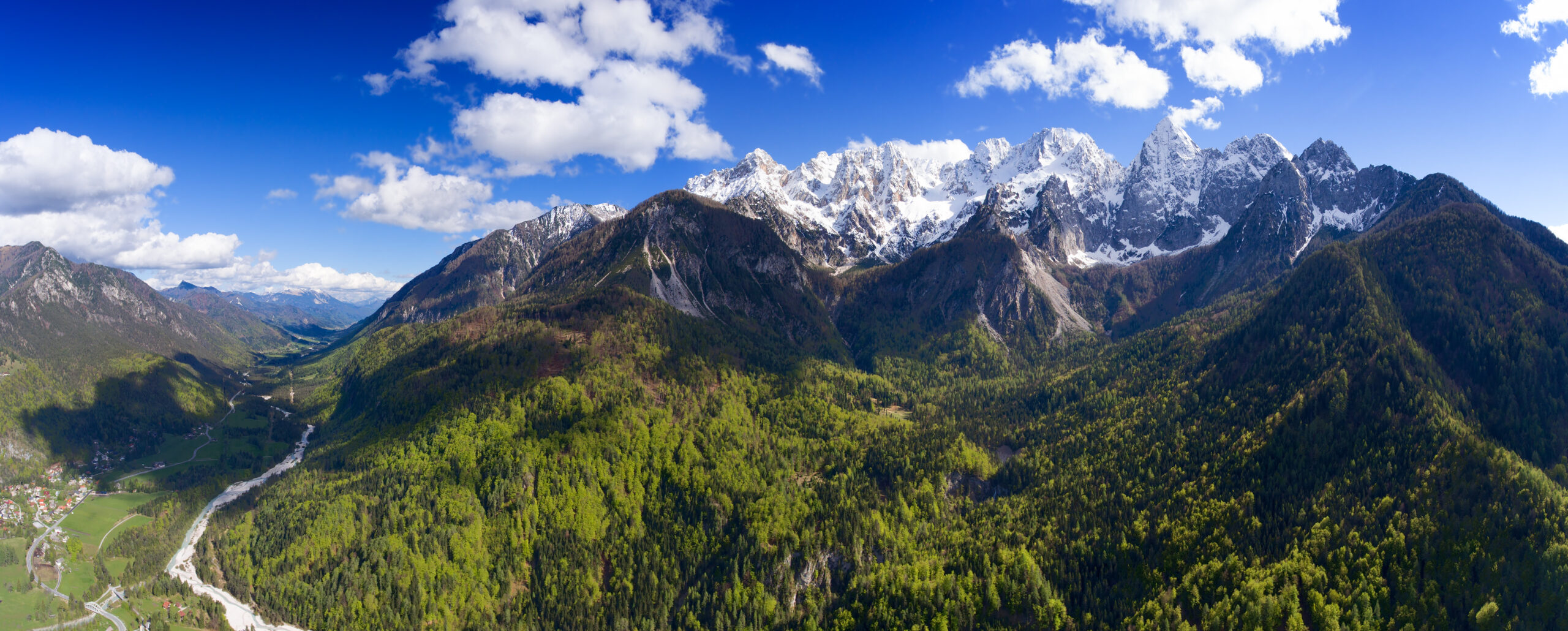
Climbing Mount Triglav: Slovenia’s National Peak
Slovenia’s highest mountain and its national symbol — the peak on the flag, the coat of arms, and the 50-cent coin. Climbing it is a rite of passage for Slovenians. But “Three Heads” isn’t a walk-up: the summit is a real, exposed via ferrata, and it deserves the right kit and real respect.
Mount Triglav (2,864 m) is Slovenia’s highest peak and the heart of its national identity — but it climbs like a mountain, not a monument. The approach is a long alpine hike to a hut; the summit is a true via ferrata — a narrow, cabled ridge with big drops on both sides. You need a helmet, a via ferrata set, a harness, and a head for exposure.
Thousands do it every summer, including Slovenian families — but people also get hurt here, usually from exposure, weather, or going without the right gear. Come prepared (or with a guide), start early to beat the afternoon storms, and it’s one of the great and most storied climbs in the Alps.
On this page
Where it is
Central Julian Alps, Triglav National Park — staged from Bled or Bohinj.
Triglav rises in the central Julian Alps of northwestern Slovenia, the centerpiece of Triglav National Park (the country’s only national park, 838 km²). Most climbers base in Bled (~35 km) or Bohinj and drive to a valley trailhead — Krma, Pokljuka, or the Vrata Valley on the north side. Ljubljana is about 75 km away; Venice roughly three hours.
The national symbol
No other country puts a named mountain at the heart of its flag.
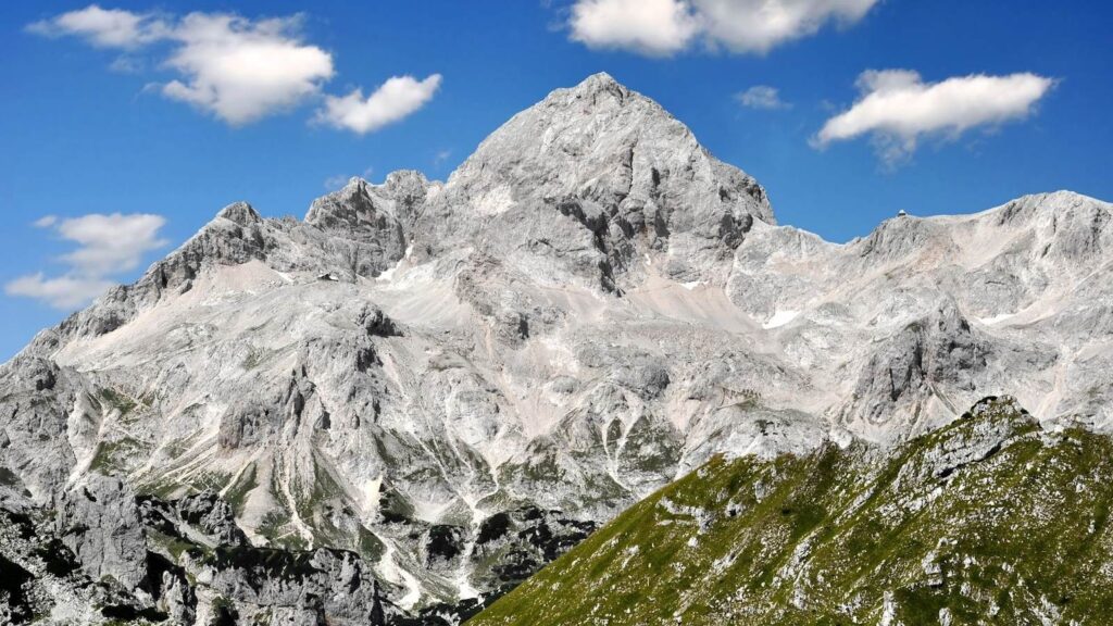
Triglav is woven into Slovenian identity like few mountains anywhere. Its three peaks are the stylized white emblem at the center of the Slovenian flag and coat of arms — designed by Marko Pogačnik and adopted on 24 June 1991, the day Slovenia declared independence — with wavy lines below for the Adriatic and the country’s rivers, and three gold stars above from the medieval Counts of Celje. The mountain also appears on the Slovenian 50-euro-cent coin. The name “Triglav” means “Three Heads,” after its three-peaked profile seen from Bohinj.
Why it’s not a walk-up
The elevation is modest; the exposure is not.
Triglav’s lower slopes feel like a long mountain walk, which lulls some visitors into treating the whole thing as a hike. It isn’t. From the high huts, the route to the top is a true via ferrata — a narrow ridge secured by steel cables and iron pegs, with vertical drops of hundreds of metres on both sides. National-park officials have publicly warned about rising rescue numbers tied to under-prepared visitors. Three things catch people out:
| The real challenge | Why it bites |
|---|---|
| Sustained exposure | The summit ridge from Mali Triglav (2,725 m) to the top is a knife-edge with big drops. Cables and pegs protect it, but you must be comfortable clipping along exposed terrain — some climbers freeze here. |
| Wet or icy rock | The polished limestone becomes dangerously slick when wet, and cables can ice up early or late in the season. Conditions, not just the calendar, decide difficulty. |
| Afternoon storms | The Julian Alps build thunderstorms fast — a clear morning can turn to lightning by early afternoon, and the exposed ridge is the worst place to be. An early summit is non-negotiable. |
The main routes
Three valley approaches, all finishing on the same summit ridge.
The standard routes climb from southern valleys to a high hut, then share the final via ferrata. From easiest to most scenic:
Krma Valley approach
A long, gently graded valley on a well-made trail with no exposed ground until the summit ridge — which is why it’s the choice for families and first-timers, and the only practical winter line. Start around 1,170 m and climb through forest and pasture to the Kredarica hut.
| Pokljuka Plateau (high start) | From Rudno Polje (1,347 m) past Vodnikov Dom to Dom Planika (2,401 m); ~5–7 hrs, less total gain |
| Bohinj / Seven Lakes (most scenic) | 2–3 days through the spectacular Seven Triglav Lakes Valley — widely called the most beautiful way up |
The Vrata North Face via ferratas
Steeper, more exposed lines for climbers with via ferrata experience.
The Vrata Valley on the north side gives access to Triglav’s imposing ~1,000 m North Face. Three via ferratas climb from the Aljažev dom hut (1,015 m) — all more serious than the southern approaches, for climbers already comfortable on cabled terrain:
| Route | Character | For |
|---|---|---|
| Tominšek | Least exposed of the three | The standard, most popular north approach |
| Čez Prag | Steeper, more direct | Includes a ~15 m vertical section; strong via ferrata skills |
| Bamberg (Plemenice) | Most technical, sustained exposure | Experienced via ferrata climbers only |
Mountain huts
Where you sleep before the summit push.
| Triglavski dom na Kredarici (2,515 m) | The highest hut in Slovenia and a weather station since 1954; the busiest summit base. Book ahead in peak season. |
| Dom Planika pod Triglavom (2,401 m) | Quieter alternative south of the summit, with a slightly easier via ferrata to the top; many climbers ascend via one hut and descend via the other. |
| Aljažev dom v Vratih (1,015 m) | Valley-head hut in Vrata; the start for all three North Face via ferratas. |
The summit via ferrata
From the hut to the Aljaž Tower — the part that makes Triglav Triglav.
Mali Triglav → the summit (2,864 m)
From Kredarica the route climbs over Mali Triglav (2,725 m) and along a narrow, exposed crest to the main summit; from Planika it joins the same ridge slightly lower down and a touch easier. Cables and iron pegs protect the whole thing, but the drops are real and the rock is polished. Clip methodically, watch for climbers above (a helmet is essential — rockfall is common), and top out at the Aljaž Tower to sign the register.
Weather & when to climb
A summer via ferrata season — with a live look at the hut.
The season runs roughly late June through September, when the huts are staffed and the cables are clear of snow. July–August is busiest — expect queues on the ridge — while September often brings the finest, quietest weather. Late June and October are shoulder windows where snow and iced cables can make the via ferrata more serious. The live forecast below is for the Kredarica hut and refreshes on load.
Kredarica hut — Triglav’s high base (2,515 m)
Loading live data…Gear essentials
Hiking kit for the approach — plus a real via ferrata set for the top.
- Via ferrata set (Y-lanyard with energy absorber), harness, and helmet — all mandatory for the summit ridge; UIAA/CE certified.
- Sturdy boots with good grip and gloves to protect your hands on the steel cables.
- Layered clothing — base, fleece, and a waterproof/windproof shell (the Julian Alps turn fast), plus a warm hat and gloves for the summit.
- Headlamp for the alpine start, sun protection (Cat 3 glasses, SPF), 1.5–2 L water, and trail food.
- For a hut night: a sleeping-bag liner (required), hut shoes, earplugs, and cash in euros — plus a map/GPS of the park.
A short history
From a 1778 scientific ascent to a nation’s emblem.
The first recorded ascent came on 26 August 1778, when four men — the surveyor Lovrenc Willomitzer with the chamois hunters Štefan Rožič, Matija Kos, and Luka Korošec — reached the top on an expedition organised by the industrialist Žiga Zois. That makes Triglav one of the earliest-climbed major peaks in the Eastern Alps, years before Grossglockner (1800). Local hunters had surely been high on the mountain long before, wrapped in folk tales like that of Zlatorog, the golden-horned chamois.
Through the 19th century Triglav became a rallying point for Slovenian identity within Austria-Hungary — which is exactly why Jakob Aljaž built his summit tower in 1895. Its three peaks anchored the Liberation Front emblem in the Second World War, then passed into the coat of arms of independent Slovenia in 1991 and onto the euro coin in 2007. One modern footnote: the small Triglav Glacier that survived near Kredarica for centuries has now effectively vanished — one of the most visible marks of a warming climate in the Eastern Alps.
Frequently asked questions
How hard is Triglav?
Harder than 2,864 m sounds. The approach is a long hike (6–8 hrs, 1,300 m+ to a hut), but the summit section is a true via ferrata — an exposed, cabled ridge. You need a helmet, via ferrata set, harness, and a head for heights. Fit, prepared hikers (or guided parties) do it routinely; casual hikers should not.
Do you need a permit or guide?
No permit, and the national park has no entry fee — you pay only for parking and huts. A guide isn’t required but is common for first-timers (about €250–450 for two days). Independent climbers should be confident with via ferrata gear and route-finding.
Best route for a first climb?
Krma Valley to the Kredarica hut, then the via ferrata to the summit and back — the easiest, least exposed approach. The Pokljuka start (Rudno Polje) saves elevation via Dom Planika. Save the Vrata North Face via ferratas until you’ve done via ferrata before.
How long does it take?
Usually two days with one hut overnight; fit parties do it car-to-car in a long single day (~12–16 hrs). The three-day Seven Lakes version is the most scenic.
Why does it matter so much to Slovenia?
It’s the national symbol — on the flag, the coat of arms, and the 50-cent coin — and climbing it is a widely held rite of passage. “Triglav” means “Three Heads,” after its profile from Bohinj.
When should I go?
Late June to September, when huts are open and cables are snow-free; July–August is busiest, September often the finest. Start early to beat the afternoon thunderstorms, and confirm hut dates with PZS.
How we built this
Research-based. This guide draws on Triglav National Park (TNP), the Alpine Association of Slovenia (PZS), and standard Julian Alps route references, cross-checked for elevation, routes, huts, and season. Where the source page carried very specific current details (exact hut opening dates, event dates), we’ve generalised to the reliable seasonal pattern and pointed you to PZS/TNP to confirm, rather than assert specifics that shift year to year.
Hut availability, prices, and cable/snow conditions change between seasons. Confirm current status with PZS and TNP and check a detailed forecast before any attempt.
Climb Slovenia’s national peak — the right way
Triglav rewards climbers who treat it as a mountain, not a monument: the right via ferrata kit, an early start, and the judgment to turn around. Do that, and standing at the Aljaž Tower is one of the Alps’ most storied summits.
Via ferrata technique →Alps Classics →Was this helpful?
🏔Related peaks nearby
🧭Explore & compare
Global Summit Guide is an independent mountaineering resource founded in 2026. The team combines first-hand trekking and climbing experience with in-depth research and professional health and nutrition review to help climbers choose objectives, prepare properly, and stay safe.
Health, altitude, and nutrition content is reviewed by Taylor Ludlow (Registered Nurse) and Brigg Hoopes (Nutritionist).
What We Don't Know Yet
Mountain information changes quickly. This box explains the limits of what this page can responsibly promise.
- Permit availability, reservation windows, quotas, and official fee rules may change after this page is updated.
- Weather, snowpack, avalanche risk, road access, and route conditions can change quickly and may be different on your climbing dates.
- Route conditions, trailhead access, crevasse exposure, stream crossings, and rescue access may vary from published planning guidance.
- Gear requirements can change by season, route variation, weather window, personal cold tolerance, and guide-service requirements.
- Fitness and altitude response vary by person; no guide, itinerary, or training plan can guarantee acclimatization or summit success.
Verify current conditions with official land managers, guide services, local forecasts, and current route reports before booking or climbing.
Mountaineering, rock and ice climbing, glacier travel, and high-altitude activity are inherently dangerous and can result in serious injury or death. The information on Global Summit Guide is provided for general informational and educational purposes only and is not a substitute for professional instruction, qualified guiding, proper equipment, or your own judgment and experience.
Route conditions, weather, snowpack, permits, regulations, and hazards change constantly and may differ from what is described here. Details may be incomplete, out of date, or contain errors. Always verify current information with local authorities, certified guides, and official sources before making any decision in the mountains.
Nothing on this site is medical, legal, or financial advice. Our fitness, acclimatization, altitude, and nutrition content is general in nature; consult a qualified physician before beginning any strenuous exercise program or exposing yourself to high altitude.
You are solely responsible for your own safety and decisions. To the fullest extent permitted by law, Global Summit Guide and its team accept no liability for any loss, injury, damage, or expense arising from use of, or reliance on, this information. By using this site you acknowledge these risks and accept these terms.
Some links on this site may be affiliate links. If you buy through them we may earn a small commission at no extra cost to you; this never affects our recommendations.
Global Summit Guide recommendation path
Next Best Mountain to Research
Use these recommendations to continue the right planning path instead of stopping on one page.
Use current permit, weather, route, and operator information before booking or climbing.
Search Flights, Hotels & Rental Cars
Have the mountain or destination picked? Use Expedia to compare the flights, lodging and rental cars that fit your actual trip dates. For mountain travel, consider arriving early enough for delays and adding a buffer night after the climb before a fixed flight home.
Compare current flight, hotel and car options.
Affiliate disclosure: Global Summit Guide may earn a commission if you book through this link, at no additional cost to you.