
Last updated September 10, 2026
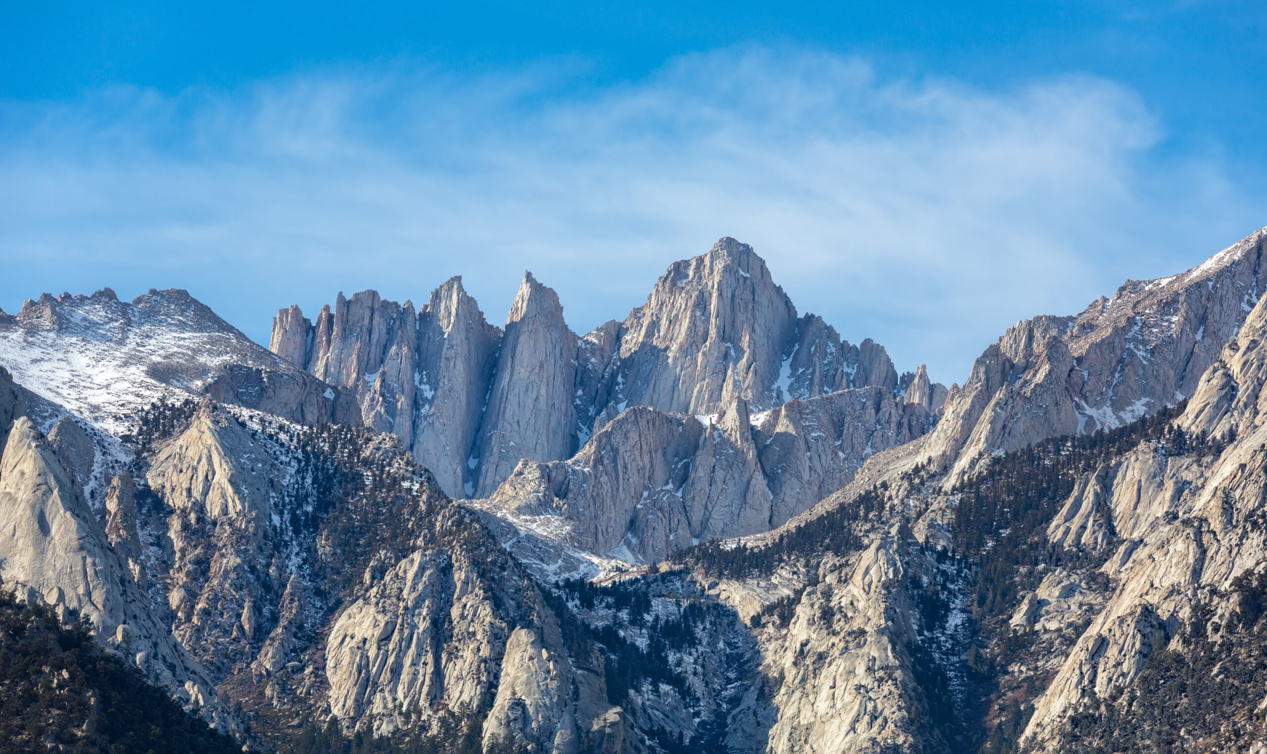
Best Hikes in the Sierra Nevada: 20 Trails from Yosemite to Mount Whitney
The Sierra Nevada is best understood as five hiking systems: Yosemite granite, the John Muir Trail corridor, Sequoia and Kings Canyon wilderness, the Eastern Sierra lake-and-pass network, and the Whitney high-altitude zone. John Muir Trail is the best overall trek; Rae Lakes is the best classic loop; Half Dome is the most iconic day hike; Whitney is the strongest summit hike.
Updated September 8, 2026 · Yosemite, Sequoia–Kings Canyon and Whitney access checked
Which Sierra Nevada Hiking Area Should You Choose?
Choose Yosemite for iconic granite and big day hikes; the JMT corridor for a long wilderness journey; Sequoia and Kings Canyon for classic backpacking loops; Mammoth and Bishop for high-access eastern Sierra lakes and passes; and Lone Pine for Mount Whitney and southern Sierra summit hikes.
For a first trip, do not try to cover the entire range. Yosemite + Mammoth works well for a week. Bishop + Lone Pine works well for an eastern-Sierra hiking and acclimatization trip. Sequoia + Kings Canyon deserves its own multi-day backpacking trip.
Choose the Sierra Nevada Region That Fits Your Trip
The Sierra is more than Yosemite. Each zone solves a different kind of hiking trip.
| Zone | Best for | Signature hikes | Primary base |
|---|---|---|---|
| Yosemite | Iconic granite, waterfalls, big day hikes | Half Dome, Clouds Rest, Mist Trail, Yosemite Falls | Yosemite Valley / El Portal |
| JMT / Central Sierra | Long-distance wilderness | John Muir Trail, Evolution Valley, Thousand Island Lake | Mammoth Lakes / trail-specific shuttles |
| Sequoia & Kings Canyon | Classic multi-day backpacking | High Sierra Trail, Rae Lakes, Pear Lake | Three Rivers / Kings Canyon corridor |
| Eastern Sierra | Lakes, passes, easier high-country access | Big Pine Lakes, Bishop Pass, Kearsarge, Little Lakes | Bishop / Mammoth |
| Whitney / Southern Sierra | Summit hiking and altitude | Mount Whitney, Mount Langley | Lone Pine |
The 20 Best Hikes in the Sierra Nevada
Ranked by the quality of the mountain experience rather than simple popularity or mileage.
John Muir Trail
Best for: Best overall Sierra trek
The classic Sierra journey links Yosemite Valley with Mount Whitney through the highest and most sustained backcountry in California. Its strength is the accumulation of granite basins, high passes and wilderness continuity rather than one isolated attraction. Southbound trips beginning in Yosemite require a Donohue Pass-eligible wilderness permit, making permit strategy part of the route itself.
High Sierra Trail
Best for: Best west-to-east Sierra crossing
The High Sierra Trail starts among Sequoia’s giant trees, crosses the Great Western Divide, reaches the Kern drainage and finishes through the Whitney zone. It is one of the best ways to experience the range as a complete geographic crossing rather than a single basin or summit.
Rae Lakes Loop
Best for: Best classic Sierra loop
Rae Lakes combines Kings Canyon, river walking, alpine lakes and Glen Pass in a logical loop. It is a better first serious Sierra backpack than a long thru-hike for many hikers because the itinerary is compact while still demanding real multi-day systems and high-country judgment.
Half Dome
Best for: Most iconic Sierra day hike
Half Dome is one of the world’s defining summit hikes. The final cable section above Subdome concentrates exposure and weather consequences into the last part of a very long day. During cable season a permit is required above Subdome, and the route should be treated as an exposed mountain objective rather than an ordinary Yosemite walk.
Mount Whitney Trail
Best for: Best Sierra summit hike
The standard Mount Whitney Trail reaches the highest point in the contiguous United States on a non-technical route when snow-free. Distance, more than 6,000 feet of gain, altitude and the permit lottery create the real difficulty. Snow or ice changes the route into a mountaineering problem.
Evolution Valley
Best for: Best high-country valley
Evolution Valley and Basin are among the most complete pieces of Sierra terrain: broad granite, quiet water, open meadow and a gradual rise toward Evolution Lake, Sapphire Lake and Muir Pass. It works as a highlight of the JMT or as the centerpiece of a shorter wilderness itinerary.
Clouds Rest
Best for: Best Yosemite panorama without cables
Clouds Rest gives one of Yosemite’s strongest summit views without the Half Dome cable permit. The broad summit ridge is exposed but generally remains hiking terrain in dry summer conditions, and the perspective looking down on Half Dome is one of the best in the park.
Mist Trail to Nevada Fall
Best for: Best Yosemite waterfall hike
The Mist Trail puts hikers beside Vernal and Nevada Falls and compresses Yosemite Valley’s granite-and-water experience into a half or full day. Spring and early summer bring the biggest flow; wet granite, crowding and heat are the key planning tradeoffs.
Yosemite Falls Trail
Best for: Best major vertical day
This trail climbs roughly 2,700 feet from Yosemite Valley to the top of Yosemite Falls. The route is straightforward to follow but physically demanding, with strong spring water flow and significant sun exposure later in the season.
Little Lakes Valley
Best for: Best easy high-elevation scenery
Little Lakes Valley offers immediate access to 10,000-foot Sierra scenery from a high trailhead near Rock Creek. It is one of the best acclimatization hikes before Whitney or a longer high-country trip because the mountain payoff arrives without a huge vertical day.
Big Pine Lakes
Best for: Best turquoise-lake hike
The North Fork Big Pine route climbs toward the Palisades through a chain of vivid alpine lakes. It can be done as a long day, but an overnight gives more time for the upper basin and glacier views while reducing the pressure to race the descent.
Thousand Island Lake
Best for: Best Ritter Range lake
Thousand Island Lake sits beneath Banner Peak and is one of the defining central-Sierra camps. Multiple approach choices make it useful for both short backpacking loops and longer JMT-linked itineraries.
Kearsarge Pass
Best for: Best first Sierra pass
Kearsarge Pass is one of the fastest ways to experience a true Sierra crest crossing without committing to a multi-day traverse. The Onion Valley trail starts high, passes alpine lakes and reaches broad views deep into Kings Canyon.
Bishop Pass
Best for: Best Bishop-area pass
Bishop Pass climbs from South Lake through a sequence of alpine basins to the Sierra crest. It is an excellent training day for longer backpacking trips because the route reaches serious elevation while remaining non-technical in dry summer conditions.
Mount Langley
Best for: Best quieter California 14er hike
Mount Langley is one of California’s more approachable 14,000-foot hiking objectives when snow-free. Its Cottonwood Lakes approach is long, and altitude remains serious, but the route offers a quieter high-summit alternative to Whitney.
Cathedral Lakes
Best for: Best Tuolumne introduction
Cathedral Lakes is a compact introduction to Yosemite’s granite high country. The trail climbs from the Tuolumne area through forest to a classic lake basin beneath Cathedral Peak, making it an excellent first high-country day.
North Dome
Best for: Best Half Dome view from across the valley
North Dome places hikers almost directly opposite Half Dome and gives one of the strongest landscape views in Yosemite. It is less famous than the cable route but excellent for photography and a full mountain day without the Half Dome permit.
Mammoth Crest Loop
Best for: Best Mammoth-area day
The Mammoth Crest rises above the Mammoth Lakes basin with broad views toward the Ritter Range and central Sierra. It is a strong acclimatization and conditioning hike before higher passes or multi-day backcountry travel.
Lakes Trail to Pear Lake
Best for: Best Sequoia alpine day
The Lakes Trail quickly leaves the road-access giant-sequoia corridor and climbs into granite lake basins. Heather, Emerald and Pear Lakes create a classic sequence that shows how much alpine terrain lies beyond Sequoia’s famous trees.
Mono Pass
Best for: Best quiet Yosemite high-country pass
Mono Pass is quieter than Yosemite’s marquee summit trails and provides a broad view over the eastern Sierra edge. It is especially good for hikers who want high-country terrain without the permit pressure of Half Dome or a major backpacking itinerary.
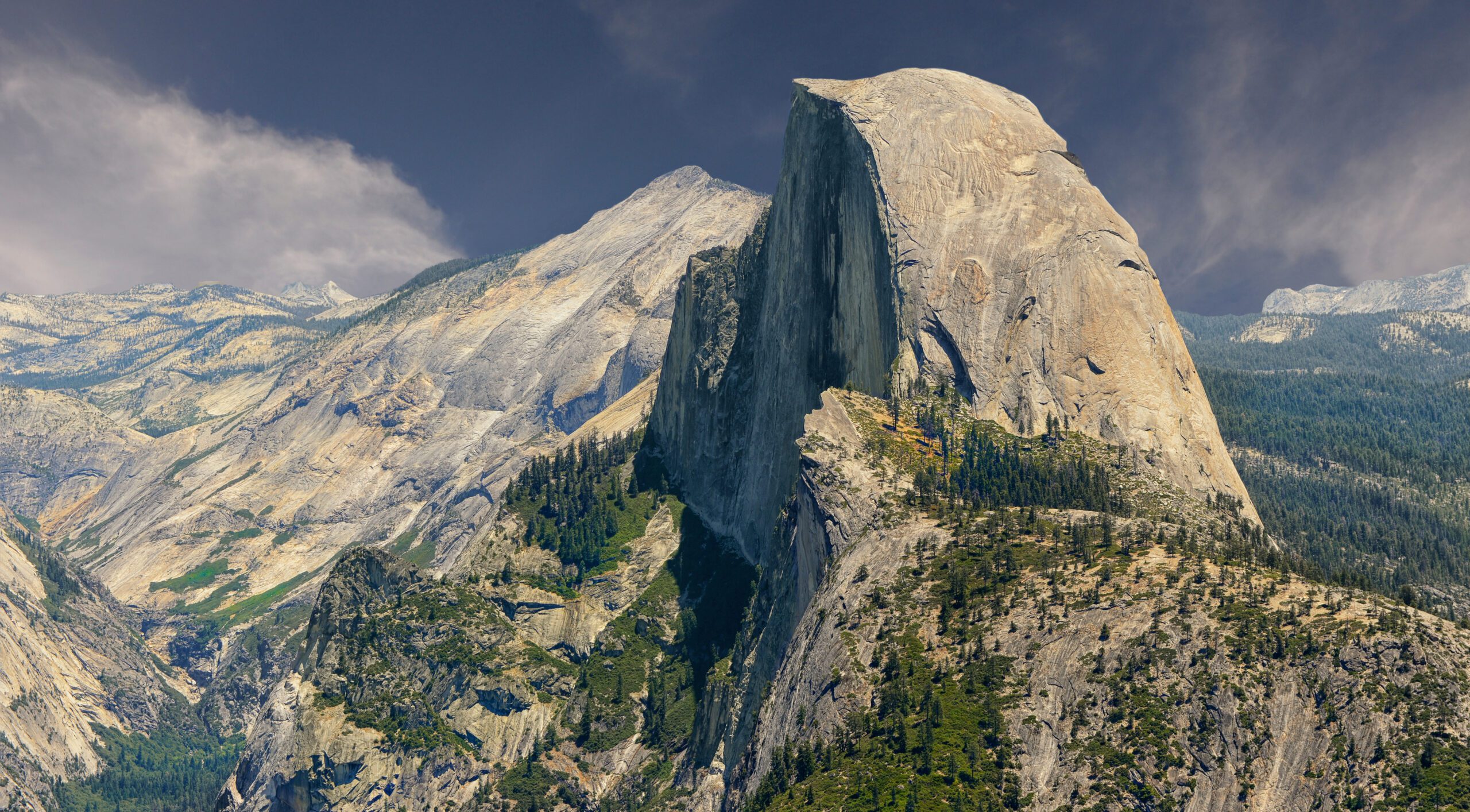
Yosemite Owns the Icons. The Rest of the Sierra Owns the Wilderness Scale.
Half Dome and the Valley are the obvious first stop, but the Sierra becomes more impressive—not less—as road access disappears into Kings Canyon, the JMT corridor and the eastern high country.
Start With These Sierra Nevada Hikes
These six routes cover the range from a two-to-four-week thru-hike to exposed Yosemite day hiking and a 14,505-foot summit. Use them to decide what kind of Sierra trip you want before narrowing the trailhead and permit.
John Muir Trail
The 211-mile flagship: permit strategy, Donohue Pass quota, resupply, bear canisters and trip direction.
Open guide / section → Sequoia → WhitneyHigh Sierra Trail
A west-to-east traverse through giant sequoias, the Great Western Divide, Kern Canyon and Whitney.
Open guide / section → Kings CanyonRae Lakes Loop
A compact classic loop with Glen Pass, lake camps and an excellent first serious Sierra backpack.
Open guide / section → YosemiteHalf Dome
Detailed GSG guide covering permits, cables, difficulty, training and Yosemite logistics.
Open guide / section → Eastern SierraMount Whitney Trail
Detailed GSG guide covering the 22-mile standard route, altitude and permit lottery.
Open guide / section → JMT corridorEvolution Valley
One of the Sierra’s best high-country valleys and a natural shorter-trip alternative to the full JMT.
Open guide / section →John Muir Trail — The Sierra’s Defining Journey
The permit is part of the route, not an administrative detail.
Yosemite National Park describes the John Muir Trail as 211 miles from Yosemite Valley to Mount Whitney. The route overlaps the Pacific Crest Trail for much of its length and repeatedly crosses high Sierra passes before finishing at 14,505 feet.
For a continuous southbound JMT trip starting in Yosemite, one Yosemite wilderness permit covers the whole trip, but it must be eligible for a Donohue Pass exit. Only two Yosemite entry choices serve the full southbound JMT beyond Yosemite: Happy Isles past Little Yosemite Valley and Lyell Canyon. The Donohue Pass exit quota is 45 people per day—15 from Happy Isles and 30 from Lyell Canyon.
The better decision is not automatically “start from Happy Isles.” Lyell Canyon skips Yosemite Valley and creates a simpler first day, while Happy Isles gives the classic symbolic start but adds hotter, more crowded terrain and stricter first-night rules.
High Sierra Trail — Best Sierra Crossing
Start in giant sequoia country and finish on the highest summit in the Lower 48.
The High Sierra Trail is the strongest alternative to the JMT for hikers who want a one-way Sierra crossing rather than a north-south thru-hike. The route begins near Crescent Meadow in Sequoia National Park, crosses the Great Western Divide, descends toward Kern Canyon and eventually joins the John Muir Trail for the approach to Whitney.
For 2026, Sequoia and Kings Canyon’s wilderness quota season runs from May 22 through September 26. Reservations can be made up to six months in advance and are released daily at 7:00 AM Pacific. During quota season, entry points are capacity-limited and permits must be picked up and validated.
Compared with the JMT, the High Sierra Trail has a cleaner geographic story: giant sequoias to Whitney. Compared with Whitney from the east, it replaces a one-day altitude shock with a gradual multi-day acclimatization profile.
Current trail note: the latest Sequoia and Kings Canyon field report lists downed trees and a washout between Mehrten Creek and Bearpaw, with additional stock obstacles farther east. That does not automatically close the hiking route, but it is a reminder to treat the park’s trail-condition page as part of the pre-trip checklist.
Rae Lakes Loop — Best Classic Sierra Backpack
For many hikers, this is the best first big Sierra itinerary.
Rae Lakes Loop is popular because it compresses the core Sierra experience into a manageable 3–5 day circuit: deep canyon, river corridor, alpine lake camps, Glen Pass and a logical return to Roads End. It is long enough to require real backpacking systems without the resupply and transportation complexity of the JMT.
The permit belongs to Sequoia and Kings Canyon’s trailhead-quota system. Entry direction matters because the loop can begin on different quota-controlled trailheads. Bear-resistant food storage is required across most park wilderness, so food volume and canister capacity should be part of itinerary design from the beginning.
Rae Lakes is the route I would choose for someone who says, “I want one classic Sierra backpack before deciding whether I love multi-week thru-hiking.”
The South Fork Kings River bridge is still out. NPS says replacement construction will not begin before 2027. Its August 26, 2026 field report described the crossing as dry via rock hopping, but conditions can change; hikers should still evaluate the river on arrival and be prepared to reverse the loop if a safe crossing is not available.
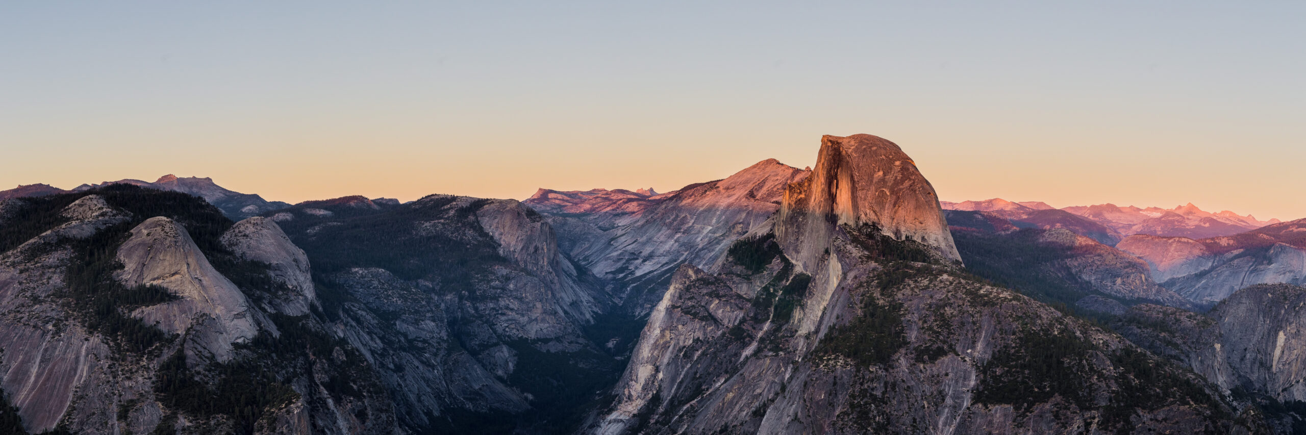
Half Dome and Whitney Test Different Parts of Mountain Readiness.
Half Dome concentrates difficulty into exposure and cables. Whitney spreads difficulty across altitude, distance and endurance. If Whitney is the target, check the Mount Whitney weather and season guide before choosing a date. If the appeal is standing on high points, the U.S. state highpoints guide places California's summit in a broader progression.
Evolution Valley — Best High-Country Sierra Basin
Use it as a JMT highlight or build a shorter trip around it.
Evolution Valley is one of the places where Sierra hiking changes from “beautiful trail” into a landscape that feels architected for backpacking: broad granite, quiet water, open meadow and a gradual climb toward Evolution Lake, Sapphire Lake and Muir Pass.
Its value for this parent page is strategic. Not everyone needs to hike all 211 miles of the JMT. A shorter trip into Evolution country can deliver much of the high-Sierra experience while reducing transportation, resupply and time-off-work problems.
Exact entry permits depend on which side and trailhead you use, so choose the itinerary first and identify the controlling land agency rather than searching for a universal “Evolution Valley permit.”
Sierra Nevada Permits That Actually Control Your Trip
The Sierra is governed by several parks and national forests. The route decides the permit agency, reservation window and pickup process.
| Trip | Current rule | Planning implication |
|---|---|---|
| Yosemite day hiking | No general entrance reservation required in 2026; most day hikes need no wilderness permit. | Keep day-hike plans flexible except for Half Dome. |
| Yosemite overnight wilderness | Wilderness permit required. 60% of reservable trailhead quota is released through the 24-week lottery; remaining 40% becomes available seven days ahead. | The entry trailhead determines your legal first-night movement. |
| John Muir Trail southbound | Donohue Pass-eligible Yosemite permit; 45 exits per day. | The classic itinerary is one of the hardest permit choices in the Sierra. |
| Half Dome | Permit required when cables are up, including backpackers who already hold a wilderness permit. | Do not assume a Yosemite wilderness permit includes the cables. |
| SEKI backpacking | Quota season May 22–Sep 26, 2026. Reservations are available up to six months ahead. Walk-up quota permits are $15 per permit plus $5 per person. | High Sierra Trail and Rae Lakes require trailhead-specific planning. |
| Mount Whitney | Permit required year-round. Lottery results post March 15; awards must be claimed by Apr 21; unclaimed dates open Apr 22; the recreation fee is $15 per person. | Build the Lone Pine portion of your trip around the permit date. |
Best Bases for Sierra Nevada Hiking
One hotel base does not serve the whole Sierra. Match the overnight base to the trailhead system instead of building a trip around one convenient hotel.
Yosemite Valley / El Portal
Best for Half Dome, Clouds Rest, Mist Trail, Yosemite Falls and the north end of the JMT.
Mammoth Lakes
Best all-purpose base for Ansel Adams Wilderness, Thousand Island Lake and acclimatization.
Bishop
Best for Bishop Pass, Big Pine Lakes, Rock Creek and multiple high trailheads within an hour.
Lone Pine
The practical base for Whitney Portal, Mount Whitney and Cottonwood Lakes / Mount Langley.
Three Rivers
Best western staging base for Sequoia National Park and High Sierra Trail access.
Kings Canyon Corridor
Best route-specific staging when Rae Lakes or Roads End is the primary objective.
Useful Sierra Planning Guides
Once the route is chosen, the next decisions are exposure, altitude, weather, fitness and whether a California summit should be part of the same trip.
Half Dome
Permits, cable season, exposure, route choices, readiness and turnaround decisions.
14,505-foot objectiveMount Whitney
Standard trail, altitude, permit lottery, acclimatization and technical alternatives.
Choose the next challengeHalf Dome vs Mount Whitney
Compare exposure, mileage, elevation gain, altitude and permit timing before committing to one.
California progressionBest Mountains to Climb in California
Move from trail objectives into larger California summits and more technical terrain.
AltitudeAcclimatization Explained
Whitney, Langley and several eastern Sierra trailheads are high enough to change pacing and recovery.
ConditionsMountain Weather
Read thunderstorms, freezing level, wind, heat and snowpack rather than relying on the calendar alone.
How We Chose the Sierra Hikes
The list balances route quality and regional variety, while permit and access facts are checked against the agencies that manage each trail.
What makes a route belong here
- Sierra identity: granite, high passes, giant trees, alpine lakes and the eastern escarpment.
- Route quality: whether the trip feels complete rather than merely popular.
- Progression value: what it teaches before longer or higher routes.
- Trip value: whether the route justifies building a California mountain trip around it.
- Distinctiveness: avoiding a list dominated by routes that solve the same Yosemite problem.
Primary planning sources
Frequently Asked Questions
Direct answers for the permit, season and route decisions that shape a Sierra trip.
What is the best hike in the Sierra Nevada?
For a long trip, the John Muir Trail is the best overall Sierra hike. For a shorter backpack, Rae Lakes Loop is the best classic loop. For a day hike, Half Dome is the most iconic, while Mount Whitney is the strongest high-altitude summit hike.
When is the best time to hike the Sierra Nevada?
Late July through September is the most reliable general high-country window because the major passes and summit trails are most likely to be snow-free. Lower Yosemite Valley trails are excellent earlier in spring, when waterfalls are strongest. Heavy-snow years can delay high-country hiking well into summer.
Do I need a reservation to enter Yosemite in 2026?
No general entrance reservation is required to enter Yosemite in 2026, but overnight wilderness trips require wilderness permits and Half Dome requires a separate permit when the cables are up.
What permit do I need for the John Muir Trail?
A continuous southbound John Muir Trail trip beginning in Yosemite needs a Yosemite wilderness permit that is eligible to exit via Donohue Pass. Yosemite limits Donohue Pass exits to 45 hikers per day: 15 from Happy Isles past Little Yosemite Valley and 30 from Lyell Canyon.
Do I need a permit for Half Dome?
Yes. A permit is required to ascend above Subdome and use the Half Dome cables when they are installed. Backpackers also need an overnight wilderness permit, and only specified wilderness trailheads are eligible for Half Dome access.
How do Sequoia and Kings Canyon wilderness permits work in 2026?
For 2026, the quota season runs May 22 through September 26. Reservations can be made up to six months in advance, with inventory released daily at 7:00 AM Pacific. The park charges a trip fee plus a per-person fee and requires permit pickup at the appropriate wilderness office.
How does the Mount Whitney permit work?
A wilderness permit is required year-round. Whitney permits are reserved through the Recreation.gov lottery, with results posted March 15, an April 21 claim deadline, and unclaimed dates released April 22. The recreation fee is $15 per person plus the reservation fee.
Is Mount Whitney a technical climb?
The Mount Whitney Trail is non-technical when snow-free, but it is still a very demanding 22-mile high-altitude hike. Snow or ice can require crampons, ice axe and winter mountaineering skills. The Mountaineers Route is a separate technical objective.
Where should I stay for Sierra Nevada hiking?
Use Yosemite Valley or nearby gateway towns for Yosemite; Mammoth Lakes for the central Sierra; Bishop for Bishop Pass and Big Pine; Lone Pine for Whitney and Langley; and Three Rivers or the Kings Canyon corridor for western trailheads. One Sierra trip rarely works from a single base.
Which is harder: Half Dome or Mount Whitney?
Mount Whitney is harder in total endurance and altitude; Half Dome is more exposed and psychologically demanding on the cables. Global Summit Guide's dedicated comparison explains the permit calendars, distances, altitude and progression tradeoffs in detail.
Yosemite Is the Introduction. The High Sierra Is the Story.
Use Half Dome and Yosemite to understand the granite landscape, Rae Lakes or High Sierra Trail to learn multi-day Sierra backpacking, and Whitney when altitude and a true summit become the objective.
Compare the Sierra with the Next Mountain Region
Stay in the western mountain system, or move from regional trail selection into Whitney-specific weather and the broader U.S. highpoint progression.
More California Guides
More trips, peaks and planning guides from the same region.
Was this helpful?
🏔Related peaks nearby
🧭Explore & compare
Global Summit Guide is an independent mountaineering resource founded in 2026. The team combines first-hand trekking and climbing experience with in-depth research and professional health and nutrition review to help climbers choose objectives, prepare properly, and stay safe.
Health, altitude, and nutrition content is reviewed by Taylor Ludlow (Registered Nurse) and Brigg Hoopes (Nutritionist).
What We Don't Know Yet
Mountain information changes quickly. This box explains the limits of what this page can responsibly promise.
- Route conditions, snowpack, closures, and weather can change quickly after this page is updated.
- Permit rules, fees, quotas, and reservation windows may change between review cycles.
- Operator availability, pricing, guide ratios, and cancellation terms can change by season.
- Your fitness, altitude response, risk tolerance, and experience level may change what is safe or realistic.
- Use this page for planning guidance, then verify current information with official sources and qualified local experts before committing.
Verify current conditions with official land managers, guide services, local forecasts, and current route reports before booking or climbing.
Mountaineering, rock and ice climbing, glacier travel, and high-altitude activity are inherently dangerous and can result in serious injury or death. The information on Global Summit Guide is provided for general informational and educational purposes only and is not a substitute for professional instruction, qualified guiding, proper equipment, or your own judgment and experience.
Route conditions, weather, snowpack, permits, regulations, and hazards change constantly and may differ from what is described here. Details may be incomplete, out of date, or contain errors. Always verify current information with local authorities, certified guides, and official sources before making any decision in the mountains.
Nothing on this site is medical, legal, or financial advice. Our fitness, acclimatization, altitude, and nutrition content is general in nature; consult a qualified physician before beginning any strenuous exercise program or exposing yourself to high altitude.
You are solely responsible for your own safety and decisions. To the fullest extent permitted by law, Global Summit Guide and its team accept no liability for any loss, injury, damage, or expense arising from use of, or reliance on, this information. By using this site you acknowledge these risks and accept these terms.
Some links on this site may be affiliate links. If you buy through them we may earn a small commission at no extra cost to you; this never affects our recommendations.
Global Summit Guide recommendation path
Next Best Mountain to Research
Use these recommendations to continue the right planning path instead of stopping on one page.
Use current permit, weather, route, and operator information before booking or climbing.
Search Flights, Hotels & Rental Cars
Have the mountain or destination picked? Use Expedia to compare the flights, lodging and rental cars that fit your actual trip dates. For mountain travel, consider arriving early enough for delays and adding a buffer night after the climb before a fixed flight home.
Compare current flight, hotel and car options.
Affiliate disclosure: Global Summit Guide may earn a commission if you book through this link, at no additional cost to you.