
Last updated July 18, 2026
Mount Shasta route comparison: Avalanche Gulch vs Casaval Ridge, the West Face & the north side
California’s great training volcano has seven documented routes – but for most climbers the choice is really among three or four. Here is every line compared by character, season, success rate, and crowding, from the standard Avalanche Gulch to the crevassed Whitney Glacier – plus which one fits your skills and your month.
For most climbers, it is Avalanche Gulch – and the month matters as much as the route.
About half of all summit attempts go up Avalanche Gulch, the standard southwest snow route from Bunny Flat – the most supported line, the best descent, and the right first Shasta for nearly everyone. The West Face and Casaval Ridge are quieter southwest alternatives a notch steeper or more exposed; Clear Creek is the easy late-season scramble; and the north-side ridges and Whitney Glacier are the glaciated, remote, expert end of the mountain.
But the real variable on Shasta is timing. The south-side snow routes are in shape roughly late April to early July; by August they turn to rotten snow and rockfall, and the mountain shifts to its north and east lines. Pick the route to match your month and your skills, not the other way around.
Where it is
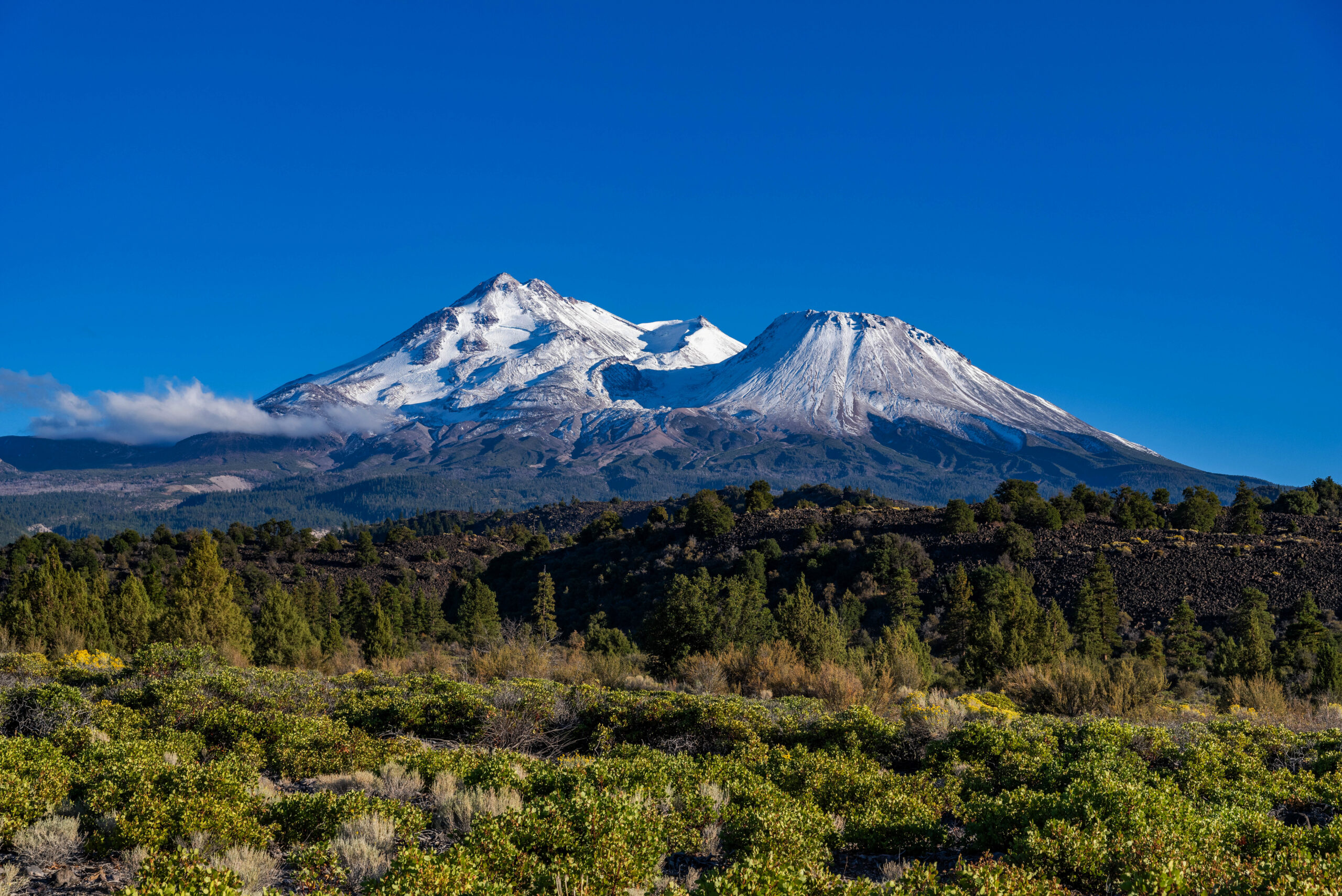
Northern California, a solitary giant above the Shasta Valley – staged from the town of Mount Shasta.
Find Hotels, Flights & Trips for the World’s Best Hiking Destinations
The Global Summit Guide Travel Shop on Expedia — curated for outdoor adventurers, mountaineers, and serious hikers. Patagonia to the Alps. Nepal to the Rockies. Curated lodging for every region we cover.
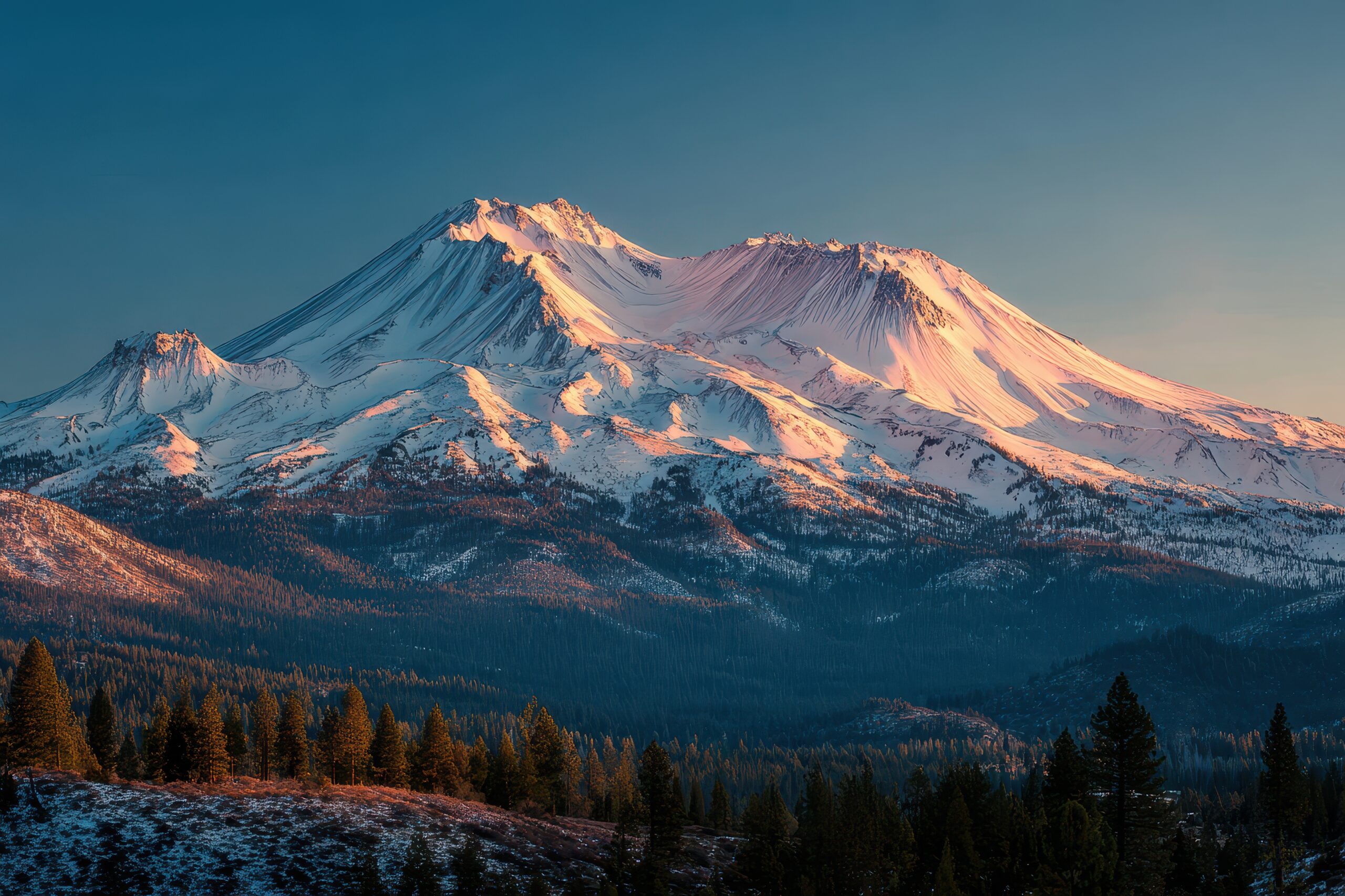
Explore Travel Shop on Expedia →Mount Shasta is a 14,179 ft (4,322 m) stratovolcano in the southern Cascades – the second-highest peak in the Cascade Range, the fifth-highest in California, and the largest Cascade volcano by volume, rising alone above Northern California’s Shasta Valley with no comparable peak within about 200 km. South-side climbs stage from the town of Mount Shasta up to Bunny Flat (~6,950 ft / 2,120 m), with camps at Horse Camp (~7,900 ft / 2,410 m) or Helen Lake (~10,440 ft / 3,180 m). Its scale, long summit day, and altitude make it the classic step between Rainier preparation and a first big glaciated peak – see the Shasta vs Rainier comparison for that progression.
Master route comparison
All seven documented lines side by side – grouped south-side snow, easy late-season, and glaciated north side.
| Route | Aspect | Character | Glacier? | Success | Level |
|---|---|---|---|---|---|
| Avalanche Gulch | SW | Moderate steep snow; the standard line | No | ~61% | Beginner-intermediate |
| West Face | W | Sustained steeper snow; remote camp | No | – | Beginner-intermediate |
| Casaval Ridge | SW | Exposed ridge; steep snow, gendarmes | No | ~55% | Intermediate |
| Clear Creek | SE | Non-technical scramble; scree and ash | No | – | Beginner (late season) |
| Hotlum-Bolam Ridge | N | Glaciated ridge; remote | Yes | – | Intermediate |
| Hotlum-Wintun Ridge | NE | Glaciated ridge; more sustained | Yes | – | Intermediate-advanced |
| Whitney Glacier | NW | Technical glacier; crevasses | Yes | ~42% | Advanced |
Route 1 · Avalanche Gulch
~50% of attempts, ~61% success – the standard southwest snow climb.
Avalanche Gulch (Southwest)
From Bunny Flat (~6,950 ft / 2,120 m), most parties camp at Horse Camp or Helen Lake (~10,440 ft / 3,180 m) and climb steep snow the next morning in three phases.
Camp approach to Helen Lake
A hike through forest and boulder fields to the Helen Lake basin – the standard high camp and the point where the real snow climbing begins.
The Heart and the Red Banks
An alpine start up the steepening snow of The Heart to the Red Banks – the crux headwall, and the zone where warming snow and rockfall become the day’s main hazard. Crampons and axe are in constant use.
Misery Hill to the summit
Above the Red Banks, the long grind of Misery Hill leads to the summit plateau and the final rise to the true summit at 14,179 ft. Turn around on time – the descent is where fatigue and soft snow bite.
Advantages
Trade-offs
- Crowded in the May-June peak window
- Rockfall through the Red Banks as the season warms
- Uncontrolled glissades are a leading accident cause
- Rotten, rockfall-prone by August
Route 2 · Casaval Ridge
~55% success – the exposed southwest ridge, for climbers with snow skills.
Casaval Ridge (Southwest)
Casaval weaves through gendarmes, traverses, and an exposed ridge crest from Horse Camp toward the upper mountain. Most of it is not highly technical, but it is sustained and far more exposed than Avalanche Gulch – “a fall would be tragic” is the standard description, and the upper ridge above the Second Window is where that exposure peaks. It is one of Shasta’s best-loved spring and winter lines because it holds only one section with real avalanche potential, but it demands solid self-arrest, comfort on steep snow, and good judgment. Many parties climb Casaval and descend the easier Avalanche Gulch.
Advantages
- Aesthetic, sustained ridge line with huge views
- Far less crowded than Avalanche Gulch
- A classic winter and early-spring route
Trade-offs
- Sustained exposure – a fall carries serious consequences
- More route-finding through gendarmes and windows
- Not a first-timer’s route; strong snow skills required
- Often descended via Avalanche Gulch, not re-descended
Route 3 · the West Face
A small step up from Avalanche Gulch – steeper snow, a quieter mountain.
West Face (West)
The West Face climbs a sustained steep-snow gully from Hidden Valley (~9,200 ft / 2,800 m), a high cirque basecamp on the southwest side reached from Bunny Flat. It has a more sustained steep section than Avalanche Gulch and far fewer climbers, with the same broad technical demands – and it drops about 4,000 ft (1,220 m) of fall line, making it one of Shasta’s premier ski descents. It suits a fit beginner-to-intermediate climber who wants a quieter mountain and is comfortable on steeper snow. Like the other south-side lines, it melts out and turns rockfall-prone by late summer.
Route 4 · Clear Creek
Shasta’s easiest line – the late-season scramble on the southeast side.
Clear Creek (Southeast)
Clear Creek is a mostly non-technical scramble on scree, ash, and snow-when-present, from a basecamp around 8,300 ft (2,530 m). It comes into its own from roughly June to September, when Avalanche Gulch has melted to rockfall and this eastern flank offers a safer, if less classic, ascent. It is the route most guides shift to in mid-to-late summer. The caution here is complacency – “casual day syndrome” leads climbers off the loose line into steeper, glaciated, or rockfall-prone terrain, and it remains a full 14,000 ft mountain with fast weather and real altitude.
Routes 5-7 · the north side
Glaciated, remote, and later in the season – the expedition end of Shasta.
Hotlum-Bolam Ridge (North)
A remote, glaciated ridge between the Hotlum and Bolam glaciers – a more Wilderness experience with far fewer climbers, best from June into September. It crosses glacier terrain and needs the full kit (rope, harness, crevasse-rescue skills), and is a common step toward true glacier expeditions.
Hotlum-Wintun Ridge (Northeast)
A more sustained glaciated ridge on the northeast aspect, holding good conditions later into summer. Similar commitment to Hotlum-Bolam with a slightly stronger mountaineering feel – glacier travel, route-finding, and a remote approach.
Whitney Glacier (Northwest) · ~42% success
Shasta’s largest glacier, running the trough between Shasta and Shastina – a genuinely technical, crevassed objective with the lowest success rate on the mountain (about 42% across the technical north-side lines). Crevasse navigation, serac awareness, and a longer timeline put it firmly in experienced-alpinist territory.
Season by aspect
On Shasta, the calendar chooses the side of the mountain.
The south and southwest snow routes – Avalanche Gulch, West Face, Casaval Ridge – are in shape from late April through early July, with May to June the sweet spot: firm, continuous snow, the best self-arrest security, and the lowest rockfall. By August those lines go rotten and rockfall-prone. The north and east routes – Hotlum-Bolam, Hotlum-Wintun, Clear Creek – hold better from June into September, which is why guides migrate there in mid-summer. Winter ascents are for experienced mountaineers only.
Choosing your route
Match the line to your skills and, above all, your month.
| If you are… | Choose | Why |
|---|---|---|
| A first-time Shasta climber (spring-early summer) | Avalanche Gulch | Standard line, most support, the best descent, non-glaciated |
| Wanting a quieter southwest line, steeper snow | West Face | A small step up, remote camp, classic ski descent |
| Experienced on snow, wanting a ridge | Casaval Ridge | Aesthetic and exposed; a spring and winter classic |
| Climbing in mid-to-late summer | Clear Creek | Least technical and safest once the south side melts out |
| After glacier experience or a remote climb | Hotlum-Bolam / Hotlum-Wintun / Whitney | Glaciated north-side lines; full kit and more commitment |
Prerequisites
Less committing than Rainier – but a serious snow climb, not a hike.
The standard routes ask for snow-climbing fundamentals rather than technical rock or ice, but the altitude, steepness, and long day are real. Come with:
- Reliable ice-axe self-arrest and crampon technique – practiced, not just read about; this is the single most important skill on every Shasta route.
- Cardiovascular fitness for a long day – the standard route gains about 7,000 ft (2,130 m); comfortably sustain uphill effort for 6+ hours with a pack.
- Altitude tolerance – a 14,000 ft summit is a real factor for climbers coming from sea level; a prior night at altitude helps.
- Weather and turnaround discipline – the difference between the ~74% guided and ~48% independent success rates is judgment, not fitness.
Shasta is the classic training peak before a full glacier expedition. Build the skills with our glacier travel basics, fitness standards, and avalanche awareness guides, and see the Shasta success-rate data for what actually moves the odds.
Permits & 2026 cost
Refreshingly simple – and no lottery.
Shasta’s permit system is easy: a free, self-issued wilderness permit for overnight camping, plus a paid summit pass for any travel above 10,000 ft – no lottery, no quota. Guided climbs run as 2-3 day programs, clustered on Avalanche Gulch and the West Face in spring and the north-side and Clear Creek lines later in summer:
| Program | Typical operators | 2026 price (USD) |
|---|---|---|
| Standard 2-3 day guided (Avalanche Gulch / West Face) | Shasta Mountain Guides, SWS Mountain Guides, International Alpine Guides | $900-1,200 |
| Shorter or group programs | Regional guide services | $500-900 |
| North-side / glaciated or private | Select operators, custom | $1,200+ |
Planning your Shasta climb?
Start with the Mount Shasta climbing guide for permits and staging, and see the Shasta vs Rainier comparison if you are building toward a glacier expedition. For flights into Redding or Sacramento and lodging in the town of Mount Shasta, compare options through the Global Summit Guide Expedia travel shop.
Disclosure: the Expedia link is an affiliate link; we may earn a small commission at no extra cost to you, and it never affects our recommendations.
Shasta Climb Guide All Route ComparisonsMount Shasta route FAQ
The questions climbers search most.
What is the standard route?
Avalanche Gulch, from Bunny Flat on the southwest side – about half of all attempts and a ~61% success rate. A big non-glaciated snow climb: camp near Helen Lake, then steep snow up The Heart, the Red Banks, and Misery Hill to the 14,179 ft summit. Ice axe, crampons, and self-arrest required.
Avalanche Gulch vs Casaval Ridge?
Avalanche Gulch is the direct, popular, well-supported snow gully; Casaval Ridge is the exposed southwest ridge – more sustained and far more consequential in a fall, and quieter. First-timers take Avalanche Gulch; Casaval is for climbers with solid snow skills.
Is the West Face harder than Avalanche Gulch?
Only a small step up – a more sustained steep-snow section from the remote Hidden Valley camp, much less crowded, and a classic ski descent. A good pick for a fit beginner-to-intermediate climber comfortable on steeper snow.
Which route is easiest?
Clear Creek, on the southeast side – a mostly non-technical scramble, best from June to September once the south-side snow routes turn to rockfall. Still a 14,000 ft mountain with real weather and altitude.
Do the north-side routes cross glaciers?
Yes. Hotlum-Bolam and Hotlum-Wintun cross Shasta’s north glaciers and need the full glacier kit; the Whitney Glacier is Shasta’s largest and a technical, crevassed objective for experienced alpinists. These come into season June to September.
What is the success rate?
About 58% overall – roughly 74% guided and 48% independent. By route: Avalanche Gulch ~61%, Casaval Ridge ~55%, the technical north-side and Whitney Glacier lines ~42%. Weather judgment and turnaround discipline drive the number.
When should I climb?
South-side snow routes: late April to early July (May-June ideal). North and east routes (Hotlum-Bolam, Hotlum-Wintun, Clear Creek): June into September. Winter is for experienced mountaineers only.
How hard is it and what experience do I need?
One of the best entry-level big-mountain snow climbs in the US – but not a hike. The standard route gains ~7,000 ft on steep snow; you need self-arrest, crampon skill, fitness for a long day, and turnaround discipline. A common training peak before Rainier and Denali.
What permits and cost in 2026?
A free self-issued wilderness permit for overnights plus a paid summit pass above 10,000 ft – no lottery. Guided 2-3 day climbs run about $500-1,200, with most standard programs $900-1,200 (Shasta Mountain Guides, SWS Mountain Guides, International Alpine Guides).
How we built this comparison
- Built from USFS Mount Shasta summit-zone permit and success-rate data (2005-2025), Mount Shasta Avalanche Center route descriptions, standard references (SummitPost), and 2026 operator programs (Shasta Mountain Guides, SWS Mountain Guides, International Alpine Guides), cross-checked for character, season, and cost.
- Per-route success rates (Avalanche Gulch ~61%, Casaval ~55%, technical north-side ~42%) are best-available USFS-derived estimates; lines with fewer permits are shown without a rate rather than guessed.
- Research-based, reviewed quarterly. Route review by Dawson Ludlow. Our team has not climbed every line described here.
Last updated: July 17, 2026 · Editor: Travis Ludlow · Route review: Dawson Ludlow. Conditions, the snow-to-rockfall transition, permit rules, and operator pricing change between seasons – verify current beta with the ranger station and avalanche center before climbing.
Confidence: Medium-high – route character and permits stable; per-route conditions and success rates shift year to year.Pick the line – then pick the month
For most climbers the answer is Avalanche Gulch in May or June. But whichever route you choose on Shasta, firm early-morning snow, a hard turnaround time, and a current avalanche and weather check matter more than the line on the map. Build the snow skills first, then go.
Mount Shasta Climb Guide All Route ComparisonsWas this helpful?
🏔Related peaks nearby
🧭Explore & compare
Global Summit Guide is an independent mountaineering resource founded in 2026. The team combines first-hand trekking and climbing experience with in-depth research and professional health and nutrition review to help climbers choose objectives, prepare properly, and stay safe.
Health, altitude, and nutrition content is reviewed by Taylor Ludlow (Registered Nurse) and Brigg Hoopes (Nutritionist).
What We Don't Know Yet
Mountain information changes quickly. This box explains the limits of what this page can responsibly promise.
- Weather, snowpack, avalanche risk, road access, and route conditions can change quickly and may be different on your climbing dates.
- Route conditions, trailhead access, crevasse exposure, stream crossings, and rescue access may vary from published planning guidance.
- Gear requirements can change by season, route variation, weather window, personal cold tolerance, and guide-service requirements.
- Fitness and altitude response vary by person; no guide, itinerary, or training plan can guarantee acclimatization or summit success.
- Comparisons simplify complex decisions; the better mountain depends on current conditions, skills, timing, budget, and risk tolerance.
Verify current conditions with official land managers, guide services, local forecasts, and current route reports before booking or climbing.
Part of this Global Summit Guide cluster
Explore the complete Mountains guide for more context, routes, planning links, and related resources.
Mountaineering, rock and ice climbing, glacier travel, and high-altitude activity are inherently dangerous and can result in serious injury or death. The information on Global Summit Guide is provided for general informational and educational purposes only and is not a substitute for professional instruction, qualified guiding, proper equipment, or your own judgment and experience.
Route conditions, weather, snowpack, permits, regulations, and hazards change constantly and may differ from what is described here. Details may be incomplete, out of date, or contain errors. Always verify current information with local authorities, certified guides, and official sources before making any decision in the mountains.
Nothing on this site is medical, legal, or financial advice. Our fitness, acclimatization, altitude, and nutrition content is general in nature; consult a qualified physician before beginning any strenuous exercise program or exposing yourself to high altitude.
You are solely responsible for your own safety and decisions. To the fullest extent permitted by law, Global Summit Guide and its team accept no liability for any loss, injury, damage, or expense arising from use of, or reliance on, this information. By using this site you acknowledge these risks and accept these terms.
Some links on this site may be affiliate links. If you buy through them we may earn a small commission at no extra cost to you; this never affects our recommendations.
Global Summit Guide recommendation path
Next Best Mountain to Research
Use these recommendations to continue the right planning path instead of stopping on one page.
Use current permit, weather, route, and operator information before booking or climbing.