
Last updated July 18, 2026
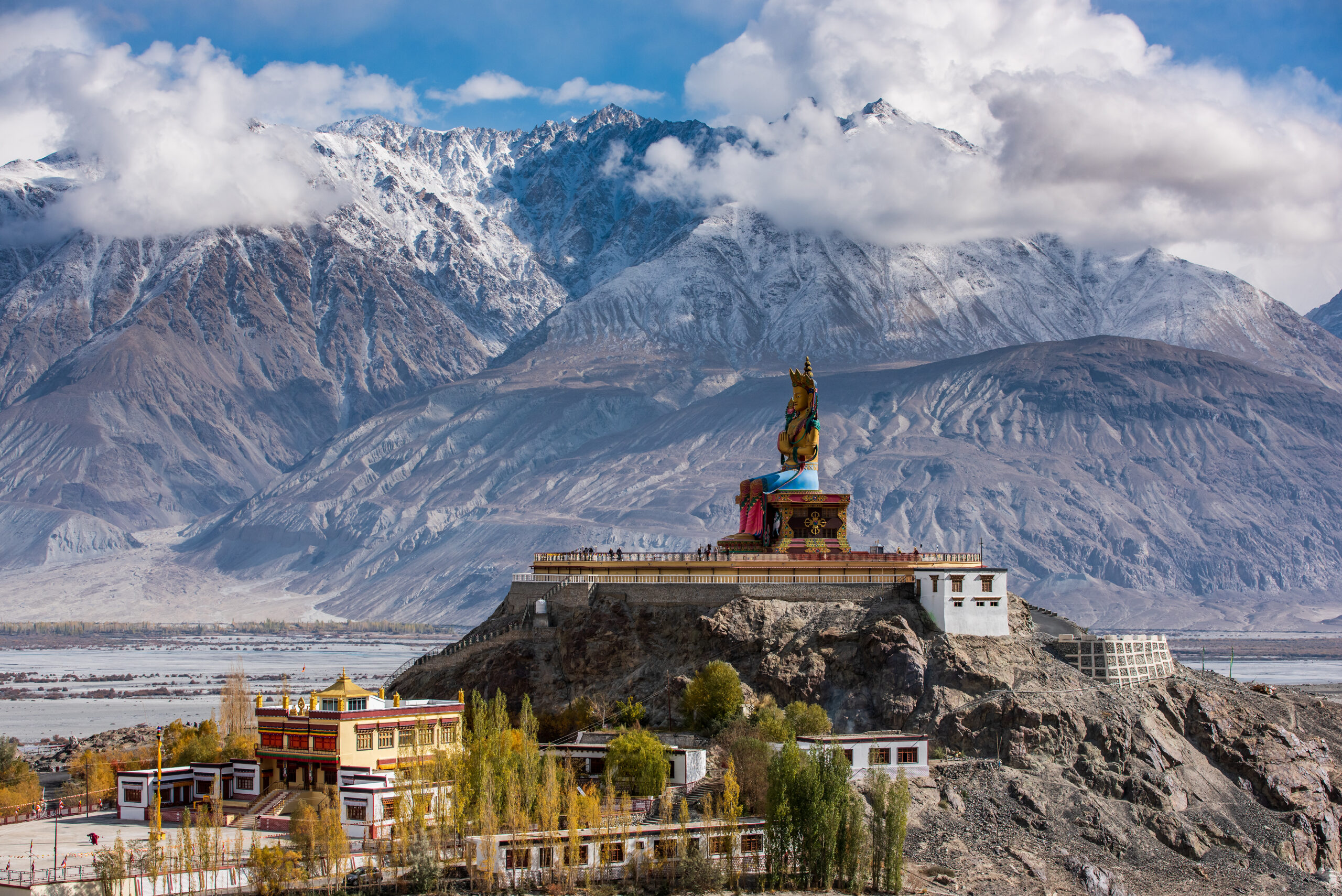
The Indian Himalaya & Ladakh: peaks, permits and how to choose a region
India’s mountains stretch from the granite spires of Garhwal to the high desert giants of Ladakh, and choosing where to climb means understanding both the peaks and the paperwork. This guide is your regional map: the summits of Garhwal, Kumaon, Ladakh, Himachal and Sikkim, the Indian Mountaineering Foundation permit system, the closures that put famous peaks off-limits, the joint-expedition rules near sensitive borders, and the gateway towns that open each range.
What this guide owns, and what lives on the peak pages.
This pillar is your regional navigator: it helps you choose a region, understand the IMF permit system and closures, and grasp the joint-expedition rules that shape access. The detailed route, cost and expedition planning stays on each mountain’s own guide, which we link throughout.
One geography note: the eastern Karakoram (the Saser Muztagh) is administratively part of Ladakh and lives here. The Pakistan and China Karakoram, including K2 and the Gasherbrums, lives in our Karakoram Mountains guide.
Garhwal Himalaya
Uttarakhand’s western ranges: sacred peaks, world-class granite, and serious 7,000m objectives around the Gangotri and Nanda Devi basins.
Nanda Devi
The highest peak entirely within India and the jewel of Garhwal. Its main summit and sanctuary are closed. See the closure-status guide.
Closed since 1983Kamet
The second-highest peak of Garhwal, near the Tibet border above the Niti valley. See the Kamet guide.
Trisul I
A historic 7,000er on the outer Nanda Devi rim. See the Trisul I guide.
Satopanth
The True Path peak above the Gangotri glacier. See the Satopanth guide.
Changabang
The Shining Mountain, a granite prize of the Nanda Devi region. See the Changabang guide.
Meru (Shark’s Fin)
The Anti-Everest big-wall objective, home of the famous Shark’s Fin. See the Meru guide.
Shivling
The Matterhorn of the Himalaya, rising above Tapovan. See the Shivling guide.
Bhagirathi III
A classic Garhwal granite wall above Nandanvan. See the Bhagirathi III guide.
Kumaon Himalaya
Eastern Uttarakhand, reached through Munsiyari, with striking peaks on the far side of the Nanda Devi massif.
Panchchuli II
The highest of the five Pandava Sisters above Munsiyari. See the Panchchuli II guide.
More Kumaon peaks
Additional Kumaon objectives are being added to this pillar as their guides are built.
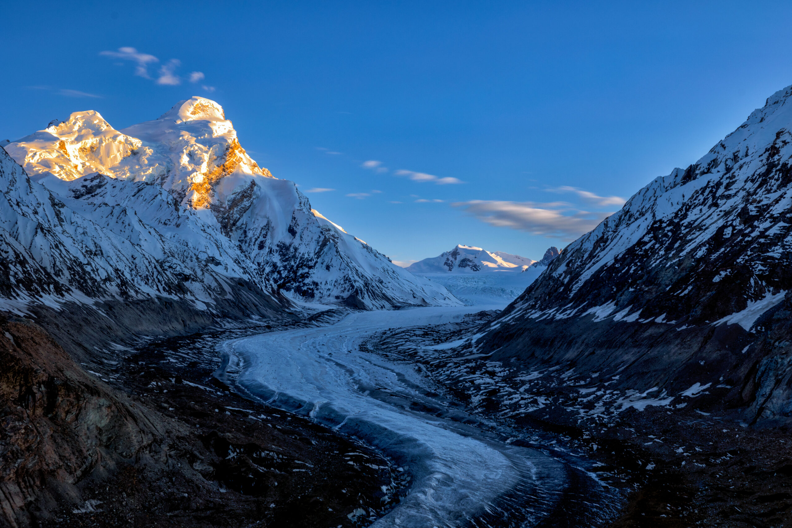
Ladakh & the eastern Karakoram
High-desert peaks reached from Leh, from accessible trekking summits to the restricted giants of the Saser Muztagh.
Saser Kangri I
The high point of the Saser Muztagh in the eastern Karakoram. See the Saser Kangri I guide.
Saser Kangri II East
One of the last great first ascents, climbed in 2011. See the Saser Kangri II East guide.
Nun
The highest peak of the Nun-Kun massif in the Suru valley. See the Nun guide.
Kang Yatse I
The technical summit of the Kang Yatse pair above the Markha valley. See the Kang Yatse I guide.
Kang Yatse II
A popular first 6,000m peak reached from Nimaling. See the Kang Yatse II guide.
Stok Kangri
Once Ladakh’s classic trekking peak, closed for ecological recovery. See the Stok Kangri status guide and what to climb instead.
Currently closedHimachal & Sikkim
Two regions where our coverage is growing: the accessible alpine peaks of Himachal Pradesh and the remote, permit-sensitive summits of Sikkim.
Himachal Pradesh
Reached from Manali, home to popular alpine objectives such as Deo Tibba, Hanuman Tibba and Friendship Peak. Guides are being added to this pillar.
Sikkim
A remote, permit-restricted region on the eastern border below Kangchenjunga. Coverage is being developed.
IMF permits & joint expeditions
Every climb in India runs through one authority and, near the borders, one special rule.
Climbing peaks in India requires a permit from the Indian Mountaineering Foundation (IMF), the national body that issues climbing permission, sets royalty fees that scale with the height of the peak, and assigns a liaison officer to higher expeditions. Environmental fees and, in national-park or protected areas, additional clearances apply. Beyond the standard permit, two things shape access in this region:
Restricted and inner-line areas. Much of Ladakh and the border zones require additional protected-area or inner-line permits on top of the climbing permit, because of their proximity to sensitive frontiers.
Joint expeditions. In militarily sensitive areas such as the eastern Karakoram around the Saser Kangri massif, India does not allow exclusive foreign expeditions. Foreign climbers must climb as part of a joint expedition together with an Indian team, under IMF and Ministry of Home Affairs clearance. This is a major reason peaks like Saser Kangri II East are so hard to reach even when permitted.
Closures to know about
Two of India’s most famous peaks are currently off-limits, and the status of both is worth checking before you plan.
Nanda Devi has been closed to climbers since 1983. The main summit and inner sanctuary were shut for ecological protection, for cultural reasons as a sacred mountain, and in the shadow of a Cold War-era nuclear surveillance device lost on its slopes. Decades of closure allowed the sanctuary’s ecosystem to recover. The IMF and Uttarakhand authorities discussed a controlled reopening in 2025 and 2026, but as of this writing the peak remains closed. Treat any reopening as unconfirmed until the IMF says otherwise.
Stok Kangri, for years Ladakh’s most popular trekking peak because of its easy access from Leh, was closed to protect a fragile environment strained by heavy traffic and local water shortages. Climbers who once used it as a first 6,000m peak now look to alternatives such as Kang Yatse II. Confirm the current status before counting on either peak.
Permit rules, closures, and restricted-area boundaries in the Indian Himalaya shift with policy and the security situation. Confirm the current status of any peak directly with the Indian Mountaineering Foundation or a licensed Indian operator well before committing to an expedition.
Gateways & seasons
Each region has its own gateway town and its own climbing window.
| Region | Gateway | Main season |
|---|---|---|
| Garhwal | Joshimath, Uttarkashi, Gangotri | Pre-monsoon May-June, post-monsoon Sept-Oct |
| Kumaon | Munsiyari | Pre-monsoon May-June, post-monsoon Sept-Oct |
| Ladakh & eastern Karakoram | Leh | Summer, roughly June-September (monsoon rain shadow) |
| Himachal | Manali | Pre-monsoon and post-monsoon; some summer objectives |
| Sikkim | Gangtok | Post-monsoon autumn, permit-dependent |
The broad pattern: Garhwal and Kumaon are climbed around the summer monsoon in spring and autumn, while Ladakh and the eastern Karakoram, sheltered in the monsoon’s rain shadow, hold a summer season. Match your window to the specific peak and always build in buffer days for weather and acclimatisation.
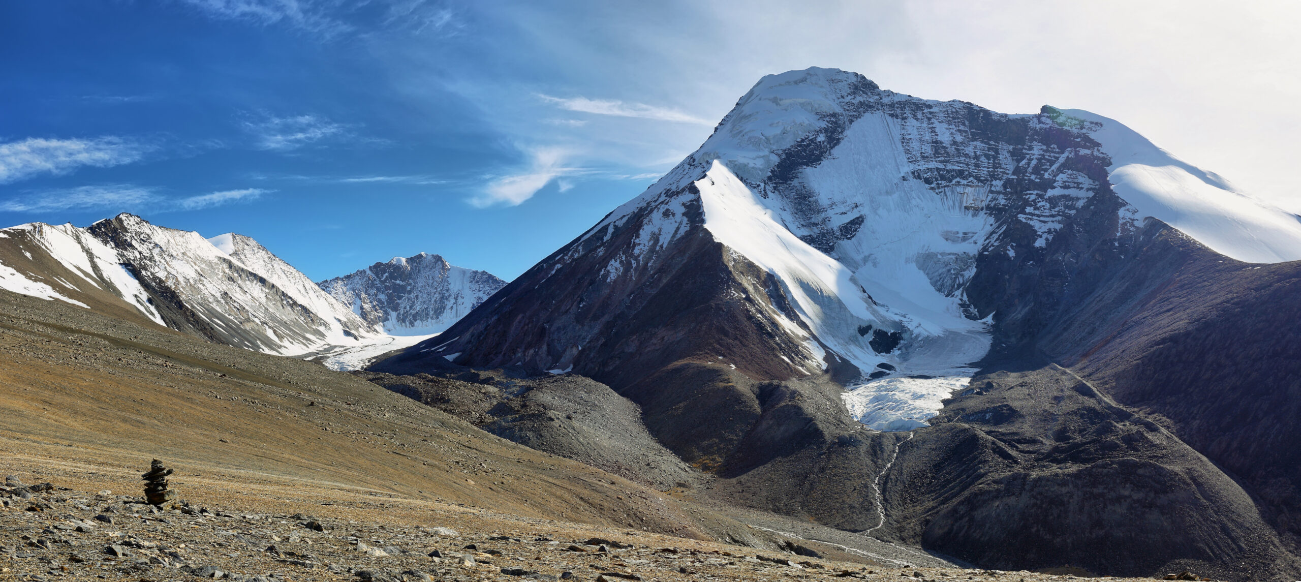
Planning an Indian Himalaya expedition?
Dive into the peak guides for route, cost and season detail, compare technical grades in our difficulty ratings guide, and see how climbers build toward Himalayan objectives in our progression plans. For flights to Delhi or Leh and regional lodging, compare options through the Global Summit Guide Expedia travel shop.
Disclosure: the Expedia link is an affiliate link; we may earn a small commission at no extra cost to you, and it never affects our recommendations.
Saser Kangri I ShivlingIndian Himalaya & Ladakh FAQ
The questions climbers ask most about the region.
What is the highest mountain in the Indian Himalaya?
Kangchenjunga (8,586 m) on the Sikkim-Nepal border is the highest mountain in India, but it is shared with Nepal. The highest peak located entirely within India is Nanda Devi (7,816 m) in the Garhwal Himalaya, whose main summit has been closed to climbing since 1983.
Can you climb Nanda Devi?
Not currently. Its main summit and inner sanctuary have been closed since 1983 for ecological protection, cultural reasons, and the legacy of a lost Cold War nuclear device. The IMF and Uttarakhand authorities discussed a controlled reopening in 2025-2026, but the peak remains closed as of this writing. Confirm the current status with the IMF.
Do you need a permit to climb in the Indian Himalaya?
Yes. Peaks require a permit from the Indian Mountaineering Foundation, with royalty fees scaling by height, a liaison officer on higher mountains, and environmental fees. Restricted and inner-line areas near sensitive borders, such as parts of Ladakh, need additional permits, and some peaks are open to joint expeditions only.
What is a joint expedition in Ladakh?
In militarily sensitive border areas such as the eastern Karakoram around Saser Kangri, India does not allow exclusive foreign expeditions. Foreign climbers must climb as part of a joint expedition with an Indian team, under IMF and Ministry of Home Affairs clearance. This is why peaks like Saser Kangri II East are so hard to access even when permitted.
Which region is best for a first Indian Himalaya peak?
Ladakh’s accessible trekking peaks such as Kang Yatse II are popular because they are reached quickly from Leh and are non-technical, though Stok Kangri, once the classic choice, is currently closed. Garhwal offers everything from the granite of Shivling to serious 7,000m peaks like Kamet. Choose by the technical grade you are ready for and the peak’s permit and closure status.
When is the climbing season?
In Garhwal and Kumaon, pre-monsoon (roughly May-June) and post-monsoon (roughly September-October). Ladakh and the eastern Karakoram sit in the monsoon’s rain shadow, so their season runs through summer, roughly June-September. Match the window to the specific peak and region.
Methodology & sources
- Peak elevations and regional geography from Indian Mountaineering Foundation records and published Himalayan references.
- Permit structure, restricted areas, and joint-expedition rules from IMF and Ministry of Home Affairs practice for the region.
- Closure status for Nanda Devi (closed since 1983, reopening under discussion) and Stok Kangri (closed for ecological recovery) from IMF, Uttarakhand, and Ladakh authority reporting; confirm current status before planning.
- Individual peak guides carry the detailed route, cost, and expedition planning. Safety framing reviewed by Dawson Ludlow.
Published: July 18, 2026 · next review January 2027.
Confidence: High on peak elevations, geography, and the permit framework; Medium on fast-changing closure and reopening status, which should be confirmed with the IMF.Global Summit Guide Editorial Team
This regional guide is maintained by the Global Summit Guide editorial team, which compiles and cross-checks mountain data, geography, and access rules from published records and official authorities. Individual peak guides carry the detailed route, cost, and expedition planning. Safety framing reviewed by Dawson Ludlow.
From sacred granite to high-desert giants
The Indian Himalaya rewards climbers who understand its regions and its rules. Use this guide to choose where to go and to navigate permits and closures, then dive into each peak’s own guide to plan the climb itself.
Browse All Mountains Karakoram GuideWas this helpful?
🏔Related peaks nearby
🧭Explore & compare
Global Summit Guide is an independent mountaineering resource founded in 2026. The team combines first-hand trekking and climbing experience with in-depth research and professional health and nutrition review to help climbers choose objectives, prepare properly, and stay safe.
Health, altitude, and nutrition content is reviewed by Taylor Ludlow (Registered Nurse) and Brigg Hoopes (Nutritionist).
What We Don't Know Yet
Mountain information changes quickly. This box explains the limits of what this page can responsibly promise.
- Permit availability, reservation windows, quotas, and official fee rules may change after this page is updated.
- Visa, passport, vaccination, border, insurance, and local transportation rules may change before your trip.
- Route conditions, snowpack, closures, and weather can change quickly after this page is updated.
- Permit rules, fees, quotas, and reservation windows may change between review cycles.
- Operator availability, pricing, guide ratios, and cancellation terms can change by season.
Verify current conditions with official land managers, guide services, local forecasts, and current route reports before booking or climbing.
Mountaineering, rock and ice climbing, glacier travel, and high-altitude activity are inherently dangerous and can result in serious injury or death. The information on Global Summit Guide is provided for general informational and educational purposes only and is not a substitute for professional instruction, qualified guiding, proper equipment, or your own judgment and experience.
Route conditions, weather, snowpack, permits, regulations, and hazards change constantly and may differ from what is described here. Details may be incomplete, out of date, or contain errors. Always verify current information with local authorities, certified guides, and official sources before making any decision in the mountains.
Nothing on this site is medical, legal, or financial advice. Our fitness, acclimatization, altitude, and nutrition content is general in nature; consult a qualified physician before beginning any strenuous exercise program or exposing yourself to high altitude.
You are solely responsible for your own safety and decisions. To the fullest extent permitted by law, Global Summit Guide and its team accept no liability for any loss, injury, damage, or expense arising from use of, or reliance on, this information. By using this site you acknowledge these risks and accept these terms.
Some links on this site may be affiliate links. If you buy through them we may earn a small commission at no extra cost to you; this never affects our recommendations.
Global Summit Guide recommendation path
Next Best Mountain to Research
Use these recommendations to continue the right planning path instead of stopping on one page.
Use current permit, weather, route, and operator information before booking or climbing.