
Last updated September 12, 2026

Kang Yatse II Climbing Guide: Markha Valley Route & 6,250m Summit
Kang Yatse II is one of Ladakh’s most practical first 6,000-metre objectives: a multi-day Markha Valley approach, Nimaling acclimatization, base-camp snow training and a long summit push on moraine, snow and glacier terrain. It is approachable by Himalayan standards, but 6,250 metres makes altitude—not the technical grade—the defining problem.
Hero image: Ladakh regional context from the Stok Range, not a claim that the photographed peak is Kang Yatse II.

A strong first 6,000m peak—if you already know you can function above 5,000m.
Kang Yatse II is not a trekking summit in the same sense as Kilimanjaro. Current guided programs include snow movement, crampon use, rope systems and a long summit push from roughly 5,100 metres. For a first Himalayan 6,000er, the Markha Valley approach is the better choice because it builds altitude gradually before the summit.
- Best approach: Markha Valley via Skiu/Chilling.
- Best baseline: strong trekker + prior 5,000m experience.
- Main difficulty: altitude plus a long summit day.
- Snow skills: crampons, ice axe and rope travel under guide supervision.
- Main season: July–September; some programs operate June/October.
- Guiding: strongly recommended for a first 6,000m climb.
The 2026 Climb Decision Table
This table replaces the old page’s blanket “non-technical” and universal-permit claims with a decision-ready summary.
| Decision | Current planning answer | What it means for you |
|---|---|---|
| Normal route | Markha Valley → Nimaling → Kang Yatse Base Camp → lower western summit | Use the longer Markha approach for better acclimatization and the full Ladakh experience. |
| Grade / character | Introductory 6,000m snow peak; one current operator publishes Alpine PD | Not steep technical climbing, but still real mountaineering: snow, crampons, rope systems and steeper upper sections. |
| Typical duration | About 10–13 days from Leh | Do not compress the schedule simply because the peak has only one summit camp. |
| Altitude / summit gain | BC ~5,100–5,150m → summit ~6,250m; roughly 1,100–1,150m vertical | The summit-day gain occurs entirely at very high altitude. |
| Key hazard | Altitude + cold/wind + snow/glacier travel + cumulative fatigue | Fitness alone cannot compensate for poor acclimatization or a late turnaround. |
| Main season | July–September is the most consistent current window | June can be snowier; some operators extend into October with colder conditions. |
| Permit / access | Applicable expedition, local and wildlife fees are normally arranged by the operator; PAP/RAP/ILP depends on nationality and itinerary | Do not assume one universal “Inner Line Permit” rule. Get the exact written permit list before paying. |
| Guide need | Strongly recommended for a first 6,000m objective | Current programs are guided and include training, snow movement and rope management. |
| Readiness standard | Strong multi-day trekking fitness; prior experience above 5,000m; comfortable learning/using crampons, axe and rope systems | If 5,000m is already your personal altitude ceiling, build another step first. |
Elevation figures vary.
Current operators publish Kang Yatse II at roughly 6,200–6,250 metres, while historical climbing reports also contain lower figures. This guide uses 6,250 m because it is the common current commercial figure and matches the dominant search intent—not because every source agrees to the metre.
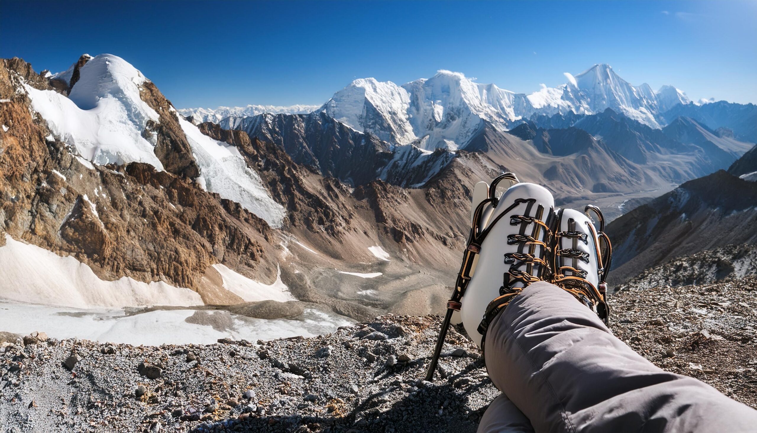
Crampons and Rope Systems Still Belong in the Plan
Kang Yatse II is approachable relative to more technical Himalayan peaks, but the summit day moves from moraine onto snow and high-altitude mountain terrain. Current programs include a base-camp training day because the route is more than a trek.
Global Summit Guide media library · high-altitude gear illustrationMarkha Valley to Nimaling and Base Camp
The route is valuable partly because the trek itself is the acclimatization plan.
Spend at least two nights acclimatizing before hard effort.
Enter Markha Valley and begin gradual trekking gain.
Cultural center of the classic approach.
Move above 4,000m and watch how the body responds.
High pasture below the Kang Yatse massif.
Markha Valley via Skiu / Chilling
Current programs commonly move through Markha and Hankar before reaching Nimaling and base camp. The gradual ascent is the strongest reason to choose this route for a first 6,000-metre objective.
Shang Sumdo via Kongmaru La
The eastern approach crosses the high Kongmaru La and can reach Nimaling faster, but it compresses acclimatization. It makes more sense for climbers who already know they adapt well at altitude.
Why Nimaling matters
Nimaling is not just a scenic camp. Sleeping around 4,750–4,800 metres before moving to base camp around 5,100–5,150 metres gives the body another important adaptation step. Current operator itineraries differ slightly, but the principle is consistent: do not rush directly from Leh to the mountain.
Base Camp to 6,250m: The Mountain Part of the Trip
Expect an overnight start, roughly 1,100 metres of vertical gain and a long descent back to base camp.
Moraine & Scree
Leave camp around midnight and gain elevation in the dark before reaching consistent snow.
Snow / Glacier
Put on crampons and move as a managed rope team where the guide judges it necessary.
Upper Slopes
The last steeper sections, wind and altitude combine when your reserves are already reduced.
Descent
Do not treat the summit as the finish. Warming snow, loose terrain and fatigue remain until base camp.
Non-technical does not mean consequence-free.
Current programs describe the peak as introductory or non-technical because it lacks sustained vertical climbing. That does not remove the risks created by 6,000-metre altitude, cold, snow, rope travel and a 10–12 hour summit day.

For a First 6,000m Peak, Use the Guide as Part of the Skill System
Current Kang Yatse II programs are structured around acclimatization, a training day, guide-led snow movement and a summit ratio that allows closer supervision. The guide is not a substitute for fitness—but should add judgment and rope-system competence where a first-time 6,000m climber needs it most.
Global Summit Guide media library · guided-expedition illustrationBuild the Summit in Leh and the Markha Valley
Altitude strategy is more important to success than squeezing another workout into the final week at home.
First 48 Hours: Slow Down
Arrive around 3,500m, rest, hydrate and keep the first two days deliberately easy. Ladakh’s own tourism guidance warns against strenuous activity immediately after arrival.
Sleep Progressively Higher
Use Markha Valley villages, Hankar/Thachungtse and Nimaling to create multiple nights of gradual adaptation before 5,100m base camp.
Train Without Exhausting Yourself
Use the training/rest day for crampon, axe and rope familiarity, then conserve energy for the overnight summit push.
Prior 5,000m experience is a useful gate.
One current Ladakh operator specifically recommends Kang Yatse II for trekkers with experience above 5,000 metres. That is a sensible readiness threshold: the mountain should introduce you to a 6,000m summit—not introduce you to high altitude for the first time.
What to Verify Before Paying an Operator
Ladakh’s permit framework is more nuanced than the old page’s blanket “Inner Line Permit required” statement.
Get the permit name, issuing authority and fee in writing—not just “all permits included.”
The route crosses protected landscape and current operator packages commonly bundle applicable wildlife and local fees.
PAP/RAP/ILP requirements depend on nationality and whether your itinerary enters a currently notified restricted area.
Ladakh’s PAP/RAP framework was under active administrative review in August 2026, so old blogs can be stale.
A competent operator should be able to explain every permission and show what is included in the quote.
Security, protected-area and wildlife rules can change faster than an evergreen climbing guide.
The safest evergreen wording
Applicable expedition, wildlife and local permissions should be arranged and confirmed before the climb. PAP/RAP/ILP requirements are itinerary- and nationality-specific, so verify the current list with the operator and District Leh rather than assuming one universal permit package.

Bring 6,000m Clothing—Not Just Markha Valley Trekking Gear
The approach may feel like a trek, but the summit night requires warm boots, crampons, harness, headlamp, glacier eyewear, insulated layers and gloves that still work when the temperature and wind are far below the pleasant daytime conditions in the valley.
Global Summit Guide media library · gear illustrationBest Time to Climb Kang Yatse II
July through September is the clearest common denominator across current operators.
Early Window
Some programs operate, but expect more seasonal snow and colder upper-mountain conditions.
Main Season
Established trekking and climbing operations with a strong balance of access and snow conditions.
Core Window
A common published operating period. Weather and snow still control the summit night.
Operator-Dependent
Some Ladakh programs extend later, but colder nights and changing snow conditions require closer verification.
Weather data from Leh is not summit weather.
Use a mountain-specific forecast and your guide’s route report for the summit push. Clear valley weather cannot tell you what the upper snow slopes will feel like at 6,000 metres before sunrise.
Compare Inclusions Before Comparing Price
Current public pricing is inconsistent enough that a universal 2026 “Kang Yatse II costs X” number would be misleading.
Leh + Markha Logistics
Hotel nights, road transfers, village/camp logistics, staff, meals and baggage support may or may not be bundled.
Guide + Group Equipment
Ask whether ropes, tents, technical group gear, summit guide ratio and base-camp training are included.
Gear + Insurance + Travel
International flights, personal technical equipment, evacuation insurance, tips and extra hotel nights are commonly separate.
Use a written quote, not a generic web price.
Ask every operator to separate: permits/fees, guiding ratio, group equipment, personal equipment rental, Markha support, hotel nights, transport, insurance, rescue assumptions and weather-buffer costs. Then compare like with like.

Mount Kun Is a Genuine 7,000m Progression—Not Just a Taller Version
Mount Kun adds multiple high camps, much longer expedition exposure and more technical glacier/ridge systems. Kang Yatse II is useful preparation precisely because it teaches how your body and systems behave above 6,000 metres before you make that jump.
Mount Kun · Global Summit Guide media libraryWhere Kang Yatse II Fits in a Bigger Climbing Path
Think of it as a bridge from high trekking into guided snow-and-glacier mountaineering.
5,000m Trekking
Build multi-day altitude experience, steady pacing and confidence sleeping high.
Kang Yatse II
First 6,000m summit with guided crampon, snow and rope systems.
Kang Yatse I
Stay in Ladakh but add substantially more technical climbing to the project.
Nun / Kun
Move into true 7,000m expedition structure only after the 6,000m systems are established.

Mount Nun Shows How Much the Project Changes Above 7,000m
Nun requires a longer expedition, multiple high camps and stronger technical systems. If Kang Yatse II feels like the limit of your altitude, cold or summit-day reserve, repeat the 6,000m level before moving higher.
Mount Nun · Global Summit Guide media libraryWhat Was Rechecked for This Rebuild
This page intentionally separates current operator practice from old blanket claims. Route character, duration, season, guide ratios and the permit framework were rechecked in September 2026.
Route & expedition sources
What must be rechecked before travel
- Exact peak/expedition authorization for your team.
- Hemis / wildlife and local fees included in the quote.
- PAP/RAP/ILP requirement for your nationality and itinerary.
- Current Markha trail, river crossing and road access.
- Snowline, glacier condition and rope strategy.
- Guide ratio, rescue plan and evacuation insurance wording.
Last verification: September 12, 2026
Ladakh’s PAP/RAP framework was under active administrative review in August 2026. That is why this rebuild avoids repeating the old page’s universal “Inner Line Permit required” statement.
Build the Next Step Around the Skill You Need
Use Kang Yatse II as the regional bridge between high trekking and expedition mountaineering. Then move into the sibling peak or planning guide that answers your next specific question.
Kang Yatse II FAQ
How high is Kang Yatse II?
Current operators commonly publish approximately 6,200–6,250 metres. This guide uses 6,250 m for consistency with common commercial programs and search usage while acknowledging that published figures vary.
Is Kang Yatse II technical?
It is often called non-technical by Himalayan standards, but that shorthand can mislead. Expect moraine, snow, crampons, rope-team movement and steeper upper sections. One active Ladakh operator publishes an Alpine PD reference.
How long does the expedition take?
Most current programs take about 10–13 days from Leh, including acclimatization, the Markha approach, base-camp training, summit day and a buffer.
What is the best season?
July through September is the strongest common current window. Some operators also run June or October departures, with different snow and cold tradeoffs.
Do I need prior altitude experience?
Yes. A strong practical baseline is previous trekking above 5,000 metres plus the fitness for repeated multi-hour days. The mountain should introduce you to 6,000 metres, not to altitude itself.
Is an Inner Line Permit always required?
No universal statement is safe. Ladakh’s PAP/RAP/ILP rules depend on nationality and itinerary. Ask your registered operator and District Leh for the exact current requirements that apply to your team.
Should I climb independently?
For a first 6,000-metre summit, use a qualified guide/operator. Current programs build in snow training and guide-led rope management, and they also simplify permit and base-camp logistics.
Was this helpful?
🏔Related peaks nearby
🧭Explore & compare
Global Summit Guide is an independent mountaineering resource founded in 2026. The team combines first-hand trekking and climbing experience with in-depth research and professional health and nutrition review to help climbers choose objectives, prepare properly, and stay safe.
Health, altitude, and nutrition content is reviewed by Taylor Ludlow (Registered Nurse) and Brigg Hoopes (Nutritionist).
What We Don't Know Yet
Mountain information changes quickly. This box explains the limits of what this page can responsibly promise.
- Route conditions, trailhead access, crevasse exposure, stream crossings, and rescue access may vary from published planning guidance.
- Visa, passport, vaccination, border, insurance, and local transportation rules may change before your trip.
- Route conditions, snowpack, closures, and weather can change quickly after this page is updated.
- Permit rules, fees, quotas, and reservation windows may change between review cycles.
- Operator availability, pricing, guide ratios, and cancellation terms can change by season.
Verify current conditions with official land managers, guide services, local forecasts, and current route reports before booking or climbing.
Mountaineering, rock and ice climbing, glacier travel, and high-altitude activity are inherently dangerous and can result in serious injury or death. The information on Global Summit Guide is provided for general informational and educational purposes only and is not a substitute for professional instruction, qualified guiding, proper equipment, or your own judgment and experience.
Route conditions, weather, snowpack, permits, regulations, and hazards change constantly and may differ from what is described here. Details may be incomplete, out of date, or contain errors. Always verify current information with local authorities, certified guides, and official sources before making any decision in the mountains.
Nothing on this site is medical, legal, or financial advice. Our fitness, acclimatization, altitude, and nutrition content is general in nature; consult a qualified physician before beginning any strenuous exercise program or exposing yourself to high altitude.
You are solely responsible for your own safety and decisions. To the fullest extent permitted by law, Global Summit Guide and its team accept no liability for any loss, injury, damage, or expense arising from use of, or reliance on, this information. By using this site you acknowledge these risks and accept these terms.
Some links on this site may be affiliate links. If you buy through them we may earn a small commission at no extra cost to you; this never affects our recommendations.
Global Summit Guide recommendation path
Next Best Mountain to Research
Use these recommendations to continue the right planning path instead of stopping on one page.
Use current permit, weather, route, and operator information before booking or climbing.
Search Flights, Hotels & Rental Cars
Have the mountain or destination picked? Use Expedia to compare the flights, lodging and rental cars that fit your actual trip dates. For mountain travel, consider arriving early enough for delays and adding a buffer night after the climb before a fixed flight home.
Compare current flight, hotel and car options.
Affiliate disclosure: Global Summit Guide may earn a commission if you book through this link, at no additional cost to you.