Global Summit Guide logo featuring mountain imagery, symbolizing hiking and mountaineering resources for trip planning and safety.

Tag: Aconcagua

  • Aconcagua Normal Route Conditions 2026-2027: Permits, Camps, Weather & What to Expect This Season

    Home · Mountains · Aconcagua · Normal Route Conditions

    Aconcagua Normal Route Conditions 2026-2027: Permits, Camps, Weather & What to Expect This Season

    Everything you need to know about climbing Aconcagua’s Normal Route from Plaza de Mulas in the 2026-2027 austral summer. Permit costs, camp-by-camp status, weather windows, gear requirements, and recent climber reports for South America’s highest peak. Season opens November 1, 2026.

    6,961m
    Summit Elevation
    Nov 1
    2026-2027 Season Opens
    $1,640
    2026-27 Permit (Unassisted)
    14-18
    Expedition Days (Typical)
    2026-2027 Season Opens November 1 · Plaza de Mulas Base Camp 4,260m · Normal Route from Horcones · Aconcagua Full Guide →
    Last updated May 24, 2026 — verified for the 2026-2027 austral summer season opening November 1, 2026

    If you’re planning to climb Aconcagua’s Normal Route this season, you need answers to specific questions. When does the 2026-2027 season open? How much do permits cost now? What’s the status at Plaza de Mulas base camp? Do I need crampons all the way from there, or only on summit day? This page answers those questions for the current season, with information verified against Mendoza Province park advisories, recent climber reports, and 2026-2027 operator updates.

    The 2026-2027 Aconcagua season opens on November 1, 2026 and runs through March 31, 2027. The peak window is mid-December through end of January — that’s when weather is statistically most stable and base camp infrastructure is fully operational. November and late February through March are shoulder periods with cheaper permits but greater weather risk.

    Two key changes affect 2026-2027 climbers. First, permit costs have risen sharply: international climbers pay $1,640 USD unassisted (up from $1,400 in 2024-2025) or $1,170 USD assisted. Second, all major local operators have removed minimum logistics packages — the “minimum mule service” option that climbers used to qualify for the assisted rate has been replaced with a “basic” package that includes 7 days of full board at base camp. Some operators are trialling these new packages for 2026 specifically, so 2027-2028 pricing may shift.

    Aconcagua Normal Route Live Conditions Snapshot

    Here’s the current status as of May 24, 2026, ahead of the November season opening. This snapshot will update through the 2026-2027 season as conditions evolve.

    2026-2027 Season Status — Updated May 24, 2026

    Park & Permits
    Aconcagua Provincial Park opens November 1, 2026. Permit office at Mendoza issues climbing permits. Book by August 2026 for prime December-January dates.
    Opens Nov 1
    Plaza de Mulas Base Camp
    4,260m. Full operational from November 1 through end of February. Operator camps (Inka, Aconcagua Express, Grajales, etc.) establish through October.
    Opens Nov 1
    High Camps
    Camp Canada (5,050m), Nido de Cóndores (5,400m), Plaza Cólera/Berlin (5,950m). All operational during peak season.
    Operational
    Permits (Non-Latin American)
    $1,640 USD unassisted / $1,170 USD assisted on Normal Route. 20-day permit limit. Possible early-bird discount through August 2026.
    Required
    Permits (Latin American)
    $1,050 USD unassisted / $660 USD with local logistics on Normal Route. Mexican through Argentine nationals qualify.
    Required
    Crampons Required
    Summit day from Plaza Cólera and on the Canaleta gully. Early-season climbers may need them on Nido de Cóndores slopes too.
    Required
    Mule Services
    All gear hauled from Horcones to Plaza de Mulas by muleteers. Cost included in operator packages or ~$400 USD independently.
    Active
    Ranger Stations
    Permits signed at Horcones entrance, Confluencia (3,300m), and Plaza de Mulas. Daily check-ins required during expedition.
    Active

    Plan your booking timeline. Permits don’t sell out, but operator packages and high-season base camp infrastructure do. Climbers targeting prime December-January 2026-2027 dates should book operator services by July or August 2026. Last-minute bookings for late February or March are possible but often face limited tent availability at Plaza de Mulas and reduced muleteer support as the season winds down.

    Aconcagua Location & Plaza de Mulas Live Weather

    Aconcagua sits in Mendoza Province, Argentina, in the central Andes about 112 km west of Mendoza city and 15 km east of the Chilean border. The Normal Route starts at Horcones Valley entrance (2,950 m) and reaches the summit at 6,961 m via Plaza de Mulas base camp. Summit coordinates: 32.6532°S, 70.0109°W.

    Plaza de Mulas Temp
    Loading…
    Wind
    Conditions
    Tomorrow

    Live weather data from Open-Meteo at Plaza de Mulas coordinates (4,260m). Summit temperatures at 6,961m typically run 25-30°C colder than base camp. The Viento Blanco — sustained 80-150 km/h winds — is the dominant weather hazard on summit day. Always check MeteoBlue or Mountain-Forecast 24-48 hours before any summit attempt.

    Aconcagua Normal Route At a Glance

    Summit elevation6,961 m (22,841 ft) — South America’s highest peak; one of the Seven Summits
    LocationMendoza Province, Argentina (15 km from Chilean border)
    Coordinates32.6532°S, 70.0109°W
    RouteNormal Route from Horcones Valley via Plaza de Mulas
    Technical gradeF+ to PD (non-technical at altitude; scrambling on scree)
    Base camp (Plaza de Mulas)4,260 m / 13,976 ft
    High campsCamp Canada 5,050m → Nido de Cóndores 5,400m → Plaza Cólera/Berlin 5,950m
    Vertical gain (BC → summit)~2,700 m (8,858 ft)
    Total expedition length14-18 days from Mendoza to summit and back
    2026-2027 season datesNovember 1, 2026 through March 31, 2027
    Peak windowMid-December 2026 through end of January 2027
    ParkAconcagua Provincial Park (Mendoza Province)
    Permits (non-Latin American)$1,640 USD unassisted / $1,170 USD assisted on Normal Route (20-day limit)
    Permits (Latin American)$1,050 USD unassisted / $660 USD with logistics
    Crampons requiredSummit day from Plaza Cólera and the Canaleta gully
    Mule serviceStandard ~$400 USD round trip Horcones to Plaza de Mulas
    2026-2027 guided cost$5,500-$8,500 USD typical (16-21 day program with IFMGA-certified guide)
    Summit success rate~40% historically; varies 30-60% by season and operator
    Children restrictionUnder 14 cannot enter past Quebrada del Durazno (3,100 m); 14-21 needs notarized parental consent
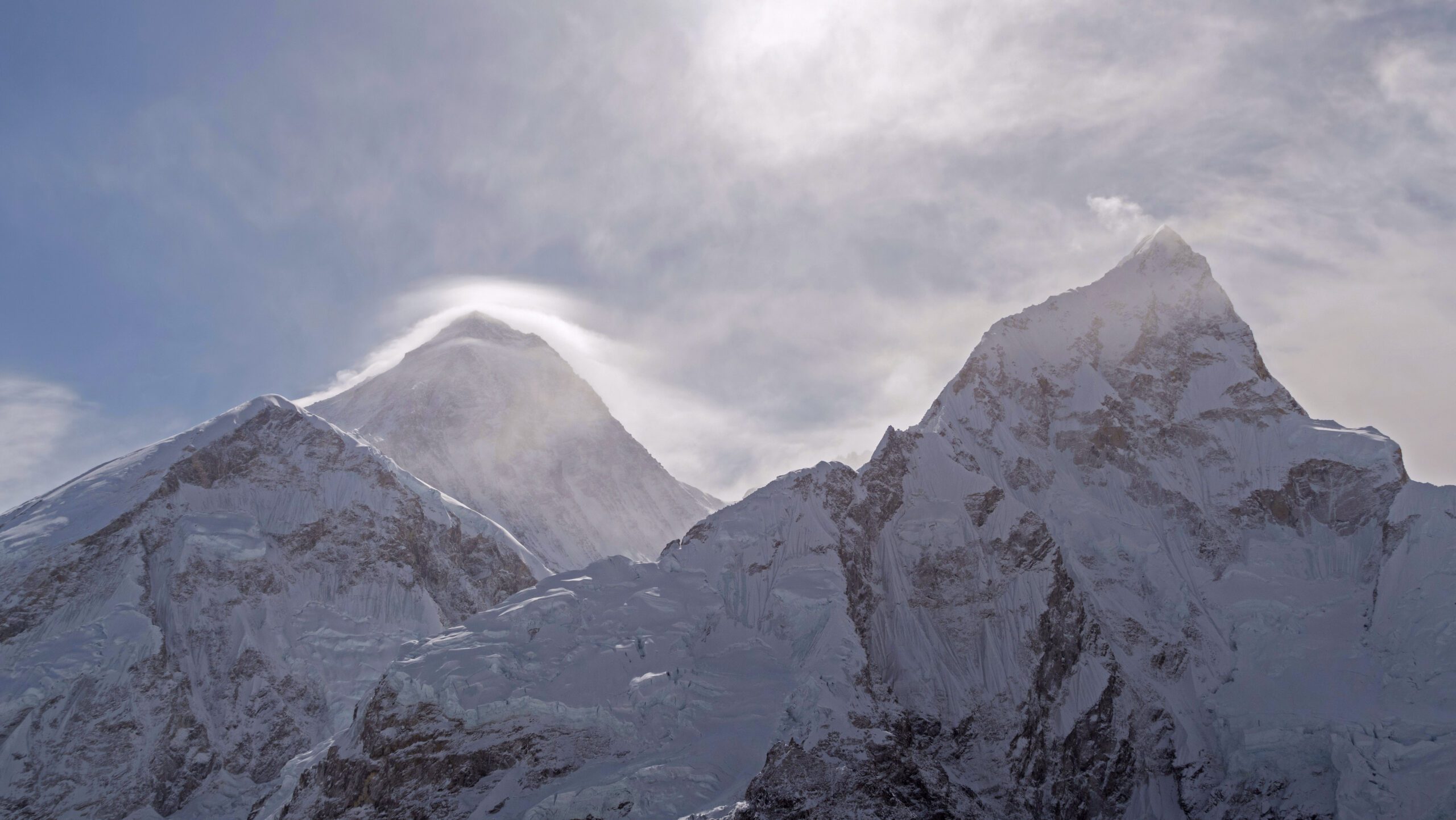
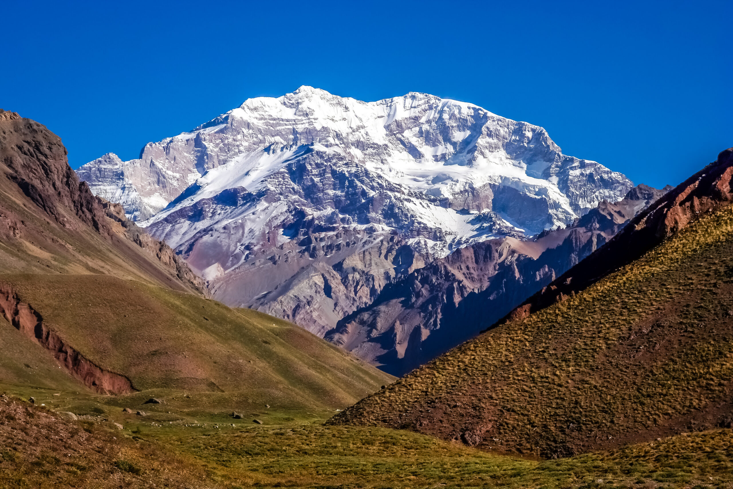
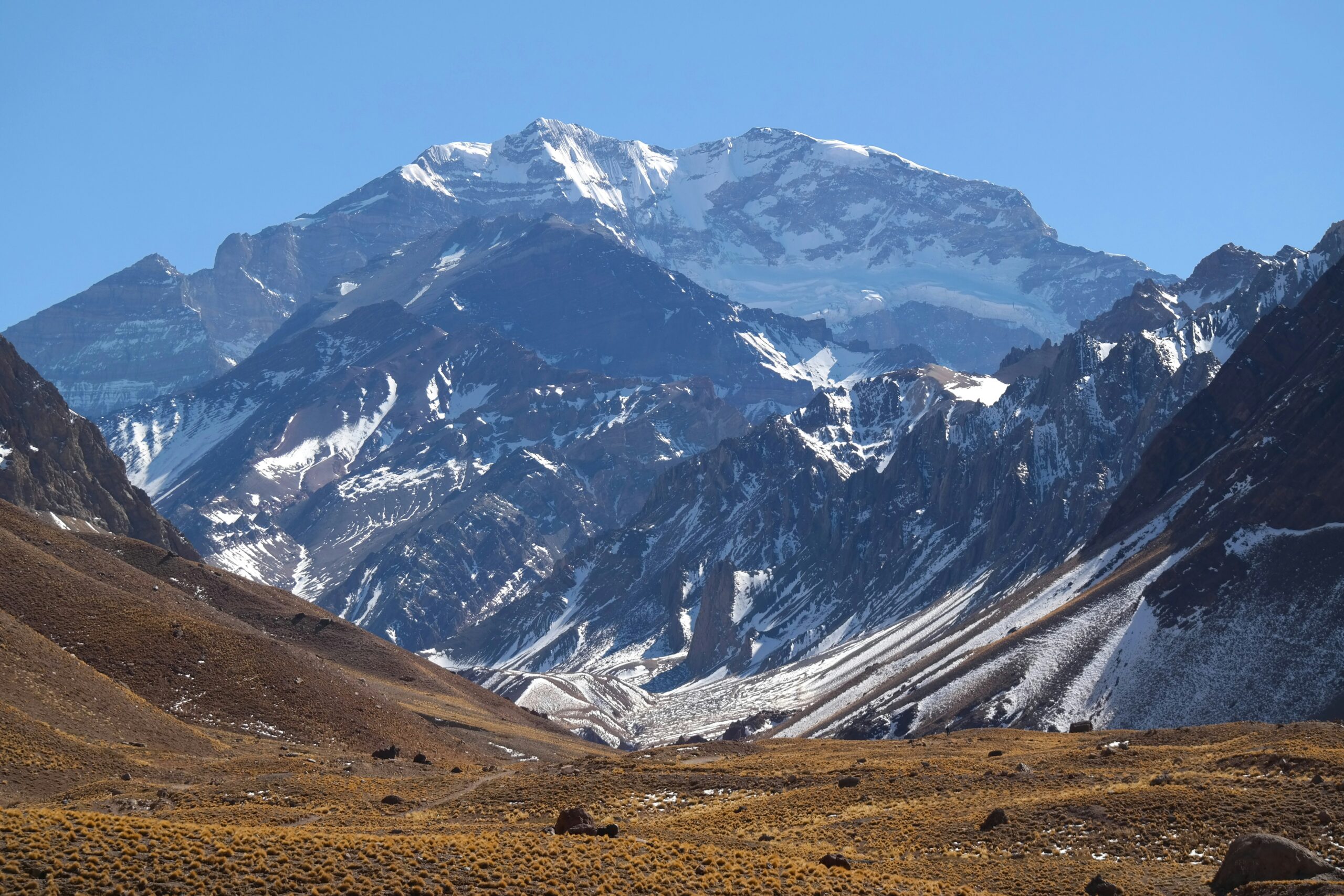
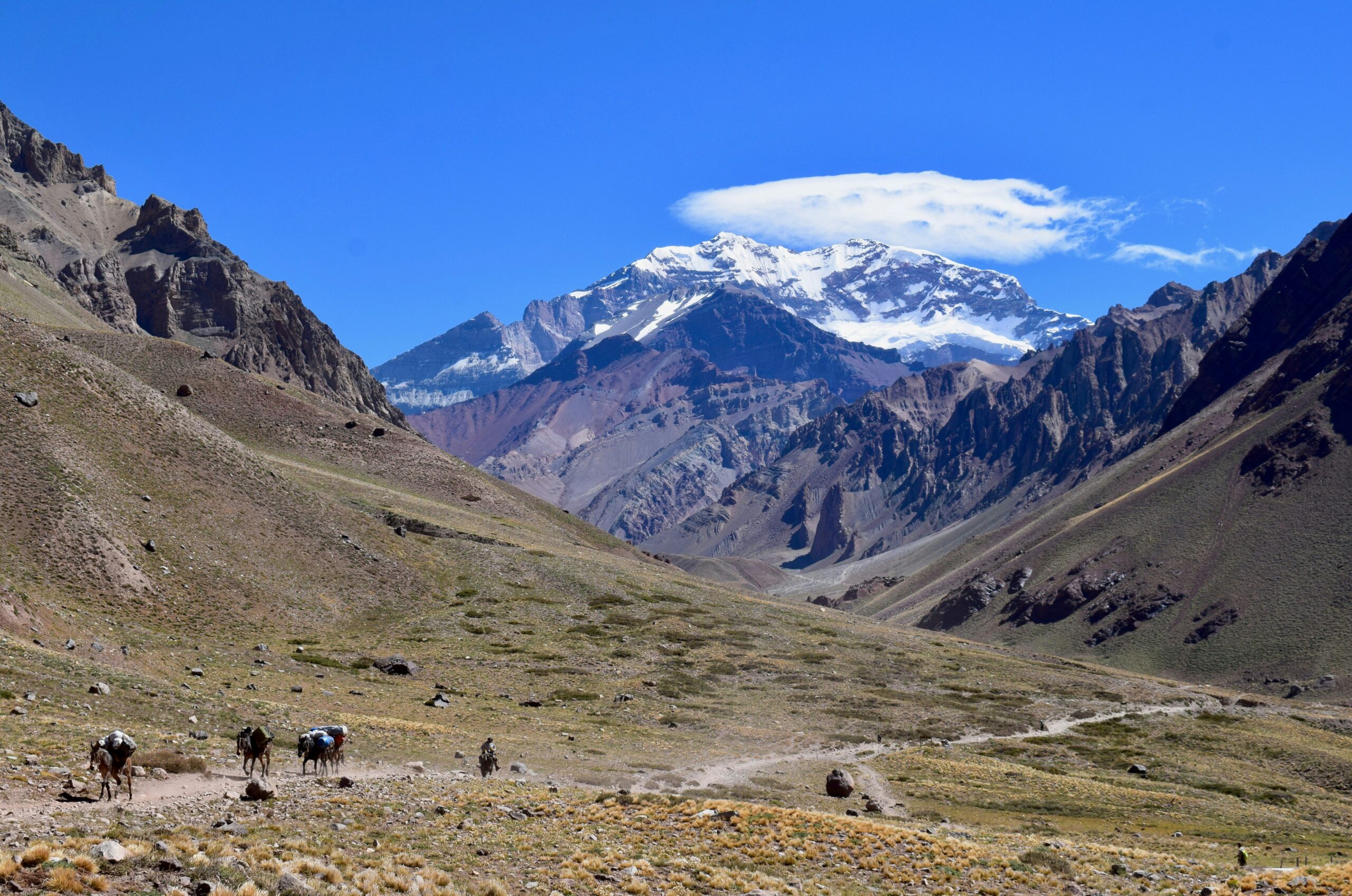
    Aconcagua mountain peak surrounded by rugged terrain and snow-capped summits, illustrating the challenges of high-altitude climbing in the Andes.
    Aconcagua’s Normal Route from Horcones Valley to the 6,961-meter summit. Plaza de Mulas base camp (4,260 m) sits in the foreground, with the route ascending through Camp Canada, Nido de Cóndores, and Plaza Cólera before the final summit push via the Canaleta gully. The 2026-2027 season runs November 1 through March 31.

    2026-2027 Permit Costs & Booking Strategy

    Aconcagua permits have risen sharply for the 2026-2027 season. The Mendoza Province permit office sets prices, and they vary by your nationality, your route, and whether you hire local logistics. Here’s the breakdown.

    Normal Route Permits (Horcones Valley)

    Climber CategoryUnassistedAssisted (with local logistics)Notes
    International (non-Latin American)$1,640 USD$1,170 USDMost common category; 20-day permit limit
    Latin American (Mexican through Argentine)$1,050 USD$660 USDRequires proof of nationality
    Argentine nationalsReduced rate (varies)Reduced rateConfirmed at permit office

    Polish Glacier & 360° Traverse Permits (Vacas Valley)

    Climber CategoryUnassistedAssisted
    International$1,900-$2,000 USD$1,400-$1,600 USD
    Latin American$1,300 USD$820 USD

    How the Assisted Discount Works

    The Mendoza permit office gives you the cheaper “assisted” rate if you hire any local services on the mountain. Historically that meant climbers could buy a basic mule service for ~$300-$400 USD and immediately qualify for the $470 USD permit discount — making the assistance essentially pay for itself.

    For 2026-2027, this calculation has shifted. All major operators (Inka, Aconcagua Express, Grajales, Mendoza Expeditions) have removed the “minimum” logistics packages from their offerings. The new “basic” package with Inka now includes 7 days of full board at Plaza de Mulas plus a few nights of accommodation, running $1,400-$2,000 USD instead of the old $300-$400 mule-only price. The permit discount still applies, but the logistics no longer pays for itself the same way.

    Early-Bird Pricing

    The Mendoza permit office traditionally offers an early-bird rate through end of August for next-season permits. For 2025-2026, the early-bird rate was $980 USD (vs $1,520 main season). For 2026-2027, similar discounts are likely but not yet confirmed. Climbers planning a January 2027 summit should monitor the Mendoza Province park website (mendoza.gov.ar/aconcagua) starting July 2026.

    Permit Validation Requirements

    • Mendoza office: Permit purchase and initial validation at the Mendoza Province park office in Mendoza city
    • Horcones ranger station: Permit signed before park entrance; passport and yellow fever certificate may be checked
    • Confluencia camp (3,300m): Ranger signature required; route plan confirmed
    • Plaza de Mulas (4,260m): Ranger signature required; medical check available; expedition timeline reviewed

    The 20-day permit limit is real. International climbers on the Normal Route have a strict 20-day window inside the park, counted from the day you check in at Horcones. The clock doesn’t stop for weather delays. Plan your buffer days carefully — if your acclimatization runs slow and you push the 20-day limit, rangers can require you to descend before your summit window. Most operator itineraries are designed for 16-18 days inside the park to maintain 2-4 days of weather buffer.

    The Camp Progression: Plaza de Mulas to Summit

    The Normal Route uses a four-camp progression above Plaza de Mulas. Each camp serves a specific acclimatization purpose, and most expeditions use a carry-and-return pattern to move equipment progressively higher while sleeping at lower altitudes. Here’s how the standard sequence works.

    Plaza de Mulas Base Camp (4,260 m)

    Plaza de Mulas is the operational hub for every Normal Route expedition. Operator camps cluster on the moraine, with major outfits running heated mess tents, dining services, basic medical checkpoints, and gear storage. The base camp is genuinely comfortable by mountaineering standards — most climbers spend 4-5 days here for acclimatization between arriving from Confluencia and starting carries to the high camps.

    What to expect: Daytime temperatures of 0-15°C depending on season; nights down to -10°C in early or late season. Strong UV. Limited running water for hygiene. Operator camps serve hot meals and have charging stations. The Plaza de Mulas medical tent operates during peak season and can address altitude-related issues. Cell coverage is generally non-existent; satellite phones and InReach devices are the standard for communication.

    Camp Canada (5,050 m)

    Camp Canada sits roughly 800 meters above Plaza de Mulas on a moraine bench. The route from base camp climbs steady scree slopes for 3-5 hours, with the camp emerging on a small flat plateau just above the first major rise.

    Most expeditions do a carry day to Camp Canada (drop gear, return to Plaza de Mulas to sleep), then move and sleep at Canada the following day or two days later. The camp is bare-bones — your tent only, no operator infrastructure. Temperatures drop notably from Plaza de Mulas, with summit-evening lows of -15 to -20°C even in peak season.

    Nido de Cóndores (5,400 m)

    Nido de Cóndores is the second high camp and a major acclimatization waypoint. The route from Camp Canada climbs through a steep scree section before traversing a broad shoulder to reach the camp at 5,400 m. Time from Canada to Nido is 3-5 hours.

    Some operators use Nido de Cóndores as their primary summit-launching camp, skipping Plaza Cólera entirely. This is a common pattern for groups with limited time inside the 20-day window — summit attempts from Nido add roughly 90 minutes to summit day compared to launching from Plaza Cólera, but eliminate one camp setup. The terrain at Nido is exposed; tents need to be anchored against wind.

    Plaza Cólera / Berlin Camp (5,950 m)

    Plaza Cólera (also called Berlin Camp or Cólera in earlier guidebooks) sits at 5,950 m and serves as the highest camp on the Normal Route. Most expeditions spend 1-2 nights here before summit day. Temperatures at this elevation routinely hit -25 to -30°C overnight, even in peak season.

    The camp area is rocky and exposed, with limited flat ground for tent placement. Wind is the dominant factor — sustained winds of 40-80 km/h are common, and the Viento Blanco (sustained 100-150 km/h) can pin teams down for multiple days. Most climbers use this camp for the final acclimatization push and the launching point for the summit attempt at 4:00-5:00 AM.

    Summit Day from Plaza Cólera

    Summit day from Plaza Cólera typically runs 8-12 hours up and 4-6 hours down. The route ascends the broad south flank of the upper mountain via a series of switchbacks, gaining roughly 1,000 vertical meters to reach the Canaleta — the final 300-meter gully below the summit. Most climbers reach the Canaleta entrance around 11:00 AM if they departed Plaza Cólera by 5:00 AM.

    The Canaleta is the crux of the summit day. The gully holds snow and ice on cold days, requiring crampons and an ice axe for safe ascent. On warmer days, the Canaleta becomes loose scree that climbers describe as “two steps up, one slide back.” Either condition is tiring at 6,800+ meters where every breath delivers less than half the oxygen of sea level. Above the Canaleta, the summit ridge runs north for 100 meters to the summit cross.

    Are Crampons Necessary on the Aconcagua Normal Route Right Now?

    Yes, crampons are required equipment on every Aconcagua Normal Route expedition, regardless of season. The question is when you put them on. Here’s how that breaks down across the 2026-2027 climbing window.

    November 2026 (Season Opening)

    Early-season climbers find more snow on the route than mid-season climbers. Fresh November snow can persist on the slopes between Camp Canada and Nido de Cóndores, requiring crampons earlier on the route than peak-season climbers experience. The Canaleta is typically icy in November mornings, with afternoon sun softening conditions.

    November protocol: Carry crampons from Plaza de Mulas. Put them on at Camp Canada or Nido de Cóndores depending on snow conditions. Use them continuously from Plaza Cólera through the Canaleta and back to high camp. Early-season teams should expect 1-2 extra days of weather delays from late-spring storms.

    December 2026 – January 2027 (Peak Season)

    Peak season offers the most consistent route conditions. Most climbers wear crampons only on summit day from Plaza Cólera, with the rest of the route accessible in approach shoes and trekking poles. The Canaleta is typically a mix of consolidated snow patches and loose scree, with crampons useful for the snow sections and tricky on the scree.

    Peak-season protocol: Crampons on at Plaza Cólera or just above. Stay on through the Canaleta. Remove for the final scree to the summit if the terrain is dry. Most guided parties use this approach.

    February-March 2027 (Late Season)

    Late-season conditions vary year to year. Some seasons see the Canaleta become almost entirely scree by mid-February, with crampons useful only for occasional ice patches. Other seasons see early autumn snow returning by late February, requiring full crampon use from Plaza Cólera again. Watch the Plaza de Mulas radio updates and operator reports for current conditions.

    Late-season protocol: Always carry crampons. Plan to use them above Plaza Cólera. Be prepared for variable conditions on the Canaleta — some teams take crampons off and on multiple times during the summit push as the terrain changes.

    The Canaleta is where things go wrong. Multiple Aconcagua fatalities involve climbers who reached the Canaleta exhausted, in worse weather than the start of summit day, with degrading conditions on the descent. Even if you didn’t need crampons on the ascent, conditions can change before you descend. Always have your crampons, ice axe, and helmet with you on every summit attempt. The Canaleta has a reputation for breaking summit dreams — climbers who turn around here often have made the right call.

    Month-by-Month 2026-2027 Conditions: What to Expect

    MonthConditionsWeather StabilityCrowdsBest/Worst For
    NovemberCold, snowier routeVariable; spring stormsLowBest: cheaper permits, fewer climbers. Worst: weather risk.
    DecemberStabilizing conditionsImprovingBuildingBest: route consolidating, decent weather. Worst: holiday crowding.
    JanuaryPeak season — best routeMost stableMaximumBest: prime weather windows. Worst: crowded camps, queues.
    FebruaryDrier route, more screeDecent; Viento Blanco returnsReducingBest: less crowded. Worst: late-season wind events.
    MarchLate-season; variableRisky; season closingMinimalBest: quiet route. Worst: declining infrastructure, more weather risk.

    November 2026: Season Opening

    November opens cool and unpredictable. Plaza de Mulas operators are still setting up infrastructure during the first two weeks. Weather windows are shorter than mid-season — three to four good days then a storm cycle. Permit costs may include early-bird discounts. Recommended for experienced climbers comfortable with weather flexibility and willing to accept lower summit probability for fewer crowds.

    December 2026: Building Toward Peak

    December sees the route stabilize and crowds begin building. The first two weeks remain quieter; mid-December onwards fills up rapidly. Holiday-season climbers (Christmas and New Year) face maximum operator pricing and peak base camp crowding. The weather typically improves through the month, with January conditions usually starting by Christmas.

    January 2027: Peak Season

    January is the most reliable month for Aconcagua summits. Weather windows open every 3-5 days, base camp infrastructure is fully operational, and most successful expeditions schedule for this window. The trade-off is maximum crowding — Plaza de Mulas can have 100+ climbers at peak, and summit day on a calm-weather day can see 50+ climbers on the upper mountain simultaneously.

    February 2027: Quieter Window

    February brings reduced crowds as the holiday season ends. Weather remains generally favorable through mid-February, then becomes increasingly unpredictable in the final week. Some operators end their fixed-date programs by February 15-20, with later trips becoming custom departures. The Viento Blanco events that struck the 2025-2026 season in early February are a recurring late-season pattern.

    March 2027: Season Closing

    March is the end of the climbing window. Operator camps begin breaking down by mid-March. Park infrastructure reduces. Weather risk increases significantly. Climbers booking March departures should expect a very different experience than peak-season climbers — quieter, colder, with less support infrastructure. The park officially closes March 31, 2027.

    Recent Aconcagua Trip Reports (2025-2026 Season Synthesis)

    The 2025-2026 season ran November 1, 2025 through March 31, 2026. Here’s a synthesis of patterns reported by climbers, operators, and guide services during the season — useful context for 2026-2027 planning.

    Permit Price Shock

    The 2025-2026 season saw the largest single-year permit increase in Aconcagua history. Permits jumped from $800 USD (2024-2025) to $1,520 USD (2025-2026) — nearly doubling. The shock left many climbers scrambling to budget. The 2026-2027 increase to $1,640 USD is less dramatic but continues the upward trend that began with Argentina’s currency reforms in 2023-2024.

    Operator Package Consolidation

    All major operators removed minimum logistics packages during the 2025-2026 season. The “basic mule service for $300” option that climbers historically used to qualify for assisted permit rates disappeared. Inka, Aconcagua Express, Grajales, and Mendoza Expeditions all moved to packages starting around $1,400-$2,000 USD that include full base camp board and accommodation. Some operators told climbers these new packages were “trial pricing for 2025-2026” with the possibility of reverting in 2026-2027. As of May 2026, the consolidated packages remain the standard.

    2025-2026 Weather Patterns

    The 2025-2026 season had relatively stable mid-January weather with several productive summit windows. Many climbers reached the summit during a 5-day high-pressure system from January 16-20, 2026. Early February brought sustained Viento Blanco events that pinned multiple parties at Plaza Cólera for 3-4 days. Late February conditions were variable but reasonable for experienced parties willing to accept weather risk.

    Summit Success Rates

    Operator success rates for the 2025-2026 season averaged 35-50%, in line with historical norms. The major guide services reported the following ranges: Inka Expeditions ~40-45%, Aconcagua Express ~45-50%, Grajales ~35-40%. Independent climbers (no operator) saw lower success rates around 25-35%, reflecting the typically less-experienced solo and small-team profile. The Viento Blanco events in early February affected late-season summit rates significantly.

    Equipment and Logistics Notes from 2025-2026

    • Mule service capacity: Standard 60 kg per climber; additional loads cost extra. Some climbers reported muleteer load limits being enforced more strictly than in previous seasons.
    • Plaza de Mulas medical tent: Operational during peak season but with limited supplies. Climbers with serious altitude issues are typically descended rather than treated on-site.
    • Communication: Garmin InReach devices became the dominant communication method, with operator-provided satellite phones used as backup. No cell coverage above Confluencia.
    • Trash management: Strict pack-out rules enforced. Rangers check trash inventory at Plaza de Mulas before approving descent.
    • Heliport status: Mendoza Province operates a helicopter rescue service from Plaza de Mulas during peak season. Costs ~$8,000-$12,000 USD without insurance coverage.
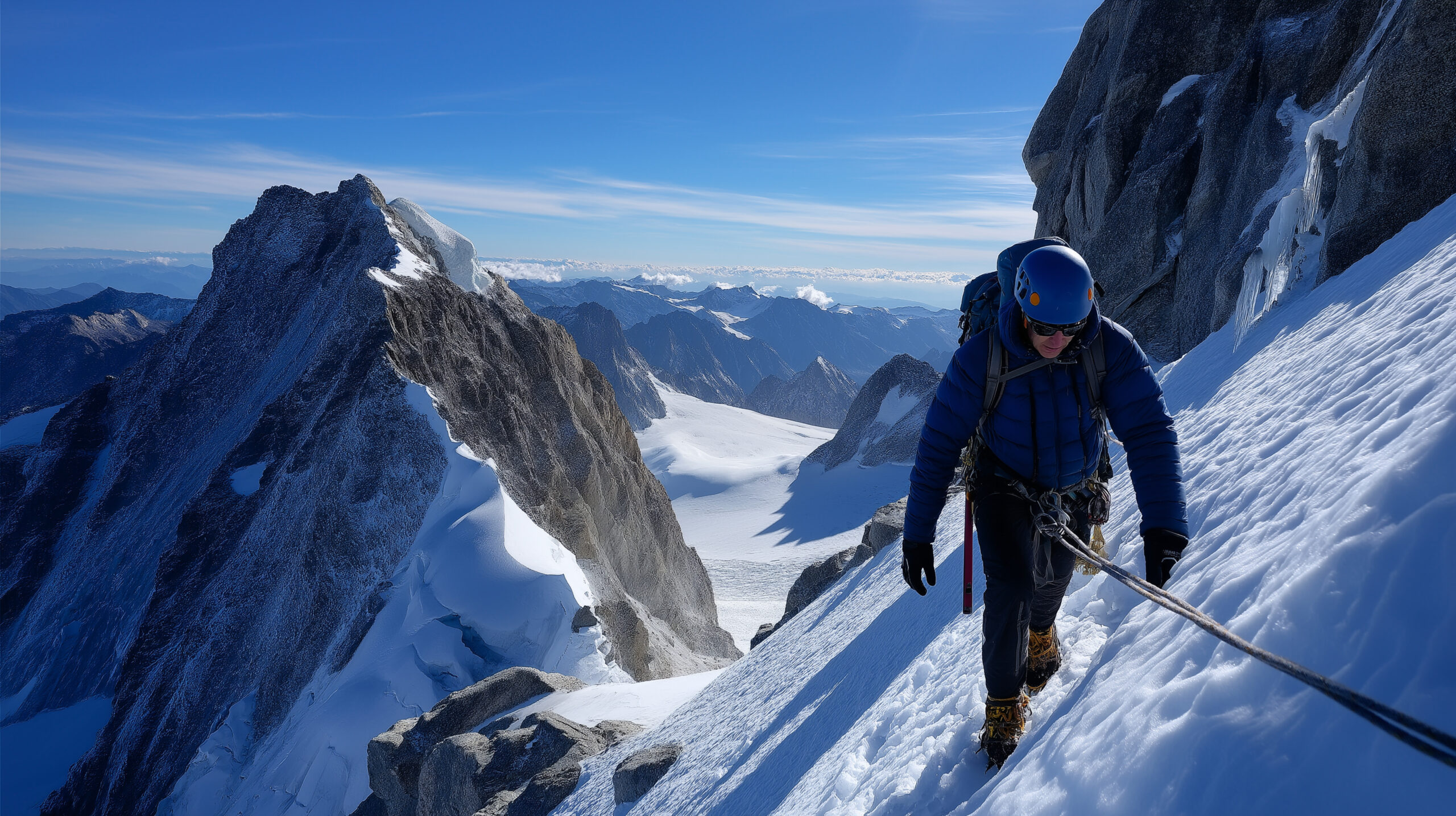
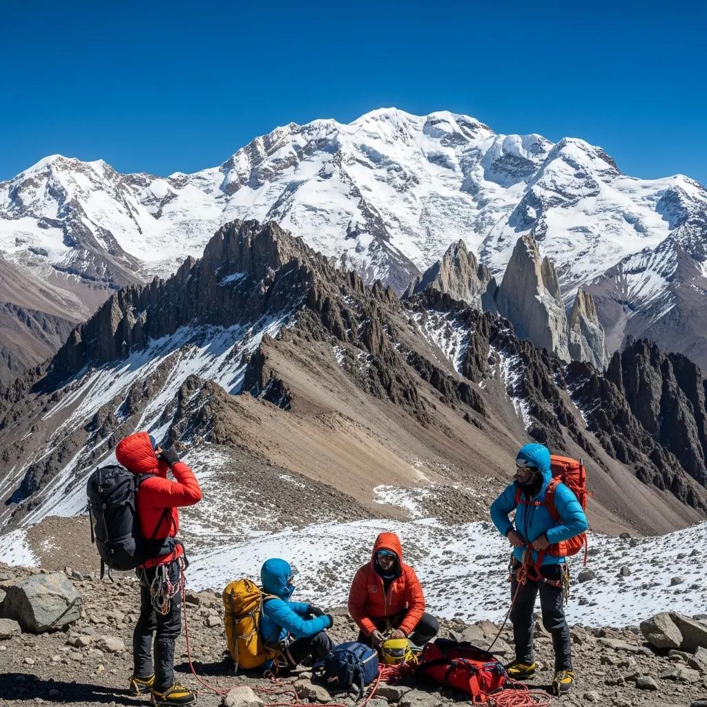
    Aconcagua mountain peak surrounded by rugged terrain and snow-capped summits, illustrating the challenges of high-altitude climbing in the Andes.
    Plaza Cólera (Berlin Camp) at 5,950 meters — the highest camp on Aconcagua’s Normal Route and the launching point for summit day. The 2026-2027 season runs November 1, 2026 through March 31, 2027, with peak weather windows opening December through January. Wind exposure here is severe — sustained 40-80 km/h is typical, with Viento Blanco events reaching 100-150 km/h.

    Required Gear for the 2026-2027 Aconcagua Normal Route

    Aconcagua’s Normal Route is technically non-difficult (F+ grade) but the altitude makes gear matter enormously. Cold, wind, and UV at 6,961 meters punish every weak link in your kit. Here’s the standard 2026-2027 equipment list.

    Footwear

    ItemSpec / ExampleNotes
    Double mountaineering bootsLa Sportiva G2 SM, Scarpa Phantom 6000, Millet Everest SummitB3-rated with built-in gaiter
    Crampons12-point steelSemi-automatic or step-in binding
    Approach shoesTrail runners or light hikersHorcones to Plaza de Mulas trek
    Camp bootiesInsulated down bootiesBase camp and high camps
    Mountaineering socksWool/synthetic blend4-5 pairs for multi-week expedition
    Vapor barrier sock linersRBH Designs or similarRecommended for summit day

    Clothing System

    LayerItemNotes
    BaseTop and bottom (merino or synthetic)2-3 sets
    MidFleeceActive climbing range
    Light insulationSynthetic or down sweaterWorking layer
    Heavy insulationDown parka-20°C rated; high camp + summit day
    Hardshell jacketGore-Tex Pro or equivalentWind + precipitation protection
    Hardshell pantsFull side-zip preferredFor crampon transitions
    Soft shell pantsSchoeller or similarLower mountain + base camp
    Hat + balaclavaWarm hat + balaclavaFrostbite protection
    Sun hat or capLight + breathableUV at altitude severe
    Gloves (3 pairs)Light climbing + insulated + expedition mittensMittens -30°C rated minimum

    Technical Equipment

    ItemSpecNotes
    Ice axe50-60cm general mountaineeringSingle tool sufficient
    HelmetClimbing-ratedRequired on Canaleta
    Climbing harnessAlpine, adjustable leg loopsFor rope work if needed
    Trekking polesAdjustable, 3-sectionEssential for approach + descent
    Belay deviceATC-Guide or similarFor rope work if needed
    Locking carabiners2-3 lockingAnchor + rope work
    Prusik cord6mm × 1-2 lengthsEmergency self-rescue

    Camping & Expedition Equipment

    ItemSpecNotes
    Expedition backpack70-90LCapacity for high camp moves
    4-season tentBombproof for high windUsually provided by operator
    Sleeping bag-20 to -30°C rated800+ fill down preferred
    Sleeping bag linerSilk or syntheticAdds warmth, protects bag
    Sleeping pads (2)Closed-cell foam + inflatable insulatedCritical insulation from cold ground
    Stove + fuelWhite gas (MSR XGK)Provided by operator at base; carried up
    Cooking pots + utensilsGroup equipmentProvided by operator
    Water bottles2-3L total, insulated NalgenesInsulating sleeves required
    Thermos1L vacuum insulatedFor hot drinks at high camp
    Water purificationFilter or tabletsRequired above base camp water
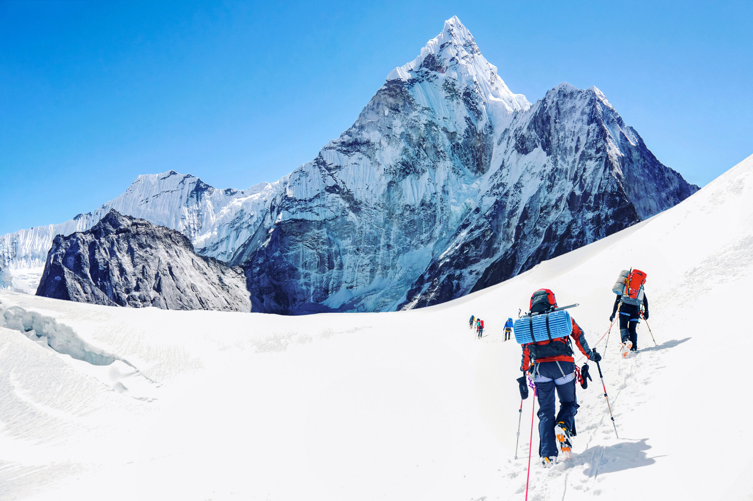
    Aconcagua mountain peak surrounded by rugged terrain and snow-capped summits, illustrating the challenges of high-altitude climbing in the Andes.
    The Canaleta — the 300-meter gully below Aconcagua’s summit and the crux of the Normal Route. Crampons are required here when the gully holds snow and ice; on warmer days the terrain becomes loose scree that climbers describe as “two steps up, one slide back.” Either condition is exhausting at 6,800+ meters, where every breath delivers less than half the oxygen of sea level.

    Personal Items & Safety

    ItemSpecNotes
    Headlamp + spare batteriesLithium for coldEssential for 4:00-5:00 AM summit start
    Sunscreen + lip balmSPF 50+ with SPF lip balmUV burns fast at altitude
    Glacier glasses (Cat 4)+ backup pairEssential snow glare protection
    First aid kitBlister care, ibuprofen, electrolytes, AMS medsCustomize to team needs
    Diamox / acetazolamide250mg twice daily typicalDiscuss with doctor; common preventive
    Satellite communicatorGarmin InReach or sat phoneNo cell above Confluencia
    Passport + visaValid Argentine entry stampRequired at park entrance
    Travel insuranceHelicopter evacuation coverageRequired by most operators
    CashUSD and Argentine pesosTips, snacks, emergencies

    2026-2027 Booking Strategy

    Aconcagua doesn’t require advance reservations the way Denali or Vinson Massif do, but operator capacity and prime dates fill rapidly. Here’s the practical booking timeline for 2026-2027.

    July-August 2026: Early-Bird Window

    This is the optimal window to book. Major operators publish 2026-2027 departures by mid-2026 with early-bird incentives. Some offer 20-30% discounts on permits when booked through their packages before August. Andes Specialists, Inka Expeditions, Aconcagua Express, and major international operators (Adventure Consultants, Alpine Ascents, Mountain Madness) typically have full 2026-2027 schedules published by July 2026.

    September-October 2026: Standard Booking

    By September 2026, prime mid-January dates are largely booked. Climbers booking in this window typically find availability in early December or late February. Operator pricing is at standard 2026-2027 rates with no early-bird discounts. Equipment rental shops in Mendoza begin accepting reservations for crampons, expedition tents, and other gear.

    November 2026: Last-Minute Bookings

    The season opens November 1, 2026. Climbers booking after this date face limited operator availability. Some last-minute spots open as cancellations occur, particularly 2-3 weeks before climb dates. Independent climbers without operator services can secure permits and arrange mule services in Mendoza, but should expect longer lead times and reduced flexibility.

    December 2026 – January 2027: In-Season Bookings

    Booking during peak season is possible but increasingly difficult. Operator camps at Plaza de Mulas are at capacity, and last-minute climbers may need to camp on the moraine outside the operator zones. This is not recommended for first-time Aconcagua climbers.

    Frequently Asked Questions About Aconcagua Normal Route Conditions

    When does the Aconcagua 2026-2027 season open?

    The Aconcagua climbing season opens on November 1, 2026 and runs through March 31, 2027. Mendoza Province’s Aconcagua Provincial Park enforces these dates for permits and ranger station access. The peak window is mid-December 2026 through end of January 2027, when weather is statistically most stable. November and late February through March are shoulder periods with cheaper permits but greater weather risk.

    How much do Aconcagua permits cost for the 2026-2027 season?

    International climbers (non-Latin Americans) pay $1,640 USD unassisted or $1,170 USD assisted on the Normal Route from Horcones Valley. Latin American climbers pay $1,050 USD unassisted from Horcones or $660 USD with local logistics. Polish Glacier and 360-degree Traverse routes from Vacas Valley cost more: $1,640 to $2,000 USD depending on assistance level. Early-bird permit discounts may be available through August 2026, with prices potentially dropping to $1,200 range.

    What is the route from Plaza de Mulas to the Aconcagua summit?

    The Normal Route from Plaza de Mulas Base Camp (4,260 m) ascends through four progressively higher camps to the 6,961-meter summit. The standard camp sequence runs Camp Canada (5,050 m), then Nido de Cóndores (5,400 m), then Plaza Cólera also called Berlin Camp (5,950 m), and finally summit day. Total vertical gain from Plaza de Mulas to summit is approximately 2,700 meters. Most expeditions take 14-18 days from Mendoza to summit and back.

    Do I need crampons on the Aconcagua Normal Route?

    Yes, crampons are required for summit day and on the Canaleta gully at high altitude. The standard transition point is at Plaza Cólera (5,950 m) or just above, where the terrain becomes scree mixed with snow patches. The Canaleta — the final 300-meter gully below the summit — is consistently icy on cold days and requires crampons and an ice axe for safe ascent. Early-season climbers (November to mid-December) often need crampons earlier on the route due to fresh snow.

    What weather should I expect on Aconcagua in 2026-2027?

    December and January represent peak conditions, with Plaza de Mulas daytime temperatures of 10-15°C and summit-day temperatures averaging -20 to -30°C with wind. The Viento Blanco — the white wind — is the dominant weather hazard. Sustained winds above 80 km/h on summit day are common in late November and again in February. Most successful summit attempts occur in calm weather windows that open every 4-7 days. Plan for 2-3 days of weather buffer at high camp.

    How long does it take to climb Aconcagua?

    A standard guided Aconcagua expedition runs 16-21 days door-to-door from Mendoza. The breakdown is approximately: 1-2 days in Mendoza for permit processing and gear prep, 3-4 days trek to Plaza de Mulas via Confluencia, 4-5 days at Plaza de Mulas for acclimatization, 4-6 days moving through high camps with carry-and-return cycles, 1 summit day with weather buffer, then 2-3 days descent to Horcones. Total expedition days inside the park typically run 16-19 days. Independent climbers sometimes complete the round trip in 12-14 days; rapid-ascent specialists can do it in 7-10 days with significant altitude risk.

    What is the Aconcagua summit success rate?

    Historical Aconcagua summit success rates average around 40%, with significant variation by operator and season. Top operators with strong itineraries and IFMGA-certified guides see rates of 50-60%. Less-experienced operators run 25-35%. Independent climbers without operator support typically see 25-35% success. The Normal Route is statistically the easiest route on Aconcagua, but the combination of altitude, cold, and Viento Blanco wind events explains why so many strong climbers don’t summit. Weather is the dominant variable — climbers who get a good summit window during their 20-day permit usually succeed.

    How much does a guided Aconcagua expedition cost in 2026-2027?

    Guided Aconcagua expeditions in 2026-2027 typically cost $5,500-$8,500 USD for the standard 16-21 day Normal Route program. Andes Specialists lists $6,750 USD for their 17-day Normal Route trip. International operators like Adventure Consultants or Alpine Ascents charge $8,000-$11,000 USD with IFMGA-certified guides. Local Mendoza-based operators offer trips from $4,500-$6,000 USD. Total trip budget including international flights to Mendoza, gear, tips, and insurance typically runs $7,500-$13,000 USD.

    What is the Viento Blanco?

    The Viento Blanco — Spanish for “white wind” — is the dominant weather hazard on Aconcagua. It’s a sustained high-altitude wind event that can last 2-7 days, with wind speeds reaching 100-150 km/h at Plaza Cólera and higher on summit day. The wind picks up loose snow and creates whiteout conditions that make summit attempts impossible. Multiple Aconcagua fatalities involve climbers attempting summit pushes during Viento Blanco events. Standard procedure is to wait it out at Plaza Cólera or descend to Plaza de Mulas. Pre-trip weather forecasting (MeteoBlue, Mountain-Forecast) is essential.

    Can I climb Aconcagua independently without a guide?

    Yes, Aconcagua’s Normal Route is one of the most popular peaks in the world for independent climbing. The Mendoza Province permit system allows unassisted climbing. Independent climbers need to handle their own permit purchase, mule service contracts (~$400 USD round trip), base camp logistics, and route navigation. Success rates for independent climbers run lower than for guided parties — typically 25-35% vs 45-60% for guided trips — reflecting the higher experience requirement. First-time 6,000m climbers should strongly consider hiring a guide service, at minimum for the high-camp progression. Experienced 6,000m climbers can usually self-organize successfully.

    Aconcagua Planning Resources

    Sources & Further Reading

    • Mendoza Province Aconcagua Provincial Park — official permit office and 2026-2027 season information
    • Inka Expediciones — 2026-2027 operator packages and current Plaza de Mulas conditions
    • Aconcagua Express — base camp and high camp operations for 2026-2027
    • Grajales Expediciones — Mendoza-based operator with 2026-2027 trip schedules
    • Andes Specialists — 2026-2027 Normal Route program ($6,750 USD) and itinerary
    • Adventure Consultants — international operator with 2026-2027 Aconcagua program
    • SummitClimb — 2026-2027 Normal Route expedition planning and cost analysis
    • Andesport Aconcagua Expeditions — official permit pricing reference
    • Ian Taylor Trekking — Aconcagua season analysis and 2026 climbing observations
    • ExplorersWeb — 2024-2025 and 2025-2026 season opening coverage
    • Brooke Beyond — independent climbing trip report and 2026-2027 permit pricing research
    • MeteoBlue, Mountain-Forecast — Aconcagua summit weather forecasting
    • Wikipedia — Aconcagua (route descriptions, elevation references, first ascent history)

    Last updated: May 24, 2026. Next scheduled update: October 31, 2026 (pre-season verification before November 1 opening).

    Planning a 2026-2027 Aconcagua Expedition?

    For the complete Aconcagua climbing guide including training plans, permit details, route comparisons, and operator selection, see our pillar guide.

    Read the Full Aconcagua Guide →

    Was this helpful?

    Yes
    No
    Thanks for your feedback!
  • The greatest peaks of the Andes: a climber’s ranking of the 10 most iconic South American mountains

    Mountain Lists / Andes / South America

    The greatest peaks of the Andes: a climber’s ranking of the 10 most iconic South American mountains

    6,961 m
    Aconcagua (highest)
    7,000 km
    Range length
    7
    Countries
    50+
    Peaks above 6,000m
    Part of the Andes peaks series This ranking supports our Andes high altitude giants master collection and connects all major South American climbing destinations. Master guide →

    The Andes are the longest continental mountain range in the world — 7,000 kilometers running the entire western edge of South America from Venezuela to Tierra del Fuego. The range contains over 50 peaks above 6,000 meters, dramatic Patagonian granite spires that define modern alpinism, perfectly conical volcanoes rising from the equator, and the highest mountain in the Americas. Picking the “greatest” Andean peaks isn’t straightforward — Aconcagua wins on height, Cerro Torre on technical difficulty, Alpamayo on aesthetics, Chimborazo on the curious title of “point farthest from Earth’s center.” This ranking covers the 10 mountains that consistently appear on serious climbers’ Andes lifetime lists, with honest assessment of why each one matters. For broader context see our Andes high altitude giants master collection.

    The geography of the Andes where the major peaks are

    Unlike the relatively compact Himalaya or the Alps, the Andes stretch across an enormous north-south distance with dramatically different mountain character in each region. Understanding the regional structure is essential to understanding the range:

    • Venezuela & Colombia (Northern Andes): lower elevation peaks topping out around 5,700m, dominated by Pico Cristóbal Colón (5,775m).
    • Ecuador (Equatorial Andes): dramatic volcanic peaks rising from the equator — Chimborazo (6,263m), Cotopaxi (5,897m), and a chain of accessible 5,000-meter cones.
    • Peru (Cordillera Blanca + Cordillera Vilcanota): some of the most aesthetic mountains in the Americas including Huascarán, Alpamayo, Artesonraju, and Pisco. Peru contains the highest concentration of beautiful 6,000-meter peaks.
    • Bolivia (Cordillera Real): high-altitude peaks rising directly from the Altiplano. Illimani, Huayna Potosí, and Sajama dominate this region.
    • Argentina & Chile (Central Andes): the absolute highest Andean peaks. Aconcagua, Ojos del Salado, Pissis, Mercedario — the giants over 6,500m.
    • Patagonia (Southern Andes): dramatically lower in elevation (peaks topping at 3,400m) but containing the most technically demanding alpine climbing in the world — Cerro Torre, Fitz Roy, the entire Torres del Paine massif.
    The Andes structure that surprises most climbers

    The Andes is two completely different mountain ranges joined by latitude. The northern and central Andes contain the highest peaks in the Americas — 30+ summits above 6,000 meters with non-technical to moderately technical climbing on standard routes. The southern Andes (Patagonia) contains some of the world’s most technically demanding mountains despite reaching only 3,400 meters. A climber’s experience in the Cordillera Real of Bolivia is fundamentally different from a climber’s experience on Cerro Torre. They’re the same range but different worlds.

    The crown peak South America’s highest

    1

    Aconcagua

    Argentina · Mendoza Province · Seven Summits · Normal Route non-technical · 18-22 days
    6,961 m

    Aconcagua is the highest peak in the Andes, the highest mountain in the Americas, and one of the most-attempted Seven Summits objectives. The mountain sits in Mendoza Province in western Argentina near the Chilean border. Approximately 7,000 climbers attempt the summit each year via two main routes — the non-technical Normal Route through the Horcones Valley and the more technical Polish Glacier Traverse via the eastern Vacas Valley.

    Aconcagua is unique among the world’s major peaks for being a 6,961-meter summit that can be climbed without technical skills on its standard route. This accessibility makes it the natural progression peak for climbers building toward Denali, Himalayan trekking peaks, or eight-thousanders. Summit success rates average around 40-50% — driven mostly by weather and acclimatization rather than technical difficulty. The full Aconcagua framework is in our Aconcagua climb guide, with route detail in our Normal Route vs Polish Traverse comparison, weather in our best time to climb Aconcagua guide, costs in our Aconcagua cost breakdown, and operator framework in our Aconcagua operators guide. For peak-vs-peak context, see our Aconcagua vs Denali comparison.

    Iconic Andean peaks recognized worldwide

    2

    Huascarán

    Peru · Cordillera Blanca · Glaciated climbing · 7-10 days
    6,768 m

    Huascarán is the highest peak in Peru and one of the most prominent mountains in the Andes. The peak has two summits — Huascarán Sur (6,768m, the higher) and Huascarán Norte (6,654m) — separated by a saddle. The mountain dominates the city of Huaraz and the surrounding Cordillera Blanca, the most aesthetically dramatic mountain range in the Andes. The Cordillera Blanca contains approximately 30 peaks above 6,000 meters concentrated in a relatively small area.

    Huascarán’s standard Garganta route involves significant glacier travel with serious crevasse hazard. The mountain is also famous for tragedy — the 1970 Ancash earthquake triggered a massive landslide from Huascarán that buried the town of Yungay and killed approximately 22,000 people. The mountain remains heavily climbed despite its tragic history. The Cordillera Blanca contains other classic objectives including Pisco (5,752m, an accessible introduction to Andean climbing) and Artesonraju (6,025m, the inspiration for the Paramount Pictures logo).

    3

    Chimborazo

    Ecuador · Cordillera Occidental · Glaciated climbing · 5-7 days
    6,263 m

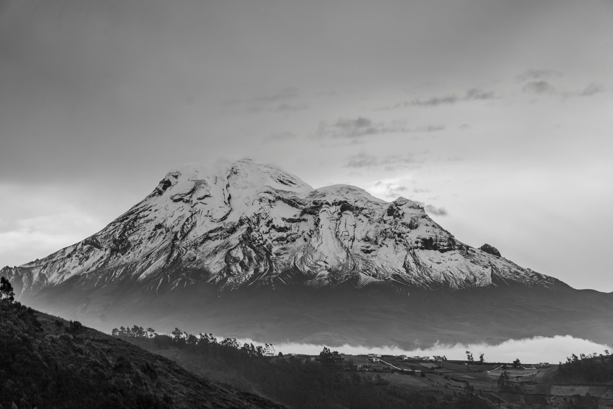
    Chimborazo is the highest peak in Ecuador and holds the curious distinction of being the point on Earth’s surface farthest from the planet’s center. Earth bulges at the equator due to rotation, and Chimborazo sits 1° south of the equator. Despite Everest being 2,500 meters taller in elevation above sea level, Chimborazo’s summit is approximately 2.1 kilometers farther from Earth’s center than Everest’s summit.

    The mountain is a dormant stratovolcano with permanent glaciers. The standard Whymper Route involves glacier travel from the Whymper Refuge with crampons, ice axe, and rope team protocols. Chimborazo is often climbed as part of an Ecuador progression that includes Cotopaxi (5,897m) and other accessible volcanoes — see our what to climb before Cotopaxi guide for the progression framework. Ecuador offers some of the best value high-altitude mountaineering in the Americas due to favorable costs and easy access from Quito.

    4

    Alpamayo

    Peru · Cordillera Blanca · Technical ice climb · 7-10 days
    5,947 m

    Alpamayo has been widely called “the most beautiful mountain in the world” — a designation it received from the German Alpine Club expedition in 1966 and that has stuck ever since. The peak is a perfect pyramid of fluted ice on its southwest face, photographed from the Santa Cruz valley below. The mountain is a serious technical climbing objective rather than a hiking peak — the standard French Direct route ascends the fluted ice at angles up to 60 degrees, requiring two ice tools, full alpine technique, and several days of fixed-rope progress.

    Despite its modest elevation by Andean standards (5,947m places it well below the giants of Argentina), Alpamayo represents the highest concentration of aesthetic alpine climbing in the Americas. The peak appears on virtually every list of “world’s most beautiful mountains” and is the dream objective for many alpine climbers. Most parties spend 7-10 days on the climb including approach, acclimatization, and weather buffers.

    The technical icons Patagonia’s granite spires

    5

    Cerro Torre

    Argentina/Chile (Patagonia) · Los Glaciares National Park · Expert technical · Highly weather-dependent
    3,128 m

    Cerro Torre is one of the most difficult mountains to climb in the world despite its modest elevation. The peak is a vertical granite spire capped with massive ice mushrooms (rime ice formed by Patagonia’s brutal westerly winds) rising from the southern Patagonian ice field. The mountain was first climbed in 1974 by an Italian team — though the first ascent claim by Cesare Maestri in 1959 remains one of mountaineering’s most contested controversies.

    Cerro Torre’s difficulty comes from three combined factors: technical climbing on the granite walls, the unpredictable ice mushrooms at the summit, and Patagonia’s notorious weather. Successful summit attempts depend almost entirely on rare weather windows that may open for only 24-48 hours at a time. Modern climbers typically spend 3-6 weeks in El Chaltén waiting for conditions. The peak is the dream of expert alpinists worldwide and represents the cutting edge of technical mountaineering in the Americas.

    6

    Fitz Roy (Cerro Chaltén)

    Argentina/Chile (Patagonia) · Los Glaciares National Park · Expert technical · Weather-dependent
    3,405 m

    Fitz Roy is the more famous neighbor of Cerro Torre and arguably the most photographed mountain in Patagonia. The peak is a massive granite tower rising 2,000 meters from the surrounding ice fields, with the Cerro Torre group visible across the valley. Fitz Roy is technically slightly easier than Cerro Torre but still requires expert alpine climbing skills including big-wall granite climbing and complex weather management.

    The Fitz Roy area centered on El Chaltén has become one of the world’s premier alpine climbing destinations. The combination of Fitz Roy, Cerro Torre, and the surrounding spires (Poincenot, Saint-Exupéry, Mermoz, Aguja Guillaumet) offers some of the best technical alpine rock climbing anywhere in the Americas. The Fitz Roy silhouette has become a global mountaineering icon — it’s the basis for the Patagonia clothing company logo.

    The classic Andean peaks deep South American mountaineering

    7

    Cotopaxi

    Ecuador · Cordillera Real · Glaciated stratovolcano · 4-5 days
    5,897 m

    Cotopaxi is the second-highest peak in Ecuador and one of the most iconic stratovolcanoes anywhere in the world. The mountain is a near-perfect cone visible from Quito (the Ecuadorian capital, 50 kilometers north) and one of the most active volcanoes in South America. Periodic eruptions close the mountain to climbing — most recently 2015-2017 — but it remains the standard “first big mountain” for many climbers in South America.

    The standard route from the José Ribas Refuge involves glacier travel with crampons, ice axe, and rope team protocols. Most climbers complete the summit attempt in a single night-and-morning push starting around midnight from the refuge. Cotopaxi is dramatically easier than Aconcagua but provides excellent introduction to high-altitude glaciated mountaineering. The full Cotopaxi framework is in our Cotopaxi routes guide and Cotopaxi acclimatization guide.

    8

    Illimani

    Bolivia · Cordillera Real · Glaciated climbing · 5-7 days
    6,438 m

    Illimani is the second-highest peak in Bolivia and the dramatic mountain that overlooks La Paz. The peak rises 4,000 meters above the city and dominates the eastern horizon. Illimani has multiple summits with Nevado Illimani Sur (6,438m) being the highest. The standard West Ridge route involves glacier travel and a long summit ridge with several false summits.

    Bolivia offers some of the best value high-altitude mountaineering in the Americas — the country’s combination of accessible 6,000-meter peaks, low costs, and the cultural draw of La Paz makes it an excellent climbing destination. Beyond Illimani, the Cordillera Real contains Huayna Potosí (6,088m, often called “the easiest 6,000-meter peak”), Pequeño Alpamayo (5,400m), and Condoriri (5,648m) within easy driving distance from La Paz.

    9

    Ojos del Salado

    Argentina/Chile border · Andes Central · Highest volcano in the world · 8-12 days
    6,893 m

    Ojos del Salado is the second-highest peak in the Andes and the highest volcano in the world. The mountain straddles the Argentine-Chilean border in the Atacama region — among the driest places on Earth. The peak is climbed primarily from the Chilean side via the Atacama town of Copiapó. Standard routes are non-technical to mildly technical depending on conditions, but the remote location, extreme aridity, and high altitude make Ojos del Salado a serious objective.

    The mountain represents a different kind of Andean climbing — desert volcanic high altitude rather than glaciated alpine. There’s almost no snow on the standard route in most years due to the extreme dryness, replacing glacier travel with high-altitude desert trekking. Ojos del Salado is often climbed by drivers reaching the highest possible vehicle altitude in the world (around 6,694m) before the summit push. The mountain has produced several “highest altitude” vehicle records.

    10

    Huayna Potosí

    Bolivia · Cordillera Real · Glaciated climbing · 2-3 days · “Easiest 6,000m”
    6,088 m

    Huayna Potosí is widely called “the easiest 6,000-meter peak in the world” — though the description is misleading. The mountain is genuinely a serious 6,000-meter glaciated climb, but its proximity to La Paz (just 25 kilometers away) and its relatively short, well-marked standard route make it the most accessible 6,000-meter summit on Earth. Most parties complete the climb in 2-3 days from La Paz including the approach.

    The standard route via the Zongo Glacier involves crampons, ice axe, rope team travel, and a long summit ridge. The peak is the standard introduction to 6,000-meter climbing for South American mountaineers and is often used as preparation for Illimani, Aconcagua, or larger Bolivian objectives. Despite its “easy” reputation, Huayna Potosí has killed climbers — typically those who underestimate the altitude or weather. The mountain still requires serious mountaineering attention and proper acclimatization.

    All 10 peaks at a glance

    RankPeakCountryElevationCharacter
    1AconcaguaArgentina6,961 mThe crown — highest in Americas
    2HuascaránPeru6,768 mHighest in Peru, Cordillera Blanca
    3ChimborazoEcuador6,263 mHighest in Ecuador, farthest from Earth’s center
    4AlpamayoPeru5,947 m“Most beautiful mountain in the world”
    5Cerro TorreArgentina/Chile (Patagonia)3,128 mExpert technical, weather-dependent
    6Fitz Roy (Cerro Chaltén)Argentina/Chile (Patagonia)3,405 mIconic granite tower, big-wall climbing
    7CotopaxiEcuador5,897 mActive stratovolcano, accessible
    8IllimaniBolivia6,438 mLa Paz icon, glaciated 6000er
    9Ojos del SaladoArgentina/Chile6,893 mHighest volcano in the world
    10Huayna PotosíBolivia6,088 m“Easiest 6,000m peak”
    What didn’t make the list

    Several iconic Andean peaks didn’t make the top 10 ranking but deserve mention: Sajama (6,542m, highest peak in Bolivia), Ojos de Sara Sara, Salcantay (6,271m, near the Inca Trail), Pisco (5,752m, the standard Cordillera Blanca introduction peak), Artesonraju (6,025m, the Paramount Pictures peak), Tocllaraju (6,034m, a Cordillera Blanca classic), Mercedario (6,720m), Pissis (6,793m, third-highest in Andes), and Cordillera Huayhuash peaks. The Andes contain so many world-class objectives that any top-10 list excludes legitimate contenders. The full peak-by-peak detail is in our Andes high altitude giants master collection.

    The Andes by country where to find each character

    CountryCharacterHighest peakKey destinations
    ArgentinaHighest peaks, Patagonian spiresAconcagua 6,961 mAconcagua, Fitz Roy, Cerro Torre, Mercedario
    ChileAtacama volcanoes, PatagoniaOjos del Salado 6,893 mOjos del Salado, Cerro Torre (shared), Patagonian peaks
    PeruMost aesthetic 6,000m peaksHuascarán 6,768 mHuascarán, Alpamayo, Cordillera Blanca, Cordillera Huayhuash
    BoliviaAccessible 6,000m peaks from La PazSajama 6,542 mIllimani, Huayna Potosí, Sajama, Cordillera Real
    EcuadorEquatorial volcanoes, cost-effectiveChimborazo 6,263 mChimborazo, Cotopaxi, Cayambe, Antisana
    ColombiaNorthern Andes, lower elevationsCristóbal Colón 5,775 mSierra Nevada de Santa Marta
    VenezuelaSierra Nevada de MéridaPico Bolívar 4,978 mPico Bolívar, lower Andes peaks

    Each Andean country has a distinct climbing character. Argentina and Chile share the absolute highest peaks. Peru contains the most aesthetic concentration of beautiful 6,000-meter summits. Bolivia offers the most cost-effective high-altitude climbing in the Americas. Ecuador provides excellent accessible introduction to glaciated mountaineering. Patagonia (split between Argentina and Chile) offers the most technically demanding alpine climbing anywhere in South America.

    The Andes vs other major ranges honest comparison

    DimensionAndesHimalayaEuropean Alps
    Highest peakAconcagua 6,961 mEverest 8,849 mMont Blanc 4,810 m
    Length7,000 km2,400 km1,200 km
    Peaks above 6,000m~50~100+0
    Standard route difficulty (highest peak)Non-technical (Aconcagua)Very technical (Everest)Technical (Mont Blanc)
    Typical climbing seasonNov-Mar (austral summer)Apr-May, Sep-OctJun-Sep
    Cost (major peak guided)$5K-$15K (Aconcagua)$25K-$100K (8000ers)$3K-$8K (Mont Blanc)
    Access difficultyModerate (one flight to gateway city)Hard (multiple flights, complex logistics)Easy (European rail and road)
    Technical climbing varietyExcellent (Patagonia world-class)Less varied, mostly altitudeMost concentrated technical anywhere

    The Andes are roughly the middle ground between the European Alps and the Himalaya. The peaks are higher than the Alps but easier than equivalent Himalayan summits. Costs are dramatically lower than Himalayan expeditions but higher than Alpine objectives. The Andean alpine variety is exceptional — climbers can experience non-technical hiking peaks in Bolivia, glaciated 6,000-meter routes in Peru, expert technical climbing in Patagonia, and the highest non-Asian mountain at Aconcagua, all within a single mountain range.

    The Andes pattern that matters

    For climbers building experience toward larger objectives, the Andes provide the most efficient progression path in the world. A climber can spend 3-5 years moving from Cotopaxi to Cordillera Blanca to Aconcagua to Patagonian alpine — gaining altitude, technical, and weather experience at each step. This progression has prepared more international climbers for Himalayan expeditions than any other regional climbing portfolio. The full Andean progression context is in our Andes master collection.

    Cost framework for Andean mountains honest budgeting

    Trip typeTypical cost (USD)Notes
    Cotopaxi (Ecuador, 4-5 days)$800-$1,800Standard introduction to high-altitude
    Chimborazo (Ecuador, 5-7 days)$1,200-$2,500More serious Ecuador objective
    Huayna Potosí (Bolivia, 2-3 days)$300-$800The “easiest 6000er” — exceptional value
    Illimani (Bolivia, 5-7 days)$1,000-$2,000Major Bolivian objective
    Pisco (Peru, 5-6 days)$500-$1,200Cordillera Blanca introduction
    Alpamayo (Peru, 10-14 days)$2,500-$4,500Technical climb, serious commitment
    Huascarán (Peru, 10-14 days)$2,000-$4,000Glaciated 6,768m objective
    Aconcagua (Argentina, 18-22 days)$5,000-$15,000The big one — see our cost breakdown
    Ojos del Salado (Chile, 8-12 days)$3,500-$6,500Remote Atacama expedition
    Fitz Roy / Cerro Torre (Patagonia)$5,000-$15,000+Highly variable due to weather waits
    International flights to South America$1,200-$3,500From US/Europe gateway cities

    The Andes offer dramatic cost range. Bolivian climbing is among the cheapest serious mountaineering anywhere — a Huayna Potosí trip costs less than a long weekend in many US ski resorts. Peruvian and Ecuadorian climbing is moderate. Aconcagua is mid-range for major peaks. Patagonian technical climbing has dramatic cost variability due to weather waits and the requirement for extended El Chaltén stays. The full Aconcagua-specific cost framework is in our Aconcagua cost breakdown.

    When to climb Andean mountains seasonal patterns

    RegionBest seasonNotes
    Aconcagua / Central AndesMid-Nov to early Mar (peak Dec-Feb)Austral summer — only viable window
    Peruvian Cordillera BlancaMay-September (dry season)Inverse of austral summer; dry season climbing
    Bolivian Cordillera RealMay-September (dry season)Same as Peru — dry season climbing
    Ecuador volcanoesJune-September, December-JanuaryTwo dry seasons due to equatorial location
    Patagonia (Fitz Roy, Cerro Torre)November-March (austral summer)Weather windows rare — buffer for extended stays
    Atacama (Ojos del Salado)October-AprilYear-round technically but easier in austral summer

    The key seasonal pattern: the high Andes split into two climbing seasons depending on latitude. The southern peaks (Aconcagua, Patagonia) are climbed in austral summer (Nov-Mar). The tropical peaks (Peru, Bolivia, Ecuador) are climbed in the southern winter dry season (May-Sep). This is the inverse of the Northern Hemisphere pattern most climbers are used to, and it has practical implications: you can climb 12 months a year by alternating between the Argentine summer and the Peruvian winter.

    ★ Andes Mountains Master Resources

    The complete Andean climbing framework

    Detailed peak profiles, route guides, costs, and the broader South American climbing context.

    Master guide →

    The bottom line on the greatest peaks of the Andes

    The Andes are the longest continental mountain range in the world and contain some of the most varied climbing experiences anywhere on Earth — from non-technical glaciated peaks accessible to fit hikers, through major 6,000-meter objectives, to the most technically demanding alpine climbing in the Americas. Aconcagua at 6,961 meters is the highest peak in the Andes, the highest mountain in the Americas, and one of the most-attempted Seven Summits objectives. Peru’s Cordillera Blanca contains the highest concentration of aesthetic 6,000-meter peaks including Huascarán and Alpamayo (often called the most beautiful mountain in the world). Patagonia’s Fitz Roy and Cerro Torre represent the cutting edge of technical alpine climbing in the Americas. Ecuador’s Chimborazo holds the curious title of being the point on Earth’s surface farthest from the planet’s center. Bolivia’s Huayna Potosí is widely called “the easiest 6,000-meter peak in the world.” The Andes offer the most efficient progression path in the world for climbers building toward Himalayan expeditions — a 3-5 year sequence from Ecuador volcanoes through Cordillera Blanca to Aconcagua provides world-class altitude, technical, and weather preparation. Costs span an enormous range: $300 Bolivian objectives to $15,000+ Aconcagua and Patagonian expeditions. The seasonal pattern is bifurcated — central and southern Andes climb in austral summer (Nov-Mar), tropical Andes climb in southern winter (May-Sep). For climbers wanting the most varied mountain experience available within a single regional range, the Andes are unmatched. The full Andean framework is in our Andes high altitude giants master collection, with detailed coverage of Aconcagua, Cotopaxi, and the broader range in our peak-by-peak guides.

    Frequently asked questions

    What is the highest peak in the Andes?

    Aconcagua at 6,961 meters (22,837 feet) is the highest peak in the Andes and the highest mountain in the Americas. The mountain is located in Mendoza Province, Argentina, near the Chilean border. Aconcagua is also one of the Seven Summits — the highest peak on each continent. Unlike the highest peaks in the Himalaya which require technical climbing, Aconcagua’s standard Normal Route is a non-technical high-altitude trek that has made it the most accessible 6,000+ meter peak in the world.

    What are the highest peaks in the Andes?

    The 10 highest peaks in the Andes are all in Argentina, Chile, or on the Argentine-Chilean border, with Bolivia and Peru containing several more. They are: Aconcagua (6,961m, Argentina), Ojos del Salado (6,893m, Argentina/Chile border, the highest volcano in the world), Pissis (6,793m, Argentina), Huascarán Sur (6,768m, Peru), Cerro Bonete (6,759m, Argentina), Tres Cruces Sur (6,748m, Argentina/Chile), Llullaillaco (6,739m, Argentina/Chile), Mercedario (6,720m, Argentina), Cazadero (6,658m, Argentina/Chile), and Tupungato (6,570m, Argentina/Chile). The Andes contain approximately 30 peaks above 6,000 meters.

    Is Aconcagua the highest mountain in South America?

    Yes, Aconcagua at 6,961 meters is the highest mountain in South America, the highest peak in the Andes, the highest mountain in the Americas, and the highest peak in the Western Hemisphere. The mountain is one of the Seven Summits and is climbed by approximately 7,000 climbers per year via the standard Normal Route. Aconcagua is located entirely within Argentina in Mendoza Province, near the border with Chile. The mountain sits within the Parque Provincial Aconcagua. The full Aconcagua framework is in our Aconcagua climbing guide.

    How long are the Andes mountains?

    The Andes mountain range is approximately 7,000 kilometers (4,300 miles) long, making it the longest continental mountain range in the world. The range stretches from Venezuela in the north to the southern tip of Chile and Argentina at Tierra del Fuego in Patagonia. The Andes pass through seven South American countries: Venezuela, Colombia, Ecuador, Peru, Bolivia, Chile, and Argentina. The range averages 200 kilometers wide and contains over 50 peaks above 6,000 meters concentrated mostly in Argentina, Chile, Peru, and Bolivia.

    What are the most famous mountains in the Andes?

    The most famous mountains in the Andes include Aconcagua (the highest, in Argentina), Huascarán (the highest in Peru), Cotopaxi (the iconic Ecuadorian volcano), Chimborazo (the point on Earth’s surface farthest from the planet’s center), Alpamayo (often called the most beautiful mountain in the world), Cerro Torre in Patagonia (one of the most technical alpine spires in the world), Fitz Roy in Patagonia (the iconic granite tower), and Illimani in Bolivia (the dramatic peak overlooking La Paz). These mountains span the full range of Andean climbing from non-technical hikes to expert technical objectives.

    Are the Andes harder to climb than the Himalayas?

    The Andes contain some peaks that are significantly easier than Himalayan equivalents (Aconcagua at 6,961 meters has a non-technical Normal Route) and others that are dramatically harder (Cerro Torre in Patagonia is among the most technically demanding climbs anywhere in the world). The absolute heights are lower than the Himalaya – Aconcagua at 6,961m vs Everest at 8,849m – but Andean weather is often more severe with brutal winds and unpredictable storms. In Patagonia specifically, weather windows are notoriously short and rare. For the standard routes on the major peaks, Andean climbing is generally more accessible than Himalayan expedition mountaineering due to lower costs, easier logistics, and shorter trip durations.

    What is the most beautiful peak in the Andes?

    Alpamayo in the Peruvian Cordillera Blanca at 5,947 meters has been widely called the most beautiful mountain in the world. The peak is a perfect pyramid of fluted ice on its southwest face, photographed from the Santa Cruz valley. The standard French Direct route ascends the steep fluted ice face and is one of the most aesthetically perfect alpine climbs anywhere. Other contenders for the title include Cerro Torre in Patagonia (the granite spire surrounded by ice mushrooms) and Fitz Roy (the iconic Patagonian granite tower). Each represents a different definition of mountain beauty – Alpamayo for its perfect symmetry, Cerro Torre for its dramatic isolation, and Fitz Roy for its commanding presence.

    Was this helpful?

    Yes
    No
    Thanks for your feedback!
  • Aconcagua vs Denali vs Rainier: the North American expedition progression compared

    Mountain Comparisons / Americas

    Aconcagua vs Denali vs Rainier: the North American expedition progression compared

    4,392 m
    Rainier (entry)
    6,190 m
    Denali
    6,961 m
    Aconcagua
    3 peaks
    2-5 year progression
    Part of the Americas progression series This three-way comparison consolidates our Aconcagua vs Denali and Rainier vs Denali deep dives, plus the broader Seven Summits framework. Aconcagua vs Denali →

    If you climb in North America and you are building toward big mountains, three peaks define the standard progression: Mount Rainier, Denali, and Aconcagua. Each represents a distinct step in expedition mountaineering — Rainier as the introduction to real glaciated expedition climbing, Denali as the cold-weather Alaska Range giant, Aconcagua as the high-altitude South American crown. This is the direct three-way comparison: difficulty, altitude, training, cost, and the natural order most climbers follow. For deeper single-comparison detail see our Aconcagua vs Denali and Rainier vs Denali guides.

    The three-way head-to-head at a glance

    Mount Rainier

    The Foundation Peak
    Elevation4,392 m
    LocationWashington, USA
    Standard routeDisappointment Cleaver
    Technical gradeF+ / PD-
    Trip duration2-3 days
    Primary challengeGlacier travel intro
    Cold exposureModerate
    Self-supported?No, day-trip style
    Guided cost$1,500-3,000
    Success rate~50%

    Denali

    The Expedition Peak
    Elevation6,190 m
    LocationAlaska, USA
    Standard routeWest Buttress
    Technical gradeAD-
    Trip duration17-21 days
    Primary challengeCold + logistics
    Cold exposureExtreme (-40°F)
    Self-supported?Yes, sled hauling
    Guided cost$8,000-13,000
    Success rate~50%

    Aconcagua

    The Altitude Peak
    Elevation6,961 m
    LocationArgentina
    Standard routeNormal Route
    Technical gradeF (non-technical)
    Trip duration18-21 days
    Primary challengeAltitude + wind
    Cold exposureModerate-high
    Self-supported?Mules to base camp
    Guided cost$5,000-9,000
    Success rate~40%
    The 30-second answer

    Rainier first, Denali or Aconcagua next, finish with whichever is left.

    Rainier is non-negotiable as the starting point — it builds the glacier and rope-team skills the other two require. Whether you climb Denali or Aconcagua second comes down to whether you prefer cold-weather expedition logistics (Denali) or pure high-altitude exposure (Aconcagua).

    The natural progression in three steps

    1

    Mount Rainier — the foundation

    4,392 m · 2-3 day trip · ~$2,000 guided · Year 1

    Rainier is where you learn whether expedition mountaineering is actually for you. The standard Disappointment Cleaver route teaches glacier travel, rope team work, crampon technique on steep snow, and the discipline of moving in the dark from a high camp. The summit day is short by expedition standards (8-12 hours round trip from Camp Muir), but the technical fundamentals you build here are the foundation everything else relies on. The full route framework is in our Rainier progression plan.

    2

    Denali (or Aconcagua) — the major expedition

    6,190 m · 17-21 days · ~$10,000 guided · Year 2-3

    Step two is your first true expedition. Most American climbers go to Denali next because the cold weather and self-supported expedition style build skills that translate directly to Himalayan objectives. Climbers who want pure altitude experience without the cold often choose Aconcagua second instead. Either order works. Denali teaches sled-hauling logistics, multi-week high-camp life, and cold-weather management. The full framework is in our Denali progression plan and our Denali route comparison.

    3

    Aconcagua — the altitude crown

    6,961 m · 18-21 days · ~$7,000 guided · Year 3-5

    Step three is the highest peak in the Americas and the standard 7 Summits South America objective. Aconcagua is non-technical (no ropes required on the Normal Route), but the altitude is the test. At 6,961 m, the summit day is performed in air with less than half the oxygen of sea level. The route is well-established but the weather window and altitude tolerance determine success. The full route framework is in our Aconcagua season guide and the cost framework is in our Aconcagua permits and cost guide.

    The honest order question

    The Denali-or-Aconcagua-second question depends on what you find harder. Climbers who do not handle cold well prefer Aconcagua second (warmer, simpler logistics). Climbers who do not handle altitude well prefer Denali second (lower, but extreme cold). There is no universal right answer — both orders produce successful 7 Summits aspirants.

    Aconcagua vs Denali head-to-head

    This is the comparison that drives most of the actual decision-making, since these two peaks fill the “biggest North/South American mountain” slot in most climbers’ plans. The full deep dive on this single comparison is in our Aconcagua vs Denali comparison — here is the summary:

    DimensionAconcaguaDenaliHarder
    Elevation6,961 m6,190 mAconcagua
    Technical gradeF (non-technical)AD-Denali
    Cold exposure-10 to -20 °F summit-20 to -40 °F sustainedDenali
    Wind exposureSevere (Vientos Blancos)Severe (Arctic systems)Tie
    Self-support logisticsMules carry to base campYou carry everythingDenali
    Total weight carried~30 lbs after base camp~60-80 lbs in sled+packDenali
    Altitude oxygen~45% of sea level~50% of sea levelAconcagua
    Trip cost$5,000-9,000 guided$8,000-13,000 guidedDenali (more $)
    Permit cost$800-1,000$415Aconcagua (more $)
    Bush plane required?NoYes (Talkeetna to base)Denali logistics
    Death rate~0.1%~0.3%Denali
    Overall difficultyAltitude-drivenCold + logistics + altitudeDenali (most agree)

    Most experienced climbers rate Denali harder than Aconcagua despite Aconcagua’s higher elevation, primarily because Denali stacks more challenges: extreme cold, self-supported logistics, technical sections, AND altitude. Aconcagua is essentially a single challenge — altitude — without the cold or technical or logistics complexity. That said, Aconcagua’s higher absolute elevation (770 m higher) means the summit-day oxygen reality is meaningfully worse, and climbers who do not adapt well to altitude can find Aconcagua brutally hard regardless of its simpler logistics.

    Denali vs Rainier head-to-head

    This is the comparison that determines whether you are ready for expedition mountaineering. The full single-comparison detail is in our Rainier vs Denali guide:

    DimensionRainierDenaliGap
    Elevation4,392 m6,190 m+1,798 m
    Technical gradeF+ / PD-AD-2 tiers harder
    Trip duration2-3 days17-21 days~7-10x longer
    Cold exposureModerate, +20 to 0 °FExtreme, -20 to -40 °F40-60 °F colder
    Self-support styleNone (day trip)Full expeditionCategorical shift
    Weight carried~30-40 lbs pack~60-80 lbs sled+pack~2x weight
    Glacier complexity1 major (Emmons/Ingraham)2 major (Kahiltna/Muldrow)More crevasse hazard
    Bush plane / logisticsDrive inBush plane to base campMajor logistics step
    Cost$1,500-3,000 guided$8,000-13,000 guided4-5x more
    Prior peaks requiredNone (entry level)Rainier or equivalentMajor skills jump
    Difficulty gapTraining peakMajor expeditionRoughly 2-3 tiers

    The gap between Rainier and Denali is the largest single jump in the standard North American progression. Climbers who attempt Denali without Rainier-level prior experience have meaningfully lower success rates and higher injury rates. Most Denali guide services either require or strongly recommend Rainier (or equivalent peaks like Mount Hood at full winter capability, Mount Baker via more difficult routes, or the Bolivian high peaks) as a prerequisite. Skipping Rainier is rarely worth the risk.

    Rainier vs Aconcagua head-to-head

    The third pair is less commonly discussed but matters when climbers consider the Rainier-to-Aconcagua jump that some choose over the Rainier-Denali-Aconcagua sequence:

    DimensionRainierAconcaguaGap
    Elevation4,392 m6,961 m+2,569 m
    Altitude categoryVery high (4,000-5,500 m)Extreme (5,500-8,000 m)Major altitude jump
    Technical gradeF+ / PD-F (non-technical)Aconcagua easier technically
    Trip duration2-3 days18-21 days~7x longer
    Cold exposureModerateModerate-high, very windyAconcagua colder + windier
    Logistics complexityDrive to trailheadInternational travel, permits, mulesAconcagua significantly more complex
    Cost$1,500-3,000$5,000-9,000~3x more
    Glacier travelYes, technical trainingLimited, mostly walkingAconcagua easier on snow
    Wind exposureModerateSevere (Vientos Blancos)Aconcagua much worse
    Overall comparisonTechnical trainingAltitude enduranceDifferent challenges entirely

    Rainier and Aconcagua test almost entirely different skills. Rainier is technical glacier climbing on a moderate-altitude peak. Aconcagua is non-technical walking-and-camping at extreme altitude. The jump from Rainier to Aconcagua skips the Denali expedition-style step, which means some skills (cold weather expedition logistics, sled hauling, multi-week camp life) get learned for the first time on Aconcagua rather than on Denali. Some climbers do make this jump successfully, but the expedition-experience gap shows.

    The full cost across all three

    Expense categoryRainierDenaliAconcagua
    Permit / park fee$50 climbing fee$415 special use$800-1,000 peak season
    Guide service (typical)$1,500-2,500$8,000-13,000$5,000-9,000
    Guide ratio1:3 typical1:2 typical1:3 typical
    Transportation to peak$50 in gas$700 bush plane$1,200-2,000 flights to Argentina
    Pre-trip lodging$200$400$500-800
    Food (expedition)Included in guidedIncluded in guidedIncluded in guided
    Gear (if needed)$500-1,500$2,000-5,000 expedition kit$1,500-3,000
    Insurance$200$500-800$400-700
    Total all-in (guided)$2,500-5,000$12,000-20,000$8,500-14,500
    Total all-in (self-guided)$1,000-2,000$5,000-8,000$3,500-6,000

    Costs scale roughly with difficulty: Rainier is the cheapest by a wide margin, Aconcagua is mid-range, Denali is the most expensive. The Denali premium comes from the bush plane logistics, the longer expedition duration, the more elaborate gear requirements, and the higher guide ratios required for safety. Climbers building toward all three should budget roughly $25,000-40,000 for the full guided progression, or $10,000-15,000 self-guided with strong prior experience. The broader cost context for South American expeditions is in our Aconcagua cost guide.

    When to climb each peak

    PeakPrimary seasonPeak windowAvoid
    Mount RainierLate May – early SeptemberLate June – JulyLate September onward
    DenaliMid-May – early JulyLate May – mid JuneAugust onward (cold returns fast)
    AconcaguaDecember – FebruaryMid-December – early FebruaryMarch onward (winter returns)

    A useful detail for climbers planning all three: the seasons don’t overlap. Rainier and Denali are northern hemisphere summer peaks. Aconcagua is a southern hemisphere summer peak, which means December-February in the southern hemisphere. This means a climber can theoretically climb Rainier in June, fly to Alaska for Denali in late May (skipping the typical sequence to use one window), and then attempt Aconcagua the following December — all within a 6-month period. Most climbers do not move this fast, but the seasonal alignment makes it possible. The Cascade Volcanoes seasonal context is in our Cascade Volcanoes collection.

    Where these three fit in the Seven Summits

    Two of these three peaks are formal Seven Summits objectives. Aconcagua is the South American 7 Summits peak (highest in South America at 6,961 m). Denali is the North American 7 Summits peak (highest in North America at 6,190 m). Mount Rainier is not a Seven Summits peak — Mount Whitney at 4,418 m is technically slightly higher in the continental US, but neither makes the global 7 Summits list. Rainier earns its place in this comparison because it is the universally recognized training peak for the Americas expedition tier.

    For climbers pursuing the full Seven Summits, the typical sequence:

    1. Kilimanjaro (5,895 m) — Africa, the gateway high-altitude peak (non-technical, well-established commercial route).
    2. Aconcagua (6,961 m) — South America, the first major altitude test.
    3. Elbrus (5,642 m) — Europe, glaciated but moderate, often combined with Caucasus exposure. Framework in our Elbrus progression plan.
    4. Denali (6,190 m) — North America, the expedition skills test.
    5. Everest (8,849 m) — Asia, the altitude apex.
    6. Vinson (4,892 m) — Antarctica, cold and remote.
    7. Carstensz Pyramid or Kosciuszko (4,884 m / 2,228 m) — Oceania, depending on which list you follow.

    Aconcagua and Denali are typically attempted in years 2-4 of a Seven Summits campaign, after Kilimanjaro builds the altitude foundation and before Everest. Rainier sits earlier as the training peak that determines whether you should commit to the broader plan. The full framework is in our Seven Summits collection.

    Which to climb first honest decision framework

    If you can only climb one of these three this year

    Climb Rainier. No exceptions. Rainier teaches the skills you need for the others. Climbing Denali or Aconcagua without Rainier-equivalent prior experience is a meaningful step up in risk for the reward of skipping a single 2-3 day trip. The math does not work.

    If you have completed Rainier (or an equivalent peak — Hood, Baker, or Boliviano high peaks at full skill level), the second-peak decision comes down to a few honest self-assessments:

    Pick Denali second if you…

    • Want to build toward Himalayan expeditions where cold and self-supported logistics matter.
    • Have already done multi-week wilderness trips and are comfortable with that style of expedition.
    • Live in North America and prefer minimizing international travel costs.
    • Have shown you handle altitude reasonably well (no AMS issues on Rainier or other peaks at 4,000+ m).
    • Are physically very fit — Denali rewards strength and endurance more than Aconcagua does.

    Pick Aconcagua second if you…

    • Want the highest altitude experience available without going to the Himalaya.
    • Prefer single-challenge climbs (altitude) over multi-challenge climbs (cold + logistics + altitude).
    • Have a tighter budget — Aconcagua is meaningfully cheaper than Denali.
    • Have the southern hemisphere summer (December-February) window available.
    • Are uncertain about expedition skills and want pure altitude experience first.
    The order most climbers actually follow

    Looking at the population of climbers who complete all three, the most common order is Rainier → Aconcagua → Denali. Aconcagua second teaches altitude. Denali third uses the cold-weather expedition skills as the capstone before potential Himalayan objectives. The reverse order (Rainier → Denali → Aconcagua) is equally valid but less common.

    Where these three lead in the broader progression

    Climbers who complete the Rainier-Denali-Aconcagua progression have the foundation for nearly any non-Himalayan objective in the world and a real platform for considering Himalayan expedition climbing. The natural next steps after completing all three:

    • Mount Vinson (4,892 m, Antarctica) — the 7 Summits Antarctica peak, similar logistics to Denali but in a more extreme setting.
    • Cho Oyu (8,188 m, Tibet/Nepal) — the standard introductory 8,000-meter peak. Most accessible eight-thousander.
    • Manaslu (8,163 m, Nepal) — the alternative entry-level 8,000-meter peak.
    • Everest (8,849 m, Nepal/Tibet) — the altitude apex of the Seven Summits.
    • Technical Alaska Range peaks — Mt Hunter, Mt Foraker, the harder routes on Denali itself.

    The fitness and skills built across Rainier, Denali, and Aconcagua are foundational rather than complete preparation for the Himalayan eight-thousanders. Climbers progressing to 8,000-meter peaks typically add several intermediate altitude objectives (Bolivian high peaks, Andean 6,000-meter peaks, or Nepalese trekking peaks like Mera or Island Peak) between Aconcagua and Cho Oyu. The full 8,000-meter framework is in our 14 Eight-Thousanders collection.

    ★ Single-Comparison Deep Dives

    For the specific two-peak comparisons

    The full detail on each individual comparison — route specifics, training plans, and decision frameworks.

    Aconcagua vs Denali →

    The bottom line on the three-way progression

    Mount Rainier, Denali, and Aconcagua form the standard expedition mountaineering progression for North American climbers. Rainier is the technical foundation — non-negotiable as the entry point. Denali is the cold-weather expedition test. Aconcagua is the high-altitude endurance crown. Most climbers complete all three across 2-5 years, in the order Rainier → Aconcagua → Denali or Rainier → Denali → Aconcagua depending on personal preferences and trip windows. The total cost runs $25,000-40,000 guided or $10,000-15,000 self-guided for serious climbers with prior experience. Whichever order you choose, the progression builds the platform for nearly any non-Himalayan objective in the world. The single-comparison deep dives sit in our Aconcagua vs Denali guide and our Rainier vs Denali guide, with the broader framework in our Seven Summits collection.

    Frequently asked questions

    Is Aconcagua harder than Denali?

    Aconcagua and Denali are roughly comparable in difficulty but in different ways. Aconcagua is significantly higher (6,961 m vs 6,190 m) and the altitude is the primary challenge — the standard Normal Route is non-technical. Denali is lower but technically more demanding, involves expedition-style logistics (you carry and bury your own loads, no porters), and exposes climbers to extreme cold and weather in the Alaska Range. Most experienced climbers find Denali harder despite the lower elevation because the cold, weather, and self-supported expedition style add cumulative difficulty that the altitude on Aconcagua does not fully match.

    Is Denali harder than Rainier?

    Yes, Denali is significantly harder than Mount Rainier in every dimension that matters for expedition mountaineering. Denali is higher (6,190 m vs 4,392 m), colder (sustained -20 to -40 F at altitude), longer (17-21 day expedition vs 2-3 day climb), and requires self-supported logistics including hauling sleds and carrying multiple weeks of food and fuel. Rainier is the standard training peak for Denali aspirants — you should be able to climb Rainier confidently before attempting Denali. The difficulty gap is roughly 2-3 tiers.

    Should I climb Rainier before Denali?

    Yes, climbing Rainier before Denali is the standard expedition progression and is strongly recommended. Rainier teaches the foundational skills Denali requires: glacier travel in rope teams, crampon and ice axe technique on steep snow, multi-day high-camp logistics, cold weather management, and confidence on real glaciated terrain. Most Denali guide services either require or strongly recommend Rainier (or an equivalent peak) as a prerequisite. Climbing Denali without prior Rainier or equivalent experience dramatically increases your risk of failure or worse.

    What is the natural progression from Rainier to Denali to Aconcagua?

    The standard expedition mountaineering progression for North American climbers builds from Rainier (4,392 m) as the introduction to glaciated expedition climbing, to Denali (6,190 m) as the first major expedition with extreme cold and self-supported logistics, and finally to Aconcagua (6,961 m) as a high-altitude objective. Some climbers reverse the Denali and Aconcagua order, treating Aconcagua as the altitude introduction before Denali. Either order works but the Rainier-first step is essentially mandatory for serious aspirants of the higher peaks.

    Which is colder, Denali or Aconcagua?

    Denali is dramatically colder than Aconcagua. Denali’s high latitude (63 degrees north) and Alaska Range location produce sustained temperatures of minus 20 to minus 40 Fahrenheit at altitude, with wind chill commonly reaching minus 60 to minus 80. Aconcagua sits at 33 degrees south latitude in subtropical Argentina, with summit-day temperatures typically minus 10 to minus 20 Fahrenheit. The cold management on Denali is a primary expedition challenge in a way it is not on Aconcagua. Denali frostbite incidents are common; Aconcagua frostbite is less frequent.

    What is the cheapest way to climb all three?

    For self-guided strong climbers, the total cost ranges from approximately 15,000 to 25,000 USD for all three peaks combined (guide-free, gear amortized, basic logistics). For guided climbs, the total ranges from approximately 25,000 to 45,000 USD for all three. Rainier guided climbs cost 1,500 to 3,000 USD, Aconcagua 5,000 to 9,000 USD, and Denali 8,000 to 13,000 USD. The Aconcagua permit alone is 800 to 1,000 USD during peak season. Denali has lower permit fees but much higher logistics costs due to the bush plane flight to base camp and longer expedition duration.

    How long does it take to climb each mountain?

    Mount Rainier is typically climbed as a 2 to 3 day trip from the trailhead. Aconcagua expeditions run 18 to 21 days including acclimatization on the standard Normal Route. Denali expeditions run 17 to 21 days from Anchorage to summit and return. For a climber completing all three, expect 6 to 8 weeks of actual expedition time spread across several years, plus the travel time, training time, and gear preparation between each climb.

    Was this helpful?

    Yes
    No
    Thanks for your feedback!
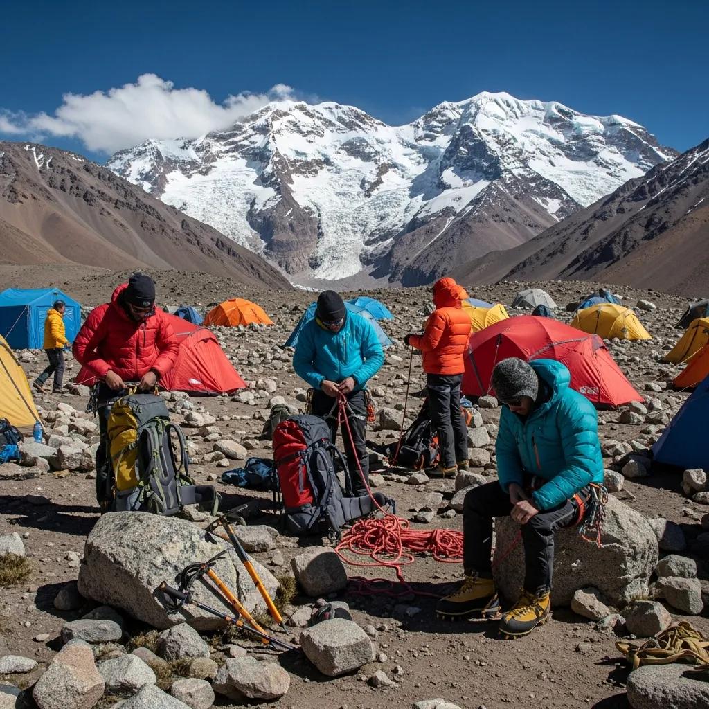
  • We summited Aconcagua in January. Here’s what no one tells you.

    Trip Reports / Aconcagua

    We summited Aconcagua in January. Here’s what no one tells you.

    6,961m
    Summit altitude
    21 days
    Expedition length
    4 of 4
    Team summit rate
    Jan 2024
    Climb date
    Part of the Master Guide This trip report is part of our comprehensive mountaineering reference. Browse all guides from one hub. Visit the Hub →

    Most Aconcagua trip reports skip the parts that actually matter. They tell you the days, the camps, the altitudes, and the summit photo. They don’t tell you how it felt to lie awake at 5,500m with a heart rate of 110 trying to catch your breath, or how the mules at Plaza de Mulas would walk through your tent vestibule at 4 a.m. looking for food, or how the Canaleta is one of the few places on a non-technical mountain where you genuinely think about whether you have the legs left to finish. This is a January 2024 expedition told the way it actually happened, with the parts most articles leave out. For the route comparison and broader 7-Summits decision context, our Aconcagua routes guide, our Seven Summits guide, and the master mountaineering hub set the broader frame.

    Why January

    The expedition booked for January 8-30, 2024. We picked January for the same reason most climbers do. December and January are the prime weather windows in the Argentine summer, and the upper-mountain temperatures are tolerable rather than vicious. The tradeoff is that you share Plaza de Mulas with 200 other climbers and the upper camps feel busy. We accepted that tradeoff. February is colder, March is essentially closed, and earlier than December the weather windows are unpredictable.

    Our team was four climbers and two guides. Two of us had been on Kilimanjaro the previous year, one had climbed Mont Blanc, and one had done Rainier and Hood multiple times. Reasonable preparation, no Everest veterans. The full background context for picking the second 7-Summit lives in our Kilimanjaro vs Aconcagua comparison.

    Mendoza, the permit, and the strange luxury before the climb

    Mendoza in January feels nothing like a high-altitude staging town. The full Mendoza guide-economy backstory lives in our Aconcagua Mendoza guide economy story. It’s hot, wine country, sidewalk cafés open until midnight, lined with sycamore trees. We spent two days there picking up our climbing permits at the provincial office (a one-hour bureaucratic slog), eating ribeye and Malbec, and adjusting to the time zone. The permit cost in 2024 was around 800 USD for the high season, paid in cash and in pesos at official exchange rates. By 2026 the figure has shifted with Argentina’s currency adjustments. Anyone reading this should verify the current high-season rate at the Mendoza tourism office before flying. The full pre-departure planning framework lives in our master mountaineering hub.

    The strange thing about Mendoza is that it lulls you. You forget you’re going to be cold for three weeks. You eat too much. You stay up too late. We had a guide who’d done Aconcagua 18 times tell us, on day two, to go home and sleep. He was right. That advice ranks among the most useful we got on the entire trip.

    The approach: Penitentes to Plaza de Mulas

    Day 03 · Approach

    Penitentes to Confluencia (3,400m)

    Start: 2,700mEnd: 3,400mDistance: 14 kmTime: 5 to 6 hr

    The bus drops you at Punta de Vacas. You shoulder a daypack, hand your duffels to the mule team, and start walking up the Horcones Valley. The first day is gentle. Wide open valley, the Vacas River alongside the trail, occasional llamas grazing in the distance. We reached Confluencia camp by mid-afternoon and pitched tents in the operator’s allocated zone. There’s a permanent ranger station here. They check your permit, check your insurance, and ask how you’re feeling.

    The acclimatization day at Confluencia is non-negotiable. We did the standard hike up to Plaza Francia (4,200m) the next morning, returning to Confluencia to sleep. This is climb-high-sleep-low protocol applied early, and it pays off three weeks later when summit night is the only night above 6,000m.

    Day 05 · Approach

    Confluencia to Plaza de Mulas (4,300m)

    Start: 3,400mEnd: 4,300mDistance: 17 kmTime: 8 to 9 hr

    The long approach day. You walk for nine hours through a barren, rocky, increasingly thin-aired landscape, climbing roughly 900m of net elevation across switchbacks and boulder fields. Most of it is exposed to direct sun and the Andean wind. You arrive at Plaza de Mulas tired, dusty, and slightly headachy. This is where the expedition starts in earnest.

    Plaza de Mulas in season is essentially a small city. There are 8-12 operator camps, a permanent ranger station, a high-altitude medical post, communal dining tents, and at certain operators hot showers. The internet works most of the time. There is a small store where you can buy candy bars and Nesquik and lukewarm beer for prices that would horrify you at sea level. The mules walk freely through camp.

    The acclimatization rotations: where most climbs are won

    Day 06 · Rest at base

    First rest day at Plaza de Mulas

    Camp: Plaza de Mulas, 4,300mActivity: Rest, gear sort

    You have to resist the urge to do something. The brain wants to climb higher, faster. The body needs to adjust. We slept 11 hours, drank water until our cheeks hurt, ate everything the dining tent put in front of us, and did almost nothing physical. By evening the headaches that some of us had on arrival had faded. Pulse oximeter readings ranged 78-86% across the team, which is normal at this altitude.

    Day 07 · Acclim rotation 1

    Carry to Camp Canada (5,050m), descend to base

    Climb to: 5,050mSleep at: 4,300mLoad: 35 lb

    The first carry day. You take a 35-pound load up to Camp Canada, leave it cached, and descend back to Plaza de Mulas to sleep. Carry-high, sleep-low again. The full physiology of why this protocol works is in our altitude acclimatization explainer. The altitude hits at Camp Canada in a way it didn’t at Plaza de Mulas. Your breathing is fast. Your heart rate is high even when you stop. You think about whether you really need everything you packed. Spoiler: you don’t, and shaving 5 lb off your high-camp kit between Plaza de Mulas and the actual carry days is something experienced climbers do quietly while their first-time partners pack everything.

    Day 08 · Rest day

    Second rest at Plaza de Mulas

    You sleep, eat, and force water. The mules outside the tent are louder than you expect. The medical staff make their rounds and check pulse-ox readings. One person on our team had readings dropping into the low 70s and was placed on Diamox at higher dose. The medical infrastructure at Plaza de Mulas is genuinely good, run by experienced high-altitude doctors. Our altitude acclimatization explainer covers the physiology of why these rotation rest days matter so much.

    Day 09 · Move up

    Plaza de Mulas to Camp Canada (5,050m), sleep there

    Up to Camp Canada with the rest of our gear. This is the first night above 5,000m for the trip. Sleep was rough. Heart rates stayed elevated, breathing was light and frequent, and several team members reported the strange dreams that come with altitude. By morning everyone was functional but no one felt rested.

    Day 10 · Acclim rotation 2

    Carry to Nido de Cóndores (5,560m), return to Camp Canada

    Climb to: 5,560mSleep at: 5,050m

    The second carry day. Climbing 500m above Camp Canada, dropping the load at Nido de Cóndores, then descending. The route is straightforward terrain but the altitude is doing things to your body that you can feel. Headaches return mid-afternoon. Appetite continues to fade. Two team members had mild AMS symptoms that evening and dosed extra hydration with Diamox unchanged. Standard protocol. Detailed symptom progression sits in our altitude sickness guide.

    Day 11 · Move up

    Camp Canada to Nido de Cóndores (5,560m)

    Moving up with our remaining gear. We slept at Nido that night. The wind picked up around 6 p.m. and pushed past 50 mph by midnight. The tent walls hammered. Sleep was effectively zero. By 4 a.m. the wind dropped, and by 7 we were able to cook breakfast and reassess. Aconcagua weather doesn’t broadcast itself politely. It announces.

    Day 12 · Rest day

    Rest at Nido de Cóndores

    A rest day at 5,560m is not really a rest day. Your body is working at maximum just to maintain itself. We ate, drank, slept in fits, and waited for the next weather forecast from base camp radio check. The forecast called for a possible summit window in 3 days, with a marginal day in 5. Our guides started talking about contingencies.

    By day 12 you stop counting the days. You count the meters above sea level you can sleep at without your heart rate spiking. The mountain has become a series of breathing problems to solve.

    Day 13 · Move up

    Nido de Cóndores to Camp Cólera (5,970m)

    The push to high camp. Camp Cólera sits just below 6,000m and is the staging point for summit night. The terrain is straightforward but the altitude is brutal. Each step requires a deliberate breath. We carried lighter loads up, having cached at Nido, but everyone arrived spent. The wind at Cólera was constant, the temperatures had dropped past freezing during the day, and the night ahead was the coldest we’d faced.

    Day 14 · Rest before push

    Resting at Camp Cólera, summit attempt tomorrow

    The day before summit night. You can’t sleep, you can’t eat much, you can’t really do anything productive. You melt snow. You sort gear. You re-pack your summit pack four times. The forecast is now firmly green for tomorrow. Wind under 30 mph, temperatures of -25°C at the summit, light cloud expected by mid-afternoon. Our guides briefed us on the timeline and turn-around protocols. Wake up at 5 a.m., depart at 6, summit by 1-2 p.m., back at Cólera by 6 p.m. Anything outside that envelope and we descend.

    Summit day

    Day 15 · Summit attempt

    Camp Cólera to Aconcagua summit (6,961m), and back

    Start: 5,970mSummit: 6,961mTotal time: 12 hours

    The 5 a.m. wake-up was rougher than expected. Sleep was maybe 90 minutes total. The vestibule of the tent was glazed in ice. The water bottle next to the sleeping bag had partially frozen overnight despite being inside the tent. We boiled water for instant oatmeal nobody really wanted, drank as much as we could force down, and were on the trail by 6:10 a.m.

    The first three hours climb steady switchbacks above Cólera, gaining 400m to a feature called Independencia (6,400m), where there’s a wrecked emergency shelter. The wind here was around 25 mph, biting through every layer of the system covered in our layering systems for mountaineering guide. Hands cycled between cold and warm depending on whether they were buried in mittens or holding a trekking pole. We did not stop long. The traverse from Independencia to the base of the Canaleta is a long, rising, exposed slope above 6,500m. You can see the summit pyramid the entire time. It does not get visibly closer for what feels like an hour. Cold-injury risk at this altitude in this wind is real, and our frostbite prevention guide covers the specific signs to watch for.

    And then the Canaleta. The final 200m up Aconcagua is a steep gully of loose scree and snow, frequently described as the hardest hour of any of the 7 Summits’ standard routes. You take three steps, you slide back one. Your lungs are operating at 40% of their normal effective oxygen. The slope is around 35-40 degrees and your body weight is fighting you the whole way. Two members of the team shifted to a step-and-rest pattern: 10 steps, then breathe for 15 seconds. The guides did not. They moved at a pace that seemed inhuman. They were not fitter than us. They were just acclimatized differently and had done this 18 times.

    We summited at 1:42 p.m., behind schedule but inside the turn-around envelope. The summit itself is small. There’s a Catholic cross. There’s a worn metal box with summit register cards. The view across the Andes runs in every direction and is genuinely stunning, though by then the cognitive bandwidth to appreciate it is limited. We took photos. We hugged. We started down within 20 minutes because that’s the rule and because the team understood that the summit isn’t the goal. The descent is the goal.

    The descent of the Canaleta was almost as difficult as the ascent. Loose scree under tired legs, fading cognition, the body just wants to sit down. By the time we reached Cólera at 6:30 p.m., we’d been moving for 12 hours straight at altitude. We ate, drank, and crawled into sleeping bags. Whether we slept or not, no one is sure.

    The descent

    You descend Aconcagua fast once the summit is done. We went Cólera to Plaza de Mulas the next day, a 1,700m drop in five hours. Your body recovers visibly with each elevation step down. By the evening at base camp you can eat real food again. Plaza de Mulas to Penitentes the day after is another long walk but at lower altitude, and the bus to Mendoza puts you back in restaurants and beds within 36 hours of the summit. The whiplash from 6,961m to a sidewalk café is psychologically strange.

    What worked, what we’d change

    Looking back, three things worked. The acclimatization rotation profile was conservative and paid off. Every team member who summited had used carry-high-sleep-low protocols across all three rotations. The gear was right. Double boots, a good parka, mittens with hand warmers, and a -20°F bag let us function in summit-night cold that would have ended a lighter kit. Our gear breakdown lives in the complete climbing gear list, with detailed boot guidance in the mountaineering boots guide. And the team had honest conversations about turn-around criteria before the summit attempt, which made the actual day calmer than it could have been.

    What we’d change. Pack lighter for the upper mountain. We carried 5-7 lb more gear than necessary above Camp Canada and paid for it on summit day. The right pack-selection framework is laid out in our expedition pack guide, and our sleeping bags for altitude guide covers the bag rating tradeoffs that matter at Aconcagua high camps. Train more for the Canaleta specifically. The slog at the top was the section we were least prepared for, and the only training that simulates it is sustained uphill scree-work at altitude. And spend an extra rest day at Plaza de Mulas. We had a 2-day rest at base camp; we’d take 3 next time. The cumulative deficit of inadequate sleep at 4,300m amplified everything that came later. Detailed Aconcagua-specific training adjustments live in our high-altitude training program, and the master hub indexes related guides.

    The honest summary

    Aconcagua is the hardest non-technical climb most recreational mountaineers will ever do. It is not technically demanding the way Everest or Denali are. It is logistically demanding, weather-dependent, cold, and long. The summit success rate of 30-40% is not an accident. It reflects what the mountain actually requires. Anyone walking into an Aconcagua expedition expecting it to be a bigger Kilimanjaro is going to find themselves at Camp Cólera wondering what they got themselves into.

    That said, it is summittable. The single most common failure point for first-time Aconcagua climbers is detailed in our Camp 2 mistake guide, with cost reality in our Aconcagua cost breakdown. With the right preparation, the right operator, the right gear, and a willingness to turn around when conditions don’t cooperate, the success rate climbs to 50-60%. Our January 2024 expedition put 4 of 4 climbers on the summit. The mountain doesn’t owe you that, but the preparation puts the odds in the right place. The complete operator-selection and expedition-planning framework lives in the master mountaineering hub, with peak-specific costs in our complete mountain climbing costs reference.

    ★ Master Resource

    Plan your Aconcagua expedition with the full guide

    The complete reference covers operator selection, training timelines, gear lists, permit logistics, and the full 7-Summits progression framework all in one hub.

    Visit the Master Hub →

    Common questions about climbing Aconcagua

    Is January a good time to climb Aconcagua?

    January is the second-best month behind December. Days are long, temperatures at high camps run -10°C to -20°C rather than the -30°C of November or February shoulder weeks, and summit windows tend to come every 4-6 days. The tradeoff is crowding. Plaza de Mulas runs at full capacity in January, permit costs are at peak season rates, and the upper camps can feel busy. Climbers seeking quieter conditions go in late February, accepting colder weather and fewer summit windows.

    How long does an Aconcagua expedition take?

    A standard Normal Route expedition runs 18-21 days door-to-door. The breakdown looks like 2 days approach trek to Plaza de Mulas, 6-9 days of acclimatization rotations, 2-4 day weather window for the summit attempt, and 2 days descent and exit. Add 2-3 days on each side for Mendoza logistics and recovery. The trip rarely runs short. It often runs long when weather windows close.

    What’s the success rate on Aconcagua?

    Aconcagua’s overall summit success rate runs 30-40% across all climbers. Quality guided expeditions push that to 50-60%. Independent climbers without local support and previous high-altitude experience often see rates below 25%. The mountain’s success rate is a function of altitude exposure, weather windows, and the willingness to turn around when conditions don’t cooperate.

    What was the hardest part of the climb?

    Summit night, by a wide margin. The day starts around 5 a.m. at Camp Cólera (5,970m), runs roughly 9-12 hours of climbing in temperatures of -20°C to -30°C with wind, includes the steep Canaleta scree gully in the final 200m, and ends with a long descent in oxygen-starved exhaustion. The Canaleta itself is the section most climbers describe as the hardest single hour of any 7-Summits climb.

    Did you carry your own gear?

    Yes, above Plaza de Mulas. The mules carry duffels to base camp at 4,300m. Above that, climbers carry their own loads of 35-50 lb between camps in coordinated team rotations. Most climbers cache gear at Camp 1 or Camp 2 on a carry day, descend to a lower camp for an extra acclimatization night, then return to the higher camp the next day with the next load.

    What was the food like?

    At Plaza de Mulas, the operator dining tent serves three hot meals a day cooked by base camp staff. Pasta, rice, soups, fresh meat, vegetables, fresh bread. The food is a real morale boost. Above base camp, the food shifts to dehydrated meals, oatmeal, soups, instant noodles, candy bars, and whatever each climber packed for snacks. Appetite collapses above 5,500m.

    What gear made the biggest difference?

    Three items stood out. The double mountaineering boots (La Sportiva G2 Evo in our case) kept feet warm through summit night when single boots would have frozen. The expedition mittens with hand warmers were the only thing that prevented cold-injury risk on the Canaleta. The -20°F sleeping bag made the difference between sleeping at high camps and shivering through nights.

    Should I climb Aconcagua before or after Kilimanjaro?

    After. Kilimanjaro is the introduction to high-altitude climbing. Aconcagua is the test of whether your body works at expedition altitudes for 3 weeks at a time. Climbers who do Kilimanjaro first arrive at Aconcagua with the altitude tolerance already proven and the camp craft skills already developed.

    Was this helpful?

    Yes
    No
    Thanks for your feedback!
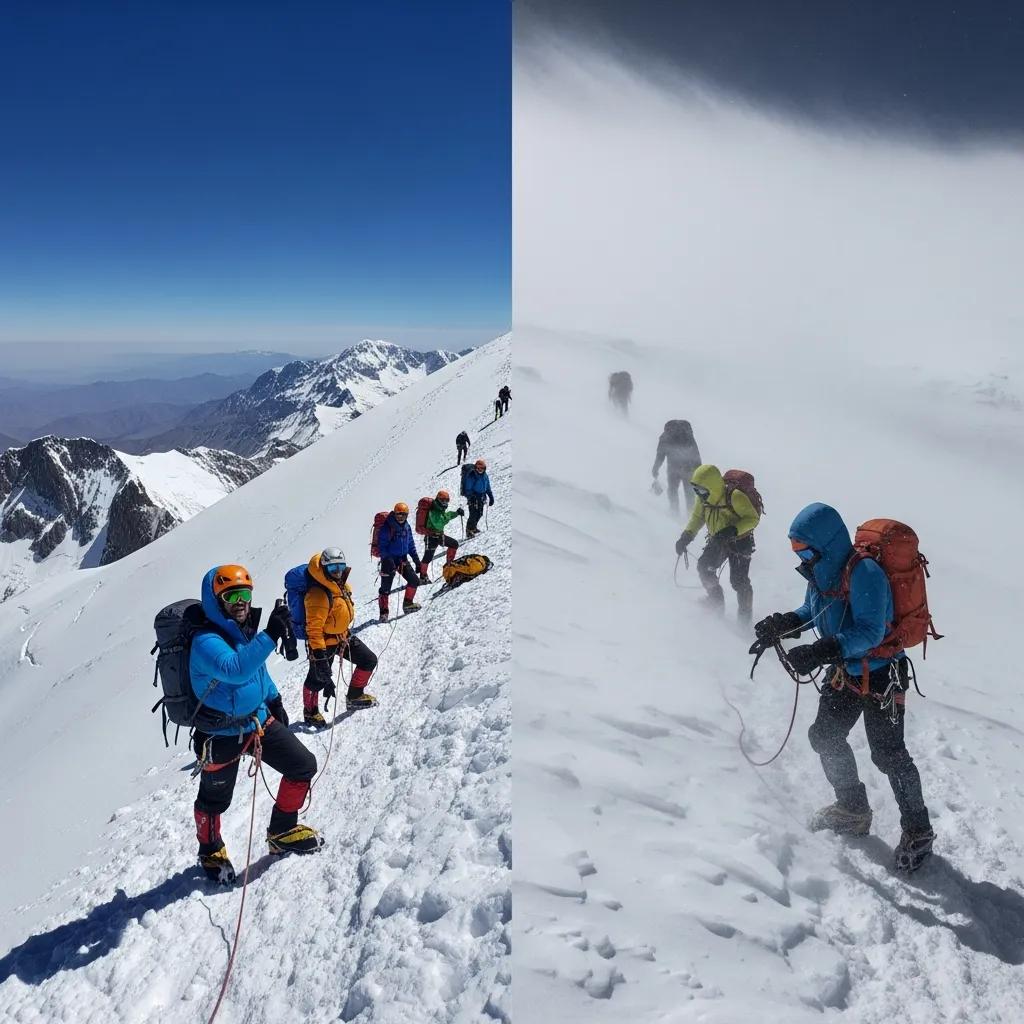
  • Kilimanjaro vs Aconcagua: which 7-summit should you climb first?

    Versus & Decision Guides / 7-Summits

    Kilimanjaro vs Aconcagua: which 7-summit should you climb first?

    5,895m
    Kilimanjaro
    6,961m
    Aconcagua
    7
    Decision Criteria
    2.5×
    Difficulty Gap
    Part of the Master Guide This decision guide is part of our comprehensive mountaineering reference — browse all guides across 12 clusters from one hub. Visit the Hub →

    Kilimanjaro and Aconcagua sit next to each other on every 7-Summits aspirant’s planning list, and the decision between them is the most consequential one a first-time high-altitude climber makes. Get it right and you build experience that carries you through the rest of the 7-Summits. Get it wrong and you either walk away from a $10,000 expedition with nothing, or worse, get evacuated. This guide compares the two peaks across the seven criteria that actually drive the decision — difficulty, altitude, success rate, cost, time commitment, technical demand, and what you learn from each — and tells you which mountain fits your current experience level. It’s part of our comprehensive mountaineering reference, alongside our full Seven Summits guide.

    The peaks at a glance: side-by-side

    Peak 01

    Kilimanjaro

    Tanzania · Africa · Free-standing volcano
    Summit altitude
    5,895m
    Trip length
    7-9 days
    Success rate
    85-95%
    Cost guided
    $2,500-4,500
    Technical grade
    Trek
    Best season
    Jun-Oct

    The introduction to high-altitude climbing. A trek with porter support, hot meals at every camp, and a deliberately-paced acclimatization profile.

    VS
    Peak 02

    Aconcagua

    Argentina · Andes · Highest peak in Americas
    Summit altitude
    6,961m
    Trip length
    16-21 days
    Success rate
    30-40%
    Cost guided
    $5,500-9,500
    Technical grade
    Expedition
    Best season
    Dec-Feb

    The test that decides whether you belong on bigger mountains. Self-supported above base camp, real cold-weather expedition skills required.

    Seven criteria that decide the call

    The difference between these two peaks isn’t summarized by a single number. It’s a constellation of practical factors that compound. Below, we work through the seven criteria that matter most, with a winner called for each. For climbers planning their full 7-Summits sequence, our master mountaineering hub covers every peak in the progression.

    I
    Difficulty & technical demand
    Kilimanjaro · Easier
    Kilimanjaro

    Pure walking from trailhead to summit on every standard route. No rope work, no glacier travel, no crampons or ice axe required. The hardest physical movement on the entire mountain is the Barranco Wall scramble — a 90-minute hands-on section with no exposure consequences. Difficulty comes from altitude and summit-night cold, not technique.

    Aconcagua

    Non-technical on the Normal Route but expedition-level. Crampons mandatory above 5,500m on snow and ice slopes. Self-arrest skills required. Climbers carry 30-40 lb loads to upper camps in multiple rotations. Cold-weather camp management at −25°C and below is a survival skill, not a comfort issue. False Polish Glacier route adds glacier travel and rope skills.

    Verdict: Kilimanjaro is fundamentally easier — the difficulty is altitude, not technique. Aconcagua adds physical load-carrying, cold-weather survival, and weather-window decision-making. Your gear setup matters more on Aconcagua, and our crampons and ice axes guide covers the hardware difference.
    II
    Altitude & physiological demand
    Aconcagua · Higher
    Kilimanjaro

    5,895m summit. Climbers spend 2-3 days above 4,000m and a single night at 4,673m before the summit push. Total time above 5,000m on summit day: 4-6 hours. Acute mountain sickness is the main physiological challenge; pulmonary or cerebral edema cases occur but are uncommon on slow-paced routes.

    Aconcagua

    6,961m summit. Climbers spend 5-6 days sleeping above 5,000m and 2-3 nights above 5,500m. Total time above 5,500m on a typical climb: 4-5 days. The body’s ability to compensate for altitude starts breaking down measurably above 5,800m, and Aconcagua’s high camp at 5,950m sits squarely in that zone. Pulmonary and cerebral edema cases are dramatically more common.

    Verdict: Aconcagua imposes 2-3x the cumulative altitude exposure. The physiological demand isn’t just the summit altitude — it’s the days spent at altitudes that would be a peak experience on Kilimanjaro. Pre-trip altitude exposure matters far more for Aconcagua. See our altitude acclimatization guide.
    III
    Summit success rate
    Kilimanjaro · Higher
    Kilimanjaro

    85-95% on long routes (Lemosho 8-day, Northern Circuit). 65-75% on short routes (Marangu 5-day). Quality operators with 7-day or longer itineraries deliver consistent success because acclimatization is built into the route design and weather rarely shuts down the mountain.

    Aconcagua

    30-40% across all climbers and routes. Top operators improve to 50-60%, but the underlying mountain is far harder. Failure causes split roughly: 40% altitude-related (AMS, exhaustion, appetite collapse), 35% weather-window misses (storms shut the mountain), 25% physical or motivational breakdown.

    Verdict: The success-rate gap is the single biggest data point in the comparison. Climbers booking Aconcagua should plan for the realistic possibility of not summiting. Climbers booking Kilimanjaro on a long route can plan as if summiting is the default outcome. To improve your Kilimanjaro odds, see our Kilimanjaro mistakes that cost the summit guide.
    IV
    Cost & budget
    Kilimanjaro · Cheaper
    Kilimanjaro

    Guided climb $2,500-4,500. Tipping $300-500. International flights $1,200-1,800 from North America. Gear (rented or owned) $500-1,500. Pre/post hotels and meals $300-600. Total trip cost: $4,500-6,500.

    Aconcagua

    Guided climb $5,500-9,500. Tipping $150-300. Permit fee $800-1,000 USD (high season). International flights $1,400-2,200. Gear (substantially more required) $1,500-3,500. Pre/post hotels and meals $400-800. Total trip cost: $9,500-13,000.

    Verdict: Aconcagua is roughly 2x the total trip cost. The gap comes from longer expedition length, higher gear requirements, mandatory permit fees, and the higher operator day-rate for technical guiding. We break this down further in our hidden costs of Kilimanjaro guide.
    V
    Time commitment
    Kilimanjaro · Shorter
    Kilimanjaro

    7-9 days on the mountain. 1-2 days each side for Moshi/Arusha logistics. Total trip 10-14 days. Easily fits inside two weeks of vacation, leaves room for safari extension, and works for working professionals with limited PTO budgets.

    Aconcagua

    16-21 days on the mountain. 2-3 days each side in Mendoza for permits and logistics. Total trip 21-26 days. The time commitment alone disqualifies many working professionals. Successful Aconcagua climbers either negotiate extended leave or take the trip during transitions between jobs.

    Verdict: The time gap is the most under-discussed difference between these peaks. Aconcagua requires nearly four weeks away from work. For climbers with finite vacation budgets, this single factor often forces the decision toward Kilimanjaro.
    VI
    Logistics & support
    Kilimanjaro · Supported
    Kilimanjaro

    Porter and cook teams carry your duffel, pitch your tent, and prepare hot meals at every camp. Climbers carry only a daypack with water, snacks, and a layer. Mess tents are warm. Kitchen tents produce real food. The expedition runs as a guided trek, not a self-supported climb.

    Aconcagua

    Mules carry your gear to Plaza de Mulas (4,300m) base camp. Above base camp, you carry your own gear, set your own tent, and cook your own meals. Cold-weather expedition camping at altitude is a real skill. Climbers spend 10-14 days self-supported above 4,000m. This is the defining experience of Aconcagua.

    Verdict: Kilimanjaro is fully supported throughout. Aconcagua is supported to base camp and self-supported from there. Climbers who haven’t camped at altitude before will find the Aconcagua expedition style a much steeper learning curve than they expect. Our Kilimanjaro porter system history covers what makes Kili’s support model unique.
    VII
    What you learn from each climb
    Different lessons
    Kilimanjaro

    How your body responds to altitude. Whether you tolerate cold-weather summit pushes. How to pace at altitude (pole pole). What the high-altitude appetite collapse feels like. Whether high-altitude climbing is something you actually want to keep doing. These lessons transfer cleanly to every bigger peak.

    Aconcagua

    Self-supported expedition camp life. Cold-weather camp management. Carrying loads at altitude. Multi-day weather-window decision-making. Mental endurance through 16-21 days of unbroken expedition life. These lessons transfer to Denali, the Himalayan trekking peaks, and the rest of the bigger 7-Summits.

    Verdict: Kilimanjaro teaches whether you can tolerate altitude. Aconcagua teaches whether you can run a real expedition. Both lessons matter. The order matters too: Kilimanjaro first means Aconcagua becomes a meaningful test rather than a guess.

    Quick-reference comparison across all factors

    FactorKilimanjaroAconcagua
    Summit altitude5,895m (19,341 ft)6,961m (22,837 ft)
    Days on mountain7-9 days16-21 days
    Total trip length10-14 days21-26 days
    Summit success rate85-95% (long routes)30-40% (all routes)
    Technical gradeTrek (no technical skills)Expedition (cold-weather skills)
    Crampons / ice axeNot requiredRequired above 5,500m
    Glacier travelNoneOptional (False Polish route)
    Porter supportFull (every day)Mules to base camp only
    Climber load above baseDaypack (5-10 lbs)30-40 lbs in rotations
    Sleep altitude maximum4,673m (Barafu)5,950m (Camp Colera)
    Summit night temp-7°C to -20°C-15°C to -30°C
    Weather-window dependencyLowHigh (storms close the mountain)
    Permit feeIncluded in climb cost$800-1,000 USD separately
    Total trip cost$4,500-6,500$9,500-13,000
    Best forFirst major high-altitude climbSecond or third 7-Summit

    Decision matrix: which one fits you?

    Below, the most common climber profiles and which peak fits each. Read the description, find the match, and use the recommendation as a starting point.

    You’ve never been above 4,000m

    You’ve done some hiking, maybe a 14er or two, but you’ve never spent multiple days at altitude. Your altitude tolerance is unknown.

    → Kilimanjaro

    You have 2 weeks of vacation, maximum

    Time off is your binding constraint. You can’t take three full weeks for a single trip and still have leave for the rest of the year.

    → Kilimanjaro

    Your budget is under $7,000

    You want a serious mountain experience but you’re not in a position to spend $10,000+ on a single trip yet.

    → Kilimanjaro

    You’ve already summited Kilimanjaro or similar

    You know how your body handles 5,500m sleeping altitude. You handled cold summit nights without major issues. You’re ready for the next test.

    → Aconcagua

    You’re chasing the 7-Summits and want to know if you belong

    You want a real check on whether bigger objectives (Denali, Himalayan peaks) are realistic for you. You need a true expedition test.

    → Aconcagua

    You have prior cold-weather camping experience

    You’ve winter-camped, done multi-day backcountry trips, and managed cold-weather camp life. The expedition style won’t be the surprise.

    → Aconcagua

    You have time, money, and want both eventually

    If you’re going to do both anyway, Kilimanjaro first is the universal recommendation — but the Kili-Aconcagua sequence works in either order if you bring real prep.

    → Kili first, then Aconcagua
    The standard 7-Summits progression

    Most climbers tackling the 7-Summits sequence them as: Kilimanjaro → Elbrus → Aconcagua → Denali → Vinson → Kosciuszko/Carstensz → Everest. Kilimanjaro is universally the entry point. Aconcagua slots in as the third or fourth peak, after Elbrus has tested European logistics and basic glacier travel. Climbing Aconcagua before any other 7-Summit is doable but punishing — most climbers who try it cold turn around.

    The training and preparation gap

    Kilimanjaro and Aconcagua require fundamentally different training stacks. For Kilimanjaro, the bar is sustained cardio fitness — climbers who can hike 6-8 hours a day with a daypack at sea level will summit if they pace correctly and acclimatize. Our 12-week Kilimanjaro training plan covers the specific build-up. For the broader training, gear, and altitude context across all 7-Summits, see our master mountaineering hub.

    For Aconcagua, the cardio bar rises and three new dimensions appear: load-carrying capability (sustained 30-40 lb pack work), altitude pre-exposure (ideally a peak above 4,500m within 12 months of the climb), and cold-weather camp competence. Our high-altitude training program covers the multi-month build for peaks like Aconcagua.

    For climbers planning a Kilimanjaro-then-Aconcagua progression, the practical training gap is 6-12 months between climbs. That’s enough time to absorb Kilimanjaro lessons, build load-carrying capacity, and add altitude exposure on a training peak (Mount Rainier, Pico de Orizaba, Cotopaxi).

    Gear and cost differences that compound

    Kilimanjaro and Aconcagua share roughly 60% of their gear list — boots, layering system, sleeping bag, headlamp, trekking poles. The other 40% is where Aconcagua becomes meaningfully more expensive and complex.

    • Sleeping bag: Kilimanjaro climbers use a 0°F (−18°C) bag. Aconcagua demands a −20°F (−29°C) expedition bag. The price gap is $300-500. See our sleeping bags for altitude guide.
    • Boots: Kilimanjaro uses B1 or B2 leather/synthetic boots. Aconcagua needs B3 double boots — typically $700-900. Detailed in our mountaineering boots guide.
    • Crampons and ice axe: Not required on Kilimanjaro. Required on Aconcagua. Add $300-500.
    • Tent: Provided by the operator on Kilimanjaro. Often climber-supplied or shared on Aconcagua. A 4-season expedition tent runs $500-1,000.
    • Layering system: Both peaks need full layering, but Aconcagua adds a heavy expedition parka rated for −30°C. Detailed in our layering systems guide.

    The total gear premium for Aconcagua over Kilimanjaro typically runs $1,500-2,500 if buying new. For a complete head-to-toe gear list, see our complete mountain climbing gear list.

    The honest answer for most climbers

    ★ Bottom Line

    Kilimanjaro first, almost always

    For 90% of climbers comparing these peaks, Kilimanjaro is the right first answer. It’s cheaper, shorter, more supported, far higher success rate, and teaches the altitude lessons that make every subsequent climb safer. Aconcagua becomes the right call only after you’ve demonstrated you tolerate altitude well, can handle cold-weather summit pushes, and have the time and budget for a 3-week expedition.

    The 10% exception: climbers with strong cold-weather backcountry experience, prior high-altitude exposure (4,500m+), and the time and budget for a full expedition. Those climbers can skip Kilimanjaro and go directly to Aconcagua. But for everyone else, Kilimanjaro first builds the foundation that makes Aconcagua a meaningful test rather than a roll of the dice.

    Continue your 7-Summits research

    Kilimanjaro vs Aconcagua is the first decision in a longer sequence. If you’re planning to take both peaks on, these are the next guides to read:

    ★ Master Resource

    Every guide, one navigation point

    This Kilimanjaro vs Aconcagua decision guide is part of a comprehensive mountaineering reference covering gear, training, altitude, routes, peak-specific planning, and field reports across all 7-Summits and beyond. Our master hub indexes every guide in one place.

    Browse the Complete Guide →

    Frequently asked questions about Kilimanjaro vs Aconcagua

    Should I climb Kilimanjaro or Aconcagua first?

    For nearly all climbers, Kilimanjaro should come first. It is a non-technical trek to 5,895m with no glacier travel, no rope work, no crampons or ice axe required, and a fully-supported logistics chain. Aconcagua climbs 1,066m higher, requires self-supported expedition camp life above base camp, demands real cold-weather skills, and exposes climbers to weather windows that can shut the mountain down for days.

    How much harder is Aconcagua than Kilimanjaro?

    Aconcagua is roughly 2-3 times harder than Kilimanjaro by most measures. The summit altitude is 1,066m higher, the expedition length is 2-3x longer (16-21 days vs 7-9), summit success rates are about half (30-40% vs 85-90% on Lemosho), and climbers must be self-sufficient above base camp. Kilimanjaro’s difficulty comes almost entirely from altitude; Aconcagua adds expedition logistics, cold-weather survival, and load-carrying.

    What’s the success rate difference?

    On Kilimanjaro, success rates run 85-95% on long routes and 60-65% on short routes. On Aconcagua, success rates run 30-40% across all climbers and routes. The gap reflects Aconcagua’s higher altitude exposure, summit-day weather windows, and lack of porter support that means physical load-carrying compounds altitude fatigue.

    Is Aconcagua technical?

    Aconcagua’s standard Normal Route is non-technical in the climbing sense — no rope work, no glacier travel above 5,500m, no rock climbing. However, it requires real mountaineering competence: confident crampon use on snow slopes, ice axe self-arrest skills, cold-weather camp management, and judgment for high-altitude weather. Climbers describe it as expedition-level non-technical.

    How long does each climb take?

    Kilimanjaro climbs run 5-9 days on the mountain depending on route, with most quality operators using 7-8 day itineraries. Total trip from a North American departure: 10-14 days. Aconcagua expeditions run 16-21 days on the mountain — the standard itinerary is 18-19 days. Total trip length: 21-26 days.

    What does Kilimanjaro vs Aconcagua cost?

    A guided Kilimanjaro climb runs $2,500-4,500 plus tipping, gear, and flights — total trip typically $4,500-6,500. Aconcagua runs $5,500-9,500 guided plus a separate $800-1,000 permit, more substantial gear, and longer flights — total trip typically $9,500-13,000. Aconcagua is roughly 2x the total cost.

    Can I skip Kilimanjaro and go straight to Aconcagua?

    You can, but most operators advise against it. Aconcagua’s 30-40% success rate punishes climbers who haven’t experienced multi-day exposure to altitude above 5,000m. If you skip Kilimanjaro, plan a serious altitude training trip (Cotopaxi, Pico de Orizaba, Mount Rainier) before Aconcagua to build the altitude data point that Kilimanjaro normally provides.

    Which has better scenery?

    Kilimanjaro wins on biodiversity — five distinct ecosystems in seven days. Aconcagua wins on raw mountain scale — climbers spend weeks within sight of 6,000m peaks across the Cordon del Plata range. Most climbers say they would return to Kilimanjaro for the experience and to Aconcagua for the achievement.

    Was this helpful?

    Yes
    No
    Thanks for your feedback!
  • Language »