
Last updated October 5, 2026

Manaslu Routes Compared: Northeast Face vs West & South Routes
Manaslu has multiple historic climbing routes, but modern climbers do not face four equal choices. The Northeast Face / Ridge is overwhelmingly the standard commercial route. The west, south-southwest face and south ridge belong to a different category: rare, technical Himalayan expedition climbing with little or none of the cooperative infrastructure that makes the normal route commercially viable.
For Almost Every Expedition Climber, There Is Only One Practical Manaslu Route.
Choose the Northeast Face / Ridge unless the purpose of your expedition is specifically to climb a rare technical line. It is the only Manaslu route with established commercial logistics, cooperative annual rope fixing, high-camp infrastructure and a meaningful population of other teams.
The Himalayan Database identifies the Northeast Face as Manaslu’s standard commercial route and reports a historical 39.0% member ascent rate on the standard route through 2024. Its analysis finds standard Manaslu routes significantly more successful than non-standard routes.
That does not make the Northeast Face easy. Crevasses, seracs, avalanches, fixed-line congestion, extreme altitude and the narrow true-summit finish remain serious hazards.
A Manaslu Route Comparison Has to Compare Infrastructure as Well as Terrain
On a lower mountain, two routes can differ mainly in grade, scenery or exposure. On an 8,000-meter peak, choosing another face can also mean abandoning fixed ropes, established camps, shared weather information, high-altitude staff and the movement patterns used by every other expedition.
That is why describing Manaslu simply as “Northeast Face vs Northwest Face” is misleading. The Northeast Face is an active commercial system. The historic alternatives are expedition objectives that require their own route development.
Route choice also does not eliminate Manaslu’s main objective risks. The standard route can be fully fixed and still become unusable because new snow, serac instability, avalanche hazard or wind removes the margin.
Changing Routes Does Not Create Better Rescue Access.
Global Summit Guide is a Global Rescue Safe Travel Partner. On Manaslu, rescue options deteriorate rapidly above Base Camp and non-standard routes can be substantially more isolated. Verify technical mountaineering, evacuation and repatriation coverage before Nepal.
Four Route Families—Only One Commercial Standard
The key comparison is not which route is five percent “harder.” It is what kind of expedition each route requires.
| Route | Modern status | Infrastructure | Terrain character | Main problem | Best suited to |
|---|---|---|---|---|---|
| Northeast Face / Ridge | Standard commercial route | Cooperative fixed ropes, approximately four camps, major operator presence | Glaciated, crevassed, snow / ice, fixed-line terrain, narrow summit finish | Avalanche / serac exposure, crowding, weather, altitude | Guided and supported 8,000 m expedition climbers |
| West / Northwest Route | Historic · very rare | No annual commercial system | Huge west-side relief, rock, ice, hanging glacier, upper plateau | Sustained route development and objective hazard | Elite independent expedition teams |
| South-Southwest Face | Elite technical terrain | No commercial infrastructure | Major Himalayan face, rock / ice, steep ramps, technical mixed terrain | Technical difficulty, commitment, storm exposure | High-level Himalayan alpinists |
| South Ridge via Pungen | Historic · rarely repeated | Independent route-building required | Pungen Glacier, difficult couloir, high col, ridge / southeast-face terrain | Long approach, route finding, technical climbing | Elite technical expedition teams |

Manaslu’s Northeast Side Is More Than a Line on a Topographic Map.
It is where the modern expedition ecosystem exists: Base Camp, annual rope fixing, high camps, commercial operators and the movement of hundreds of climbers and staff.
Face / Ridge
The route that defines modern Manaslu. If you are comparing commercial expeditions, this is almost certainly the mountain you are buying.
Why the Northeast Face Became the Standard
The modern route uses the northeast side of the mountain, reached from the Samagaun / Manaslu Base Camp side. It follows glaciated terrain through a sequence of approximately four high camps before reaching the upper plateau and summit ridge.
The technical challenge is reduced by annual cooperative fixed ropes, established camp locations and large high-altitude support teams. Those systems make the route commercially manageable; they do not make the terrain objectively safe.
Approximate Modern Camp Structure
| Position | Approx. elevation | Route character | Main planning issue |
|---|---|---|---|
| Base Camp | ~4,700–4,800 m | Moraine / glacier edge above Samagaun | Expedition base, acclimatization and weather waiting. |
| Camp 1 | ~5,700 m | Above lower glacier terrain | Crevasses, fixed-line efficiency and route condition. |
| Camp 2 | ~6,300–6,400 m | Heavily glaciated terrain | Crevasses, serac exposure and snow loading. |
| Camp 3 | ~6,700–6,900 m | Higher snow / glacier terrain | Avalanche exposure, wind and acclimatization rotations. |
| Camp 4 | ~7,400–7,500 m | Upper shoulder / plateau | Death-zone exposure, summit timing, oxygen and wind. |
| True summit | 8,163 m | Narrow, exposed, condition-dependent final ridge | Cornices, congestion and the final true-summit variation. |
Need the Camp-by-Camp Route Instead of the Comparison?
The dedicated Northeast Ridge guide owns rotations, camps, fixed-line terrain, route anatomy and the normal expedition sequence.

Fixed Ropes and High Camps Reduce Route-Finding Problems—not Himalayan Exposure.
Manaslu’s normal route remains an 8,000-meter glacier expedition even when hundreds of climbers are using the same line.
Northwest
The 1971 Japanese route from the west belongs to Manaslu’s pioneering era, not its modern commercial menu.
The Historic West-Side Route Is a Different Mountain Problem
A Japanese expedition completed Manaslu’s second ascent from the west in May 1971. Contemporary reporting describes an enormous rock-and-ice face, hanging-glacier hazard and a line using west-ridge-side terrain before reaching the upper plateau.
The expedition used extensive fixed rope, multiple camps and siege-style support. That historical success should not be interpreted as evidence that the west route is a normally maintained alternative today.

Manaslu’s Other Faces Were Opened by Climbers Solving New Terrain—not Following a Commercial Track.
That distinction is the reason the south-side routes should never receive a consumer-style success percentage beside the Northeast Face.
Southwest
Face
A major face with a history stretching from Messner’s 1972 ascent to a new line established in 2025.
Messner’s 1972 Route Established the South-Face Benchmark
A Tyrolean expedition led by Wolfgang Nairz climbed Manaslu’s south side in 1972. Reinhold Messner ultimately reached the summit alone after climbing a route involving difficult rock, an ice labyrinth and steep upper terrain.
The expedition ended tragically: Franz Jäger and Andi Schlick were lost during deteriorating weather. The history illustrates why this face cannot be summarized as simply a “harder alternative.”
Why 2025 Matters
The American Alpine Journal reported a new route near the center of the south-southwest face in 2025. Before that climb, no additional line had been established on the broad south side since the historic routes bordering the face.
That is a useful modern reality check: Manaslu’s non-standard faces are still terrain where elite climbers can establish genuinely new Himalayan routes. They are not overflow options for a commercial expedition.

The South Ridge Was Reached From the Pungen Side—not From the Modern Commercial Base Camp System.
Route choice changes approach logistics, camps, load carries and the terrain that must be established before summit day.
via Pungen
First completed in 1984 by a small Polish-led team from the Pungen Glacier side.
A Route Built Around Access to the Ridge Itself
The successful 1984 expedition approached from the Pungen Glacier, climbed a sustained couloir to Pungen La and then continued over the south ridge and adjacent southeast-face terrain.
Aleksander Lwow and Krzysztof Wielicki reached the summit on October 20. The team used only two fixed high camps and the successful climbers did not use supplementary oxygen.
Use the technical, altitude, fitness and expedition categories separately. Strength in one does not erase weakness in another.

The True Summit Is a Narrow Final Problem on an Otherwise Broad Mountain.
Cornices, a sharp upper ridge and changing snow conditions make the last meters disproportionately important.
The Final Route Can Change With the Summit Ridge
Modern Manaslu claims increasingly distinguish the actual highest point from the foresummits used historically by many expeditions.
Several Foresummits
Manaslu’s upper ridge contains multiple high points that can appear to be the summit, particularly when visibility is poor or fixed ropes terminate early.
Rolwaling Diversion
Mingma G and team used a variation dropping away from the sharp upper arete, traversing below it and climbing back to the true summit.
8,163 m Means the Highest Point
Current commercial rope-fixing efforts are expected to reach the actual summit, not simply the familiar foresummit area.
The Northeast Face Is More Supported—not Hazard-Free
Infrastructure changes how hazards are managed. It does not remove the mountain that creates them.
| Hazard | NE Face | West / NW | South Face | South Ridge |
|---|---|---|---|---|
| Crevasses | High concern on glaciated lower route | Route-specific glacier exposure | Approach / face dependent | Pungen Glacier exposure |
| Avalanche / serac | Major historic concern | Significant hanging-glacier exposure | Major face exposure | Snow / couloir / ridge exposure |
| Technical rock / mixed | Moderate relative to alternatives | High | Very high | High |
| Fixed ropes | Extensive annual commercial system | No annual system assumed | No annual system assumed | No annual system assumed |
| Crowding | Major autumn issue | Minimal | Minimal | Minimal |
| Route finding | Reduced by fixed route | Major | Major | Major |
| Rescue / support | Best available on Manaslu | Much more limited | Much more limited | Much more limited |
| Altitude | Extreme | Extreme | Extreme | Extreme |
On Manaslu, the route may be completely fixed while the snowpack or wind still makes a summit push indefensible.

The Fixed Ropes Reached 8,163 Meters. The Weather Still Ended the Season.
Manaslu’s modern support system can open the technical route. It cannot negotiate with unstable snow.
A Fully Fixed Standard Route Can Still Become the Wrong Route to Climb Today
September 2026 provides an unusually clear example of infrastructure versus conditions.
Route fixing reaches Camp 3
The main technical lower section was becoming operational while a record-scale group of climbers acclimatized on the mountain.
Avalanche disrupts rope fixing
Avalanche activity above Camp III buried or destroyed fixed rope and equipment, forcing additional rope and staff upward.
Rope fixers reach 8,163 m
The Expedition Operators Association Nepal team completed the line to the true summit, technically opening the commercial route.
Hundreds of climbers face a compressed window
Nearly 500 foreign permit holders were positioned for a route whose highest point is narrow and condition dependent.
Major operators end summit attempts
Persistent precipitation, unstable snow and avalanche hazard forced teams down despite the completed fixed route.
Fixed Ropes Reduce Route Finding—not the Need for Competence
The modern Northeast Face is supported, but a climber still has to function efficiently at extreme altitude.
Ascender Efficiency
Passing anchors, managing safety attachments and ascending fixed ropes must remain efficient while wearing heavy gloves and high-altitude clothing.
Crampon Movement
Crevassed, uneven glacier terrain makes competent footwork essential long before summit night.
Fixed-Line Descending
The summit is only halfway. Climbers must remain capable of safe descent, anchor transitions and movement under severe fatigue.
Glove Dexterity
The hand system has to preserve enough dexterity to operate carabiners, ascenders, oxygen and clothing adjustments.
Glacier Eye Protection
Category-appropriate high-altitude eyewear and backup protection matter through long days on reflective snow.
Turnaround Discipline
The existence of fixed ropes does not convert an unstable slope or deteriorating summit ridge into acceptable terrain.
High-Altitude Hand & Eye Protection
Gloves and eyewear are two systems where failure directly interferes with fixed-line movement, oxygen adjustments and safe descent.
High-Altitude Hand & Eye Protection
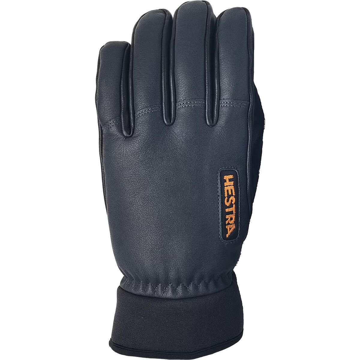

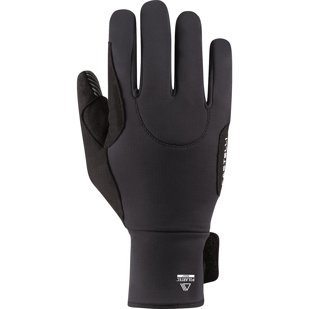
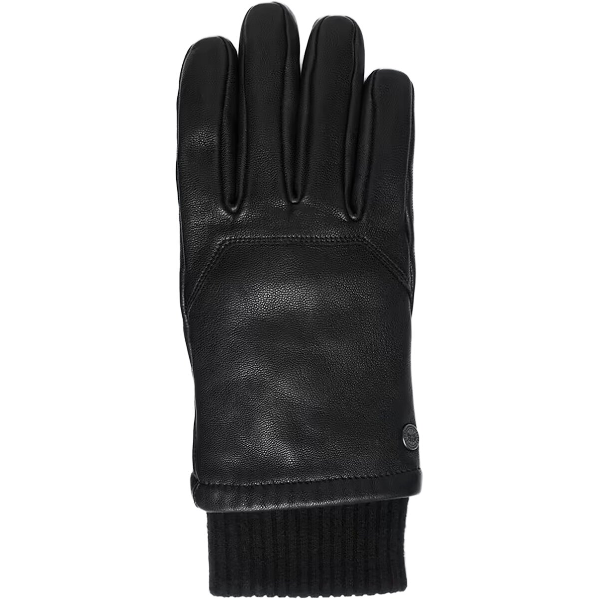
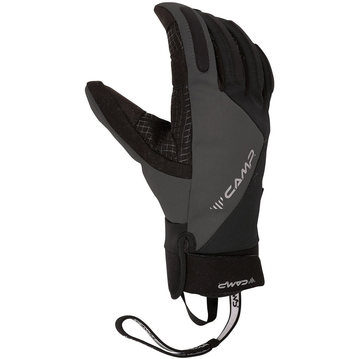
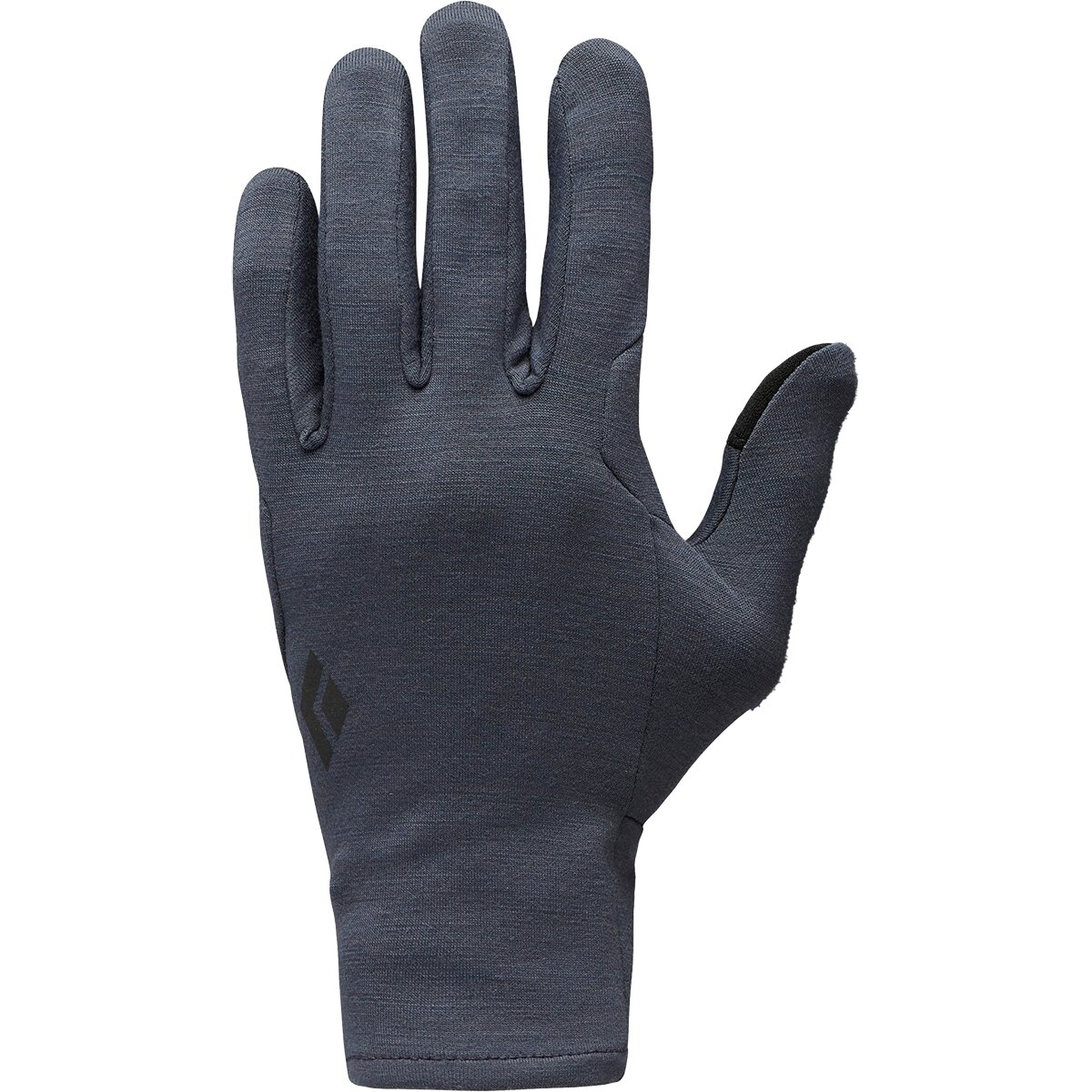
Build the complete equipment system in the Manaslu Gear List .
The Route Is Standardized. Operator Support Is Not.
Compare Sherpa ratios, oxygen, leadership, avalanche decision-making, expedition dates and current prices before treating every Northeast Face package as the same product.
Which Manaslu Route Should You Climb?
For most readers, the answer is much simpler than the existence of four route families suggests.
| Climber profile | Route | Why |
|---|---|---|
| First Manaslu expedition | Northeast Face | Established support, camps, fixed ropes and operator experience. |
| First 8,000er with extensive preparation | Northeast Face | The only route that belongs in a normal commercial 8,000-meter progression. |
| Experienced guided 8,000m climber | Northeast Face | Choose support model, oxygen strategy and operator—not another face. |
| Elite alpinist seeking an independent technical objective | West, South Face or South Ridge | Only after route-specific research, permitting, team design and objective-hazard analysis. |
| Climber trying to avoid crowds | Still usually Northeast Face | Solve crowding with operator strategy, timing and expedition style—not by casually moving to a major unclimbed face. |
| Climber not comfortable on fixed lines / glaciers | None yet | Build skills and altitude experience before committing to Manaslu. |
The farther you move from Manaslu’s commercial route, the more route finding, communication and emergency self-sufficiency move back onto the team.
Route Infrastructure Cannot Replace Prior Expedition Experience.
Test the altitude, technical, physical, recovery and judgment categories independently before treating Manaslu as an “easy” first 8,000er.

Geography Explains Why One Side Became the Standard.
Samagaun, Birendra Lake and the northeast Base Camp approach feed directly into the modern commercial expedition system.
The Northeast and South Approaches Build Different Expeditions
The normal commercial Base Camp lies above the Samagaun side; the historic Pungen route approaches a different side of the massif.
Manaslu Route Comparison FAQ
Direct answers to the route questions that matter before choosing an expedition.
What is the standard route on Manaslu?
The Northeast Face / Ridge is Manaslu’s standard modern commercial route. It uses established Base Camp logistics, approximately four high camps and a cooperative fixed-rope system.
Which Manaslu route do commercial expeditions use?
Almost all normal commercial Manaslu expeditions use the Northeast Face / Ridge. The west, south-southwest face and south ridge are rare technical expedition objectives.
What is Manaslu’s easiest route?
The Northeast Face is the most practical and supported route, but “easiest” is relative. It remains an 8,163-meter expedition with crevasses, avalanche and serac exposure, fixed-line climbing, extreme altitude and a narrow summit finish.
What is Manaslu’s standard-route success rate?
The Himalayan Database’s 1950–2024 analysis gives a 39.0% member ascent rate for Manaslu’s standard route. That is a historical member statistic, not a prediction for a specific client or season.
Is the Northwest Face a normal alternative to the Northeast Face?
No. Manaslu was climbed from the west by a Japanese expedition in 1971, but west / northwest terrain is not maintained as a normal commercial alternative. It requires a fundamentally different expedition model.
Has Manaslu’s South Face been climbed?
Yes. Reinhold Messner reached the summit during the successful 1972 Tyrolean south-face expedition. In 2025, another team established a new line near the center of the south-southwest face.
Has Manaslu’s South Ridge been climbed?
Yes. Aleksander Lwow and Krzysztof Wielicki completed the south-ridge route from the Pungen side in 1984 after approaching through Pungen La.
How many camps are on Manaslu’s normal route?
Modern commercial expeditions normally use approximately four high camps above Base Camp. Exact camp elevations and positions can shift with snow, glacier change and annual route decisions.
What is the hardest part of Manaslu’s Northeast Face?
There is no single permanent crux. Major concerns include crevassed and serac-threatened glacier terrain, avalanche exposure higher on the mountain and the narrow, potentially corniced route to the true summit.
Does Manaslu have a false summit?
Manaslu’s upper ridge has multiple foresummits that were historically treated as the summit by many expeditions. Modern summit claims increasingly require reaching the true highest point at 8,163 meters.
Are fixed ropes installed to Manaslu’s true summit?
Modern commercial route-fixing teams now aim to fix the line to the actual summit. In autumn 2026, EOAN rope fixers reached the 8,163-meter summit on September 17. The precise final variation can still change with ridge conditions.
Should I choose another Manaslu route to avoid crowds?
Usually no. For a normal expedition climber, moving to a historic technical face is not a sensible crowd-avoidance strategy. Compare operator timing, team size, summit-window strategy and support structure on the Northeast Face instead.
What Is Your Next Manaslu Decision?
Pick the unresolved decision rather than opening every page in the cluster.
Route History and 2026 Verification
Historic route claims are separated from current commercial route conditions.
Himalayan Database
Identifies the Northeast Face as Manaslu’s standard route and supplies historical standard-vs-non-standard ascent analysis.
American Alpine Journal
Akira Takahashi’s detailed account of the successful Japanese expedition climbing Manaslu from the west.
American Alpine Journal
Contemporary account of the Tyrolean south-face expedition and Reinhold Messner’s summit.
American Alpine Journal
Krzysztof Wielicki’s account of the first successful ascent from the Pungen Valley and south ridge.
American Alpine Journal
Current AAJ report documenting a new route on Manaslu’s south-southwest face.
The Himalayan Times
September 18 reporting confirms the EOAN rope-fixing team reached Manaslu’s 8,163-meter summit on September 17.

For a Commercial Expedition, Choose the Northeast Face—Then Make Better Decisions Inside It.
Manaslu’s west and south routes matter enormously to Himalayan climbing history. They do not create a realistic menu for the typical expedition client. The Northeast Face provides the camps, ropes, staff and shared infrastructure that make modern Manaslu possible. Your real decisions are then operator, acclimatization, weather, crowd strategy, oxygen and whether conditions justify climbing at all.
Study the Northeast Route Build the Complete Manaslu PlanWas this helpful?
🏔Related peaks nearby
🧭Explore & compare
Global Summit Guide is an independent mountaineering resource founded in 2026. The team combines first-hand trekking and climbing experience with in-depth research and professional health and nutrition review to help climbers choose objectives, prepare properly, and stay safe.
Health, altitude, and nutrition content is reviewed by Taylor Ludlow (Registered Nurse) and Brigg Hoopes (Nutritionist).
What We Don't Know Yet
Mountain information changes quickly. This box explains the limits of what this page can responsibly promise.
- Route conditions, trailhead access, crevasse exposure, stream crossings, and rescue access may vary from published planning guidance.
- Comparisons simplify complex decisions; the better mountain depends on current conditions, skills, timing, budget, and risk tolerance.
- Visa, passport, vaccination, border, insurance, and local transportation rules may change before your trip.
Verify current conditions with official land managers, guide services, local forecasts, and current route reports before booking or climbing.
Mountaineering, rock and ice climbing, glacier travel, and high-altitude activity are inherently dangerous and can result in serious injury or death. The information on Global Summit Guide is provided for general informational and educational purposes only and is not a substitute for professional instruction, qualified guiding, proper equipment, or your own judgment and experience.
Route conditions, weather, snowpack, permits, regulations, and hazards change constantly and may differ from what is described here. Details may be incomplete, out of date, or contain errors. Always verify current information with local authorities, certified guides, and official sources before making any decision in the mountains.
Nothing on this site is medical, legal, or financial advice. Our fitness, acclimatization, altitude, and nutrition content is general in nature; consult a qualified physician before beginning any strenuous exercise program or exposing yourself to high altitude.
You are solely responsible for your own safety and decisions. To the fullest extent permitted by law, Global Summit Guide and its team accept no liability for any loss, injury, damage, or expense arising from use of, or reliance on, this information. By using this site you acknowledge these risks and accept these terms.
Some links on this site may be affiliate links. If you buy through them we may earn a small commission at no extra cost to you; this never affects our recommendations.
Global Summit Guide recommendation path
Next Best Mountain to Research
Use these recommendations to continue the right planning path instead of stopping on one page.
Use current permit, weather, route, and operator information before booking or climbing.
Explore Travel Options for Your Destination
Once your mountain, dates and route are taking shape, compare flights, hotels and other travel options that fit the trip.
Affiliate link. We may earn a commission at no additional cost to you.