
Last updated October 3, 2026
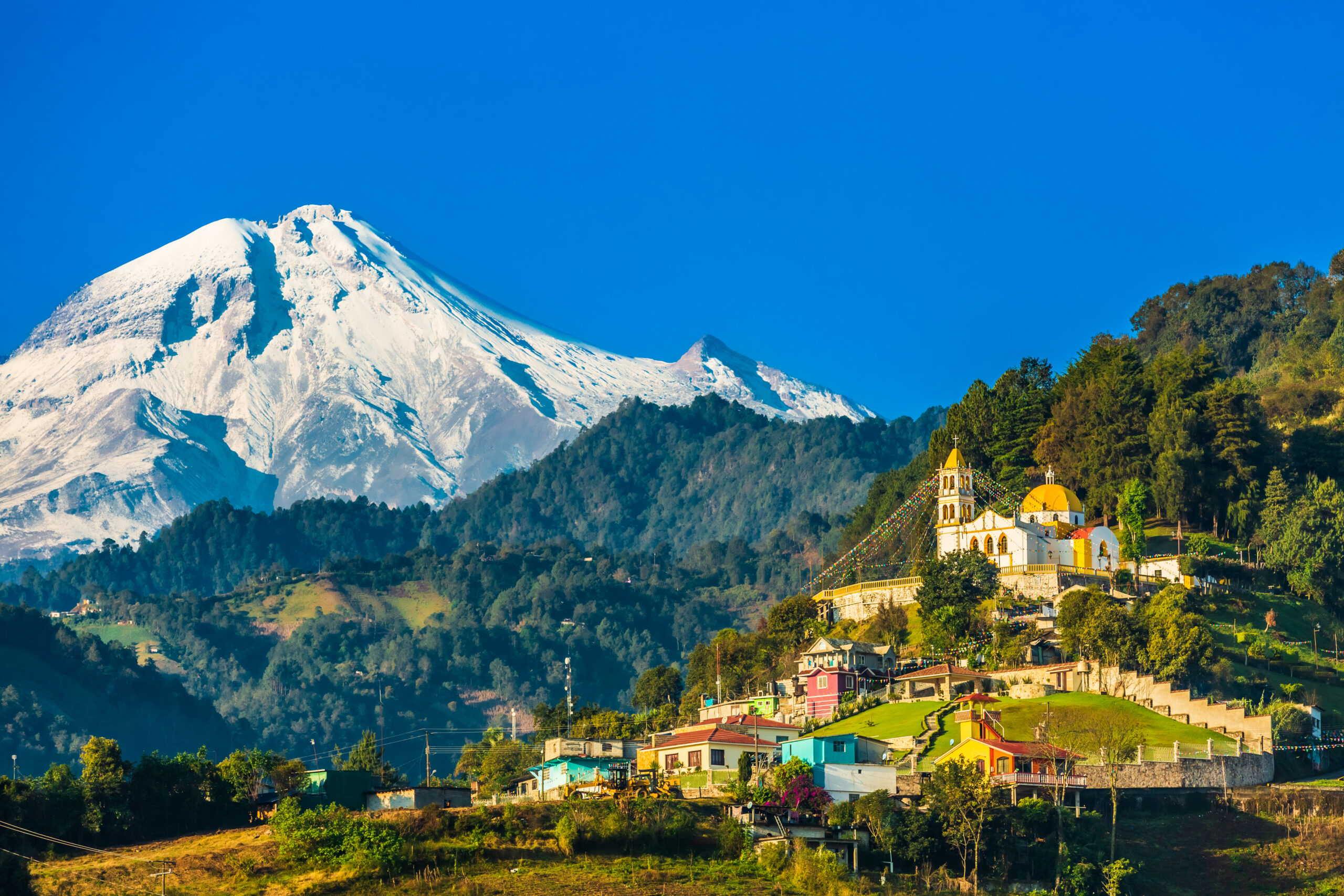
Pico de Orizaba Jamapa Glacier Conditions: Current Status, Ice & Route
The north-side glacier route on Pico de Orizaba is still being climbed, but the glacier is smaller and higher than many older route descriptions suggest. Scientific measurements put the remaining Glaciar Norte ice at 0.37 km² in May 2024 with the front near 5,130 m. What cannot be responsibly confirmed from public sources today is the exact surface—firm snow, fresh snow, névé or hard ice—or the current crevasse, Piedra Grande road and summit-weather picture. Those require a recent field report.
The North Glacier Route Still Exists. The Exact Surface Today Is Not Verified.
Current commercial guide programs still treat Pico de Orizaba as a glacier climb and specify mountaineering crampons, an ice axe and rope systems. That is strong evidence that the north-side glacier route remains an active climbing line.
What has changed is the ice body itself. A peer-reviewed study published in the Journal of South American Earth Sciences measured 0.37 km² of Glaciar Norte ice in May 2024 and put the glacier front near 5,130 m. The researchers concluded that the glacier continues to shrink in both area and thickness.
The name needs context. Climbers still commonly say Jamapa Glacier Route. Modern scientific work describes the surviving Glaciar Norte, while the lower historic Jamapa outlet tongue has retreated away. The climbing name survived even as the glacier geometry changed.
As of September 3, 2026, we do not have a dated same-day field report confirming the exact upper-mountain surface, open or bridged crevasses, Piedra Grande road condition or summit forecast.
What Is Verified—and What Still Needs Local Beta
A useful conditions report separates durable evidence from observations that can be stale within hours.
Current guide programs continue to offer Pico de Orizaba as a glacier climb.
Peer-reviewed measurement of Glaciar Norte ice area.
Peer-reviewed May 2024 front elevation.
Current operator equipment lists continue to specify mountaineering crampons.
Late summer remains less predictable than the normal November–March commercial window.
No same-day independent field report confirming firm snow, fresh snow, névé or hard ice.
Needs a recent team report from the actual north route.
Mud, washouts and high-clearance access can change after storms.
Use a current high-elevation forecast close to the climb.
How Much Glacier Is Left on Pico de Orizaba?
The best current scientific area figure is a measurement, not an estimate based on climbing photographs.
0.37 km² of Remaining Glaciar Norte Ice
Researchers Víctor Soto and colleagues updated Pico de Orizaba’s ice extent through May 2024. They measured approximately 0.37 square kilometers of glacier ice.
The study describes the glacier as continuing to retreat in both surface extent and thickness.
Glacier Front Near 5,130 m
The same study placed the glacier front at roughly 5,130 meters above sea level. That is important for climbers because older route descriptions may describe reaching continuous ice much lower.
Seasonal snow can extend below the glacier, so “where crampons go on” and “where permanent ice begins” are not the same question.
Is the Jamapa Glacier Still There?
“Jamapa Glacier Route” Is Still the Familiar Name
Guides, climbers and route references still use Jamapa Glacier to describe Pico de Orizaba’s standard north-side climb from Piedra Grande toward the crater rim.
If someone says they are climbing “the Jamapa,” they normally mean this traditional north glacier line.
The Surviving Ice Body Is Glaciar Norte
Modern glaciological research maps the remaining Glaciar Norte. The lower outlet tongue historically identified as Jamapa has retreated away.
That distinction explains why older maps, scientific papers and modern climber language can appear to disagree even when describing the same side of the volcano.

The Same North Route Can Feel Very Different After Fresh Snow, Freeze–Thaw or Extended Dry Weather.
That is why a route description and a conditions report are different tools. The line can remain the same while the crampon point, visible crevasses, ice hardness and descent margin change substantially.
Firm Snow, Fresh Snow, Névé or Hard Ice?
Those four surfaces can all exist on a retreating high-altitude glacier, but they do not create the same movement or fall-consequence problem.
| Surface | What it can mean | Why the distinction matters | What to ask |
|---|---|---|---|
| Firm snow | Supportive frozen surface over glacier or seasonal snow. | Crampon travel can be efficient, but a fall can accelerate quickly on steeper terrain. | How hard was the surface on the latest ascent and descent? |
| Fresh snow | Recent storm snow over rock, névé or glacier ice. | Can hide route features and create softer travel or poor visibility. | How much new snow fell and was the route broken? |
| Névé / old snow | Compacted older snow surviving repeated freeze–thaw cycles. | Can provide good travel but become very hard after a cold night. | Were guides front-pointing or using normal flat-foot technique? |
| Exposed hard ice | Glacier ice with little snow cover. | Requires confident crampon technique; a slip may become difficult to arrest. | How much exposed ice is on the upper route? |
| Snow bridges | Seasonal snow spanning crevasse openings. | Can look solid while weakening with warmth or changing weather. | Which crevasses are open, bridged or being bypassed? |
What Can Change From Piedra Grande to the Summit?
The route line has recognizable zones. What needs updating before every climb is the condition inside each zone.
| Route zone | What can change | Why it matters | Question before departure |
|---|---|---|---|
| Piedra Grande approach | Mud, washouts, road deterioration, 4WD access | Changes arrival time, staging and summit-day logistics. | Can your normal vehicle reach Piedra Grande now? |
| Rocky approach / Labyrinth | Bare scree, snow coverage, mixed patches, track visibility | Changes footing, navigation and where technical gear goes on. | What was the approach surface on the latest climb? |
| Glacier transition | Higher ice line, exposed rock, seasonal snow over ice | Older route descriptions may place permanent ice too low. | At what elevation did the latest team put on crampons? |
| Lower glacier | Open crevasses, bridged crevasses, hard ice, route deviations | Changes the line, rope system and travel efficiency. | Which crevasses are currently affecting the route? |
| Upper glacier | Firm snow, névé, hard ice, wind slab, new snow | Changes movement technique and fall consequence. | What is the surface above 5,000 m right now? |
| Crater rim / summit | Wind, cloud, rim snow, visibility | Can make the final summit section slower or harder to navigate. | What upper-mountain wind and visibility are expected? |
| Descent | Warming surface, fatigue, softer snow or harder exposed ice | Accident risk continues after the summit. | What turnaround time keeps the team inside the best descent conditions? |
Do You Still Need Crampons on Pico de Orizaba?
Yes. Current commercial guide programs still specify real mountaineering equipment for the north glacier climb.
| Equipment | Current signal | Why it matters |
|---|---|---|
| 12-point mountaineering crampons | RMI currently specifies automatic or semi-automatic 12-point steel crampons. | Designed for firm snow and glacier ice; boot compatibility matters. |
| Ice axe | Current Pico de Orizaba glacier programs continue to list an ice axe. | Used for balance, movement systems and fall response according to the guide/team plan. |
| Harness & rope | Current guided programs include glacier rope systems. | Crevasse and team-fall management depends on terrain and conditions. |
| Helmet | Standard technical equipment on current programs. | Useful around rock, mixed transition zones and team movement. |
| Microspikes | Not equivalent | Microspikes are not a substitute for mountaineering crampons on firm steep snow or glacier ice. |

Hard Snow Can Turn a Small Mistake Into a Fast, Long Fall.
The American Alpine Club’s analysis of the 2023 Jamapa Glacier team-fall accident is a reminder that surface condition matters as much as route grade. Above 5,000 meters, the report notes crevasses and snow slopes reaching roughly 35 degrees.
Why Hard Surface Matters on the Jamapa Route
This is not presented as a forecast for your climb. It is evidence for why “the route is PD” is not enough information.
Four Climbers Died in a Roped-Team Fall
The American Alpine Club’s Accidents in North American Climbing report describes four climbers falling together above 5,000 meters on the Jamapa Glacier after one climber fell.
The AAC analysis notes that the normal route is not technically difficult, but crevasses are present above 5,000 m and the snow steepens to about 35°.
Surface + Team System Matter
The AAC analysis emphasizes how quickly a climber accelerates on hard snow. That makes same-week beta about surface hardness materially useful.
The report should not be read as a universal instruction about spacing, rope technique or guide decisions. Those depend on the actual team and terrain.
What Does the Time of Year Tell You?
It gives context, not a route report.
Still the More Variable Part of the Year
Late summer in central Mexico remains more affected by moisture, cloud and precipitation than the normal dry-season climbing window. Fresh snow can improve coverage temporarily while also hiding features or complicating road access.
The Main Commercial Climbing Window
Current guide programs commonly target the dry-season months. That usually improves weather reliability, but it does not guarantee good glacier coverage or soft snow. A dry winter can expose more ice.
10 Questions for a Real Current Jamapa Conditions Check
A local guide’s latest team report becomes much more useful when the questions are specific.
Science, Guide Signals & Accident Evidence
Different sources answer different questions. Glacier science does not tell you today’s crampon point; a guide equipment list does not measure glacier area.
Journal of South American Earth Sciences
The 2025 paper Retraction status of “Glaciar Norte” of Pico de Orizaba, Mexico: Update to 2024 reports 0.37 km² of ice in May 2024 and a glacier front near 5,130 m.
Open study →UNAM Geological Field Guide
A 2025 geological-geographic field guide documents the traditional north-side / Jamapa Glacier ascent terminology.
Open UNAM guide →RMI Mexico Volcanoes
Current equipment guidance specifies automatic or semi-automatic 12-point steel mountaineering crampons for the program.
Open RMI program →Yacana Pico de Orizaba
A current Pico program still describes the climb as a glacier expedition using crampons, an ice axe and rope.
Open current program →American Alpine Club
The 2023 Jamapa Glacier team-fall report explains why hard snow and fall consequence matter even on a moderate technical grade.
Open AAC report →Global Summit Guide Routes
Use the route page for distances, staging and normal-line structure; use this conditions page for what can change close to departure.
Open routes →Pico de Orizaba Planning Guides
Pico de Orizaba Climbing Guide
Difficulty, route, altitude, logistics and complete expedition planning.
Open Orizaba →RouteJamapa & Orizaba Routes
Stable route description, elevation, staging and alternatives.
Open routes →WeatherWeather & Best Season
Long-range seasonal timing and summit weather patterns.
Open weather →GuidesPico de Orizaba Operators
Compare local and international guide services.
Compare operators →GearOrizaba Gear List
Boots, crampons, axe, layers and summit-day equipment.
Open gear list →PreparationOrizaba Progression Plan
Build altitude and technical preparation before the summit attempt.
Open progression →Deep recovery 1Glacier Travel Basics
Understand the systems behind rope teams and crevasse terrain.
Read glacier basics →Deep recovery 2Mountaineering Crampons
Choose the right crampon type and binding for your boots.
Compare crampons →Deep recovery 3Altitude Acclimatization
Prepare for the 5,636-meter physiological challenge.
Read acclimatization →Pico de Orizaba Jamapa Glacier FAQ
What are the current conditions on Pico de Orizaba?
As of September 3, 2026, current commercial programs still climb the north-side glacier route and require technical glacier equipment. We do not have a same-day independent field report confirming today’s snow hardness, crevasse bridging, road condition or summit weather.
Is the Jamapa Glacier still there?
The traditional climbing name remains in use, but glacier geometry has changed. Modern scientific literature measures the surviving Glaciar Norte ice body, while the lower historic Jamapa outlet tongue has retreated away.
How much glacier is left on Pico de Orizaba?
A peer-reviewed update measured 0.37 km² of Glaciar Norte ice in May 2024 and placed the glacier front near 5,130 m. This is the latest precise peer-reviewed area measurement used on this page, not an exact September 2026 area.
Do I still need crampons on Pico de Orizaba?
Yes for the north glacier climb under normal current commercial practice. RMI currently specifies 12-point steel mountaineering crampons, and other active Pico programs continue to list crampons, an ice axe and rope.
Can I use microspikes instead of crampons?
Not as an equivalent substitute for the north glacier route. Microspikes are not designed to replace mountaineering crampons on firm steep snow or glacier ice.
Is the Jamapa Glacier route open right now?
Current guide programs continue to offer the north-side route, but this page does not claim same-day open status without a recent field report. Road access, surface condition, crevasses and weather can change quickly.
What is the best season to climb Pico de Orizaba?
The more reliable commercial window is generally November through March. September remains in the wetter, more variable part of the year. Even in dry season, verify the glacier surface and summit forecast close to departure.
Where do climbers put on crampons now?
There is no fixed elevation that should be copied from an old route description. Seasonal snow can begin below permanent ice, and the glacier front has retreated. Ask the latest local team where they put crampons on during its most recent climb.
Are there crevasses on the Jamapa route?
Yes. The American Alpine Club has documented crevasse hazards above 5,000 m, and glacier retreat changes the route environment over time. Ask for a dated report on which crevasses are currently open, bridged or being bypassed.
How do I get a genuine current conditions report?
Ask a guide service when its most recent team climbed, what the glacier surface was, where crampons went on, which crevasses affected the route, whether Piedra Grande road access was normal and whether the guide would choose the north route for your exact dates.
Use Science to Understand the Trend. Use a Recent Team Report to Decide What You Are Climbing.
The north glacier route remains a real mountaineering climb, but the ice is smaller and higher than older descriptions suggest. The most valuable update before departure is not another evergreen route article—it is a dated report covering Piedra Grande access, crampon point, glacier surface, crevasses, route choice and summit weather.
What Has—and Has Not—Changed on the Jamapa / Glaciar Norte Route
The north-side route remains an active mountaineering line, and the long-term glacier trend remains clear. What public sources still do not provide is a dated same-day report for the exact snow hardness, exposed ice, crevasse bridging, Piedra Grande road condition or summit weather. Those details should come from a recent local team report close to your climb.
The most useful update is observational, not promotional.
Before leaving Tlachichuca, ask when the guide’s last team climbed, whether Piedra Grande access is normal, where crampons went on, whether the upper route was firm snow or exposed hard ice, which crevasses affected the line, and what turnaround time the guide is using for the current surface.
Pair conditions with the current season page
The latest weather guide separates long-range dry-season timing from the actual summit-day wind, new snow and hard-ice problem.
Pico de Orizaba Weather & Best Season →Hard ice changes the risk even when the route line is familiar
The difficulty page explains why long-fall exposure, crampon technique and altitude can matter more than old descriptions of a heavily crevassed glacier.
Pico de Orizaba Difficulty & Safety →Use the route guide for stable geography
Keep route layout, staging and normal-line structure separate from current surface condition.
Pico de Orizaba Routes →Train for the glacier that exists now
The progression plan emphasizes crampon, axe and rope-team competence before the trip instead of assuming the north route will present easy seasonal snow.
Pico de Orizaba Progression Plan →Ask operators for dated beta before booking
Compare acclimatization structure and guide systems, then ask the actual guide what the latest team encountered on the north side.
Pico de Orizaba Operators →Microspikes are not a glacier-crampon substitute
Use the dedicated gear page to match real mountaineering crampons, boots, axe, helmet and rope-system equipment to the current route plan.
Pico de Orizaba Gear List →Access, Operator & Departure Checks
These three planning tools are especially useful when current route conditions depend on local access, guide judgment and a final pre-departure verification.
Was this helpful?
🏔Related conditions
🧭Explore & compare
Global Summit Guide is an independent mountaineering resource founded in 2026. The team combines first-hand trekking and climbing experience with in-depth research and professional health and nutrition review to help climbers choose objectives, prepare properly, and stay safe.
Health, altitude, and nutrition content is reviewed by Taylor Ludlow (Registered Nurse) and Brigg Hoopes (Nutritionist).
What We Don't Know Yet
Mountain information changes quickly. This box explains the limits of what this page can responsibly promise.
- Weather, snowpack, avalanche risk, road access, and route conditions can change quickly and may be different on your climbing dates.
- Route conditions, trailhead access, crevasse exposure, stream crossings, and rescue access may vary from published planning guidance.
- Gear requirements can change by season, route variation, weather window, personal cold tolerance, and guide-service requirements.
- Fitness and altitude response vary by person; no guide, itinerary, or training plan can guarantee acclimatization or summit success.
Verify current conditions with official land managers, guide services, local forecasts, and current route reports before booking or climbing.
Mountaineering, rock and ice climbing, glacier travel, and high-altitude activity are inherently dangerous and can result in serious injury or death. The information on Global Summit Guide is provided for general informational and educational purposes only and is not a substitute for professional instruction, qualified guiding, proper equipment, or your own judgment and experience.
Route conditions, weather, snowpack, permits, regulations, and hazards change constantly and may differ from what is described here. Details may be incomplete, out of date, or contain errors. Always verify current information with local authorities, certified guides, and official sources before making any decision in the mountains.
Nothing on this site is medical, legal, or financial advice. Our fitness, acclimatization, altitude, and nutrition content is general in nature; consult a qualified physician before beginning any strenuous exercise program or exposing yourself to high altitude.
You are solely responsible for your own safety and decisions. To the fullest extent permitted by law, Global Summit Guide and its team accept no liability for any loss, injury, damage, or expense arising from use of, or reliance on, this information. By using this site you acknowledge these risks and accept these terms.
Some links on this site may be affiliate links. If you buy through them we may earn a small commission at no extra cost to you; this never affects our recommendations.
Global Summit Guide recommendation path
Next Best Mountain to Research
Use these recommendations to continue the right planning path instead of stopping on one page.
Use current permit, weather, route, and operator information before booking or climbing.