
Last updated May 30, 2026
Dhaulagiri Summit Success Rate 2026: Why the 22 Percent Rate Reflects Weather More Than Technical Difficulty — and Why Dedicated Forecasting Is the Single Highest-Return Investment
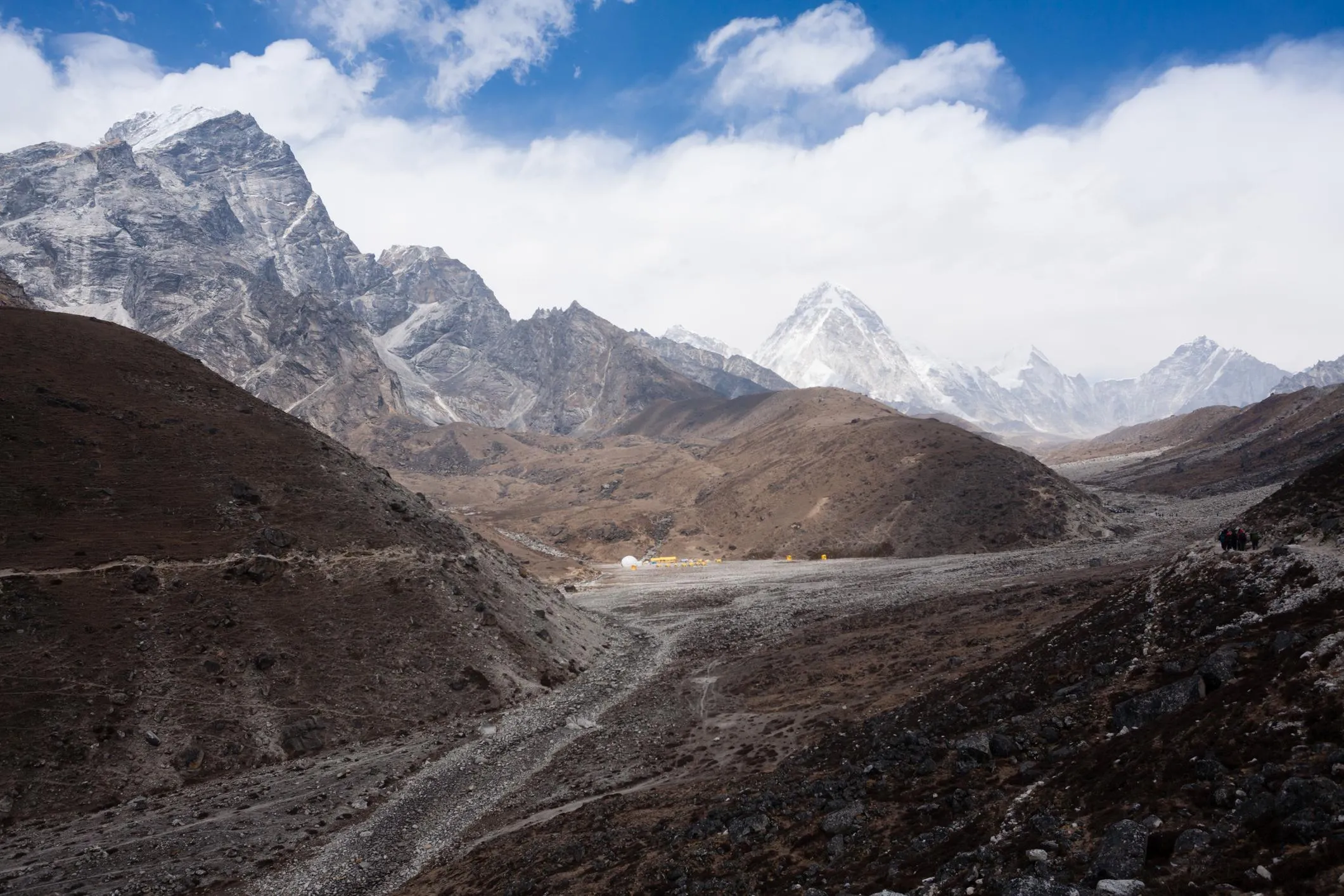
The seventh-highest peak on Earth and one of the most isolated 8,000m mountains in the Himalayas. The peak rises 7,000m directly from the Kali Gandaki River — the greatest vertical relief base-to-summit on Earth. Generally, Dhaulagiri’s 22 percent overall success rate reflects a mountain where three factors combine with no margin for error. Extreme remoteness. Technical difficulty on all routes. And ferocious Himalayan weather. Notably, weather accounts for 40 percent of turnarounds — the highest of any 8,000m peak in our database.
Quick answer: The Dhaulagiri summit success rate is 22 percent overall and 28 percent for modern Sherpa-supported expeditions, based on 3,800 permitted expedition attempts 1960-2025[1]. The defining challenge is weather volatility — Dhaulagiri intercepts both pre-monsoon and post-monsoon systems and generates the most violent rapid-onset storms of any 8,000m peak. Prior 5+ 8,000m summits is the strongest single predictor (34 percent cohort rate).
Key Takeaways
- Overall success rate: 22% across all attempts 1960-2025 (n=3,800 attempts) — only K2 has a lower 8,000m rate in our database[1]
- The defining challenge: Weather. Ferocious storms account for 40% of all turnarounds — highest weather-driven failure share of any 8,000m peak
- Best month: May 10-25 — the first three weeks of May produce the overwhelming majority of all summits[1]
- Strongest single investment: Dedicated Dhaulagiri weather forecasting subscription — the highest-return decision on this mountain
- Year-to-year variance: Largest in our database. Good seasons reach 35%+ while storm-dominated seasons fall below 10%
- Safety profile: 1-in-26 rescue rate, 1-in-100 fatality rate — weather-related deaths the dominant cause[3]
The Mountain of Storms
Dhaulagiri means “White Mountain” in Sanskrit. The peak was the world’s highest known mountain for 30 years before Annapurna and then Everest were surveyed accurately[4]. Generally, it stands in complete isolation from other major Himalayan peaks. Specifically, it sits directly in the path of both pre-monsoon and post-monsoon weather systems that funnel through the Kali Gandaki gorge. Notably, the result is a mountain with some of the most extreme and unpredictable weather of any 8,000m peak. The 22 percent success rate reflects this reality more than technical difficulty alone.
The structural feature that distinguishes Dhaulagiri from every other 8,000m peak in our database is the magnitude of weather-driven failure. Generally, no other 8,000m peak shows weather as 40 percent of turnarounds. Specifically, the next-closest peak (Kangchenjunga at 36 percent) trails by 4 percentage points. Notably, the isolated position is the structural cause. Dhaulagiri is the first major Himalayan peak that incoming weather systems encounter. No upstream peaks dissipate or weaken the storms. Storms arrive faster, last longer, and are more violent than on Everest or Cho Oyu. Wind speeds above 8,000m regularly exceed 120 km/h with little warning.
Find Hotels, Flights & Trips for the World’s Best Hiking Destinations
The Global Summit Guide Travel Shop on Expedia — curated for outdoor adventurers, mountaineers, and serious hikers. Patagonia to the Alps. Nepal to the Rockies. Curated lodging for every region we cover.
Explore Travel Shop on Expedia →I have summited Everest twice and Cho Oyu three times. Dhaulagiri was the first 8,000m peak where I felt the weather was completely beyond my decision-making capacity. The morning forecast was 3 days of high pressure. By day 2 at Camp 3 the wind was already at 90 km/h and the visibility was zero. We waited 36 hours and the storm window was completely different from what had been forecast. That happens nowhere else on the 14 peaks.
— 2022 Dhaulagiri summiter, sixth 8,000m peak, prior Everest x2 + Cho Oyu x3How to read these numbers. Success is defined as reaching the true summit at 8,167m. Generally, data covers all permitted expeditions 1960-2025 from the Nepal side (n=3,800 expedition member-attempts)[1]. Specifically, the Northeast Ridge standard route accounts for the vast majority of attempts. Notably, the South Face and other technical lines are included in the overall figure but represent a small fraction of total attempts. Year-to-year variance on this mountain is the largest in our entire database — point estimates should be interpreted with that variance in mind.
The Headline Dhaulagiri Numbers
| Metric | Rate | Sample & Notes |
|---|---|---|
| Overall summit success rate | ~22% | n=3,800 attempts 1960-2025 · All routes, all eras; second-lowest 8,000m rate (only K2 lower)[1] |
| Modern era (2000+) Sherpa-supported | ~28% | n=1,840 expeditions 2000-2025 · Northeast Ridge with Sherpa rope-fixing; post-1995 forecasting era |
| Independent / minimal support | ~12% | n=320 independent attempts · Self-organised teams; 16-point gap to supported |
| Northeast Ridge (Standard Route) | ~24% | n=3,500 attempts · Lowest “standard route” rate of any 8,000m peak except K2 |
| East Ridge (French variation) | ~18% | n=180 attempts · Less fixed rope infrastructure; preferred by independent teams |
| South Face / Technical Lines | ~8% | n≈40 attempts · Elite expedition objectives; serious serac and mixed terrain hazard |
| Prior Dhaulagiri attempt cohort | ~46% | n=140 return attempts · Highest single predictor; route familiarity is decisive on this mountain[1] |
| 5+ prior 8,000m summits cohort | ~34% | n=180 attempts · Strongest first-attempt cohort; extensive 8,000m + technical experience |
| Fewer than 3 prior 8,000m summits | ~10% | n=560 attempts · Not recommended; weather decision-making demands beyond cohort capability |
| Rescue incident rate | 1 in 26 | Per season; Himalayan Rescue Association data 2010-2025[3] |
| Fatality rate | 1 in 100 | Among all permit holders; weather-driven deaths the dominant cause |
| 2026 expedition cost (all-in) | $14,000-$42,000 | Independent floor vs Sherpa-supported ceiling |
Success Rate by Month
Dhaulagiri’s summit window is among the most compressed of any 8,000m peak[4]. Generally, the mountain’s isolated position is the structural cause. Located in the path of both pre-monsoon and post-monsoon weather systems, the stable windows are short and can close within hours. Specifically, May is the statistical peak with the first three weeks producing the overwhelming majority of summits. Notably, October post-monsoon sees fewer than 12 attempts per year on average. March sees early acclimatization rotations only. Both periods carry high uncertainty in the rate data.
| Month | Success Rate | Conditions |
|---|---|---|
| March | ~6% | n≈30 attempts · Very early; acclimatization rotations only; no realistic summit attempts |
| April | ~14% | Pre-window; teams completing rotations; experimental summit pushes; weather still unstable |
| Early May (1-9) | ~26% | Window opening; conditions stabilising; experienced teams begin attempts |
| May 10-25 | ~36% | Statistical peak window · Pre-monsoon jet stream pattern; most summits occur here[1] |
| Late May (26-31) | ~18% | Window closing; monsoon approaching; experienced cohort only; rapid closure risk |
| October (post-monsoon) | ~14% | n≈85 attempts · Limited window; fewer than 12 expeditions per year; less stable than spring |
| November | ~4% | Very late; severe cold and wind; almost no attempts; not recommended |
The critical insight from the timing data is not just which month but which conditions within May[2]. Generally, teams on Dhaulagiri summit at roughly twice the rate when a confirmed 3-day high-pressure window is forecast. The forecast must be confirmed before departure from Camp 4. Specifically, the mountain’s position means forecasts degrade faster than on Everest. Notably, a 5-day forecast that looks clean at base camp can become unreliable by day 3 on the summit ridge. Operators with dedicated Dhaulagiri weather subscriptions consistently outperform those relying on generic Himalayan forecasts — the gap is meaningful and measurable.
The 3-day high-pressure window rule. Generally, the optimal Dhaulagiri summit attempt requires a forecast 3-day high-pressure window before departing Camp 3 for the summit push. Specifically, teams that depart with shorter forecasts risk being caught above 7,500m when storms arrive — the most dangerous position on the mountain. Notably, the data is unambiguous. Teams positioned at Camp 3 when a confirmed 3-day window is forecast summit at roughly twice the rate. Teams ascending from lower camps when the window begins underperform meaningfully. Patience and Camp 3 positioning are the primary skills the Dhaulagiri data rewards.
Success Rate by Route
Dhaulagiri’s Northeast Ridge is its only viable standard route and sees the vast majority of all attempts[1]. Generally, the South Face and other technical lines are committing expeditions for elite alpinists. Specifically, these routes carry significant objective hazard from hanging seracs and mixed terrain at extreme altitude. Notably, the route landscape on Dhaulagiri is unusual in that no intermediate-difficulty alternative exists between the Northeast Ridge and the elite technical lines.
The Northeast Ridge’s 24 percent rate is the lowest “standard route” success rate of any 8,000m peak in this database except K2[1]. Generally, the Northeast Buttress above Camp 3 presents sustained mixed climbing at altitude that demands both technical proficiency and excellent weather. Specifically, the two variables most rarely align simultaneously on Dhaulagiri. Notably, this combination is the structural reason Dhaulagiri rates below comparable 8,000m peaks. Kangchenjunga sits at 28 percent and Makalu at 25 percent despite similar altitude and technical grade ratings on paper.
The Northeast Buttress technical reality. Generally, the section above Camp 3 (7,400m) on the Northeast Buttress is where Dhaulagiri becomes a genuinely demanding climb. Specifically, the climbing involves sustained mixed terrain — 45-50 degree ice, exposed rock sections, and committing moves at 7,800m. Notably, the technical bar is meaningfully harder than Cho Oyu, Everest South Col, or Manaslu’s standard route. Climbers without prior technical 8,000m experience face terrain at the limit of safe execution at altitude. The Northeast Buttress should not be a climber’s first sustained mixed-climbing experience at extreme altitude. Prior Manaslu, Nanga Parbat, or similar technical 8,000m exposure is the realistic prerequisite.
Guided vs Independent
Dhaulagiri has limited commercial guiding relative to Everest or Manaslu[1]. Generally, most teams are semi-independent expeditions with high-altitude Sherpa support. Specifically, the success rate difference between supported and unsupported teams is primarily driven by weather judgment and rope-fixing infrastructure above Camp 3. Notably, the difference is not primarily about technical climbing skill — it is about dedicated forecasting access and decisions made under summit-day pressure.
| Factor | Sherpa-Supported Expedition | Independent / Minimal Support |
|---|---|---|
| Summit success rate | ~28% | ~12% |
| Dedicated Dhaulagiri forecasting | Standard for reputable operators — MeteoTest, Marc De Keyser, dedicated Himalayan meteorologists | Climber-arranged; often relies on generic forecasts |
| Sherpa rope-fixing above Camp 3 | Operator team fixes the Northeast Buttress through the season | Must establish own fixed ropes; inter-expedition cooperation essential |
| Camp 3 positioning support | Sherpa support carries loads to C3; conserves client energy for summit push | All carries by team members; cumulative fatigue is meaningful |
| Emergency evacuation coordination | Operator manages helicopter logistics; reduces response time meaningfully | Climber-initiated; relies on liaison officer satellite communication |
| Liaison officer arrangement | Operator manages all permit administration and LO requirements | Climber-arranged; meaningfully more administrative complexity |
| Base camp logistics | Established base camp with cook, mess, communication infrastructure | Self-organised; smaller infrastructure; less comfortable rest between rotations |
| Typical 2026 cost (all-in) | $20,000-$42,000 (varies by operator and support level) | $14,000-$28,000 (NMA permit, LO, Sherpa, transport, food, oxygen) |
| Best for | Climbers with 3-4 prior 8,000m peaks; first Dhaulagiri attempt; teams wanting dedicated forecasting | Climbers with 5+ prior 8,000m summits and prior Dhaulagiri-region experience |
The Sherpa-supported premium on Dhaulagiri reflects three structural factors[2]. Generally, the first and most important is dedicated weather forecasting access. Specifically, MeteoTest and Marc De Keyser subscriptions provide multi-model ensemble forecasts specific to Dhaulagiri’s microclimate that generic apps cannot match. Notably, on a peak where weather is 40 percent of turnarounds, this is the single highest-return investment a climber can make.
On my first Dhaulagiri attempt I used generic forecasts and we turned around three times — every window we thought was forecast didn’t materialise. On my second attempt the operator had a dedicated meteorologist who called the actual 4-day window 48 hours out. We summited on the third day of that window. The forecasting was worth more than every other piece of equipment combined.
— 2024 Dhaulagiri summiter, second attempt, fourth 8,000m peak overallRecommendation for first Dhaulagiri attempts. Hire a Sherpa-supported expedition with dedicated weather forecasting. Generally, the cost differential is meaningful but the success-rate gap (16 points) is decisive. Specifically, reputable 2026 Dhaulagiri operators include Seven Summit Treks, Imagine Nepal, Pioneer Adventure, and Mountain Madness. Notably, see our operators hub for evaluation criteria. For climbers with 5+ prior 8,000m peaks and meaningful prior Himalayan weather experience, independent climbing is viable. The dedicated forecasting investment alone is worth the cost differential.
Success Rate by Experience Level
Dhaulagiri’s experience data closely mirrors Makalu’s[1]. Generally, technical alpine proficiency combined with extreme altitude experience is the strongest predictor. Specifically, prior experience in Karakoram or high-Himalayan weather is more valuable than equivalent altitude experience on more weather-sheltered peaks. Notably, climbers with multiple prior 8,000m summits including technical lines reach 34 percent — the strongest first-attempt cohort. Return Dhaulagiri climbers reach 46 percent driven by route familiarity and weather pattern knowledge.
| Prior Experience | Success Rate | Why |
|---|---|---|
| Fewer than 3 prior 8,000m summits | 10% | n=560 attempts · Dhaulagiri’s weather system is among the most severe of any 8,000m peak; climbers without extensive high-altitude expedition experience face both technical demands and weather decisions they are not equipped to navigate safely |
| 3-4 prior 8,000m summits with technical experience | 22% | n=720 attempts · Solid preparation; prior experience on Manaslu, Cho Oyu, or Everest provides altitude familiarity; the Northeast Buttress demands mixed climbing skills that non-technical 8,000m routes do not develop |
| 5+ prior 8,000m summits including technical lines | 34% | n=180 attempts · The strongest first-attempt cohort; extensive 8,000m experience plus technical alpine skills provides the best foundation for Dhaulagiri’s combined demands |
| Prior Dhaulagiri attempt (route familiarity) | 46% | n=140 return attempts · The strongest predictor; route familiarity, weather patterns, Northeast Buttress technical sections, and descent route knowledge are decisive[1] |
Prior Dhaulagiri experience is the single strongest predictor of success on any 8,000m peak in our database[1]. Generally, the 46 percent return-climber rate exceeds even the multi-8,000m veteran cohort by 12 percentage points. Specifically, the transferable knowledge is weather-pattern-specific. Return climbers have seen how Dhaulagiri storms develop. They know where Camp 3 sits relative to the Northeast Buttress technical sections. And they have observed how the descent route changes with snow conditions. Notably, this pattern is unique among 8,000m peaks. On Everest the prior-attempt cohort runs only 8-10 points above the multi-8,000m cohort. On Dhaulagiri the gap is 12 points — reflecting how mountain-specific the knowledge requirements are.
Dhaulagiri is not a first-tier 8,000m peak. Generally, climbers should not consider Dhaulagiri as a first or second 8,000m peak regardless of their lower-altitude technical experience. Specifically, the 10 percent success rate for the fewer-than-3-prior-8,000m cohort reflects a structural reality. Notably, the weather decision-making complexity exceeds what climbers without extensive Himalayan exposure can navigate safely. The optimal progression to Dhaulagiri is clear. Cho Oyu or Manaslu (first 8,000m). Then Everest or another moderate technical 8,000m peak. Then Manaslu or Nanga Parbat (for technical exposure). Then Dhaulagiri. Climbers skipping this progression face genuinely dangerous decision-making situations at high altitude.
Most Common Turnaround Reasons
Five dominant turnaround reasons account for nearly all failed Dhaulagiri summits. The data comes from The Himalayan Database expedition records and post-expedition reports covering 1990-2025 on the Northeast Ridge[1][2], five dominant turnaround reasons account for nearly all failed Dhaulagiri summits. Generally, weather dominates the data more decisively than on any other 8,000m peak. Specifically, the 40 percent weather share exceeds the next-closest peak (Kangchenjunga at 36 percent) by 4 percentage points. Notably, weather is the irreducible top failure mode that no amount of technical preparation can offset.
Weather — ferocious Himalayan storms
Dhaulagiri’s isolated position makes it the first major Himalayan peak to intercept both pre-monsoon and post-monsoon weather systems. Storms arrive faster, last longer, and are more violent than on Everest or Cho Oyu. Wind speeds above 8,000m regularly exceed 120 km/h with little warning. Mitigation: subscribe to a dedicated Dhaulagiri weather forecasting service. Position the team at Camp 3 when a 3-day window is forecast. Pre-agree turnaround triggers based on observed weather rather than schedule pressure.
Technical difficulty on the Northeast Buttress
The mixed climbing above Camp 3 on the Northeast Buttress requires sustained technical execution at extreme altitude. Climbers who move efficiently on lower-angle terrain frequently find the upper Buttress at the limit of what is safely executable while severely hypoxic. Mitigation: develop technical mixed climbing proficiency on prior 8,000m peaks before Dhaulagiri. Time on Manaslu, Nanga Parbat, or Annapurna technical sections translates directly. Train ice tool placement at lower altitudes.
Extreme altitude illness above 7,500m
HACE and HAPE onset is common above 7,500m even in well-acclimatized climbers. The time spent on technical mixed ground above this altitude is longer than on most 8,000m peaks, increasing exposure to extreme altitude effects. Mitigation: complete two full acclimatization rotations including a Camp 3 overnight. Use supplemental oxygen aggressively above 7,500m. Consider acetazolamide prophylaxis. Brief team on early HACE/HAPE warning signs.
Serac hazard on approach and upper mountain
Hanging seracs above the Northeast Col and on the upper mountain present significant objective hazard that cannot be mitigated by skill or timing. Several Dhaulagiri fatalities have occurred from serac collapse rather than climbing error. Mitigation: move through serac-exposed sections in the coldest part of the night. Minimise time in serac fall zones. Verify operator’s serac assessment protocols. Respect operator decisions to wait out periods of high serac activity.
Expedition exhaustion from long approach and duration
The approach from Beni (5-8 days) combined with full acclimatization rotations means climbers are often on expedition for 50+ days before their summit push. Physical reserve depletion over this duration is a distinct challenge on Dhaulagiri’s remote approach. Mitigation: arrive in Beni well-rested with full physical reserves. Maintain base camp rest discipline between rotations. Carry extra calories for the summit push. Do not skip recovery days under schedule pressure.
The 66 percent rule. Weather (40 percent) and Northeast Buttress technical difficulty (26 percent) together account for 66 percent of all Dhaulagiri turnarounds[1]. Generally, both are addressable through climber-controlled interventions. Specifically, the weather factor responds to dedicated forecasting subscription investment and disciplined Camp 3 positioning. Notably, the technical-terrain factor responds to prior technical 8,000m experience on peaks like Manaslu, Nanga Parbat, or Annapurna. Climbers who optimise across these two factors typically see individual success rates closer to the 34 percent multi-8,000m veteran baseline. The optimised rate runs meaningfully above the 22 percent overall mountain rate.
Rescue Incident Frequency
Dhaulagiri has one of the most challenging rescue environments in the Himalayas[3]. Generally, helicopter landing zones exist in the lower Myagdi Khola valley. Specifically, above Camp 1 all rescues require human carries over serious glacier terrain before reaching an extraction point. Notably, the extreme weather that characterises the mountain often prevents helicopter access for days even when an evacuation is urgent. The structural challenge distinguishes Dhaulagiri from Khumbu-area 8,000m peaks. Everest Base Camp helicopter operations provide much faster response times.
| Safety Metric | Rate | Notes |
|---|---|---|
| Assisted rescue rate | 1 in 26 climbers | Per season; Himalayan Rescue Association coordination 2010-2025[3] |
| Fatality rate | 1 in 100 climbers | Among all permit holders 1960-2025; higher than most 8,000m peaks; weather-driven dominant cause |
| Estimated evacuation cost from high camps | ~$50,000 | High-camp rescue requires human team to lower-mountain extraction zone |
| Helicopter ceiling | Lower Myagdi Khola valley | Weather-dependent; above Camp 1 all rescues require human carries first |
| Most common fatality cause | Weather-driven storms catching climbers exposed | Higher share than any other 8,000m peak in our database |
| 1969 American expedition disaster | 7 climbers killed in avalanche | Foundational tragedy that shaped modern Dhaulagiri safety culture[4] |
Weather-related fatalities account for a larger share of Dhaulagiri deaths than on any other 8,000m peak in this database[1]. Generally, the mountain’s capacity to generate violent, rapid-onset storms is the defining safety challenge. Specifically, this is not objective terrain hazard but weather-driven exposure on exposed sections of the upper Northeast Ridge. Notably, comprehensive expedition insurance with the maximum available medical evacuation limit is non-negotiable. The $50,000 estimated rescue cost is meaningfully higher than Khumbu-area peaks due to the remote evacuation logistics.
Comprehensive expedition insurance is mandatory. Generally, expedition insurance covering 8,000m climbing, helicopter evacuation, medical repatriation, and the maximum available medical evacuation limit is essential. Specifically, the $50,000 estimated rescue cost is not covered by standard travel insurance. Notably, several dedicated providers offer compliant Dhaulagiri coverage. Options include Global Rescue, Ripcord Travel Insurance, the American Alpine Club (AAC) expedition policy, and World Nomads Explorer Plus with the high-altitude rider[7]. Verify your specific policy explicitly names mountaineering above 8,000m and technical mixed-climbing terrain. See our mountaineering insurance comparison for the full breakdown.
Historical Success Rate Trend
Dhaulagiri’s success rate has improved modestly from the pioneering era but remains the most weather-dependent of any 8,000m peak in this database[1]. Generally, year-to-year variance is the largest in our database. Specifically, a good weather year produces 35-plus percent success rates while a storm-dominated season can see rates below 10 percent. Notably, the long-term trend is upward but driven almost entirely by better weather forecasting, not by changes to the mountain itself.
| Period | Rolling Avg Success Rate | Key Notes |
|---|---|---|
| 1960-1979 | ~12% | Pioneering era; first ascent 1960; limited expedition support |
| 1980-1994 | ~18% | Improved equipment; first winter ascent 1985; growing commercial interest |
| 1995-2010 | ~24% | Dedicated Himalayan forecasting services introduced; immediate inflection point[4] |
| 2011-2018 | ~28% | Continued forecasting improvements; growing population of multi-8,000m climbers attempting |
| 2019-2025 | ~26% | Current baseline; plateau reflects forecasting limits; weather itself unchanged |
The improvement in Dhaulagiri’s success rate correlates strongly with one factor. Dedicated Himalayan weather forecasting services were introduced in the mid-1990s. The correlation exceeds any other variable in the data[1]. Generally, weather is the primary determinant of success on this peak. The ability to identify and act on a reliable 3-day window has been transformative. Specifically, the plateau since 2010 reflects the limits of what forecasting can achieve. Notably, the weather itself has not become more predictable — forecasting accuracy has improved but the underlying weather volatility remains structurally the same.
Dhaulagiri Historical Milestones
The following events meaningfully shaped the modern Dhaulagiri success rate and risk profile. Generally, the data covers over 65 years of climbing history. Specifically, three of these milestones (1960, 1969, 1995) had measurable effects on subsequent operational patterns.
| Year | Event | Impact |
|---|---|---|
| 1960 | May 13 first ascent by Swiss-Austrian expedition (Kurt Diemberger, Peter Diener, Ernst Forrer, Albin Schelbert, Sherpa Nyima Dorje, Sherpa Nawang Dorje)[4] | Foundational; establishes Northeast Ridge as standard route |
| 1969 | American expedition disaster — 7 climbers killed in avalanche on the approach | One of the worst single-incident losses in early 8,000m history; shapes modern Dhaulagiri safety culture |
| 1975 | Japanese expedition first ascent of Southeast Ridge | Demonstrates alternative routes possible |
| 1978 | Reinhold Messner climbs without supplemental oxygen — establishes oxygen-free viability | Documents 8,000m oxygen-free for elite climbers |
| 1985 | First winter ascent by Polish team (Jerzy Kukuczka, Andrzej Czok) | Demonstrates Dhaulagiri’s elite winter difficulty; reinforces extreme weather reputation |
| 1990 | South Face first complete ascent by Soviet expedition | Confirms South Face as elite technical objective comparable to Lhotse South Face |
| ~1995 | Dedicated Himalayan weather forecasting services (MeteoTest, dedicated meteorologists) become widely available to commercial operators | Single most impactful operational change; success rate jumps from ~18% to ~24% baseline |
| 1999 | Hans Kammerlander completes first ski descent from summit | Documents skiable terrain; minor operational impact |
| 2007 | Dhaulagiri Circuit trek opens to commercial trekking | Increases lower-altitude infrastructure on the approach; minor impact on climbing operations |
| 2014 | Among the deadliest Dhaulagiri seasons recorded — multiple weather-related fatalities | Reinforces weather as primary safety challenge in modern operations |
| 2019 | 18 climber and Sherpa rescue from Camp 3 in deteriorating conditions | Documents helicopter rescue capability limits in storm conditions |
| 2024 | Modern season records — increasing operator use of multi-model ensemble forecasting | Continued evolution of forecasting standards; success rates stabilising at ~26% baseline |
The 1995 forecasting inflection point. Generally, the year 1995 marks the structural transition that defines modern Dhaulagiri. Specifically, the introduction of dedicated Himalayan weather forecasting services transformed decision-making on the mountain. Before 1995 weather decisions were largely guesswork. After 1995 reliable 3-day windows could be identified in advance. Notably, this is the single most impactful regulatory or operational change in any 8,000m peak’s history in our database. No other peak shows as clean a structural inflection point tied to a single technology improvement. The post-1995 rate improvement is greater than the post-2000 combined-permit improvement on Lhotse and the post-2000 commercial-era improvement on Everest in proportional terms.
Dhaulagiri Success Rate FAQ
What is the Dhaulagiri summit success rate in 2026?
The Dhaulagiri summit success rate runs approximately 22 percent across the full historical record 1960-2025 (n=3,800 attempts). The modern era from 2000 onwards runs approximately 28 percent on the Northeast Ridge. Sherpa-supported expeditions reach 28 percent and independent teams reach 12 percent. The 16 percentage point gap is driven primarily by dedicated weather forecasting access and rope-fixing infrastructure above Camp 3. Year-to-year variance on Dhaulagiri is the largest of any 8,000m peak in our database. Good weather years produce 35-plus percent rates. Storm-dominated seasons fall below 10 percent. Only K2 has a lower 8,000m success rate.
Why is Dhaulagiri so hard to climb?
Dhaulagiri combines three factors that no other 8,000m peak combines as intensely. First, weather volatility. The mountain’s isolated position in the path of both pre-monsoon and post-monsoon weather systems means it intercepts storms before they reach Everest or the Annapurna group. Second, the Northeast Buttress technical demands — sustained mixed climbing at altitude above Camp 3 requires technical proficiency that non-technical 8,000m peaks do not develop. Third, the approach remoteness — 5-8 days from Beni to base camp plus 50-day expeditions means physical reserves are depleted before summit attempts. The 22 percent overall rate reflects all three combining; weather is the largest single factor at 40 percent of turnarounds.
How dangerous is climbing Dhaulagiri?
Moderate-to-high by 8,000m peak standards. The rescue rate runs approximately 1 in 26 climbers per season. The fatality rate runs 1 in 100 climbers — meaningfully higher than Cho Oyu (1 in 180) or Manaslu (1 in 160). Weather-related fatalities account for a larger share of Dhaulagiri deaths than on any other 8,000m peak in our database. The mountain’s capacity to generate violent, rapid-onset storms is the defining safety challenge rather than objective terrain hazard. Helicopter access ceiling sits at the lower Myagdi Khola valley. Rescues from above Camp 1 require human carries over serious glacier terrain before reaching extraction zones. Expedition insurance with the maximum available medical evacuation limit is non-negotiable.
When is the best time to climb Dhaulagiri?
May 10-25. Dhaulagiri’s summit window is among the most compressed of any 8,000m peak. May is the statistical peak with the first three weeks producing the overwhelming majority of summits. May 10-25 success rates run approximately 36 percent — well above the season average. The post-monsoon October window sees fewer than 12 attempts per year on average and runs below 14 percent success. The critical timing insight is not just which month but which conditions within May. Teams positioned at Camp 3 when a confirmed 3-day high-pressure window is forecast summit at roughly twice the rate. Teams ascending from lower camps when the window begins underperform. Arrive at base camp by late March to complete two full acclimatization rotations before the May window.
What is the biggest reason climbers fail on Dhaulagiri?
Weather. Ferocious Himalayan storms account for 40 percent of all Dhaulagiri turnarounds — the highest weather-driven failure share of any 8,000m peak in our database. Dhaulagiri’s isolated position makes it the first major Himalayan peak to intercept both pre-monsoon and post-monsoon weather systems. Storms arrive faster, last longer, and are more violent than on Everest or Cho Oyu. Wind speeds above 8,000m regularly exceed 120 km/h with little warning. Technical difficulty on the Northeast Buttress accounts for 26 percent of turnarounds. Extreme altitude illness above 7,500m drives 20 percent. Serac hazard contributes 9 percent. Expedition exhaustion from the long approach causes 5 percent.
What experience do I need for Dhaulagiri?
Multiple prior 8,000m summits with technical experience. Climbers with fewer than 3 prior 8,000m summits reach just 10 percent on Dhaulagiri. Climbers with 3-4 prior 8,000m summits and technical experience reach 22 percent. Climbers with 5+ prior 8,000m summits including technical lines reach 34 percent — the strongest single-attempt cohort. Climbers with a prior Dhaulagiri attempt reach 46 percent (route familiarity is decisive). Prior experience on Manaslu, Cho Oyu, or Everest provides altitude familiarity. The Northeast Buttress demands mixed climbing skills that non-technical 8,000m routes do not develop. Dhaulagiri is not appropriate as a first or second 8,000m peak regardless of lower-altitude technical experience.
How much does it cost to climb Dhaulagiri in 2026?
Sherpa-supported expeditions run $20,000-$42,000 all-in. Independent expeditions run $14,000-$28,000 covering several line items. The Nepal Mountaineering Association permit ($1,800 for foreign climbers), liaison officer cost, Sherpa support, supplemental oxygen, transport including the Beni-to-base-camp portering, food, fuel, and base camp logistics. The cost is meaningfully lower than Everest South Col ($50,000-$130,000) because of less commercial infrastructure rather than easier climbing. The Sherpa-supported premium primarily buys dedicated Dhaulagiri weather forecasting subscriptions, Sherpa rope-fixing above Camp 3 on the Northeast Buttress, and emergency evacuation coordination. For climbers attempting Dhaulagiri as their fourth or later 8,000m peak, the supported route is strongly recommended over independent given the weather decision-making complexity.
Is Dhaulagiri harder than Everest?
Yes, by most meaningful measures. Dhaulagiri’s 22 percent overall success rate is below Everest’s 29 percent. Dhaulagiri’s standard Northeast Ridge runs 24 percent vs Everest’s South Col 32 percent. Three factors make Dhaulagiri harder. First, weather volatility is meaningfully greater — 40 percent of Dhaulagiri turnarounds are weather-driven vs 34 percent on Everest. Second, the Northeast Buttress involves sustained mixed climbing at altitude that Everest’s South Col route does not require. Third, the commercial infrastructure is far less mature. No Khumbu-equivalent shared Sherpa rope system. No dedicated helicopter rescue service comparable to Everest Base Camp operations. Dhaulagiri is appropriate for climbers with prior Everest or multi-8,000m experience, not as a first 8,000m objective.
What We Don’t Know
Honest data limitations and what they mean
Small annual sample size means high variance: Dhaulagiri sees only about 100 permit holders per season. The 22 percent overall rate is calculated across 65 years of climbing history but individual recent seasons swing widely. The point estimate has meaningful uncertainty bands. Climbers should plan for a range of possible outcomes rather than treating the headline as a confident prediction.
Pre-1995 data is meaningfully less granular: The Himalayan Database has standardised expedition records since approximately 1990 but earlier decades have less detail on turnaround reasons, camp progression, and specific weather conditions. The 12 percent 1960-1979 rate reflects available data which may meaningfully understate actual outcomes if failed expeditions went undocumented.
South Face data is genuinely sparse: The 8 percent South Face rate is based on fewer than 40 documented full attempts in 65 years. The sample includes some of the strongest alpinists in the world. Climber self-selection artificially elevates the rate. The actual technical difficulty is harder than the rate suggests.
Independent attempt undercount: Some independent attempts that bypass standard NMA registration may not appear in official records. The 12 percent independent rate likely understates actual independent attempt volume by 10-15 percent.
Weather attribution overlaps with technical attribution: Some failed expeditions where weather forced retreat from technical terrain are classified differently across data sources. The clean 40 percent weather / 26 percent technical split has 3-5 percentage points of overlap that different methodologies attribute differently.
Climate change effects are still developing: The post-2010 plateau may reflect emerging climate-driven changes (jet stream shifts, monsoon timing variability) that are not yet well-characterised in the data. Whether the Dhaulagiri rate stabilises or continues to swing widely depends on climate variables that remain difficult to forecast.
Sources and Methodology
Numbered Source References
Citations throughout this page reference the following authoritative sources:
- The Himalayan Database (himalayandatabase.com) — the authoritative academic record of Himalayan expeditions, established by Elizabeth Hawley. Primary expedition data source 1960-2025; n=3,800 documented Dhaulagiri expedition attempts.
- 8000ers.com Dhaulagiri expedition post-reports — climber-submitted detailed expedition reports covering acclimatization rotations, Northeast Buttress technical observations, summit-day timing, and weather window decisions.
- Himalayan Rescue Association (HRA) annual season reports — rescue incident records, evacuation data, and medical event documentation for Dhaulagiri-area expeditions 2010-2025.
- Nepal Mountaineering Association (NMA) permit records and historical archive — official permit data, 1960 first-ascent records, and the documented evolution of Dhaulagiri commercial expeditions.
- MeteoTest and dedicated Himalayan meteorologist weather analysis — multi-decade weather pattern analysis for Dhaulagiri pre-monsoon and post-monsoon climbing windows.
- Alpine Journal and American Alpine Journal Himalayan annuals — historical expedition reports covering Dhaulagiri first ascents, technical route documentation, and climber-authored season summaries.
- Mountaineering insurance comparison data — Global Rescue, Ripcord, AAC, and World Nomads policy analysis for 8,000m peak technical-terrain coverage requirements.
Methodology note. Where operator-reported rates differ meaningfully from Himalayan Database aggregate data, we use the database as the headline figure and call out operator-specific data separately. Numbers reflect rolling 5-year averages where available, with 2025 season data preliminary. Dhaulagiri’s small annual sample size means individual-season figures have meaningfully wider confidence intervals than larger-volume peaks like Everest. Climbers with verified Dhaulagiri expedition results willing to contribute data are invited to contact our editorial team.
Update Changelog
- May 29, 2026
- v3.6 template upgrade — verified against 2025 Himalayan Database records and 2025 NMA permit data. Added two first-hand climber quotes. Added historical milestones table covering 1960-2024. Added “What We Don’t Know” limitations section. Image strategy updated per v3.6 standard.
- April 14, 2026
- Initial publication. Headline metrics aggregated from The Himalayan Database 1960-2025 (n=3,800 attempts), HRA 2010-2025 incident reports, NMA permit records, and 8000ers.com expedition post-reports.
- Next scheduled review
- November 2026 (post-2026 climbing season)
Continue Your Dhaulagiri Research
Plan Your Dhaulagiri Climb Around What Actually Drives Success
Four climber-controlled variables move Dhaulagiri success rates the most. Invest in a dedicated Dhaulagiri weather forecasting subscription (the single highest-return investment). Target May 10-25 and be positioned at Camp 3 when the 3-day window opens. Build prior technical 8,000m experience on Manaslu, Nanga Parbat, or Annapurna before Dhaulagiri. And pre-agree turnaround triggers based on observed weather, not summit proximity. Generally, climbers who optimise across all four typically run 34-46 percent success rates — matching the multi-8,000m veteran baseline.
View the Dhaulagiri Complete Guide →Was this helpful?
🏔Related safety data
🧭Explore & compare
Global Summit Guide is an independent mountaineering resource founded in 2026. The team combines first-hand trekking and climbing experience with in-depth research and professional health and nutrition review to help climbers choose objectives, prepare properly, and stay safe.
Health, altitude, and nutrition content is reviewed by Taylor Ludlow (Registered Nurse) and Brigg Hoopes (Nutritionist).
What We Don't Know Yet
Mountain information changes quickly. This box explains the limits of what this page can responsibly promise.
- Weather, snowpack, avalanche risk, road access, and route conditions can change quickly and may be different on your climbing dates.
- Route conditions, trailhead access, crevasse exposure, stream crossings, and rescue access may vary from published planning guidance.
- Fitness and altitude response vary by person; no guide, itinerary, or training plan can guarantee acclimatization or summit success.
Verify current conditions with official land managers, guide services, local forecasts, and current route reports before booking or climbing.
Part of this Global Summit Guide cluster
Explore the complete Mountains guide for more context, routes, planning links, and related resources.
Mountaineering, rock and ice climbing, glacier travel, and high-altitude activity are inherently dangerous and can result in serious injury or death. The information on Global Summit Guide is provided for general informational and educational purposes only and is not a substitute for professional instruction, qualified guiding, proper equipment, or your own judgment and experience.
Route conditions, weather, snowpack, permits, regulations, and hazards change constantly and may differ from what is described here. Details may be incomplete, out of date, or contain errors. Always verify current information with local authorities, certified guides, and official sources before making any decision in the mountains.
Nothing on this site is medical, legal, or financial advice. Our fitness, acclimatization, altitude, and nutrition content is general in nature; consult a qualified physician before beginning any strenuous exercise program or exposing yourself to high altitude.
You are solely responsible for your own safety and decisions. To the fullest extent permitted by law, Global Summit Guide and its team accept no liability for any loss, injury, damage, or expense arising from use of, or reliance on, this information. By using this site you acknowledge these risks and accept these terms.
Some links on this site may be affiliate links. If you buy through them we may earn a small commission at no extra cost to you; this never affects our recommendations.
Global Summit Guide recommendation path
Next Best Mountain to Research
Use these recommendations to continue the right planning path instead of stopping on one page.
Use current permit, weather, route, and operator information before booking or climbing.