
Last updated September 19, 2026
9 Best Mountains to Climb in Vermont
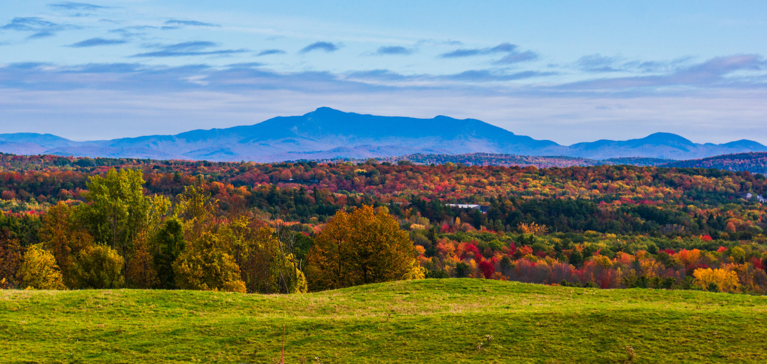
Vermont packs a remarkable range of mountain days into a small state: exposed alpine ridges, steep 4,000-footers, fire-tower summits, historic Long Trail miles and easy scenic climbs above classic New England towns. This guide compares nine standout objectives by route, difficulty, access and the kind of day each one delivers.
Which Vermont Mountains Belong on Your Shortlist?
Mount Mansfield and Camel’s Hump are the signature high-elevation days. Mount Abraham gives you a compact 4,000-footer with summit exposure, while Killington Peak makes a longer forest-to-summit day. Stratton Mountain combines Appalachian Trail history with a fire tower; Mount Hunger is a shorter, steeper workout; Snake Mountain trades altitude for broad Champlain Valley views. Mount Tom and Hogback Mountain are the most flexible choices for a scenic outing without committing to a full high-mountain day.
A Small State With Several Very Different Mountain Experiences
The Green Mountains run north to south through Vermont, but elevation alone does not tell you what a hike feels like. Exposed rock, trail steepness, seasonal access, fragile alpine vegetation and the character of the summit can matter more than the number on the map.
Vermont Mountain Comparison Table
Distances and elevation gain are route-specific. These figures use the featured route or trail system below rather than pretending every mountain has one universal mileage.
| Mountain | Featured route | Distance | Gain | Difficulty | Best fit |
|---|---|---|---|---|---|
| Mount Mansfield | Sunset Ridge to the Chin | 6.2 mi out & back | 2,628 ft | Difficult | Vermont high point + exposed ridge |
| Camel’s Hump | Burrows Trail + Long Trail | 4.8 mi out & back | 2,400 ft | Difficult | Iconic undeveloped 4,000-footer |
| Killington Peak | Bucklin Trail | 7.2 mi out & back | 2,525 ft | Difficult | Longer 4,000-footer day |
| Mount Abraham | Long Trail from Lincoln Gap | 5.2 mi out & back | 1,600 ft | Difficult | Compact high-peak objective |
| Stratton Mountain | Long Trail North | 7.6 mi out & back | 1,735 ft | Moderate / challenging | Fire tower + A.T. history |
| Mount Hunger | Waterbury Trail | 3.6 mi round trip | Steady, steep ascent | Moderate + scramble | Shorter, athletic summit day |
| Snake Mountain | West-side / summit trail network | About 5.4 mi | About 1,060 ft | Moderate | Lake Champlain + Adirondack views |
| Mount Tom | Faulkner Trail | 1.7 mi NPS route | Gradual; steep finish | Easy overall | Woodstock + historic landscape |
| Hogback Mountain | Conservation-area trail network | Variable | Variable | Easy to moderate options | Southern Vermont views + flexibility |
Route conditions, closures, parking rules and trail measurements can change. Recheck the linked official or maintaining organization before you leave home.
Pick the Mountain That Matches the Day You Want
“Best” changes with your objective. A hiker chasing Vermont’s highest summit is solving a different problem from a family looking for a half-day viewpoint or a Long Trail fan who wants a summit with history.
Mount Mansfield
Choose it for Vermont’s highest summit, broad ridgeline exposure and the strongest sense of an alpine day among the nine.
Featured route: Sunset RidgeCamel’s Hump
A steep, concentrated climb to one of Vermont’s most recognizable profiles, with a small and fragile alpine zone near the summit.
Featured route: Burrows + Long TrailMount Abraham
Shorter than Mansfield or Killington on the featured route, but still a real mountain day with rocky scrambles and alpine vegetation.
Featured route: Long Trail from Lincoln GapKillington Peak
A steady forest approach builds to a very steep final summit spur and a broad payoff from Vermont’s second-highest peak.
Featured route: Bucklin TrailStratton Mountain
Choose Stratton for a classic Long Trail approach, the summit fire tower and its place in Appalachian Trail history.
Featured route: Long Trail NorthMount Hunger
The mileage is modest, but the Waterbury Trail rises steadily and reaches open rock near the summit where some scrambling is required.
Featured route: Waterbury TrailSnake Mountain
Lower elevation, moderate mileage and a west-facing panorama make this a strong choice when a high summit is not the goal.
Featured route: summit trail networkMount Tom
Pair a gentle climb above Woodstock with one of Vermont’s most distinctive historic landscapes and an NPS-maintained trail network nearby.
Featured route: Faulkner TrailHogback Mountain
Use the conservation-area network for a shorter hike, snowshoe or relaxed viewpoint day rather than a single mandatory summit itinerary.
Access: Route 9, MarlboroVermont Mountain Map: From Woodstock to Mansfield
The nine mountains stretch from southern Vermont to the northern Green Mountains. Use the map for regional orientation, then use the trailhead and road information from the route manager before navigating to a specific hike.
Think in Corridors, Not Just Summits
A practical Vermont mountain trip is easier to plan when you group objectives by area.
Vermont’s Classic Undeveloped High Summit
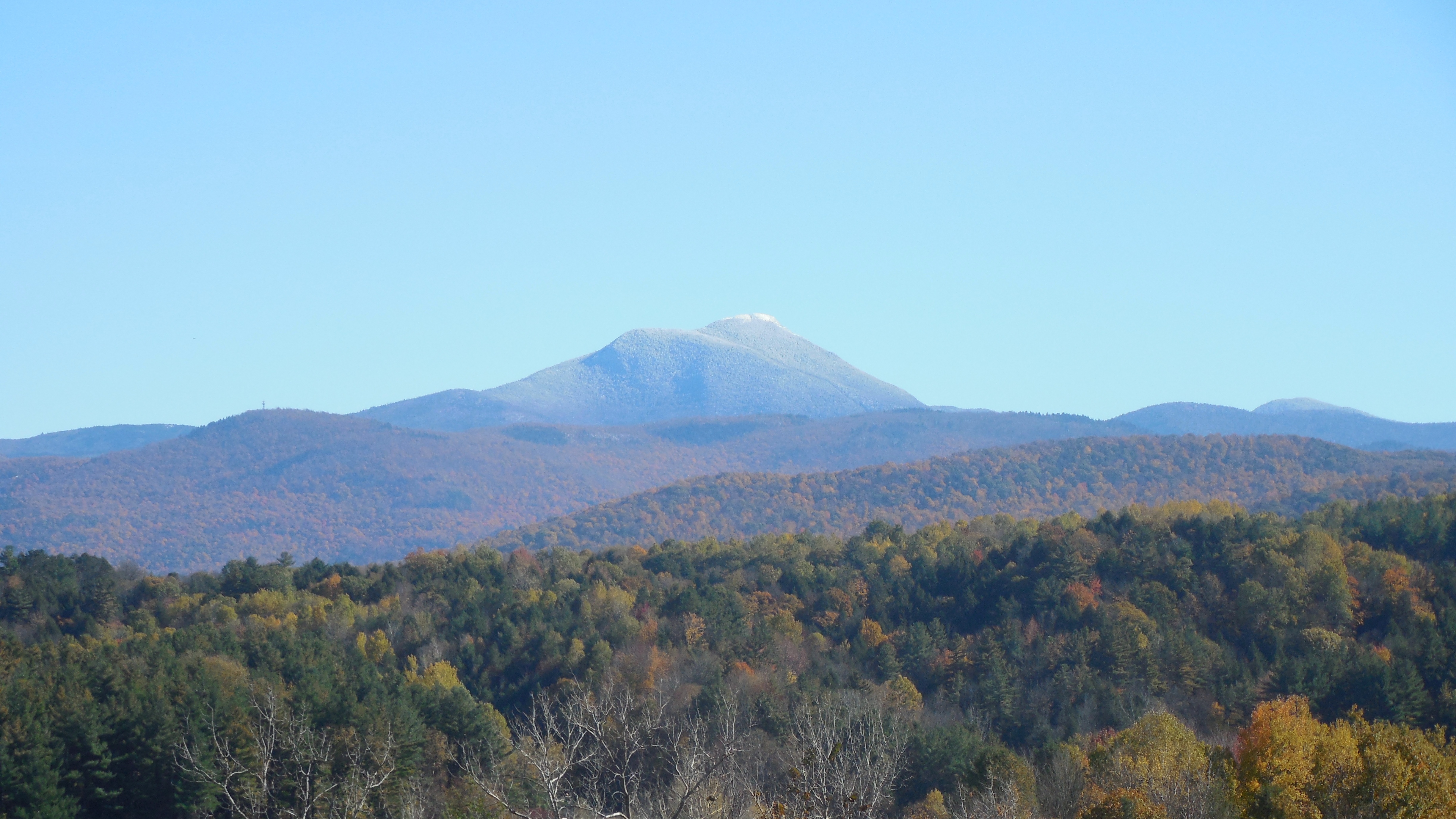
Camel’s Hump is not a drive-up summit. The state park is undeveloped and free-entry, with access from trailheads rather than an entrance station or summit road. That helps preserve the mountain’s backcountry character—and makes parking discipline and alpine-zone stewardship especially important.
Route-by-Route Vermont Mountain Guide
The profiles below are arranged around decision value, not a forced one-through-nine ranking. The right choice depends on your available time, comfort on steep terrain, season, trail access and the experience you want.
Mount Mansfield
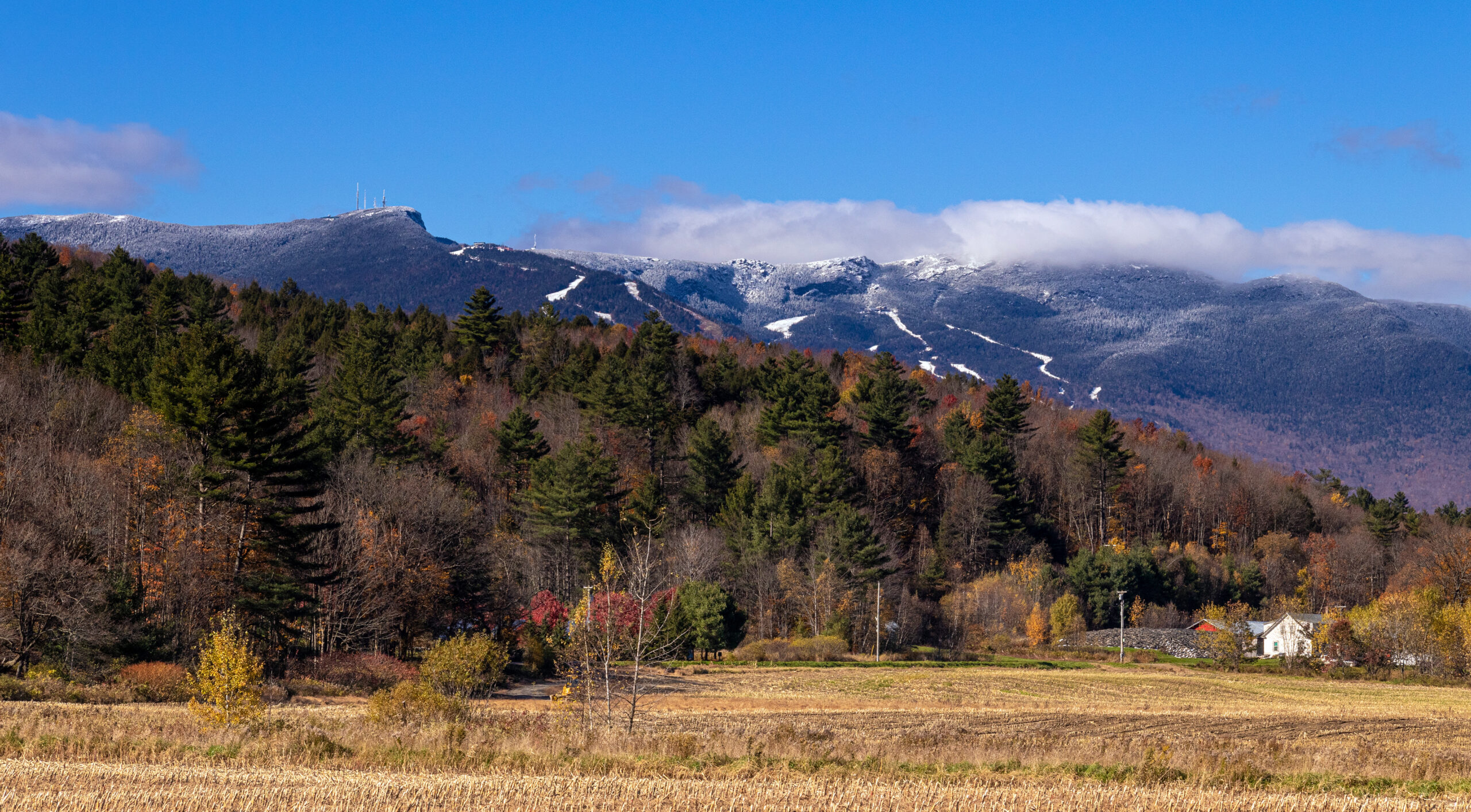
Mount Mansfield is Vermont’s highest peak and the obvious place to look when you want the state’s most substantial high-elevation day. The Green Mountain Club’s Sunset Ridge route starts from the Underhill State Park side and climbs through forest before reaching a long stretch of exposed rock and ridge terrain on the way to the Chin.
The route is listed as difficult, and the final upper mountain feels more serious than the mileage alone suggests. Wind, wet rock, cold and cloud can change the character of the exposed ledges quickly. The summit ridge also protects rare alpine vegetation, so staying on durable rock and the marked route matters.
Choose Mansfield when: you want Vermont’s high point and are comfortable with sustained climbing, exposed ledges and a busy flagship trail. Underhill State Park is a fee area; operating season and access should be checked before departure.
Green Mountain Club: Sunset Ridge route →
Camel’s Hump
The Burrows Trail is a compact but steep way to experience one of Vermont’s most recognizable mountains. The Green Mountain Club lists the hike as difficult: Burrows reaches the Hut Clearing after about 2.1 miles, then the Long Trail continues roughly 0.3 mile to the summit. Near the top, footing becomes rockier and more exposed.
Camel’s Hump State Park is an undeveloped, free-entry park with no entrance station or visitor facilities. Popular access points include Burrows in Huntington and Monroe in Duxbury. That is different from a developed state park where an entry booth, large paved lot and services can absorb crowds.
Choose Camel’s Hump when: you want a classic Vermont 4,000-footer with a wild summit character in a relatively short mileage package. Protect the tiny alpine zone by staying on rock and marked tread.
Green Mountain Club: Burrows Trail →Killington Peak
Killington is Vermont’s second-highest summit and a satisfying choice when you want a longer 4,000-footer day without committing to Mansfield’s exposed ridge. The Bucklin Trail begins gradually, follows an old road for roughly two miles and then steepens as it climbs toward the Long Trail.
Near Cooper Lodge, the final summit spur changes the tone. The Green Mountain Club describes the 0.2-mile spur as extremely steep and notes that it may require some scrambling. That final burst is short, but it is the crux of the featured route and can feel very different when wet.
Choose Killington when: you want a sustained forest approach, a legitimate 4,000-footer and a steep finish. Do not confuse resort infrastructure elsewhere on the mountain with the character of the Bucklin hiking route.
Green Mountain Club: Bucklin Trail →Mount Abraham
Mount Abraham is the lowest of Vermont’s five 4,000-foot peaks, but it should not be treated as an easy walk. From Lincoln Gap, the Long Trail climbs north to Battell Shelter and then continues over rocky terrain, including several short scrambles, before emerging above treeline.
The summit provides views toward the Champlain Valley and Adirondacks, and it supports a small amount of rare alpine vegetation. The route’s compact distance and moderate total gain make Abraham appealing to hikers stepping into Vermont’s 4,000-footers, but the terrain still deserves full mountain-day preparation.
Choose Abraham when: you want a relatively compact 4,000-footer with real summit character. Remember that Lincoln Gap Road has seasonal closure rules, so access is part of the plan.
Green Mountain Club: Mount Abraham →
Stratton Mountain
Stratton Mountain is a strong southern Vermont choice because its value is bigger than the summit number. The Long Trail North route climbs gradually from Stratton-Arlington Road, becomes steeper after the opening miles and reaches a summit fire tower with broad views.
The mountain is also woven into Appalachian Trail history. Benton MacKaye later said that his idea for a long Appalachian footpath took shape during a 1900 hike on Stratton; he developed the written proposal that became famous in 1921. The modern Appalachian Trail and Long Trail share miles through southern Vermont, making Stratton a natural place to connect hiking with trail history.
Choose Stratton when: you want a medium-length summit day with a fire tower and a meaningful connection to the history of long-distance hiking in the United States.
Green Mountain Club: Stratton route description →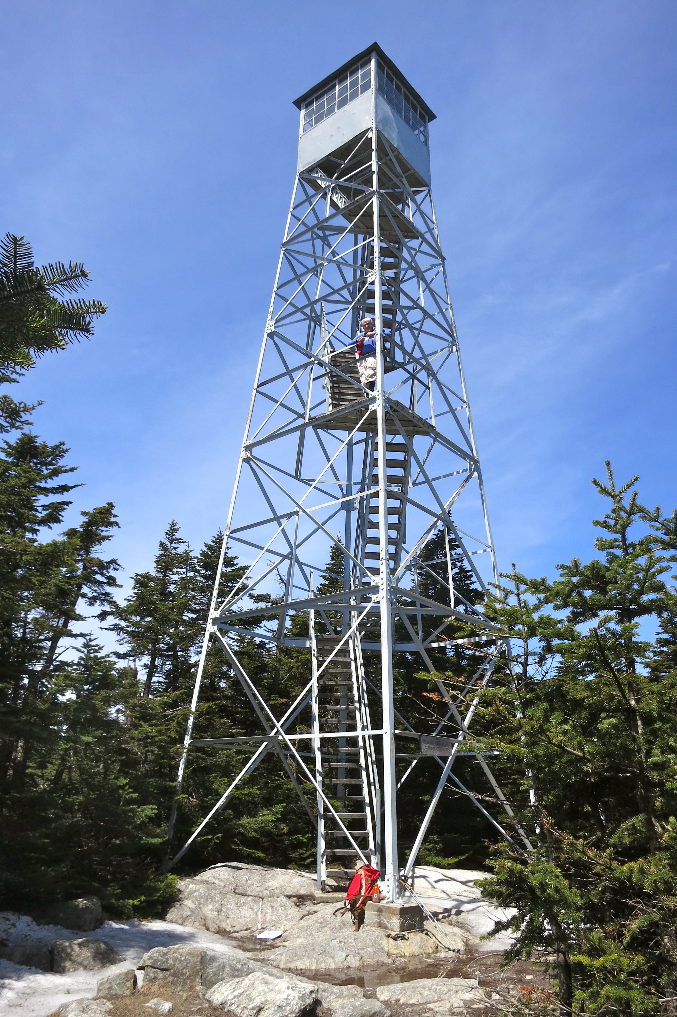
Mount Hunger
The Waterbury Trail makes Mount Hunger one of the most efficient ways to get a steep, summit-focused day in central Vermont. The round trip is only 3.6 miles, but the ascent is steady and the upper trail reaches open rock that requires some scrambling.
Trail Finder flags Mount Hunger as a high-use trail, especially on weekends. If the lot is full, the published guidance is to choose another hike rather than improvise parking. That matters on Vermont’s narrow mountain roads, where roadside congestion can block neighbors and emergency access.
Choose Mount Hunger when: you have less time but still want a physical climb and a panoramic summit. Short mileage should not be confused with low effort.
Trail Finder: Waterbury Trail →Snake Mountain
Snake Mountain is different from the Green Mountain 4,000-footers. It rises from the Champlain Valley in Addison and Weybridge, and the payoff is a broad west-facing view toward Lake Champlain and the Adirondacks rather than a high alpine summit.
Green Mountain Club’s current fall-hike guidance describes a roughly 5.4-mile moderate outing with about 1,060 feet of gain. Vermont Fish & Wildlife manages Snake Mountain Wildlife Management Area and describes trail access from eastern and western parking areas into a network crossing the ridgeline and summit.
Choose Snake Mountain when: you want moderate effort, expansive western views and a lower-elevation option that feels very different from the state’s central spine.
Vermont Fish & Wildlife: Snake Mountain WMA →Mount Tom
Mount Tom is the list’s strongest fit when the goal is a scenic, lower-commitment hike that can be woven into a Woodstock visit. The National Park Service lists the Faulkner Trail as a 1.7-mile hike with gradual elevation gain, though the final 100 yards become strenuous and include uneven footing.
The trail was constructed in 1937 by Marianne Faulkner in memory of her husband, Edward Daniels Faulkner, and connects Woodstock with the broader trail landscape around Marsh-Billings-Rockefeller National Historical Park. The park itself has more than 20 miles of trails and carriage roads.
Choose Mount Tom when: you want a shorter hike, a village-and-mountain day, or an option that works well with a mixed-ability itinerary.
National Park Service: Faulkner Trail →Hogback Mountain
Hogback is best understood as a conserved mountain landscape with multiple recreation options rather than one definitive summit route. The conservation area straddles Route 9 in Marlboro and is associated with the famous “100-mile view,” which on clear days reaches across Vermont, Massachusetts and New Hampshire.
The Hogback Mountain Conservation Association says the area is open year-round for hiking, snowshoeing and other low-impact recreation. A designated parking area sits on the north side of Route 9 just west of the gift shop; the conservation group also publishes printable and georeferenced trail maps.
Choose Hogback when: you want southern Vermont scenery, a flexible trail day or a winter snowshoe without needing the fixed itinerary of a 4,000-footer.
Hogback Mountain Conservation Association →Five 4,000-Foot Peaks Define the State’s High-Peak Goal
Vermont’s five 4,000-foot summits are Mount Mansfield, Killington Peak, Mount Ellen, Camel’s Hump and Mount Abraham. Four are profiled above. Mount Ellen is the important fifth peak and is often combined with Abraham on a longer Monroe Skyline traverse.
This broader “best mountains” guide intentionally includes lower summits too, because Vermont hiking is not only a 4,000-footer checklist. Fire towers, Champlain Valley views, historic landscapes and shorter trail days are part of what makes the state distinctive.
- Mansfield gives the state high point and exposed ridge travel.
- Camel’s Hump offers an undeveloped high-summit experience.
- Killington supplies a longer forest approach with a steep summit finish.
- Abraham is a compact but still difficult alpine objective.
- Mount Ellen completes the five-peak project.
Best Season for Vermont Mountains
Vermont’s calendar is shaped by spring saturation, summer humidity and thunderstorms, fall foliage traffic and a real winter season. High-elevation trail readiness matters more than an arbitrary calendar date.
Wait for Mud Season to End
Green Mountain Club asks hikers to avoid vulnerable high-elevation trails during spring thaw, typically from late March or early April through late May. In 2026, the organization marked May 22 as the start of the general hiking season.
Longest Planning Window
July and August bring long daylight and full access, but warm-weather storms, heat, insects and busy trailheads still reward early starts and conservative turnaround decisions.
Excellent Hiking, Heavy Demand
September into early October can combine cooler temperatures with foliage. Popular trailheads fill quickly, and shorter daylight makes start time more important than it was in midsummer.
A Different Activity
Snow, ice, cold and short daylight transform Vermont routes. Winter hikers need route-specific equipment and experience; a familiar summer trail should not be treated as the same objective in January.
If the tread is saturated or a closure is posted, choose a durable low-elevation alternative. Walking around mud widens trails and damages vegetation; walking through it accelerates erosion.
What to Check Before You Drive to a Vermont Trailhead
Vermont’s mountain access is fragmented among state parks, state forests, wildlife management areas, federal land, town conservation land and trail organizations. The access rules are therefore mountain-specific.
Confirm the Route Is Open
Check the current trail manager, especially during spring mud season, after storm damage and around seasonal road closures. A cached trail page is not a substitute for current access information.
Have a Backup Hike
High-use trailheads can fill. Mount Hunger’s published guidance explicitly asks hikers to choose another trail when the lot is full. Do not block roads, driveways or emergency access.
Know Which Access Is Developed
Camel’s Hump State Park is undeveloped and free-entry. Underhill State Park at Mansfield is a fee area. Other locations use different ownership and parking systems.
Check Mountain Roads
Lincoln Gap access to Mount Abraham is seasonal. Toll-road or gondola options around Mansfield also operate on their own schedules and should be verified directly before relying on them.
Plan for Summit Exposure
Forest temperatures can hide stronger wind and colder air above treeline. Carry layers and rain protection even when the valley forecast looks comfortable.
Route Difficulty Is More Than Mileage
Wet ledges, roots, short scrambles and steep summit spurs can make a five-mile Vermont hike feel more technical and tiring than a smoother trail of similar length elsewhere.

The Long Trail Came First—and Stratton Helped Inspire the Appalachian Trail
Vermont’s mountain culture is inseparable from the Long Trail. Green Mountain Club describes the route as a 272-mile trail running north–south along the spine of the Green Mountains. It crosses all five of Vermont’s 4,000-foot peaks, and its southern section overlaps with the Appalachian Trail.
Stratton Mountain adds a second layer of history. Appalachian Trail Conservancy records that Benton MacKaye later traced the idea for a long Appalachian footpath to a hike on Stratton in July 1900. He did not publish the famous written proposal until 1921, so the cleaner historical story is not “the A.T. was invented on Stratton in 1921,” but that the mountain figured in the idea’s earlier development.
For a visitor, this means a Vermont mountain trip can be more than summit collecting. A day on Abraham, Killington or Stratton can also be a small section of one of America’s foundational trail systems.
Appalachian Trail Conservancy: where the A.T. began →Official & Maintainer Sources to Recheck
Use these organizations for current route descriptions, closures, seasonal access, parking and land-management rules. Conditions can change faster than a general mountain guide can be updated.
Questions Hikers Ask Before Choosing a Peak
These answers are route-planning shortcuts. For day-of conditions, closures and land-management rules, use the current sources above.
What is the highest mountain in Vermont?
Mount Mansfield is Vermont’s highest mountain at 4,395 feet. The Chin is the highest point on the summit ridge.
What are Vermont’s five 4,000-foot mountains?
They are Mount Mansfield, Killington Peak, Mount Ellen, Camel’s Hump and Mount Abraham. The Long Trail reaches all five.
Which Vermont mountain is a good first step before a harder 4,000-footer?
If you want easier terrain and shorter commitment, Mount Tom is the most forgiving option in this nine-peak list. If your goal is specifically a first Vermont 4,000-footer, Mount Abraham has a relatively compact featured route, but Green Mountain Club still rates it difficult and it includes rocky scrambles.
Is Camel’s Hump State Park free?
Yes. Vermont State Parks currently describes Camel’s Hump as an undeveloped, free-entry state park with no entrance or office. Access is from trailheads such as Burrows in Huntington and Monroe in Duxbury.
When should I avoid high-elevation trails in Vermont?
Spring mud season is the key period. Green Mountain Club says it typically begins in the second half of March or early April and runs through late May; saturated high-elevation trails should be avoided until they dry and any closures are lifted.
Do I need a permit to day hike these Vermont mountains?
There is no single statewide summit permit covering the nine hikes. Access rules differ by land manager. Some state-park access points charge day-use fees, some locations are free, and seasonal roads or trail closures can affect whether a route is reachable.
Which Vermont mountain has the strongest Appalachian Trail connection?
Stratton Mountain is especially important historically because Benton MacKaye later connected his early idea for an Appalachian footpath to a 1900 hike there. Killington and other southern Vermont terrain also sit within the modern Long Trail/Appalachian Trail corridor.
Compare Vermont With the Mountains Around It
Once you know what you like about Vermont—high ridges, long trail days, fire towers or approachable scenic hikes—the neighboring states give you a natural next comparison.
Best Mountains to Climb in New Hampshire
Compare Vermont’s Green Mountain terrain with the White Mountains, longer alpine exposure and larger vertical days.
Deep Recovery · MaineBest Mountains to Climb in Maine
Move northeast toward Katahdin, western Maine peaks and a more remote mountain-planning style.
Deep Recovery · New YorkBest Mountains to Climb in New York
Cross Lake Champlain for Adirondack objectives, steeper trail profiles and a much larger high-peak list.
Choose the Vermont Mountain That Fits Your Hike.
Start with time, terrain and season. Then verify access, parking and trail conditions with the organization that manages the route. Vermont rewards hikers who arrive with a specific plan—and a backup when conditions or parking change it.
Best Mountains in Vermont – and the Northeast
Vermont’s peaks sit within the wider Northeast. Compare the neighbouring states’ best mountains below.
Best Mountains by State
Compare the best mountains to climb in each state, or jump to the highest point in every state.
Was this helpful?
🏔Related peaks nearby
🧭Explore & compare
Global Summit Guide is an independent mountaineering resource founded in 2026. The team combines first-hand trekking and climbing experience with in-depth research and professional health and nutrition review to help climbers choose objectives, prepare properly, and stay safe.
Health, altitude, and nutrition content is reviewed by Taylor Ludlow (Registered Nurse) and Brigg Hoopes (Nutritionist).
What We Don't Know Yet
Mountain information changes quickly. This box explains the limits of what this page can responsibly promise.
- Visa, passport, vaccination, border, insurance, and local transportation rules may change before your trip.
- Route conditions, snowpack, closures, and weather can change quickly after this page is updated.
- Permit rules, fees, quotas, and reservation windows may change between review cycles.
- Operator availability, pricing, guide ratios, and cancellation terms can change by season.
- Your fitness, altitude response, risk tolerance, and experience level may change what is safe or realistic.
Verify current conditions with official land managers, guide services, local forecasts, and current route reports before booking or climbing.
Mountaineering, rock and ice climbing, glacier travel, and high-altitude activity are inherently dangerous and can result in serious injury or death. The information on Global Summit Guide is provided for general informational and educational purposes only and is not a substitute for professional instruction, qualified guiding, proper equipment, or your own judgment and experience.
Route conditions, weather, snowpack, permits, regulations, and hazards change constantly and may differ from what is described here. Details may be incomplete, out of date, or contain errors. Always verify current information with local authorities, certified guides, and official sources before making any decision in the mountains.
Nothing on this site is medical, legal, or financial advice. Our fitness, acclimatization, altitude, and nutrition content is general in nature; consult a qualified physician before beginning any strenuous exercise program or exposing yourself to high altitude.
You are solely responsible for your own safety and decisions. To the fullest extent permitted by law, Global Summit Guide and its team accept no liability for any loss, injury, damage, or expense arising from use of, or reliance on, this information. By using this site you acknowledge these risks and accept these terms.
Some links on this site may be affiliate links. If you buy through them we may earn a small commission at no extra cost to you; this never affects our recommendations.
Global Summit Guide recommendation path
Next Best Mountain to Research
Use these recommendations to continue the right planning path instead of stopping on one page.
Use current permit, weather, route, and operator information before booking or climbing.