
Last updated September 9, 2026
Best Hikes on New Zealand’s South Island: 18 Trails from Milford to Aoraki
The South Island has New Zealand’s deepest hiking menu: seven mainland Great Walks, glacial valleys below Aoraki/Mount Cook, exposed Wānaka ridges, Fiordland rainforests and a coastal track system where tides matter more than altitude.
Milford is the classic, Routeburn is the compact alpine choice, and Hooker Valley is the easy day every road trip can use.
Milford Track is the best once-in-a-lifetime four-day Great Walk if the booking and one-way transport work. Routeburn gives more alpine scenery per day and fits a shorter itinerary. Kepler is the easiest Fiordland Great Walk to organize because it loops from the Te Anau area.
For day hiking, Hooker Valley is the strongest easy scenic walk and is fully open again. Mueller Hut is the best harder Aoraki objective, Roys Peak is the classic Wānaka viewpoint, and Key Summit is the best short taste of Fiordland alpine terrain.
Start with the experience, not the famous name
The South Island’s best hikes range from bookable hut journeys to exposed ridge days and easy glacial-valley walks. The right choice depends on how many days you have, how much weather risk you can absorb and whether a fixed booking should control the road trip.
| Priority | Choose | Why | Main constraint |
|---|---|---|---|
| Classic Great Walk | Milford | Four-day Fiordland journey with Mackinnon Pass and Milford Sound finish. | Fixed huts + one-way transport |
| Short alpine traverse | Routeburn | Big alpine scenery in two or three days. | Road ends 325 km apart |
| Simplest Fiordland logistics | Kepler | Loop from the Te Anau area with a superb alpine ridge. | Bookings + ridge weather |
| First multi-day walk | Abel Tasman | Low elevation, water taxis, beaches and flexible trip lengths. | Awaroa tide window |
| Easy Aoraki day | Hooker Valley | Glacial valley and Aoraki views with modest climbing. | Cold, ice and busy parking |
| Hard Aoraki day / hut | Mueller Hut | Steep climb into genuine alpine terrain. | Booking + snow/avalanche conditions |
| Wānaka viewpoint | Roys Peak | Huge lake views and a simple trail concept. | Heat, no shade, Oct 1–Nov 10 closure |
| Backcountry circuit | Rees–Dart | Excellent Mount Aspiring country when intact. | Full circuit currently impassable |
The best hikes on New Zealand’s South Island
The list deliberately mixes Great Walks, hut routes and day hikes. A lower-ranked route may be much harder; ranking reflects overall trip value and how well the route represents the South Island rather than technical difficulty.
Milford Track
The iconic one-way Fiordland journey through the Clinton and Arthur valleys, over Mackinnon Pass and out to Milford Sound/Piopiotahi. It is the most logistics-sensitive choice because both ends require arranged transport and peak hut dates are highly competitive.
Routeburn Track
A compact alpine traverse with Harris Saddle, Lake Harris, open tussock and big mountain views. The route can be walked either direction, but its two road ends are 325 km apart, so transport must be solved before the walk.
Kepler Track
A loop from Te Anau with beech forest, lake shore and the exposed Luxmore ridge. It is the cleanest Fiordland alternative when Milford dates are gone because the route returns toward the same gateway.
Abel Tasman Coast Track
Golden beaches, forested headlands and water-taxi flexibility make Abel Tasman the least alpine major trip on this page. Tide timing at Awaroa Inlet is the controlling detail rather than mountain weather.
Heaphy Track
A long traverse from tussock and beech forest to nīkau palms and the wild West Coast. It feels more like a complete ecosystem journey than a single mountain crossing.
Paparoa Track
Limestone, rainforest, escarpments and open tops give Paparoa a different character from Fiordland. It is also a shared walking and mountain-biking Great Walk.
Tuatapere Hump Ridge Track
New Zealand’s 11th Great Walk combines coast, forest, subalpine ridge travel and historic viaduct country. The track remains open in 2026, but two historic viaducts are closed and bypassed.
Hooker Valley Track
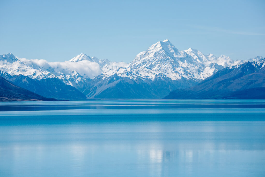
The signature easy walk beneath Aoraki/Mount Cook is fully open again after the July 2026 opening of the new 189 m suspension bridge. Glacial river, moraine and Hooker Lake deliver major scenery for modest effort.
Mueller Hut Route
A serious climb above Sealy Tarns to one of New Zealand’s most dramatic hut settings. Summer bookings are required; snow, ice and avalanche terrain can push the route into mountaineering.
Roys Peak Track
A relentless exposed climb above Lake Wānaka with huge lake-and-mountain views. There is almost no shade, and the track closes every year from October 1 to November 10 for lambing.
Rob Roy Glacier Track
A forested valley approach to viewpoints beneath Rob Roy Glacier. The hike is less exposed than Roys Peak but the drive into the Matukituki Valley is part of the day’s planning.
Ben Lomond Track
A steep climb from Queenstown or the gondola area to a panoramic summit over Lake Wakatipu and the surrounding ranges. The upper ridge is exposed and can hold snow outside summer.
Key Summit Track
A shorter use of the Routeburn Track from The Divide, climbing to alpine wetland and broad views of the Humboldt and Darran Mountains. It is one of the best weather-day stops on the Milford Road.
Sealy Tarns Track
The famous stair climb above White Horse Hill gives Mueller Lake, Hooker Valley and Aoraki views without committing to Mueller Hut. It is a strong fitness day and a sensible turnaround point when upper conditions deteriorate.
Lake Marian Track
A steep forest track to a hanging alpine lake below the Darran Mountains. Wet roots and mud can make the modest distance slower than expected.
Avalanche Peak
A steep route from Arthur’s Pass village to an exposed summit with views across the central Southern Alps. It is a real mountain route with weather and snow consequences, not a casual tourist walk.
Rees–Dart Track
Normally one of the South Island’s great backcountry circuits. A large Dart Valley slip currently makes the full circuit impassable, with the Dart Track closed until at least December 2026.
Isthmus Peak Track
A long open ridge above Lakes Wānaka and Hāwea that offers a quieter alternative to Roys Peak. Exposure to sun, wind and winter snow matters more than technical difficulty.
The South Island’s Great Walk menu is deeper than the old six-track list
Hump Ridge became New Zealand’s 11th Great Walk and belongs in the South Island count. Rakiura is an additional Great Walk on Stewart Island/Rakiura offshore.
| Great Walk | Distance | Typical time | Best for | 2026/27 note |
|---|---|---|---|---|
| Milford | 53.5 km | 4 days | Classic Fiordland | Bookings open; Great Walk season Nov 1–Apr 30 |
| Routeburn | 32 km | 2–3 days | Short alpine traverse | Bookings open; Great Walk season Nov 1–Apr 30 |
| Kepler | ~60 km | 4 days | Te Anau loop | Bookings open; season begins Oct 27, 2026 |
| Abel Tasman Coast | ~60 km | 3–5 days | Coast + first multi-day | Bookings open; huts/camps book year-round |
| Heaphy | 78.4 km | 4–6 days | Long ecological traverse | Bookings open |
| Paparoa | 55 km | 3 days | West Coast + karst | Bookings open |
| Hump Ridge | 60 km | 3 days | Southern Fiordland | Open; viaduct bypasses in place; bookings managed separately |
A Great Walk booking is not the same as a permit to ignore the weather. Outside the serviced season, alpine tracks such as Routeburn and Kepler can lose bridges, ranger support and normal hut services while snow and avalanche risk increase sharply.
These are the six South Island guides to build around
The site architecture centers on three Fiordland classics, one Mount Aspiring backcountry route, one Aoraki day-hike family and the Abel Tasman coast. Until their dedicated URLs are verified and published, each has a complete in-page destination here.
Milford Track
The booking-sensitive classic with boat/bus transport at both ends.
Plan Milford →Fiordland / AspiringRouteburn Track
The strongest short alpine traverse and one of 2026’s highest-demand DOC bookings.
Plan Routeburn →FiordlandKepler Track
The easiest Great Walk logistics for hikers already based in Te Anau.
Plan Kepler →Mount AspiringRees–Dart Track
A major backcountry circuit whose Dart side is currently closed by a large slip.
Review current alternatives →Southern AlpsAoraki / Mount Cook Day Hikes
Hooker Valley, Sealy Tarns, Kea Point, Tasman Lake and Mueller Hut.
Choose an Aoraki day →Nelson / TasmanAbel Tasman Coast Track
Beaches, huts, camps, water taxis and a tide-controlled Awaroa crossing.
Plan Abel Tasman →
The biggest improvement on the old page: Hooker Valley is open again.
The 189 m second suspension bridge opened on July 28, 2026, restoring the full valley walk to Hooker Lake. That makes Hooker Valley the easy anchor again, while Sealy Tarns and Mueller Hut provide the harder progression. For the mountain itself, use the Aoraki / Mount Cook mountain guide rather than treating a technical alpine summit as an extension of the hiking track.
Build one easy valley day and one harder mountain day
The park is compact enough that hikers can choose difficulty after seeing the weather. That flexibility is valuable in a range where cloud, wind, ice and precipitation can change quickly.
Hooker Valley
From White Horse Hill, the route crosses three suspension bridges and finishes at Hooker Lake beneath Aoraki. DOC’s section times total roughly 90 minutes each way. In winter, ice and severe cold can still turn an easy track into a more serious outing.
Mueller Hut
The route climbs through Sealy Tarns into exposed alpine terrain. Bookings are open for stays from November 9, 2026 to April 27, 2027, and the hut has no held-back walk-in allocation when online availability is gone.
Winter and shoulder-season conditions can require ice axe, crampons and avalanche equipment. The hut’s spectacular location does not reduce the terrain standard.
Sealy Tarns
Choose Sealy Tarns when you want a hard stair-climb workout and high views but do not need the upper Mueller Hut route. It is also the logical turnaround when snow, wind or timing makes the hut a poor decision.
Kea Point
DOC lists 3 km with about 180 m of climbing from the village option. It ends at a viewing deck above Mueller Glacier lake with views toward Mount Sefton and the Hooker Valley.
Tasman Lake
A useful short walk for seeing Haupapa/Tasman Glacier country without another major ascent. DOC identifies the glacier as New Zealand’s longest at 23 km.
Do not turn Aoraki into a hiking objective
Aoraki/Mount Cook is a technical mountaineering peak. The regional hiking page stops at the national park’s walking and tramping routes; the mountain guide is the right place for climbing context.
Te Anau is the most useful hiking base on the island
Milford, Kepler and the western Routeburn access all connect to the Fiordland transport system. A weather day here can be converted into a shorter Milford Road walk rather than lost entirely.
Transport is part of the itinerary
The Great Walk starts with transport from Te Anau to Te Anau Downs and a boat to Glade Wharf. It finishes at Sandfly Point, where another boat connects to Milford Sound/Piopiotahi and onward bus services. DOC is explicit that there is no private vehicle access to the track ends.
The 2026/27 Great Walk season runs November 1 through April 30, with the last departure April 28. Book huts and transport as one system rather than separately hoping the times match.
Short track, long road transfer
Routeburn Shelter sits 25 km from Glenorchy; The Divide is 85 km from Te Anau. The road journey between trailheads is about 325 km. This is why a 32 km trail can create more transport complexity than the 60 km Kepler loop.
Outside November–April, DOC warns of snow, ice, removed avalanche-prone bridges and reduced facilities. Winter Routeburn is an alpine undertaking, not a cheap off-season Great Walk.
The logistics winner
Most hikers take four days and three nights. The Great Walk season begins October 27, 2026 and runs through April 30, 2027. The route’s loop geometry makes it the simplest major Fiordland walk for travelers who want to keep one accommodation/transport hub.
The best short Milford Road mountain walk
From The Divide, use the Routeburn Track before turning onto Key Summit. DOC describes roughly an hour to the junction and about 20 minutes more to the summit area. It is a strong backup when a full multi-day booking is not available.
Forest first, alpine lake second
This is a shorter itinerary commitment than a Great Walk but still benefits from dry footing and a reasonable forecast. Wet roots and steep forest can slow the day considerably.
Open despite viaduct closures
DOC reported in April 2026 that Percy Burn and Edwin Burn viaducts are closed for structural safety, but the three-day Great Walk remains open using existing bypasses and a newer swing bridge. Check the operator’s current instructions before departure.
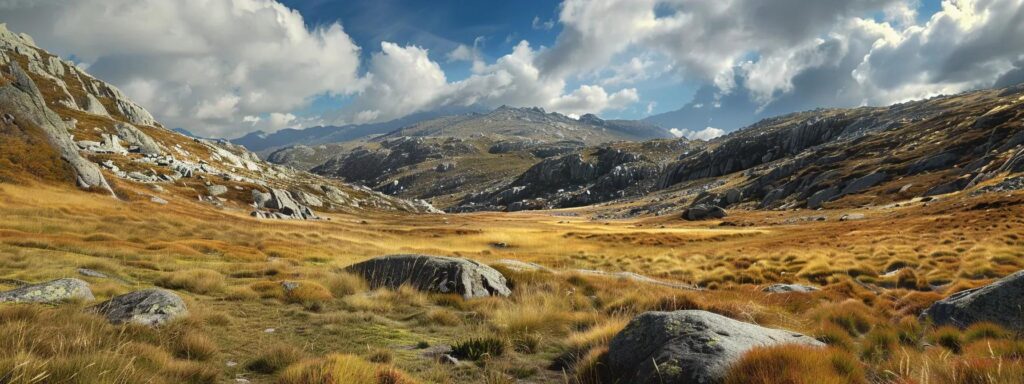
Rees–Dart belongs in the plan even while the circuit is broken.
The route is one of the core South Island backcountry journeys, but the current Dart Valley slip changes what is actually possible. That makes it more useful to explain the closure clearly than to pretend the classic circuit is operating normally.
Use the lake towns for ridge days and Mount Aspiring access
These are the easiest places to combine serious day hikes with normal travel infrastructure. They also make good weather-buffer bases because lower walks and town activities remain available when the high ridges are poor.
Roys Peak
Roys Peak is simple to understand and hard to underestimate: a long, exposed climb with little shade. DOC recommends avoiding the hottest part of summer days and carrying ample water. The annual lambing closure runs October 1 to November 10, so a spring itinerary must use another objective.
Isthmus Peak
Choose Isthmus when you want a long ridge day without the same concentration of visitors. The route is still exposed to wind, sun and winter snow, so it works as an alternative to Roys Peak, not as an all-weather backup.
Rob Roy Glacier
The walk itself is more sheltered than the open ridges, but the approach road and valley access are part of the day. Check current road conditions before assuming a rental-car itinerary will reach the trailhead without issue.
Ben Lomond
Ben Lomond is the best full mountain day directly from Queenstown. The summit is 1,748 m and the upper ridge is exposed. Starting higher via the gondola reduces the approach but does not remove the weather or snow considerations above.
Rees–Dart: current alternatives
DOC says the full circuit is impassable because of a large slip between Daleys Flat Hut and Chinamans Bluff, with the Dart Track closed until at least December 2026. Current options include a Rees Valley out-and-back to Dart Hut, a Cascade Saddle route into Dart Hut and out the Rees Valley, or a pre-booked helicopter transfer over the affected section.
That closure should control the itinerary. Do not arrive in Glenorchy with an old GPX file and assume the circuit still exists as a walk-through route.
Match the day to the forecast
Roys Peak and Ben Lomond are strong clear-weather days. Rob Roy can work better under higher cloud. Lower lake walks and town-based options make Wānaka and Queenstown useful places to absorb a bad mountain day without wasting the entire itinerary.
The easiest major multi-day choice still has one hard constraint: the tide
Abel Tasman is the best counterpoint to Fiordland. It is lower, sunnier and easier to shorten with water taxis, but the Awaroa Inlet crossing puts the tide timetable directly into the itinerary.
Build around the nights you can book
Huts and campsites require advance bookings year-round. Water taxis allow partial walks, one-way day hikes and route shortening, which makes Abel Tasman much more flexible than Milford or Routeburn once accommodation is secured.
No all-tide bypass
DOC allows the crossing from 1 hour 30 minutes before to 2 hours after low tide, in daylight and when conditions are safe. There is no alternative track around the estuary. This is the timing point to check before paying for a hut sequence.
More flexible tide choice
Torrent Bay Estuary can normally be crossed two hours on either side of low tide, but an all-tide track exists around the estuary. That makes Awaroa the more important itinerary constraint.
December through March gives the broadest menu, not guaranteed good weather
The South Island’s western mountains can receive heavy rain in summer, while high ridges can hold snow into spring. Treat the calendar as a route filter, then use the forecast to choose the actual day.
| Period | Best fit | Advantages | Main caution |
|---|---|---|---|
| December–February | All Great Walks, Aoraki, Wānaka, Queenstown | Longest days and broadest high-route access. | Peak demand, heat on exposed ridges, Fiordland rain. |
| March–April | Great Walks, Aoraki, Abel Tasman, Otago | Excellent shoulder season with somewhat lower demand. | Shorter days; cold and early snow become more plausible late April. |
| May–September | Lower coast/forest walks; specialist alpine parties | Quieter travel and dramatic winter scenery. | Snow, ice, avalanche terrain, removed bridges and reduced hut services on alpine tracks. |
| October–November | Abel Tasman, lower Aoraki walks, progressive alpine return | Spring daylight and growing access. | Roys Peak closes Oct 1–Nov 10; winter conditions can persist high. |
Lock the scarce hut or transport before the hotel sequence
The 2026/27 Great Walk season is already on sale. The practical question now is availability and cancellation inventory, not when the booking system opens.
| Trip | Current booking reality | First move |
|---|---|---|
| Milford | Bookings open; Nov 1–Apr 30 serviced season; fixed one-way transport required. | Find hut sequence and matched transport together. |
| Routeburn | Bookings open; Nov 1–Apr 30; two trailheads 325 road km apart. | Choose direction and transfer plan before lodging. |
| Kepler | Bookings open; Great Walk season Oct 27–Apr 30. | Book huts, then Te Anau buffer nights. |
| Abel Tasman | Huts/campsites book year-round. | Check Awaroa tide first, then beds and water taxi. |
| Mueller Hut | Bookings open Nov 9, 2026–Apr 27, 2027; no held walk-in spaces. | Secure hut before committing to an overnight plan. |
| Hump Ridge | Bookings managed separately and can be made farther ahead. | Use the Hump Ridge booking system, then check bypass notices. |
DOC reported more than 33,000 bookings during the 2026 opening period. Milford and Routeburn produced its two largest opening days ever, with Routeburn alone drawing 13,100 users at peak demand. That is why a serious South Island itinerary starts with availability rather than assuming the famous track can be added later.
Move the base with the hiking region
The planned lodging guide correctly centers on Queenstown, Te Anau, Aoraki/Mount Cook and Wānaka. The regional page adds Nelson/Tasman and the West Coast because a longer island itinerary needs more than four bases.
Te Anau
The best pure hiking base on the South Island. Milford Track transport, Kepler, The Divide, Milford Road day hikes and many Fiordland operators are organized around Te Anau. Stay here rather than commuting daily from Queenstown when Fiordland is the focus.
Queenstown
Best for Ben Lomond, Glenorchy/Routeburn access and a trip that mixes hiking with flights, rental cars, restaurants and activity days. It is convenient, but not close enough to replace Te Anau for repeated Fiordland starts.
Wānaka
Best for Roys Peak, Isthmus Peak, Rob Roy and the Matukituki side of Mount Aspiring country. It is also a calmer buffer base between Aoraki and Queenstown.
Aoraki / Mount Cook Village
Use the village when Hooker Valley, Sealy Tarns and Mueller Hut matter. Staying nearby lets you choose the best weather window instead of driving a long approach on the only day assigned to the park.
Nelson / Motueka / Marahau
Nelson works as the broader transport base; Motueka and Marahau move you closer to Abel Tasman. Water-taxi departure and the exact track section should determine which one is most useful.
Move rather than backtrack
Paparoa, glacier country and Arthur’s Pass sit along a long corridor. A moving West Coast itinerary is more efficient than trying to serve the whole coast from one hotel town.
Lodging rule: Great Walk or hut first, gateway second. That principle keeps a three-week South Island road trip flexible enough to absorb weather without breaking the fixed wilderness booking.
Three South Island itineraries that stay geographically coherent
The island rewards loops and moving bases. A good plan avoids driving from Queenstown to every trailhead simply because the airport is there.
Fiordland + Queenstown
Anchor with Milford, Routeburn or Kepler; keep Te Anau for the hiking block and Queenstown for arrival/departure plus Ben Lomond or a Glenorchy day. This is the strongest first South Island hiking trip when time is limited.
Aoraki + Wānaka + Fiordland
Use Aoraki for Hooker Valley and one harder weather-dependent day, move through Wānaka for a ridge or Rob Roy, then finish with a Fiordland Great Walk. This sequence steadily increases trip complexity without requiring a north-island detour.
Full island hiking journey
Start Nelson/Abel Tasman, move down the West Coast, cross into Wānaka and Aoraki, then finish in Queenstown and Te Anau. One fixed Great Walk can anchor the dates while everything else stays weather-flexible.
For a volcanic contrast before or after this island, the new New Zealand North Island hiking guide covers Tongariro, Taranaki, Waikaremoana and the North Island’s hut-and-coast routes.
Check DOC before the trip becomes non-refundable
Track status, hut availability, winter bridges, slips, tide windows and route closures can change faster than an evergreen regional guide.
Planning South Island hiking
Use these answers to choose the trip shape, then verify exact route status and booking availability close to departure.
What is the best hike on New Zealand's South Island?
For a multi-day trip, Milford Track is the classic choice, Routeburn is the strongest shorter alpine traverse, and Kepler has the easiest logistics. For a day hike, Hooker Valley is the best easy scenic choice, while Mueller Hut, Roys Peak and Ben Lomond are stronger fitness objectives.
How many Great Walks are on the South Island?
There are seven Great Walks on the South Island mainland: Milford, Routeburn, Kepler, Abel Tasman Coast, Heaphy, Paparoa and Tuatapere Hump Ridge. Rakiura Track is another Great Walk on Stewart Island/Rakiura just south of the South Island.
Is Hooker Valley Track open in 2026?
Yes. The new 189-metre second suspension bridge opened on July 28, 2026, restoring access through the Hooker Valley to Hooker Lake. Winter ice and cold can still affect the experience, so check DOC conditions before departure.
When do 2026/27 Great Walk bookings open?
They are already open. DOC staggered 2026/27 openings in May 2026: Paparoa May 12, Milford May 13, Abel Tasman May 14, Routeburn May 15, Kepler May 19 and Heaphy May 20. Hump Ridge bookings are managed separately.
Is the Rees–Dart Track open?
Not as a full circuit. DOC says a large slip in Dart Valley has made the circuit impassable and the Dart Track is closed until at least December 2026. Rees Valley out-and-back and other alternatives remain possible.
When is Roys Peak closed?
DOC closes Roys Peak Track every year from October 1 through November 10 for lambing. Winter and spring can also bring snow, ice and frozen ground.
Do I need a guide for the Great Walks?
No. The Great Walks can be walked independently with the required bookings, equipment and judgment. Guided options exist, especially on tracks such as Milford, but they are not required.
Which South Island hike is easiest for a first multi-day trip?
Abel Tasman Coast Track is the gentlest major multi-day choice because it stays low, has water-taxi options and offers several itinerary lengths. Tides, bookings and coastal weather still need planning.
When is the best time to hike the South Island?
December through March gives the broadest hiking access. The main Great Walk season generally runs from late October or November through April. Winter on Routeburn, Kepler, Mueller Hut and other alpine routes requires substantially more skill and equipment.
Where should I stay for South Island hiking?
Te Anau is the main Fiordland base; Queenstown and Wānaka cover Otago and Mount Aspiring access; Aoraki/Mount Cook Village is the best base for Hooker Valley and Mueller Hut; Nelson, Motueka or Marahau serve Abel Tasman; and the West Coast needs its own moving base.
Anchor one scarce booking, then keep the mountain days flexible.
A Great Walk bed, Mueller Hut night or tide-controlled coastal itinerary can set the calendar. Everything else should retain enough flexibility to move with South Island weather.
Open My Climb →Continue from the Southern Alps
Compare another major hiking region, or move from South Island trails into the Aoraki mountain objective and the broader Australia–New Zealand peak collection.
Best Hikes on New Zealand’s South Island
The South Island’s Great Walks are world-class. Explore the country’s peaks and the Oceania collection below.
Was this helpful?
🏔Related peaks nearby
🧭Explore & compare
Global Summit Guide is an independent mountaineering resource founded in 2026. The team combines first-hand trekking and climbing experience with in-depth research and professional health and nutrition review to help climbers choose objectives, prepare properly, and stay safe.
Health, altitude, and nutrition content is reviewed by Taylor Ludlow (Registered Nurse) and Brigg Hoopes (Nutritionist).
What We Don't Know Yet
Mountain information changes quickly. This box explains the limits of what this page can responsibly promise.
- Visa, passport, vaccination, border, insurance, and local transportation rules may change before your trip.
- Route conditions, snowpack, closures, and weather can change quickly after this page is updated.
- Permit rules, fees, quotas, and reservation windows may change between review cycles.
- Operator availability, pricing, guide ratios, and cancellation terms can change by season.
- Your fitness, altitude response, risk tolerance, and experience level may change what is safe or realistic.
Verify current conditions with official land managers, guide services, local forecasts, and current route reports before booking or climbing.
Mountaineering, rock and ice climbing, glacier travel, and high-altitude activity are inherently dangerous and can result in serious injury or death. The information on Global Summit Guide is provided for general informational and educational purposes only and is not a substitute for professional instruction, qualified guiding, proper equipment, or your own judgment and experience.
Route conditions, weather, snowpack, permits, regulations, and hazards change constantly and may differ from what is described here. Details may be incomplete, out of date, or contain errors. Always verify current information with local authorities, certified guides, and official sources before making any decision in the mountains.
Nothing on this site is medical, legal, or financial advice. Our fitness, acclimatization, altitude, and nutrition content is general in nature; consult a qualified physician before beginning any strenuous exercise program or exposing yourself to high altitude.
You are solely responsible for your own safety and decisions. To the fullest extent permitted by law, Global Summit Guide and its team accept no liability for any loss, injury, damage, or expense arising from use of, or reliance on, this information. By using this site you acknowledge these risks and accept these terms.
Some links on this site may be affiliate links. If you buy through them we may earn a small commission at no extra cost to you; this never affects our recommendations.
Global Summit Guide recommendation path
Next Best Mountain to Research
Use these recommendations to continue the right planning path instead of stopping on one page.
Use current permit, weather, route, and operator information before booking or climbing.
Search Flights, Hotels & Rental Cars
Have the mountain or destination picked? Use Expedia to compare the flights, lodging and rental cars that fit your actual trip dates. For mountain travel, consider arriving early enough for delays and adding a buffer night after the climb before a fixed flight home.
Compare current flight, hotel and car options.
Affiliate disclosure: Global Summit Guide may earn a commission if you book through this link, at no additional cost to you.