
Last updated September 1, 2026
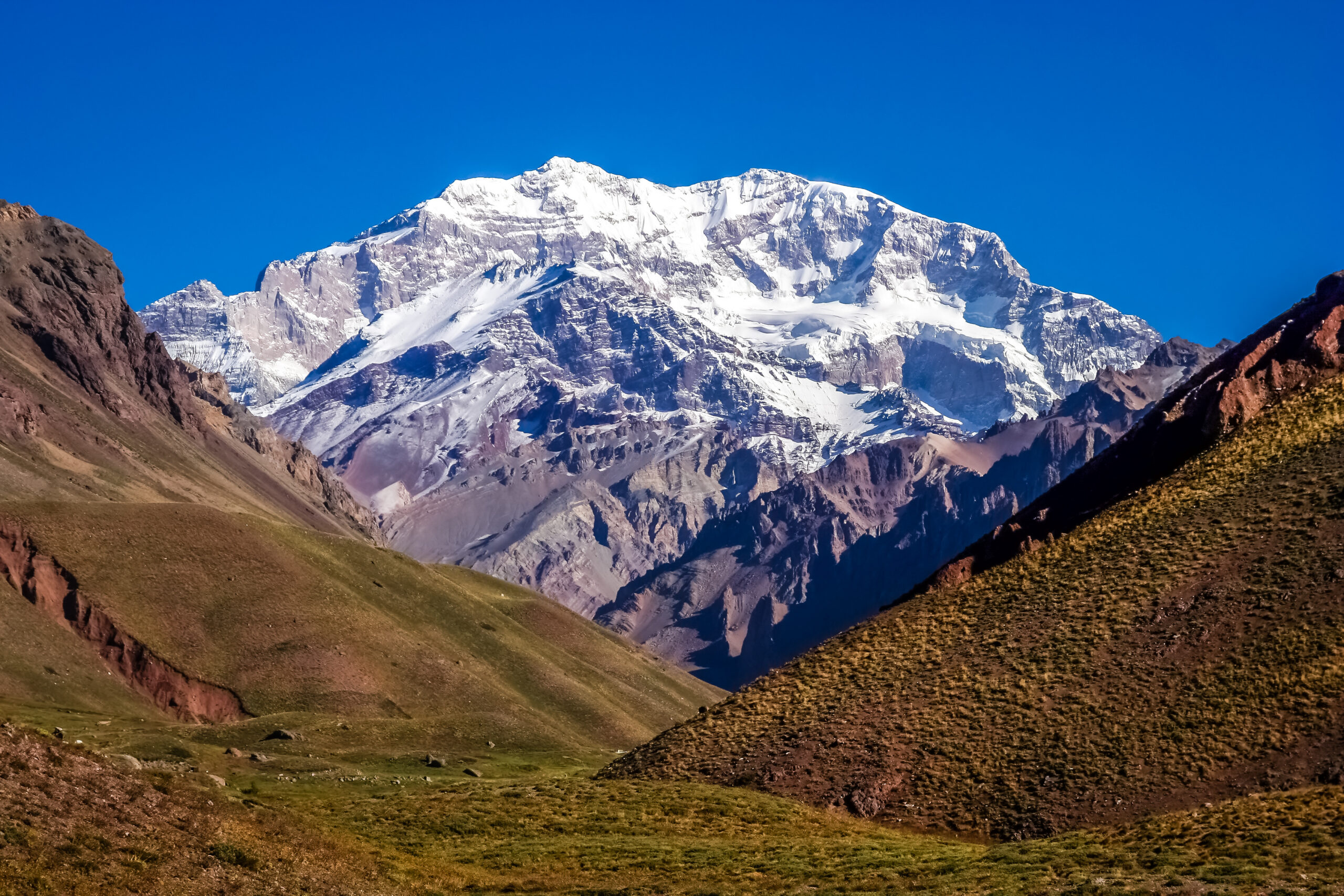
Andes Expedition Planning Guide: Peru, Bolivia, Ecuador, Chile & Argentina
The best Andes expedition starts with country and season, then builds around a staging city, acclimatization objective, recovery days and the main peak. Peru and Bolivia align around the drier May–August period; Aconcagua and many southern high-Andes objectives align with austral summer; Ecuador needs its own equatorial planning logic.
How Should You Plan an Andes Climbing Expedition?
Start with the seasonal region, not the mountain list. Then choose a staging city, build a conservative altitude sequence, add one or more preparation objectives, protect recovery days and leave enough weather and transport margin that the main summit is not forced by airline dates.
The Andes can be logistically faster than the Himalaya because roads and cities reach high altitude quickly. Your body does not acclimatize faster simply because the road does.
Which Andes Region Fits Your Expedition?
| Region | Primary base | Broad climbing window | Best use |
|---|---|---|---|
| Peru — Cordillera Blanca | Huaraz | May–Aug | Technical glaciated 5,000–6,700 m objectives |
| Bolivia — Cordillera Real | La Paz | May–Aug / early Sep | Accessible 5,000–6,500 m progression and multi-peak trips |
| Ecuador — Volcanoes | Quito | Multiple drier windows | Fast-access volcano progression and acclimatization sequences |
| Argentina — Aconcagua | Mendoza | Austral summer | 6,961 m non-technical high-altitude expedition |
| Chile — Atacama | Copiapó / regional desert bases | Austral summer | Remote 6,000 m desert volcanoes including Ojos del Salado |
Use the Right City Before You Use the Mountain
Huaraz
The practical hub for the Cordillera Blanca, with guide services, gear logistics, transport and access to acclimatization peaks.
La Paz
A high urban base with fast access to the Cordillera Real. Arrival itself creates altitude stress, so early days should be conservative.
Quito
A strong base for progressive volcano itineraries using lower objectives before Cotopaxi or Chimborazo.
Mendoza
The commercial and administrative gateway for Aconcagua, with permits, transport and operator logistics concentrated here.
Atacama gateways
Ojos del Salado programs use regional desert logistics rather than one universal high-altitude staging city.
Andes Climbing Seasons Are Regional
| Period | Best regional fit | Planning implication |
|---|---|---|
| May–August | Peru + Bolivia | Best alignment for a northern Andes technical/high-altitude trip |
| September–October | Transition | Conditions become less predictable regionally; verify mountain-specific windows |
| November–March | Argentina + northern Chile high Andes | Core austral-summer expedition period for Aconcagua and Atacama objectives |
| Equatorial windows | Ecuador | Plan around mountain-specific precipitation, wind and volcanic conditions rather than a single Andes rule |
Road Access Can Be Fast. Acclimatization Cannot.
One of the Andes’ great logistical advantages is that roads, cities and refuges can place climbers at high altitude quickly. That reduces approach days. It does not justify assuming the physiology can be compressed at the same rate.
| Logistical advantage | What it changes | What it does not change |
|---|---|---|
| High staging cities | Less time needed to reach altitude | Individual acclimatization response |
| Road access | Shorter approaches | Safe ascent-rate principles |
| Multiple nearby peaks | Better progression options | Need for recovery |
| Short mountain phases | Less expedition overhead | Need for pre-summit acclimatization |
Huascarán illustrates the difference clearly: the mountain phase itself may take roughly six to seven days, while a responsible complete program commonly needs much longer once acclimatization and preparation are included. citeturn962146search1
For physiology and ascent-rate principles, use the separate Altitude Acclimatization Guide.
Sample Andes Expedition Frameworks
14-Day High-Altitude Progression
| Days | Purpose |
|---|---|
| 1–3 | Arrival, staging-city acclimatization, gear check, easy hikes |
| 4–6 | First lower objective or high-altitude day trip |
| 7 | Recovery / transport / weather reset |
| 8–12 | Main mountain phase |
| 13–14 | Contingency + exit |
21-Day Multi-Peak Expedition
| Days | Purpose |
|---|---|
| 1–4 | Urban acclimatization + local hikes |
| 5–8 | Preparation peak |
| 9 | Full recovery |
| 10–15 | Intermediate or second peak |
| 16 | Recovery / repositioning |
| 17–20 | Main objective or summit window |
| 21 | Exit buffer |
Transport Is the Hidden Andes Planning Variable
Protect connections
Do not put an international flight immediately after a remote summit day.
Distance is deceptive
Mountain roads and desert approaches can turn modest map distances into long travel days.
Stage intelligently
Use hotels, operator depots or trusted storage points so every peak does not require carrying every item.
Travel is not rest
A six-hour road transfer after a summit should not automatically count as a recovery day.
Use a Permit Decision Tree, Not One Andes Rule
| Question | Why it matters |
|---|---|
| Is the mountain inside a national/provincial park? | Park entry and climbing permits can be separate |
| Is advance registration required? | Some objectives cannot be handled at the trailhead |
| Does the permit depend on nationality or season? | Fee structures may vary |
| Is a licensed guide required? | Local regulations differ by mountain and park |
| Are route or volcanic closures active? | Current hazard status can override normal permit planning |
Use each mountain’s current permit/logistics child for exact fees and regulations rather than relying on regional evergreen numbers.
Which Andes Countries Combine Well?
| Combination | Verdict | Why |
|---|---|---|
| Peru + Bolivia | Strong | Dry-season timing aligns and both support progressive high-altitude climbing |
| Bolivia + northern Chile | Possible | Good high-altitude continuity, but cross-border transport and season need care |
| Ecuador + Peru | Possible | Useful volcano-to-glacier progression if weather windows align |
| Argentina + Chile | Strong regionally | Austral-summer timing can align for central/southern objectives |
| Aconcagua + Cordillera Blanca | Usually separate trips | Their strongest climbing windows sit in different parts of the year |
Build the Expedition Around the Main Objective
Huascarán
A serious Cordillera Blanca expedition with glacier complexity and substantial acclimatization needs.
Open Huascarán → EcuadorCotopaxi
Use current volcanic status, access and mountain-specific planning before placing it in a sequence.
Open Cotopaxi → ArgentinaAconcagua
Build a full high-altitude expedition around Mendoza and the park permit system.
Open Aconcagua → Chile / ArgentinaOjos del Salado
Plan desert transport, progressive high camps and a multi-peak acclimatization sequence.
Open Ojos → Deep recoveryAndes High-Altitude Giants
Use the regional collection to compare possible 6,000 m objectives before choosing a country.
Explore Andes giants → PhysiologyAltitude Acclimatization
Keep medical and physiologic altitude principles separate from regional logistics.
Read acclimatization → Deep recoveryInsurance Decision Framework
Match coverage to the highest altitude, exact activity and rescue scenario.
Check insurance → Deep recoveryMountain Weather
Use current mountain-specific forecasts rather than assuming regional season guarantees good conditions.
Plan weather → TrainingExpedition Training Plans
Match physical preparation to altitude, technicality and expedition duration.
Build training → JourneyMy Climb
Save the country, staging city, acclimatization objective, main peak, permits and contingency days.
Build Andes plan →Andes Expedition Logistics Checklist
| Decision | Confirm before booking |
|---|---|
| Country / region | Season fits the main objective |
| Staging city | Arrival altitude and first 72 hours are realistic |
| Acclimatization | Preparation peak or staged ascent is built in |
| Recovery | At least one true rest/reset day before the main mountain |
| Transport | Road, flight and border-transfer buffers included |
| Permits | Current park and route requirements verified |
| Insurance | Maximum altitude and exact activity covered |
| Weather | Contingency days exist rather than a forced summit schedule |
| Exit | International departure is not tied to summit day |
What This Andes Page Owns
Regional logistics
- Country and season selection.
- Staging-city strategy.
- Multi-peak and multi-country sequencing.
- Recovery, transport and contingency logic.
- Regional permit decision framework.
Kept on specialist pages
- Altitude physiology and symptom management.
- Mountain-specific permit fees.
- Route descriptions and condition reports.
- Operator comparison and pricing.
- Detailed training prescriptions.
This keeps the page useful without competing with its own supporting cluster.
Andes Expedition Planning FAQ
What country is best for a first Andes expedition?
Bolivia and Ecuador often offer the simplest high-altitude logistics; Peru is stronger for technical glaciated climbing, while Aconcagua is a full expedition-style objective.
When is the Andes climbing season?
There is no single season. Peru and Bolivia align broadly with May–August, while Aconcagua and many southern high-Andes peaks align with austral summer.
How long should I allow?
Roughly two to three weeks is a practical starting range for many single-objective high-altitude trips once acclimatization and weather margin are included.
Does road access mean I can acclimatize faster?
No. It shortens travel, not human adaptation to altitude.
Can Peru and Bolivia be combined?
Yes. Their main dry-season timing aligns well enough to make them one of the stronger multi-country combinations.
Can I combine Aconcagua and Peru?
Usually not efficiently because their strongest seasons are separated.
What are the main staging cities?
Huaraz, La Paz, Quito, Mendoza and regional Atacama gateways are the key planning bases for the regions covered here.
Where should I plan acclimatization in detail?
Use the dedicated altitude acclimatization and mountain-specific pages; this page owns regional logistics and sequencing.
Compress the Logistics—Not the Acclimatization.
The Andes reward good sequencing: choose the right season, stage intelligently, climb a preparation objective, recover properly, protect the main summit with contingency days and never let a fast road create a rushed altitude schedule.
Was this helpful?
🏔Related training
🧭Explore & compare
Global Summit Guide is an independent mountaineering resource founded in 2026. The team combines first-hand trekking and climbing experience with in-depth research and professional health and nutrition review to help climbers choose objectives, prepare properly, and stay safe.
Health, altitude, and nutrition content is reviewed by Taylor Ludlow (Registered Nurse) and Brigg Hoopes (Nutritionist).
What We Don't Know Yet
Mountain information changes quickly. This box explains the limits of what this page can responsibly promise.
- Weather, snowpack, avalanche risk, road access, and route conditions can change quickly and may be different on your climbing dates.
- Fitness and altitude response vary by person; no guide, itinerary, or training plan can guarantee acclimatization or summit success.
- Route conditions, snowpack, closures, and weather can change quickly after this page is updated.
- Permit rules, fees, quotas, and reservation windows may change between review cycles.
- Operator availability, pricing, guide ratios, and cancellation terms can change by season.
Verify current conditions with official land managers, guide services, local forecasts, and current route reports before booking or climbing.
Mountaineering, rock and ice climbing, glacier travel, and high-altitude activity are inherently dangerous and can result in serious injury or death. The information on Global Summit Guide is provided for general informational and educational purposes only and is not a substitute for professional instruction, qualified guiding, proper equipment, or your own judgment and experience.
Route conditions, weather, snowpack, permits, regulations, and hazards change constantly and may differ from what is described here. Details may be incomplete, out of date, or contain errors. Always verify current information with local authorities, certified guides, and official sources before making any decision in the mountains.
Nothing on this site is medical, legal, or financial advice. Our fitness, acclimatization, altitude, and nutrition content is general in nature; consult a qualified physician before beginning any strenuous exercise program or exposing yourself to high altitude.
You are solely responsible for your own safety and decisions. To the fullest extent permitted by law, Global Summit Guide and its team accept no liability for any loss, injury, damage, or expense arising from use of, or reliance on, this information. By using this site you acknowledge these risks and accept these terms.
Some links on this site may be affiliate links. If you buy through them we may earn a small commission at no extra cost to you; this never affects our recommendations.
Global Summit Guide recommendation path
Next Best Mountain to Research
Use these recommendations to continue the right planning path instead of stopping on one page.
Use current permit, weather, route, and operator information before booking or climbing.