
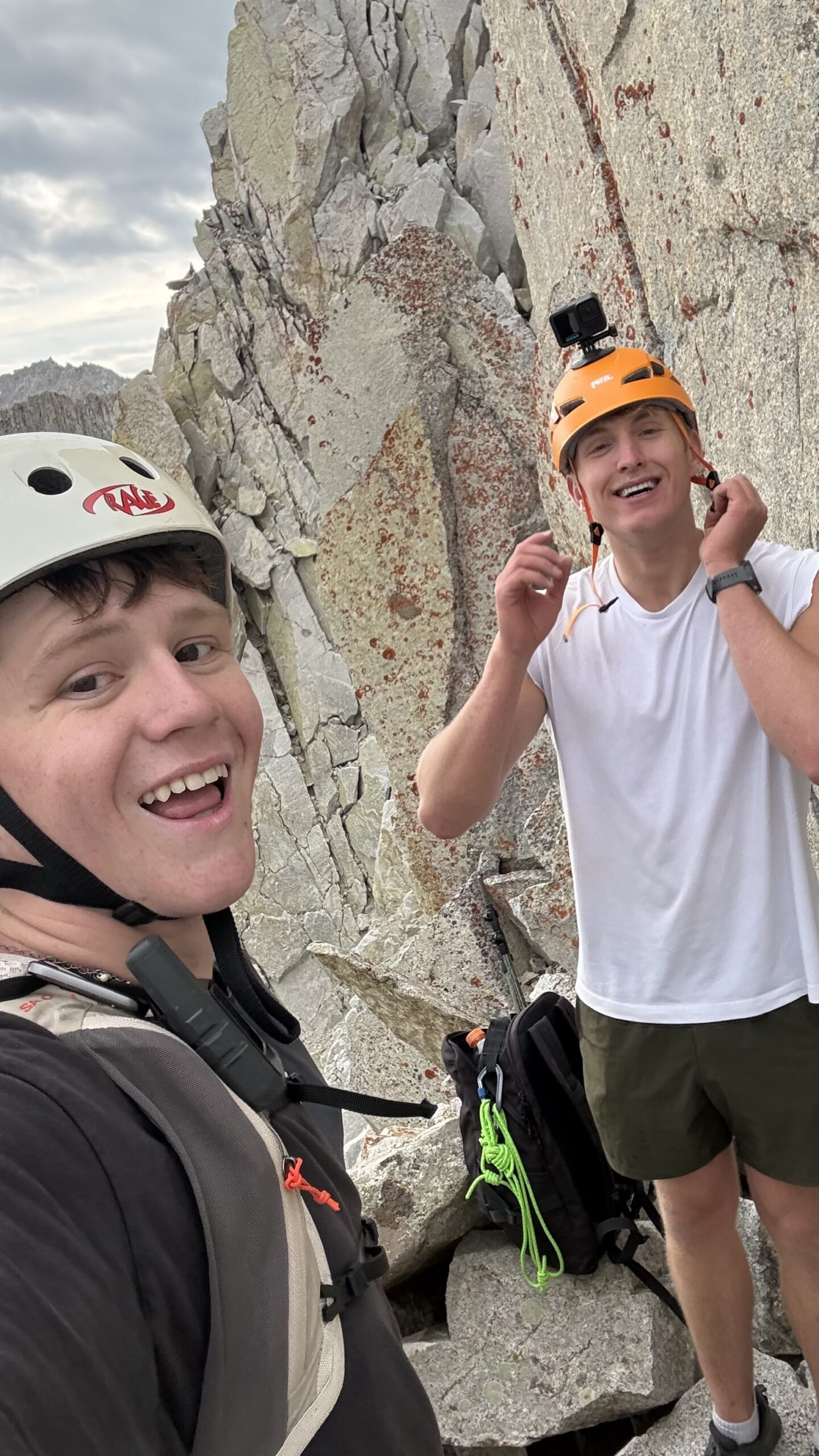
Pfeifferhorn North Ridge: Sawyer Shawd & Dawson Ludlow Climb a Utah Classic
Pfeifferhorn is famous as one of the Wasatch’s great scrambling summits. Sawyer Shawd and Dawson Ludlow chose the other side of the mountain: the technical North Ridge, an aesthetic alpine line above the Red Pine–Maybird country of Little Cottonwood Canyon.
Published August 12, 2026 · Global Summit Guide Trip Reports
A Different Pfeifferhorn Than Most Utah Hikers See
Sawyer Shawd and Dawson Ludlow climbed Pfeifferhorn by the North Ridge, choosing a technical alpine-rock line rather than the mountain’s standard Red Pine / East Ridge hiking route.
That distinction matters. The familiar Pfeifferhorn summit day is already one of the Wasatch’s classic strenuous hikes and scrambles. The North Ridge adds technical climbing, route-finding, exposure and a much more serious alpine character.
Sawyer Shawd & Dawson Ludlow on Pfeifferhorn’s North Ridge
A local Wasatch objective with much bigger alpine character than its proximity to Salt Lake City suggests.
Pfeifferhorn has a silhouette that makes it look like it belongs much farther from a major city. Rising to roughly 11,326 feet in the central Wasatch, it is sometimes called the “Little Matterhorn,” and the standard East Ridge scramble is one of northern Utah’s most recognizable summit days.
But the North Ridge is a different objective. Instead of approaching the summit primarily as a strenuous hike with scrambling, the route follows the mountain’s sharper northern architecture through technical rock, exposed ridge terrain and sections where alpine judgment matters as much as fitness.
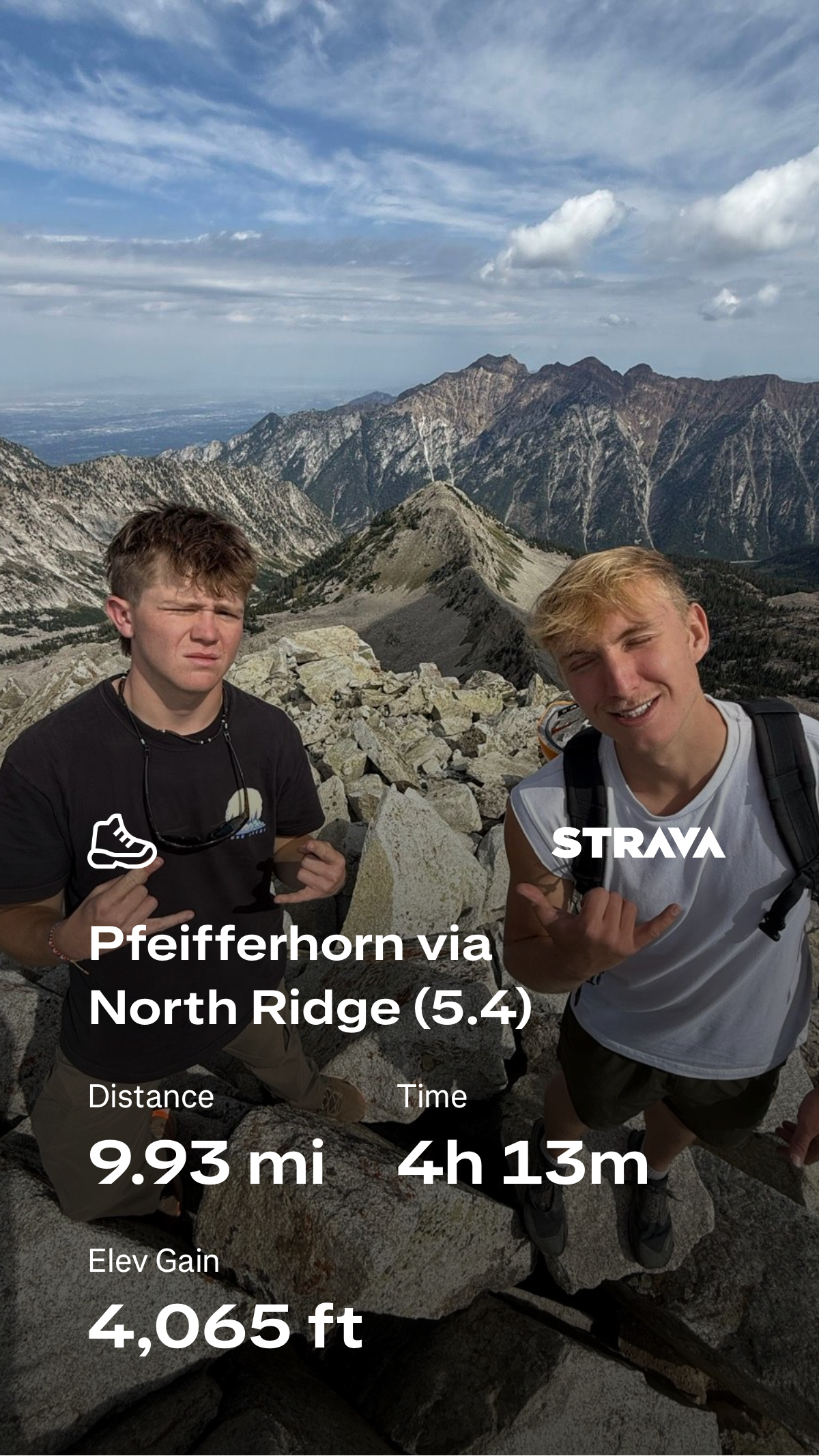
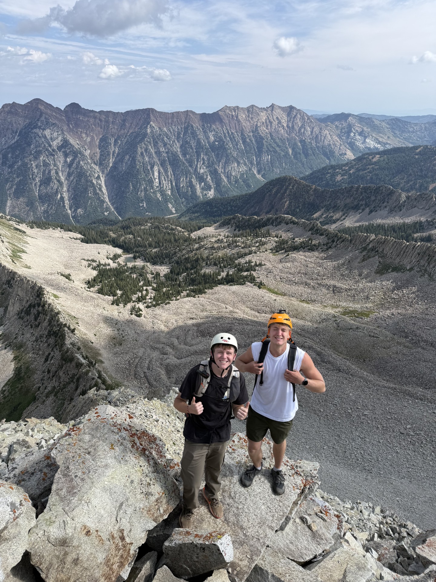
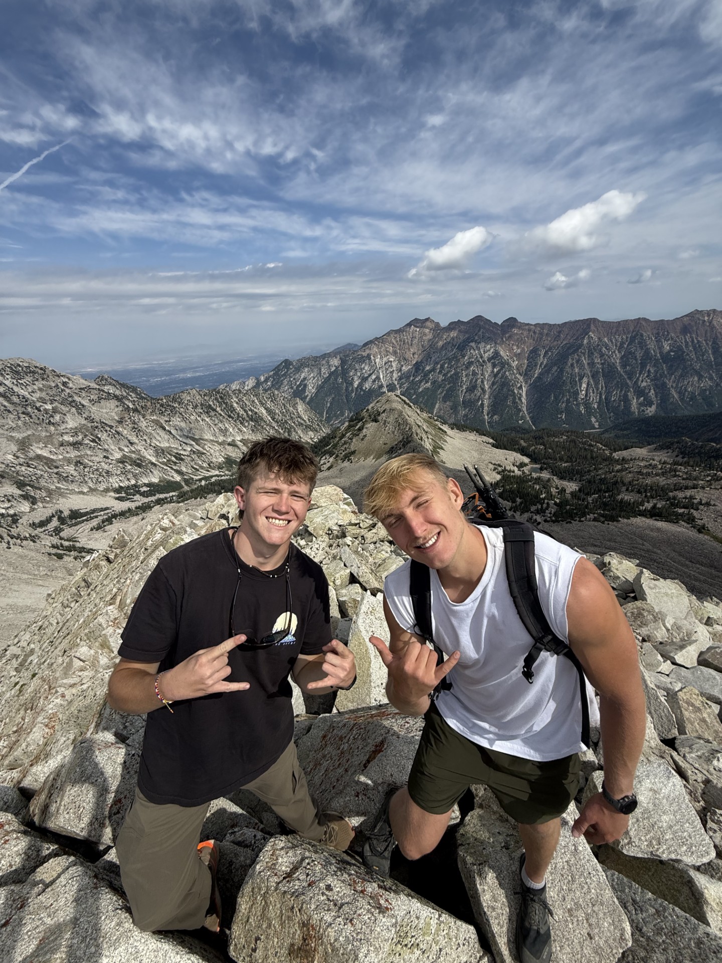
That is the line Sawyer Shawd and Dawson Ludlow chose. The photographs from the climb show the kind of field experience Global Summit Guide wants to preserve in its Trip Reports collection: local climbers moving beyond a familiar hiking summit and seeing the same mountain through a much more technical lens.
The value of a report like this is not that every climber should immediately try to duplicate the route. It is that Pfeifferhorn demonstrates how quickly the Wasatch progression changes. A peak that can be reached by a strong hiker on one side can become a legitimate technical alpine climb on another.
Follow Sawyer & Dawson
Link the climb back to the climbers who were actually on the mountain.
Sawyer Shawd
Sawyer Shawd joined Dawson Ludlow for the Pfeifferhorn North Ridge climb featured in this report.
@sawyershawd on Instagram →Dawson Ludlow
Dawson Ludlow is part of the Global Summit Guide climbing team and contributes first-hand field experience from Utah and beyond.
@daws_lud on Instagram →Why Pfeifferhorn’s North Ridge Is a Serious Wasatch Route
The route’s published character helps explain why this ascent is different from the normal summit hike.
Long-standing North Ridge descriptions classify the route as a technical rock / mixed alpine climb, commonly around 5.5 and Grade II–III. Published descriptions also emphasize loose rock, exposure and the fact that parties can encounter substantially different conditions depending on season.
One route source describes the full ridge as roughly a mile of technical ridge terrain with about 1,300 feet of climbing from the lower route, while older Utah climbing coverage describes a longer technical experience when the full approach and ridge are considered together. Those differences are exactly why numbers should be treated as route-context estimates rather than a substitute for current local beta.
Historically, the North Ridge has also been climbed as a winter mountaineering objective because cold conditions can freeze some of the loose rock in place. That does not make winter automatically safer: snow, ice and avalanche terrain add entirely different hazards. A dry-season ascent and a winter ascent can feel like different routes.
The common thread is the ridge itself—an aesthetic line that turns Pfeifferhorn from a hiking summit into a technical Wasatch alpine objective.
Do not confuse proximity with simplicity.
Pfeifferhorn is close to Salt Lake City, but the North Ridge belongs in the technical-climbing category. It should be evaluated by route conditions, protection, exposure and party competence—not by how quickly you can drive to the trailhead.
Pfeifferhorn North Ridge Photo Story
Four images supplied from Sawyer Shawd and Dawson Ludlow’s climb.
North Ridge vs the Standard Pfeifferhorn Route
Understanding the difference keeps this field report from being mistaken for normal hiking beta.
| Feature | Standard East Ridge / Red Pine | North Ridge |
|---|---|---|
| Primary activity | Strenuous hiking + scrambling | Technical alpine rock climbing |
| Published difficulty | Short Class 3 section on normal route | Commonly described around 5.5, Grade II–III |
| Typical approach system | Red Pine Lakes to East Ridge | Red Pine / Maybird access to north-side ridge |
| Primary skills | Fitness, scrambling, route judgment | Technical climbing, protection, route-finding, alpine judgment |
| Best use in progression | Major Wasatch scramble | Technical Wasatch alpine objective |
The standard route is already substantial. Utah trail sources commonly put the normal Pfeifferhorn day around 9–10 miles round trip with roughly 3,700–3,900 feet of gain. The ridge above Red Pine includes boulder scrambling and a short Class 3 section before the summit.
The North Ridge changes the category. A climber who is comfortable hiking the normal Pfeifferhorn should not assume that experience automatically transfers to a technical line on the other side of the mountain.
Where Pfeifferhorn Fits in Utah Climbing
One of the best things about the Wasatch is the density of progression: hiking, scrambling and technical climbing can exist on neighboring peaks—or the same peak.
Pfeifferhorn belongs in the conversation with the Wasatch’s best local mountains because it can meet climbers at multiple levels. The standard East Ridge introduces strong hikers to exposed scrambling; the North Ridge pushes into technical alpine climbing; neighboring Little Cottonwood and Lone Peak terrain can extend that progression much farther.
For the statewide view, start with Best Mountains in Utah. For the immediate geography around Salt Lake City, use Best Mountains Near Salt Lake City and Salt Lake County Top 10 Peaks. Those pages place Pfeifferhorn in the larger Wasatch system instead of treating it as an isolated objective.
The new Best Hikes in Utah parent serves a different purpose: it compares statewide hiking, from Zion and Moab to Timpanogos, Nebo and Kings Peak. This field report sits on the technical-climbing side of that Utah ecosystem.
What Future North Ridge Parties Should Take From This Report
The lesson is route selection and preparation—not imitation of an undocumented pitch sequence.
Know which Pfeifferhorn you are climbing
East Ridge and North Ridge are not interchangeable descriptions. Confirm the line before using any distance, difficulty or equipment information.
Conditions can change the route category
Dry rock, snow, ice, thawing rock and avalanche terrain create very different North Ridge problems. Current conditions outrank old trip reports.
Loose rock is part of the reputation
Published North Ridge descriptions repeatedly warn about loose rock. Helmets, spacing and protection decisions should reflect that reality.
Have a descent plan before starting
A summit is only the midpoint. Know the intended descent and how changing weather or darkness affects the route home.
Use technical progression, not summit familiarity
Having hiked Pfeifferhorn does not qualify someone for the North Ridge. Build climbing systems and alpine judgment on appropriate objectives first.
Keep route reports current
Wasatch conditions move quickly. Local reports, forecasts and current route observations are essential before committing to technical terrain.
Continue Exploring Utah Mountains
Use the field report as an entry point into the broader Utah mountain system.
Best Mountains in Utah
Compare the state’s major mountain objectives by difficulty, landscape and progression.
Local collectionSalt Lake County Top 10 Peaks
Place Pfeifferhorn among the strongest mountains immediately surrounding Salt Lake City.
Wasatch planningBest Mountains Near Salt Lake City
Choose local objectives by canyon, difficulty and progression.
Range guideWasatch & Uintas
Understand how Utah’s major mountain ranges differ before choosing the next objective.
ChallengeThe Wasatch 7
A longer-term Utah summit challenge built around major Wasatch objectives.
Southern WasatchBest Peaks in Utah County
Extend the local progression south toward Timpanogos, Nebo and neighboring peaks.
Major hikeMount Timpanogos
One of Utah’s defining non-technical big mountain days.
Wasatch high pointMount Nebo
The highest summit in the Wasatch and a quieter big-day hiking objective.
Regional hiking parentBest Hikes in Utah
From Zion and Moab to the Wasatch and Uintas, compare Utah’s full hiking portfolio.
Field reportsMore Climber Trip Reports
Read first-hand mountain experiences from the Global Summit Guide community.
Two Utah pages especially benefit from this field report.
Best Mountains in Utah provides the statewide mountain context, while Salt Lake County Top 10 Peaks is the most direct local collection for a Pfeifferhorn North Ridge story.
Sources, Attribution & What We Don’t Know
A trip report is strongest when it distinguishes first-hand facts from route information gathered elsewhere.
What comes from this field report
- Sawyer Shawd and Dawson Ludlow climbed Pfeifferhorn’s North Ridge.
- The four images on this page were supplied for this climb.
- The climber names and Instagram handles were supplied directly to Global Summit Guide.
What comes from published route references
- Pfeifferhorn elevation around 11,326 feet.
- The standard Red Pine / East Ridge route is a strenuous hike with Class 3 scrambling.
- The North Ridge is commonly described around 5.5 and Grade II–III.
- Published accounts warn about loose rock and season-dependent mixed conditions.
Frequently Asked Questions
Keep the technical North Ridge distinct from the mountain’s standard hiking route.
Is the Pfeifferhorn North Ridge the standard hiking route?
No. The normal summer route approaches through Red Pine Lake and uses the East Ridge, with a short Class 3 scrambling section. The North Ridge is a technical alpine-rock route and should not be confused with the standard Pfeifferhorn hike.
How high is Pfeifferhorn?
Published route references place Pfeifferhorn at roughly 11,326 feet in Utah's Wasatch Range.
How difficult is the North Ridge?
Published North Ridge descriptions commonly place the route around 5.5 and Grade II–III. Conditions, exact variation, loose rock, snow or ice, and party experience can materially change the seriousness.
Where does the usual Pfeifferhorn approach begin?
The standard summit approach uses the White Pine / Red Pine trail system in Little Cottonwood Canyon. North Ridge parties commonly use the Red Pine–Maybird area to reach the technical ridge.
Who climbed the route in this report?
Sawyer Shawd and Dawson Ludlow are the climbers featured in this August 2026 Global Summit Guide field report.
Is this post a pitch-by-pitch route guide?
No. It is a field report and photo story. It gives enough route context to understand why the North Ridge is significant while directing climbers to current route-specific sources and their own judgment for technical planning.
One Mountain. Two Very Different Ways to Experience It.
Pfeifferhorn’s standard route is a Wasatch hiking classic. The North Ridge shows what happens when the same summit becomes a technical alpine objective.
Pfeifferhorn: More From the Mountains We Have Climbed
Continue through our firsthand Wasatch reports, summit guides and documented mountain experience.