Global Summit Guide logo featuring mountain imagery, symbolizing hiking and mountaineering resources for trip planning and safety.

Tag: Karakoram

  • Gasherbrum I (Hidden Peak) Expedition Update 2026: The Harder Gasherbrum Twin

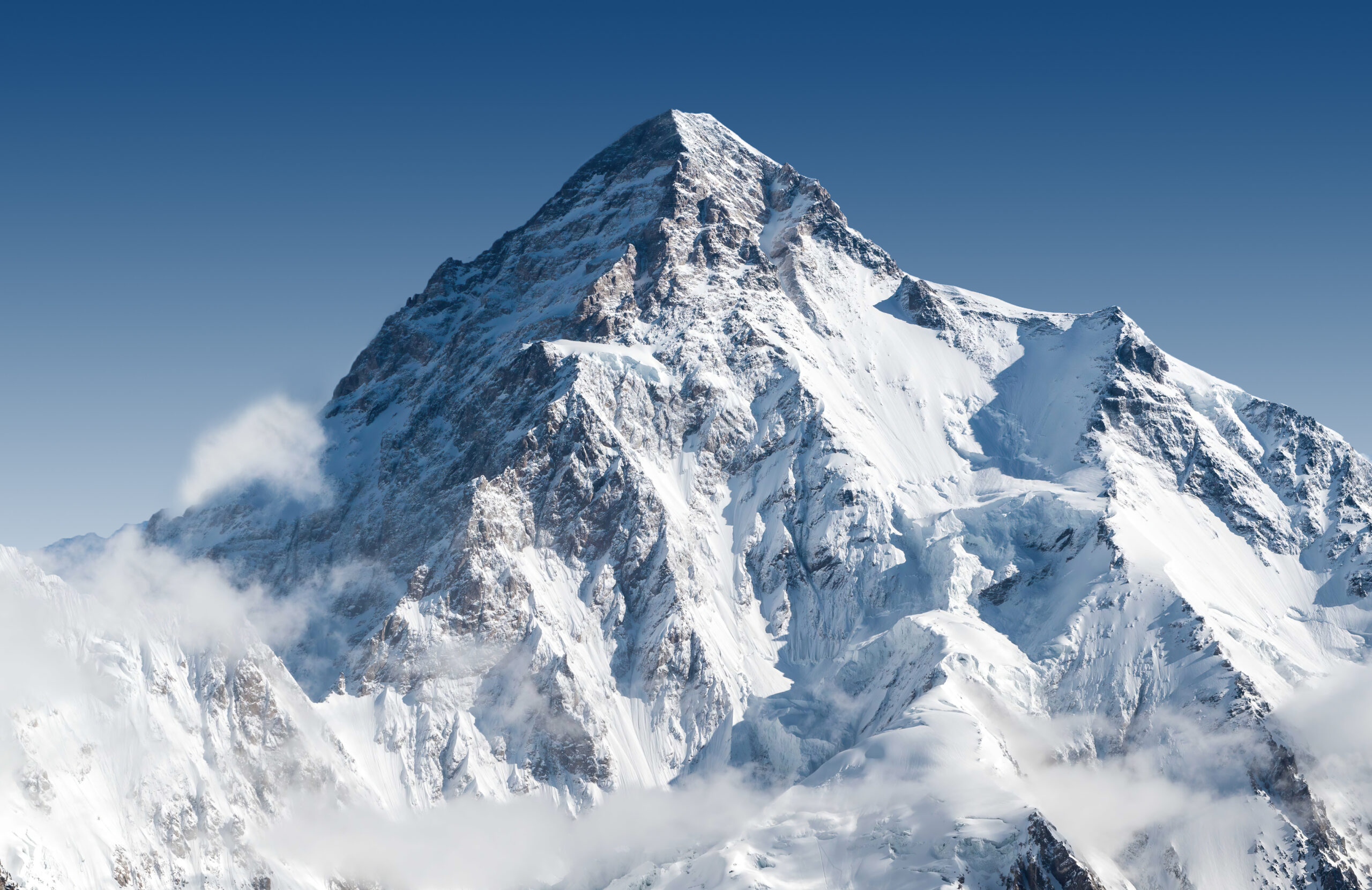
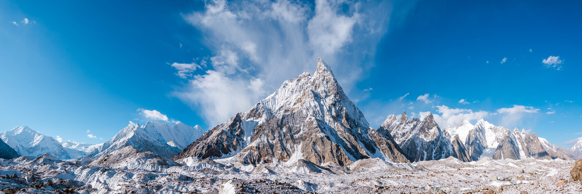
    Gasherbrum I, Hidden Peak, the eleventh-highest mountain in the world, in the Karakoram of Pakistan
    Gasherbrum I is 8,080 m (26,509 ft), the eleventh-highest mountain on earth. Known as Hidden Peak, it is the harder and less-visited of the two Gasherbrum 8000ers.
    Expedition Updates · Karakoram

    Gasherbrum I expedition update

    Hidden Peak, the harder of the Gasherbrum twins. This page tracks why it earned the name, how it compares to Gasherbrum II, the Japanese Couloir route, its honest safety record, the Karakoram summer season, and a go or no-go checklist. A single-mountain page in our Expedition Updates directory. Elevations in metres (feet).

    Current status Karakoram summer 8,080 m (26,509 ft)

    The hidden one, and the harder one.

    Gasherbrum I is the eleventh-highest mountain in the world, tucked so deep in the Karakoram that a British surveyor named it Hidden Peak in 1892. It is the harder of the two Gasherbrum 8000ers, steeper and more technical than its twin Gasherbrum II, and the least-visited of all fourteen 8000-metre peaks.

    It carries history out of proportion to its fame: the only 8000er first climbed by an American team, in 1958, and the site of the first alpine-style ascent of an 8000er, in 1975. For the full route, camps, and cost, see our Gasherbrum I climb guide.

    8,080 m

    Summit (26,509 ft)

    Eleventh-highest in the world; Hidden Peak, or K5.

    Jun to Aug

    Karakoram season

    Summer, the opposite of the Himalayan seasons.

    Least-visited

    Of the 8000ers

    Remote, technical, and for experienced climbers.

    Gasherbrum I stands at the head of the Baltoro Glacier, on the Pakistan and China border, part of a cluster of high peaks that includes its twin Gasherbrum II. It is a serious mountaineer’s objective rather than a commercial trophy, drawing far fewer climbers than K2 or Everest, and rewarding those who make the long journey with solitude as well as difficulty. This page owns the current picture, the twins comparison, and the honest safety record. For the Japanese Couloir route detail, camps, gear, and cost breakdown, see our Gasherbrum I climb guide.

    Season and status

    A Karakoram summer peak.

    Gasherbrum I is climbed from June to August, the Karakoram summer, which is the opposite of the spring and autumn seasons used across the Nepalese Himalaya. Every one of Pakistan’s 8000ers is a summer peak. A full expedition runs 45 to 60 days, taking in the trek, several acclimatization rotations, and a long wait at base camp for a safe summit window. Each year the mountain hosts only a handful of teams, often alongside climbers on its twin, so the status that matters is simply whether a season’s weather opens a window at all.

    Why it is called Hidden Peak

    A name earned by remoteness.

    The British surveyor William Martin Conway gave Gasherbrum I the name Hidden Peak in 1892, because the mountain is set so far back in the range, screened behind Gasherbrum IV and II, that it cannot be seen from the lower Baltoro Glacier where expeditions approach. Its survey label was K5. The word Gasherbrum, often mistranslated as shining wall, actually comes from the Balti rgasha, meaning beautiful, and brum, meaning mountain. Hidden and beautiful is a fair description of a peak most people, even many climbers, would struggle to point to.

    The Gasherbrum twins

    Two 8000ers, one base camp, very different climbs.

    Gasherbrum I against its twin, Gasherbrum II. The two share a base camp and Camp 1.
    AspectGasherbrum IGasherbrum II
    Height8,080 m (26,509 ft), 11th-highest8,035 m (26,362 ft), 13th-highest
    DifficultySteeper and more technicalThe easier, safer twin
    Normal routeThe Japanese Couloir, north-east faceThe south-west ridge
    Typical roleThe harder prizeOften a climber’s first 8000er
    Objective hazardRelatively low, few seracsLow
    Base campShared with Gasherbrum IIShared with Gasherbrum I

    The two Gasherbrum 8000ers sit side by side and share the same base camp, but they are not the same climb. Gasherbrum II is one of the more approachable 8000ers and is often a climber’s first, while Gasherbrum I is steeper, more technical, and the bigger prize. Because they share the lower mountain, many strong climbers attempt both in a single season, a challenge known as the Gasherbrum Double, first achieved as a traverse by Reinhold Messner and Hans Kammerlander in 1984. If you are eyeing GI, its twin is worth understanding too.

    The Japanese Couloir route

    A direct line, but a technical one.

    From the Gasherbrum La to the summit

    The normal route climbs the north-east face via the Japanese Couloir, reached from the Gasherbrum La, the col between GI and GII. It shares base camp and Camp 1 with Gasherbrum II, then works up crevassed glacial slopes to the col before the steeper couloir and face above, with three high camps to reach the summit. It is a direct line to the top, but the couloir and the upper face are genuine technical climbing at extreme altitude. For the full camp-by-camp detail, see our Gasherbrum I climb guide.

    How dangerous it really is

    A low death rate that needs explaining.

    ⚠ Hard, not safe

    Gasherbrum I carries one of the lower fatality records among the 8000ers, which sounds reassuring until you look at why. Part of the reason is that only experienced climbers attempt a peak this technical and this remote, so the pool is self-selected. The other part is that the normal route has relatively few of the objective hazards, such as collapsing seracs, that make neighbours like K2 and Broad Peak so lethal.

    In other words, the statistic reflects who climbs Gasherbrum I and the character of its route, not a forgiving mountain. Crevasses, avalanches, severe storms, extreme cold, and altitude remain ever-present. Treat the low death rate as a fact about the climbers, not an invitation to underestimate the peak. This page is educational and is not a substitute for experience.

    Access, cost and the Baltoro trek

    The great glacier highway, away from the K2 crowds.

    The approach is one of the finest in mountaineering. From Islamabad you fly to Skardu, drive to the village of Askole, then trek six to eight days up the Baltoro Glacier, past Paiju and Urdukas to Concordia, before branching away from the K2 crowds into the quieter Gasherbrum sanctuary and base camp. A guided expedition runs roughly $15,000 to $25,000, less than K2, and the permit sits in Pakistan’s 8000er band below K2, broadly in line with Broad Peak and Gasherbrum II; climbers doing the Gasherbrum Double often arrange a custom combined royalty. Confirm the current figures with your operator, and vet teams with how to choose an operator.

    Weather and timing

    A live look at the Gasherbrum massif.

    Karakoram weather is fierce and fast-moving, and a summit push depends on a settled window in the short summer season. The live map below shows current conditions for the massif; a real attempt relies on expedition forecasting for every move above base camp.

    Live wind and weather for Gasherbrum I. Source: Windy.com. For how to read a mountain forecast, see our weather guide.
    Gasherbrum I, at the head of the Baltoro Glacier on the Pakistan-China border. Map: OpenStreetMap contributors.

    Go or no-go checklist

    Work through these before you commit.

    Before you go

    • Bring 8000er experience – GI expects solid 7,000 m ability and ideally a previous 8000er, not a first trip to extreme altitude.
    • Respect the couloir – the Japanese Couloir and upper face are technical ground high on the mountain.
    • Do not misread the low death rate – it reflects who climbs it, not a safe peak; the hazards are real.
    • Consider the Double – if strong, pairing GII from the shared base camp is efficient, but plan the royalty and time.
    • Plan the long trek – six to eight days up the Baltoro before the climb, and 45 to 60 days total.
    • Carry proper cover – helicopter evacuation and high-altitude rescue insurance are essential in this remote range.

    Gasherbrum I update FAQ

    The questions climbers ask most about the name, the twins, and the difficulty.

    Why is Gasherbrum I called Hidden Peak?

    The British surveyor William Martin Conway gave it the name in 1892 because the mountain is tucked deep in the Karakoram, hidden behind Gasherbrum IV and II and not visible from the lower Baltoro Glacier. Its survey designation was K5. The name Gasherbrum itself comes from the Balti words rgasha, meaning beautiful, and brum, meaning mountain, so it means beautiful mountain, not shining wall as is often wrongly claimed.

    How does Gasherbrum I compare to Gasherbrum II?

    They are twins that share a base camp, but Gasherbrum I is the harder of the two. Gasherbrum II, at 8,035 m, is regarded as one of the easier and safer 8000ers and is often a climber’s first, taken on the south-west ridge. Gasherbrum I, at 8,080 m, is steeper and more technical, the bigger prize of the pair. Many strong climbers attempt both in a single season from the shared base camp, a challenge known as the Gasherbrum Double.

    What is the normal route on Gasherbrum I?

    Most climbers take the Japanese Couloir on the north-east face, reached from the Gasherbrum La, the col that separates Gasherbrum I and II. The route shares base camp and Camp 1 with Gasherbrum II, then climbs crevassed glacial slopes up to the col before the steeper couloir and face above, with three high camps used to reach the summit. It is a direct line, but a technical one at extreme altitude.

    How dangerous is Gasherbrum I?

    It is technically demanding and remote, yet it carries one of the lower fatality records among the 8000ers, and the reason matters. Part of it is that only experienced climbers attempt a peak this hard and this far from help, and part of it is that the normal route has relatively few objective hazards such as seracs. So the low death rate reflects who climbs it and the character of the route, not that the mountain is forgiving. It is hard, not safe.

    When is the Gasherbrum I climbing season?

    June to August, the Karakoram summer, which is the opposite of the spring and autumn seasons used in the Nepalese Himalaya. All of Pakistan’s 8000ers are summer peaks. A full expedition usually runs 45 to 60 days including the trek in, acclimatization rotations, and waiting at base camp for a safe summit window, so it is a long commitment as well as a hard one.

    What experience do you need for Gasherbrum I?

    Prior high-altitude experience is essential: solid ability on 7,000 m peaks and ideally a previous 8000er. Gasherbrum I is an advanced expedition peak, not a first 8000er, and its steeper, more technical ground at extreme altitude is unforgiving of climbers who arrive underprepared. It is often climbed by mountaineers working through the fourteen 8000ers rather than by those new to the death zone.

    How do you get there, and what does it cost?

    From Islamabad you fly to Skardu, drive to the village of Askole, then trek six to eight days up the Baltoro Glacier past Concordia to base camp, branching away from the K2 crowds into the quieter Gasherbrum sanctuary. A guided expedition runs roughly $15,000 to $25,000, less than K2, and the Gasherbrum Double with GII is a popular value option, often arranged with a custom combined royalty.

    How high is Gasherbrum I and where is it?

    Gasherbrum I is 8,080 m (26,509 ft), the 11th-highest mountain in the world and the second-highest in the Karakoram after K2, on the Pakistan-China border at the head of the Baltoro Glacier. It was first climbed in 1958 by an American team, the only 8000er with an American first ascent, and in 1975 it became the first 8000er climbed in pure alpine style, by Reinhold Messner and Peter Habeler.

    📋 How this update is built

    This page is compiled by Travis Ludlow, Founder and Head of Research at Global Summit Guide, from Pakistan Ministry of Tourism permit rules, route guides for the Japanese Couloir, and operator-published expedition records, with sources named below. It was reviewed for safety by Dawson Ludlow, our Climbing and Mountaineering Lead (Wilderness First Aid), whose highest first-hand summit is Kilimanjaro.

    Our team has not climbed Gasherbrum I, so we report official rules and expedition records rather than personal experience, and we review this page before each Karakoram season. Permit fees and rules change, so confirm the current royalty and requirements with your operator and the Ministry of Tourism before planning around them.

    Planning a Gasherbrum expedition?

    Start with our Gasherbrum I climb guide for the full route and cost, compare the giant next door in our K2 climb guide and K2 update, and follow the range live in the K2 2026 season tracker. Every expedition stages through Islamabad and Skardu, so for flights and hotels, browse travel on Expedia.

    Disclosure: the Expedia link above is a sponsored affiliate link. We may earn a commission at no extra cost to you.

    Was this helpful?

    Yes
    No
    Thanks for your feedback!
  • K2 Climbing Season: Late-July Window, Permits & Access

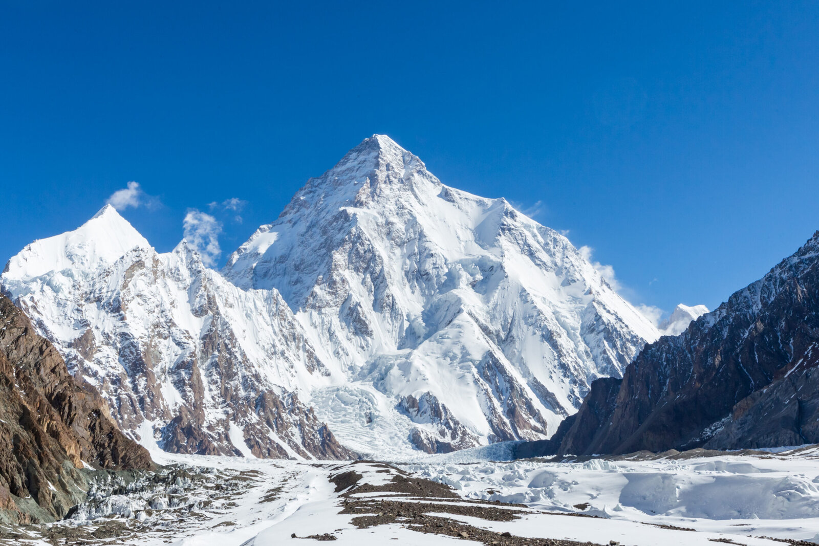
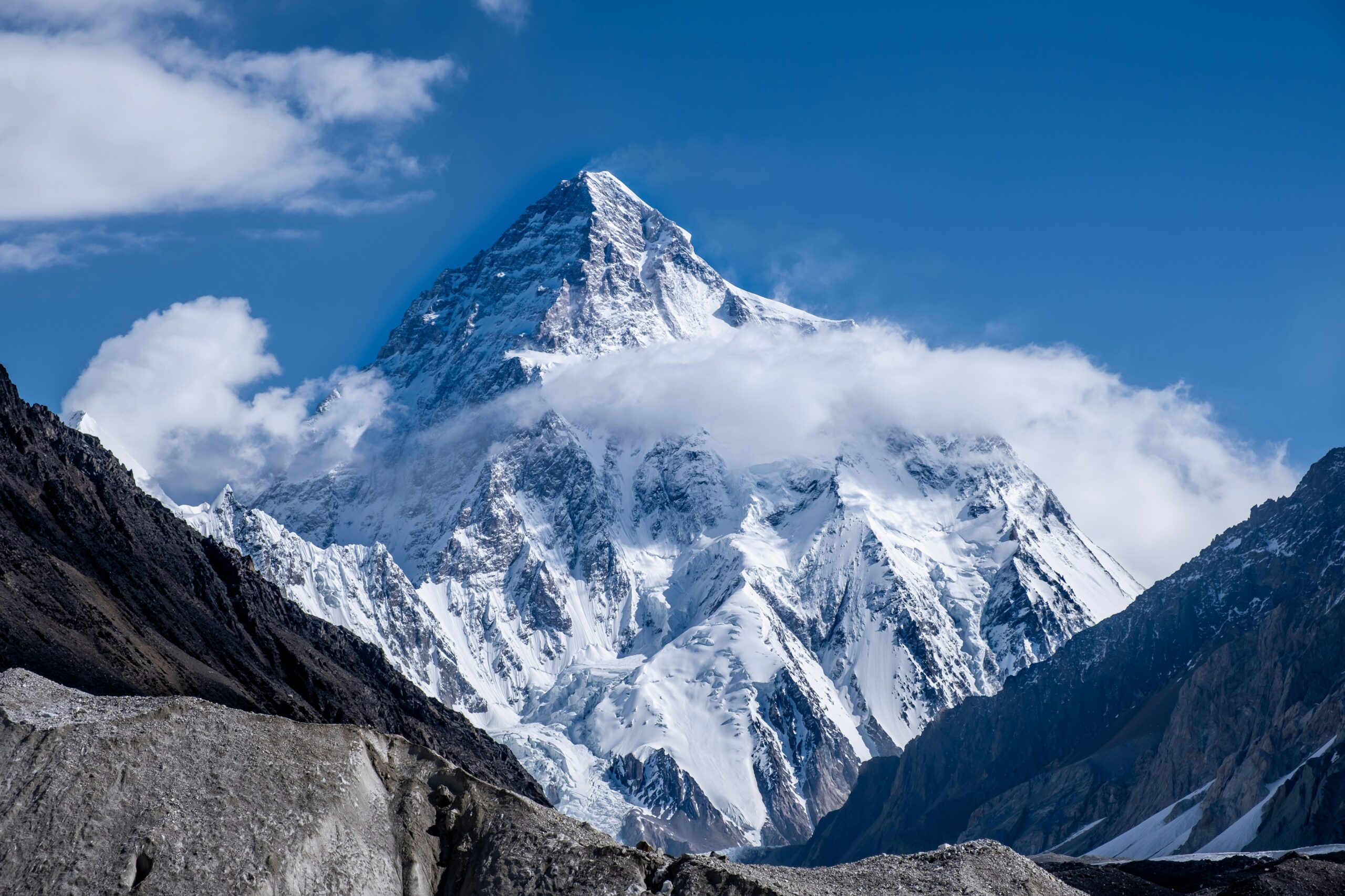
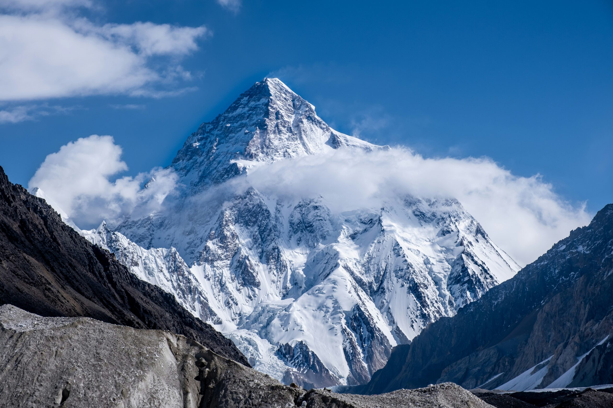
    Majestic view of K2, the Savage Mountain, showcasing its snow-capped peak and surrounding rugged terrain under a clear blue sky, emphasizing the challenges climbers face in high-altitude conditions.
    K2 · 8,611 m · Karakoram summer · permits · access · route fixing

    K2 Climbing Season: Summit Window, Permits, Access & Route Readiness

    K2’s practical expedition season runs from late June through August, but the strongest summit period is usually much shorter—often a few days in late July or early August. Reaching that window requires more than favorable weather: the permit must be approved, the Baltoro approach completed, camps and fixed lines established, climbers acclimatized, and the route ready for both ascent and descent.

    Official GB permit source checked Current K2 royalty schedule cited Weather guide kept separate Live tracker linked for current events

    Reviewed August 16, 2026 · Gilgit-Baltistan Tourism Department + current expedition planning sources · Verify permit paperwork before payment

    Jun–AugPractical expedition season
    Late JulCentral summit period
    $12,000Published K2 royalty · up to 7*
    +$3,000Each additional member*
    8,611 mK2 summit
    By Travis Ludlow · Founder & Head of Research · Safety review: Dawson Ludlow
    *Current published Gilgit-Baltistan schedule; confirm the invoice and expedition-specific fees through your registered Pakistani operator
    The direct answer

    When is the K2 climbing season?

    The normal expedition cycle begins in late June, when teams travel through Skardu and Askole, trek the Baltoro, establish Base Camp and begin route work. July is the core acclimatization and fixing month. The strongest summit opportunity commonly falls in late July, sometimes extending into early August.

    August is not automatically “too late,” but the value of a second window depends on whether the route remains established, camps and oxygen are intact, the team is healthy, and forecasts still offer enough margin for a complete summit-and-descent cycle.

    For temperature, wind, snowfall, monsoon influence and forecast interpretation, use the K2 Weather Guide.

    • Late June: approach and Base Camp establishment.
    • Early July: lower rotations and fixing.
    • Mid July: upper rotations, camps and recovery.
    • Late July: central summit-window period.
    • Early August: possible second opportunity.
    • Afterward: descent can be the correct decision even after weeks of investment.
    The season is a sequence, not a date

    K2 Expedition Calendar

    A commercial expedition may last seven or eight weeks even though the mountain offers only a short final opportunity.

    Late JuneApproach

    Skardu logistics, Askole roadhead, Baltoro trek, Base Camp setup and early route assessment.

    Early JulyLower rotations

    Camp 1/2 movement, acclimatization, load carries and lower-route fixing.

    Mid JulyUpper readiness

    Higher rotations, Camp 3 work, Black Pyramid progress, oxygen/camp staging and recovery.

    Late Jul–Early AugSummit period

    The best chance comes when a usable forecast overlaps with fixed ropes, stocked camps and rested climbers.

    PhaseMain workPrimary uncertainty
    ApproachTravel, permits, roadhead, Baltoro trekFlights, roads, bridges, porter logistics
    Lower rotationsCamps 1–2, rope work, acclimatizationRockfall, snow, heat cycles, illness
    Upper rotationsCamp 3, Black Pyramid, high-altitude recoveryWind, new snow, fixing delays, fatigue
    Summit stagingCamp 4, oxygen, team selection, forecastWindow duration, congestion, cache integrity
    Summit/descentBottleneck, summit, return through technical routeWind trend, turnaround time, queues, oxygen
    A summit opportunity is an intersection

    Five Things Must Align at the Same Time

    Good weather alone does not make K2 ready for a summit push.

    1 · Weather

    Upper wind, snowfall and visibility must provide enough margin for the complete high-altitude cycle.

    2 · Route

    Fixed lines and camps must reach high enough for the team to use the forecast window.

    3 · Team

    Climbers must be acclimatized, healthy and recovered from their final rotations.

    4 · Logistics

    Oxygen, tents, fuel, stoves and caches have to be in place and functioning.

    5 · Descent

    The forecast has to protect the return through the Bottleneck, Black Pyramid and lower ridge.

    Human judgment

    Weeks of waiting create deadline pressure; a disciplined team still has to walk away from a marginal day.

    K2 mountain peak in Karakoram range, Pakistan, showcasing a challenging and deadly 8,000-meter ascent
    The forecast does not climb the route

    Weather, fixing, camps and team readiness must peak together.

    A calm spell can be unusable if snow has buried the route, ropes stop below the Bottleneck, Camp 4 is damaged or the team has not recovered from its final acclimatization rotation.

    Conditions change by thousands of vertical meters

    What “K2 Conditions” Means From Askole to the Summit

    The expedition can lose margin long before a climber reaches the Abruzzi Spur.

    ZoneCondition questionsWhy it matters
    Skardu / AskoleFlights, road status, bridges, landslides, vehiclesDelays consume acclimatization and recovery days.
    Baltoro approachHeat, precipitation, glacial streams, porter movementTeams can arrive at Base Camp already depleted.
    K2 Base CampRest, illness, snow/rain, communicationsRecovery quality determines readiness for rotations.
    Lower AbruzziRockfall, snow cover, fixed-line conditionEarly delays can stall the entire route-building schedule.
    Black PyramidMixed conditions, rope integrity, congestionTechnical climbing slows traffic and increases oxygen/cold exposure.
    Shoulder / Camp 4Wind, snow loading, tent and oxygen-cache conditionSummit plans often unravel here before the Bottleneck.
    Bottleneck / summitSerac exposure, queues, wind, temperature, turnaround timeThe descent through the same terrain remains part of the summit decision.

    For the atmospheric side of these conditions, see K2 Weather by Month.

    Current official Gilgit-Baltistan schedule

    K2 Permit Royalty & Expedition Rules

    Use the current government-published schedule as the starting point, then have your registered Pakistani operator confirm the full invoice.

    Official published itemCurrent GB schedule
    K2 royalty · party up to 7 membersUS$12,000
    Each additional member above 7US$3,000
    Maximum party size under published K2 terms15 members
    Peak coverageOne permit is issued for one peak
    Registered company relationshipRequired for expeditions under current GB guidance
    Insurance documentationRequired before permit issuance for local high-altitude workers under current policy
    Budget beyond the headline royalty. The official permit process also involves environmental/waste fees, insurance and operator administration. Ask for a written breakdown showing which government fees, deposits, liaison/administrative costs and operator charges are included.

    For a detailed cost and paperwork breakdown, use the K2 Permits & Fees Guide.

    Start paperwork well before expedition month

    What the Permit Application Requires

    Gilgit-Baltistan Tourism publishes an online application process handled through the expedition’s registered tour company.

    Core application documents listed by the Tourism Department

    The official FAQ lists an online mountaineering/trekking application followed by royalty/environment payments and insurance documentation. The operator submits the expedition material and coordinates the government process.

    • Application from the tour operator on company letterhead.
    • Route map of the proposed peak or trek.
    • Passport copies for expedition members.
    • Completed visa application information for foreign trekkers/climbers.
    • Occupation details for trekking/expedition members.
    • Copy of the licensed tour operator’s documentation.
    • Royalty / trekking fee receipt as applicable.
    • Waste-management / environmental fee receipt as applicable.
    • Insurance documentation required by current policy.

    Do not plan around a bare minimum deadline.

    Visa processing, expedition paperwork, fee transfers and corrections can consume time. Ask your operator for a dated document checklist and submission schedule months before travel rather than waiting until the Karakoram season begins.

    K2 peak partially obscured by clouds at dusk, surrounded by rugged mountain terrain, symbolizing the challenges of K2 expeditions.
    The approach is part of the season

    K2 has no road to Base Camp.

    International arrival, Skardu logistics, Askole road access and the multi-day Baltoro trek all happen before the first acclimatization rotation. A delay in that chain can consume the margin needed for the summit period.

    Build schedule slack before Base Camp

    Skardu, Askole & Baltoro Access

    The strongest itinerary is not the one that reaches K2 fastest; it is the one that absorbs delays without stealing recovery days.

    Islamabad → Skardu

    Domestic flights are valuable but weather-sensitive. Operators commonly plan road contingencies when schedules matter.

    Skardu → Askole

    Road and bridge conditions in the Shigar/Braldu corridor can change after rain, landslides or infrastructure damage.

    Askole → Base Camp

    The Baltoro trek is a real high-altitude approach through Paiju, Urdukas, Goro and Concordia before the Godwin-Austen Glacier and K2 Base Camp.

    Confirm access close to departure. Ask your operator about current Skardu transport, Askole roadhead, bridges, porter logistics and any administrative briefing that must be completed before the team moves into the Baltoro.
    A usable forecast can arrive too early

    Route Fixing, Shared Lines & Congestion

    K2’s commercial season depends on the route being established quickly enough to use the atmospheric window.

    SectionWhy fixing mattersSeason consequence
    Lower AbruzziEarly ropes establish camp movement and acclimatization flowDelay here pushes every later rotation back.
    House’s ChimneyTechnical bottleneck on the lower routeSlow fixing creates queues before the high mountain.
    Black PyramidSustained technical terrainA major schedule gate for Camp 3 access.
    Shoulder / Camp 4High camps and oxygen must be establishedForecast opportunity is useless without summit staging.
    Bottleneck / TraverseFinal lines control traffic through the key upper hazardLate fixing can compress many teams into the same window.

    Study the terrain in the K2 Routes Guide.

    No summit attempt can be the right outcome

    Seven Ways a K2 Season Can Fail

    Permit approval and weeks at Base Camp do not create an obligation to attempt the summit.

    Access delays

    Flights, roads, bridges or porter logistics consume days before Base Camp.

    Persistent upper wind

    No forecast provides enough calm time for the summit and descent.

    Fresh snow

    A storm leaves unacceptable loading, buried lines or slow trail-breaking.

    Fixing stalls

    The route is not established when the best forecast appears.

    Illness or injury

    Climbers or staff are unable to recover enough for the summit cycle.

    Camp / oxygen failure

    Damaged tents, stoves, caches or cylinders reduce the margin above Camp 3.

    The seventh failure mode is deadline pressure.

    The longer a team waits, the easier it is to reinterpret a marginal forecast as “good enough.” Strong expedition leadership treats sunk cost as irrelevant when conditions no longer support a defensible attempt.

    For dated expedition developments

    Where to Follow the Current K2 Season

    Season patterns are stable; rope fixing, summit pushes and team movements change day by day.

    Use the live season tracker for temporary developments.

    The K2 2026 Season Tracker is the better place for dated information such as team arrivals, current fixing progress, active delays and summit pushes. This guide is designed for the planning framework that remains useful from one season to the next.

    • Current teams at Base Camp.
    • Latest fixing progress.
    • Active summit-window reports.
    • Season incidents and major changes.
    • Temporary access or weather disruptions.
    Useful next steps

    Turn the Season Calendar Into an Expedition Plan

    Two planning decisions matter immediately after choosing the season: the route system and the operator.

    Terrain & fixing

    K2 Routes Guide

    Understand where ropes, camps and congestion shape the timing of a commercial summit push.

    Open Routes →
    Execution

    K2 Operators

    Compare who controls fixing, oxygen, staffing, turnaround authority, rescue planning and permit administration.

    Compare Operators →
    Direct planning answers

    K2 Climbing Season FAQ

    The most common questions involve timing, permits, access and whether the route is ready when the forecast appears.

    What is the K2 climbing season?

    The practical commercial expedition season is late June through August. Most teams spend July acclimatizing and establishing the route, with the strongest summit opportunity usually in late July or early August.

    What is the best month to climb K2?

    July is the central month. Late July is especially important because route fixing, acclimatization and summer weather can finally align. For atmospheric detail, see the separate K2 Weather Guide.

    Can K2 be climbed in August?

    Yes. Early August can provide a second opportunity if the route remains established, the team is healthy and a defensible weather window appears. It should not be treated as guaranteed.

    How much is the K2 climbing royalty?

    Gilgit-Baltistan Tourism currently publishes a K2 royalty of US$12,000 for a party of up to seven members, plus US$3,000 for each additional member. Confirm the full expedition invoice and any additional fees through the registered Pakistani operator.

    Can foreign climbers apply independently?

    Gilgit-Baltistan Tourism states that expeditions must have proper permits and be associated with a registered tour company. Foreign expeditions normally use a licensed Pakistani operator to administer the process.

    Does a K2 permit cover Broad Peak too?

    No assumption should be made that one permit covers both. The current published terms state that a permit is issued for one peak, with another permit required for another peak.

    How early should I start the permit process?

    Start months before travel. The official process requires operator documentation, member information, route material, fees and insurance; visa and administrative timelines can add delays.

    What if the best weather arrives before ropes reach the summit?

    The forecast may be unusable. On K2, weather, route fixing, high camps, oxygen caches and team readiness all have to align before a commercial summit cycle can begin.

    Where can I follow current K2 conditions?

    Use the K2 2026 Season Tracker for dated team arrivals, rope-fixing progress, active delays and summit-window reporting.

    Sources & methodology

    How Global Summit Guide Evaluates the K2 Season

    Government permit rules, stable expedition timing and live field developments are treated as different types of information.

    What changes during the season

    • Skardu and Askole access.
    • Baltoro approach condition.
    • Rope-fixing progress and camp locations.
    • Upper-mountain snow loading and wind.
    • Operator staffing and oxygen caches.
    • Whether the team is healthy enough to use a forecast window.

    Verify before payment and again before departure.

    Government schedules can change, and expedition access is affected by weather, roads and administrative processes. Get the final royalty, fees, paperwork status and access plan in writing from the operator handling your expedition.

    The calendar gets you to K2. Readiness gets you to the window.

    Plan for Late July—But Build Enough Margin to Wait or Walk Away.

    A strong K2 expedition reaches Base Camp early enough to absorb delays, completes acclimatization without exhausting the team, establishes the route before the forecast appears and treats the summit period as an opportunity rather than a deadline.

    Was this helpful?

    Yes
    No
    Thanks for your feedback!
  • Karakoram Weather Window Explained: How Teams Time a Summit Push

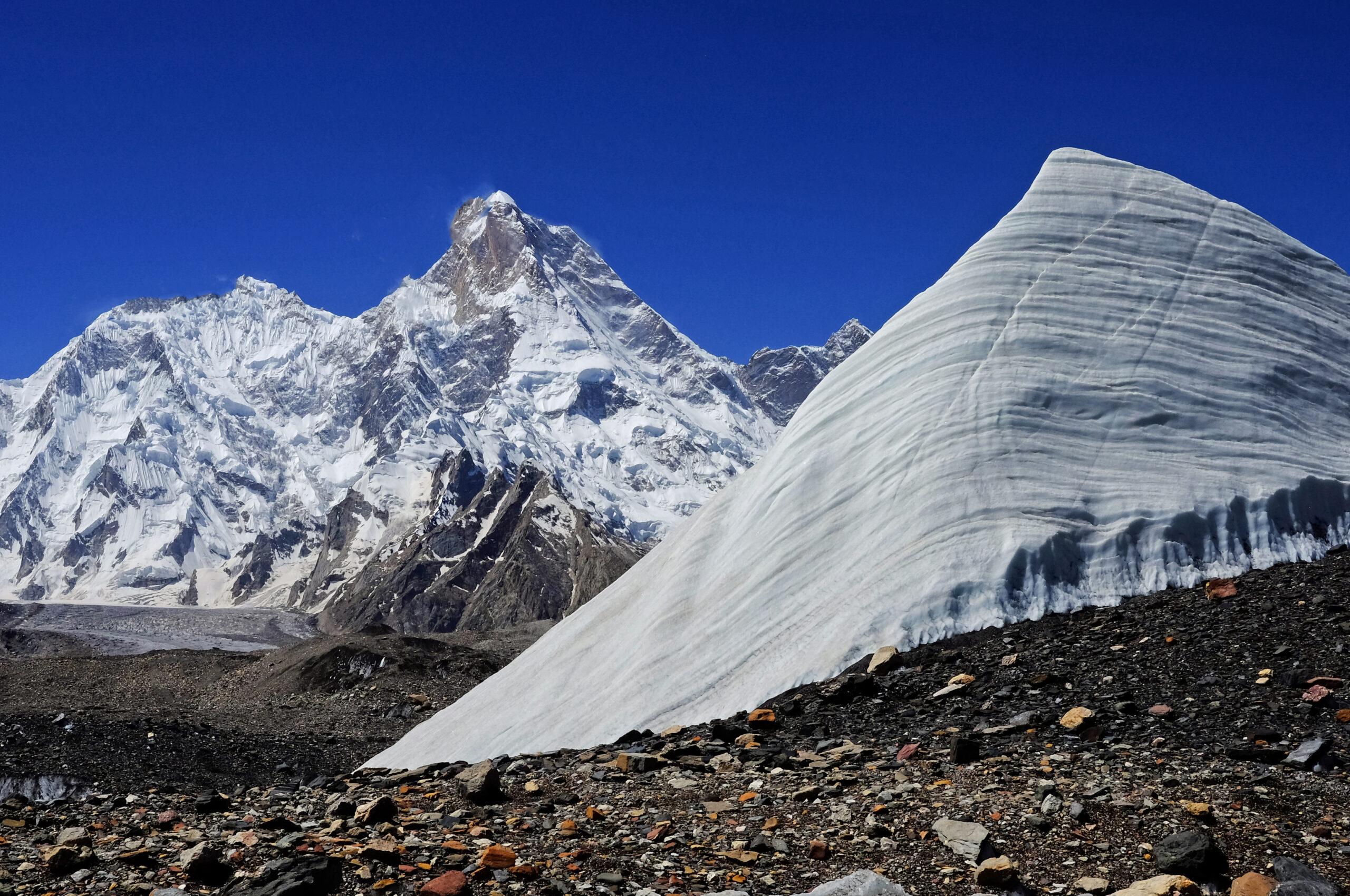
    Majestic view of K2, the Savage Mountain, showcasing its snow-capped peak and surrounding rugged terrain under a clear blue sky, emphasizing the challenges climbers face in high-altitude conditions.
    🇵🇰 Karakoram · Explainer · Summit Window

    Karakoram Weather Window Explained: How Teams Time a Summit Push

    On the 8,000ers of Pakistan, the whole season comes down to a handful of days. Here’s what opens that window, why it’s so short and unreliable, and how expedition teams read the sky to time a summit push on K2 and its neighbours.

    🌦️ The window, in brief

    Every Karakoram 8,000m season hinges on one thing: a short, unreliable weather window in late July. Two giant weather systems — the retreating monsoon and the migrating jet stream — briefly align to drop the wind and precipitation over the peaks. Statistically, nearly all K2 summits fall between about July 20 and August 10, and the true window is often just a few days inside that.

    Right now, in mid-July 2026, teams across K2, Broad Peak, and the Gasherbrums are doing exactly what this article describes: acclimatizing, pre-positioning, and watching the forecast. Follow the live picture in our K2 2026 tracker and Broad Peak & Gasherbrum dispatch.

    Jul 20–Aug 10
    Prime window
    ~−20 °C
    Summit temp (in window)
    39%
    Years with no K2 summits (’86–’16)
    1954
    First K2 summit (Jul 31)

    Why the window exists

    Two weather systems, one brief truce.

    The Karakoram sits further north and deeper inland than the Himalaya, which makes its climate more continental and more violent. For most of the year, the peaks are scoured by jet-stream winds — hurricane-force gusts that make the upper mountain unclimbable and drive off-season summit temperatures toward −60 °C. The season is defined by the brief period when those winds lift.

    Two systems govern it. First, the South Asian monsoon: through June and July, warm, moist air drives north, bringing rain low and heavy snow high. Then, near the end of July, the polar jet stream migrates north and the monsoon slides north with it toward the Tibetan highlands, while the subtropical jet shifts well south of the Karakoram. For a short spell, the peaks are left in relative calm — lower wind, less precipitation, and “manageable” cold around −20 °C on the summit. That truce is the window.

    When it opens

    The last two weeks of July, give or take.

    The best Karakoram climbing weather is typically the last two weeks of July, sometimes starting as early as mid-July and running into early August. It’s not a new discovery — the Italians made the first ascent of K2 on July 31, 1954, squarely inside it, and the pattern has held ever since. Statistically, nearly every K2 summit in history has landed between roughly July 20 and August 10.

    Early–mid JulyMonsoon still active — snow high, rain low. Teams trek in, acclimatize, and fix the lower route.
    ~July 20 onwardJet stream lifts, monsoon retreats. The prime window opens — a few stable days at a time.
    Into early AugustWindow can persist, but warming raises rockfall and instability. Later is riskier.

    Why it’s short & unreliable

    Two systems have to line up — and often don’t.

    Because the window depends on two large systems briefly aligning, it’s fragile. If the monsoon lingers or the jet stream dips back, the window slams shut. The numbers are sobering: between 1986 and 2016, 39% of years — 12 of 30 — produced no K2 summits at all because the weather never cooperated in the back half of July. A whole season of effort can end without a single summit.

    Why forecasts fail hereThe Karakoram is a forecaster’s nightmare: remote, high, and crowded with giant peaks that spin up local wind tunnels and microclimates — including the notorious localized “K2 cloud” that can trap climbers in the high camps. Global models struggle at this altitude and resolution, so forecasts several days out are frequently wrong. Teams buy specialist high-altitude forecasts and still treat any window as provisional until it actually arrives.
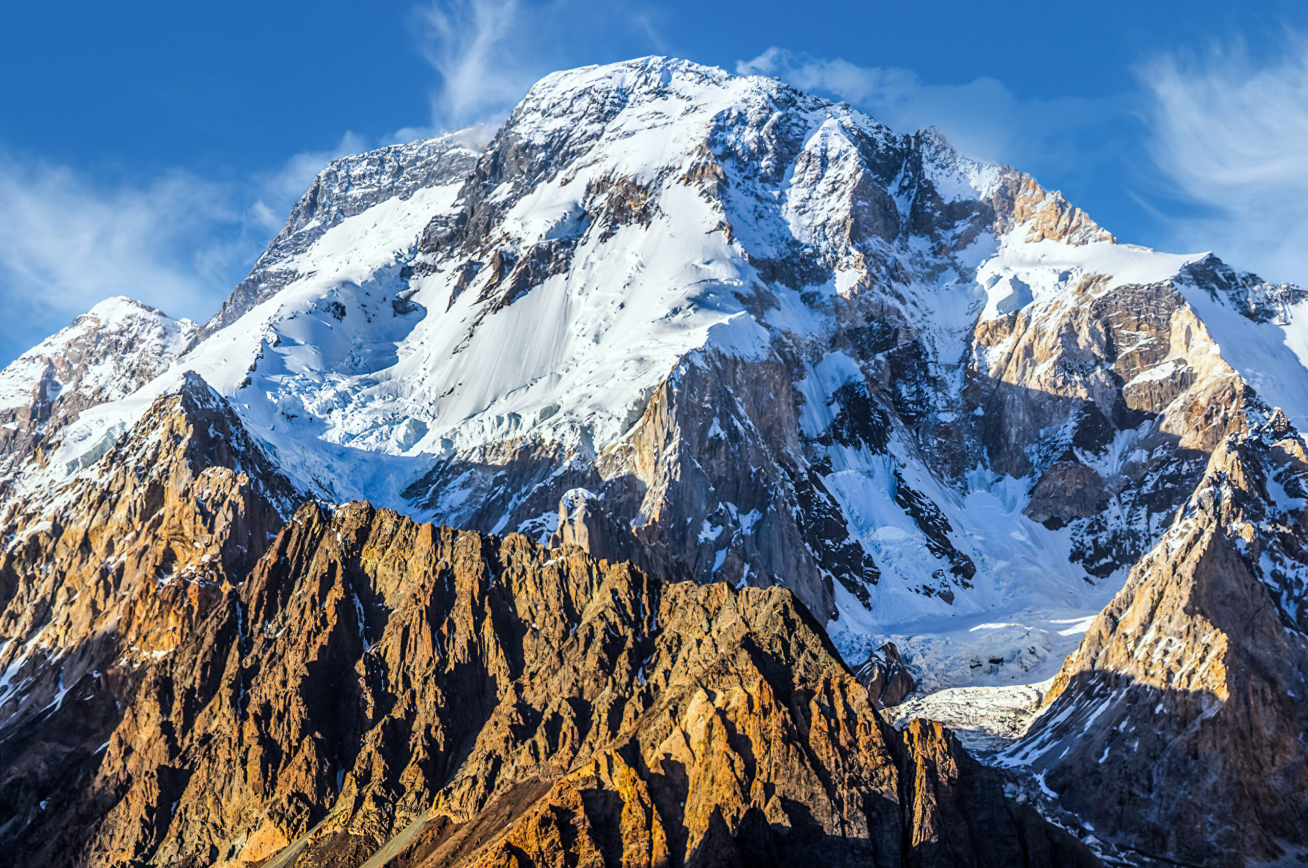
    Gasherbrum I peak and glacier in the Karakoram range, Pakistan climbing expedition.
    The trail-breaking problem. A window in the sky isn’t enough — someone still has to open the route. After heavy monsoon snow, rope-fixers must break trail through deep snow above the high camps before anyone can push to the top, which can eat the first day or two of a precious window.

    How teams time a push

    Acclimatize early, wait, then move fast.

    The choreography is remarkably consistent across the Karakoram’s big peaks:

    1 · AcclimatizeComplete rotations to the high camps early in the season, sleeping progressively higher to adapt — done before the window, not during it.
    2 · Pre-position & watchReturn to Base Camp, rest, and monitor multi-model forecasts, waiting for a stable multi-day window to appear.
    3 · Fix the routeRope-fixers break trail and fix lines through the upper mountain — the deep-snow section above the high camps is the crux of opening the route.
    4 · The pushWhen the window and the fixed route align, teams move fast to the high camps and launch a night-time summit bid, aiming to top out in the morning and descend before it closes.
    Who the window punishes mostAs on Everest, the climbers with the least margin are those going without supplemental oxygen. They benefit from fixed ropes and a broken trail, but they must move fast and avoid the traffic jams that form when everyone launches into the same narrow window — lingering high and cold without oxygen is how no-O2 attempts turn dangerous. It’s one reason the compressed, single-window nature of the Karakoram season carries real risk. See where these peaks rank in our 8,000ers ranked by difficulty.

    Live Karakoram conditions

    The window, in real time — watch it build or break.

    Here’s the concept in action. The 7-day outlook below is modelled data for the K2 region — a general indicator, not a summit-day forecast (teams pay for specialist high-altitude models before committing). Watch for a run of calm, dry days: that’s the shape of a window forming.

    K2 region (~Base Camp, Karakoram)

    Loading live data…
    Fetching the latest forecast…
    A general indicator only. This is modelled data near Base Camp altitude; the 8,000m summits are colder and far windier. The window is defined at the summit, not the valley — which is exactly why teams pay for specialist high-altitude forecasts.

    Reading the window yourself

    What experienced climbers actually watch.

    You don’t need to be a meteorologist, but you do need to know what matters. On the 8,000ers, the two variables that define a window are summit-altitude wind (ideally dropping below ~30–40 km/h) and precipitation (none, ideally, with settled snow). Temperature matters less than wind — it’s the wind that kills. Climbers cross-reference several models rather than trusting one, and treat a forecast more than three or four days out as a rough guide, not a promise.

    🧭 Go deeper

    Frequently asked questions

    When is the Karakoram summit window?

    Roughly the last two weeks of July into early August — statistically nearly all K2 summits fall between about July 20 and August 10, opened by the monsoon retreating and the jet stream migrating north.

    Why is the window so short?

    It depends on two big systems briefly aligning. When the monsoon slides north and the jet stream lifts off the peaks, wind and precipitation drop; when either shifts back, the window closes — often after just a few days.

    Why are forecasts unreliable?

    The Karakoram is remote, high, and full of giant peaks that create local wind tunnels and microclimates like the “K2 cloud.” Global models struggle at this resolution, so multi-day forecasts are often wrong. See mountain weather for climbers.

    How do climbers time a push?

    Acclimatize early, then wait at Base Camp for a stable multi-day window with the route fixed high, then move fast to the high camps for a night-time summit bid — topping out in the morning and descending before it closes.

    How cold is it in the window?

    Around −20 °C on the summit — harsh but survivable — versus about −60 °C off-season, when jet-stream winds make the peak unclimbable.

    About this explainer

    The mechanics here — the monsoon and jet-stream interaction, the late-July window, and the historical summit statistics — are drawn from meteorological analysis of Karakoram summer weather and long-run summit records, and are evergreen. The current-season notes and the live widget reflect conditions as they change; for the day-to-day picture, follow our season trackers.

    This is an educational overview, not operational guidance. Real summit-push decisions rely on specialist high-altitude forecasts and experienced judgment on the ground.

    Travis Ludlow

    Founder & Head of Research, Global Summit Guide

    Travis leads research at Global Summit Guide, where the team tracks the world’s major climbing seasons and maintains guides to more than 500 peaks. This explainer sits alongside our live Karakoram dispatches — the theory here, the day-to-day reality there.

    Watch the window with us

    The theory is here; the drama is on the mountain. Follow the 2026 Karakoram season as teams read the sky and time their push on K2 and its neighbours.

    Follow the K2 season → Broad Peak & Gasherbrum →

    Was this helpful?

    Yes
    No
    Thanks for your feedback!
  • Nanga Parbat 2026 Season Wrap: Summits, Records & Ski Descent

    Nanga Parbat in Pakistan, focus of the 2026 season wrap
    2026 season record · Pakistan · Diamir & Rupal · updated August 11

    Nanga Parbat 2026 Season Wrap: Who Summited & What Happened

    Nanga Parbat opened Pakistan’s 8,000-metre summer with a concentrated commercial summit wave, delivered a historic ski descent and a 14×8000 completion, then stayed active into August through an ambitious Rupal Face project.

    Major summit waves verifiedMilestones sourced separatelyCommercial + alpine season distinguishedUncertainty disclosed

    Published July 11, 2026 · Updated August 11, 2026 · By Travis Ludlow

    8,126 mNanga Parbat
    Jun 30First Major Summit Wave
    Jul 18K Summit Wave
    Jul 314×8000 Completion
    Jun 30Bargiel Ski Descent
    Aug 6Rupal Project Ends
    By Travis Ludlow · Global Summit Guide Research
    Season retrospective · not a live dispatch
    Why this page changed after July 11: the original wrap was published while confirmations were still arriving and before the late Rupal Face project had finished. This August 11 version treats the page as a retrospective 2026 season record, not an early-July live update.
    The direct answer

    What Defined Nanga Parbat’s 2026 Season?

    The commercial season was concentrated on the Kinshofer Route on the Diamir Face, with the key summit activity clustered around June 30 through July 3. The season included Pakistan’s first 8,000m summit wave of the summer, Andrzej Bargiel’s historic ski descent, Kili Pemba Sherpa’s completion of all fourteen 8,000ers, an oldest-woman summit record, and a later alpine-style Rupal Face attempt that continued into August.

    • Main commercial route: Kinshofer / Diamir Face.
    • Major summit period: June 30–July 3.
    • Historic ski event: Andrzej Bargiel summited June 30 and skied the mountain without supplemental oxygen.
    • 14×8000 milestone: Kili Pemba Sherpa completed all fourteen on July 3.
    • Season character: relatively quiet, warm and strongly shaped by heat, soft snow and route timing.
    The season in sequence

    Nanga Parbat 2026 Timeline

    The commercial Diamir season and the later Rupal alpine project were related by weather, but they were very different climbing operations.

    1

    Early June — a quieter Pakistan season takes shape

    Pakistan’s 8,000m summer was lighter than some recent years. Several large international outfitters had reduced or skipped Pakistan programs, while Seven Summit Treks, 8K Expeditions, Imagine Nepal and independent/alpine teams still fielded Nanga Parbat projects.

    2

    June — route fixing and heat become central

    Commercial teams worked the Diamir side and standard Kinshofer line. Warm conditions slowed progress at times and increased concern about soft snow, rockfall and lower-route timing.

    3

    June 30 — first major summit wave

    A Seven Summit Treks team reached 8,126m after seasonal rope-fixing work. The summit group included Tao Hu, Antonina Samoilova, Mindaugas Satkauskas, Abbas Ali Mehdi and Nepali guides, and was reported as Pakistan’s first 8,000m summit wave of the summer.

    4

    June 30 — Andrzej Bargiel skis Nanga Parbat

    Andrzej Bargiel summited with Janusz Golab and then descended the mountain on skis without supplemental oxygen. Reporting by Red Bull and ExplorersWeb described it as the first continuous ski descent of Nanga Parbat.

    5

    July 1 — 8K Expeditions summit wave

    8K Expeditions documented a large summit group that included Liliya Ianovskaia, Naoko Watanabe, Iryna Karagan, Saori Eragaki, Valentyn Sypavin, Pavlo Sydrenko, Danylo Yasnyuk, Muhammad Ali, Keizo Konishi and a team of Nepali high-altitude guides.

    6

    July 3 — Kili Pemba completes all 14 eight-thousanders

    Imagine Nepal reported Kili Pemba Sherpa on the summit with Lakpa Chhiri Sherpa and Wang Zhong. The ascent completed Kili Pemba’s set of all fourteen 8,000-metre peaks.

    7

    July–August — the Rupal project continues

    Marek Holecek and Tomas Petrecek pursued an alpine-style project on the Rupal Face after the main commercial summit wave. Warmth, rain, avalanches, meltwater and rock movement repeatedly complicated the line.

    8

    August 6 — Rupal project ends

    The pair’s annual project ended without a new route. This matters because it shows the 2026 Nanga Parbat season did not truly end when the Diamir commercial teams began leaving in early July.

    Documented summit waves

    Who Summited Nanga Parbat in 2026?

    The strongest public record is operator-by-operator rather than one centralized official final list.

    Date / waveOperator / projectDocumented climbersWhy it mattered
    June 30Seven Summit Treks / KinshoferTao Hu, Antonina Samoilova, Mindaugas Satkauskas, Abbas Ali Mehdi, Dawa Sherpa, Dendi Sherpa, Lakpa Temba SherpaReported as Pakistan’s first 8,000m summit wave of the 2026 summer
    June 30Andrzej Bargiel projectAndrzej Bargiel, summit with Janusz GolabSummit followed by historic continuous ski descent; no supplemental oxygen
    July 18K ExpeditionsLiliya Ianovskaia, Naoko Watanabe, Iryna Karagan, Saori Eragaki, Valentyn Sypavin, Pavlo Sydrenko, Danylo Yasnyuk, Muhammad Ali, Keizo Konishi and Nepali guidesLarge multinational commercial summit wave; included oldest-woman record claim
    July 3Imagine NepalKili Pemba Sherpa, Lakpa Chhiri Sherpa, Wang ZhongKili Pemba completed all fourteen 8,000m peaks

    This table intentionally does not claim to be the official final person-by-person total for the season. Operator posts, expedition dispatches and specialist reporting document the major summit waves well, but there is no single centralized public record that resolves every duplicate, spelling variant, guide role and late confirmation in one place.

    That distinction makes the page more useful, not less. Readers can see the best-documented summit events without Global Summit Guide pretending that a provisional tally is an audited registry.

    Nanga Parbat mountain range with snow-capped peaks and rugged terrain, illustrating high-altitude climbing challenges associated with 8,000m peaks.
    June 30 · one of the season’s defining stories

    Andrzej Bargiel Summited — Then Skied Nanga Parbat.

    The ski descent turned an already important summit day into one of the defining mountaineering stories of Pakistan’s 2026 summer.

    A different style from the commercial wave

    Why Bargiel’s Descent Belongs in the Season Record

    The achievement was not simply another summit on the Kinshofer traffic calendar.

    Andrzej Bargiel reached Nanga Parbat’s summit on June 30 with Janusz Golab and then descended the mountain on skis without supplemental oxygen. Red Bull described the descent as the first fully continuous ski line recorded on Nanga Parbat, while ExplorersWeb also reported the complete ski descent.

    The significance is partly stylistic. A commercial summit wave depends on fixed lines, team logistics and shared infrastructure; a high-altitude ski project must also solve snow quality, continuity, route transitions and descent timing. The same warm season that complicated climbing conditions could create both opportunities and hazards for a skier depending on aspect and hour.

    Do not let the ski story displace the route context.

    Use the Nanga Parbat route comparison and Nanga Parbat routes guide to understand how Diamir, Rupal and historic lines differ. This page owns the 2026 event record, not the technical route encyclopedia.

    Beyond the summit count

    Records and Milestones from 2026

    The season produced several achievements that matter independently of the raw number of successful climbers.

    14×8000

    Kili Pemba Sherpa

    Imagine Nepal reported Kili Pemba Sherpa on Nanga Parbat’s summit July 3 with Lakpa Chhiri Sherpa and Wang Zhong, completing all fourteen 8,000-metre peaks.

    Women’s age record

    Liliya Ianovskaia

    8K Expeditions and specialist reporting identified Ianovskaia as the oldest woman to summit Nanga Parbat during the July 1 wave. Sources differ on the exact age published, so this page preserves the record claim without forcing a disputed number.

    Ski mountaineering

    Andrzej Bargiel

    A no-supplemental-oxygen summit followed by a full ski descent added a major ski-mountaineering milestone to what otherwise might have been remembered mainly as a short commercial summit window.

    Climber preparing beneath Nanga Parbat during a high-altitude expedition
    Nanga Parbat’s commercial season is short, but the mountain can remain active after the main summit wave through independent, alpine-style and technical projects.
    The recurring 2026 theme

    Warm Conditions Changed the Character of the Season

    Heat showed up differently on the Diamir commercial route and the Rupal alpine project.

    Season signalDiamir / Kinshofer implicationRupal implication
    Warm temperaturesSoftening snow and greater attention to early movement on the lower mountainRain, meltwater and thawing rock/ice systems complicated a new-route project
    Rockfall / instabilityLower-route timing became more important as the day warmedRock movement added to avalanche and water hazards on steep terrain
    Short usable windowsCommercial teams concentrated summit activity into a small number of daysAlpine climbers needed a much longer stable sequence to commit to a major face
    Route styleFixed-line Kinshofer climbing allowed multiple teams to use the same openingNew-route climbing had no equivalent commercial infrastructure buffer

    For the evergreen climate and seasonal-planning question, move into the underlinked Nanga Parbat Weather guide. That page should own normal summer patterns, monsoon-edge uncertainty, temperature and forecast planning. This page should remain anchored to what actually happened in 2026.

    The commercial season was not the whole season

    The Rupal Face Project Continued into August

    This is the most important update missing from the original July 11 wrap.

    Marek Holecek and Tomas Petrecek established a separate alpine-style project on Nanga Parbat’s Rupal Face after the main Diamir summit wave. Their objective belonged to a different category from commercial Kinshofer climbing: a new-line problem on one of the world’s largest mountain faces.

    As the project developed, warm weather and unusual rain became major obstacles. Reporting described repeated avalanches, meltwater and rock movement. The conditions made it increasingly difficult to justify a committing push into terrain where retreat options could shrink rapidly.

    By August 6 the project had ended without a new route. That changes the season summary in an important way: the commercial Diamir season largely wound down in early July, but meaningful alpine activity on Nanga Parbat continued into August.

    Commercial season ≠ mountain season.

    That distinction is worth preserving on future season-wrap pages. A commercial summit list can be mostly settled while alpine-style, ski or new-route projects are still active elsewhere on the mountain.

    What carries forward

    What the 2026 Season Means for 2027 Planning

    A retrospective is most useful when it improves the next decision instead of merely listing names.

    Timing

    Early movement matters more in warm cycles

    Soft snow, rockfall and thaw-related instability can make predawn movement and conservative turnaround discipline increasingly important on lower exposed terrain.

    Route choice

    Diamir and Rupal are different sports

    The Kinshofer line can support coordinated commercial climbing; a Rupal new-route project requires a much larger stable-weather commitment and far fewer infrastructure assumptions.

    Operator system

    Rope fixing remains central to the commercial window

    The 2026 summit wave followed coordinated fixing and camp establishment. Climbers comparing 2027 companies should ask who fixes, who supports high camps and how the operator handles a short weather window.

    Training

    A short window punishes slow recovery

    A climber who needs too long to recover after rotations can miss the only viable summit period. The training target is not simply strength; it is repeatable high-altitude work and recovery.

    Forecasting

    Base Camp warmth is not a summit forecast

    The lower mountain and high mountain can respond differently. Teams need wind, snow and temperature information at the elevations that determine the summit decision.

    Decision discipline

    No summit is a normal outcome

    Nanga Parbat’s history and 2026 conditions reinforce the need to treat retreat as a legitimate expedition result when snow, heat, avalanche or timing removes the margin.

    Parent-child architecture

    The Nanga Parbat Planning Library

    This season-wrap URL owns the 2026 retrospective. The surrounding cluster owns evergreen planning questions.

    Parent guide

    Nanga Parbat Climb Guide

    Evergreen planning for the Killer Mountain: history, main routes, difficulty, access and expedition structure.

    Open guide →
    Orphan #1

    Nanga Parbat Operators

    A hard-orphan commercial child in the earlier audit. Compare expedition companies, support models and Pakistan logistics.

    Open guide →
    Orphan #2

    Nanga Parbat Weather

    The underlinked evergreen weather child: monsoon edge, summer heat, snow loading and timing by season.

    Open guide →
    Route comparison

    Nanga Parbat Route Comparison

    Diamir/Kinshofer vs Rupal vs Rakhiot: different hazards, styles and expedition systems.

    Open guide →
    Route atlas

    Nanga Parbat Routes

    Detailed Kinshofer, Rupal and historic route architecture.

    Open guide →
    Permits & logistics

    Nanga Parbat Permits & Logistics

    Pakistan permit, local operator and approach planning without mixing the season-wrap intent.

    Open guide →
    Difficulty

    Nanga Parbat Difficulty & Safety

    Objective hazards, Kinshofer Wall, descent risk and responsible readiness.

    Open guide →
    Equipment

    Nanga Parbat Gear List

    8,000m clothing, boots, technical kit, oxygen compatibility and redundancy.

    Open guide →
    Training

    Nanga Parbat Training Plan

    Prepare for long rotations, fixed lines, steep terrain, recovery and the compressed summit window.

    Open guide →
    Outcome data

    Nanga Parbat Summit Success Rate

    Understand modern and historical success before comparing a single season with the long record.

    Open guide →
    Risk data

    Nanga Parbat Death Rate

    Separate historical death-to-summit ratios from individual per-attempt risk.

    Open guide →
    8,000m collection

    All 14 Eight-Thousanders

    Place the 2026 Nanga Parbat milestones inside the wider 8,000m landscape.

    Open guide →
    Search-intent coverage

    Nanga Parbat 2026 Season FAQ

    These answers separate confirmed season events from the broader evergreen mountain guide.

    Who summited Nanga Parbat in 2026?

    Multiple teams reached the summit during the main commercial wave around June 30 to July 3. Documented summiters included climbers and guides from Seven Summit Treks, 8K Expeditions and Imagine Nepal. Because there is no single official centralized person-by-person season register, this page separates well-documented summit waves and milestone ascents from any claim of a final exhaustive total.

    What was the main Nanga Parbat route in 2026?

    Commercial teams primarily used the Kinshofer Route on the Diamir Face, the standard modern line on the western side of the mountain. The season also included a separate alpine-style project on the Rupal Face, which continued into August but ended without a new route.

    When were the main Nanga Parbat summits in 2026?

    The principal commercial summit activity clustered around June 30 through July 3. Seven Summit Treks reported Pakistan’s first 8,000-metre summit wave of the summer, 8K Expeditions documented a July 1 summit group, and Imagine Nepal’s Kili Pemba Sherpa, Lakpa Chhiri Sherpa and Wang Zhong summited on July 3.

    Did Andrzej Bargiel ski Nanga Parbat in 2026?

    Yes. On June 30, 2026, Andrzej Bargiel summited Nanga Parbat with Janusz Golab and then skied down the mountain without supplemental oxygen. Red Bull and ExplorersWeb described the descent as the first continuous ski descent of Nanga Parbat.

    Who completed all 14 eight-thousanders on Nanga Parbat in 2026?

    Kili Pemba Sherpa of Imagine Nepal reached Nanga Parbat’s summit on July 3, 2026, with Lakpa Chhiri Sherpa and Wang Zhong, completing all fourteen 8,000-metre peaks.

    Was there a Rupal Face attempt in 2026?

    Yes. Marek Holecek and Tomas Petrecek established an alpine-style project on the Rupal Face after the main commercial Diamir summit wave. Warm temperatures, rain, avalanches, meltwater and rock movement complicated the attempt, and the project ended in early August without a new route.

    What did the 2026 season reveal about Nanga Parbat conditions?

    Warm conditions were a recurring theme. Commercial teams on the Diamir side dealt with softening snow and increased lower-route instability, while the Rupal project later reported rain, avalanches, meltwater and rock movement. The season reinforced how strongly timing, route choice and early movement affect Nanga Parbat.

    Is this page the main Nanga Parbat climbing guide?

    No. This URL is the retrospective record of the 2026 season. The Nanga Parbat parent page owns evergreen route, history, difficulty and expedition planning; separate children cover weather, operators, permits, routes, training, gear and safety.

    Source hierarchy and uncertainty

    Methodology and Known Limits

    A season wrap needs stricter event verification than an evergreen mountain guide.

    How We Verified 2026

    • Operator summit announcements for commercial summit waves.
    • Imagine Nepal’s dated July 3 record for Kili Pemba Sherpa.
    • 8K Expeditions’ July 1 summit list and record announcement.
    • Specialist climbing reporting and Red Bull project reporting for Andrzej Bargiel.
    • Specialist climbing reporting for the late Rupal Face project.

    What Remains Imperfect

    • No single official centralized final person-by-person summit registry was located.
    • Operator spellings and guide-role labels can vary between reports.
    • Sources differ on Liliya Ianovskaia’s exact age, so we preserve the oldest-woman record claim without asserting one disputed number.
    • Weather descriptions are qualitative unless tied to a specific forecast archive.
    • Commercial season closure and all-mountain season closure occurred at different times.
    Confidence: high for the major summit waves, Bargiel’s ski descent, Kili Pemba’s 14×8000 completion and the existence/outcome of the Rupal project; medium for any claim of a complete final season-wide summit count because no single audited centralized list was found.
    The 2026 season was short—but not simple

    A Concentrated Diamir Summit Wave, a Historic Ski Descent, and a Rupal Project That Lasted into August.

    Use the season wrap as the historical record, then move into the Nanga Parbat parent, weather, route and operator pages for 2027 planning.

    Was this helpful?

    Yes
    No
    Thanks for your feedback!
  • Broad Peak & Gasherbrum: First Summit Pushes of the Karakoram Season

    Snow-covered Broad Peak mountain in Karakoram Range, climbing preparation for K2 expeditions
    🇵🇰 Karakoram · Season Dispatch · 2026

    Broad Peak & Gasherbrum: First Summit Pushes of the Karakoram Season

    Before K2 takes the spotlight, its neighbours go first. Three of the Baltoro’s 8,000ers — Broad Peak, Gasherbrum I, and Gasherbrum II — are where the 2026 Karakoram season opens. Here’s who’s on the mountains, where the ropes are, and when the first summits are likely.

    Where things stand · Jul 11, 2026

    The 2026 Karakoram season is opening on Broad Peak and the Gasherbrums — quietly. It’s a lighter summer than usual in Pakistan, but teams are in position. On Broad Peak, rope-fixing had pushed high on the standard route and a first summit push was poised, only to be postponed by strong wind and fresh snow while teams wait for a cleaner window.

    On the Gasherbrums, commercial and alpine teams have been establishing at base camp after the long Baltoro trek, with a notable number of climbers going without supplemental oxygen. No confirmed 8,000m summits yet — the first of the season would be expected with the next stable weather window, typically mid-to-late July. Meanwhile the Nanga Parbat season over on the Diamir side has been wrapping up.

    This is a live dispatch. Karakoram conditions change by the day; we refresh it as the pushes develop.

    📌 This is the live dispatch — the deep guides are one click awayThis page tracks the 2026 season. For routes, difficulty, cost, and planning on each peak, go straight to the full guides: Broad Peak, Gasherbrum I, and Gasherbrum II — and see where all three sit in our 8,000ers ranked by difficulty.
    8,080 m
    Gasherbrum I (11th)
    8,051 m
    Broad Peak (12th)
    8,035 m
    Gasherbrum II (13th)
    Jul–Aug
    Summit window

    Where they are

    Four of the world’s fourteen 8,000ers, clustered around one glacial junction.

    Broad Peak, Gasherbrum I, Gasherbrum II, and K2 all sit within about 20 km of Concordia, the confluence of the Baltoro and Godwin-Austen glaciers — one of the greatest concentrations of high peaks on Earth. Climbers reach them the same way: fly to Skardu, drive to Askole, then trek roughly a week up the Baltoro. Broad Peak’s base camp sits on the Godwin-Austen Glacier near K2’s; the Gasherbrums share a base camp further up the South Gasherbrum Glacier.

    Broad Peak: 8,051 m Gasherbrum I & II: 8,080 / 8,035 m K2: 8,611 m (nearby) Concordia: Baltoro junction

    Broad Peak: first to move

    The 12th-highest mountain — and often the season’s opening act.

    At 8,051 m, Broad Peak is the 12th-highest mountain in the world, standing about 8 km from K2. First climbed in June 1957 by an Austrian team — Marcus Schmuck, Fritz Wintersteller, Kurt Diemberger, and the legendary Hermann Buhl, who died on nearby Chogolisa days later — it’s long been considered one of the more approachable 8,000ers. That reputation comes with an asterisk: its summit is reached via a long, deceptive ridge with a notorious false summit that repeatedly turns climbers back short of the true top.

    In 2026, Broad Peak has been the pace-setter. Rope-fixing pushed high on the standard route, and a first summit push was ready to go before wind and fresh snow forced a postponement. It’s the familiar Karakoram waiting game — everything set, held back by the sky.

    Full Broad Peak guideRoutes, camps, cost, permits, and the false-summit trap are covered in depth in our complete Broad Peak climb guide.
    Gasherbrum I peak and glacier in the Karakoram range, Pakistan climbing expedition.
    The Gasherbrum group. “Gasherbrum” comes from the Balti rgasha brum — “beautiful mountain.” Two of the massif’s peaks are 8,000ers: Gasherbrum I (the Hidden Peak) and Gasherbrum II, both climbed from a shared base camp up the South Gasherbrum Glacier.

    The Gasherbrums: I & II

    Two 8,000ers, one massif — and very different climbs.

    The Gasherbrum massif holds two of the fourteen 8,000ers, and they’re often confused despite being quite different objectives:

    PeakHeight / rankCharacterFirst ascent
    Gasherbrum I (Hidden Peak)8,080 m · 11thSteeper, more technical; Japanese Couloir from Gasherbrum La1958 (American)
    Gasherbrum II8,035 m · 13thOne of the most accessible 8,000ers; a common first eight-thousander1956 (Austrian)

    In 2026, the Gasherbrums have drawn both commercial groups and elite alpinists. Teams have been establishing at base camp for standard-route attempts, while small alpine parties eye harder objectives on the massif. As on Broad Peak, the first summits hinge entirely on the next weather window.

    🏔️ Go deeper on the Gasherbrums

    Why they share one window

    Same glacier, same weather, same waiting game as K2.

    These peaks don’t just sit next to each other — they run on the same clock. The Karakoram summer offers shorter, less reliable weather windows than Nepal’s Himalaya, so teams across Broad Peak, the Gasherbrums, and K2 all watch the same forecasts and often move within days of one another. Typically the sequence runs Gasherbrum II and Broad Peak first, Gasherbrum I alongside, and K2 last, in its late-July to early-August window.

    That’s also why many climbers pair these peaks with bigger goals: Gasherbrum II and Broad Peak are common stepping stones toward K2. You can follow the top of that pyramid in our 2026 K2 season tracker — the companion to this dispatch — and see the season’s other Pakistan giant in our Nanga Parbat guide.

    Where they rank

    Accessible by 8,000er standards — but never easy.

    It’s tempting to file Broad Peak and Gasherbrum II under “easier 8,000ers,” and by standard-route difficulty they are among the more approachable of the fourteen — well below K2, Annapurna, or Nanga Parbat. But “accessible 8,000er” still means extreme altitude, real objective hazard, and Karakoram weather. Gasherbrum I sits a clear notch harder than GII, and Broad Peak’s false summit has ended more attempts than its grade suggests.

    We don’t re-rank them here — that’s the pillar’s job. For the full hardest-to-easiest picture, with fatality rates and technical grades:

    📊 See the full ranking

    Live Karakoram conditions

    The forecast is the story — these summits wait on the window.

    Every summit push on this page depends on one thing: a stable weather window. The 7-day outlook below is modelled data for the Concordia / Baltoro region — a general indicator, not a summit-day forecast (expedition teams buy specialist high-altitude forecasts before committing). It’s a useful read on whether the next window is building or breaking down.

    Karakoram summit region (~Concordia / Baltoro)

    Loading live data…
    Fetching the latest forecast…
    A general indicator only. This is modelled data near glacier/base-camp altitude — the 8,000m summits are colder and far windier. Teams launch only when a multi-day window of light wind lines up with the route being fixed to the top.

    Frequently asked questions

    Has anyone summited Broad Peak or Gasherbrum in 2026 yet?

    Not as of this update (July 11, 2026). Broad Peak was fixed high with a first push poised but weather-delayed; Gasherbrum teams were still establishing at base camp. The season’s first summits usually come mid-to-late July with the first stable window. We refresh this dispatch as pushes develop.

    When are these peaks climbed?

    In the Karakoram summer only — roughly June through August, with most summits in July and August. Gasherbrum II often sees the season’s first 8,000m summits, followed by Broad Peak and Gasherbrum I, with K2 last.

    Which is easiest — Broad Peak, GI or GII?

    Gasherbrum II is one of the most accessible 8,000ers and a common first eight-thousander. Broad Peak is approachable but has a deceptive false summit. Gasherbrum I is meaningfully steeper and more technical. See our 8,000ers ranked by difficulty.

    How do they relate to K2’s season?

    They share the same Baltoro region, weather, and summer window as K2, and many climbers use Broad Peak or GII to build Karakoram experience before K2. First summits here usually precede K2’s late-July window — follow it in our K2 2026 tracker.

    Are Broad Peak and GII good first 8000ers?

    GII is one of the more common first eight-thousanders, and Broad Peak is often a K2-region acclimatizer. Both are serious expeditions with real hazards, but their moderate grade makes them a genuine step into 8,000m climbing.

    How we track this

    This dispatch is compiled from expedition dispatches, operator updates, and specialist mountaineering coverage (including ExplorersWeb), cross-checked against the standard Karakoram climbing calendar. Fast-moving details — rope-fixing progress, summit pushes, casualties — are reported cautiously and dated, because early base-camp information is often incomplete and evolves.

    Conditions change daily during the season. For the current state of any climb, follow the operators directly; for routes, cost, and planning, our full mountain guides are the authoritative reference.

    Travis Ludlow

    Founder & Head of Research, Global Summit Guide

    Travis leads research at Global Summit Guide, where the team tracks the world’s major climbing seasons and maintains guides to more than 500 peaks. This Karakoram dispatch is updated through the summer; for full route, cost, and difficulty detail, we always point you to the individual mountain guides.

    The Karakoram season is just getting started

    Broad Peak and the Gasherbrums open the summer; K2 closes it. See where these giants rank among the world’s highest, then follow the whole season as it unfolds.

    8,000ers by difficulty → Follow the K2 season →

    Was this helpful?

    Yes
    No
    Thanks for your feedback!
  • K2 2026 Season Tracker: Who’s at Base Camp and What Happens Next

    Majestic view of K2, the Savage Mountain, showcasing its snow-capped peak and surrounding rugged terrain under a clear blue sky, emphasizing the challenges climbers face in high-altitude conditions.
    🇵🇰 Karakoram · Season Tracker · 8,611 m · 2026

    K2 2026 Season Tracker: Who’s at Base Camp and What Happens Next

    The world’s second-highest mountain has one short window a year — and it’s opening now. Here’s where the 2026 season stands on the Savage Mountain: who’s at Base Camp, how far the ropes are fixed, and when the summit push is likely to go. Updated through the Karakoram summer.

    Where things stand · Jul 11, 2026

    The 2026 Karakoram season is underway, and it’s a quieter one than recent years. As of early-to-mid July, most teams are established at K2 Base Camp (~5,150 m) after the long trek up the Baltoro Glacier, and have been running acclimatization rotations up the standard Abruzzi Spur.

    Rope-fixing had reached roughly Camp 2, with progress toward Camp 3 and the upper mountain slowed by spells of rain, snow, and wind. No summits yet — none would be expected this early. The main summit window remains late July to early August, once the route is fixed to the top and the jet stream lifts off the peak.

    This is a live tracker. Conditions in the Karakoram change by the day; we refresh it as the summit push develops.

    📌 Looking to climb K2 yourself — not just follow the season?This page tracks what’s happening on the mountain right now. For the full how-to — operators, cost, permits, day-by-day itinerary, and preparation — start with our complete K2 climb guide, then dig into the guide to all of K2’s climbing routes and the K2 gear list.
    8,611 m
    Summit (28,251 ft)
    #2
    Highest on Earth
    Late Jul–Aug
    Summit window
    Abruzzi
    Standard route

    Where K2 is

    On the China–Pakistan border, deep in the Karakoram — six days’ trek beyond the road.

    K2 straddles the border between Pakistan’s Gilgit-Baltistan and China’s Xinjiang, at the head of the Baltoro Glacier in the heart of the Karakoram. Almost all climbing happens from the Pakistan side: teams fly to Skardu, drive to Askole, then trek roughly a week up the Baltoro past Concordia to K2 Base Camp at about 5,150 m. There are no roads, no helicopters for routine access, and no quick way out — part of what makes K2 so committing.

    Summit: K2 (8,611 m) Base Camp: ~5,150 m, Godwin-Austen Glacier Access: Baltoro Glacier trek via Concordia

    The 2026 season so far

    A lighter crowd, a slow-building route, and a familiar waiting game.

    2026 is shaping up as a quieter Karakoram summer than the busy recent years, with a modest number of climbers spread across K2, Broad Peak, and the Gasherbrums. One recurring theme this season: a notable share of climbers are attempting Pakistan’s 8,000ers without supplemental oxygen or personal Sherpa support, which puts extra weight on getting acclimatization and timing exactly right.

    On K2 itself, the rhythm has followed the usual script. Teams reached Base Camp, held their puja ceremonies, and began pushing up the Abruzzi in rotations to sleep higher and adapt. As of this update, the fixed ropes had reached around Camp 2, with the harder rock of the Black Pyramid and the route to Camp 3 still ahead — and repeatedly stalled by weather. Meanwhile the nearby peaks set the tone: on Broad Peak, rope-fixing teams have been poised for a first summit push but held back by wind and fresh snow, while the Nanga Parbat season over on the Diamir side has been wrapping up.

    Why the wait mattersOn K2 there is effectively one route and one narrow window. When rope-fixing runs late — as it often does — teams get compressed into a single mass summit push instead of staggered days. That raises the odds of crowding at the Bottleneck, the most dangerous point on the mountain. The climbers with the least margin are those going without bottled oxygen, who can’t afford long waits in the cold at 8,000 m+.

    What happens next

    The season now hinges on one thing: a weather window.

    From here, the sequence is almost always the same. The rope-fixing team pushes the line from Camp 2 up through Camp 3 and the upper mountain toward the summit; forecasters watch for the jet stream to lift off the peak; and when a two-to-three-day window appears, teams move fast — Base Camp to the high camps, then a midnight summit push through the Bottleneck at around 8,200 m. Historically the K2 summit day lands somewhere in the last week of July or the first days of August.

    Now → mid-windowFixing & positioning. Ropes extended toward the summit; teams complete final rotations and pre-position at Base Camp, watching the forecast.
    The windowSummit push. A 2–3 day weather window triggers the move to high camps and a night-time summit bid via the Bottleneck and the traverse under the serac.
    AfterDescent & wrap-up. The most dangerous phase — down-climbing tired through the same hazards — followed by the season retrospective.

    We’ll update the status block at the top of this page as the push develops. For the mechanics of the climb itself — the camps, the crux sections, and how the standard route is laid out — see our complete guide to K2’s routes.

    K2 peak partially obscured by clouds at dusk, surrounded by rugged mountain terrain, symbolizing the challenges of K2 expeditions.
    One window a year. The Karakoram summer — roughly late June through August — is the only realistic time to climb K2, and the true summit window is often just a few days inside it. Everything before that is trekking, acclimatizing, and waiting on the weather.

    The route they’re on

    The Abruzzi Spur — the standard line, and the one being fixed now.

    As in most modern seasons, the action is on the Abruzzi Spur, the ridge on the Pakistan side that has been the standard route since the 1954 first ascent. Commercial teams’ Sherpa staff fix the ropes, usually supported by Pakistani high-altitude climbers, and the season’s other big line — the Cesen (Basque) route — joins the Abruzzi around Camp 3. Beyond these, K2’s harder faces and ridges are the domain of a handful of elite alpinists each year rather than the commercial teams.

    We’re deliberately not re-explaining every camp and crux here — that’s covered in depth on the pillar pages. If you want the full picture:

    🏔️ Go deeper on the routes (evergreen guides)

    Why the descent is the danger

    K2’s reputation isn’t hype — and it isn’t the summit that kills.

    K2 is steeper, more technical, and more exposed than Everest, with no easy line to the top. The crux Bottleneck sits directly beneath a hanging serac, and the section that has claimed the most lives isn’t the way up — it’s the exhausted, oxygen-depleted descent back through the same terrain, often in deteriorating afternoon weather. Rockfall low on the mountain and avalanche risk higher up round out a genuinely serious picture. It’s why K2’s historical fatality rate sits far above Everest’s, and why experienced guides talk about “red flags stacking up” as a reason to turn around.

    The numbers behind the reputationK2 has one of the highest death-to-summit ratios of any 8,000 m peak. For the full comparison against Everest and the rest of the 8,000ers, see our death rates by mountain analysis and where K2 lands in our 8,000ers ranked by difficulty.

    Live K2 conditions

    Modelled forecast for the K2 region — a read on the window teams are waiting for.

    The single biggest variable in any K2 season is the weather at altitude. The 7-day outlook below is modelled data for the K2 region — treat it as a general indicator, not a summit-day forecast (expedition teams pay for specialist high-altitude forecasts before committing to a push). Even in July, high temperatures and jet-stream winds swing conditions from perfect to unclimbable within a day.

    K2 region (~Base Camp, Karakoram)

    Loading live data…
    Fetching the latest forecast…
    A general indicator only. This is modelled data near Base Camp altitude — the summit at 8,611 m is a different world, colder and far windier. Teams launch only when a multi-day window of light wind lines up with the route being fixed to the top.

    Thinking of climbing it?

    K2 is a realistic objective for experienced 8,000 m climbers — with a lot of preparation.

    Following the season is one thing; standing on top is another. Commercial operators do run guided K2 expeditions with fixed ropes, oxygen, and Sherpa support, but it remains one of the most serious objectives in guided mountaineering and expects real prior high-altitude experience. If K2 is on your list, our evergreen guides are built to take you from “someday” to a concrete plan:

    🧭 Start your K2 planning here

    And if you’re just here to explore the mountains themselves, K2 is one of more than 500 peaks in our mountain database — compare it against the other giants and find your own next objective.

    Frequently asked questions

    Has anyone summited K2 in 2026 yet?

    Not as of this update (July 11, 2026). Ropes on the Abruzzi Spur had reached roughly Camp 2, with the upper mountain still to be fixed. K2 summits almost always come in the late-July to early-August window, so none would be expected this early. We refresh this tracker as the push develops.

    When is K2 climbed each year?

    Only in the Karakoram summer — roughly late June through August. The true summit window is usually just a few days in late July or early August, when the jet stream lifts off the peak. Everything before that is trekking, acclimatizing, and rope-fixing.

    What route are they using?

    The standard Abruzzi Spur on the Pakistan side, where the commercial teams fix the ropes. The Cesen (Basque) route is the main alternative and joins the Abruzzi around Camp 3. Full detail in our K2 routes guide.

    How many people are climbing K2 in 2026?

    2026 is a quieter season than recent years, with a modest number of climbers across K2, Broad Peak, and the Gasherbrums, and an unusually high share going without supplemental oxygen. Exact permit numbers shift through the season.

    Why is K2 more dangerous than Everest?

    It’s steeper, more technical, and more exposed, with the crux Bottleneck under a hanging serac — and most tragedies happen on the descent, not the summit. Its historical fatality rate is far higher than Everest’s. See our death rates by mountain comparison.

    Can I climb K2 as a client?

    Yes — guided K2 expeditions exist, with fixed ropes, oxygen, and Sherpa support, but K2 demands prior 8,000 m experience. Our full K2 climb guide covers operators, cost, permits, and preparation.

    How we track this

    This tracker is compiled from expedition dispatches, operator updates, and specialist mountaineering coverage (including ExplorersWeb and Alan Arnette), cross-checked against the standard Karakoram climbing calendar. Fast-moving details — rope-fixing progress, summit pushes, casualties — are reported cautiously and dated, because early Base Camp information is often incomplete and evolves.

    Conditions and status change daily during the season. For the current state of any climb, we recommend following the operators directly; for the how-to detail, our evergreen K2 guides are the authoritative reference.

    Travis Ludlow

    Founder & Head of Research, Global Summit Guide

    Travis leads research at Global Summit Guide, where our team tracks the world’s major climbing seasons and maintains in-depth guides to more than 500 peaks. This K2 tracker is a live season dispatch, updated through the Karakoram summer, with safety notes reviewed by Taylor Ludlow, RN. For the full climbing detail, we always point you to our evergreen guides.

    Follow the season, then plan your own

    The K2 window opens once a year, and we track it as it happens. When you’re ready to go from watching to planning, our complete K2 guide and the 8,000ers difficulty ranking will get you started.

    The complete K2 guide → 8,000ers by difficulty →

    Was this helpful?

    Yes
    No
    Thanks for your feedback!
  • K2 climbing routes explained: the Abruzzi Spur, North Ridge, and every major line

    Mountain Routes / Karakoram

    K2 climbing routes explained: the Abruzzi Spur, North Ridge, and every major line

    8,611 m
    K2 summit
    Abruzzi
    Standard route
    ~12
    Documented routes
    ~1 in 4
    Historical death rate
    Part of the K2 series This route deep-dive supports our complete K2 climb guide and our K2 route comparison. K2 climb guide →

    K2 is the second-highest mountain on Earth at 8,611 meters and is widely considered the hardest of the 14 eight-thousanders. The mountain sits at the head of the Baltoro Glacier in the Karakoram range on the Pakistan-China border. Unlike Everest, K2 has no commercial trade route in any meaningful sense — even the standard Abruzzi Spur is graded TD (very difficult) and requires elite-level mountaineering. This guide breaks down every documented K2 climbing route: the Abruzzi Spur normal route, the Cesen alternative, the rarely-climbed North Ridge from China, and the technical lines that have seen only a handful of ascents in mountain history. For the full climbing logistics see our complete K2 climb guide and our K2 route comparison.

    Why K2 routes matter more than on most peaks

    On most mountains, the route choice is a stylistic preference — easier route for commercial expeditions, harder route for personal-style climbers. On K2, the route choice is closer to a life-or-death decision. The Abruzzi Spur, despite being called “the standard route,” is more technical and dangerous than almost any standard route on any other eight-thousander. The other K2 routes range from “even more dangerous” to “almost never attempted.” Understanding the routes is the first step in understanding why K2 has earned its reputation as the most dangerous of the 14 peaks above 8,000 meters.

    The K2 routes reality

    K2 has approximately 12 documented routes on its various faces and ridges. Of those, only two see regular ascent traffic (the Abruzzi Spur and the Cesen). Several have seen fewer than 5 ascents in the entire history of the mountain. K2 is not a mountain with a beginner route. Every line on K2 demands elite alpine skills, full 8,000-meter altitude experience, and acceptance of high objective risk. The full historical context is in our 14 eight-thousanders guide.

    The standard route: the Abruzzi Spur

    1

    Abruzzi Spur (Southeast Ridge)

    Pakistan side · First ascent 1954 · Compagnoni and Lacedelli · Grade: TD/ED1 · The standard normal route
    Grade TD

    The Abruzzi Spur is K2’s southeast ridge and the line followed by virtually all commercial expeditions to the mountain. The route was pioneered in 1909 by Luigi Amedeo, Duke of the Abruzzi (hence the name), and was the line of the first successful ascent by the 1954 Italian expedition led by Ardito Desio. The route ascends from base camp on the Godwin-Austen Glacier through a series of established high camps before the summit push through the deadly Bottleneck.

    Camp structure on the Abruzzi Spur:

    • Base camp: 5,150 m on the Godwin-Austen Glacier.
    • Camp 1: 6,050 m, on the lower ridge above the initial mixed climbing.
    • Camp 2: 6,700 m, just above House’s Chimney — the famous rock pitch climbed by William House on the 1938 American expedition.
    • Camp 3: 7,400 m, above the Black Pyramid mixed climbing section.
    • Camp 4 (the Shoulder): 7,800 m, where climbers stage the summit push.
    • The Bottleneck: 8,200-8,400 m, the deadly couloir below the summit serac.
    • The summit: 8,611 m, after the Bottleneck and the upper snowfield.

    The Abruzzi Spur is climbed using fixed ropes through the technical sections (House’s Chimney, the Black Pyramid, the Bottleneck), with most ascents now relying on rope-fixing teams that establish the route in the lower portions and dedicated guides who climb with summit clients. Despite the support infrastructure, the route is climbed only by climbers with prior 8,000-meter experience and elite-level skills.

    The Abruzzi Spur danger profile

    The technical climbing on the Abruzzi Spur — House’s Chimney, the Black Pyramid, the Bottleneck — would be challenging at any altitude. At 7,000-8,500 meters, with diminished oxygen and cumulative fatigue, every move on this route requires concentration that climbers struggle to maintain after multi-week expeditions. The Bottleneck alone has killed dozens of climbers from serac fall.

    The alternative route: the Cesen / South-Southeast Spur

    2

    Cesen Route (South-Southeast Spur / Basque Route)

    Pakistan side · First ascent 1986 · Tomo Česen (solo to ~8,000 m) · Completed by Basques 1994 · Grade: ED1
    Grade ED1

    The Cesen Route, also called the South-Southeast Spur or sometimes the Basque Route, is the secondary commonly-climbed line on K2. The route joins the Abruzzi Spur near the Shoulder camp at approximately 7,800 m, sharing the summit-day terrain through the Bottleneck. Below the join, the Cesen offers a different lower-route option that some climbers consider less dangerous than the Abruzzi due to lower exposure to rockfall in certain sections.

    The route’s history is unusual: it was pioneered as a partial line by Slovenian climber Tomo Česen in 1986, who soloed to approximately 8,000 m before retreating. The full route to the summit was completed by a Basque expedition in 1994. The Cesen has since become the secondary commercial route, with several modern expeditions choosing it over the Abruzzi when conditions favor that side of the mountain.

    From a practical climbing perspective:

    • The Cesen avoids House’s Chimney and the Black Pyramid sections of the Abruzzi, replacing them with a different technical line on the south-southeast face.
    • The route joins the Abruzzi at the Shoulder, which means everyone on K2 funnels into the same Bottleneck regardless of which lower route they used.
    • Modern commercial expeditions sometimes use the Cesen for ascent and Abruzzi for descent (or vice versa) depending on conditions and crowding.
    • The route is graded ED1 rather than TD because of sustained technical climbing on the lower spur, though many climbers consider it less serially dangerous than the Abruzzi.

    The north side route: the North Ridge from China

    3

    North Ridge (Chinese side)

    China / Tibet side · First ascent 1982 · Japanese expedition · Grade: TD+/ED1 · Rarely climbed
    Grade TD+

    The K2 North Ridge climbs the mountain from the Chinese side via the Shaksgam Valley. The route was first climbed in 1982 by a Japanese expedition. Despite being technically similar in difficulty to the Abruzzi Spur, the North Ridge has seen only a small fraction of total K2 ascents because of the more complex access logistics and the political situation around Chinese-side expeditions.

    The North Ridge approach requires:

    • Travel into the remote Shaksgam Valley in Xinjiang, China, north of the Karakoram main divide.
    • Significantly longer approach march — typically 7-10 days from the nearest road versus 4-7 days for the Pakistan-side Baltoro approach.
    • Chinese mountaineering permits, which are more complex and sometimes politically restricted compared to Pakistani permits.
    • Less commercial infrastructure — fewer guide services operate Chinese-side K2 expeditions.

    From a climbing perspective, the North Ridge avoids the Bottleneck entirely (a meaningful safety advantage), but introduces its own challenges including longer summit-day distances and exposure to north-side weather patterns that can be more variable. Modern North Ridge ascents are typically by alpine-style expeditions with significant prior K2 experience or by national-team-style expeditions from Asian countries. The Chinese-side context for Himalaya/Karakoram peaks generally is discussed in our Everest route comparison for the broader north-side access framework.

    The harder technical lines rarely climbed

    Beyond the Abruzzi, Cesen, and North Ridge, K2 has been climbed by approximately 9 other documented routes, most of which have seen fewer than 5 total ascents in the history of the mountain. These are not commercial objectives — they are climbed by elite alpine teams pursuing specific style or first-ascent goals. The major harder routes:

    4

    The Magic Line (South Pillar / South Face Direct)

    Pakistan side · First ascent 1986 · Polish-Slovak team (Piotr Konopka, Wojciech Wróż, Przemyslaw Piasecki) · Grade: ED3
    Grade ED3

    The Magic Line is K2’s direct south pillar, climbing straight up the south face of the mountain through the most prominent rib visible from base camp. The route was the dream of the 1986 climbing season — multiple expeditions attempted it that year as the great unclimbed problem of K2 — and was finally completed by a Polish-Slovak team in August 1986. The line has seen only a handful of ascents since. The Magic Line involves sustained technical rock and mixed climbing for over 2,000 meters of vertical at extreme altitude. It is considered one of the hardest climbs in the world.

    5

    The West Ridge

    Pakistan side · First ascent 1981 · Japanese expedition (Eiho Otani, Nazir Sabir) · Grade: ED1
    Grade ED1

    The K2 West Ridge ascends the mountain’s west side from the Savoia Glacier, climbing a long ridge feature that connects to the upper mountain near 8,000 m. The route was first climbed in 1981 by a Japanese expedition. The West Ridge sees occasional attempts but is not a regular commercial objective. Modern interest in the route has been mixed — some elite climbers view it as a logical alpine-style objective while others note its sustained technical demands at altitude make it impractical for non-elite teams.

    6

    The Polish Line (South Face)

    Pakistan side · First ascent attempt 1986 · No confirmed ascent · Grade: ED4
    Grade ED4

    The Polish Line is a direct south face line attempted multiple times but never confirmed as fully climbed. The route ascends the central south face of K2 directly to the summit, bypassing the south pillar (Magic Line) to the west. The 1986 Polish expedition that attempted the line lost climbers to avalanche and storm. The route remains essentially unclimbed and represents one of the great remaining problems on K2.

    7

    The Northwest Ridge

    China side · First ascent 1990 · Japanese expedition · Grade: TD+
    Grade TD+

    The Northwest Ridge ascends K2 from the Chinese side via the western flank of the North Ridge. The route was first climbed in 1990 by a Japanese expedition and has seen very few ascents since. Like the standard North Ridge, the route avoids the Bottleneck but adds significant technical climbing on the upper ridge.

    Route comparison at a glance

    RouteSideFirst ascentGradeStatus
    Abruzzi SpurPakistan (SE)1954TDStandard route, ~95% of ascents
    Cesen RoutePakistan (SSE)1994 (completion)ED1Secondary commercial route
    North RidgeChina (N)1982TD+/ED1Rare, complex access
    Magic Line (South Pillar)Pakistan (S)1986ED3Elite alpine, very rare
    West RidgePakistan (W)1981ED1Rarely attempted
    Northwest RidgeChina (NW)1990TD+Very rare
    Polish Line (South Face)Pakistan (S)UnclimbedED4Open problem
    Northeast RidgeChina (NE)1978ED1Rare
    Various other linesMultipleVariousED1-ED45 or fewer ascents each

    The Bottleneck: the crux that defines K2

    Why the Bottleneck dominates K2 conversation

    The Bottleneck is a narrow couloir at 8,200 to 8,400 m on the standard Abruzzi Spur route, directly beneath a hanging ice serac that periodically calves off and produces avalanches. The Bottleneck is the standard summit-day route from the Shoulder camp at 7,800 m. The serac above it has killed many climbers throughout K2’s history, including 11 climbers in the 2008 K2 disaster when a major collapse trapped a large summit-day group on the descent.

    The Bottleneck is the single most dangerous section on K2’s standard route. Climbers must traverse beneath the serac in both directions — ascending to the summit and descending after — typically spending 30 to 90 minutes total in the danger zone. The serac is impossible to predict; it can collapse on calm clear days or stay stable through major storms. Modern Abruzzi Spur expeditions accept the Bottleneck as the trade-off for K2 summit success — there is no way to avoid it on the standard route.

    The Bottleneck has driven significant exploration of alternative summit-day strategies:

    • Earliest possible departure from the Shoulder to minimize time in the danger zone — typically 10 PM to midnight starts.
    • Move quickly through the couloir — climbers train specifically for fast Bottleneck passage despite the altitude.
    • Alternative summit lines — some climbers have proposed bypassing the Bottleneck via traverses to the east, though these have not become standard.
    • North Ridge as the safer alternative — the route avoids the Bottleneck entirely, which is one reason it appeals to climbers who refuse the Abruzzi serac exposure.

    K2 routes vs Everest routes

    Climbers familiar with Everest often look for the K2 equivalent of the standard South Col or North Ridge commercial routes. The comparison helps frame why K2 is fundamentally different. The full Everest framework is in our Everest route comparison:

    DimensionEverest standard routesK2 Abruzzi Spur
    Technical gradePD/ADTD/ED1
    Sustained technical climbingLimited (Khumbu Icefall, Hillary Step)Throughout the route
    Fixed rope infrastructureExtensive, professionally maintainedPartial, less developed
    Commercial expedition supportMassive, multi-operatorLimited, fewer operators
    Rescue infrastructureHelicopter rescue to ~7,000 mLimited helicopter access
    Bottleneck-equivalent hazardNone comparableThe Bottleneck serac
    Annual successful ascents (standard route)500-80010-50
    Death rate (per climber on the mountain)~1%~25%
    Prerequisite experienceOther 8000m peak or extensive 7000mMultiple 8000m peaks, elite skills

    The single most important number in this comparison is the death rate. Everest is dangerous but climbed by hundreds annually with a ~1% per-climber fatality rate. K2 is fundamentally more dangerous with a ~25% per-climber fatality rate even on the standard route. This is not a small difference — it reflects K2’s combination of sustained technical climbing, the Bottleneck, the more variable Karakoram weather, and the more limited rescue infrastructure. The death-rate comparison framework is in our death rates by mountain analysis.

    When K2 routes are climbed

    K2’s climbing season is narrow and unpredictable. The window is essentially the summer monsoon transition period when weather windows open between Karakoram storm cycles:

    MonthConditionsActivity
    MayApproach march beginsExpeditions arrive at base camp
    JuneAcclimatization rotationsCamps established to ~7,000 m
    Early JulyFirst summit attempts possibleWatch for stable windows
    Mid-July to early AugustPeak summit windowMost summits happen here
    Mid-AugustWindow typically closesExpeditions retreat
    SeptemberLate attempts rareMost years no further ascents
    WinterK2 winter climbingNepali team first winter ascent 2021

    The narrow summer window is one reason K2 has lower annual summit numbers than Everest — even strong expeditions sometimes go a full season without a viable summit window. Winter K2 was an unclimbed objective until 2021 when an all-Nepali team led by Nirmal Purja completed the first winter ascent. Winter K2 climbing remains extreme — the combination of jet-stream winds, Karakoram cold, and short daylight hours puts it in a different category from summer ascents.

    Where K2 routes fit in the broader progression

    Climbers attempting K2 routes have completed years of prior progression. The standard pathway:

    1. First eight-thousander: Cho Oyu, Manaslu, or Dhaulagiri as the introduction to 8000m peak logistics.
    2. Major Himalayan peaks: Everest, Kangchenjunga, or Makalu as the altitude proving ground.
    3. Karakoram introduction: Gasherbrum II, Broad Peak, or Gasherbrum I as the Karakoram-specific experience builder. Most K2 aspirants climb at least one of these first.
    4. K2 attempt: typically after 3-5 prior eight-thousanders, with at least one Karakoram peak among them.
    5. Beyond K2: the remaining 14 eight-thousanders, K2 winter, K2 alternative routes for elite climbers.

    The reason for this long progression is that K2 punishes any gap in alpine skill, altitude tolerance, or expedition experience. Climbers who attempt K2 without the Karakoram-specific preparation often turn around at the lower camps when the technical climbing reveals itself to be harder than they expected. The full eight-thousander progression context is in our 14 Eight-Thousanders collection.

    Cost by route honest numbers

    RouteTypical guided costSelf-supported costNotes
    Abruzzi Spur (commercial)$40,000 – $80,000$15,000 – $25,000Multiple operators available
    Cesen Route (commercial)$45,000 – $90,000$15,000 – $25,000Fewer operators
    North Ridge (Chinese side)$70,000 – $130,000$30,000 – $50,000Limited operators, complex permits
    Magic Line / South FaceNot commercially offered$25,000 – $50,000Elite expeditions only
    Permit fee (Pakistan, peak season)$7,500-12,000 per climber$7,500-12,000 per climberRoyalty plus base camp fees
    Permit fee (China, peak season)$15,000-25,000 per climber$15,000-25,000 per climberHigher than Pakistani side

    The total cost for a guided K2 attempt typically lands in the $50,000-$90,000 range, comparable to the higher end of Everest pricing. K2 commercial operators are fewer in number than Everest operators, with major names including Seven Summit Treks (Nepal), Madison Mountaineering, Furtenbach, and a small number of Pakistani-based operators. The economics of K2 climbing are challenging for operators — small client numbers, high failure rates, and high risk make K2 expeditions a niche business compared to the larger commercial Everest market.

    ★ K2 Master Resources

    The complete K2 climbing framework

    Route details, climbing logistics, expedition costs, and historical context — everything you need to understand K2 ascents.

    K2 climb guide →

    The bottom line on K2 climbing routes

    K2 has approximately a dozen documented climbing routes, but only the Abruzzi Spur and the Cesen Route see meaningful regular ascent traffic. The Abruzzi Spur is the standard normal route used by almost all commercial expeditions, graded TD with sustained technical climbing on rock, ice, and mixed terrain at extreme altitude. The Cesen Route offers an alternative lower-route line that joins the Abruzzi near the Shoulder camp. The North Ridge from China offers the only major non-Pakistan-side option but sees few ascents due to complex access. The harder lines — Magic Line, West Ridge, Polish Line — have seen fewer than 5 ascents each and remain elite alpine objectives rather than commercial routes. Every K2 route requires elite skills, full 8,000-meter experience, and acceptance of objectively dangerous conditions including the deadly Bottleneck serac on the standard route. There is no easy way up K2. The full climbing framework is in our K2 climb guide, with the side-by-side route detail in our K2 route comparison.

    Frequently asked questions

    How many routes are there on K2?

    K2 has approximately a dozen documented climbing routes, though only two are climbed with any regularity in modern commercial expeditions. The standard route is the Abruzzi Spur on the southeast ridge from the Pakistan side, which accounts for the overwhelming majority of all K2 ascents. The Cesen Route (also called the South-Southeast Spur or Basque Route) is the secondary commonly-climbed line. Other documented routes include the North Ridge from China, the Magic Line on the South Pillar, the West Ridge, the Polish Line on the South Face, and several rarely-attempted technical lines that have seen only a handful of ascents in the history of the mountain.

    What is the standard route on K2?

    The Abruzzi Spur is the standard normal route on K2 and the line followed by virtually all commercial expeditions. The route ascends the southeast ridge of the mountain from a base camp on the Godwin-Austen Glacier in Pakistan, passing through four established high camps before the summit push through the Bottleneck and across the dangerous serac traverse below the summit. The Abruzzi Spur is rated technically difficult (TD on the alpine grading scale) with sustained class 4 and class 5 climbing on rock, ice, and mixed terrain at extreme altitude. It is not an easy route in any sense — it is simply the easiest line on K2.

    What is the K2 Abruzzi route?

    The Abruzzi route, or Abruzzi Spur, is the southeast ridge of K2 and the standard climbing route. The line was pioneered by an Italian expedition led by Luigi Amedeo, Duke of the Abruzzi, in 1909 and was the line of the first ascent in 1954. The route ascends from base camp at 5,150 meters through House’s Chimney (a famous rock pitch around 6,700 m), the Black Pyramid (a technical mixed climbing section around 7,000 m), the Shoulder camp at approximately 7,800 m, and the Bottleneck below the summit serac at 8,300 m. The Bottleneck is widely considered the most dangerous section of the route due to constant serac fall risk.

    What is the K2 Bottleneck?

    The Bottleneck is a narrow couloir at approximately 8,200 to 8,400 meters on K2’s Abruzzi Spur route, directly beneath a hanging ice serac that periodically calves off and produces avalanches that have killed many climbers. The Bottleneck is the standard summit-day route from the Shoulder camp and is approximately 100 to 150 meters tall, climbed at a slope of 50 to 60 degrees on hard ice and snow. The 2008 K2 disaster killed 11 climbers when a serac collapse trapped a large summit-day group. The Bottleneck remains the single most dangerous section on K2’s standard route and is the leading cause of K2 fatalities.

    Can you climb K2 from the China side?

    Yes, K2 can be climbed from the China (Tibet) side via the North Ridge route, but it is rarely done in modern times. The Chinese side requires more complex permit logistics and a longer approach across the Shaksgam Valley, and the political situation has at times limited or closed access for foreign climbers. Historically only a small fraction of K2 ascents have come from the Chinese side. The standard commercial climbing of K2 happens from Pakistan via the Abruzzi Spur. Climbers wanting the China side typically need expedition-level commitment, advanced permits, and acceptance that the route sees almost no commercial support.

    What is the easiest route on K2?

    The Abruzzi Spur is the easiest route on K2 in relative terms, but this is misleading — there is no easy route on K2. Even the Abruzzi Spur is rated TD (very difficult) on the alpine grading scale, involves sustained technical climbing on rock and ice at extreme altitude, and traverses the deadly Bottleneck couloir below the summit serac. K2 has a historical death rate of approximately 1 in 4 climbers on the standard route. Any K2 ascent requires multi-week expedition logistics, full 8000-meter altitude experience, and elite-level mountaineering skills. The mountain is widely considered the hardest of the 14 eight-thousanders.

    How dangerous is K2 compared to Everest?

    K2 is dramatically more dangerous than Mount Everest by per-climber death rate. Approximately 1 in 4 climbers who summit K2 die on the mountain (counting deaths on the descent), while Everest’s death rate is closer to 1 in 100. Everest has more total deaths because of the much larger volume of climbers, but the per-climber risk is far higher on K2. The reasons include K2’s much steeper terrain, the deadly Bottleneck serac, more technical climbing throughout, less commercial support and fewer rescue resources, and more unpredictable Karakoram weather compared to the Himalaya. K2 is widely considered the most dangerous of the eight-thousanders.

    Was this helpful?

    Yes
    No
    Thanks for your feedback!
  • The 14 peaks: complete list of all 8,000-meter mountains

    Mountain Lists / Eight-Thousanders

    The 14 peaks: complete list of all 8,000-meter mountains

    14
    Peaks above 8,000m
    8,849 m
    Everest high point
    8,027 m
    Shishapangma low
    < 50
    Climbers completed all 14
    Part of the Eight-Thousanders series This list summary supports our comprehensive 14 Eight-Thousanders complete guide covering routes, history, difficulty, and climbing logistics for every peak. Full guide →

    The 14 peaks — also called the eight-thousanders, the 14 summits, or simply “the 8000ers” — are the mountains on Earth above 8,000 meters in elevation. All 14 are in Asia, distributed across the Himalaya and Karakoram ranges through Nepal, Tibet (China), Pakistan, and the disputed Kashmir region. Climbing all 14 is one of the rarest achievements in mountaineering, accomplished by fewer than 50 climbers in history. This is the complete list with heights, locations, first ascents, and the relative difficulty climbers use to plan their progression. For detailed route guides on individual peaks, see our complete guide to every eight-thousander.

    The 14 peaks in order of height

    1

    Mount Everest

    Location: Nepal / Tibet · Range: Mahalangur Himalaya · First ascent: May 29, 1953 by Edmund Hillary and Tenzing Norgay
    8,849 m
    29,032 ft

    The highest point on Earth and the most-climbed eight-thousander. Standard routes via the South Col (Nepal) and the North Ridge (Tibet) operate as large commercial expeditions during the spring season. See our Everest route comparison.

    2

    K2

    Location: Pakistan / China (Kashmir disputed) · Range: Karakoram · First ascent: July 31, 1954 by Achille Compagnoni and Lino Lacedelli
    8,611 m
    28,251 ft

    “The Savage Mountain.” Second-highest peak in the world but widely considered the hardest of the eight-thousanders. The Abruzzi Spur is the standard route. See our K2 climb guide and K2 route comparison.

    3

    Kangchenjunga

    Location: Nepal / India (Sikkim) · Range: Himalaya · First ascent: May 25, 1955 by George Band and Joe Brown
    8,586 m
    28,169 ft

    The “Five Treasures of the Snow.” Third-highest peak in the world. The first ascent team stopped just short of the true summit out of respect for local religious beliefs — a tradition climbers have continued for decades.

    4

    Lhotse

    Location: Nepal / Tibet · Range: Mahalangur Himalaya · First ascent: May 18, 1956 by Ernst Reiss and Fritz Luchsinger
    8,516 m
    27,940 ft

    Shares the lower portion of Everest’s South Col route — the two peaks are often climbed back-to-back by guided expeditions. See our Lhotse climb guide.

    5

    Makalu

    Location: Nepal / Tibet · Range: Mahalangur Himalaya · First ascent: May 15, 1955 by Lionel Terray and Jean Couzy
    8,485 m
    27,838 ft

    The distinctive four-sided pyramid east of Everest. Considered one of the more technically demanding eight-thousanders despite its standard route. Lower commercial traffic than the nearby Everest-Lhotse-Cho Oyu peaks. See our Makalu permits and cost guide.

    6

    Cho Oyu

    Location: Nepal / Tibet · Range: Mahalangur Himalaya · First ascent: October 19, 1954 by Herbert Tichy, Joseph Jöchler, Pasang Dawa Lama
    8,188 m
    26,864 ft

    Widely considered the easiest of the eight-thousanders and the standard “first 8000er” for climbers progressing toward Everest. The Tibetan north side is the commercial route, though Chinese-side access has varied with geopolitics. See our Cho Oyu climb guide.

    7

    Dhaulagiri I

    Location: Nepal · Range: Himalaya · First ascent: May 13, 1960 by Kurt Diemberger, Peter Diener, Nawang Dorje, Nima Dorje, Albin Schelbert, Ernst Forrer
    8,167 m
    26,795 ft

    “The White Mountain.” Famous for being the first peak ever supported by aerial deposits during a first ascent. Lower commercial popularity than the eastern Nepalese giants but a regular target for serious climbers. See our Dhaulagiri climb guide.

    8

    Manaslu

    Location: Nepal · Range: Himalaya · First ascent: May 9, 1956 by Toshio Imanishi and Gyalzen Norbu
    8,163 m
    26,781 ft

    “Mountain of the Spirit.” Has become the most popular alternative to Cho Oyu as a first eight-thousander since Chinese-side access tightened. The autumn season sees substantial commercial traffic on the standard northeast route.

    9

    Nanga Parbat

    Location: Pakistan · Range: Western Himalaya · First ascent: July 3, 1953 by Hermann Buhl (solo final push)
    8,126 m
    26,660 ft

    “The Killer Mountain.” Westernmost of the eight-thousanders and historically one of the deadliest. The Diamir face is the standard route. See our Nanga Parbat route comparison.

    10

    Annapurna I

    Location: Nepal · Range: Himalaya · First ascent: June 3, 1950 by Maurice Herzog and Louis Lachenal
    8,091 m
    26,545 ft

    The first eight-thousander ever climbed (in 1950) and the one with the highest death rate of all 14 peaks. The standard north face route is heavily exposed to serac fall. Annapurna remains feared even among elite high-altitude mountaineers.

    11

    Gasherbrum I (Hidden Peak)

    Location: Pakistan / China · Range: Karakoram · First ascent: July 5, 1958 by Andy Kauffman and Pete Schoening
    8,080 m
    26,509 ft

    The 11th eight-thousander and the highest peak in the Gasherbrum massif. Climbed via the Japanese Couloir on the southwest face. Often combined with Gasherbrum II as a Karakoram double-summit expedition.

    12

    Broad Peak

    Location: Pakistan / China · Range: Karakoram · First ascent: June 9, 1957 by Marcus Schmuck, Fritz Wintersteller, Kurt Diemberger, Hermann Buhl
    8,051 m
    26,414 ft

    Named for its expansive summit ridge. The standard west face route shares base camp with K2, allowing acclimatization climbs for K2 expeditions. Considered one of the more accessible Karakoram eight-thousanders.

    13

    Gasherbrum II

    Location: Pakistan / China · Range: Karakoram · First ascent: July 7, 1956 by Fritz Moravec, Hans Willenpart, Sepp Larch
    8,035 m
    26,362 ft

    The most-climbed Karakoram eight-thousander and considered the easiest of the four Pakistani 8000ers. Shares the Gasherbrum base camp with GI, making it a logical companion peak for stronger parties.

    14

    Shishapangma

    Location: Tibet (China) · Range: Himalaya · First ascent: May 2, 1964 by Xu Jing and Chinese team of 10
    8,027 m
    26,335 ft

    The 14th and lowest eight-thousander. The only one located entirely in Tibet (China) with no Nepal or Pakistan border. Was the last 8000m peak first-ascended due to Chinese restrictions on foreign climbers. Has a true summit and a slightly lower central summit, which has caused confusion about valid ascents.

    Key facts about the 14 peaks

    The big-picture stats

    All 14 peaks are in Asia. All 14 are in either the Himalaya or the Karakoram. The tallest is Everest at 8,849 m. The shortest is Shishapangma at 8,027 m. The difference between the tallest and shortest is just 822 m. Fewer than 50 climbers have completed all 14. The first to do so was Reinhold Messner in 1986.

    StatisticDetail
    Total number of 8000m peaks14
    TallestMount Everest (8,849 m)
    ShortestShishapangma (8,027 m)
    First climbedAnnapurna I (1950)
    Last first-ascendedShishapangma (1964)
    Highest death rateAnnapurna I
    Considered easiestCho Oyu (with current access limitations: Manaslu)
    Considered hardestK2, Annapurna I, Nanga Parbat (debated)
    First to climb all 14Reinhold Messner (1986)
    Fastest known time all 14Nirmal Purja (6 months, 6 days, 2019)
    Climbers completed all 14Fewer than 50

    Where the 14 peaks are by country

    CountryNumber of 8000ersWhich ones
    Nepal (entirely or partially)8Everest, Kangchenjunga, Lhotse, Makalu, Cho Oyu, Dhaulagiri I, Manaslu, Annapurna I
    Pakistan (entirely or partially)5K2, Nanga Parbat, Gasherbrum I, Broad Peak, Gasherbrum II
    China / Tibet (entirely or partially)9Everest, K2, Lhotse, Makalu, Cho Oyu, Shishapangma, Gasherbrum I, Broad Peak, Gasherbrum II
    India (Kangchenjunga only)1Kangchenjunga (Sikkim side)
    Entirely in one country5Nepal: Dhaulagiri, Manaslu, Annapurna; Pakistan: Nanga Parbat; Tibet: Shishapangma

    The political geography matters because climbing permits, costs, and logistics depend heavily on which country issues the permit. Nepal hosts the most accessible permit regime for foreign climbers, particularly for Everest, Lhotse, Manaslu, and Annapurna. Pakistan offers lower-cost permits for the Karakoram peaks but more complicated visa logistics. Tibet (China) periodically tightens or loosens access for foreign expeditions, with Cho Oyu and Shishapangma typically requiring more advance planning. The full Everest-region context is in our Everest route comparison, and the K2 cost framework is in our K2 climb guide.

    The 14 peaks by climbing difficulty

    The order of difficulty among the eight-thousanders is debated and depends heavily on the chosen route and season. A widely-accepted general ordering for the standard commercial routes, from most accessible to most difficult:

    TierPeakWhy
    Most accessibleCho OyuGentle glaciated slopes, well-established route
    AccessibleManasluStandard commercial route, autumn season
    AccessibleEverest (commercial)Highly resourced but altitude-driven challenge
    ModerateLhotse, Gasherbrum IISolid commercial routes, manageable technical difficulty
    Moderate to hardBroad Peak, DhaulagiriMore objective hazards, less infrastructure
    HardMakalu, Shishapangma, Gasherbrum IGreater technical and route-finding demands
    Very hardKangchenjunga, Nanga ParbatLong, complex routes; high objective danger
    HardestK2, Annapurna IExtreme technical difficulty + high death rate

    This ordering is a general framework, not a strict ranking. Individual seasons can completely change the relative difficulty — a heavy snow year on Annapurna creates much higher avalanche risk, while an unusually dry year on Cho Oyu can expose ice that adds technical difficulty. The cumulative difficulty across all 14 peaks is what makes the full completion such a rare achievement. The broader hardest-mountains context is in our 10 hardest mountains to climb and the death-rate framework is in our death rates by mountain analysis.

    Notable climbers of the 14 peaks

    The list of climbers who have completed all 14 eight-thousanders is short and historically significant:

    • Reinhold Messner (Italy, 1986) — first to complete all 14, and first to do so without supplemental oxygen.
    • Jerzy Kukuczka (Poland, 1987) — second to complete, multiple new routes and winter ascents.
    • Erhard Loretan (Switzerland, 1995) — third to complete, exclusively without supplemental oxygen.
    • Edurne Pasaban (Spain, 2010) — first woman to complete all 14 (verification debated for some ascents).
    • Gerlinde Kaltenbrunner (Austria, 2011) — first woman to complete all 14 without supplemental oxygen.
    • Nirmal “Nims” Purja (Nepal, 2019) — fastest known time, all 14 in 6 months and 6 days. Featured in the documentary “14 Peaks: Nothing Is Impossible.”
    • Kristin Harila (Norway, 2023) — broke Purja’s speed record, all 14 in 92 days.

    The 14 peaks completion list grows slowly. Of those who have attempted it, most expeditions end on the harder peaks — particularly K2, Annapurna, and Nanga Parbat. The combination of cost (potentially over $500,000 USD for a complete tour), time commitment (most completers take 7-15 years), and survival probability (multiple climbers have died on their last few peaks) keeps the achievement rare even as commercial expedition support has expanded. The framework for understanding this scale of objective is in our top 50 technical mountaineering objectives.

    The peaks that just miss the list

    Several mountains exceed 8,000 m in elevation but are not counted in the standard 14 because they are considered subsidiary summits of larger massifs rather than independent peaks. The most commonly discussed of these “near-misses”:

    • Yalung Kang (8,505 m) — western summit of Kangchenjunga.
    • Lhotse Middle (8,410 m) — middle summit of the Lhotse massif.
    • Lhotse Shar (8,383 m) — eastern summit of the Lhotse massif.
    • Kangchenjunga South (8,494 m) — south summit of Kangchenjunga.
    • Kangchenjunga Central (8,482 m) — central summit of Kangchenjunga.
    • Broad Peak Central (8,011 m) — central summit of Broad Peak.

    The line between “independent peak” and “subsidiary summit” depends on topographic prominence — the elevation a peak rises above the lowest col that connects it to a higher peak. The standard threshold for an independent eight-thousander is roughly 500 m of prominence, which excludes the subsidiary summits above. If you used a stricter prominence threshold, the list could be smaller; with a looser threshold, several subsidiary summits would qualify. The 14 peaks list reflects the most widely accepted convention.

    ★ Eight-Thousanders Master Guide

    Routes, history, and difficulty for every peak

    The complete deep guide to all 14 eight-thousanders: route comparisons, first-ascent history, climbing logistics, and the broader Himalaya and Karakoram context.

    Read the full guide →

    How climbers progress toward the eight-thousanders

    The 14 peaks are not entry-level objectives. The standard progression that climbers follow before attempting any eight-thousander typically takes 5-15 years and includes a sequence of progressively harder mountains. The general framework:

    1. Foundational glaciated peaks: Cascade volcanoes (Hood, Rainier), Mexican volcanoes (Pico de Orizaba, Iztaccíhuatl). Framework in our mountaineering for beginners guide.
    2. First 5,000-meter peak: Mount Elbrus or Cotopaxi as the introduction to high-altitude glaciated climbing.
    3. First 6,000-meter peak: Aconcagua or Denali as the next step. See our Aconcagua season guide.
    4. First 7,000-meter peak: typically Aconcagua followed by a Himalayan 7000m peak like Spantik, Khan Tengri, or Mount Manaslu’s lower trekking peaks.
    5. First 8,000-meter peak: usually Cho Oyu or Manaslu. The introduction to true Himalayan expedition climbing.
    6. Everest and beyond: the standard high-volume commercial objective, followed by individual eight-thousanders pursued one at a time based on personal goals.

    Climbers pursuing the full 14 typically have completed several eight-thousanders before formally committing to the all-14 goal. The cost framework, training timeline, and broader expedition planning context that supports this progression is in our full eight-thousanders guide, with the next-step framework in our intermediate climbing guide.

    The bottom line on the 14 peaks

    The 14 eight-thousanders represent the highest mountains on Earth and the highest tier of mountaineering objectives. All 14 are in Asia, distributed across the Himalaya and Karakoram, with Nepal hosting the largest share. The list has been climbed in its entirety by fewer than 50 people in human history, with the first complete ascent by Reinhost Messner in 1986 and the current speed record held by Kristin Harila at 92 days. For climbers building toward 8,000-meter objectives, the standard progression starts with smaller glaciated peaks, builds through 5,000 to 7,000 meter mountains, and graduates to Cho Oyu or Manaslu as the first true eight-thousander. The full route framework, expedition logistics, and historical context for each peak is in our complete eight-thousanders guide.

    Frequently asked questions

    What are the 14 peaks?

    The 14 peaks, also called the eight-thousanders or 14 summits, are the mountains on Earth above 8,000 meters (26,247 feet) in elevation. All 14 are located in the Himalaya and Karakoram ranges of Asia, distributed across Nepal, China (Tibet), Pakistan, and the disputed Kashmir region. The 14 peaks in order of height are: Mount Everest, K2, Kangchenjunga, Lhotse, Makalu, Cho Oyu, Dhaulagiri I, Manaslu, Nanga Parbat, Annapurna I, Gasherbrum I, Broad Peak, Gasherbrum II, and Shishapangma.

    How many 8000m peaks are there?

    There are exactly 14 mountains on Earth above 8,000 meters in elevation. The number is fixed because it depends on the definition of what counts as an independent peak, which is generally measured by topographic prominence. Mountains like Lhotse Middle (8,410 m) or Yalung Kang (8,505 m) exceed 8,000 m in height but are considered subsidiary summits of larger massifs (Lhotse and Kangchenjunga respectively) and are not counted in the standard list of 14.

    Who climbed all 14 eight-thousanders first?

    Reinhold Messner of Italy became the first person to climb all 14 eight-thousanders in 1986 when he summited Lhotse on October 16. Messner climbed all 14 peaks without supplemental oxygen, which remains a defining accomplishment in mountaineering history. The second person to complete the list was Jerzy Kukuczka of Poland in 1987. As of the most recent counts, fewer than 50 climbers have completed the 14 eight-thousanders. The fastest known time for completing all 14 is held by Nirmal Purja, who climbed all 14 in 6 months and 6 days in 2019.

    What is the 14th peak?

    Shishapangma at 8,027 meters (26,335 feet) is the 14th and lowest of the eight-thousanders. Located entirely in Tibet (China), Shishapangma is the only 8000-meter peak not partially in Nepal or Pakistan. It was the last 8000-meter peak to be first ascended, summited by a Chinese team led by Xu Jing in 1964. The mountain has a true main summit and a slightly lower central summit, which has caused historical confusion in determining true ascents of the peak.

    How hard are the 14 peaks to climb?

    The 14 peaks range from technically moderate to extreme depending on route and conditions. The easier eight-thousanders for guided commercial ascents include Cho Oyu, Manaslu, and the trade routes on Everest, Lhotse, and Dhaulagiri. The harder ones for technical difficulty and death rate include K2, Annapurna I, Nanga Parbat, and Kangchenjunga. Annapurna I has the highest death rate of any 8000m peak, while Everest has the largest number of total deaths due to the volume of climbers. All 14 are serious objectives that require multi-week expeditions, significant prior altitude experience, and substantial financial investment.

    Where are the 14 eight-thousanders located?

    All 14 eight-thousanders are located in two adjacent mountain systems in Asia: the Himalaya and the Karakoram. The Himalayan eight-thousanders include Everest, Kangchenjunga, Lhotse, Makalu, Cho Oyu, Dhaulagiri I, Manaslu, Nanga Parbat, Annapurna I, and Shishapangma, distributed across Nepal, Tibet (China), and the western Himalaya in Pakistan. The Karakoram eight-thousanders are K2, Gasherbrum I, Broad Peak, and Gasherbrum II, all located in northern Pakistan and the disputed Kashmir region. No 8000m peaks exist outside this region of Asia.

    How much does it cost to climb an 8000-meter peak?

    Costs for climbing 8000-meter peaks vary dramatically by mountain, country, and service level. Mount Everest from Nepal currently ranges from roughly $45,000 to $130,000 per climber depending on operator and oxygen plan. Less popular peaks like Cho Oyu, Manaslu, and the Pakistani eight-thousanders typically range from $15,000 to $40,000. Permit fees alone range from $250 (Pakistan summer season) to over $11,000 (Everest South Side). Add international flights, equipment, training, and insurance for a full expedition budget.

    Was this helpful?

    Yes
    No
    Thanks for your feedback!
Language »