
Last updated September 17, 2026

The Best Hikes in Patagonia: 12 Trails Across Chile & Argentina
For a first Patagonia hiking trip, combine Torres del Paine with El Chaltén. The W Trek is the best overall multi-day route; Laguna de los Tres is the strongest single-day hike. Go to Aysén for Cerro Castillo and Patagonia National Park when you want a quieter Chilean trip, or Bariloche when huts, forests and lake-country terrain matter more than the famous southern granite skyline.
What Are the Best Hikes in Patagonia?
W Trek: best overall multi-day Patagonia trek and the easiest major route to build into a first Chile trip.
Laguna de los Tres: best single-day hike for the Fitz Roy view, with an official current distance of 25 km and an 8–9 hour planning time.
O Circuit: best for experienced trekkers who want the full Torres del Paine circuit and have about eight days.
Laguna Torre: best El Chaltén alternative when you want a long valley hike without the steep finish of Laguna de los Tres.
Cerro Castillo and Lagunas Altas: best choices when the goal is Chilean Patagonia beyond Torres del Paine. Refugio Frey and Otto Meiling: best entry points into Bariloche’s hut-and-lake hiking network.
Which Patagonia Hike Fits Your Time?
Patagonia is too large to treat as one trail network. The right answer changes when you have one day, five days, two weeks or a dedicated regional trip.
| Your trip | Best choice | Why | Main planning issue |
|---|---|---|---|
| One serious day | Laguna de los Tres | Fitz Roy destination with full-day mountain effort | 25 km + weather |
| One day in Torres del Paine | Mirador Base Torres | Direct tower viewpoint | Long day + seasonal guide rules |
| 4–5 days | W Trek | Main Torres del Paine landmarks in one route | Accommodation and transport sequence |
| About 8 days | O Circuit | Full massif circuit including northern terrain | Seasonal opening + more commitment |
| Flexible day-hike trip | El Chaltén | Multiple trailheads near town | Wind/cloud can move the plan daily |
| Quieter Chilean Patagonia | Aysén | Cerro Castillo + Patagonia National Park | Current guide/access restrictions |
| Northern Patagonia | Bariloche | Refugios, forests, lakes and glacier approaches | Trekking registration + hut planning |
| Long binational route | Huella de Glaciares | El Chaltén to Villa O’Higgins in stages | 120 km + navigation/boat logistics |

Choose the W for a First Trek. Choose the O When You Want the Whole Circuit.
The W is easier to fit into a broader Patagonia trip. The O is a longer commitment with seasonal access constraints and a more remote northern section. The harder route is not automatically the better first route.
The 12 Best Hikes in Patagonia
The ranking favors trip quality and usefulness, not fame alone. Route variants can change the final mileage.
W Trek — Torres del Paine
The W links the three parts of Torres del Paine most first-time trekkers want: Base Torres, French Valley and Grey Glacier. Current concessioner programs show both four-day express and five-day classic versions.
The route is physically demanding but logistically supported. The challenge is consecutive long days, wind, rain and the need to make the overnight and transport sequence fit.
Laguna de los Tres — Fitz Roy
The walk starts near El Chaltén, moves through lenga forest and opens toward the Fitz Roy massif before the steep final climb to Laguna de los Tres. That finish makes this a full mountain day, not a scenic village walk.
Argentina’s National Parks administration currently publishes 25 km and 8–9 hours. Use those planning numbers rather than shorter figures copied from older summaries.
O Circuit — Macizo Paine
The O wraps around the Paine massif and adds the northern/backside terrain the W never reaches. Current Vertice programming uses an eight-day classic circuit.
As of September 3, 2026, CONAF says the O remains closed and its possible November opening depends on conditions. Plan from the live park status, not an evergreen date assumption.
Laguna Torre
Laguna Torre follows the Fitz Roy River valley toward Cerro Torre, with a gentler overall profile than Laguna de los Tres and a different granite skyline at the finish.
The current national-park listing gives 18 km round trip and 3–4 hours each way. It works well as a second El Chaltén hiking day.
Mirador Base Torres
Base Torres is the eastern arm of the W but also stands alone as a long day hike. A current four-day W program uses approximately 21 km and 8–10 hours for its Base Torres day.
The route climbs through the Ascencio Valley before the steep moraine finish below the three towers. Weather, wind and seasonal park rules matter more than the modest altitude.
Loma del Pliegue Tumbado
This route solves a different problem than the two famous lagoons: instead of walking toward one massif, you climb to an open viewpoint that can place Fitz Roy, Cerro Torre, Lago Viedma and the surrounding valleys in the same panorama.
Patagonia Argentina’s current trail page lists 24 km round trip, roughly 10 hours and high difficulty. The exposed upper terrain makes wind a major decision factor.
Huemul Circuit
The Huemul Circuit moves beyond El Chaltén’s ordinary day-hike network into remote terrain near the Southern Patagonian Ice Field. Route systems can include river crossings and tyrolean infrastructure, and it requires a much higher level of independence than Laguna de los Tres.
APN requires registration for remote areas. The circuit was temporarily suspended during a January 2026 fire near one of its tyrolean sectors, so verify current status immediately before planning.
Las Horquetas — Cerro Castillo
Las Horquetas crosses the Cerro Castillo landscape south of Coyhaique through forest, high valleys and the jagged massif that gives the park its name.
CONAF lists 53.5 km and 3–5 days. The important 2026 detail is access: current park notices say Las Horquetas is closed to standard self-guided use and is enabled only with a certified guide.
Lagunas Altas — Patagonia National Park
Lagunas Altas gives travelers on the Carretera Austral a major full-day hike without committing to a refugio circuit. CONAF lists 21 km, about seven hours and medium difficulty.
The trail closes June through September, so this is a main-season objective rather than a year-round road-trip stop.
Refugio Frey
Frey is the cleanest introduction to Bariloche’s hut system: forest approach, Laguna Toncek and granite towers around Cerro Catedral. It can be a long day or an overnight depending on your plan.
Bariloche’s official tourism site lists the traditional outing at approximately eight hours round trip, 10 km and 700 m of incline. Nahuel Huapi requires prior trekking registration.
Refugio Otto Meiling — Cerro Tronador
The trail from Pampa Linda climbs to Refugio Otto Meiling between the Castaño Overa and Alerce glaciers on Cerro Tronador. It feels much more alpine than the lower forest-and-lake hikes around Bariloche.
Official Bariloche tourism lists 14 km, 5–7 hours one way and 1,050 m of ascent. Continuing onto glaciated summit terrain is mountaineering and requires specialized guidance because of crevasses.
Huella de Glaciares
Huella de Glaciares connects El Chaltén with Villa O’Higgins through seven stages that combine established paths, tourism services and a lake-navigation section.
This is a different kind of Patagonia trek: less about one summit viewpoint, more about linking protected landscapes and crossing the border on foot-and-boat logistics.
Patagonia Hike Comparison
Difficulty combines physical effort, remoteness and route complexity. A route can be low altitude and still be a serious commitment.
| Hike | Region | Time | Distance | Best fit | 2026 planning issue |
|---|---|---|---|---|---|
| W Trek | Torres del Paine | 4–5 days | Variant-dependent | First major Patagonia trek | Accommodation + seasonal rules |
| Laguna de los Tres | El Chaltén | 8–9 hr | 25 km RT | Best single day | ARS 50k current general park rate |
| O Circuit | Torres del Paine | ~8 days | Route-dependent | Full massif circuit | Seasonal opening |
| Laguna Torre | El Chaltén | 6–8 hr | 18 km RT | Cerro Torre day | Check live trail status |
| Base Torres | Torres del Paine | 8–10 hr | ~21 km | One-day Chile hike | Seasonal guide rules |
| Loma del Pliegue Tumbado | El Chaltén | ~10 hr | 24 km RT | Panoramic viewpoint | Wind exposure |
| Huemul Circuit | El Chaltén | ~4 days | Route-dependent | Advanced remote trek | Registration + current status |
| Las Horquetas | Cerro Castillo | 3–5 days | 53.5 km | Aysén multi-day | Currently guide-only |
| Lagunas Altas | Patagonia NP | ~7 hr | 21 km | Aysén day hike | Closed Jun–Sep |
| Refugio Frey | Bariloche | ~8 hr RT | ~10 km official listing | First northern hut hike | Trekking registration |
| Otto Meiling | Cerro Tronador | 5–7 hr one way | 14 km | Glacier-hut approach | Summit terrain is mountaineering |
| Huella de Glaciares | El Chaltén → Villa O’Higgins | 8 days | 120 km | Long binational route | Border + navigation logistics |
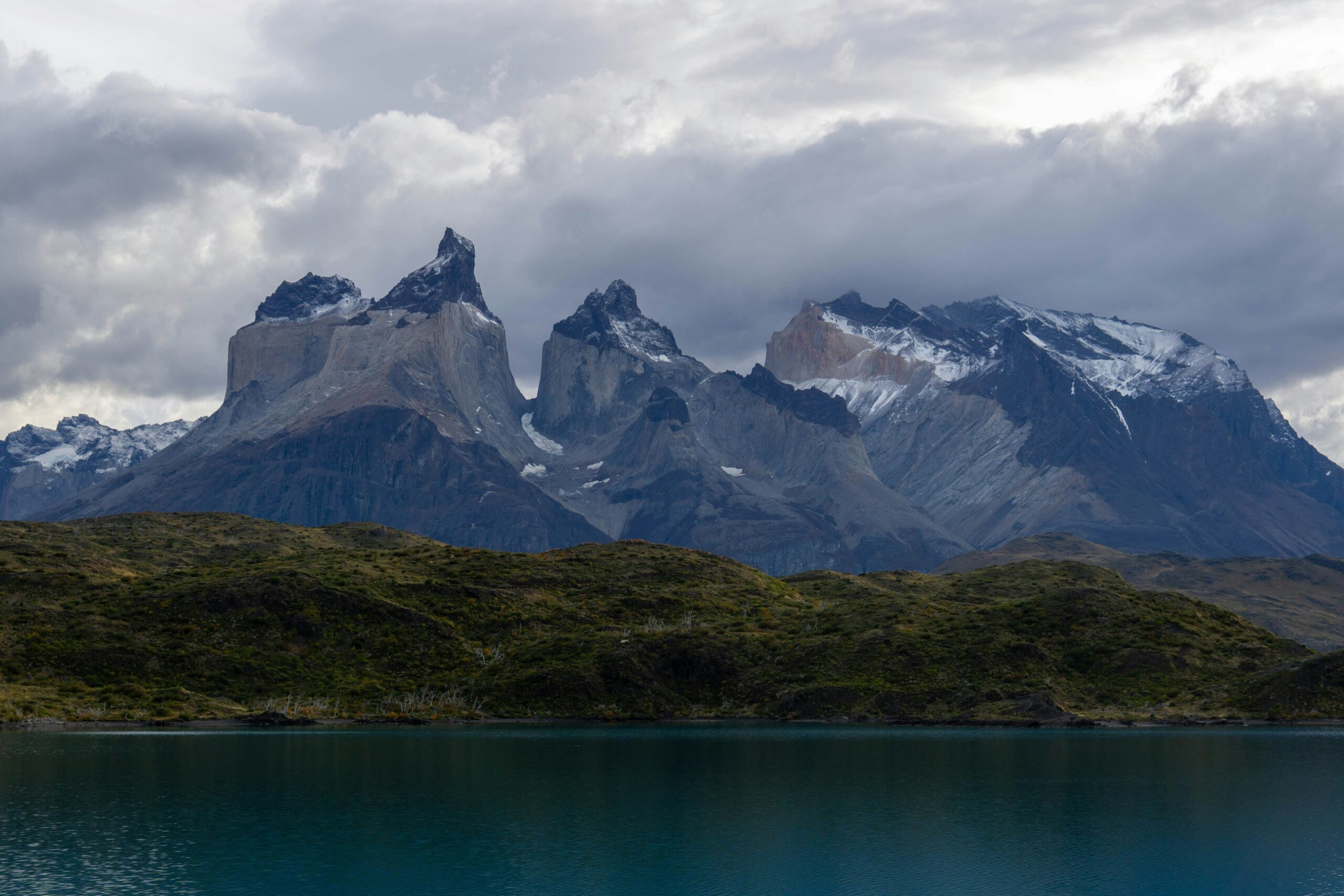
Two Clear Days Can Be More Valuable Than a Packed Seven-Day Checklist.
Laguna de los Tres, Laguna Torre and Loma del Pliegue Tumbado all depend on the same basic reality: the mountains look very different when the cloud closes in. Keep at least one movable hiking day when Fitz Roy is a major trip goal.
Where to Hike in Patagonia
Perito Moreno is a glacier excursion. These are the four hiking networks that deserve to shape the actual trekking trip.
Torres del Paine
Best for: pre-planned multi-day trekking.
- W Trek
- O Circuit
- Base Torres
- Grey corridor
El Chaltén / Los Glaciares
Best for: forecast-driven day hiking and remote circuits.
- Laguna de los Tres
- Laguna Torre
- Loma del Pliegue Tumbado
- Huemul Circuit
Cerro Castillo + Patagonia NP
Best for: quieter Carretera Austral hiking.
- Las Horquetas
- Lagunas Altas
- Patagonia NP trail network
Bariloche / Nahuel Huapi
Best for: refugios, lakes and forest-to-alpine routes.
- Refugio Frey
- Otto Meiling
- López / Jakob network
Torres del Paine: W, O or One Big Day?
Torres del Paine is the region where reservations and seasonal regulation matter most.
The default first choice
Use four days when Patagonia time is tight and five days when Torres del Paine itself is the main trip. Current concessioner products support both structures.
The whole massif
The current classic is an eight-day trip. It adds the northern/backside terrain and is far harder to fit into a first two-country itinerary.
The one-day answer
Choose it when you do not have the nights for the W. It still demands a long hiking day and should not be treated as a short viewpoint walk.
The western hiking arm
Grey can be experienced as part of the W or through shorter packages tied to Paine Grande, Refugio Grey, hanging bridges and boat/catamaran logistics.
El Chaltén: Pick the Hike After You See the Forecast
The town remains Patagonia’s best base for stacking several major hiking days without changing hotels each night.
| Route | Why choose it | Current planning figure | What changes the decision |
|---|---|---|---|
| Laguna de los Tres | Fitz Roy destination | 25 km · 8–9 hr | Cloud + final steep climb |
| Laguna Torre | Cerro Torre valley | 18 km · 3–4 hr each way | Wind + visibility |
| Loma del Pliegue Tumbado | Widest panorama | 24 km · ~10 hr | Upper exposure + wind |
| Huemul Circuit | Remote Ice Field journey | ~4 days | Registration, systems, route status |
Cerro Castillo & Patagonia National Park
This is the strongest section of Chile for hikers who want a Patagonia trip without building everything around Puerto Natales.
Las Horquetas
CONAF lists the route at 53.5 km and 3–5 days with a medium hiking rating. Current 2026 access is the important complication: Las Horquetas is closed to standard self-guided access and enabled only with a certified guide.
Lagunas Altas
CONAF lists 21 km, about seven hours and medium difficulty. It is a strong full day for travelers already moving through Valle Chacabuco and the Carretera Austral.
Summer access matters
Lagunas Altas closes June through September. Cerro Castillo also uses seasonal closures and special winter rules. Check trail dates before fixing a road-trip itinerary.
Give Aysén its own week
Cerro Castillo and Patagonia National Park are not convenient add-ons to a short Torres del Paine trip. They work better as part of a dedicated Carretera Austral itinerary.

Bariloche Replaces Granite-Spire Drama With Huts, Forest, Lakes and Glacier Approaches.
If every Patagonia list ends with Fitz Roy and Torres del Paine, it misses an entire hiking culture around Nahuel Huapi. Frey is the easiest entry point; Otto Meiling moves the trip closer to true alpine terrain.
Bariloche & Nahuel Huapi
Bariloche deserves to be treated as its own hiking destination rather than an afterthought below a southern-Patagonia article.
Refugio Frey
The official tourism listing describes an approximately eight-hour round trip, 10 km, 700 m of incline and easy-to-medium difficulty. The hut sits at Laguna Toncek below the granite needles of Cerro Catedral.
Otto Meiling
From Pampa Linda, the official route is 14 km, 5–7 hours one way and about 1,050 m of ascent. The hut sits between two glaciers on Cerro Tronador.
Nahuel Huapi requires it
Argentina’s National Parks administration requires prior trekking registration in Nahuel Huapi. Treat registration as part of the plan, not an optional courtesy.
ARS 35,000 general
The current APN tariff lists Nahuel Huapi at ARS 35,000 for the general daily category where entrance is charged. Verify the access point and current implementation for your route.
Where Perito Moreno Glacier Fits
It belongs in a Patagonia trip. It does not belong in a ranked hiking list as though the boardwalk network were comparable to the W Trek or Laguna de los Tres.
Glacier viewing
The normal Perito Moreno experience is the network of viewing walkways and glacier viewpoints accessed from the El Calafate side of Los Glaciares National Park.
Operator-led activity
Walking on the glacier is a guided commercial activity with its own eligibility, equipment and operating rules. It should not be confused with ordinary independent hiking.
Patagonia Hiking Fees & Access Rules
Patagonia no longer divides neatly into “Chile costs money, Argentina is free.” Current park systems are more specific.
| Area | Current baseline | What hikers should know |
|---|---|---|
| Torres del Paine | Foreign adult CLP 32,400 daily; CLP 48,500 for >2 days | W/O accommodations and seasonal rules are separate from entry |
| Los Glaciares / El Chaltén | General ARS 50,000 daily | Current Portada El Chaltén fee replaces old “free access” assumption |
| Nahuel Huapi | General ARS 35,000 daily where charged | Prior trekking registration required |
| Cerro Castillo | Live access restrictions | Major routes currently certified-guide only under CONAF notice |
| Patagonia NP Chile | Route-specific seasonal access | Lagunas Altas closes Jun–Sep |
Best Time to Hike Patagonia
November through March is the broad answer. The useful answer depends on which region and route you chose.
| Period | Best use | Main tradeoff |
|---|---|---|
| October | Lower/shoulder routes where open | Snow, wind and incomplete seasonal services |
| November | TDP opening period, El Chaltén, Aysén | Strong wind and variable early-season conditions |
| December–February | Broadest high-route access | Highest demand and booking pressure |
| March | Excellent shoulder hiking | Cooler temperatures and shorter daylight |
| April | Selective routes / autumn scenery | More closures and weather variability |
| May–September | Winter-specific plans only | Closures, guide rules, snow and reduced services |
Patagonia Guides to Open Next
W Trek Guide
Turn the regional choice into a specific Torres del Paine overnight sequence.
Open W Trek →ChileTorres del Paine Guide
Park access, W/O decisions, Base Torres and Grey logistics.
Open Torres del Paine →ArgentinaLaguna de los Tres
Plan the 25 km Fitz Roy day from El Chaltén.
Open Fitz Roy hike →ArgentinaLaguna Torre
Compare the Cerro Torre valley day with Fitz Roy.
Open Laguna Torre →RegionalBest Hikes in Argentine Patagonia
Go deeper into El Chaltén, Bariloche and Argentina-side route choices.
Open Argentina →Trip designPatagonia 10-Day Itinerary
Combine a four-day W with Fitz Roy without forcing every stop into the same trip.
Build 10 days →Deep recovery 1Patagonia Packing List
Build the wind, rain and temperature system around the route you actually chose.
Pack for Patagonia →Deep recovery 2Mountain Weather
Use wind, precipitation and cloud forecasts to place long exposed days.
Read weather guide →Deep recovery 3Trip Planning
Build buffers, transport and insurance around an international hiking trip.
Open trip planning →Glacier add-onPerito Moreno Glacier
Decide whether the glacier earns a day in the final itinerary.
Plan Perito Moreno →Patagonia Trail Sources
Distances change slowly. Access rules, fees, accommodation inventory and seasonal opening dates can change quickly.
Chile
Argentina
Frequently Asked Questions
What is the best hike in Patagonia?
The W Trek is the strongest overall multi-day choice. Laguna de los Tres is the strongest day hike. Choose the O Circuit for a longer Torres del Paine trip, Laguna Torre for a gentler El Chaltén full day, and Cerro Castillo or Patagonia National Park for a quieter Aysén trip.
What is the best day hike in Patagonia?
Laguna de los Tres is the best all-around day for fit hikers. APN currently lists it at 25 km round trip, 8–9 hours and medium-high difficulty. Mirador Base Torres is the best Chilean alternative.
What is the best multi-day trek?
For most first-time visitors, choose the W Trek. It combines Base Torres, French Valley and Grey Glacier with established accommodation and transport. Choose the O when you want the full Torres del Paine circuit and have about eight days.
Is hiking in El Chaltén free in 2026?
Do not use old guidance saying all El Chaltén trails are free. APN currently lists a general Los Glaciares / Portada El Chaltén daily rate of ARS 50,000 from June 1, 2026. Remote camps and routes can also require reservations or registration.
Can Cerro Castillo be hiked self-guided right now?
Current CONAF notices restrict ordinary self-guided access on major routes including Las Horquetas and Laguna Castillo. Those routes are currently tied to certified-guide or authorized access. Check CONAF again for your travel date.
When is the best time to hike Patagonia?
November through March is the broad main season. December through February has the widest services and longest days. November and March can be excellent with fewer visitors, while high routes and park services become much less predictable outside the main season.
Is Perito Moreno one of the best Patagonia hikes?
It is one of the best glacier experiences, but not primarily a hike. The normal visit uses viewing walkways, while glacier walking is an operator-led activity. Treat it as an El Calafate side trip rather than one of the core independent hiking routes.
Which Patagonia region is best for flexible day hiking?
El Chaltén. Laguna de los Tres, Laguna Torre and Loma del Pliegue Tumbado can all be selected around the forecast while staying in the same town. Current Los Glaciares entry fees apply.
Which Patagonia region is best for fewer crowds?
Aysén is the strongest broad answer, particularly Patagonia National Park and Cerro Castillo compared with Torres del Paine. Current Cerro Castillo access restrictions mean quieter does not mean simpler to organize.
Is Bariloche worth adding to a first Patagonia trip?
Only if you have enough time to make it a real northern-Patagonia segment. Frey and Otto Meiling are excellent hikes, but Bariloche is far enough from El Chaltén and Torres del Paine that forcing it into a short southern-Patagonia itinerary creates more travel than hiking.
Start With the W Trek and El Chaltén. Save Aysén or Bariloche for a Trip That Gives Them Time.
Patagonia becomes easier to plan when you stop treating every famous place as part of the same itinerary. The W Trek gives you the strongest multi-day introduction. El Chaltén gives you the strongest day-hiking base. Cerro Castillo and Patagonia National Park reward a dedicated Aysén route, while Bariloche opens a separate network of refugios, forest trails and glacier approaches.
Torres del Paine Has Moved Out of the Temporary Guide-Required Period.
The page’s September 3 fact check correctly reported that CONAF had extended mandatory accredited-guide use on Base Torres and the W Trek through September 15. CONAF has now issued the next update: from September 16, a guide is no longer required for those two routes. Winter-like trail conditions still remain in some sectors, and poles and microspikes may still be recommended or required depending on conditions.
Which Patagonia Hike Fits the Experience You Want?
The existing 12-hike table compares routes one by one. This layer answers a different question: what kind of hiking trip are you actually trying to build?
Return to the Same Bed
Use these when weather flexibility matters more than a fixed overnight sequence.
- Laguna de los Tres — Fitz Roy objective
- Laguna Torre — gentler Cerro Torre valley day
- Base Torres — iconic Chilean day
- Loma del Pliegue Tumbado — broad El Chaltén panorama
Build the Trip Around the Trail
These require a more committed overnight sequence and less day-to-day flexibility.
- W Trek — strongest first multi-day framework
- O Circuit — full Torres del Paine circuit
- Las Horquetas — Aysén traverse with current guide restrictions
- Huella de Glaciares — long binational journey
More Independence, More Consequence
These are for hikers whose goal is remoteness rather than the easiest access to famous viewpoints.
- Huemul Circuit — remote Ice Field terrain
- O Circuit — longer commitment behind the Paine massif
- Las Horquetas — multi-day Aysén backcountry
- Huella de Glaciares — logistics across two countries
Sleep in the Mountains Without Full Expedition Camping
Patagonia has several very different hut systems rather than one unified hut-to-hut network.
- W Trek — refugio/camp chain across Torres del Paine
- Refugio Frey — easiest Bariloche hut introduction
- Otto Meiling — glacier-side alpine hut on Cerro Tronador
Let the Forecast Pick the Trail
El Chaltén is the strongest base when you want to choose among several major hikes after seeing the next day’s wind and cloud forecast.
- Laguna de los Tres
- Laguna Torre
- Loma del Pliegue Tumbado
- Shorter valley options on marginal days
Move Beyond the Two Famous Hubs
Choose Aysén or northern Patagonia when the goal is a broader regional trip rather than only Fitz Roy and Torres del Paine.
- Lagunas Altas — Patagonia National Park
- Las Horquetas — Cerro Castillo
- Refugio Frey — Bariloche
- Otto Meiling — Cerro Tronador
Patagonia Is Not One Hiking Base.
The distances between Torres del Paine, El Chaltén, Aysén and Bariloche are large enough that each should be treated as its own hiking system rather than as neighboring trailheads.
Move From the Patagonia Hub Into the Right Planning Layer
The parent page should help readers choose a region and hike. The guides below handle the next decision in more detail.
Was this helpful?
🏔Related guides
🧭Explore & compare
Global Summit Guide is an independent mountaineering resource founded in 2026. The team combines first-hand trekking and climbing experience with in-depth research and professional health and nutrition review to help climbers choose objectives, prepare properly, and stay safe.
Health, altitude, and nutrition content is reviewed by Taylor Ludlow (Registered Nurse) and Brigg Hoopes (Nutritionist).
What We Don't Know Yet
Mountain information changes quickly. This box explains the limits of what this page can responsibly promise.
- Permit availability, reservation windows, quotas, and official fee rules may change after this page is updated.
- Route conditions, trailhead access, crevasse exposure, stream crossings, and rescue access may vary from published planning guidance.
- Comparisons simplify complex decisions; the better mountain depends on current conditions, skills, timing, budget, and risk tolerance.
Verify current conditions with official land managers, guide services, local forecasts, and current route reports before booking or climbing.
Mountaineering, rock and ice climbing, glacier travel, and high-altitude activity are inherently dangerous and can result in serious injury or death. The information on Global Summit Guide is provided for general informational and educational purposes only and is not a substitute for professional instruction, qualified guiding, proper equipment, or your own judgment and experience.
Route conditions, weather, snowpack, permits, regulations, and hazards change constantly and may differ from what is described here. Details may be incomplete, out of date, or contain errors. Always verify current information with local authorities, certified guides, and official sources before making any decision in the mountains.
Nothing on this site is medical, legal, or financial advice. Our fitness, acclimatization, altitude, and nutrition content is general in nature; consult a qualified physician before beginning any strenuous exercise program or exposing yourself to high altitude.
You are solely responsible for your own safety and decisions. To the fullest extent permitted by law, Global Summit Guide and its team accept no liability for any loss, injury, damage, or expense arising from use of, or reliance on, this information. By using this site you acknowledge these risks and accept these terms.
Some links on this site may be affiliate links. If you buy through them we may earn a small commission at no extra cost to you; this never affects our recommendations.
Global Summit Guide recommendation path
Next Best Mountain to Research
Use these recommendations to continue the right planning path instead of stopping on one page.
Use current permit, weather, route, and operator information before booking or climbing.
Search Flights, Hotels & Rental Cars
Have the mountain or destination picked? Use Expedia to compare the flights, lodging and rental cars that fit your actual trip dates. For mountain travel, consider arriving early enough for delays and adding a buffer night after the climb before a fixed flight home.
Compare current flight, hotel and car options.
Affiliate disclosure: Global Summit Guide may earn a commission if you book through this link, at no additional cost to you.