
Last updated September 22, 2026
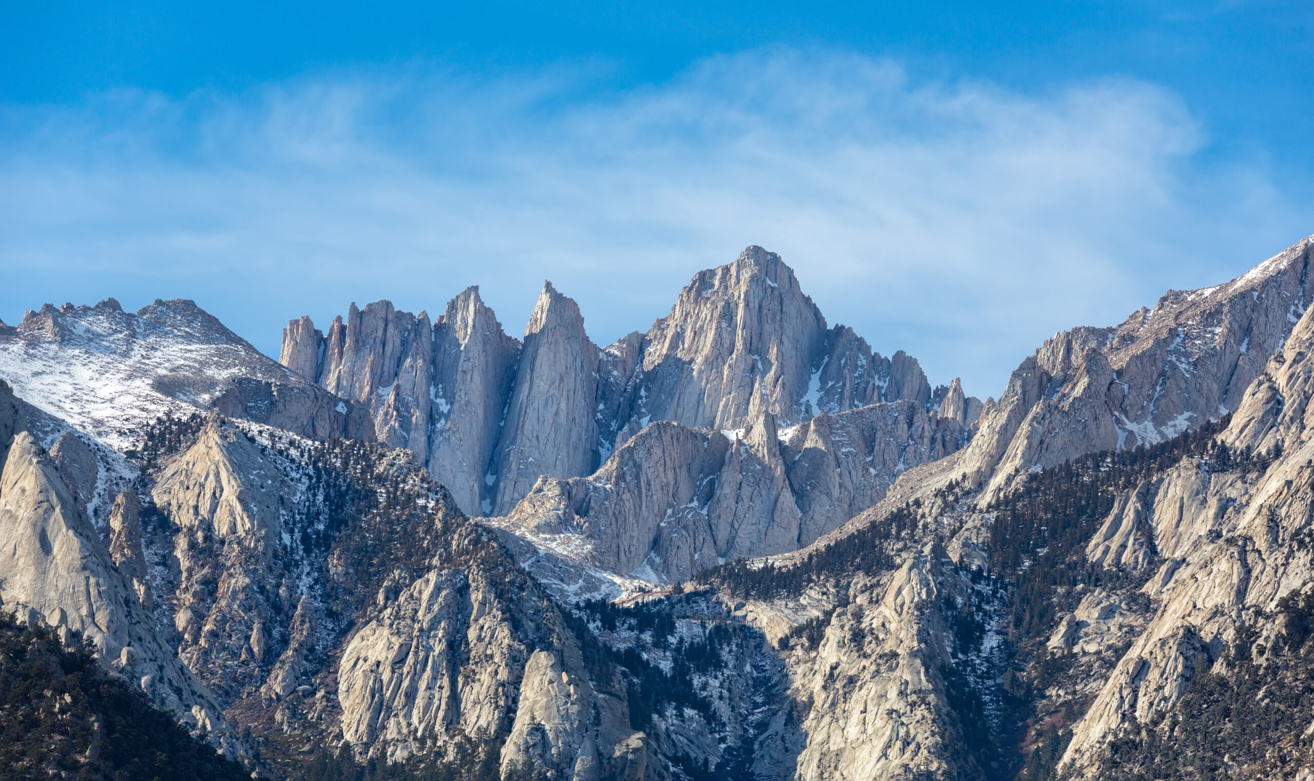
The Triple Crown & America’s Great Thru-Hikes
The Appalachian Trail, Pacific Crest Trail and Continental Divide Trail form hiking’s American Triple Crown: nearly 8,000 miles from the eastern forests to the Sierra, Cascades and Rocky Mountains. This guide compares those three season-long routes with four shorter American classics—the John Muir Trail, Colorado Trail, Long Trail and Wonderland Trail—so you can choose the scale of thru-hike that actually fits your life.
What Is the Triple Crown of Hiking?
The Triple Crown of Hiking means completing the entire Appalachian Trail, Pacific Crest Trail and Continental Divide Trail. ALDHA-West administers the long-running Triple Crown of Hiking Award and recognizes hikers who complete all three trails in their entirety. They do not have to be completed in one calendar year, and ALDHA-West accepts full section-hike completions as well as conventional thru-hikes. For hikers who want the same long-distance rhythm without committing four to six months to one trail, the John Muir Trail, Colorado Trail and Vermont Long Trail form an informal shorter trio sometimes called the Triple Tiara or Mini Triple Crown.
The American Triple Crown Is Three Completely Different Hiking Problems.
The mileage is only the beginning. The Appalachian Trail is defined by relentless eastern climbing, shelters and a dense trail-town culture. The Pacific Crest Trail adds deserts, the Sierra Nevada and Cascades inside one narrow seasonal window. The Continental Divide Trail adds greater remoteness, altitude and route-choice complexity.

Appalachian Trail
The AT is the eastern member of the Triple Crown, stretching through 14 states from Springer Mountain to Katahdin. Town access, shelters and a deeply established trail community simplify logistics compared with the western trails—but the rocks, roots, humidity and constant elevation changes make the walking physically relentless.
Open the Appalachian Trail guide →
Pacific Crest Trail
The PCT crosses California, Oregon and Washington through desert, the Sierra Nevada and the Cascades. Most northbound hikers work inside a tight sequence: avoid dangerous early snow, reach the Sierra at the right time, move north through summer and reach Washington before serious autumn snow closes the window.
Open the Pacific Crest Trail guide →
Continental Divide Trail
The CDT follows the Continental Divide through New Mexico, Colorado, Wyoming, Idaho and Montana. Its combination of remote terrain, long food carries, desert water, high snow, exposed weather and alternate-route decisions makes it the Triple Crown trail where planning independence matters most.
Open the Continental Divide Trail guide →Seven Great American Trails, From Vermont to the Pacific Crest.
The three colored corridors show the approximate sweep of the Triple Crown trails. The additional markers locate the John Muir Trail, Colorado Trail, Long Trail and Wonderland Trail. The map is for geographic orientation—not backcountry navigation.
AT vs PCT vs CDT vs America’s Shorter Classics.
Use the table to reduce the field before diving into individual guides. “Difficulty” is intentionally described by the dominant problem rather than an arbitrary numerical score.
| Trail | Distance | Typical commitment | Primary landscape | Dominant challenge | Support style |
|---|---|---|---|---|---|
| Appalachian Trail | 2,197.9 mi | ≈6 months | Appalachian Mountains | Relentless climbing, rocks, roots, humidity and duration | Shelters, towns, hostels and resupply |
| Pacific Crest Trail | 2,655.84 mi | ≈5 months | Desert · Sierra · Cascades | Snow timing, heat, long mileage and wildfire | Camping + periodic trail-town resupply |
| Continental Divide Trail | ≈3,100 mi | 4–6 months | Rocky Mountains + high desert | Remoteness, navigation, altitude and route choice | Self-supported with longer remote stretches |
| John Muir Trail | 211 mi | 2–4 weeks | High Sierra | Permits, sustained altitude and resupply spacing | Backcountry camping |
| Colorado Trail | 486–491 thru miles | 4–6 weeks | Colorado Rockies | Altitude, storms and sustained high-country travel | Camping + mountain-town resupply |
| Long Trail | 272 mi | 21–25 days | Green Mountains | Mud, roots, rocks and steep northern terrain | Shelters + camping + towns |
| Wonderland Trail | 93 mi | 10–14 days | Mount Rainier | Repeated climbing, permits and mountain weather | Designated wilderness camps |
Trail mileage can change as tread is relocated and mapping improves. The ATC updates official Appalachian Trail mileage annually; PCTA updates its GIS centerline annually; CDT mileage remains an approximate planning figure because route development and alternatives continue to evolve.

The Most Useful American Thru-Hike May Be 200–500 Miles Long.
The John Muir Trail, Colorado Trail and Long Trail preserve the defining elements of thru-hiking—living from your pack, repeated backcountry days, resupply decisions, weather management and an end-to-end objective—without requiring an entire spring and summer. That is why these three are increasingly described together as the informal Triple Tiara or Mini Triple Crown.
Photo: Dcrjsr · Wikimedia Commons · CC BY 3.0Which American Thru-Hike Fits the Trip You Can Actually Take?
The correct first filter is time. After that, choose between trail culture, western mountain scenery, remoteness, altitude and permit complexity.
Wonderland Trail
A complete mountain circuit around Rainier with designated camps, major vertical gain and a real wilderness-itinerary problem packed into a normal vacation.
JMT or Long Trail
Choose the JMT for high-elevation Sierra wilderness. Choose Vermont when you want eastern trail culture, shelters and rugged forest terrain.
Colorado Trail
A month-scale Rocky Mountain journey that supplies much of the rhythm of a major western thru-hike without requiring an entire season.
Appalachian Trail
The AT has frequent road access, shelters, hostels and towns, making logistics more forgiving even though the physical accumulation is formidable.
Pacific Crest Trail
The PCT delivers the broadest west-coast landscape progression, with the tradeoff that snow, heat, fire and timing must all line up across one season.
Continental Divide Trail
The CDT rewards hikers comfortable with remote terrain, route alternatives, long logistics chains and making consequential decisions without constant infrastructure.
The Triple Tiara: JMT, Colorado Trail & Long Trail.
Green Mountain Club highlighted this emerging nickname in 2025. The three trails are useful together because they compress different parts of the Triple Crown experience into trips measured in weeks rather than months.
John Muir Trail
The JMT runs 211 miles from Yosemite Valley to Mount Whitney through some of the highest, most continuous wilderness terrain in the Sierra Nevada. It overlaps the PCT for much of its length but turns the experience into a two-to-four-week mountain journey dominated by permits, passes, altitude and food carries.
Colorado Trail
The Colorado Trail Foundation manages a 567-mile trail system because both Collegiate East and Collegiate West are included. A complete Denver-to-Durango hike is approximately 486 miles using Collegiate East or 491 miles using Collegiate West.
Long Trail
The 272-mile Long Trail runs north through Vermont from Massachusetts to Canada. Green Mountain Club calls it America’s oldest long-distance hiking trail. The southern section overlaps the Appalachian Trail before the Long Trail continues into increasingly rugged northern Vermont.
A Training Ground for Bigger Commitments
Each trail teaches the routines that become critical on the Triple Crown: waking up and walking again, managing food over repeated resupplies, protecting feet, adjusting daily mileage, living with weather and making decisions when fatigue accumulates.
 Long Trail on Mount Mansfield · Joe Calzarette · public domain
Do Not Assume the Western Trails Are Automatically Harder.
The western trails generally reach greater altitude and cross larger wilderness blocks, but eastern hiking can produce an extraordinary amount of vertical movement over shorter horizontal distances.
- AT and Long Trail: steep grades, rocks, roots, humidity, mud and constant short climbing.
- PCT and JMT: longer cruising tread interrupted by major passes, snow and altitude.
- CDT and Colorado Trail: elevation, exposure, weather and longer remote decisions.
- Wonderland: only 93 miles, but roughly 27,000 feet of cumulative climbing and the same amount of descent.
The useful comparison is therefore not “East versus West.” It is which kind of difficulty matches your experience and the amount of time you can sustain it.
Wonderland Trail: 93 Miles That Behave Like Much More.
The National Park Service describes the Wonderland Trail as a strenuous 93-mile loop around Mount Rainier with about 27,000 feet of elevation gain and 27,000 feet of loss. Most people need at least ten days, and overnight camping requires a wilderness permit.
A Complete Thru-Hike Experience Inside Two Weeks.
Wonderland is not a Triple Crown trail and it does not resemble a conventional end-to-end national trail. Its value is different: it gives hikers a continuous wilderness journey around one enormous mountain.
- 93-mile circuit around Mount Rainier.
- Approximately 27,000 feet of climbing.
- Approximately 27,000 feet of descending.
- Designated wilderness camps control the itinerary.
- Full-loop hikers generally need at least ten days.
- Mid- to late July is often the realistic beginning of the mostly snow-free season in an average year.
 Mount Rainier · Stan Shebs · CC BY-SA 3.0
A Long Trail Is a Systems Test Before It Is an Endurance Test.
Pack weight, footwear, food, water, sleep, pace, recovery and town strategy repeat hundreds of times. Small mistakes that feel harmless on a weekend become trip-ending problems when repeated for weeks. The best preparation is not simply getting fitter—it is testing the complete hiking system before the long trail begins.
Shenandoah National Park · National Park Service · public domainWhen to Hike America’s Great Long Trails.
The trail’s latitude, altitude and snowpack matter more than a generic “summer hiking season.” A season-long thru-hiker has to move through several climate zones before the window closes.
Spring Start · Autumn Finish
Most northbound thru-hikers begin in Georgia from late February through early April and work toward Katahdin before Baxter State Park’s autumn access becomes a limiting factor.
Thread the Snow Window
PCTA generally points northbound hikers toward late April or early May, with Sierra snow, desert heat and the arrival of autumn in Washington creating the season’s moving deadlines.
Direction Changes the Problem
Northbound hikers begin with New Mexico desert and spring snow farther north; southbound hikers begin after the northern Rockies become viable and race the onset of autumn farther south.
High Summer
Both concentrate major mileage at altitude. High passes, lingering snow and afternoon thunderstorms matter more than simply choosing a warm month.
Avoid Mud Season
Summer into early fall is the conventional end-to-end window. Vermont’s wet soils and rugged northern terrain make trail condition as important as air temperature.
Mid-Summer Into Early Fall
NPS says the trail is typically mostly snow-free from mid-July into October, with earlier trips potentially requiring winter travel skills.
The Six Planning Problems Every U.S. Thru-Hiker Has to Solve.
The details change, but nearly every long American trail reduces to the same six systems. Solve these before obsessing over daily mileage.
The Weather Window
Decide when the route becomes viable and when it becomes dangerous again. Work backward from mountain snow rather than forward from your preferred vacation date.
Permits
PCT long-distance permits, Sierra wilderness quotas and Wonderland itineraries are different systems. Never assume one “thru-hike permit” model applies everywhere.
Resupply
Identify how often you can realistically reach food, whether boxes are useful, where stores are unreliable and where long carries become unavoidable.
Pack Weight
The objective is not the lightest spreadsheet number. It is a system light enough to move efficiently while still matching snow, water, cold and food-carry requirements.
Repeated-Day Durability
Long trails punish feet, tendons and recovery more than one-day aerobic weakness. Training should progressively teach the body to hike loaded on consecutive days.
The Exit Plan
Wildfire, snow, injury, illness and closures can alter the route. Know where you can leave, how you reach transportation and what conditions justify ending the trip.
Go From the Hub to the Trail You Are Actually Planning.
This page owns the comparison. Each child guide owns the permit system, direction, itinerary, resupply, trail towns, season and current logistics for one route.
Build the Skills Behind the Trail.
These supporting guides answer the questions that repeat across every American thru-hike.
Explore the Regions Behind the Long Trails.
The thru-hike cluster connects directly into existing Sierra Nevada and Pacific Northwest hiking coverage rather than living as an isolated collection.
Where the Mileage and Planning Baselines Come From.
Trail distances, permits and closures can change. These organizations are the final planning sources before a hike begins.
Triple Crown & U.S. Thru-Hiking FAQ.
These are the questions that most often determine whether someone needs a season-long trail or a shorter American thru-hike.
What trails make up the Triple Crown of Hiking?
The Triple Crown consists of the Appalachian Trail, Pacific Crest Trail and Continental Divide Trail. ALDHA-West recognizes hikers who complete all three trails in their entirety.
How many miles is the Triple Crown of Hiking?
Using the Appalachian Trail Conservancy’s 2026 figure of 2,197.9 miles, PCTA’s January 2026 estimate of 2,655.84 miles and the CDT Coalition’s approximately 3,100-mile figure, the Triple Crown represents roughly 7,950 miles of trail. The exact combined number changes because trail alignments and official mileage measurements change.
Do you have to thru-hike all three trails to earn the Triple Crown?
No. ALDHA-West states that section hiking, conventional thru-hiking and flip-flop approaches can qualify as long as each of the three trails is completed in its entirety.
Do all three Triple Crown trails have to be completed in one year?
No. Completing all three in one calendar year is a separate extreme challenge sometimes called a Calendar Year Triple Crown. Standard Triple Crown recognition does not require completing them in the same year.
How many people have completed the Triple Crown?
ALDHA-West says it had recognized 806 Triple Crown of Hiking award recipients through its 2025 awards ceremony. The organization also notes that not every person who completes all three trails applies for recognition, so this is not a count of every person who has ever done it.
What is the Triple Tiara or Mini Triple Crown?
It is an informal nickname for the John Muir Trail, Colorado Trail and Long Trail. Green Mountain Club has highlighted the concept as a shorter alternative to the three multi-thousand-mile Triple Crown trails. Each can usually be completed in several weeks rather than an entire season.
What is a good shorter alternative to the Triple Crown trails?
The John Muir Trail, Colorado Trail and Long Trail preserve the end-to-end backpacking experience while fitting inside roughly three to six weeks. Wonderland Trail is shorter again, normally requiring at least about ten days for the complete 93-mile loop.
Which Triple Crown trail has the most developed trail-town system?
The Appalachian Trail has an especially dense network of shelters, road crossings, hostels, trail towns and hiker services. The PCT also has a mature resupply system, while CDT hikers encounter longer remote sections and more route-choice complexity.
Which Triple Crown trail is longest?
The Continental Divide Trail is generally described at approximately 3,100 miles, making it longer than the current published AT and PCT figures. Because CDT alternatives and ongoing trail completion can change the exact route walked, its mileage is normally presented as approximate.
Choose the Amount of Life You Can Give the Trail.
If you can protect an entire season, compare the Appalachian, Pacific Crest and Continental Divide trails. If you have a month, move to the John Muir, Colorado or Long Trail. If you have about two weeks, look hard at Wonderland. That one decision turns “I want to thru-hike someday” into a trail you can actually begin planning.
Was this helpful?
Global Summit Guide is an independent mountaineering resource founded in 2026. The team combines first-hand trekking and climbing experience with in-depth research and professional health and nutrition review to help climbers choose objectives, prepare properly, and stay safe.
Health, altitude, and nutrition content is reviewed by Taylor Ludlow (Registered Nurse) and Brigg Hoopes (Nutritionist).
What We Don't Know Yet
Mountain information changes quickly. This box explains the limits of what this page can responsibly promise.
- Visa, passport, vaccination, border, insurance, and local transportation rules may change before your trip.
- Route conditions, snowpack, closures, and weather can change quickly after this page is updated.
- Permit rules, fees, quotas, and reservation windows may change between review cycles.
- Operator availability, pricing, guide ratios, and cancellation terms can change by season.
- Your fitness, altitude response, risk tolerance, and experience level may change what is safe or realistic.
Verify current conditions with official land managers, guide services, local forecasts, and current route reports before booking or climbing.
Mountaineering, rock and ice climbing, glacier travel, and high-altitude activity are inherently dangerous and can result in serious injury or death. The information on Global Summit Guide is provided for general informational and educational purposes only and is not a substitute for professional instruction, qualified guiding, proper equipment, or your own judgment and experience.
Route conditions, weather, snowpack, permits, regulations, and hazards change constantly and may differ from what is described here. Details may be incomplete, out of date, or contain errors. Always verify current information with local authorities, certified guides, and official sources before making any decision in the mountains.
Nothing on this site is medical, legal, or financial advice. Our fitness, acclimatization, altitude, and nutrition content is general in nature; consult a qualified physician before beginning any strenuous exercise program or exposing yourself to high altitude.
You are solely responsible for your own safety and decisions. To the fullest extent permitted by law, Global Summit Guide and its team accept no liability for any loss, injury, damage, or expense arising from use of, or reliance on, this information. By using this site you acknowledge these risks and accept these terms.
Some links on this site may be affiliate links. If you buy through them we may earn a small commission at no extra cost to you; this never affects our recommendations.
Global Summit Guide recommendation path
Next Best Mountain to Research
Use these recommendations to continue the right planning path instead of stopping on one page.
Use current permit, weather, route, and operator information before booking or climbing.