
Last updated September 22, 2026

Pacific Crest Trail: Complete PCT Thru-Hike Guide
The Pacific Crest Trail runs 2,655.84 miles from the Mexican border through California, Oregon and Washington to the U.S.–Canada border. A full thru-hike normally consumes nearly an entire snow-free season. This guide brings the route, 2027 permit process, start-date strategy, Sierra snow, resupply, cost, gear, border rules and regional hazards into one planning system.
How Long Is the Pacific Crest Trail—and How Long Does It Take?
The Pacific Crest Trail Association’s January 2026 GIS update gives the PCT’s best current length estimate as 2,655.84 miles. The trail starts near Campo, California, at the Mexican border and runs north through the Sierra Nevada and Cascade Range to the international boundary in Washington. PCTA says a typical thru-hike takes about five months. Most northbound hikers start from mid-April through early May; southbound hikers generally begin in late June or early July. A thru-hike is not simply a 2,655-mile walking problem—the real challenge is fitting desert heat, Sierra snowmelt, wildfire season and Washington’s first autumn snow into one workable calendar.
The 2027 PCT Long-distance Permit process is already scheduled. The first northbound release is November 4, 2026; the second release is January 13, 2027. Since 2025, hikers may no longer cross the international border on the PCT into Canada. The official northern terminus is reached from the U.S. side, and northbound hikers should plan their exit back toward Hart’s Pass or another legal U.S. trailhead.
The Pacific Crest Trail Is Really Five Different Trails.
A thru-hiker does not experience one continuous climate. Southern California can create a water-and-heat problem while the Sierra is still buried in snow; Oregon may be fast and dry while wildfire changes the route ahead; Washington can turn wintry before a late northbound hiker reaches the border.
What Is the Pacific Crest Trail Actually Like?
PCTA divides the trail geographically into Southern California, Central California, Northern California, Oregon and Washington. Those regions are useful because each changes the skills, gear and timing decisions.
Southern California
Approximately the first 700 miles. Desert valleys alternate with surprisingly high mountain ranges. Water planning, heat management and occasional spring snow all matter.
Sierra Nevada
The high-country centerpiece. Long stretches above 10,000 feet lead across major passes, including 13,153-foot Forester Pass.
Northern California
The Sierra gives way to volcanic and Klamath landscapes. Summer heat and wildfire exposure can become more important than snow.
Oregon
Generally faster trail through forests and volcanic country, passing landmarks such as Crater Lake and Mount Hood before the Columbia River.
Washington
The final northbound state is not an easy victory lap. Goat Rocks, Glacier Peak country and the North Cascades produce steep, remote mountain travel.

The PCT Does Not Begin With an Easy Warm-Up.
Northbound hikers immediately begin solving water, heat, foot care and pack-weight problems. Southern California also crosses high terrain such as the San Jacinto and San Gabriel mountains, where early-season snow can turn an assumed desert hike into consequential mountain travel.
Photo: AlexKora90 · Wikimedia CommonsShould You Hike the PCT Northbound or Southbound?
PCTA says more than 90% of thru-hikers travel northbound. That popularity does not automatically make NOBO safer or easier; it simply creates a different seasonal puzzle.
Most Common
PCTA recommends late April or early May for many northbound hikers. The challenge is reaching the Sierra late enough for improving snow conditions without arriving in Washington after winter begins.
More Solitude
Most southbounders start around late June or early July. They immediately face the North Cascades and may encounter steep snow before eventually racing the calendar toward autumn Sierra storms.
Use Weather Strategically
A flip can reduce exposure to dangerous seasonal conditions, but permit rules matter. Long-distance permit flip segments must meet PCTA requirements and should be organized before permit issuance.
There is no universal perfect PCT start date.
A permit date does not guarantee appropriate conditions. Snowpack, hiking speed, prior snow skills, water availability and the expected Washington finish window should all influence the decision.
2027 Pacific Crest Trail Permit Dates.
If you are planning from late 2026, these are the dates that matter. The PCT Long-distance Permit is free and is available for qualifying continuous trips of 500 miles or more.
Put These Dates on the Calendar.
October 15–22, 2026First registration period.
November 4, 2026First Permit Release Day. Thirty-five permits per day become available for quota-controlled northbound starts south of Sonora Pass.
November 5–December 11, 2026Second registration period.
January 13, 2027Second Permit Release Day. The remaining 15 northbound permits per day are released, along with other limited trips including southbound starts.
January 14, 2027Registration and applications reopen for remaining permit availability.
What the PCT Long-Distance Permit Does
The permit is an interagency system authorized by the U.S. Forest Service and administered through PCTA. It simplifies travel through many of the separate federal and state areas along the PCT that otherwise have their own wilderness-permit systems.
- It is for qualifying trips of 500 or more continuous miles.
- It is free.
- Only one PCT Long-distance Permit per person per year is issued.
- Northbound trips starting south of Sonora Pass are limited to 50 permits per day.
- Those quota-controlled northbound permits are available for starts from March 1 through May 31.
- PCTA states that no northbound long-distance permits beginning south of Sonora Pass are issued for June starts.
- You must begin at the date and location printed on the permit.
- An approved permit must be printed before the start date and carried physically on the trail.

The Sierra Is Where a Thru-Hike Can Become Mountaineering.
Forester Pass is the highest point on the PCT. In dry summer conditions it is hiking terrain. Under early-season snow, the same corridor can demand navigation, traction, self-arrest judgment and the ability to decide that turning around is safer than continuing.
Photo: wetwebwork · Wikimedia CommonsHow Fast Do PCT Thru-Hikers Actually Walk?
PCTA describes a normal thru-hike as roughly five months. The 2025 Halfway Anywhere hiker survey provides a useful independent snapshot of what that looked like for recent hikers who responded.
Among survey respondents who completed their thru-hike.
Total miles divided across the full trip calendar.
Average after removing zero-mile rest days.
Town, weather, recovery and logistical rest days add up.
Do not start the PCT expecting to hike your final-month mileage on day one.
Long-distance durability is built on trail. A smart early pace lets feet, connective tissue and recovery systems adapt before daily mileage naturally rises. The goal is not to prove fitness in Southern California; it is to remain capable of hiking when Washington is still more than 2,000 miles away.
PCT Resupply Is Easier Than It Looks—Until It Isn’t.
PCTA advises that most hikers can generally buy food every four to ten days and recommends shipping boxes mainly to the relatively small number of remote locations where store selection is poor.
The 2025 hiker survey found that completing thru-hikers averaged roughly:
- 30 resupply stops over the trail.
- 5 days between resupplies.
- 90.5 miles between resupplies on average.
- 8.3 mailed boxes on average, although strategies varied widely.
That argues against pre-packing five months of food unless dietary restrictions or a special itinerary make it necessary. Trail appetite changes. Mileage changes. Town plans change. Fire and snow can change the route entirely.
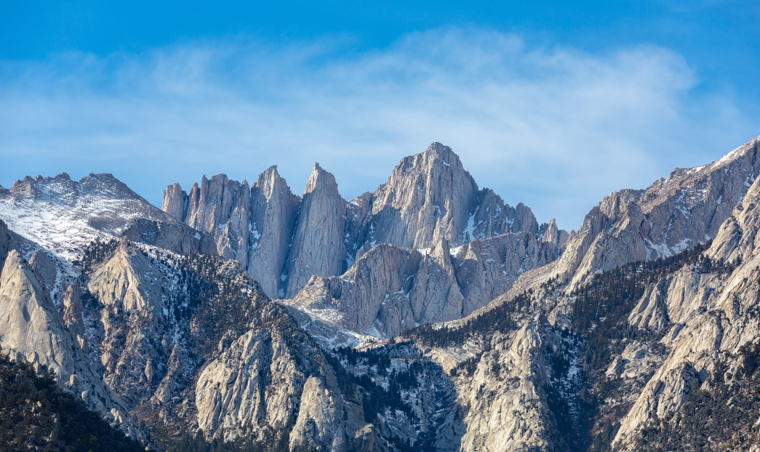 The Sierra can create some of the trail’s longest and most consequential food-carry decisions.
How Much Does It Cost to Thru-Hike the PCT?
There is no official PCT budget. Recent hiker surveys are more useful than pretending one fixed number applies to every style of thru-hike.
Average reported total spent during a completed thru-hike.
The middle reported full-hike spending figure in the same survey.
Reported daily average among completing respondents.
Average reported gear spending before starting, tracked separately.
These are voluntary survey results from the 2025 PCT class, not a required or official cost schedule. Individual spending varies sharply with hotels, restaurants, gear replacement, transportation, international travel, medical issues and number of town days.
Build the budget around contingency, not the cheapest possible perfect trip.
Fire detours, injury, weather delays, replacement shoes and unexpected town stays are exactly the expenses that a bare-minimum budget handles poorly.

Oregon Can Feel Fast—Until Fire, Smoke or Snow Changes the Equation.
The PCT crosses Oregon’s volcanic Cascades and passes through Crater Lake National Park. Dry summer trail can support bigger mileage, but the same late-season calendar that removes snow also increases exposure to smoke and wildfire closures.
Photo: Zainubrazvi · Wikimedia CommonsSnow, Water, Heat, Fire and Weather.
The safest way to think about the PCT is not as one long backpacking trip but as a sequence of regional risk problems.
Water + Heat
Natural water sources can be widely separated. Never build a safety plan around unofficial water caches being full. Heat can make normal hiking mileage unsafe.
San Jacinto Snow
The first 200 miles can include dangerous snow slopes. A desert label does not mean a snow-free trail in spring.
Snow + Creeks
Early-season travel can involve steep snow, difficult navigation and powerful snowmelt crossings. May and June can be mountaineering rather than ordinary backpacking.
Wildfire + Smoke
Later summer improves snow conditions while increasing the likelihood of fire restrictions, smoke, closures and reroutes.
Early Winter
Washington has recorded season-ending mountain snow as early as September. PCTA urges hikers to plan to finish before winter travel takes over.
Conditions Change
A route plan written months before departure cannot outrank a current closure, forecast, river condition or agency order.
What Gear Does a PCT Thru-Hiker Actually Need?
The mistake is building one static gear list in winter and assuming it should remain unchanged for 2,655 miles. The PCT rewards a modular system that can respond to the Sierra, wildfire season and the colder Cascades.
Shelter + Sleep
A reliable lightweight shelter, sleeping bag or quilt, pad and repair system need to survive months of use rather than just one good-weather weekend.
Capacity Changes
Southern California may require larger water carries than later trail sections. Treatment needs to remain reliable after thousands of miles.
Snow Equipment
Ice axe, traction and snow-travel equipment should be driven by actual conditions and by the hiker’s ability to use them—not by what another year’s gear list recommended.
Bear Requirements
Food storage regulations vary along the trail. Bear-resistant canisters are required in specific areas of the Sierra and other protected landscapes.
Expect Replacement
Very few hiking shoes are designed to last an entire PCT thru-hike. Budget and resupply planning should assume multiple pairs.
Offline Redundancy
Carry offline mapping and enough navigation competence to function when snow, fire detours or poor visibility make a visible trail difficult to follow.

By Mount Hood, the Gear Is Familiar. The Body Is the Unknown.
A thru-hiker arriving in northern Oregon has already walked for months. At that point, durability, nutrition, repetitive-use injuries and mental recovery can matter as much as whether the original gear spreadsheet was perfect.
Photo: Lyn Topinka / USGS · public domainThe PCT Ends at Canada—but You Cannot Cross the Border There.
This is one of the most important corrections to older PCT planning articles. The previous Canada PCT Entry Permit program was discontinued in January 2025.
Reach the Monument. Stay in the United States.
The official northern terminus sits just south of the international boundary in Washington’s Pasayten Wilderness.
Crossing the border on the PCT is now prohibited. A northbound hiker should therefore plan to:
- Reach the official northern terminus from the U.S. side.
- Turn around rather than continue illegally into Canada.
- Normally hike south toward Hart’s Pass or another legal U.S. exit.
- Check current road access and closures before relying on Hart’s Pass transportation.
For southbound hikers, the same rule works in reverse: start inside the United States, commonly from Hart’s Pass, hike north to the monument, then turn around and begin the southbound journey.
 Washington mountain terrain · Goat Rocks Wilderness · K Cushman / Wikimedia Commons
What If You Do Not Have Five Months?
A section hike can deliver the trail’s strongest landscapes without forcing a full border-to-border calendar. For many hikers, that is a better first long-distance project.
Sierra / JMT Corridor
The overlap with the John Muir Trail gives section hikers access to the PCT’s most famous high-country terrain without committing to the desert or Cascades.
Volcano Country
Oregon offers long sections through the Cascades with Crater Lake, Three Sisters and Mount Hood country, generally inside the prime summer backpacking window.
Goat Rocks + North Cascades
Washington contains some of the trail’s strongest mountain scenery, but the hiking window is shorter and the terrain can be substantially more rugged.
A Practical PCT Planning Sequence.
Start with the seasonal window and permit. Gear and mail drops make more sense after the route direction and expected pace exist.
Choose Direction
NOBO, SOBO or a legal flip-flop determines which snowpack and weather problems arrive first.
Choose Start Window
Use recent snowpack, likely Sierra timing and expected pace rather than picking the earliest available permit.
Secure Permits
Register for the correct permit release and do not book nonrefundable travel until the permit is approved.
Build the Budget
Include food, town stays, shoes, travel, replacements and contingency rather than only the gear purchase.
Test the System
Use multi-day hikes to test pack fit, shelter, food, water treatment, feet and recovery before Campo.
Place the PCT Inside the Larger Long-Trail System.
The PCT child should own this trail completely while the parent hubs handle comparison across the Triple Crown and the wider long-distance hiking world.
Plan the Parts of a PCT Thru-Hike Separately.
The flagship PCT page should remain the route owner. These supporting guides can go deeper on decisions shared with other long trails.
Three More Resources for Conditions, Gear and Progression.
A thru-hiker still needs mountain judgment. Snow, weather and equipment failures do not become less consequential because the objective is a trail rather than a summit.
Primary Pacific Crest Trail Planning Sources.
The route changes. Permit processes change. Fire closes trail. Bridges fail. Snow melts at different speeds every year. The responsible land manager and PCTA should always outrank an old itinerary saved to your phone.
Pacific Crest Trail FAQ.
These are the core questions hikers need answered before turning the PCT from an idea into a permit application.
How long is the Pacific Crest Trail?
The Pacific Crest Trail Association’s January 2026 GIS update gives 2,655.84 miles as the latest best estimate of the trail’s official length. The number changes slightly as mapping improves and trail segments are rerouted.
How long does it take to hike the entire Pacific Crest Trail?
PCTA says a thru-hike generally takes about five months. The 2025 Halfway Anywhere survey found that completing respondents averaged 148 days for the entire trip.
Where does the Pacific Crest Trail start and end?
The southern terminus is near Campo, California, at the U.S.–Mexico border. The northern terminus is in Washington’s Pasayten Wilderness immediately south of the U.S.–Canada border.
Can PCT hikers enter Canada at the northern terminus?
No. The Canada PCT Entry Permit program ended in January 2025. Crossing the international border on the PCT is prohibited. Hikers should reach the official monument from the U.S. side and return to a legal U.S. exit such as Hart’s Pass.
When should a northbound PCT thru-hike start?
PCTA recommends late April or early May for many northbound thru-hikers. The right date depends on current Southern California and Sierra snow, the hiker’s pace and the expected finish window in Washington.
When do southbound PCT hikers start?
Southbound thru-hikers commonly begin in late June or early July. Snow can persist in the North Cascades well into summer, so southbounders need strong fitness and snow judgment from the beginning.
Do you need a permit to thru-hike the PCT?
Permits are required in many areas along the PCT. For qualifying continuous trips of 500 miles or more, hikers can apply for the free interagency PCT Long-distance Permit administered by PCTA under U.S. Forest Service authorization.
When are 2027 PCT permits released?
The first 2027 release is November 4, 2026, after the October 15–22 registration period. The second release is January 13, 2027. Northbound quota permits starting south of Sonora Pass are split between those releases.
What is the highest point on the Pacific Crest Trail?
Forester Pass in the Sierra Nevada is the highest point on the PCT at 13,153 feet. Early-season snow can make the crossing substantially more serious than ordinary summer hiking.
How much does a PCT thru-hike cost?
There is no official fixed budget. In the 2025 Halfway Anywhere survey, completing thru-hikers reported spending an average of $10,339 over the hike, with pre-hike gear spending tracked separately at an average of $1,701. Individual budgets vary considerably.
How often do PCT hikers resupply?
PCTA says food can generally be purchased every four to ten days. In the 2025 hiker survey, completing hikers averaged about 30 resupplies, five days and roughly 90 miles between resupply stops.
Do you need to mail food boxes for the entire PCT?
No. PCTA recommends keeping resupply relatively simple and buying food in trail communities where practical. Mail boxes are most useful for remote stops, special dietary needs or specific itinerary constraints.
Is the Pacific Crest Trail harder than the Appalachian Trail?
The two trails concentrate difficulty differently. The PCT has larger water carries, major snow-travel sections, higher elevations and a narrow seasonal window. The Appalachian Trail has its own steep, rocky terrain, humidity, rain and repeated elevation change. Use the dedicated PCT vs Appalachian Trail comparison rather than treating mileage alone as difficulty.
Can beginners thru-hike the PCT?
Some hikers do complete the PCT as their first long-distance trail, but the route still requires backcountry judgment, self-management, navigation, water planning and the ability to adapt to snow, heat, fire and injury. A shorter section hike is a strong way to test whether the thru-hiking lifestyle fits before committing five months.
2,655 Miles Is Not the Hardest Number.
The harder problem is reaching each landscape during the window when you can travel through it safely: Southern California before extreme heat, the Sierra after conditions become manageable, Oregon through an unpredictable fire season, and Washington before winter closes the mountains. Build that seasonal sequence first. Then fit the permit, pace, resupply, gear and budget around it.
Was this helpful?
Global Summit Guide is an independent mountaineering resource founded in 2026. The team combines first-hand trekking and climbing experience with in-depth research and professional health and nutrition review to help climbers choose objectives, prepare properly, and stay safe.
Health, altitude, and nutrition content is reviewed by Taylor Ludlow (Registered Nurse) and Brigg Hoopes (Nutritionist).
What We Don't Know Yet
Mountain information changes quickly. This box explains the limits of what this page can responsibly promise.
- Permit availability, reservation windows, quotas, and official fee rules may change after this page is updated.
- Route conditions, trailhead access, crevasse exposure, stream crossings, and rescue access may vary from published planning guidance.
- Visa, passport, vaccination, border, insurance, and local transportation rules may change before your trip.
Verify current conditions with official land managers, guide services, local forecasts, and current route reports before booking or climbing.
Mountaineering, rock and ice climbing, glacier travel, and high-altitude activity are inherently dangerous and can result in serious injury or death. The information on Global Summit Guide is provided for general informational and educational purposes only and is not a substitute for professional instruction, qualified guiding, proper equipment, or your own judgment and experience.
Route conditions, weather, snowpack, permits, regulations, and hazards change constantly and may differ from what is described here. Details may be incomplete, out of date, or contain errors. Always verify current information with local authorities, certified guides, and official sources before making any decision in the mountains.
Nothing on this site is medical, legal, or financial advice. Our fitness, acclimatization, altitude, and nutrition content is general in nature; consult a qualified physician before beginning any strenuous exercise program or exposing yourself to high altitude.
You are solely responsible for your own safety and decisions. To the fullest extent permitted by law, Global Summit Guide and its team accept no liability for any loss, injury, damage, or expense arising from use of, or reliance on, this information. By using this site you acknowledge these risks and accept these terms.
Some links on this site may be affiliate links. If you buy through them we may earn a small commission at no extra cost to you; this never affects our recommendations.
Global Summit Guide recommendation path
Next Best Mountain to Research
Use these recommendations to continue the right planning path instead of stopping on one page.
Use current permit, weather, route, and operator information before booking or climbing.