
Last updated September 22, 2026
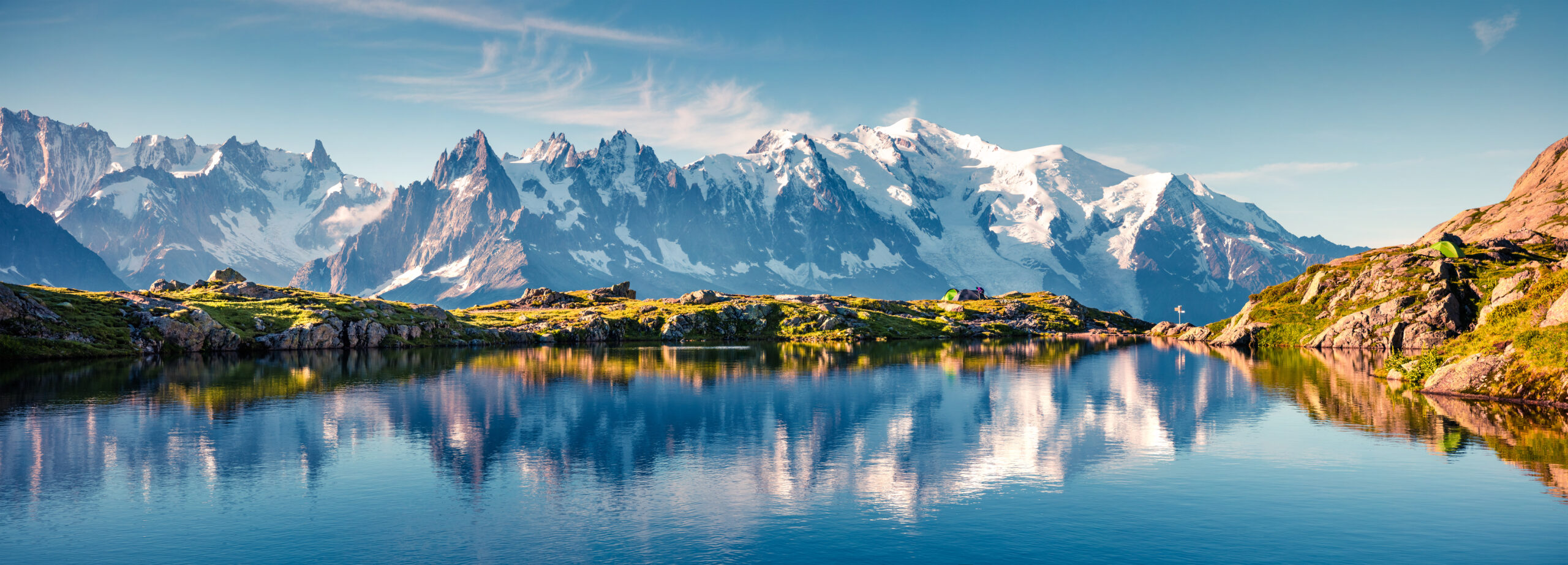
Europe’s Great Long-Distance Trails
Europe’s great long-distance trails range from Scotland’s 96-mile West Highland Way and Iceland’s four-day Laugavegur to the hut-to-hut circuits of the Alps, Corsica’s rugged GR20 and the 1,100-kilometre GR10 across the Pyrenees. This guide compares seven defining routes by distance, time, terrain, accommodation and trip style so you can choose the European trek that actually fits your experience.
Which European Long-Distance Trail Should You Choose?
Choose the Tour du Mont Blanc if you want the classic first Alpine hut-to-hut trek. Choose Alta Via 1 for Dolomite scenery and rifugio culture. Choose the West Highland Way when straightforward logistics and inn-to-inn options matter most. Choose Laugavegur when you have only four to six days and want Icelandic wilderness. The Walker’s Haute Route is the stronger step up for experienced Alpine walkers, while GR20 demands comfort on rough, rocky mountain terrain. Choose the GR10 when you want a true coast-to-coast mountain journey measured in weeks rather than days.
Seven Trails Across Six Very Different European Mountain Systems.
The routes are spread from Iceland and Scotland to the Pyrenees, Corsica, Dolomites and central Alps. That geography creates very different weather windows, hut systems and transport strategies.
Europe’s Great Long-Distance Trails Compared.
Mileage alone tells you very little. GR20 is far shorter than GR10 but much rougher underfoot. Laugavegur is only about 55 kilometres, yet weather and Highland isolation matter more than the distance suggests.
| Trail | Country / region | Approx. distance | Typical time | Accommodation | Defining challenge |
|---|---|---|---|---|---|
| Tour du Mont Blanc | France · Italy · Switzerland | ≈170 km / 105 mi | 7–11 days | Refuges + villages | Repeated Alpine passes and reservation demand |
| GR20 | Corsica, France | ≈180–200 km | ≈15–16 days | Refuges + bivouacs | Rocky terrain, scrambling and sustained mountain days |
| Walker’s Haute Route | France → Switzerland | ≈200 km | 10–14 days | Huts + hotels + villages | Long high-pass days and greater Alpine commitment |
| West Highland Way | Scotland | 154 km / 96 mi | 6–8 days | Inns + hotels + camping | Wet weather and accumulated distance |
| Laugavegur | Iceland | ≈55 km / 34 mi | 4–6 days | Huts + camping | Exposed Highland weather and river crossings |
| Alta Via 1 | Dolomites, Italy | ≈125 km / 78 mi | 8–12 days | Rifugi | High passes, sustained ascent and hut reservations |
| GR10 | French Pyrenees | ≈1,100 km / 684 mi | ≈5–7 weeks | Refuges + gîtes + camping | Duration, cumulative ascent and remote mountain stages |
Distances are planning baselines. Variants, reroutes, measuring methods and optional stages can change the exact distance walked. GR20 figures in particular vary among official and regional sources, so it is more accurate to treat it as approximately 180–200 km than to imply one permanent measurement.
Which European Trek Fits Your Trip?
The simplest way to narrow Europe is to decide what you want waiting at the end of each hiking day: a staffed hut, an inn, a campsite or another long stretch of mountain trail.
Tour du Mont Blanc
The most developed all-around introduction to a major Alpine journey: three countries, high passes, refuges, villages and excellent transport.
Alta Via 1
Rifugi, enormous limestone walls and a route that stays in the mountains without forcing the standard hiker onto compulsory technical climbing.
West Highland Way
A 96-mile point-to-point route with towns, inns, baggage transfer and rail or bus access at the major gateways.
Laugavegur
Only several days long but visually unlike the Alps: geothermal mountains, black desert, rivers, glaciers and Icelandic Highland weather.
GR20
Choose Corsica when you want rocky terrain and a more physical mountain route rather than comfortable village-to-village trekking.
GR10
The coast-to-coast Pyrenean traverse turns European trekking into a multi-week endurance project rather than a standard vacation trek.
The European Long-Distance Trails to Know First.
These seven form the core of the Global Summit Guide European long-trail collection because together they cover the continent’s main styles: Alpine circuits, hut traverses, GR routes, British long walks and Nordic wilderness trekking.
Tour du Mont Blanc
The TMB loops around the Mont Blanc massif through three countries. The official route organization describes nearly 170 kilometres normally divided into 7–11 days, with stages connecting villages and mountain refuges.
It is popular for good reason. Strong public transport, staffed accommodation, frequent food and route variants remove many of the complications that make a first multi-day mountain trip intimidating. The tradeoff is demand: beds can shape your itinerary months before the trek begins.
Tour du Mont Blanc complete guide →
GR20
GR20 runs through Corsica’s mountainous spine between Calenzana and Conca. Regional tourism sources divide the full route into 16 stages and repeatedly describe it as a trail for experienced mountain walkers.
The challenge is not altitude on the Himalayan scale. It is the texture of the terrain: granite, steep climbing, exposed ridges, scrambling and substantial daily ascent and descent. Vizzavona roughly divides the northern and southern halves and makes a half-route possible.
GR20 Corsica guide →
Walker’s Haute Route
The walking version of the Haute Route connects two of the Alps’ great mountain towns without requiring the glacier travel of the original mountaineering Haute Route. Chamonix’s trekking information describes roughly 10–12 days of demanding high-level walking.
This is a natural progression after the TMB. Days are often longer, the route feels more linear and committing, and several passes approach 3,000 metres. Accommodation still uses the Alpine hut-and-village network, but the overall journey asks for greater mountain fitness.
Walker’s Haute Route guide →
West Highland Way
The official West Highland Way runs 96 miles / 154 kilometres from Milngavie to Fort William. It begins in gentler countryside, follows Loch Lomond and then moves through increasingly mountainous Highland scenery toward Glen Coe and Ben Nevis country.
Its defining advantage is accessibility. Accommodation, shops, transport and baggage-transfer services allow hikers to experience a genuine point-to-point long walk without needing a tent or an Alpine hut reservation system.
West Highland Way guide →
Laugavegur
Iceland’s Ferðafélag Íslands gives the Laugavegur route at approximately 55 kilometres. The trail links Landmannalaugar with Þórsmörk through rhyolite mountains, geothermal terrain, black volcanic desert, rivers and glacial landscapes.
The modest mileage makes it easy to underestimate. Weather exposure, cold, river conditions and a short Highland operating season are the real constraints. Hut and campsite capacity also makes advance booking important.
Laugavegur Trail guide →
Alta Via 1
Official Dolomites sources describe Alta Via 1 as the classic Dolomites High Route: about 125 kilometres, traditionally divided into 12 stages, with roughly 7,300 metres of cumulative climbing from Lago di Braies toward Belluno.
The attraction is the combination of dramatic limestone terrain and rifugio infrastructure. The standard trekking line is accessible to experienced hikers, while harder equipped variants should not be confused with the basic route.
Alta Via 1 guide →
GR10 Pyrenees
The GR10 crosses the French side of the Pyrenees from Hendaye on the Atlantic to Banyuls-sur-Mer on the Mediterranean. FFRandonnée currently gives approximately 1,100 kilometres for the full traverse.
This is the outlier in the collection. Rather than a one- or two-week trekking vacation, GR10 is a true long-distance project with repeated valleys, mountain passes, villages, refuges and resupply decisions over roughly a month and a half for many walkers.
GR10 Pyrenees guide →
You Can Spend a Week in Serious Mountains Without Carrying a Tent.
That single fact separates many European long trails from classic North American thru-hiking. On routes such as the TMB, Alta Via 1 and Walker’s Haute Route, staffed huts and valley lodging can supply a bed, dinner and breakfast. The hiking remains physically serious, but the backpacking problem changes completely.
What Does GR Mean on a European Hiking Trail?
GR is commonly derived from the French Grande Randonnée tradition: long-distance, waymarked walking routes. France’s GR system uses the familiar red-and-white marking and includes everything from mountain crossings to longer national itineraries.
One Island · Mountain Spine
Corsica’s route is comparatively short but highly mountainous. Its identity comes from sustained rugged terrain rather than huge mileage.
One Mountain Range · Coast to Coast
The French-side Pyrenees traverse is closer to a traditional long-distance journey, linking hundreds of kilometres of valleys and passes.
Different Systems Coexist
TMB, Alta Via 1, West Highland Way, Laugavegur and Walker’s Haute Route come from different national and regional trail traditions.
Hut-to-Hut, Inn-to-Inn or Backpacking?
Before comparing scenery, decide how independently you want to travel.
- Full Alpine hut system: Tour du Mont Blanc and Alta Via 1.
- Mixed huts and villages: Walker’s Haute Route.
- Refuges plus bivouac culture: GR20.
- Hotels, inns and luggage transfer: West Highland Way.
- Huts or camping in isolated terrain: Laugavegur.
- Mixed refuges, gîtes and camping over weeks: GR10.
The lighter the overnight system, the more your planning shifts toward reservations. On Europe’s famous hut routes, obtaining the right beds can matter as much as choosing the right daily mileage.
Rifugio Nuvolau on Alta Via 1 · R Pollack · public domainWhen to Hike Europe’s Great Long-Distance Trails.
High-summer overlap makes these trails look more similar than they are. Iceland’s hut season, Scotland’s maritime weather, Corsican heat and the snowpack on high Alpine passes create different planning windows.
| Trail | Typical core window | Main seasonal issue | Planning priority |
|---|---|---|---|
| Tour du Mont Blanc | Late June–September | Lingering snow early; refuge demand in peak summer | Reserve accommodation early |
| GR20 | June–September | Early snow, summer heat and fast mountain weather | Match conditions to mountain experience |
| Walker’s Haute Route | July–September | Snow on higher passes and long exposed days | Wait for reliable high-pass conditions |
| West Highland Way | Spring–autumn | Rain, wind and midges rather than high-altitude snow alone | Choose weather tolerance and accommodation style |
| Laugavegur | Late June–early September | Short Highland season and rapidly changing weather | Book huts and transport before arrival |
| Alta Via 1 | June–September | Snow on passes and a short staffed-hut season | Book rifugi well ahead |
| GR10 | Generally summer into early autumn | Snow on high passes plus heat at lower elevations | Plan an entire multi-week weather progression |
What About the Camino, Kungsleden and the Other Great Routes?
The seven core trails above are the foundation of this mountain-focused collection, not a claim that Europe has only seven important long-distance walks.
Pilgrimage First
The Camino belongs among the world’s great long walks, but its pilgrimage tradition, cultural purpose and accommodation system are different enough that Global Summit Guide treats it inside the pilgrimage collection rather than forcing it into a mountain-trek hierarchy.
Kungsleden & Nordic Routes
Sweden’s Kungsleden and the Nordic hut systems deserve their own treatment as this collection expands. They introduce a more remote hut-and-wilderness model than the Alps.
Via Alpina, Peaks of the Balkans & More
Europe also contains much longer Alpine networks and cross-border routes. This hub begins with seven routes that represent the major planning styles, then expands through dedicated regional coverage.
Why the Camino Is Separate
A pilgrimage can be a long-distance hike, but the journey’s purpose, history and infrastructure change the planning question. See Pilgrimage vs Thru-Hike for the full distinction.
Move From the Hub Into the Exact Trail.
This page owns the European comparison. Each trail guide owns its route, stage strategy, accommodation, access, weather, permits or reservations and current logistics.
Explore the Mountains Around the Long Trails.
A long-distance route is one way to experience a region. These existing guides let you compare day hikes, summit objectives and shorter treks before committing to the full route.
Three Guides That Help Before You Pick the Route.
These related Global Summit Guide resources answer the broader decisions that sit above any individual European trek.
Verify Conditions With the Organizations That Manage the Routes.
Distances are comparatively stable. Weather, snow, hut openings, reservations, reroutes and access are not. Use the individual Global Summit Guide route page for planning, then verify final details with the relevant trail or regional authority.
European Long-Distance Trail FAQ.
The most useful questions concern trip length, accommodation, difficulty and the difference between Alpine hut trekking and traditional backpacking.
What is the best long-distance trail in Europe for a first multi-day trek?
Tour du Mont Blanc and West Highland Way are two of the most accessible starting points for different reasons. TMB gives a full Alpine hut-to-hut experience with excellent infrastructure, while the West Highland Way offers especially straightforward lodging, resupply and baggage-transfer logistics.
What is the best hut-to-hut hike in Europe?
Tour du Mont Blanc and Alta Via 1 are two of Europe’s defining staffed-hut routes. TMB offers a three-country circuit around the Mont Blanc massif, while Alta Via 1 pairs the Dolomites with an extensive rifugio network.
What does GR mean in European hiking?
GR is associated with the Grande Randonnée long-distance trail tradition. France’s GR routes are marked long-distance paths, commonly using red-and-white trail markings. GR20 in Corsica and GR10 across the French Pyrenees are two very different examples.
Is the GR20 the hardest hike in Europe?
There is no single objective measure that can identify one trail as Europe’s hardest. GR20 is widely regarded as particularly demanding because of steep granite terrain, scrambling, exposure and repeated ascent and descent. Other European routes may be longer, higher, more remote or technically more complex.
How long is the Tour du Mont Blanc?
The official Tour du Mont Blanc organization describes nearly 170 kilometres around the Mont Blanc massif, normally divided into roughly 7–11 days depending on itinerary, pace and route variants.
How long is the GR10?
FFRandonnée currently describes the complete GR10 traverse across the French Pyrenees at approximately 1,100 kilometres from Hendaye to Banyuls-sur-Mer. Many hikers divide the route into sections rather than completing it in one journey.
Can you hike long-distance trails in Europe without camping?
Yes. Tour du Mont Blanc, Alta Via 1, Walker’s Haute Route and West Highland Way can all be planned around huts, hotels, inns or village accommodation. Camping remains useful or normal on other routes, but carrying a tent is not a requirement for every major European trek.
Which European long-distance trail fits into one week?
Laugavegur normally fits comfortably inside a week, and West Highland Way is commonly completed in roughly six to eight days. Faster or shortened TMB itineraries can also fit near one week, though that creates longer daily stages.
Is the Walker’s Haute Route the same as the mountaineering Haute Route?
No. The Walker’s Haute Route is a trekking route between Chamonix and Zermatt that avoids the glacier travel required by the classic mountaineering Haute Route. Similar names should not be treated as equivalent technical objectives.
Why is the Camino de Santiago not one of the seven core routes?
The Camino is one of Europe’s defining long walks, but Global Summit Guide treats it primarily as a pilgrimage because its history, purpose, accommodation network and decision framework differ from the mountain trekking routes in this collection.
Do You Want Huts, Inns, Wilderness or a Six-Week Traverse?
That decision narrows Europe faster than a list of beautiful trails ever will. For Alpine huts, start with TMB or Alta Via 1. For straightforward inn-to-inn walking, look at the West Highland Way. For a compact wilderness trip, choose Laugavegur. Move to Walker’s Haute Route or GR20 when you want a more demanding mountain journey, and choose GR10 when the long-distance journey itself is the objective.
Was this helpful?
Global Summit Guide is an independent mountaineering resource founded in 2026. The team combines first-hand trekking and climbing experience with in-depth research and professional health and nutrition review to help climbers choose objectives, prepare properly, and stay safe.
Health, altitude, and nutrition content is reviewed by Taylor Ludlow (Registered Nurse) and Brigg Hoopes (Nutritionist).
What We Don't Know Yet
Mountain information changes quickly. This box explains the limits of what this page can responsibly promise.
- Route conditions, trailhead access, crevasse exposure, stream crossings, and rescue access may vary from published planning guidance.
- Comparisons simplify complex decisions; the better mountain depends on current conditions, skills, timing, budget, and risk tolerance.
- Visa, passport, vaccination, border, insurance, and local transportation rules may change before your trip.
Verify current conditions with official land managers, guide services, local forecasts, and current route reports before booking or climbing.
Mountaineering, rock and ice climbing, glacier travel, and high-altitude activity are inherently dangerous and can result in serious injury or death. The information on Global Summit Guide is provided for general informational and educational purposes only and is not a substitute for professional instruction, qualified guiding, proper equipment, or your own judgment and experience.
Route conditions, weather, snowpack, permits, regulations, and hazards change constantly and may differ from what is described here. Details may be incomplete, out of date, or contain errors. Always verify current information with local authorities, certified guides, and official sources before making any decision in the mountains.
Nothing on this site is medical, legal, or financial advice. Our fitness, acclimatization, altitude, and nutrition content is general in nature; consult a qualified physician before beginning any strenuous exercise program or exposing yourself to high altitude.
You are solely responsible for your own safety and decisions. To the fullest extent permitted by law, Global Summit Guide and its team accept no liability for any loss, injury, damage, or expense arising from use of, or reliance on, this information. By using this site you acknowledge these risks and accept these terms.
Some links on this site may be affiliate links. If you buy through them we may earn a small commission at no extra cost to you; this never affects our recommendations.
Global Summit Guide recommendation path
Next Best Mountain to Research
Use these recommendations to continue the right planning path instead of stopping on one page.
Use current permit, weather, route, and operator information before booking or climbing.