
Last updated September 10, 2026
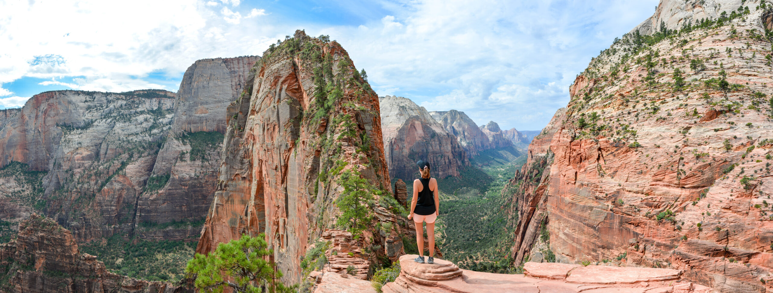
Angels Landing Hike Guide: Permit, Difficulty, Chains & Route
Yes, you need a permit to continue from Scout Lookout onto Angels Landing. The full hike is about 5.4 miles round trip with 1,488 feet of gain, and the final half mile is the defining section: a narrow exposed ridge with chains, steep drop-offs and two-way traffic in limited space.
Should You Hike Angels Landing?
Choose Angels Landing if you are comfortable with exposure, can move carefully on uneven rock while using chains as handrails, and are willing to turn around if crowding, wind, ice or your own comfort level changes.
If your main goal is the Zion Canyon view but you do not want the exposed chain section, hike to Scout Lookout instead. You do not need an Angels Landing permit to stop there, and it removes the narrowest ridge terrain from the day.
Angels Landing Permit: What You Need to Know
| Question | Current answer |
|---|---|
| Where is the permit required? | From Scout Lookout to Angels Landing |
| Scout Lookout only? | No Angels Landing permit required |
| Advance option | Seasonal lottery on Recreation.gov |
| Last-minute option | Day-before lottery |
| Seasonal application fee | $6 per application, up to 6 people |
| If awarded | $3 per person |
| Permit proof | Print, download or screenshot before hiking |
For the 2026 seasonal lotteries, Zion scheduled separate spring, summer, fall and winter application windows. The day-before lottery opens at 12:01 a.m. and closes at 3 p.m. Mountain Time the day before the hike; results are issued after 4 p.m.

Scout Lookout Is Where the Hike Changes.
Everything before Scout Lookout is strenuous trail hiking. Everything after it is a narrower, more exposed route where comfort with heights and deliberate movement matter much more.
The Angels Landing Route, Step by Step
| Section | What it feels like | Decision |
|---|---|---|
| The Grotto → lower West Rim | Steady paved/climbing trail above Zion Canyon | Set an easy pace |
| Refrigerator Canyon | Flatter, shaded relief | Hydrate before next climb |
| Walter’s Wiggles | 21 steep switchbacks | Do not burn out before Scout |
| Scout Lookout | Major viewpoint and rest point | Stop here if exposure feels wrong |
| Chains section | Narrow ridge, chains, uneven rock, major exposure | Permit required; continue only if comfortable |
| Summit | Broader resting area with canyon views | Leave enough margin for descent |
How Hard Is Angels Landing?
Strenuous but Manageable
5.4 miles and 1,488 feet of gain are significant but not extraordinary for a fit hiker.
The Main Difficulty
The final ridge is what separates Angels Landing from an ordinary steep hike.
Two-Way Movement
Passing and yielding on narrow sections can be more stressful than the climbing itself.
Wind, Ice & Heat Matter
Weather can move the hike from difficult to inappropriate even when the trail is technically open.
What the Angels Landing Chains Are Actually Like
The chain section begins at Scout Lookout and is roughly a half mile one way. NPS describes a steep, narrow ridge with uneven steps cut into rock and chains installed intermittently. In several places the route is less than three feet wide, and hikers move in both directions.
When to Hike Angels Landing
| Season | Main advantage | Main concern |
|---|---|---|
| Spring | Cooler temperatures | Wind, rain, occasional lingering ice |
| Summer | Long daylight | Extreme heat, thunderstorms, crowds |
| Fall | Often the best balance | Shortening daylight, colder mornings |
| Winter | Lower visitation | Ice/snow can make the chain section inappropriate |
There is no one best clock time for every permit window. In hot weather, earlier is usually more comfortable. In cold or icy conditions, a later start can improve footing—but only if conditions actually thaw and the park has not issued warnings or closures.
How to Get to Angels Landing
The hike starts at The Grotto, Zion Canyon shuttle stop #6. Cross the road and bridge and begin on the West Rim Trail. When the Zion Canyon shuttle is operating, private vehicle access into the main canyon is restricted and the shuttle becomes the practical trailhead connection.
You do not need a reservation for the park shuttle. You do need to check the current seasonal schedule so you do not finish after the last bus.
When You Should Turn Around at Scout Lookout
You Are Already Uncomfortable
If the view down from Scout Lookout makes you freeze or lose confidence, do not test that reaction on narrower terrain.
Wind or Storms Are Building
Exposure magnifies gusts, lightning and rapidly changing weather.
Ice or Wet Rock
Traction and confidence matter more than whether other hikers are continuing.
The Ridge Is Overwhelming
If congestion makes you feel rushed or unable to move deliberately, stopping is the better decision.
Angels Landing FAQ
Do you need a permit?
Yes, to continue from Scout Lookout onto Angels Landing. You do not need the permit if Scout Lookout is your turnaround point.
How long is the hike?
About 5.4 miles round trip with roughly 1,488 feet of elevation gain. NPS says many hikers take around four hours.
How difficult is Angels Landing?
The physical effort is strenuous; the defining difficulty is the exposed final ridge with chains, narrow rock and major drop-offs.
Can I hike Scout Lookout without a permit?
Yes.
How do 2026 permits work?
Seasonal and day-before lotteries are handled through Recreation.gov. The seasonal application fee is $6 for up to six people, with a $3-per-person fee if awarded.
Where does the hike start?
At The Grotto, Zion Canyon shuttle stop #6.
Is Angels Landing good for beginners?
Not for hikers who are new to exposed terrain or uncomfortable with heights. Scout Lookout is a much better endpoint if you are unsure.
What is the best season?
Spring and fall often offer the best temperature balance, but current wind, ice, heat and storm conditions matter more than the calendar alone.
You Do Not Have to Finish the Chains to Have a Great Zion Hike.
Scout Lookout is a legitimate destination. Continue only if the permit, weather, surface conditions and your comfort with exposure all align.
Zion: Plan the Whole Climb
Permits, routes, difficulty, weather and logistics all decide the day. Start with the main guide, then go deeper below.
Was this helpful?
Global Summit Guide is an independent mountaineering resource founded in 2026. The team combines first-hand trekking and climbing experience with in-depth research and professional health and nutrition review to help climbers choose objectives, prepare properly, and stay safe.
Health, altitude, and nutrition content is reviewed by Taylor Ludlow (Registered Nurse) and Brigg Hoopes (Nutritionist).
What We Don't Know Yet
Mountain information changes quickly. This box explains the limits of what this page can responsibly promise.
- Permit availability, reservation windows, quotas, and official fee rules may change after this page is updated.
- Route conditions, trailhead access, crevasse exposure, stream crossings, and rescue access may vary from published planning guidance.
- Visa, passport, vaccination, border, insurance, and local transportation rules may change before your trip.
Verify current conditions with official land managers, guide services, local forecasts, and current route reports before booking or climbing.
Mountaineering, rock and ice climbing, glacier travel, and high-altitude activity are inherently dangerous and can result in serious injury or death. The information on Global Summit Guide is provided for general informational and educational purposes only and is not a substitute for professional instruction, qualified guiding, proper equipment, or your own judgment and experience.
Route conditions, weather, snowpack, permits, regulations, and hazards change constantly and may differ from what is described here. Details may be incomplete, out of date, or contain errors. Always verify current information with local authorities, certified guides, and official sources before making any decision in the mountains.
Nothing on this site is medical, legal, or financial advice. Our fitness, acclimatization, altitude, and nutrition content is general in nature; consult a qualified physician before beginning any strenuous exercise program or exposing yourself to high altitude.
You are solely responsible for your own safety and decisions. To the fullest extent permitted by law, Global Summit Guide and its team accept no liability for any loss, injury, damage, or expense arising from use of, or reliance on, this information. By using this site you acknowledge these risks and accept these terms.
Some links on this site may be affiliate links. If you buy through them we may earn a small commission at no extra cost to you; this never affects our recommendations.
Global Summit Guide recommendation path
Next Best Mountain to Research
Use these recommendations to continue the right planning path instead of stopping on one page.
Use current permit, weather, route, and operator information before booking or climbing.
Search Flights, Hotels & Rental Cars
Have the mountain or destination picked? Use Expedia to compare the flights, lodging and rental cars that fit your actual trip dates. For mountain travel, consider arriving early enough for delays and adding a buffer night after the climb before a fixed flight home.
Compare current flight, hotel and car options.
Affiliate disclosure: Global Summit Guide may earn a commission if you book through this link, at no additional cost to you.