
Last updated September 10, 2026
Zion National Park Hiking Guide: Choose the Right Trail, Permit & Season
Zion is not one hiking problem. Angels Landing is about exposure and a permit. The Narrows is about river flow and flash floods. Observation Point is about east-rim access. The Subway is a permit-required wilderness route. This guide helps you choose the right Zion hike before sending you into the route-specific details.
What Are the Best Hikes in Zion?
For the most uniquely Zion experience, hike The Narrows. For exposed adventure, choose Angels Landing if you have a permit and are genuinely comfortable with the final ridge. For the best high canyon viewpoint without the chains, choose Observation Point from the east-rim side. For a permit-controlled wilderness challenge, choose The Subway. For a short first-day viewpoint, Canyon Overlook is hard to beat.
The mistake is ranking those hikes as if they were interchangeable. They demand different skills and fail for different reasons. A clear river forecast does nothing for Angels Landing exposure. An Angels Landing permit does nothing for a Narrows flash-flood warning. Strong fitness does not convert The Subway into a maintained trail.
Build the trip around your limiting variable: exposure, water, wilderness navigation, heat, shuttle timing or trailhead access. Then use the dedicated child guide when you are ready to plan the route itself.
Which Zion Hiking Experience Fits You?
The park becomes much easier to plan when you sort the hikes by the decision they demand.
Angels Landing
Choose this because you want the exposed chain-assisted ridge—not because it is Zion’s most famous name. A permit only gives permission; it does not make exposure appropriate for you.
The Narrows
The Virgin River is the route. Flow, flash-flood potential, water temperature and footing matter more than elevation gain.
Observation Point
A stronger choice for hikers who want a huge Zion Canyon view without Angels Landing’s final chains. The historic Weeping Rock approach remains closed.
The Subway
Permit required. Bottom-up is a long off-trail route with scrambling and creek travel. Top-down is technical canyoneering and belongs to a different skill category.
The Zion Hiking Portfolio
This parent compares the objectives. Detailed route execution belongs in dedicated child guides and current NPS pages.
| Hike | Planning distance | Time | Difficulty | Permit | Main problem | Best for |
|---|---|---|---|---|---|---|
| The Narrows — Bottom-Up | Up to ~9.4 mi RT | 2–8 hr | Moderate–strenuous | No | River / flash flood | Most distinctive Zion day |
| Angels Landing | ~5.4 mi RT | 3–5 hr | Strenuous / exposed | Required | Exposure + chains | Experienced exposure-tolerant hikers |
| Observation Point | Route-dependent | 3–8+ hr | Moderate–strenuous | No day permit | East-rim access | Best big viewpoint |
| The Subway — Bottom-Up | 9.0 mi RT | 6–10 hr | Strenuous | Required | Off-trail route finding | Wilderness hikers |
| West Rim Trail | Route-dependent | Half/full day | Strenuous | Only for overnight use | Water + length | Big canyon-rim day |
| Canyon Overlook | 1.0 mi RT | ~1 hr | Easy–moderate | No | Limited parking | Best short viewpoint |
| Scout Lookout | ~3.8 mi RT | 2–4 hr | Strenuous | No AL permit needed | Steep paved climb | Angels alternative |
| Watchman Trail | ~3.3 mi RT | 2–3 hr | Moderate | No | Heat / sun | Arrival or sunset-style hike |
| Pa’rus Trail | ~3.5 mi RT | 1–2 hr | Easy | No | Sun / shared use | Recovery, families, sunset |
| Riverside Walk | ~2.2 mi RT | 1–2 hr | Easy | No | Crowds / shuttle timing | Narrows approach or easy day |
| Timber Creek Overlook | ~1 mi RT | ~1 hr | Easy | No | Drive to Kolob Canyons | Quiet short viewpoint |
| Taylor Creek | ~5 mi RT | 3–4 hr | Moderate | No day permit | Creek crossings / heat | Kolob alternative |
What Each Famous Zion Hike Is Really Asking From You
These four should become the first dedicated children beneath this parent.
The Narrows
The Narrows is the strongest “only in Zion” hiking experience because the trail eventually becomes the Virgin River. Distance is flexible: walk upstream as long as conditions, time and energy support, then reverse the same route.
The main planning error is treating it like a normal trail. River depth, current, water temperature and flash-flood potential all matter. Zion closes The Narrows when flow is above 150 CFS and when the National Weather Service issues a Flash Flood Warning.
Angels Landing
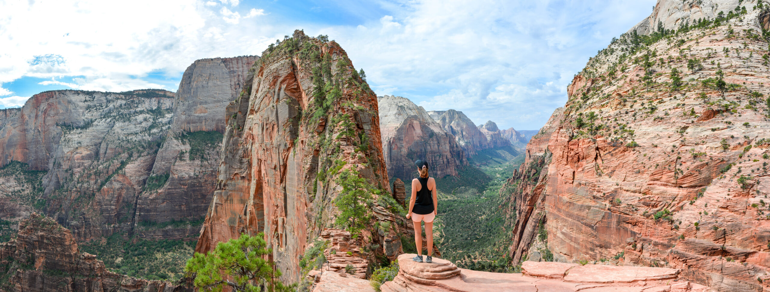
Angels Landing is Zion’s iconic exposure hike, but it is not the best default trail for every visitor. The route climbs the West Rim Trail from The Grotto to Scout Lookout, then continues onto a narrow chain-assisted sandstone ridge with major drop-offs.
In 2026, everyone entering the permitted section needs a permit every day and at all times. Seasonal and day-before lotteries are the only normal route to a permit. If you do not win—or decide the exposure is wrong for you—Scout Lookout remains an excellent objective.
Observation Point
Observation Point sits higher than Angels Landing and looks directly into the main canyon. It is the right answer for hikers who want the huge aerial view without depending on a chain-section permit.
The important modern planning fact is access: the historic approach from Weeping Rock remains closed long-term after rockfall. Current NPS guidance directs east-rim hikers to East Rim, East Mesa or Stave Spring access instead.
The Subway — Bottom-Up
The Subway is not a maintained “trail to a slot canyon.” NPS describes the bottom-up route as a strenuous off-trail wilderness hike involving boulders, creek travel and route finding. That is exactly why it works as an advanced hiking progression objective.
The top-down route should be kept separate: it is technical canyoneering requiring ropes, harnesses, rappelling, swimming and route-finding skills.

A Five-Mile Hike Can Demand More Judgment Than a Fifteen-Mile Trail.
Angels Landing proves why distance is a weak way to rank Zion. Exposure, moving water, route-finding, desert heat and access logistics can matter more than mileage.
Which Zion Hikes Need a Permit?
Do not let “Zion permit” become one vague planning task. Different routes use different permit systems.
| Objective | Day-hike permit? | How it works | Important distinction |
|---|---|---|---|
| Angels Landing | Yes | Seasonal lottery + day-before lottery | Permit begins at Scout Lookout / permitted section; Scout Lookout itself does not require the Angels Landing permit |
| The Narrows bottom-up | No | No wilderness permit for the standard bottom-up day hike | River closures override plans |
| The Narrows top-down | Yes | Wilderness permit | 16-mile through-route; a different trip |
| The Subway bottom-up | Yes | Wilderness permit required year-round | Off-trail strenuous wilderness route |
| The Subway top-down | Yes | Wilderness/canyoneering permit | Technical canyoneering, not ordinary hiking |
| West Rim day hike | No | No standard day-hike permit | Overnight camping requires wilderness permit |
| Observation Point day hike | No standard day permit | Access from east-rim side | Private shuttle/road logistics can still matter at some eastern approaches |
Official Zion Angels Landing permit page → · Official Zion wilderness permits →
The Narrows: Know the Flow Before You Go
For The Narrows, the best itinerary is the one that survives the morning river and weather check.
Flexible Day Hike
Start from Temple of Sinawava, walk Riverside Walk and then enter the Virgin River. No wilderness permit is required for the normal bottom-up day hike. Turnaround is flexible up to the allowed day-use limit.
16-Mile Wilderness Route
This is a different commitment level and requires a wilderness permit. Do not treat the top-down route as simply “more Narrows” after a successful bottom-up day.
150 CFS + Flash Flood Warning
Zion closes The Narrows when the Virgin River exceeds 150 cubic feet per second and when the National Weather Service issues a Flash Flood Warning. Flash floods are possible even below the flow threshold.
Cyanobacteria Is a Separate Issue
NPS currently warns visitors not to submerge their heads in or drink water from Zion rivers. Treat river-flow safety and water-quality precautions as separate planning questions.
Observation Point: Stop Planning From Weeping Rock
Old guides still make the historic canyon-floor approach look normal. It is not.
Weeping Rock → East Rim
The lower East Rim Trail from Weeping Rock remains closed long-term because of a major rockfall. There is no current through-access between Zion Canyon and the East Rim using that historic line.
East Mesa / East Rim / Stave Spring
NPS directs visitors to approach east-rim objectives from the plateau side. Exact distance and logistics therefore depend on the eastern trailhead used.
View Without the Chain Section
Observation Point is the stronger answer for hikers whose goal is a high look into Zion Canyon rather than Angels Landing’s narrow-ridge experience.
Do Not Use an Old GPX Blindly
If a track starts at Weeping Rock and climbs directly toward Observation Point, it reflects an approach that is no longer open. Verify trailhead side before following any downloaded route.
The Subway: Bottom-Up vs Top-Down
The same destination name hides two different skill categories.
| Bottom-Up Subway | Top-Down Subway | |
|---|---|---|
| Style | Strenuous wilderness hike | Technical canyoneering route |
| Distance | 9.0 mi RT | Route-dependent through trip |
| Time | 6–10 hr NPS estimate | Full technical day |
| Trail | No maintained trail; creek/boulder travel | Canyon travel, swims, rappels |
| Permit | Required | Required |
| Skills | Navigation, scrambling, endurance | Ropes, harness, rappelling, cold-water management, canyoneering |
| This parent covers | Decision framework | Boundary warning only |
When Should You Hike Zion?
“Best time for Zion” is too broad until you name the route.
| Season | Main canyon hiking | Narrows | High rim / West Rim | Main planning issue |
|---|---|---|---|---|
| Mar–Apr | Excellent temperatures | Can be cold/high from snowmelt | Snow/mud possible higher up | Flow + high-elevation snow |
| May–Jun | Strong but warming | Improves as runoff drops | Increasingly reliable | Heat + runoff transition |
| Jul–Aug | Very hot midday | Popular but monsoon flood risk matters | Hot approaches / thunderstorms | Heat + flash floods |
| Sep–Oct | Best broad balance | Often strong, still condition-dependent | Excellent before snow | Shorter days + storms/cold snaps |
| Nov–Feb | Quiet, cold | Cold water | Snow/ice possible | Short days + winter traction |
Use the GSG Mountain Weather framework for heat, thunderstorms and wind decisions →
Zion Shuttle, Trailheads & 2026 Access
Many Zion hiking days begin with the shuttle rather than with parking at the trailhead.
No Reservation Needed
The park shuttle is free and does not require a ticket or reservation. In 2026, the main summer schedule from May 17 through September 12 starts at 7 a.m.; the last outbound bus from the Visitor Center is 7 p.m.
Last Bus Gets Earlier
From September 13 through October 24, the last outbound canyon shuttle is 6 p.m. From October 25 through November 28 it moves to 5 p.m. Do not assume August operating hours apply to a fall trip.
Canyon Overlook Has Almost No Parking Margin
NPS specifically warns that parking is extremely limited near Canyon Overlook. A one-mile hike can become a transportation problem before the walking starts.
Large Vehicle Restrictions
Starting June 7, 2026, Zion began enforcing vehicle size and weight limits on the Zion-Mt. Carmel Highway between Canyon Junction and the East Entrance. Oversize vehicles need a different routing strategy.
How to Build a Zion Hiking Trip
This is a planning framework—not a rigid itinerary that ignores permits, river conditions or heat.
Canyon Overlook + Watchman / Pa’rus
Use the first day to understand desert heat, canyon geography and transportation. Canyon Overlook provides an immediate high-return view; Watchman or Pa’rus adds a lower-consequence second outing.
Angels Landing or Observation Point
If you have an Angels Landing permit and exposure fits your group, use it here. If not, shift the major-view day to Observation Point, Scout Lookout or a longer West Rim objective.
The Narrows
Keep The Narrows later in the itinerary when possible so you have time to react to flow, flash-flood forecasts and water conditions rather than making it the trip’s only viable day.
The Subway
If you have the permit and wilderness experience, The Subway can replace one mainstream day. It should not be added casually on top of a full Angels Landing/Narrows itinerary simply because it appears on a “top hikes” list.
A Zion Hiking Progression
The park works unusually well as a progression because each step introduces a different planning variable.
Pa’rus · Riverside · Canyon Overlook
Learn heat, hydration, slickrock and shuttle logistics without making route-finding or extreme exposure the main problem.
Watchman · Scout Lookout
Add meaningful vertical and a longer desert day. Scout Lookout teaches the approach to Angels Landing without requiring the permitted ridge.
Narrows · Observation Point · West Rim
Introduce moving-water judgment, longer mileage, high-rim weather and more complex trailhead logistics.
Angels Landing · Subway Bottom-Up
Exposure or off-trail wilderness movement becomes the defining problem. These are not “must-do” rites of passage.
Build a Zion Trip Around the Constraint That Can Break It.
Choose the experience first, then identify the one thing that can stop it: permit, river, exposure, trailhead access or heat. Save the route in My Climb with a primary plan and a backup from a different trail system. That turns a Zion vacation from a checklist into a resilient hiking plan.
Lottery result should not decide whether the whole day succeeds.
Flow and flood warnings get the last word.
Build around current east-rim access rather than old Weeping Rock data.
Route-finding experience belongs in the decision.
How This Zion Parent Is Maintained
Route facts that change quickly are tied to land-manager sources rather than copied indefinitely from old trip reports.
What this page evaluates
- Route identity and trip value.
- Difficulty beyond mileage: exposure, river, navigation and heat.
- Current permit ownership.
- Trailhead / shuttle dependencies.
- Seasonal planning and backup value.
- Progression from easy visitor hikes to wilderness objectives.
It does not try to become a complete turn-by-turn guide to every trail. That job belongs to child pages.
Primary 2026 sources
- Zion NPS — Current Conditions
- Zion NPS — Angels Landing Permits
- Zion NPS — Wilderness Permits
- Zion NPS — East Rim / Observation Point Access
- Zion NPS — Subway Bottom-Up
- Zion NPS — 2026 Shuttle Schedule
Maintenance rule: permit mechanics, river closures, shuttle schedules and trail closures should be rechecked seasonally and any time NPS posts a major access change.
Zion National Park Hiking FAQ
Answers written for the planning questions this destination parent should own.
What are the best hikes in Zion National Park?
For most first-time visitors, build around The Narrows, Angels Landing or Scout Lookout, Observation Point, Canyon Overlook and one easier trail such as Watchman or Pa’rus. Add The Subway only if the permit and wilderness skill level fit your group.
Do you need a permit to hike Angels Landing?
Yes. In 2026, a permit is required every day and at all times to continue from Scout Lookout onto the permitted Angels Landing section. Zion uses seasonal lotteries and a day-before lottery. Scout Lookout itself does not require an Angels Landing permit.
Do you need a permit for The Narrows?
Not for the standard bottom-up day hike from Temple of Sinawava. The 16-mile top-down route requires a wilderness permit. High water and flash-flood warnings can close The Narrows regardless of your itinerary.
Is Observation Point open?
Observation Point remains inaccessible from the historic Weeping Rock / lower East Rim route because of a long-term rockfall closure. East-rim approaches remain available from East Rim, East Mesa or Stave Spring access, subject to current conditions.
Do you need a permit for The Subway?
Yes. Every hiker visiting the Left Fork of North Creek, commonly called The Subway, needs a wilderness permit year-round. The bottom-up route is a strenuous off-trail wilderness hike; top-down is technical canyoneering.
What is the best time of year to hike in Zion?
Spring and fall provide the best broad balance for most trails. The Narrows depends heavily on river flow, high-rim routes can hold snow in spring, and midsummer heat plus monsoon flash-flood risk require a different schedule.
Do you need a reservation for the Zion shuttle?
No. Zion’s park shuttle is free and does not require a reservation or ticket. Service is seasonal, and first/last bus times change through the year.
What Zion hike should a beginner do first?
Start with Canyon Overlook, Watchman, Pa’rus or Riverside Walk. Scout Lookout can be a strong next step for fit hikers. Angels Landing and The Subway should not be treated as beginner rites of passage.
Choose One Signature Hike. Build Two Good Backups.
The strongest Zion itinerary does not depend on winning one lottery, getting one perfect river day or forcing one exposed route. Pick the experience you want, understand the constraint that controls it, and keep a second trail system ready when conditions change.
Zion: Plan the Whole Climb
Permits, routes, difficulty, weather and logistics all decide the day. Start with the main guide, then go deeper below.
Was this helpful?
Global Summit Guide is an independent mountaineering resource founded in 2026. The team combines first-hand trekking and climbing experience with in-depth research and professional health and nutrition review to help climbers choose objectives, prepare properly, and stay safe.
Health, altitude, and nutrition content is reviewed by Taylor Ludlow (Registered Nurse) and Brigg Hoopes (Nutritionist).
What We Don't Know Yet
Mountain information changes quickly. This box explains the limits of what this page can responsibly promise.
- Permit availability, reservation windows, quotas, and official fee rules may change after this page is updated.
- Weather, snowpack, avalanche risk, road access, and route conditions can change quickly and may be different on your climbing dates.
- Route conditions, trailhead access, crevasse exposure, stream crossings, and rescue access may vary from published planning guidance.
Verify current conditions with official land managers, guide services, local forecasts, and current route reports before booking or climbing.
Mountaineering, rock and ice climbing, glacier travel, and high-altitude activity are inherently dangerous and can result in serious injury or death. The information on Global Summit Guide is provided for general informational and educational purposes only and is not a substitute for professional instruction, qualified guiding, proper equipment, or your own judgment and experience.
Route conditions, weather, snowpack, permits, regulations, and hazards change constantly and may differ from what is described here. Details may be incomplete, out of date, or contain errors. Always verify current information with local authorities, certified guides, and official sources before making any decision in the mountains.
Nothing on this site is medical, legal, or financial advice. Our fitness, acclimatization, altitude, and nutrition content is general in nature; consult a qualified physician before beginning any strenuous exercise program or exposing yourself to high altitude.
You are solely responsible for your own safety and decisions. To the fullest extent permitted by law, Global Summit Guide and its team accept no liability for any loss, injury, damage, or expense arising from use of, or reliance on, this information. By using this site you acknowledge these risks and accept these terms.
Some links on this site may be affiliate links. If you buy through them we may earn a small commission at no extra cost to you; this never affects our recommendations.
Global Summit Guide recommendation path
Next Best Mountain to Research
Use these recommendations to continue the right planning path instead of stopping on one page.
Use current permit, weather, route, and operator information before booking or climbing.
Search Flights, Hotels & Rental Cars
Have the mountain or destination picked? Use Expedia to compare the flights, lodging and rental cars that fit your actual trip dates. For mountain travel, consider arriving early enough for delays and adding a buffer night after the climb before a fixed flight home.
Compare current flight, hotel and car options.
Affiliate disclosure: Global Summit Guide may earn a commission if you book through this link, at no additional cost to you.