
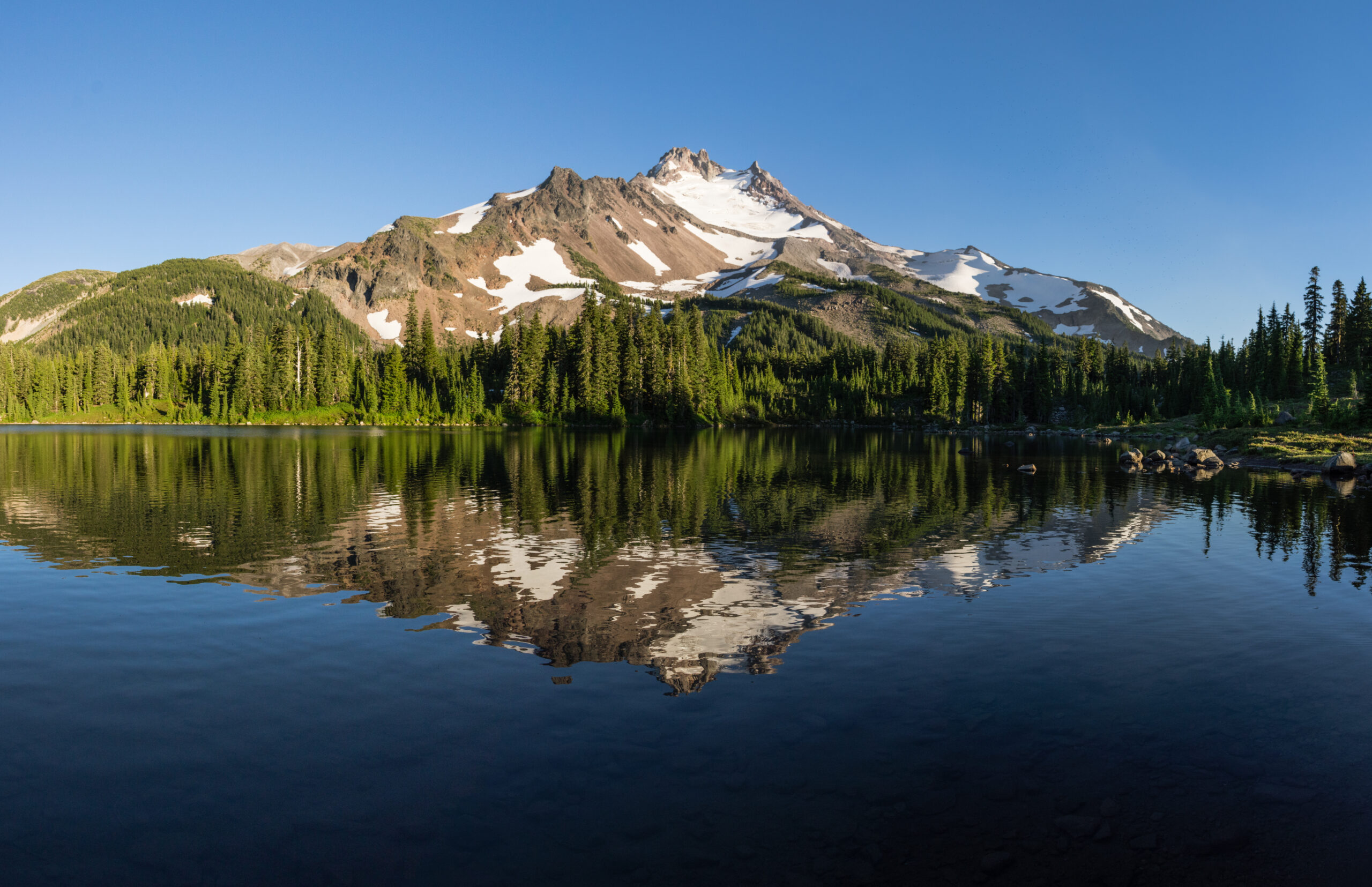
Mount Jefferson: Oregon’s second-highest, and its hardest volcano to top out
Jefferson is Oregon’s second-highest peak, but where Mount Hood draws the crowds, Jefferson keeps its solitude and its difficulty. A remote, glaciated, decaying stratovolcano, its summit is a loose Class 4 to 5 rock pinnacle above the Red Saddle that stops many climbers cold. This update covers the routes, the permits, the hazards, and an honest readiness view. Heights in feet (metres).
Updated 27 July 2026 · Compiled by Travis Ludlow · Safety review by Dawson Ludlow · Medical review by Taylor Ludlow, RN
Single-mountain expedition update, compiled from Forest Service and permit information, guide-service and climber route descriptions, and published records. Our team has not climbed Mount Jefferson; the only first-hand summit anyone on our team claims is Kilimanjaro. This is a planning briefing for experienced Cascade climbers, not a how-to and not a substitute for training or a guide.
Lower than Hood, and much harder to climb.
Jefferson is Oregon’s second-highest peak, and widely called its hardest major volcano. Unlike Hood’s popular standard route, Jefferson stacks a long wilderness approach, glacier and steep-snow travel, and a loose, exposed summit pinnacle into one committing climb. Many strong climbers reach the Red Saddle and go no higher. It is not a first Cascade volcano, and it is often called the peak that proves you are ready for Rainier.
- Oregon’s second-highest peak, after Hood.
- The hardest of Oregon’s major volcanoes.
- Summit is a loose Class 4 to 5 pinnacle.
- Long, remote, permit-controlled wilderness climb.
- A serious step toward Rainier and beyond.
On this page
What Jefferson involves
A long, remote, glaciated climb with a loose and exposed summit, the most committing volcano in Oregon.
Mount Jefferson rises to 10,497 ft in the central Oregon Cascades, a deeply eroded stratovolcano inside the Mount Jefferson Wilderness, about 60 miles east of Salem. It is Oregon’s second-highest peak, and by wide agreement its hardest major volcano to climb. Where Mount Hood has a short, popular standard route, Jefferson demands a long wilderness approach of many miles, glacier and steep-snow travel, and a summit that is a genuine rock climb.
That summit is the point. Every route gains the Red Saddle, at about 9,900 ft, and then climbs a loose, exposed pinnacle of Class 4 to 5 volcanic rock, or an exposed steep-snow traverse early in the season, to reach the true top. Rockfall on that friable rock is the defining hazard. It is a superb, committing objective for experienced climbers, and not a first Cascade volcano. For the full route, permits, and cost, see our Mount Jefferson climb guide.
The Red Saddle, and the summit pinnacle
Jefferson’s difficulty is concentrated in its last few hundred feet, and that is where the mountain turns many climbers back.
The long approach and the upper snow and scree bring a climber to the Red Saddle, a notch of red volcanic soil at about 9,900 ft, directly below the summit block. It is a natural stopping point, and an honest one: from here the summit is a loose, exposed pinnacle, and reaching it is a different order of commitment from the walk that got you here. Many capable parties call the Red Saddle their high point and turn around, which is a respectable choice.
Above it, the final 400 to 600 ft varies sharply with the season. Later in summer, the block is a scramble up dangerously loose Class 4 to 5 volcanic rock, where rockfall, including rock knocked loose by ropes, is the main danger, and many climbers unrope to move safely. Earlier in the season, the same ground is an exposed steep-snow traverse with severe runout below. Either way, the pinnacle is the climb, and icy or out-of-condition rock is a clear reason to descend.
The Red Saddle is a real summit choice
Turning around at the Red Saddle is common and not a failure. If the pinnacle is iced, badly loose, or beyond your team’s comfort on exposed rock, the saddle is a fine high point, and the smart one.
A decaying volcano with a vertical sting
Jefferson has not erupted in the age of memory, but its summit is still being taken apart, one loose block at a time. The friable rock that makes the pinnacle so hazardous is the same erosion that gives the mountain its sharp, sculpted profile. It is beautiful from the wilderness below, and serious the moment you commit to its final tower.
Are you ready for Jefferson?
Jefferson asks for three things together: glacier and snow skill, nerve on loose rock, and the fitness for a long approach. These are the prerequisites.
Rope, Axe, Crampons
The approach crosses glaciers and steep snow. Roped travel, crevasse rescue, and ice-axe arrest are prerequisites.
Evidence: prior glaciated climbs.The Summit Pinnacle
The crux is friable Class 4 to 5 rock with real exposure. You must move calmly and precisely on bad rock.
Evidence: prior loose alpine rock.Miles With A Pack
Jefferson is a wilderness climb of 13 to 22 miles and thousands of feet of gain, often over two to three days.
Evidence: prior long approaches under load.Stop At The Saddle
Many strong climbers top out at the Red Saddle. Knowing when the pinnacle is out of condition is a skill.
Evidence: willingness to turn back.| Requirement | Baseline | Why it matters |
|---|---|---|
| Glacier competence | Roped travel and crevasse rescue | The standard routes cross live glaciers and steep snow. |
| Loose rock | Calm on friable Class 4-5 | The summit pinnacle is decaying volcanic rock. |
| Fitness | Strong for a long wilderness approach | 13 to 22 miles with 6,000 to 8,000 ft of gain. |
| Rockfall discipline | Helmet, spacing, often unroped high | Rope-induced rockfall is a real danger on the pinnacle. |
| Permits | Central Cascades Wilderness Permit | Required Jun 15 to Oct 15; quotas apply. |
| Judgment | Willing to stop at the Red Saddle | An out-of-condition pinnacle is a turnaround. |
Build the foundation with glacier travel basics and crevasse rescue basics, and study the snow and rockfall hazard in avalanche awareness for climbers. Coming from Mount Hood is good preparation.
The ridges, and the glaciers
Two families of route, from the south ridges and the northern glaciers, all finishing on the same summit pinnacle.
South and Southwest Ridges
The usual routes, from the Pamelia Lake and Whitewater trailheads, gaining the south ridge to the Red Saddle. They involve a long approach, steep snow or loose scree, and finish on the summit pinnacle. This is the most reasonable way up a mountain with no easy route.
- Long wilderness approach
- Steep snow or loose scree to the Red Saddle
- Finish on the Class 4-5 summit pinnacle
- 13 to 22 miles; usually 2 to 3 days
Whitewater and Jefferson Park Glaciers
From the north, the Whitewater and Jefferson Park Glacier routes add genuine glacier travel, grade III with Class 5 rock, and are usually climbed from camps in Jefferson Park. They are best earlier in the season, when snow reduces rockfall, and they still finish on the same loose pinnacle.
- Genuine glacier travel from the north
- Grade III with Class 5 rock
- Best earlier season, less rockfall
- Same summit-pinnacle crux
| Factor | South / Southwest Ridge | Whitewater / Jefferson Park Glacier |
|---|---|---|
| Approach | Pamelia Lake, Shale Lake camps | Whitewater, Jefferson Park camps |
| Character | Long ridge, snow and scree | Genuine glacier travel, grade III |
| Best season | Summer, year-round on the ridge | Earlier season, less rockfall |
| Crux | The summit pinnacle | The summit pinnacle |
| Who it suits | Most experienced parties | Climbers wanting a glaciated line |
The Mount Jefferson climb guide covers the camps, permits, and gear in full.
From the trailhead to the pinnacle
An overview of a standard South Ridge ascent, from the wilderness trailhead to the summit block and back.
Salem / Portland / Bend
The Oregon cities and forest roads leading to the trailheads.
Pamelia Lake or Whitewater
South and Southwest ridges, or the northern glacier routes.
Miles Of Trail
A long forest and PCT approach into the Mount Jefferson Wilderness.
Shale Lake / Jefferson Park
Common camps near 5,800 to 5,900 ft below the upper mountain.
Snow And Scree
Steep snow or loose volcanic sand gains the south ridge.
The Decision Point
The notch below the summit block, where many parties stop.
The Loose Crux
400 to 600 ft of exposed snow or friable Class 4 to 5 rock.
Reverse With Care
Down the pinnacle and the long approach, rockfall-aware.
The pinnacle decides the day
Everything below the Red Saddle is a long, strenuous approach; everything above it is the real climb. Arrive at the saddle with time, energy, and a clear head, assess the block honestly, and treat the last few hundred feet as the serious pitch they are.
A Jefferson climb timeline
Jefferson is usually a two to three-day climb, dominated by a long wilderness approach and a committing summit day.
Secure permits and travel
Book the Central Cascades permit, get a Northwest Forest Pass, and drive to the trailhead.
Hike the wilderness approach
Trek miles of forest and PCT trail into the Mount Jefferson Wilderness.
Camp below the mountain
Set a high camp near Shale Lake or in Jefferson Park.
Alpine start up the ridge
Leave early and climb snow and scree toward the Red Saddle.
Gain the Red Saddle
Reach the notch below the summit block and assess the pinnacle’s condition.
Climb the summit pinnacle
Take the exposed snow or loose Class 4 to 5 rock to the true summit.
Descend to camp
Reverse the pinnacle and upper mountain carefully, wary of rockfall.
Pack out
Hike the long approach back to the trailhead.
Cost, permits and access
Jefferson is inexpensive to climb but tightly permitted, and access can be shaped by quotas and by wildfire.
| Component | Figure | Note |
|---|---|---|
| Guided climb | Two to three days | A committing wilderness climb; few operators run it. |
| Central Cascades permit | Jun 15 to Oct 15 | Overnight and Whitewater day use, via Recreation.gov; quotas apply. |
| Northwest Forest Pass | To park | Required at the trailheads to leave a vehicle. |
| Personal gear | Glacier and rock kit | Crampons, axe, harness, helmet, and rock protection. |
| Skills | Glacier, snow, loose rock | The three skill sets Jefferson demands together. |
Plan the permit and check for fire
A Central Cascades Wilderness Permit is required from 15 June to 15 October, booked on Recreation.gov, with daily quotas on popular zones like Pamelia Lake, plus a Northwest Forest Pass to park. Book early, and check current conditions: wildfire in recent years has closed trails and trailheads around the mountain. Confirm the details with the Forest Service before you go.
Choosing a Jefferson guide
Few operators guide Jefferson, and its loose summit rewards real experience on the peak. These are the questions to ask.
Not Just Hood
Ask how often the guide has climbed Jefferson and its pinnacle.
Pinnacle And Snow
The state of the summit block and the traverse for your dates.
Tight On The Pinnacle
Loose, exposed rock calls for a low guide-to-client ratio.
Handled In Advance
A good operator secures the Central Cascades permits and quotas.
Helmets And Spacing
How the team manages rope-induced and natural rockfall.
Clear At The Saddle
A serious guide will stop at the Red Saddle when needed.
How to choose an expedition operator covers the vetting, and the operator directory is a place to start.
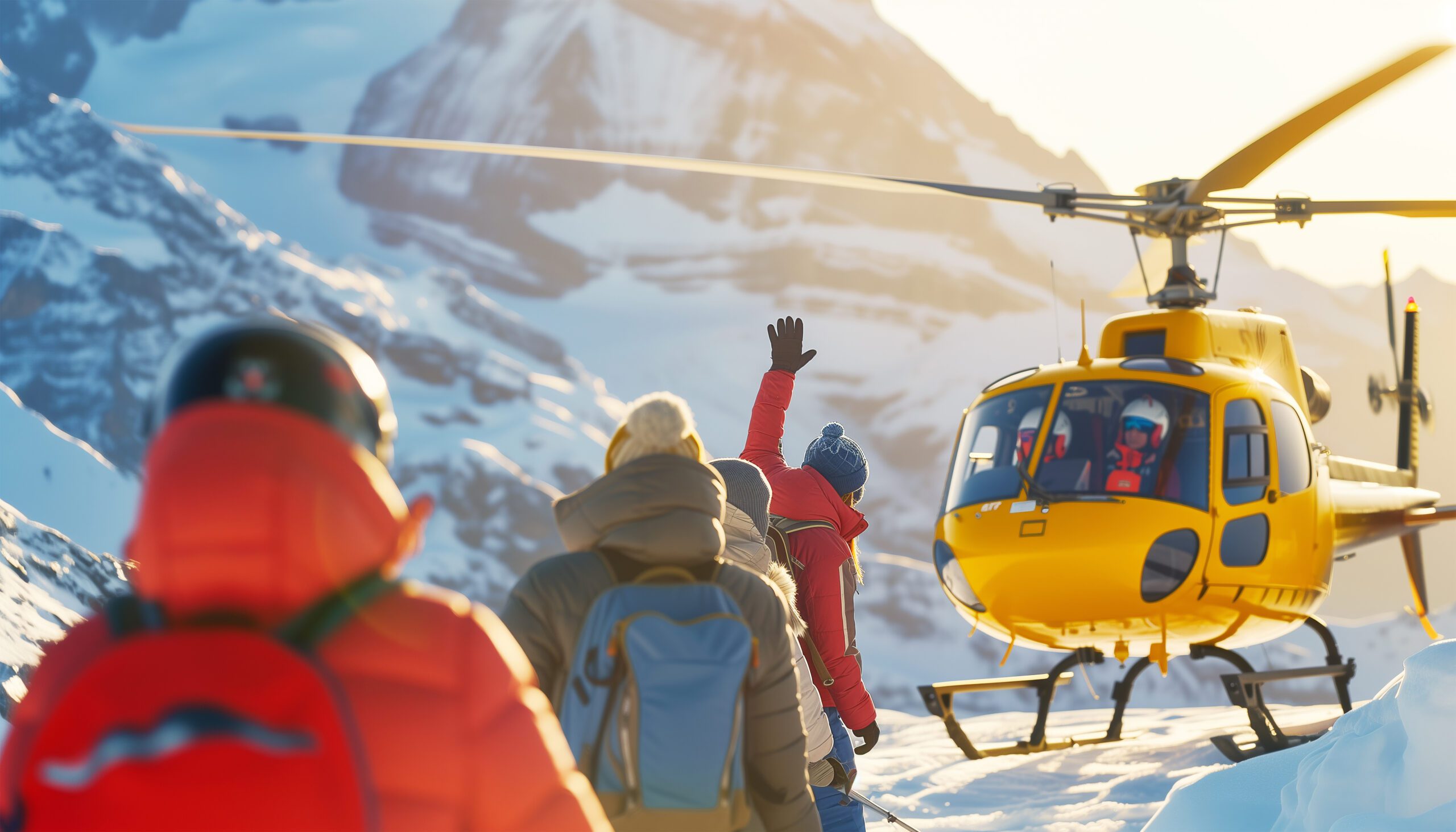
Remote, loose, and a long way from the road
Jefferson’s wilderness setting is part of its appeal and part of its risk. An accident on the loose summit pinnacle, miles from the trailhead, is a serious situation, and rescue is neither quick nor guaranteed. Move deliberately, protect against rockfall, and keep enough in reserve for the long walk out.
Difficulty and hazard, honestly
Jefferson’s difficulty is not its height. It is the loose summit rock, the exposed snow, the remoteness, and the weather.
| Hazard | What it is | How to treat it |
|---|---|---|
| Loose summit rock | The defining hazard | Friable Class 4-5; rockfall, including rope-induced. |
| The exposed traverse | Early-season snow | Steep snow with severe runout below the pinnacle. |
| Remote approach | A wilderness climb | Long miles from the trailhead; help is far away. |
| Fast weather and fire | Cascade conditions | Storms move fast; wildfire can close access. |
Season and weather
Summer is the season, but the state of the summit block, rock or snow, matters more than the month.
Season Opens
Snow lingers on the pinnacle; the exposed traverse in play.
Prime, Rock
The summit block clears to loose rock; the classic window.
Looser
Drier and looser rock, with more rockfall risk.
Snow Climb
Steep-snow ascents, with less rockfall but real avalanche care.
Check The Block
The summit block’s state matters more than the month.
A short history of Jefferson
From a Lewis and Clark naming to an 1888 first ascent and a reputation as Oregon’s hardest volcano.
Mount Jefferson was named in 1806 by the Lewis and Clark expedition, for President Thomas Jefferson, who had sent them west; the peoples of the region knew it long before by their own names. Its first recorded ascent came in 1888, by E. C. Cross and Ray L. Farmer, who reached the loose summit pinnacle that still defines the climb.
In the years since, Jefferson has kept a quiet, formidable reputation. It lacks Hood’s crowds and Rainier’s fame, but among Cascade climbers it is respected as the hardest of Oregon’s major volcanoes, a remote peak whose difficulty is concentrated in a few hundred feet of decaying rock. For many, standing on that pinnacle is the moment they know they are ready for bigger glaciated mountains.
The Cascades cluster
Jefferson sits among the Oregon and Washington Cascade volcanoes, with the glacier, snow, and rock skills it demands.
Mount Hood
Oregon’s highest volcano, more popular and less committing than Jefferson.
Read the update ->The next stepMount Rainier
The glaciated giant Jefferson is said to prepare you for.
Read the update ->Core skillGlacier travel basics
The roped-glacier skills Jefferson’s approach demands.
Learn the skill ->HazardAvalanche awareness
Reading snow and rockfall hazard on the upper mountain.
Learn the skill ->Mount Jefferson climb guide
The full route, permits, and cost detail.
->Mount Hood climb guide
The state’s highest volcano and the natural pairing.
->Mount Baker expedition update
A Cascade glacier climb to the north.
->Crevasse rescue basics
Essential practice for the glaciers.
->Mountaineering fitness standards
Preparing for the long wilderness approach.
->Mountain weather for climbers
Reading fast-changing Cascade conditions.
->Back to the full Expedition Updates dashboard for every mountain we track.
Where Jefferson fits
The Cascade volcanoes, and Jefferson’s place on the road to Rainier.
Hood, Baker, and Rainier
Where Jefferson sits among the great Cascade volcanoes.
Read the updates ->The road to RainierProgression peaks
Jefferson as the climb that readies you for Rainier.
See the progression ->SkillsGlacier, snow, and rock
The three skill sets a Jefferson climb depends on.
Build the skills ->Mount Jefferson FAQ
The questions climbers ask most about the difficulty, the summit pinnacle, the permits, and the season.
How high is Mount Jefferson, and where is it?
Mount Jefferson is 10,497 ft (3,199 m), Oregon’s second-highest peak after Mount Hood. It is a deeply eroded stratovolcano in the central Oregon Cascades, inside the Mount Jefferson Wilderness, about 60 miles east of Salem and 90 miles southeast of Portland. It has had no eruptions in recorded geological recent history and now carries four named glaciers.
Is Jefferson really harder than Mount Hood?
Yes. Though it is lower than Hood, Jefferson is widely regarded as the hardest of Oregon’s major volcanoes to summit. Where Hood has a popular, guided standard route, Jefferson stacks a long wilderness approach, glacier travel, and a loose, exposed summit pinnacle into a far more committing climb. It is not a first Cascade volcano.
What is the Red Saddle, and the summit pinnacle?
The Red Saddle, at about 9,900 ft, is the notch of red volcanic soil just below the summit block, and the point where many climbers stop. Above it, the final 400 to 600 ft is the crux: either an exposed steep-snow traverse with severe runout early in the season, or a scramble up dangerously loose Class 4 to 5 volcanic rock once the snow melts. The true summit is that pinnacle.
What is the standard route?
The usual lines are the South and Southwest Ridges, reached from the Pamelia Lake or Whitewater trailheads, with the Whitewater Glacier and Jefferson Park Glacier routes from the north. All of them gain the Red Saddle and finish on the summit pinnacle. Expect a 13 to 22 mile round trip with 6,000 to 8,000 ft of gain, usually done over two to three days.
Why is the rock so dangerous?
Jefferson is a decaying volcano, and its upper rock is friable and loose. Rockfall, including rock knocked down by ropes and by other climbers, is the defining hazard on the summit pinnacle, and many parties choose to unrope there to avoid rope-induced rockfall. A helmet, careful movement, and spacing are essential, and icy rock is a reason to turn around.
Do I need a permit?
Yes. A Central Cascades Wilderness Permit is required from 15 June to 15 October, booked through Recreation.gov, for overnight trips and for day use at the Whitewater trailhead, and popular zones like Pamelia Lake have strict daily quotas. You also need a Northwest Forest Pass to park. Confirm the current rules and quotas before you plan, and note that wildfire can affect trail access.
When is the best time to climb?
Roughly July to September. Later summer clears the summit block to rock, at the cost of looser conditions and rockfall; earlier season keeps snow on the upper mountain, which can make the final traverse a steep, exposed snow climb instead. Each has trade-offs, and the state of the summit block is the key thing to check for your dates.
What experience do you need?
Glacier travel and crevasse rescue, competence and a cool head on steep snow and loose exposed rock, and the fitness for a long wilderness approach with a heavy pack. Jefferson rewards climbers who already have peaks like Hood, Adams, or St. Helens behind them, and it is often described as the climb that proves you are ready for Rainier.
How we built this update
What this page is based on, who reviewed it, and what we do not claim to know.
Sources
- Forest Service and Recreation.gov information for permits and access.
- Guide-service and climber route descriptions for the ridges and glaciers.
- Published records for the summit pinnacle, grades, and 1888 first ascent.
- USGS material on the mountain’s geology and glaciers.
- Our own Mount Jefferson climb guide for the detailed route and cost.
Review and standards
Compiled by Travis Ludlow and reviewed for safety by Dawson Ludlow, our Climbing and Mountaineering Lead (Wilderness First Aid), whose highest first-hand summit is Kilimanjaro. Health and medical points were reviewed by Taylor Ludlow, RN. We do not fabricate summit experience, quotes, or credentials, and we say plainly when we are reporting rather than recounting.
What we do not claim to know
Conditions on Jefferson change through the season and year, and no web page can replace current reports and a guide’s judgment. In particular:
- The summit block’s state, rock or snow or ice, varies through the season.
- Permit quotas and rules change; confirm current details on Recreation.gov.
- Wildfire can close trails and trailheads with little notice.
- Our team has not climbed Jefferson, so we report records and route descriptions, not personal experience.

Global Summit Guide research
We compile mountain updates from land-manager and permit information, route descriptions, and published records, review them for safety and medical accuracy, and refresh them each season. We are transparent about what we have and have not climbed, and Jefferson is a research-based briefing, not a personal account.
About our team and standards ->Earn the pinnacle. Respect the Red Saddle.
Start with the full route and permits in our Mount Jefferson climb guide, warm up on Mount Hood, build the skills with our glacier travel guide, and weigh yourself against our fitness standards. Trips stage through Portland, Salem, and Bend, so for flights and lodging, browse travel on Expedia.
Disclosure: the Expedia link above is a sponsored affiliate link, and we may earn a commission at no extra cost to you. It is the only affiliate link on this page; our route, permit, and safety guidance is independent.