
Last updated September 21, 2026
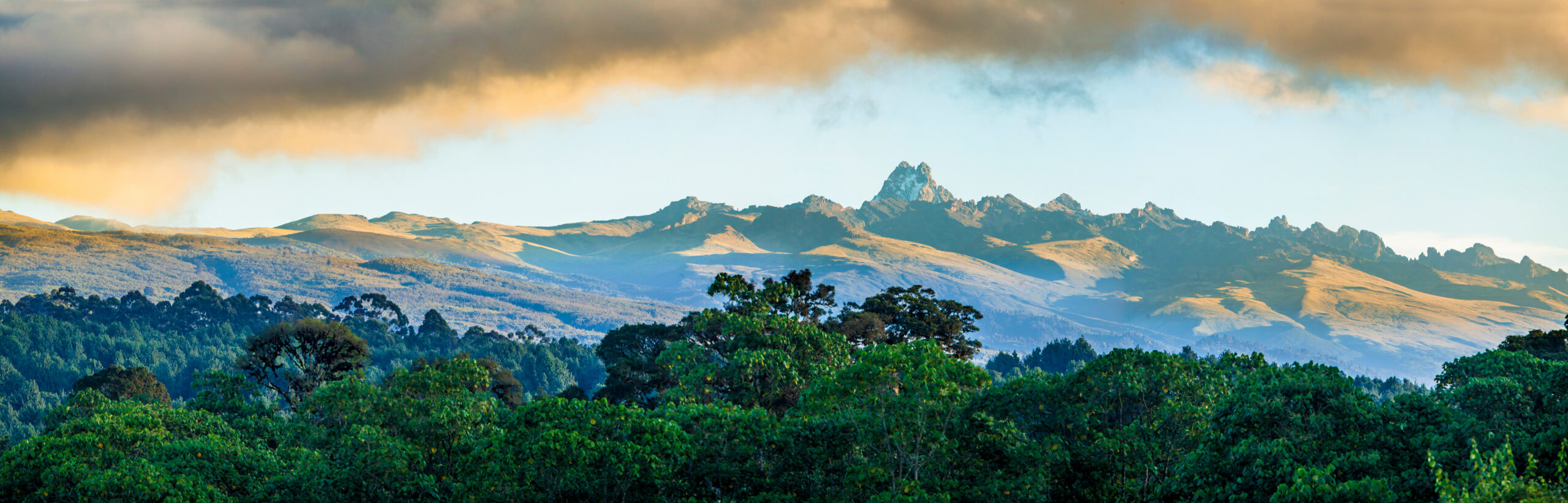
Mount Kenya Routes: Sirimon, Chogoria & Naro Moru Compared
Most Mount Kenya trekkers are choosing a route to Point Lenana, not the mountain’s true summit. Sirimon, Chogoria and Naro Moru are the three official KWS access routes to the peaks. Burguret is a wilder unofficial approach. Batian and Nelion are separate technical rock-climbing objectives.
What Is the Best Route on Mount Kenya?
For most first-time Point Lenana trekkers, the strongest overall itinerary is Sirimon up and Chogoria down over five or six days. Sirimon provides a gradual northern approach with established high camps, while Chogoria gives the most scenic descent through tarns, valleys and the mountain’s eastern side.
Naro Moru is the most direct of the three official approaches but gains height quickly, leaving less acclimatization margin. Burguret is better treated as a specialist wilderness approach: Kenya Wildlife Service currently lists it as an unofficial route requiring advance notice to park management.
Point Lenana Is a Trek. Batian and Nelion Are Climbs.
Much of the confusion around Mount Kenya comes from treating all three summits as versions of the same objective. They are not.
Batian · 5,199 m
Mount Kenya’s highest point. Reached by technical multi-pitch rock climbing, most commonly using the North Face during its preferred season.
Nelion · 5,188 m
Another technical summit. The South-East Face is the classic line, often targeted during the opposite seasonal window from Batian.
Point Lenana · 4,984 m
The normal objective for trekkers. Sirimon, Chogoria and Naro Moru all provide access without sustained technical climbing.

Mount Kenya’s Route Choice Starts With Whether You Are Trekking or Rock Climbing.
Point Lenana is the trekking summit seen by most visitors. Nelion and Batian rise beyond it as technical alpine rock objectives. A Point Lenana operator is not automatically the right guide for Batian or Nelion.
Sirimon vs Chogoria vs Naro Moru vs Burguret.
KWS currently identifies Sirimon, Naro Moru and Chogoria as the three official gates to the peaks. Burguret can still be used, but KWS classifies it as an unofficial route requiring advance notice.
| Route | Status / side | Typical role | Acclimatization | Scenery | Best fit |
|---|---|---|---|---|---|
| Sirimon | Official · North | Common ascent | Strong | Open Mackinder Valley | Most first-time Point Lenana trekkers |
| Chogoria | Official · East | Scenic ascent or descent | Good with sensible itinerary | Best-known scenery | Travelers prioritizing Gorges Valley, lakes and tarns |
| Naro Moru | Official · West | Direct ascent or efficient descent | Less margin if rushed | More functional than scenic | Shorter schedules or already-acclimatized trekkers |
| Burguret | Unofficial · Southwest | Wilderness approach | Can be gradual | Remote forest and solitude | Experienced trekkers with current KWS coordination |
Which Mount Kenya Route Should You Take?
Route choice is mostly about acclimatization, scenery, time and how much wilderness you want—not about finding one universal “easiest” line.
Sirimon ↑ Chogoria ↓
The strongest all-round combination: gradual approach, good acclimatization rhythm and the finest scenic descent.
Chogoria
Choose the eastern route for Gorges Valley, Lake Michaelson, Lake Ellis and Hall Tarns.
Naro Moru
The most direct official approach, but do not compress the schedule so aggressively that altitude becomes the dominant problem.
Burguret
A wilder unofficial approach. Coordinate the route with KWS and a guide who currently works the line.

The Scenic Case for Crossing the Mountain Instead of Repeating One Route.
A Sirimon–Chogoria traverse changes landscapes rather than retracing the same valley. Chogoria’s eastern side adds glacial valleys, tarns and dramatic views of the summit massif.
What Each Point Lenana Route Actually Feels Like.
Distances and exact overnight stops vary by operator. The more important differences are gradient, scenery, infrastructure and acclimatization rhythm.
The Strongest Standard Ascent
Sirimon approaches Mount Kenya from the north and gradually leaves forest for broad moorland and the Mackinder Valley. The route reaches the high-mountain zone near Shipton’s Camp, a common base for Point Lenana and technical climbers.
Its strongest advantage is not that it is “easy.” It is that a properly paced Sirimon itinerary gives you room to gain altitude gradually before the pre-dawn Point Lenana summit push.
The Scenic Route
Chogoria reaches the mountain from the east through terrain very different from Sirimon. The route’s appeal comes from its lakes, glacial valleys, giant afro-alpine plants and long open views toward the summit massif.
It can be climbed uphill, but pairing it with a Sirimon ascent creates a particularly strong traverse because you avoid repeating the same scenery.
The Direct Route
Naro Moru has long been the efficient western approach. Its famous Vertical Bog can be wet and tiring, and the shorter standard schedules can push trekkers upward faster than ideal.
The route makes more sense when speed is genuinely important or when the climber has already established acclimatization rather than simply because a shorter itinerary is cheaper.
The Wilderness Alternative
Burguret offers a quieter and less-developed approach through dense lower forest. It is not one of the three official KWS gates to the peaks.
Current KWS material specifically lists Burguret among the unofficial climbing routes and instructs visitors to notify the park office before using it. Treat it as a route requiring stronger local coordination rather than simply a fourth interchangeable tourist trail.
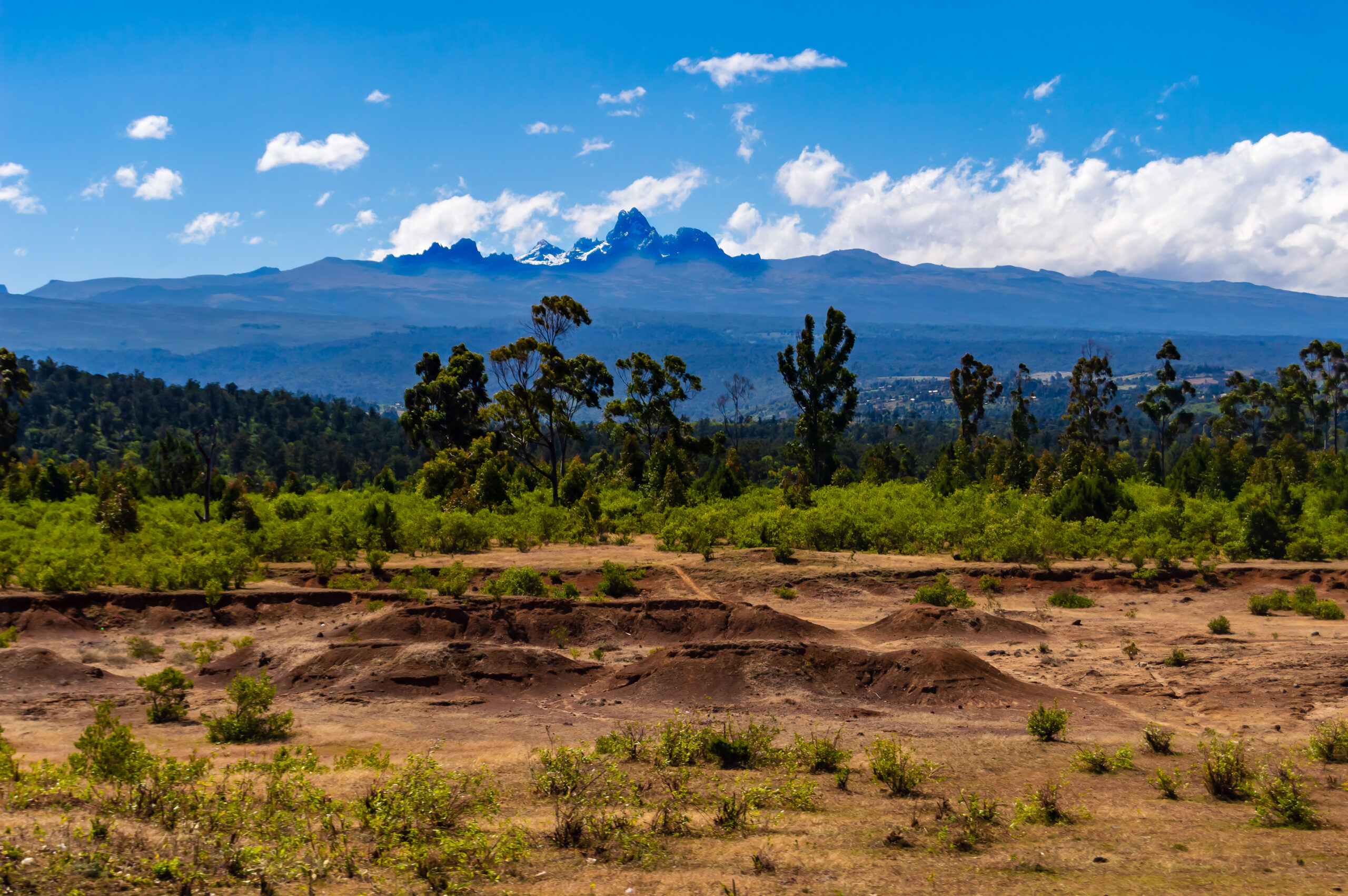
The Route Matters Less Than How Fast You Move Through It.
Point Lenana is below 5,000 meters, but that is still high enough for serious altitude illness. A slower itinerary with a deliberate high-altitude night is more important than shaving one day from the trip.
A 5–6 Day Sirimon–Chogoria Traverse.
Exact camps vary, but this structure preserves the most important idea: do not rush from the park gate to nearly 5,000 meters.

Standing on Point Lenana Shows You Why Batian Is a Different Objective.
The true summit rises as a technical rock peak rather than a continuation of the trekking trail. Reaching Point Lenana does not prepare a climber automatically for Batian or Nelion.
Batian and Nelion Have Their Own Routes—and Opposite Preferred Seasons.
The mountain’s true summits are specialist technical objectives. Current professional guide programs generally target Batian’s North Face from June through September and Nelion’s South-East side from December through March, using the seasonal weather differences around the equatorial massif.

Nelion Is a Multi-Pitch Rock Climb at High Altitude.
The summit demands technical movement, rope systems, rappelling and a guide or climbing team capable of operating efficiently on long alpine rock terrain. It should never be marketed as simply the “next summit above Point Lenana.”
Mount Kenya Access Rules That Affect Route Choice.
These details come from current KWS park information and should still be checked again when your dates are fixed.
Qualified Guide Required
KWS currently states that all visitors must be accompanied by a qualified and certified guide whose identification is issued by park management.
Three Main Access Points
KWS identifies Naro Moru, Sirimon and Chogoria as the official gates providing access toward the peaks.
Advance Notice Required
Burguret, Marania, Kamweti and Themwe are listed by KWS as unofficial climbing routes. Notify the park office before using them.
Current KWS Park Fee
KWS currently lists Mount Kenya National Park entry for a non-resident adult at US$70. Camping, guiding, transport and other services can add separate charges.
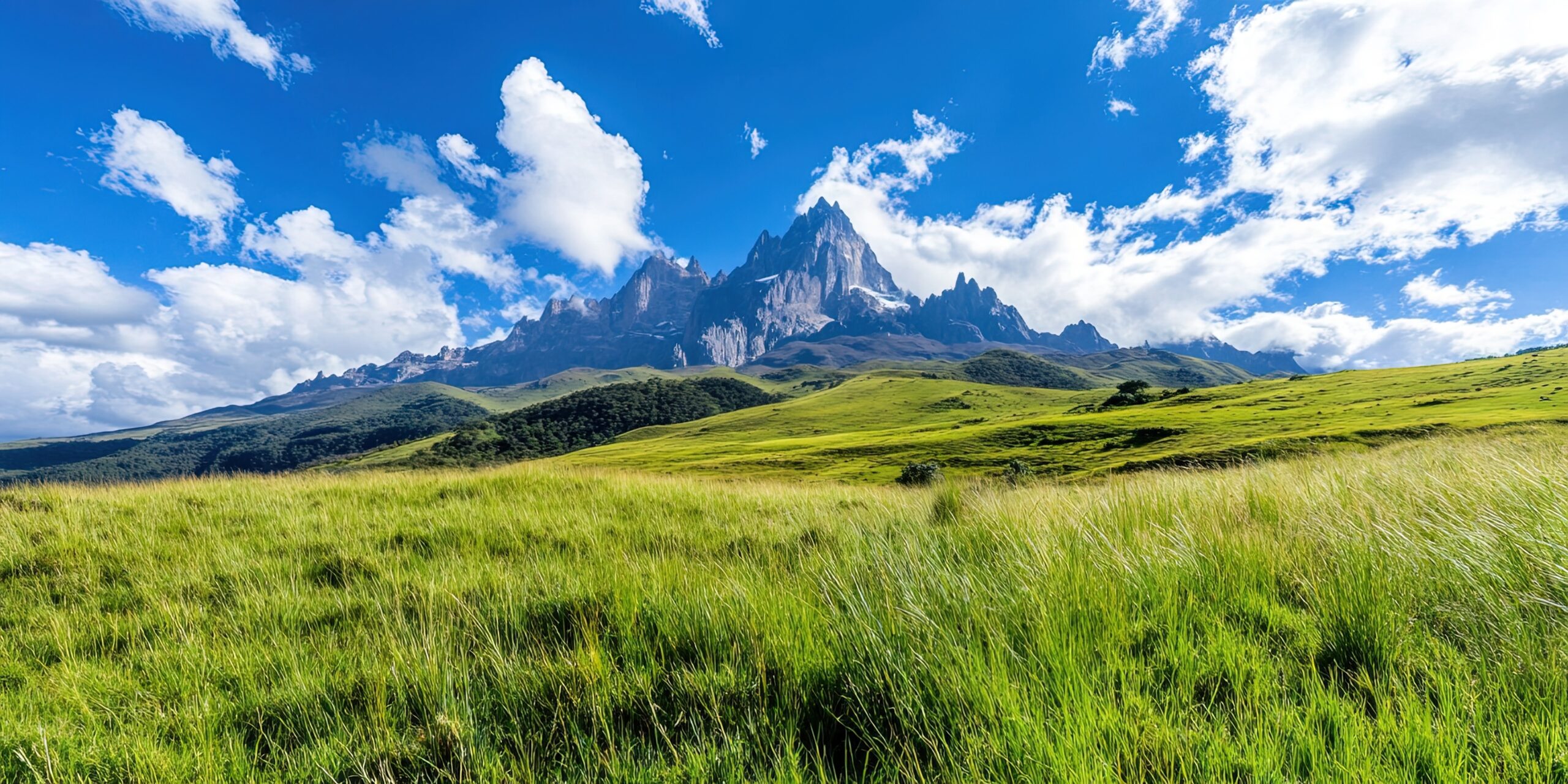
Route Season Depends on Which Side—and Which Summit—you Are Climbing.
Point Lenana trekking and the technical faces of Batian and Nelion do not share one simple “best season.” Match the route to the mountain’s seasonal weather pattern and check current conditions shortly before departure.
Mount Kenya Route Geography.
The three official access corridors reach the central summit massif from different sides, which is why a traverse produces such a different trip from an out-and-back itinerary.

Old Ice-Climbing Descriptions Do Not Always Describe Modern Mount Kenya.
Mount Kenya’s glaciers have retreated substantially. Historic couloirs and ice lines should not be assumed to exist in the condition described by older guidebooks. Current route observation matters.
Mount Kenya Routes FAQ.
The most important route questions before selecting an operator and itinerary.
What is the best route up Mount Kenya?
For most Point Lenana trekkers, a five- or six-day Sirimon ascent combined with a Chogoria descent provides a strong balance of gradual acclimatization, established access and scenic variety.
Is Sirimon or Chogoria better?
Sirimon is particularly well suited to an ascent because of its gradual northern approach. Chogoria provides the more dramatic scenic experience, making Sirimon up and Chogoria down a strong combination.
What is the fastest Mount Kenya route?
Naro Moru is generally the most direct of the three official approaches. Shorter itineraries provide less acclimatization margin, so speed should not be the only reason to select it.
Is Burguret an official Mount Kenya route?
Kenya Wildlife Service currently classifies Burguret as an unofficial climbing route. Visitors intending to use it must notify the park office in advance.
Do I need a guide on Mount Kenya?
Current Kenya Wildlife Service visitor information states that all visitors are required to be accompanied by a qualified and certified guide.
Is Point Lenana the summit of Mount Kenya?
Point Lenana at about 4,984 meters is the main trekking summit. Mount Kenya’s true summit is Batian at 5,199 meters, followed by Nelion at 5,188 meters. Batian and Nelion require technical climbing.
When is the best time to climb Batian?
Current professional guide programs generally favor Batian’s North Face from June through September, although exact route conditions must always be checked for the planned dates.
When is the best time to climb Nelion?
Current professional guide programs generally favor Nelion’s South-East side from December through March, when that side of the mountain is normally drier.
How many days should I spend on a Point Lenana trek?
Five or six days provides a much stronger planning framework than a rushed three-day itinerary because it allows more gradual altitude gain and can include a dedicated acclimatization day.
Choose the Route, Then Build the Trip.
This URL owns Mount Kenya route choice. Use the parent mountain guide for the overall objective and the operator page after the summit and route are decided.
Verify Current Access Before Departure.
Mount Kenya access, park rates, route conditions, camps and technical climbing conditions can change. This guide uses current park information and professional climbing-program guidance rather than relying solely on historic route descriptions.
- Kenya Wildlife Service — Mount Kenya National Park
- Kenya Wildlife Service — current Mount Kenya park brochure
- Adventure Consultants — current Batian and Nelion seasonal guidance
Current planning rule: official park requirements and current route observations override generalized itinerary advice when they conflict.
For Most Trekkers: Sirimon Up, Chogoria Down.
Start by choosing Point Lenana, Batian or Nelion. If Point Lenana is the objective, use enough days to acclimatize and choose the route combination that gives you the mountain experience you actually want. If Batian or Nelion is the objective, switch completely into technical-climbing planning.
Was this helpful?
🏔Related guides
🧭Explore & compare
Global Summit Guide is an independent mountaineering resource founded in 2026. The team combines first-hand trekking and climbing experience with in-depth research and professional health and nutrition review to help climbers choose objectives, prepare properly, and stay safe.
Health, altitude, and nutrition content is reviewed by Taylor Ludlow (Registered Nurse) and Brigg Hoopes (Nutritionist).
What We Don't Know Yet
Mountain information changes quickly. This box explains the limits of what this page can responsibly promise.
- Route conditions, trailhead access, crevasse exposure, stream crossings, and rescue access may vary from published planning guidance.
- Comparisons simplify complex decisions; the better mountain depends on current conditions, skills, timing, budget, and risk tolerance.
- Visa, passport, vaccination, border, insurance, and local transportation rules may change before your trip.
Verify current conditions with official land managers, guide services, local forecasts, and current route reports before booking or climbing.
Mountaineering, rock and ice climbing, glacier travel, and high-altitude activity are inherently dangerous and can result in serious injury or death. The information on Global Summit Guide is provided for general informational and educational purposes only and is not a substitute for professional instruction, qualified guiding, proper equipment, or your own judgment and experience.
Route conditions, weather, snowpack, permits, regulations, and hazards change constantly and may differ from what is described here. Details may be incomplete, out of date, or contain errors. Always verify current information with local authorities, certified guides, and official sources before making any decision in the mountains.
Nothing on this site is medical, legal, or financial advice. Our fitness, acclimatization, altitude, and nutrition content is general in nature; consult a qualified physician before beginning any strenuous exercise program or exposing yourself to high altitude.
You are solely responsible for your own safety and decisions. To the fullest extent permitted by law, Global Summit Guide and its team accept no liability for any loss, injury, damage, or expense arising from use of, or reliance on, this information. By using this site you acknowledge these risks and accept these terms.
Some links on this site may be affiliate links. If you buy through them we may earn a small commission at no extra cost to you; this never affects our recommendations.
Global Summit Guide recommendation path
Next Best Mountain to Research
Use these recommendations to continue the right planning path instead of stopping on one page.
Use current permit, weather, route, and operator information before booking or climbing.
Explore Travel Options for Your Destination
Once your mountain, dates and route are taking shape, compare flights, hotels and other travel options that fit the trip.
Affiliate link. We may earn a commission at no additional cost to you.