
Last updated July 10, 2026
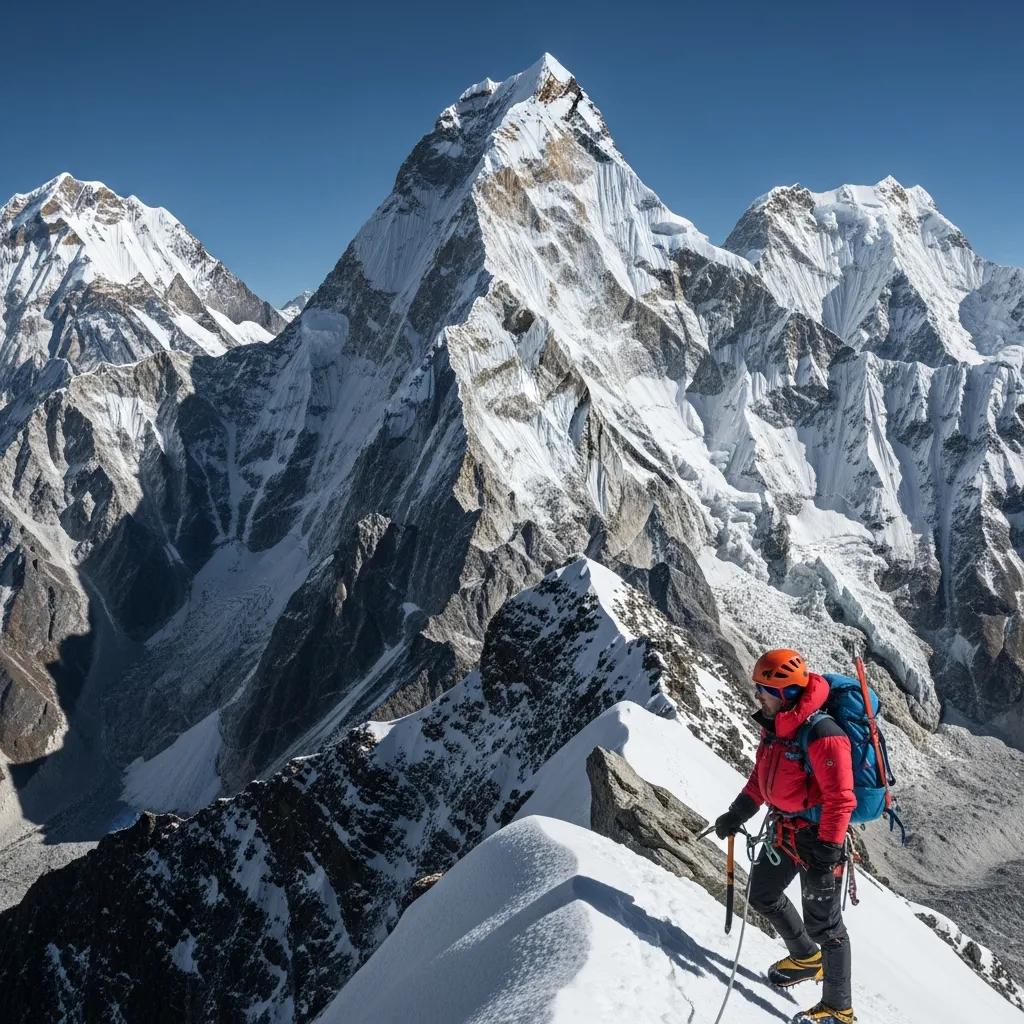
Climbing Island Peak (Imja Tse): Your First Technical 6,000er
Nepal’s most popular “first technical” Himalayan peak — a real glacier climb with fixed ropes and a steep summit headwall, wrapped inside an Everest-region trek. The climbing is achievable; the trap is treating a “trekking peak” like a walk. Here’s how to do it right in 2026.
Island Peak (Imja Tse), 6,189 m, is the classic first technical Himalayan summit — glacier travel with crevasses, a 100–200 m fixed-line headwall at 45–50°, and an exposed summit ridge, all reached through the Everest trekking corridor. It’s rated a “trekking peak,” but that label misleads: it produces serious accidents every season, mostly on the fixed-line descent and from altitude.
Do it as a 14–19 day guided trip (a certified guide is required), arrive with prior time above ~4,500 m and some rope/crampon practice, and don’t rush the acclimatisation. Get those right and it’s one of the best-value big-mountain experiences anywhere — and the standard rehearsal for Everest and other 8,000ers.
On this page
Where it is
Khumbu region, Sagarmatha National Park — about 14 km east of Everest.
Island Peak rises from the Imja Glacier at the head of the Imja Valley in the Khumbu, roughly 14 km east of Mount Everest and ringed by giants — Lhotse (8,516 m), Nuptse (7,861 m), and Lhotse Shar. The climb is staged from the village of Chhukung (~4,730 m); the whole trip begins with a flight into Lukla.
The peak, in brief
Named for how it looks, famous for who first climbed it.
The British explorer Eric Shipton named it “Island Peak” in 1952, because from Dingboche the snow-covered summit appears to rise like an island from a sea of glacial ice. Nepal officially renamed it Imja Tse in 1983 (after the Imja Glacier below), but the climbing world still calls it Island Peak. It’s classed by the Nepal Mountaineering Association as a Group B trekking peak.
Its place in history is outsized: the southwest summit was first climbed on 20 April 1953 by a British team that included Tenzing Norgay, as training for the Everest expedition — and just 39 days later, Tenzing and Edmund Hillary made the first ascent of Everest. The slightly higher main summit was first climbed in 1956 by a Swiss party. Today Island Peak plays the same role it did in 1953: the proving ground before the biggest Himalayan objectives.
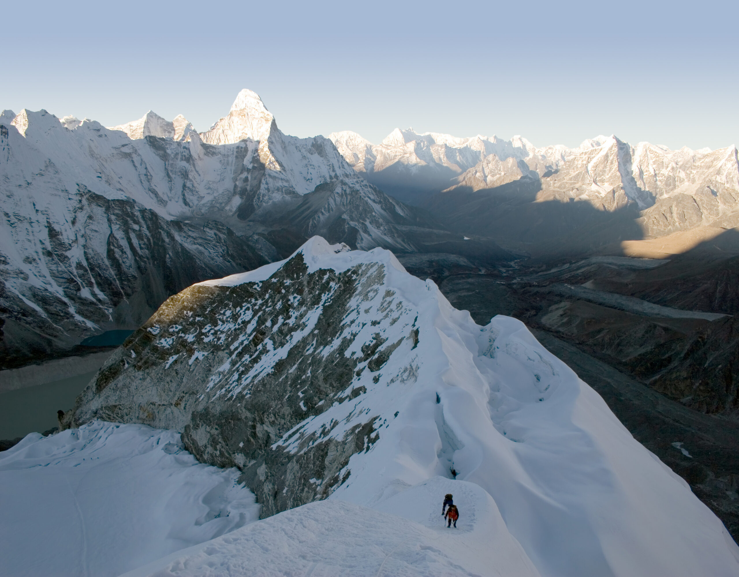
Why “trekking peak” misleads
The label sells the approach — not the summit day.
Island Peak is routinely called “beginner-friendly” or a “trekking peak.” All technically true, and all misleading. The mountain produces fatalities and evacuations every season, and the reasons cluster in four places:
| The real challenge | Why it bites |
|---|---|
| Altitude | Base camp sits at 5,087 m — above where most people have ever slept. Climbers without prior time over ~4,500 m often develop AMS before summit day even starts. |
| The fixed-line headwall | 100–200 m of 45–50° snow/ice climbed on an ascender. Move slowly and you cause a backup and chill at altitude; arrive with no rope practice and you cause summit-day delays. |
| The descent | Most accidents happen coming down the headwall — tired, after a pre-dawn start, when concentration is lowest. A good climb ends with a controlled descent, not just a summit. |
| A changing mountain | Khumbu glacial retreat is exposing more bare rock and new crevasses; recent seasons report more rockfall than the peak’s old snow-plod reputation suggests. |
The route & itinerary
One summit day, wrapped in the acclimatisation that makes it work.
The standard trip is 14–19 days (16 is typical), following the Everest corridor from Lukla up the Imja Valley to Chhukung and base camp. Only one of those days is the climb — the rest is the walk-in and the acclimatisation that determines whether you summit safely. Many climbers combine it with an Everest Base Camp trek (about 19 days), which adds altitude and the Kala Patthar viewpoint before the climb.
| Lukla (2,860 m) | Fly in; trek to Phakding, then Namche Bazaar (3,440 m) |
| Namche → Tengboche (3,867 m) | Acclimatisation day at Namche first; monastery at Tengboche |
| Dingboche (4,410 m) | Acclimatisation day (climb-high hike ~5,100 m); first Island Peak views |
| Chhukung (4,730 m) | Access village; pre-climb skills session (crampons, ascender, rope) |
| Base Camp — Pareshaya Gyab (5,087 m) | Move up; early night before the summit push |
| Summit day (6,189 m) | ~13–15 hours round trip; reserve day held for weather |
Summit day, hour by hour
Pre-dawn start, glacier, headwall, ridge — then the descent that matters most.
Base Camp (5,087 m) → Imja Tse (6,189 m)
A headlamp start on rocky ground leads to Crampon Point (~5,750 m), where you rope up for the glacier. Roughly 1.5 km of roped crevasse navigation brings you to the base of the headwall around first light — then the fixed-line ascent on the ascender, a short exposed summit ridge, and the top, usually reached mid-morning. Then it reverses: rappel or arm-wrap down the headwall, re-cross the glacier before the afternoon sun softens it, and back to camp by mid-afternoon.
Getting there (the Lukla question)
Yes, you may fly from a different airport — here’s why.
Everyone starts with the flight from Kathmandu to Lukla (about 30–35 minutes onto one of the world’s most dramatic runways), then treks. The part that surprises first-timers:
Permits & guides (2026)
A short stack of fees — and a guide is not optional.
Since 2023, Nepal bans solo trekking in its national parks, and its trekking peaks require an NMA-certified climbing guide — so in practice you climb Island Peak with a licensed operator who arranges everything below.
| Fee | 2026 rate | Notes |
|---|---|---|
| NMA climbing permit | $250–$350 | Spring/autumn (lower in winter/monsoon); per person |
| Sagarmatha National Park entry | ~$25 | NPR 3,000; SAARC nationals discounted |
| Khumbu Pasang Lhamu Rural Municipality | $20 | Local fee, paid at Lukla |
| Garbage deposit | $500 | Refundable with proper waste documentation |
| TIMS card | ~$15 | Trekkers’ information system; standard for Nepal treks |
What it costs in 2026
One of the best-value big-mountain trips going.
| Option | 2026 price (per person) | Notes |
|---|---|---|
| Budget Nepali operator | $1,800–$2,500 | Permits, teahouses, guides; some gear rental extra |
| Mid-range Nepali operator | $2,500–$3,500 | Meals, Lukla flights, Kathmandu hotel included |
| Premium international | $3,500–$4,500 | Western lead + Sherpa support, full logistics |
| Combined with Everest Base Camp | $3,500–$5,500 | ~19 days; adds EBC + Kala Patthar |
Add international flights to Kathmandu (~$1,200–$2,000), travel insurance with high-altitude helicopter-evacuation cover (mandatory, ~$300–$500), gear (owned or rented in Thamel), and crew tips. A realistic all-in trip budget is about $4,500–$8,500. If a quote looks suspiciously low, confirm that NMA permits, the garbage deposit, and Lukla flights are actually included.
Weather & when to climb
Two windows — and a summit far colder than any village reading.
Spring (April–May) is the primary season: warmer, stable, busiest, and aligned with the Everest season. Autumn (October–November) is the strong secondary window — crisp post-monsoon skies, drier trails, colder temperatures, fewer crowds. Avoid the summer monsoon (June–September) and deep winter (December–March), when most operators close. The live forecast below is for Chhukung, the staging village, and refreshes on load.
Chhukung — Island Peak staging village (~4,730 m)
Loading live data…Gear essentials
Full mountaineering kit — more than a trek, less than an 8,000er.
Unlike a non-technical trekking peak, Island Peak needs real climbing hardware. Operators often include the group technical gear and ropes; you bring your clothing system and boots (quality rental is available in Thamel). The core:
- Crampon-compatible mountaineering boots (B2/B3) + 12-point steel crampons, ice axe, harness, helmet.
- Ascender (jumar) plus belay/rappel device, locking and non-locking carabiners, and prusik cords for the fixed lines.
- Full layering system — base layers, fleece, an 800-fill down jacket rated to around −20°C, and a waterproof shell top and bottom; liner + heavy gloves plus spare mittens.
- Category 4 glacier glasses and goggles, high-SPF sunscreen — Himalayan glacier UV is intense.
- Sleeping bag to about −20°C, insulated bottles/thermos, headlamp with spare (lithium) batteries, and any altitude medication your doctor advises.
Frequently asked questions
How high and how hard is Island Peak?
6,189 m (20,305 ft). It’s a real but moderate mountaineering climb: roped glacier travel, a 100–200 m fixed-line headwall at 45–50°, and an exposed summit ridge. Altitude, cold, and a 13–15 hour summit day are the main challenges. Success rates run ~75–85% with good acclimatisation.
Do you need a guide?
Yes. Nepal requires an NMA-certified climbing guide for its trekking peaks, and solo trekking in the parks has been banned since 2023, so you’ll climb with a licensed operator.
How long does it take?
14–19 days (16 typical), of which just one is the summit day — the rest is approach and acclimatisation. Combined Island Peak + Everest Base Camp runs ~19 days.
How much does it cost in 2026?
About $2,200–$4,500 for a guided climb, or $3,500–$5,500 with EBC. All-in with flights, insurance, and gear, budget ~$4,500–$8,500. Permits: NMA $250–$350, park ~$25, local fee $20, refundable $500 garbage deposit, TIMS.
What’s the deal with flying via Ramechhap?
In peak seasons Nepal routes Lukla flights through Manthali Airport in Ramechhap (a 4–5 hour pre-dawn drive from Kathmandu) to ease airport congestion — a routine seasonal measure, not a one-off crisis. Off-season, flights usually go direct from Kathmandu.
When should I go?
Spring (Apr–May) is primary; autumn (Oct–Nov) is the strong secondary window with clearer skies and fewer crowds. Avoid monsoon (Jun–Sep) and deep winter.
How we built this
Research-based. This guide is compiled from the Nepal Mountaineering Association, current 2026 Lukla-flight and operator sources, and standard Khumbu route references, cross-checked for elevation, permits, logistics, and season. We corrected a widely repeated claim that the Lukla–Ramechhap routing stems from a “2026 fuel crisis” — it’s a long-standing seasonal congestion measure.
Permit fees, flight arrangements, operator pricing, and glacier conditions change between seasons. Treat the figures here as planning background and confirm current details with a licensed Nepali operator before booking.
Your first Himalayan summit — done right
Island Peak rewards climbers who respect it: a proper 14–19 day itinerary, a certified guide, prior altitude and rope practice, and the discipline to turn around. Get that right and you’ve got the ideal rehearsal for everything bigger.
What to climb before Everest →Nepal trekking peaks →
Was this helpful?
🏔Related guides
🧭Explore & compare
Global Summit Guide is an independent mountaineering resource founded in 2026. The team combines first-hand trekking and climbing experience with in-depth research and professional health and nutrition review to help climbers choose objectives, prepare properly, and stay safe.
Health, altitude, and nutrition content is reviewed by Taylor Ludlow (Registered Nurse) and Brigg Hoopes (Nutritionist).
What We Don't Know Yet
Mountain information changes quickly. This box explains the limits of what this page can responsibly promise.
- Visa, passport, vaccination, border, insurance, and local transportation rules may change before your trip.
- Route conditions, snowpack, closures, and weather can change quickly after this page is updated.
- Permit rules, fees, quotas, and reservation windows may change between review cycles.
- Operator availability, pricing, guide ratios, and cancellation terms can change by season.
- Your fitness, altitude response, risk tolerance, and experience level may change what is safe or realistic.
Verify current conditions with official land managers, guide services, local forecasts, and current route reports before booking or climbing.
Mountaineering, rock and ice climbing, glacier travel, and high-altitude activity are inherently dangerous and can result in serious injury or death. The information on Global Summit Guide is provided for general informational and educational purposes only and is not a substitute for professional instruction, qualified guiding, proper equipment, or your own judgment and experience.
Route conditions, weather, snowpack, permits, regulations, and hazards change constantly and may differ from what is described here. Details may be incomplete, out of date, or contain errors. Always verify current information with local authorities, certified guides, and official sources before making any decision in the mountains.
Nothing on this site is medical, legal, or financial advice. Our fitness, acclimatization, altitude, and nutrition content is general in nature; consult a qualified physician before beginning any strenuous exercise program or exposing yourself to high altitude.
You are solely responsible for your own safety and decisions. To the fullest extent permitted by law, Global Summit Guide and its team accept no liability for any loss, injury, damage, or expense arising from use of, or reliance on, this information. By using this site you acknowledge these risks and accept these terms.
Some links on this site may be affiliate links. If you buy through them we may earn a small commission at no extra cost to you; this never affects our recommendations.
Global Summit Guide recommendation path
Next Best Mountain to Research
Use these recommendations to continue the right planning path instead of stopping on one page.
Use current permit, weather, route, and operator information before booking or climbing.
Search Flights, Hotels & Rental Cars
Have the mountain or destination picked? Use Expedia to compare the flights, lodging and rental cars that fit your actual trip dates. For mountain travel, consider arriving early enough for delays and adding a buffer night after the climb before a fixed flight home.
Compare current flight, hotel and car options.
Affiliate disclosure: Global Summit Guide may earn a commission if you book through this link, at no additional cost to you.