
Last updated May 25, 2026
Climbing Piz Bernina 2026: The Only 4,000m Peak in the Eastern Alps, the Biancograt ‘Sky Ladder’ Route & the Highest Peak in Graubünden
At 4,049 meters, Piz Bernina holds a singular position in Alpine mountaineering — the only 4,000m peak in the entire Eastern Alps and the highest peak in canton Graubünden, Switzerland. The legendary Biancograt ridge — the “white ridge” or “sky ladder” — is widely considered one of the most beautiful snow ridges in the entire Alps. The 1850 first ascent by Johann Coaz, the 1878 Biancograt first ascent by Paul Güssfeldt, the classic 3-day Pontresina program with horse-drawn carriage approach — the complete 2026 climbing guide.
Piz Bernina occupies a uniquely distinctive position in European mountaineering. The peak isn’t the highest in the Alps — Mont Blanc holds that distinction at 4,810m. It isn’t even particularly tall by Alpine 4,000m standards, barely qualifying as a four-thousander at 4,049 meters. What Piz Bernina holds, definitively, is geographic singularity. The mountain is the only 4,000m peak in the entire Eastern Alps. It is also the highest peak in canton Graubünden (Grisons) — Switzerland’s largest and easternmost canton. The mountain stands isolated from the better-known Valais 4,000m peaks (Matterhorn, Dufourspitze, Weisshorn) by approximately 200 km, dominating the eastern Swiss Alps in extraordinary visual prominence. Switzerland Tourism notes that in terms of beauty and impact, Piz Bernina surpasses many other mountains of around the same height — a recognition the broader Alpine climbing community shares.
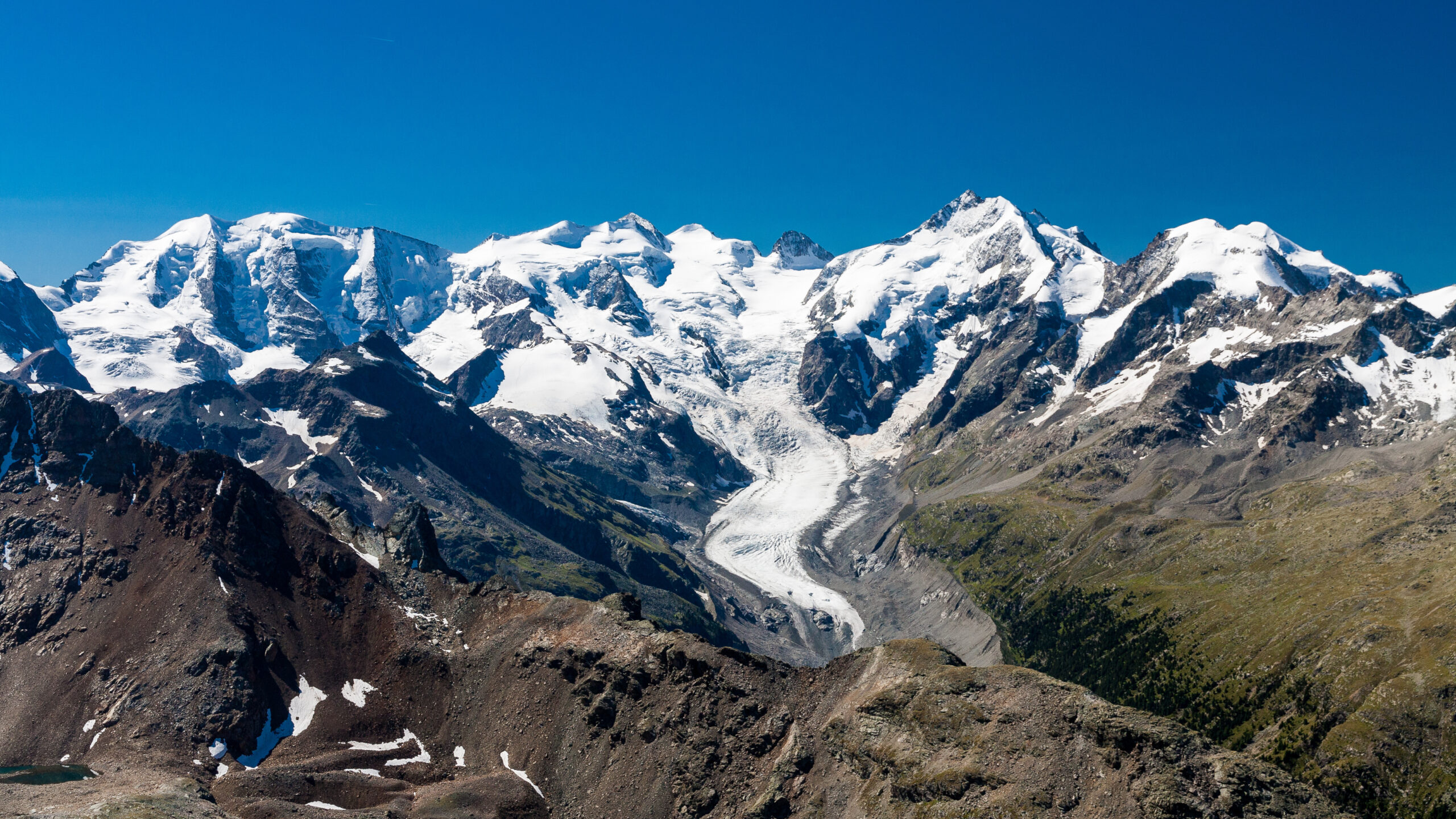
The mountain stands on the main Swiss-Italian watershed in the Bernina Range. It sits between the municipalities of Samedan and Pontresina in the canton of Graubünden. The actual highest point sits in Switzerland. Piz Bernina separates two major glacial valleys: the Tschierva Glacier to the west and the Morteratsch Glacier to the east. The mountain gives its name to the broader Bernina Massif. The massif stretches approximately 20 km east-west and 10 km north-south. It contains numerous notable peaks including Piz Palü (3,899m), Piz Roseg, Piz Morteratsch, and the legendary Pizzo Bianco (Piz Alv) fore-summit at 3,993m. The summit consists of two distinct but closely spaced tops connected by the famous Biancograt. Piz Bernina (4,049m) is the highest point. Piz Alv (Pizzo Bianco) is the white-ridged fore-summit — “alv” means “white” in the local Romansh dialect.
The climbing itself makes Piz Bernina genuinely special. The Biancograt — the “white ridge” or Crast’Alva — is one of the most famous ridges in the Alps. It is widely considered one of the most beautiful snow ridges in the entire range. The legendary Austrian climber Karl Blodig called it the most beautiful snow ridge in the Alps. The route winds dramatically from the Fuorcla Prievlusa col up to Piz Bianco, then continues over connecting ridge sections to Piz Bernina. The Biancograt rates AD+ on the French Alpine scale with UIAA III-IV rock sections and 40-50° ice slopes. The grade is considerably harder than F-grade easier 4,000m peaks like Allalin or Breithorn. However, it remains more achievable than the AD-D routes on harder Valais 4,000m peaks. The classic descent via the Spallagrat south ridge brings climbers down to the Italian Rifugio Marco e Rosa, often extended on day 3 with the traverse to Piz Palü.
Find Hotels, Flights & Trips for the World’s Best Hiking Destinations
The Global Summit Guide Travel Shop on Expedia — curated for outdoor adventurers, mountaineers, and serious hikers. Patagonia to the Alps. Nepal to the Rockies. Curated lodging for every region we cover.
Explore Travel Shop on Expedia →This guide covers what you need to climb Piz Bernina in 2026. The legendary Biancograt north ridge from the Tschierva Hut above Pontresina in detail. The Spallagrat south ridge as both descent route and standalone normal route option. The classic 3-day combined program with optional Piz Palü traverse extension. The 1850 first ascent by Swiss surveyor Johann Coaz — one of the early Alpine first ascents that predates the Golden Age of Alpinism. The legendary 1878 Biancograt first ascent by Paul Güssfeldt and guides Hans Grass and Johann Gross. Mountain hut accommodation at Tschierva, Boval, and Marco e Rosa. Pontresina approach logistics including the famous horse-drawn carriage ride into Val Roseg. Costs in CHF and EUR. And honest assessment of who should climb this peak. The Biancograt rewards prior alpine experience. Yet it remains achievable for prepared climbers seeking one of the Alps’ most aesthetic ridge climbs.
Piz Bernina At a Glance
The essential reference facts for Piz Bernina. Detailed sections follow below.
| Summit height in meters | 4,049 m (13,284 ft) — the highest peak in Graubünden canton |
|---|---|
| Native name | Piz Bernina (Romansh); also Pizzo Bernina (Italian) |
| Location | Bernina Range, on Swiss-Italian border |
| Country | Switzerland (highest point); border with Italy |
| Canton | Graubünden (Grisons), southeastern Switzerland |
| Coordinates | 46.3825°N, 9.9081°E |
| Unique distinction | Only 4,000m peak in the Eastern Alps |
| Canton ranking | Highest peak in canton Graubünden |
| Fore-summit | Piz Alv / Pizzo Bianco (3,993m) — “white” peak in Romansh |
| Mountain range | Bernina Range (Bernina Massif) |
| Adjacent glaciers | Tschierva Glacier (west); Morteratsch Glacier (east) |
| Famous ridge | The Biancograt — “white ridge” / “sky ladder” |
| First ascent | September 13, 1850 — Johann Coaz with Joan and Lorenz Ragut Tscharner from Bernina Suot |
| Biancograt first ascent | August 12, 1878 — Paul Güssfeldt with guides Hans Grass and Johann Gross |
| Biancograt difficulty | AD+ (Assez Difficile +) — UIAA III-IV rock, 40-50° ice |
| Spallagrat difficulty | AD (typically used for descent) |
| Biancograt summit day | 10-12 hours from Tschierva Hut; 1,500m elevation gain |
| Approach base | Pontresina (1,805 m) — Engadine valley village |
| Standard hut (Biancograt) | Chamanna da Tschierva / Tschierva Hut (2,584 m) — SAC, accessed via Val Roseg |
| Italian hut (descent) | Rifugio Marco e Rosa (3,597 m) — CAI, for Spallagrat descent |
| Alternative approach hut | Boval Hut (2,495 m) — for Spallagrat or Morteratsch approach |
| Trip duration | 2-3 days typical; 3-day Biancograt + Piz Palü traverse is the classic option |
| Best season | Mid-July to mid-September (peak mid-July to August) |
| 2026 guided cost | CHF 1,200-2,800 per person for 2-3 day programs |
| Gateway town | Pontresina (1,805 m) — accessible by Rhaetian Railway from Chur or via St. Moritz |
| Nearest airport | Zurich (ZRH) ~3 hours by train; Milan Malpensa (MXP) ~3 hours by car |
Why Piz Bernina being the only 4,000m peak in the Eastern Alps matters. The Alps are conventionally divided into Western Alps and Eastern Alps along an imaginary line approximately following the Rhine-Splügen-Lake Como axis. The Western Alps contain the vast majority of the 82 official 4,000m peaks — Mont Blanc Massif, Valais Alps, Bernese Alps, Pennine Alps. The Eastern Alps include the Bernina Range, Engadine Alps, Ötztal Alps, Stubai Alps, Dolomites, and Austrian Alps. Of all these Eastern Alpine ranges, only Piz Bernina reaches above 4,000 meters. Wildspitze (3,768m) in Austria’s Ötztal Alps comes closest but falls 281 meters short. For climbers pursuing comprehensive Alpine experience, Piz Bernina is the essential Eastern Alps objective. There’s no alternative if the goal is climbing in the eastern half of the range at 4,000m+ elevation. The mountain’s geographic uniqueness contributes considerably to its prestige in Alpine climbing culture.
Why Piz Bernina Earns Its Singular Reputation
Piz Bernina holds a specific position in European mountaineering. The mountain combines four distinguishing elements. First, status as the only 4,000m peak in the entire Eastern Alps. Second, the legendary Biancograt as one of the most aesthetic ridge climbs in the Alps. Third, the dramatic dual-summit configuration with Piz Bianco fore-summit. Finally, the classic 3-day Pontresina-based program that combines two famous summits in extraordinary scenery. The combination makes Piz Bernina both essential for completing Alpine 4,000m peak lists and individually worthwhile as a climbing objective.
The Only Eastern Alps 4,000er
The Eastern Alps stretch across Switzerland’s eastern cantons, Austria, the Italian Dolomites, and Slovenia. Throughout this vast mountain region, only Piz Bernina reaches above 4,000 meters. The nearest Eastern Alps competitor — Austria’s Wildspitze (3,768m) in the Ötztal Alps — falls 281 meters short. This geographic singularity gives Piz Bernina enormous prestige in Alpine climbing culture. Climbers pursuing comprehensive Alpine experience must come to the Bernina Massif. The mountain’s geographic isolation from the Western Alps 4,000m cluster also creates extraordinary visual prominence. Piz Bernina dominates the entire eastern Swiss Alps. The peak is visible from dozens of surrounding peaks and valleys. Pontresina, the standard approach village, sits at 1,805m in the Engadine valley with Piz Bernina visible from nearly everywhere in the town.
The Biancograt — “Sky Ladder” of the Alps
The Biancograt (literally “white ridge” in German, or Crast’Alva in Romansh meaning “white ridge”) is widely considered one of the most beautiful snow ridges in the entire Alps. Karl Blodig was the legendary Austrian alpinist who became the first person to climb all the Alpine 4,000m peaks. He explicitly called the Biancograt the most beautiful snow ridge in the Alps. The ridge winds dramatically from the Fuorcla Prievlusa col (3,430m) upward to Piz Bianco (3,993m), forming a sinuous arc of pure white snow against the surrounding glaciers. From below, the ridge appears as a heavenward ladder of snow — earning the nickname “sky ladder.” The climbing is sustained 40-50° snow and ice. Rock sections add UIAA III-IV difficulty. However, the aesthetic value far exceeds the technical demands. Climbers report the Biancograt creates one of the most memorable summit-day experiences in Alpine climbing. The combination delivers a perfect line, a dramatic glacier setting, and unforgettable views from Piz Bianco to Piz Bernina.
The Classic 3-Day Pontresina Program
The standard Piz Bernina climbing experience is a 3-day program from Pontresina that combines two famous summits with extraordinary alpine scenery. Day 1 begins at the Pontresina railway station with a horse-drawn carriage ride into Val Roseg. The traditional approach is a uniquely Alpine experience preserved from earlier eras when climbers traveled to remote huts by traditional means. From Val Roseg, climbers hike to the Chamanna da Tschierva (Tschierva Hut) at 2,584m. Day 2 is the Biancograt summit day. Climbers depart pre-dawn for ridge climbing to Piz Bianco and then Piz Bernina. The descent follows the Spallagrat to the Italian Rifugio Marco e Rosa at 3,597m. Day 3 typically extends with the Piz Palü traverse — across the Bellavista terrace and over the three Piz Palü summits (3,899m main summit) to Diavolezza cable car station. The combined program delivers two iconic Bernina Massif summits in three days with optimal hut logistics. Many experienced alpinists consider this 3-day program the single best Alpine climbing experience of its difficulty level.
The 1850 First Ascent — Pre-Golden Age Heritage
Piz Bernina was first climbed on September 13, 1850 by Swiss surveyor Johann Coaz with brothers Joan and Lorenz Ragut Tscharner — taking 12 hours from Bernina Suot. The 1850 ascent predates the famous Golden Age of Alpinism (1854-1865 when British climbers dominated Alpine first-ascent activity) by four years. The early timing makes Piz Bernina one of the earliest major Alpine first ascents. Coaz was a Swiss cartographer and forester whose first ascent was part of broader topographical survey work for the Swiss government. The Tscharner brothers were local mountain men who provided the route-finding competence. The Biancograt itself wasn’t climbed until August 12, 1878 — 28 years later — by Paul Güssfeldt with Swiss guides Hans Grass and Johann Gross. The Biancograt route quickly became established as the most aesthetic line on the mountain, eventually eclipsing the standard Spallagrat route in prestige despite being technically harder.
Karl Blodig and the Alpine 4,000m peak list. Karl Blodig (1859-1956) was the Austrian alpinist who became the first person to climb all the Alpine 4,000m peaks. He completed the feat in 1932 when he summited the final peaks on his list. Blodig’s pursuit established the modern concept of “the Alpine 4,000m peaks” as a recognized climbing achievement. The official list (now standardized at 82 peaks by the UIAA) requires Piz Bernina, making it essential for any modern climber pursuing all the Alpine 4,000m peaks. Blodig’s explicit praise of the Biancograt as the most beautiful snow ridge in the Alps carries particular weight given his extensive experience across all major 4,000m peaks. Modern climbers attempting the “all 82 4,000ers” goal must climb Piz Bernina. Most choose the Biancograt as their route. The route delivers both aesthetic value and one of the most rewarding climbs in the entire 4,000m peak project.
Who Should Climb Piz Bernina?
Piz Bernina sits at a specific position in Alpine mountaineering progression. The Biancograt is more demanding than F-grade easier 4,000m peaks but more achievable than the AD-D routes on harder peaks like Weisshorn or the Matterhorn. Honest pre-trip self-assessment matters considerably, particularly regarding snow ridge competence and rock climbing ability at UIAA III-IV.
Piz Bernina Is Appropriate For:
Climbers with prior 4,000m experience. Climbers who have successfully completed Gran Paradiso, Mont Blanc, Allalin, Breithorn, or other easier 4,000m peaks have the foundational altitude and glacier travel experience. Piz Bernina builds on this with sustained ridge climbing.
Climbers comfortable on exposed snow ridges. The Biancograt demands sustained focus on 40-50° snow and ice across an exposed ridge. Climbers who’ve experienced exposed ridge climbing on Mont Blanc’s Trois Monts route or similar terrain have the relevant foundation.
Climbers with UIAA III rock climbing ability. The Biancograt includes rock sections requiring UIAA III scrambling and UIAA IV moves on some sections. Climbers comfortable at this grade have the technical foundation. The Spallagrat descent also involves rappelling and downclimbing.
Climbers pursuing the Alpine 4,000m peak list. Piz Bernina is essential for anyone working through Karl Blodig’s list of Alpine 4,000m peaks. The mountain cannot be skipped — there’s no Eastern Alps alternative.
Climbers seeking an aesthetic ridge climb. The Biancograt is among the most beautiful ridge climbs in the Alps. Climbers prioritizing aesthetic line over difficulty find this peak extraordinary value.
Climbers wanting Engadine and Bernina Massif experience. The classic 3-day program combining Biancograt + Piz Palü provides exceptional exposure to the Eastern Alps’ premier climbing region. The Engadine valley culture, Pontresina hospitality, and Bernina Massif scenery offer Alpine experience distinct from the Valais or Mont Blanc regions.
Piz Bernina Is Not Appropriate For:
First-time 4,000m climbers. The Biancograt isn’t a first 4,000m peak. Climbers without prior 4,000m experience should build progression on Gran Paradiso, Allalin, or Mont Blanc first.
Climbers without snow ridge competence. The Biancograt’s sustained snow ridge climbing demands real ability with crampons and ice axe on steep snow. Climbers comfortable only with glacier walking face elevated risk.
Climbers without rock climbing ability. The UIAA III-IV rock sections aren’t optional. Climbers without rock climbing experience should take a course before attempting.
Solo climbers. The route’s exposure and complexity make solo attempts genuinely dangerous. Even experienced climbers should plan with partners or guides.
Climbers on rigid weather windows. The Biancograt demands good snow conditions. Climbers locked into specific dates face elevated risk. Build buffer days for weather flexibility.
Where Piz Bernina Fits in Your Alpine 4,000m Progression
| Stage | Peak / Experience | Difficulty | What it builds |
|---|---|---|---|
| Foundation | Italian Dolomites via ferrate, Gran Paradiso, Allalin | F to PD- | Alpine environment; basic 4,000m exposure |
| First 4,000m peaks | Breithorn, Mont Blanc Gouter route | F+ to PD | Basic glacier travel; first 4,000m summits |
| Snow ridge peaks | Mont Blanc Trois Monts route, Castor, Pollux | PD to PD+ | Snow ridge climbing; longer summit days |
| Piz Bernina step | Piz Bernina Biancograt | AD+ / UIAA III-IV | Sustained ridge climbing across snow/ice/rock; Eastern Alps experience |
| Combined Bernina program | Biancograt + Piz Palü traverse | AD+ multi-day | Two summits, multi-day stamina, hut culture |
| Technical 4,000m peaks | Matterhorn Hornli Ridge, Eiger Mittellegi | AD+ to D | Sustained technical climbing at altitude |
| Hard 4,000m peaks | Weisshorn East Ridge, Grandes Jorasses | AD to D+ | The hardest 4,000m normal routes |
| Complete Alpine 4,000ers | Karl Blodig’s full list of 82 peaks | Various | Where Piz Bernina sits as the essential Eastern Alps peak |
The Standard Routes Up Piz Bernina
Three principal routes serve Piz Bernina climbing. The Biancograt (north ridge) is the most famous and aesthetically prized. The Spallagrat (south ridge) is the technically easier normal route, typically used for descent. The Fuorcla Crast’ Agüzza approach from the Marco e Rosa Hut serves the Spallagrat as both ascent and descent.
| Route | Side | Difficulty | From hut to summit | Usage |
|---|---|---|---|---|
| Biancograt (north ridge) | North | AD+ / UIAA III-IV / 40-50° ice | 5-7 hrs from Tschierva Hut | ~60% of climbers |
| Spallagrat (south ridge) | South | AD / III | 3-4 hrs from Marco e Rosa Hut | ~30% of climbers (mostly descent) |
| Morteratsch Glacier / Spallagrat | East-south | AD / multi-day approach | From Boval Hut via Fuorcla Crast’ Agüzza | ~10% of climbers |
Route 1: The Biancograt — “White Ridge / Sky Ladder” (Most Famous — 60% of climbers)
The Biancograt is the legendary climbing line on Piz Bernina and widely considered one of the most beautiful ridge climbs in the Alps. The route ascends from the Tschierva Hut (2,584m) above Pontresina. It crosses the Tschierva Glacier and climbs to the Fuorcla Prievlusa col. Then it follows the sinuous Biancograt snow ridge to Piz Bianco (3,993m). A final rock-and-ridge section reaches the main summit of Piz Bernina (4,049m). The standard descent uses the Spallagrat south ridge to the Italian Rifugio Marco e Rosa, often extended with the Piz Palü traverse on day 3.
The Full Route Progression
- Day 1 — Pontresina to Tschierva Hut (1,805 → 2,584m): Meet at Pontresina railway station, typically morning departure. Take horse-drawn carriage from Pontresina into Val Roseg — a uniquely traditional Alpine approach. Hike from the Roseg-Inn (1,999m) to the Tschierva Hut. Approximately 3-4 hours total approach with the carriage option, or 4-5 hours fully on foot. Mountain bike rental is available as an alternative. The hut features bunk accommodation with half-board meals and Swiss Alpine Club hospitality. Many parties also do a glacier training session on the Tschierva Glacier on day 1 afternoon to refresh crampon and ice axe technique.
- Tschierva Hut overnight (2,584m): SAC hut named for the Tschierva Glacier and stags (Romansh “tschierv” = stag). The hut wardens often report stags calling near the hut throughout the night during rutting season. Early dinner and bed for the pre-dawn summit attempt. Reservations essential — book 2-3 months ahead for peak season.
- Day 2 — Summit day departure 03:00-04:30: Pre-dawn breakfast and departure with headlamps. Cool temperatures even in summer at 2,584m.
- Approach to Fuorcla Prievlusa (2,584-3,430m): Initial climb directly above the hut on a well-marked path that gains elevation steadily. At the second fixed-rope section, traverse right (southeast) to avoid ending up on Piz Morteratsch. Continue on a steadily ascending traverse above the Vadret da Tschierva glacier following reflective markers. Descend briefly onto the glacier before the final approach to Fuorcla Prievlusa col (3,430m). Approximately 2-3 hours from hut to col.
- Sunrise at Fuorcla Prievlusa: Most parties arrive at the col around sunrise — extraordinary alpenglow on Piz Bianco and the Biancograt ahead. Brief rest, hot drink, gear check, and rope team configuration adjustment.
- Easy climbing to the Biancograt base (3,430-3,500m): From the col, easy well-secured climbing brings climbers to the beginning of the actual Biancograt ridge. Belay points are well-established.
- The Biancograt snow ridge (3,500-3,993m): The legendary “white ridge” — approximately 2 hours of sustained ridge climbing on 40-50° snow and ice to reach Piz Bianco (3,993m). The ridge winds dramatically with exceptional exposure on both sides. This is the most photogenic and aesthetically rewarding section of the climb. Pace varies with conditions — firm snow allows fast progress while softer afternoon snow demands more careful technique.
- Piz Bianco (3,993m) — the white fore-summit: The fore-summit named “alv” (white in Romansh) for its constantly snow-covered character. Brief stop for water, food, and photographs. The connecting ridge to Piz Bernina is visible from here.
- Connecting ridge to Piz Bernina (3,993-4,049m): Approximately 1 hour of ridge climbing with ascending and descending sections over ridge towers. UIAA III rock sections require careful movement. The terrain is more technical than the Biancograt snow ridge below.
- Summit at 4,049m — Piz Bernina: The highest peak of the Eastern Alps and canton Graubünden. Extraordinary 360-degree panorama — Piz Palü, the Bernina Massif, the Engadine valley, Mont Blanc to the west on clear days, the Ötztal Alps to the east. Stay 30-45 minutes for photos and absorption.
- Descent via Spallagrat (4,049-3,597m): The standard descent route uses the Spallagrat south ridge with firn slopes and several rappelling points. Approximately 1-2 hours of careful descent to the Italian Rifugio Marco e Rosa at 3,597m. The descent crosses the Swiss-Italian border at the summit ridge.
- Rifugio Marco e Rosa overnight (3,597m): Italian CAI hut named for Marco Anatole and Rosa Schaibler — the hut wardens of an earlier era. The hut provides bunk accommodation, half-board, and Italian alpine cuisine. Total day 2 from hut to hut: 10-12 hours with 1,500m gain and 500m descent.
- Day 3 (optional) — Piz Palü traverse: Sunrise departure from Marco e Rosa onto the Bellavistaterrasse to the start of the Spinasgrat on Piz Palü. Traverse of the three Piz Palü summits with extraordinary panoramic views — main summit at 3,899m. Normal route descent to Diavolezza cable car station for return to Pontresina.
Strengths
- The most beautiful snow ridge in the Alps (Blodig)
- Only 4,000m peak in the Eastern Alps
- Classic 3-day Pontresina program
- Combined with Piz Palü traverse option
- Horse-drawn carriage approach to Val Roseg
- Two summits in one tour (Piz Bianco + Piz Bernina)
Considerations
- AD+ demands sustained ridge competence
- UIAA III-IV rock requires climbing skills
- 40-50° snow demands ice axe technique
- 10-12 hour summit day is long
- Spallagrat descent demands focus when tired
- Tschierva Hut reservations fill 2-3 months ahead
Route 2: Spallagrat (South Ridge) — Standard Normal Route (30% of climbers)
The Spallagrat is the technically easier normal route up Piz Bernina from the Italian (south) side. The route ascends from Rifugio Marco e Rosa (3,597m) via firn slopes, mixed climbing sections, and a final ridge to the summit. The approach to Marco e Rosa is itself considerable — typically from the Italian Forno valley or via the Fuorcla Crast’ Agüzza from the Diavolezza cable car. While technically easier than the Biancograt, the Spallagrat lacks the iconic aesthetic of the white ridge and is climbed by relatively few parties as an ascent route. Most climbers experience the Spallagrat as the descent from the Biancograt traverse. Climbers wanting the technically easier route up Piz Bernina without the Biancograt’s challenge can use the Spallagrat as an ascent — though they miss the mountain’s most famous feature.
Route 3: Fuorcla Crast’ Agüzza Approach via Boval Hut (10% of climbers)
The Fuorcla Crast’ Agüzza approach offers an alternative for climbers wanting to climb the Spallagrat from the Swiss side without the multi-day Italian approach. The route starts at the Diavolezza cable car station (2,978m). It crosses the upper Morteratsch Glacier and climbs to the Fuorcla Crast’ Agüzza col (3,601m). Then the route connects with the Spallagrat ridge. The Boval Hut (2,495m) on the Morteratsch Glacier provides an alternative starting point for parties wanting a lower approach. The route is less common than the Biancograt or pure Spallagrat approaches but offers genuine Swiss-side experience without the Italian hut requirements. Total summit day from Diavolezza or Boval typically runs 8-10 hours.
Piz Bernina Climbing History: From 1850 to 2026
The name “Barnyna” appears in historical records from 1429, when the alpine pasture below the mountain was sold to the municipality of Bondo in Bergell. This is the earliest known recorded name for the area that would later become Piz Bernina. The name’s etymology is debated but likely derives from a Romansh or pre-Roman Alpine word. The mountain itself was a known regional landmark for centuries before the first ascent. The peak’s location at the intersection of Romansh-speaking Graubünden and Italian-speaking valleys created multilingual naming traditions.
The early 19th century brought increasing Swiss government interest in topographic surveying of the Alps. Multiple survey expeditions explored the Bernina Massif. Local mountain men in Pontresina and Bondo developed extensive familiarity with the lower mountain. Piz Bernina remained unclimbed despite growing topographical interest. The mountain was widely considered the obvious objective for any major Eastern Alps climbing achievement, but the technical challenges of the upper sections deterred early attempts.
Piz Bernina was first climbed on September 13, 1850 by Swiss surveyor Johann Coaz with brothers Joan and Lorenz Ragut Tscharner — taking 12 hours from Bernina Suot. Coaz was a Swiss cartographer and forester whose first ascent was part of broader topographical survey work for the Swiss government. The ascent route is debated but likely followed terrain that would later become parts of the Spallagrat. The 1850 ascent predates the famous Golden Age of Alpinism (1854-1865 when British climbers dominated Alpine first ascents) by four years. The timing makes Piz Bernina one of the earliest major Alpine first ascents. It was also the first 4,000m peak in the Eastern Alps to be climbed.
Through the 1850s-1870s, Piz Bernina became established as a sought-after climbing objective. British alpine climbers including members of the Alpine Club (founded 1857) made occasional ascents. The Swiss Alpine Club (Schweizer Alpen-Club, SAC) was founded in 1863, just 13 years after the Piz Bernina first ascent. The SAC began establishing the hut infrastructure that supports modern climbing. The Spallagrat south ridge was established as the standard route during this era. Multiple alternative routes were explored on the dramatic north and east faces but none became standard.
The legendary Biancograt was first climbed on August 12, 1878 by German alpinist Paul Güssfeldt with Swiss guides Hans Grass and Johann Gross. The ascent took 600 meters of climbing with 1,500 meters of overall elevation gain from the Chamanna da Tschierva. The Biancograt’s combination of aesthetic line, sustained difficulty, and dramatic setting quickly established the route as one of the most prized ridge climbs in the Alps. Within decades, the Biancograt would eclipse the Spallagrat in prestige among serious alpinists. The route’s grade of AD+ with UIAA III-IV rock and 40-50° ice made it a significant achievement for the era.
The late 19th century saw construction of the mountain huts that support modern Piz Bernina climbing. The Tschierva Hut was originally built in this era and has been rebuilt multiple times since. The Boval Hut on the Morteratsch Glacier dates from the same period. The Rifugio Marco e Rosa was built later on the Italian side. The Romantic era of Alpine climbing celebrated peaks like Piz Bernina as both physical and spiritual objectives. Climbing literature from this era frequently featured the Biancograt as an emblematic Alpine line. The Bernina Massif became firmly established as one of Switzerland’s premier alpine climbing destinations.
Through the early 20th century, Piz Bernina became firmly established as a major Alpine climbing objective. The two World Wars interrupted climbing activity significantly, but Swiss alpinism remained more active than Austrian or German due to Switzerland’s neutrality. The Karl Blodig 4,000m peaks project established Piz Bernina as essential for any serious Alpine climber pursuing comprehensive 4,000m peak achievement. Blodig completed all the Alpine 4,000m peaks by 1932 and explicitly praised the Biancograt as the most beautiful snow ridge in the Alps. The mountain became firmly fixed in Alpine climbing literature.
The mid-20th century brought modern technical climbing standards to Piz Bernina. Italian and Swiss alpinists established harder variations on the east face and north face. The classic 3-day program combining Biancograt + Piz Palü emerged as the standard “Bernina experience” during this era. Commercial guiding from Pontresina and the Bergsteigerschule Pontresina (mountain guide school) became established. The Tschierva Hut and Marco e Rosa Hut were modernized while maintaining their traditional alpine character. Annual climbing numbers grew steadily.
The late 20th century saw international guide operators add Piz Bernina to their Alpine portfolios. UK, German, and Italian operators began offering structured Biancograt programs targeting climbers from across Europe and North America. The mountain became established as one of the essential Alpine 4,000m climbing experiences. The horse-drawn carriage approach from Pontresina to Val Roseg was preserved as a uniquely traditional alpine experience contrasting with the cable-car-heavy approaches to other 4,000m peaks. Annual climbing numbers stabilized at considerable but not overcrowded levels.
The 2010s brought visible impacts of climate change to the Bernina Massif. The Tschierva and Morteratsch glaciers retreated significantly. Snow conditions on the Biancograt became less reliable, with later-season climbing facing increasing risk of bare rock or thin snow on the ridge. Crevasse patterns evolved as glaciers thinned. Some traditional approach routes to the Tschierva Hut required modifications as glacier surfaces dropped. Climbers approaching the mountain in modern conditions face evolving route conditions that differ from older guidebook descriptions. The hut wardens at Tschierva and Marco e Rosa increasingly play roles in advising parties on current conditions.
The COVID-19 pandemic affected Piz Bernina climbing during 2020 with European travel restrictions. Swiss alpine tourism was reduced during 2020 but recovered through 2021-2022. The Tschierva Hut and Marco e Rosa Hut implemented health protocols including capacity management and pre-booking systems. The Swiss-Italian border created some additional logistical complexity during the pandemic but didn’t prevent the classic 3-day program from operating. Post-pandemic climbing returned to typical levels by 2022.
The 2023-2025 climbing seasons saw continued strong demand for Piz Bernina among Alpine climbers, particularly those pursuing the Alpine 4,000m peak list. IFMGA Swiss and Italian guide services run regular programs throughout July and August. The Bergsteigerschule Pontresina continues operating as the traditional Pontresina-based guide service. International operators continue offering Biancograt programs combined with Piz Palü traverses. The Tschierva Hut and Marco e Rosa Hut operate at capacity during peak weeks — reservations essential. 2026 climbing season is currently active with the late June through mid-September window. Glacier retreat continues affecting approach routes but the mountain remains genuinely climbable for prepared parties.
The Biancograt Beauty: Why This Ridge Is Considered the Most Beautiful in the Alps
The Biancograt’s reputation as the most beautiful snow ridge in the Alps deserves examination. What specifically makes this ridge stand out from other classic Alpine ridge climbs? And what creates its iconic visual character?
Karl Blodig’s Authoritative Praise
Karl Blodig (1859-1956) was the first person to climb all the Alpine 4,000m peaks — completing the list by 1932 after decades of pursuit. Blodig’s experience encompassed essentially every major ridge climb in the Alps. His explicit designation of the Biancograt as the most beautiful snow ridge in the Alps carries unique weight. Blodig wasn’t a casual observer praising one peak among few options. He was the most experienced 4,000m climber of his era. His judgment came from direct comparison against every other major Alpine ridge. The judgment has held up through subsequent generations. Modern alpinists with similar comprehensive Alps experience generally agree with Blodig’s assessment, though some prefer alternatives like the Weisshorn Schalligrat or the Eiger Mittellegi Ridge. The breadth of expert opinion supporting Blodig’s view establishes the Biancograt’s status as genuinely exceptional.
The Physical Characteristics That Create the Beauty
| Characteristic | Why It Creates Aesthetic Value |
|---|---|
| Pure white snow throughout | The constantly snow-covered character (hence “alv” / “bianco” = white) creates uniform visual purity unlike rock ridges |
| Sinuous winding shape | The ridge curves dramatically rather than running straight — creating visual interest that straight ridges lack |
| Dramatic glacier setting | The Tschierva Glacier flowing below creates a stunning visual contrast and frames the ridge |
| Heaven-pointing angle | The ridge angles steeply upward, creating the “sky ladder” appearance from below |
| Visible from Pontresina | The ridge is fully visible from the gateway village — climbers see exactly what they’ll climb |
| Dual-summit configuration | Climbing up to Piz Bianco then continuing to Piz Bernina creates dramatic visual progression |
| Approachable difficulty | AD+ grade means many alpinists can experience the ridge — wider accessibility than D-grade routes |
| Eastern Alps singularity | No competing 4,000m ridges in the Eastern Alps amplifies the visual dominance |
The “sky ladder” appearance from below. When viewed from Pontresina or the Engadine valley looking south toward the Bernina Massif, the Biancograt creates a striking visual impression. A long white ridge angles steeply upward from the Fuorcla Prievlusa to Piz Bianco. The ridge appears as if connecting earth to sky. The German term “Himmelsleiter” (heaven ladder) and the modern English “sky ladder” both capture this visual character. The ridge’s sinuous curve, combined with the steeply angled approach and the white snow throughout, creates one of the most photographed alpine features in Switzerland. Climbers approaching the Tschierva Hut on day 1 of the standard program see the Biancograt during the approach hike from Val Roseg. The early sighting provides visual anticipation of the next day’s climb. The visual impact is part of the psychological experience of climbing the route.
Piz Bernina Summit Day Timeline: Hour-by-Hour from Tschierva Hut
Summit day on Piz Bernina via the Biancograt typically runs 10-12 hours. The route goes from the Tschierva Hut (2,584m) to the summit at 4,049m. Then climbers descend to the Marco e Rosa Hut at 3,597m. Strong, well-conditioned teams complete the round trip in 9-10 hours. Slower parties may take 12-14 hours.
Standard Piz Bernina Biancograt Summit Day — Tschierva Hut to Summit and Marco e Rosa Descent
Which Piz Bernina Approach Fits Your Situation?
The choice on Piz Bernina involves route selection, program length, operator decision, and prior experience assessment. Use this matrix to match yourself.
Match Yourself to a Piz Bernina Approach
When to Climb Piz Bernina: Season-by-Season Analysis
Mid-July to Mid-August: Peak Season
The prime Piz Bernina climbing window. The Biancograt is generally in good condition with firm snow on the ridge, the Tschierva Hut and Marco e Rosa operate at full capacity, and trail conditions are excellent. Trade-off: hut reservations require booking 2-3 months ahead during peak weeks. The Engadine valley afternoon thunderstorms are common — climbers should plan to be on descent by early afternoon. Most successful Biancograt summits occur during this window.
Late August to Early September: Sweet Spot
Many experienced Swiss climbers consider this the optimal Piz Bernina window. Conditions remain excellent with somewhat less afternoon weather instability. Crowds drop noticeably from peak summer. Hut reservations easier to obtain. The Engadine valley larch trees begin showing early autumn colors. Daylight remains adequate for the long summit day.
Mid-September to Early October: Autumn Window
The autumn window brings stable weather, golden larch colors throughout Val Roseg and the approach, and significantly reduced crowds. The Tschierva Hut typically closes in mid-to-late September depending on weather. Temperatures drop noticeably — start with warmer layers than summer. Early October can bring first new snow on the Biancograt that creates winter-style conditions. Climbers attempting after Tschierva Hut closure must use the Boval Hut alternative or descend to Pontresina between summits.
Late June to Early July: Early Season
Early July can have heavy snow on the upper Biancograt with snow bridges over crevasses typically stronger early in the season. The approach to Tschierva Hut may have remaining snow patches. The Biancograt’s snow conditions are typically firm and reliable in this window — sometimes better than peak summer. Daylight is at its longest. The Tschierva Hut typically opens in late June depending on snow conditions.
October-May: Off-Season
Winter Piz Bernina ascents become serious alpine mountaineering objectives requiring considerable winter experience. The Tschierva Hut closes for the season. Avalanche risk on the approach to Fuorcla Prievlusa is genuine throughout winter. Some experienced ski mountaineers approach the Bernina Massif during stable spring conditions for ski tours that don’t reach the main summit. The Biancograt itself isn’t typically climbed in winter due to the combined avalanche, cold, and route condition challenges.
Climbing Piz Bernina in 2026: Cost Breakdown (CHF / EUR)
Piz Bernina climbing pricing reflects the Biancograt’s serious nature, the standard 1:2 or 1:1 guide ratios, and Swiss alpine operator costs. The peak is moderately priced compared to harder peaks like Weisshorn but more expensive than easier 4,000m peaks like Allalin.
2026 Guided Expedition Pricing
| Operator Tier | 2026 Cost (CHF / EUR) | What’s Included |
|---|---|---|
| Biancograt 2-day program (1:2 ratio) | CHF 1,200-1,600 / €1,280-1,710 | Certified Swiss/Italian guide, Tschierva Hut overnight; 2 climbers per guide |
| Biancograt 3-day program (1:2 ratio) | CHF 1,400-1,900 / €1,490-2,030 | 3-day classic program with carriage approach, both huts; better acclimatization |
| Biancograt + Piz Palü traverse (3-day) | CHF 1,800-2,800 / €1,920-2,990 | The complete Bernina experience with both summits; classic program |
| Private 1:1 guiding | CHF 2,200-3,000 / €2,350-3,200 | Dedicated guide attention; custom dates; flexible itinerary |
| Bergsteigerschule Pontresina program | CHF 1,500-2,500 / €1,600-2,670 | Traditional Pontresina-based local guide service; authentic local experience |
| Multi-week Alpine program with Bernina | CHF 4,000-6,500 / €4,270-6,940 | Combined with other 4,000m peaks; ideal for Alpine 4,000ers list pursuit |
2026 Independent Trip Cost Breakdown
| Cost Component | 2026 Amount (CHF) | Notes |
|---|---|---|
| Tschierva Hut (1 night) | CHF 80-110 | Half-board (bed, dinner, breakfast); SAC members 50% discount |
| Rifugio Marco e Rosa (1 night) | €70-€95 | Italian CAI hut; half-board; CAI/SAC reciprocal discounts apply |
| Boval Hut (alternative, 1 night) | CHF 80-110 | SAC hut; alternative starting point |
| Hut additional nights | CHF 80-110/night | For weather flexibility or post-summit recovery |
| Pontresina accommodation | CHF 120-280/night | Hotels, B&Bs in the Engadine village; pre/post trip |
| Restaurant meals (Pontresina) | CHF 35-80/day | Swiss cuisine; meal prices typical for Engadine valley |
| Horse-drawn carriage (Pontresina to Val Roseg) | CHF 25-40 | One-way; the famous traditional approach |
| Train to Pontresina (from Zurich) | CHF 80-150 round trip | SBB to Chur, then Rhaetian Railway to Pontresina; Half-Fare Card discount |
| Diavolezza cable car (for day 3) | CHF 25-35 | Round trip for Piz Palü return descent |
| Personal climbing gear (if buying) | CHF 0-1,000 | Helmet, harness, crampons, ice axe, mountaineering boots |
| International flights to Zurich/Milan | CHF 100-450 | Zurich ZRH for Swiss approach; Milan MXP for Italian access |
| Travel insurance (alpine) | CHF 30-100 | Should cover Swiss/Italian alpine rescue |
| SAC annual membership | CHF 100-150 | Pays for itself within one Bernina trip through hut discounts |
| Total 3-day independent budget | CHF 500-1,000 | Excluding flights and existing gear |
| Total guided trip including flights | CHF 2,000-3,500 | Most climbers use guided programs for safety and route knowledge |
The Swiss-Italian border on Piz Bernina. Piz Bernina sits on the Swiss-Italian watershed with the highest point in Switzerland but the descent route (Spallagrat) crossing into Italy at the Rifugio Marco e Rosa. Climbers should carry passports and travel insurance valid in both countries. The Swiss-Italian border crossing at the summit ridge is informal with no checkpoints. However, climbers should be prepared for border verification at lower-elevation crossings if combining with Italian travel. The Marco e Rosa Hut is operated by the Italian Alpine Club (CAI) with hut wardens speaking primarily Italian; some German and English communication is also possible. Climbers staying at Marco e Rosa benefit from CAI/SAC reciprocal arrangements for member discounts. The combination of two countries, two alpine clubs, and two language environments adds cultural richness to the standard Bernina climbing experience.
Gear Checklist for Piz Bernina
Piz Bernina gear requirements emphasize alpine ridge climbing kit for the Biancograt’s combination of snow ridge, ice, and UIAA III-IV rock. The 10-12 hour summit day demands lightweight but complete equipment. The 3-day program with hut overnights means climbers pack moderately.
Technical Climbing Gear
- Climbing helmet (REQUIRED) — non-negotiable for the ridge climbing and rockfall hazards
- Climbing harness — alpine harness; lightweight design preferred
- Crampons — 12-point general mountaineering or technical crampons; semi-automatic mounts essential — see our Crampons Buyer’s Guide
- Ice axe (1 general mountaineering) — straight-shaft or slightly curved; lightweight design — see our Ice Axe Guide
- Mountaineering boots — B2 boots compatible with semi-automatic crampons; sturdy ankle support
- 30m alpine rope — guides typically carry; independent parties bring
- Crevasse rescue kit — pulleys, prusiks, slings; competence required
- Locking carabiners (3-4)
- Non-locking carabiners (3-4)
- Slings/runners (3-4)
- Belay/rappel device — essential for Spallagrat descent rappels
- Ice screw (1-2) — for ice climbing sections and protection on the Biancograt
Clothing System
- Base layer top and bottom — merino or synthetic; pre-dawn 03:00 temperatures cold
- Soft shell pants — for ridge climbing
- Hardshell pants — for weather protection on summit ridge
- Mid-layer fleece or insulated jacket — for cool starts and summit stops
- Light insulated jacket (down or synthetic) — for summit stops at 4,049m
- Hardshell jacket — Gore-Tex or equivalent; weather protection essential
- Warm hat / beanie
- Light gloves and warm gloves — multiple pairs essential for the long summit day
- Mountaineering socks (2 pairs) — merino wool
Pack & Hut Items
- 30-40L summit pack — for summit day from hut; lightweight design
- Trekking poles — useful for the approach to Tschierva Hut
- Gaiters — for snow sections
- Hut essentials: sleeping bag liner (huts provide bedding); personal toiletries; earplugs; slippers/sandals (SAC and CAI hut etiquette)
- Cash for huts (CHF and EUR) — Swiss huts often cash-only; Italian huts increasingly accept cards but cash safer
- SAC/CAI/Alpine Club membership card — for discounted hut rates and reciprocal arrangements
- Passport — for Swiss-Italian border crossing at Marco e Rosa Hut
Food, Water, and Safety
- Water capacity 2-3L for summit day — limited water on upper route
- High-energy summit day food — bars, gels, sandwiches; calorie-dense
- Sunscreen SPF 50+ and lip balm with SPF — high altitude UV severe
- Glacier glasses (Cat 4) plus backup pair
- Goggles (storm-rated) — useful for whiteout conditions on the Biancograt
- Personal first aid kit — blisters, ibuprofen, basic supplies
- Headlamp with spare batteries — ESSENTIAL for pre-dawn 03:30 starts
- Emergency bivy — for unexpected weather or injury
- Satellite communicator or PLB — recommended for the high-alpine terrain
- Map and compass
- GPS with route loaded — recommended for whiteout navigation
- Travel insurance documentation — must cover Swiss/Italian alpine rescue
Frequently Asked Questions About Climbing Piz Bernina
How tall is Piz Bernina and where is it located?
Piz Bernina rises to 4,049 meters (13,284 feet) in the Bernina Range on the Swiss-Italian border. The coordinates are 46.3825°N, 9.9081°E. The mountain is the highest peak in the canton of Graubünden (Grisons) in southeastern Switzerland, and notably the only 4,000m peak in the entire Eastern Alps. The summit sits on the main Swiss-Italian watershed between the municipalities of Samedan and Pontresina, with the highest point situated in Switzerland. Piz Bernina separates two glacial valleys — the Tschierva Glacier to the west and the Morteratsch Glacier to the east. The summit consists of two distinct tops: Piz Bernina (4,049m) and Piz Alv (Pizzo Bianco, 3,993m).
How difficult is climbing Piz Bernina?
Piz Bernina’s most famous route, the Biancograt, is rated AD+ on the French Alpine scale — moderate to serious difficulty with UIAA III-IV rock sections and 40-50° ice slopes. The normal Spallagrat route is somewhat easier at AD grade. The Biancograt summit day typically runs 10-12 hours with 1,500m elevation gain from the Tschierva Hut. Climbers need good high-alpine fitness, prior glacier travel experience, comfort on exposed snow ridges, and basic rock climbing competence up to UIAA III. The route demands more technical competence than easier 4,000m peaks like Allalin or Breithorn but less than harder peaks like Weisshorn or the Matterhorn.
What’s the standard route up Piz Bernina?
Two routes dominate Piz Bernina climbing. The Biancograt (north ridge) is the most famous and aesthetically prized. The route climbs the legendary ‘white ridge’ from the Tschierva Hut above Pontresina via the Fuorcla Prievlusa to Piz Bianco (3,993m). Then a connecting ridge leads to Piz Bernina (4,049m). The Spallagrat (south ridge) is the standard normal route — typically used for descent from the summit to the Italian Rifugio Marco e Rosa (3,597m). Most climbers do a combined 3-day Biancograt-up / Spallagrat-down traverse, often extended with the Piz Palü traverse on day 3. The classic 3-day program starts from Pontresina with a horse-drawn carriage ride into Val Roseg.
When is the best time to climb Piz Bernina?
The Piz Bernina climbing season runs from late June through mid-September, with the optimal window being mid-July through August. The Biancograt typically requires firm snow conditions on the ridge — July and August generally provide the most reliable conditions. The Tschierva Hut, Boval Hut, and Rifugio Marco e Rosa all operate during this season. September brings cooler conditions and reduced crowds but increasing chance of new snow. Pre-dawn departures around 03:00-04:00 from the Tschierva Hut are standard for the Biancograt summit day. Afternoon thunderstorms are common in summer. Winter ascents are reserved for experienced winter alpinists.
How much does climbing Piz Bernina cost in 2026?
Climbing Piz Bernina via the Biancograt typically runs CHF 1,200-2,200 per person (approximately €1,280-2,340) for a 2-3 day guided program with an IFMGA/UIAGM-certified Swiss or Italian guide. Combined Biancograt + Piz Palü traverse programs run CHF 1,800-2,800 per person. Private 1:1 guiding runs CHF 1,800-3,000. Independent climbers should budget CHF 300-600 per day including Tschierva Hut accommodation (CHF 80-110 per night with half-board, SAC members 50% discount). The horse-drawn carriage from Pontresina to Val Roseg costs CHF 25-40 per person. Total trip budget including international flights typically runs CHF 1,800-3,500 for guided climbers.
Who first climbed Piz Bernina?
Piz Bernina was first climbed on September 13, 1850 by Swiss surveyor Johann Coaz with brothers Joan and Lorenz Ragut Tscharner — taking 12 hours from Bernina Suot. Coaz was a Swiss cartographer and forester whose first ascent was part of broader topographical survey work for the Swiss government. The 1850 ascent predates the famous Golden Age of Alpinism (1854-1865) by four years, making Piz Bernina one of the earliest major Alpine first ascents. The legendary Biancograt itself wasn’t climbed until August 12, 1878 — 28 years later — by German alpinist Paul Güssfeldt with Swiss guides Hans Grass and Johann Gross.
What is the Biancograt and why is it famous?
The Biancograt — literally “white ridge” in German or Crast’Alva in Romansh — is the most famous climbing route on Piz Bernina. It is widely considered one of the most beautiful snow ridges in the entire Alps. Karl Blodig — the first person to climb all the Alpine 4,000m peaks — explicitly called the Biancograt the most beautiful snow ridge in the Alps. The ridge winds dramatically from the Fuorcla Prievlusa col (3,430m) upward to Piz Bianco (3,993m) as a sinuous arc of pure white snow against the surrounding glaciers. From below the ridge appears as a heavenward “sky ladder.” The climbing is sustained 40-50° snow and ice with rock sections of UIAA III-IV. The aesthetic value far exceeds the technical demands.
Why is Piz Bernina special among Alpine 4,000m peaks?
Piz Bernina is the only 4,000m peak in the entire Eastern Alps — the Alps east of the Rhine-Splügen-Lake Como axis. Throughout the vast Eastern Alps region including the Bernina Range, Engadine Alps, Ötztal Alps, Stubai Alps, Dolomites, and Austrian Alps, no other peak reaches 4,000 meters. Austria’s Wildspitze (3,768m) comes closest but falls 281 meters short. This geographic singularity gives Piz Bernina enormous prestige in Alpine climbing culture and makes it essential for any climber pursuing the complete list of 82 Alpine 4,000m peaks. The mountain is also highest peak in canton Graubünden — Switzerland’s largest and easternmost canton.
What’s the Tschierva Hut like?
Chamanna da Tschierva (Tschierva Hut) is the standard high mountain hut for Piz Bernina Biancograt climbers, located at 2,584m in Val Roseg above Pontresina. The hut is operated by the Swiss Alpine Club (SAC) and provides bunk room accommodation with half-board (dinner and breakfast included). Typical rates are CHF 80-110 per night, with SAC members receiving 50% discounts. The hut is accessed via the famous horse-drawn carriage ride from Pontresina to Val Roseg, then a hike from the Roseg-Inn. The hut’s name comes from the Tschierva Glacier directly below and the Romansh word “tschierv” meaning stag. The hut operates from late June through mid-to-late September depending on conditions. Reservations essential during peak season.
Can I combine Piz Bernina with Piz Palü?
Yes — combining Piz Bernina with Piz Palü is the classic 3-day Bernina Massif experience and the most popular extended program. Day 1: Pontresina to Tschierva Hut via Val Roseg. Day 2: Biancograt up to Piz Bernina summit, descent via Spallagrat to Rifugio Marco e Rosa. Day 3 begins with sunrise departure across the Bellavistaterrasse to the Spinasgrat on Piz Palü. Then the route traverses the three Piz Palü summits with the main summit at 3,899m. Descent follows the normal route to Diavolezza cable car station for return to Pontresina. The combined program delivers two iconic Bernina Massif summits in three days. Many experienced alpinists consider this 3-day program the single best Alpine climbing experience of its difficulty level. Total guided cost CHF 1,800-2,800.
Piz Bernina Planning Resources
Sources & Further Reading
- Switzerland Tourism — Piz Bernina (4,049m a.s.l.) official destination reference
- SummitPost — Piz Bernina climbing reference including all routes and first ascents
- Swiss Alpine Club (SAC) — Piz Bernina alpinism route portal and Tschierva Hut information
- Bergsteigerschule Pontresina — Piz Bernina Biancograt 4049m & Piz Palü 3900m guided programs
- Explore-Share — Piz Bernina Biancograt 3-day climbing tour (IFMGA/UIAGM guide)
- Berie.ch — Biancograt Piz Bernina Pontresina Tschierva Hut Val Roseg program (May 2025)
- Climbapedia — Piz Bernina Biancograt route reference
- Hikr.org — Piz Bernina 4049m via Biancograt trip reports
- Wikipedia — Piz Bernina reference for elevation, geography, and first ascent
- Karl Blodig — historical 4,000m peaks documentation and Biancograt beauty assessment
- Johann Coaz historical accounts — September 13, 1850 first ascent
- Paul Güssfeldt historical accounts — August 12, 1878 Biancograt first ascent
Last updated: May 25, 2026. Next scheduled update: March 2027 (pre-season verification of Tschierva Hut rates, IFMGA Swiss/Italian guide pricing, and current Biancograt conditions).
Planning an Alpine 4,000m Climbing Trip?
Piz Bernina is essential for any complete Alpine 4,000m climbing experience. It is the only Eastern Alps peak above 4,000 meters and home to the most beautiful snow ridge in the Alps. The classic 3-day Biancograt + Piz Palü program delivers two iconic summits in extraordinary scenery. See our complete mountain guides for the broader Alpine 4,000m climbing picture.
View All Mountain Guides →Was this helpful?
🏔Related peaks nearby
🧭Explore & compare
Global Summit Guide is an independent mountaineering resource founded in 2026. The team combines first-hand trekking and climbing experience with in-depth research and professional health and nutrition review to help climbers choose objectives, prepare properly, and stay safe.
Health, altitude, and nutrition content is reviewed by Taylor Ludlow (Registered Nurse) and Brigg Hoopes (Nutritionist).
What We Don't Know Yet
Mountain information changes quickly. This box explains the limits of what this page can responsibly promise.
- Route conditions, trailhead access, crevasse exposure, stream crossings, and rescue access may vary from published planning guidance.
- Visa, passport, vaccination, border, insurance, and local transportation rules may change before your trip.
- Route conditions, snowpack, closures, and weather can change quickly after this page is updated.
- Permit rules, fees, quotas, and reservation windows may change between review cycles.
- Operator availability, pricing, guide ratios, and cancellation terms can change by season.
Verify current conditions with official land managers, guide services, local forecasts, and current route reports before booking or climbing.
Part of this Global Summit Guide cluster
Explore the complete Mountains guide for more context, routes, planning links, and related resources.
Mountaineering, rock and ice climbing, glacier travel, and high-altitude activity are inherently dangerous and can result in serious injury or death. The information on Global Summit Guide is provided for general informational and educational purposes only and is not a substitute for professional instruction, qualified guiding, proper equipment, or your own judgment and experience.
Route conditions, weather, snowpack, permits, regulations, and hazards change constantly and may differ from what is described here. Details may be incomplete, out of date, or contain errors. Always verify current information with local authorities, certified guides, and official sources before making any decision in the mountains.
Nothing on this site is medical, legal, or financial advice. Our fitness, acclimatization, altitude, and nutrition content is general in nature; consult a qualified physician before beginning any strenuous exercise program or exposing yourself to high altitude.
You are solely responsible for your own safety and decisions. To the fullest extent permitted by law, Global Summit Guide and its team accept no liability for any loss, injury, damage, or expense arising from use of, or reliance on, this information. By using this site you acknowledge these risks and accept these terms.
Some links on this site may be affiliate links. If you buy through them we may earn a small commission at no extra cost to you; this never affects our recommendations.
Global Summit Guide recommendation path
Next Best Mountain to Research
Use these recommendations to continue the right planning path instead of stopping on one page.
Use current permit, weather, route, and operator information before booking or climbing.