
Last updated July 18, 2026
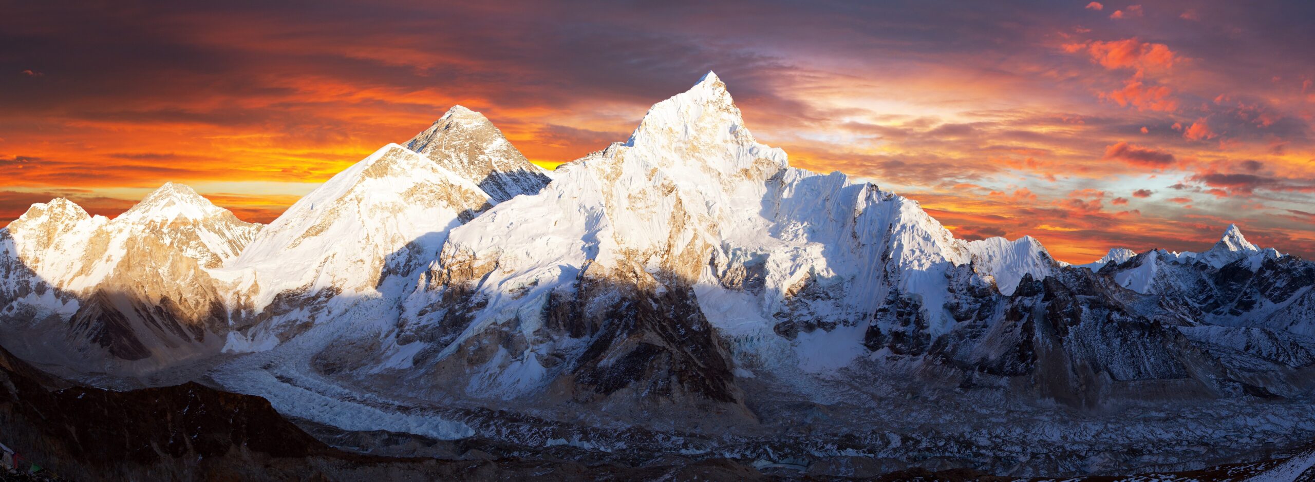
Mount Everest routes: every major line, compared
Around eighteen routes have reached the summit of Everest – but more than 95% of climbers use just two. This is the complete comparison of every major line: the South Col and the North Ridge camp by camp, the extreme historic faces, the obstacles from the Khumbu Icefall to the Second Step, how the route gets built each season, summit day hour by hour, and the 2026 access situation with the North side closed.
Two routes matter. For 2026, only one is open.
The two that matter: the South Col (Southeast Ridge, Nepal) and the North Ridge (Northeast Ridge, Tibet) – together over 95% of all ascents. The standard: the South Col – most support, highest success (~60-65%), but it crosses the deadly Khumbu Icefall. The rest – West Ridge, Southwest Face, North Face couloirs, Kangshung Face – are extreme, rarely-climbed lines for elite alpinists only.
For the 2026 season the North Ridge was closed by China, so every commercial climber was on the South Col. We cover the North Ridge in full anyway – it is half the story of how Everest is climbed, and it has reopened before. If you are planning a first Everest expedition, the route is chosen for you; the work is in the preparation.
How many routes are there?
Roughly eighteen distinct lines since 1953 – but a 95% concentration on just two of them.
Find Hotels, Flights & Trips for the World’s Best Hiking Destinations
The Global Summit Guide Travel Shop on Expedia — curated for outdoor adventurers, mountaineers, and serious hikers. Patagonia to the Alps. Nepal to the Rockies. Curated lodging for every region we cover.
Explore Travel Shop on Expedia →Everest has been climbed by roughly eighteen distinct routes, a number that folds in a tangle of variations on its three great faces and three main ridges. Yet the statistic that matters is this: more than 95% of all summits have come by just two – the South Col from Nepal and the North Ridge from Tibet. Everything else belongs to expedition alpinism at its most serious.
That split exists because those two routes are the only ones that can be turned into repeatable, supportable, commercially guided climbs. They can be fixed with rope from bottom to top, stocked with a chain of camps, and supplied by Sherpa teams – which is what lets a fit, experienced amateur climb them with oxygen and support. The other lines cannot be tamed that way; they demand that a small, self-reliant team solve the mountain itself. One planning note for 2026: China did not open the Tibetan side for the season, so the North Ridge was unavailable and every climber this year was on the South Col. We still cover the North Ridge in full – it remains half the story, and it has reopened before.
The South Col route, camp by camp
The 1953 first-ascent line and the route the great majority follow today – climbed in staged rotations, not a single push.
The South Col, or Southeast Ridge, begins after the famous trek up the Khumbu Valley to Base Camp and climbs the mountain in a series of rotations. Below is the full chain, section by section – the legendary features that define the climb and the hazards each one carries.
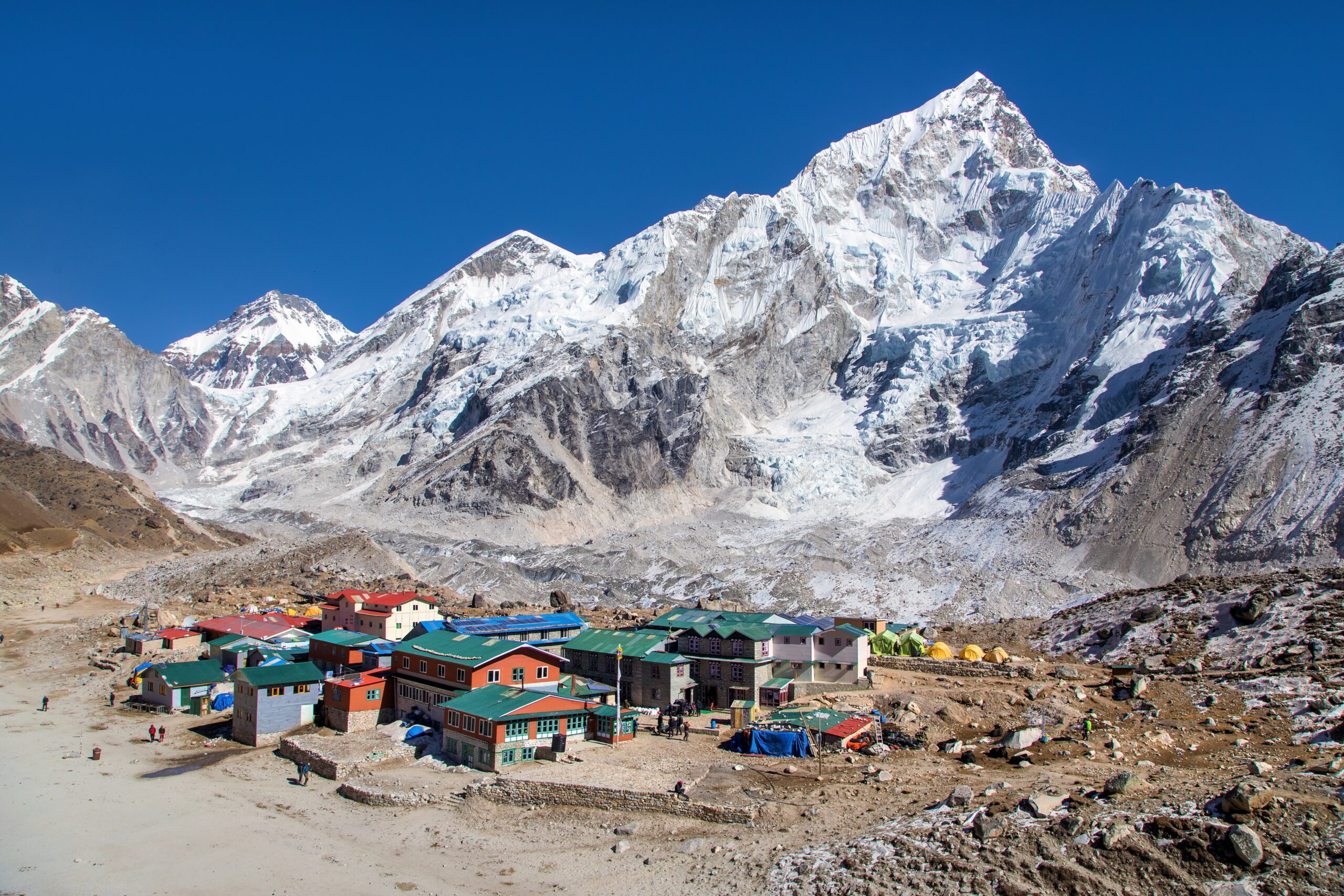
Base Camp (5,364 m / 17,598 ft)
Everest’s south Base Camp sprawls across the rocky moraine at the foot of the Khumbu Icefall, and it is home for the better part of two months – the logistical heart of the expedition, with dining and communications tents, medical support, and a helipad. Even at 5,364 m, simply living here is a physiological strain.
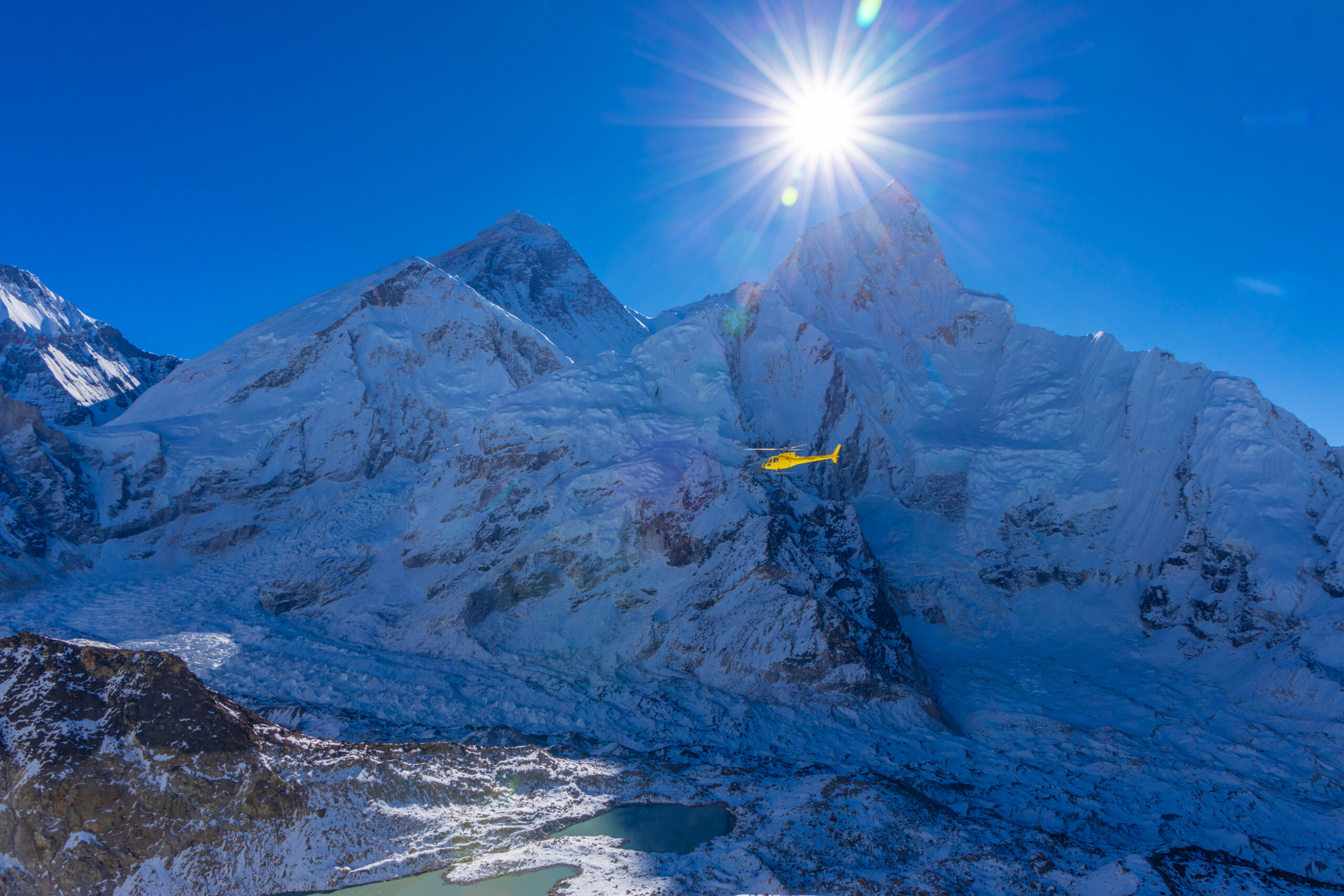
The Khumbu Icefall (5,486-5,943 m)
Immediately above Base Camp lies the most dangerous obstacle on the route: the Khumbu Icefall, a chaotic, constantly shifting river of ice where the Khumbu Glacier tumbles off the lip of the Western Cwm. It is a maze of deep crevasses and house-sized seracs that can collapse without warning. Climbers cross it on aluminium ladders in the pre-dawn cold, when the ice is most stable, and aim to spend as little time in it as possible. The route through is fixed each season by the Icefall Doctors, a specialist Sherpa team, but no skill removes the objective danger – the Icefall has killed many, including in the 2014 avalanche disaster.
Camp I (6,065 m) & the Western Cwm
At the top of the Icefall sits Camp I, on the edge of the Western Cwm – a broad, gently rising glacial valley called the “Valley of Silence.” It is deceptively benign: walled by Everest, Lhotse, and Nuptse, it traps and reflects sunlight, and on a still day the heat becomes brutal even as the surrounding peaks stay frozen.
Camp II / Advanced Base Camp (6,400 m)
Camp II sits at the head of the Western Cwm beneath the enormous wall of the Lhotse Face – the main working camp high on the mountain, where climbers spend much of their rotation time. From here the route steepens dramatically.
The Lhotse Face & Camp III (7,200 m)
Above Camp II rises the Lhotse Face, a vast sweep of hard, glassy blue ice at 40-50 degrees, climbed on fixed ropes where a slip would be unstoppable. Partway up, Camp III is chopped into the ice of the face itself – an airy perch where tents cling to cut platforms. Around 7,200 m, most climbers begin using supplemental oxygen.
The Yellow Band, Geneva Spur & Camp IV / South Col (7,950 m)
The route crosses the Yellow Band (a stripe of sedimentary rock) and the Geneva Spur (a dark rock buttress) to reach the South Col at roughly 7,950 m – a desolate, wind-scoured saddle of ice and rock. This is Camp IV, the launch pad for the summit, and the threshold of the death zone: above 8,000 m the air holds about a third of the oxygen at sea level, and the body can no longer acclimatize – only deteriorate. Climbers usually set out for the summit the same night they arrive.
The summit push: Balcony, South Summit & Hillary Step
The final climb is the crux of the whole expedition, made through the night to summit near dawn and descend before the afternoon weather closes in. The milestones come in sequence: the Balcony (around 8,400 m), where climbers often swap oxygen bottles as the sun rises; the South Summit (about 8,750 m), a false top; the corniced, knife-edge summit ridge; and the Hillary Step (about 8,790 m).
| South Col camp / feature | Elevation | Character |
|---|---|---|
| Base Camp | 5,364 m | Two-month home below the Icefall |
| Khumbu Icefall | 5,486-5,943 m | Most dangerous section; ladders & seracs |
| Camp I | 6,065 m | Top of the Icefall, edge of the Cwm |
| Western Cwm | 6,000-6,400 m | Flat, glacial, intensely hot valley |
| Camp II / ABC | 6,400 m | Main working camp below the Lhotse Face |
| Lhotse Face | 6,400-7,200 m | 40-50° blue-ice wall on fixed ropes |
| Camp III | 7,200 m | Platforms cut into the Lhotse Face |
| Camp IV / South Col | 7,950 m | Final camp; start of the death zone |
| Balcony | ~8,400 m | Dawn oxygen-change point |
| South Summit | ~8,750 m | False summit before the final ridge |
| Hillary Step | ~8,790 m | Last obstacle (changed post-2015) |
| Summit | 8,848.86 m | The highest point on Earth |
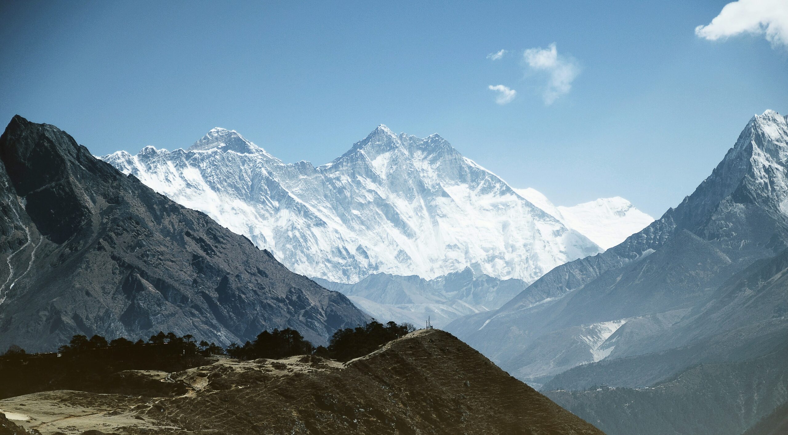
The North Ridge route, camp by camp
Everest’s second commercial route and its most historic – no Icefall, a road-accessible Base Camp, but a colder, windier, more technical upper mountain. Closed for 2026.
The North Ridge, or Northeast Ridge, is the line of the early British attempts of the 1920s, where George Mallory and Andrew Irvine disappeared near the summit in 1924. It was first climbed in full by a Chinese team in 1960. Climbed from Tibet, it has a very different character from the South Col.
North Base Camp / Rongbuk (~5,150 m)
The northern Base Camp sits near the Rongbuk Monastery on the Tibetan plateau and – unlike the south – can be reached by road. Teams drive across the plateau from Lhasa, and a vehicle-supplied Base Camp lets expeditions stock their higher camps far more generously.
Advanced Base Camp (6,400 m)
A long trek up the barren East Rongbuk Glacier leads to ABC at around 6,400 m – already as high as the South Col’s Camp II, reached over gentle glaciated terrain. Because the approach is so mellow, teams build a remarkably well-equipped ABC with cook, dining, and sleeping tents. Above it, the fixed lines begin.
The North Col / Camp I (7,020 m)
A steep ice slope averaging around 45 degrees climbs roughly 300 m to the North Col at about 7,020 m – the sharp saddle between Everest and Changtse, and the first camp on the mountain proper. It was the first major feature reached on Everest, by the 1921 British reconnaissance. Steep, crevassed, and climbed on fixed ropes.
Camp II (7,500-7,800 m) & the North Ridge
From the North Col the route follows the exposed North Ridge – snow and firn to about 40 degrees – to Camp II, on tiny platforms of piled rock wherever a little shelter can be found. The north side’s reputation for relentless wind is well earned here.
Camp III / High Camp (8,300 m)
Higher still, Camp III sits at around 8,300 m on a steep, rocky, largely snowless face just below the Northeast Ridge. The terrain is so steep that platforms often fit only two-thirds of a tent, the rest hanging over the slope. This is the launch point, already deep in the death zone.
The Northeast Ridge & the Three Steps
The summit push follows the Northeast Ridge over its defining obstacles: the Three Steps, a trio of near-vertical rock outcrops at extreme altitude. The First Step comes around 8,564 m; the infamous Second Step, about 8,610 m, is a sheer rock wall climbed since 1975 using a metal ladder placed by a Chinese team – still in use today; and the Third Step, near 8,690 m, leads onto the final summit pyramid. These rock steps, climbed in the death zone, are what make the north side’s summit day more technical and committing than the south’s.
| North Ridge camp / feature | Elevation | Character |
|---|---|---|
| North Base Camp (Rongbuk) | ~5,150 m | Road-accessible; near Rongbuk Monastery |
| Advanced Base Camp (ABC) | 6,400 m | Well-stocked; up the East Rongbuk Glacier |
| North Col / Camp I | 7,020 m | Steep ~45° ice slope; col by Changtse |
| Camp II | 7,500-7,800 m | Exposed, windy, rocky platforms on the ridge |
| Camp III / High Camp | 8,300 m | Steep rocky face; tiny tent platforms |
| First Step | ~8,564 m | Rock outcrop on the Northeast Ridge |
| Second Step | ~8,610 m | Near-vertical wall; 1975 Chinese ladder |
| Third Step | ~8,690 m | Final rock step before the summit pyramid |
| Summit | 8,848.86 m | Reached via the summit pyramid |
South Col vs North Ridge
For the years both are open, the choice comes down to a handful of real trade-offs.
| Factor | South Col (Nepal) | North Ridge (Tibet) |
|---|---|---|
| Base Camp access | Multi-day trek | Road / drive-up |
| Big objective hazard | Khumbu Icefall | No Icefall; more wind & exposure |
| Summit-day difficulty | Less technical | More technical (Three Steps) |
| Time in the death zone | Shorter | Longer |
| Crowds | Higher | Lower |
| Support & rescue | Extensive; heli to ~6,000 m | Limited; little high rescue |
| Success rate | ~60-65% | ~50-55% |
| 2026 status | Open | Closed by China |
In short: the South Col trades the danger of the Icefall for more support, a shorter death-zone exposure, and an easier summit day – which is why it carries the higher success rate and the heavier crowds. The North Ridge trades crowds and the Icefall for cold, wind, a longer push, and the technical Three Steps. With the north closed for 2026 the decision is moot this season, but it has shaped Everest mountaineering for a century. Our dedicated South Col vs North Ridge comparison goes deeper.
The extreme routes
The other Everest – the great faces and ridges that cannot be fixed, stocked, or guided, climbed only a handful of times by the world’s best alpinists.
These lines carry no rope to clip, no chain of stocked camps, and little prospect of rescue. They are listed roughly in order of fame, not difficulty; all are far beyond the reach of guided climbing.
West Ridge & Hornbein Couloir
First climbed in 1963 by Americans Tom Hornbein and Willi Unsoeld, who pioneered the upper North Face via the couloir that bears Hornbein’s name and made the first traverse of the mountain. Long, committing, unsupported – one of the great hard lines, seldom repeated.
Southwest Face
A major Himalayan wall first climbed in 1975 by Chris Bonington’s British expedition, with Doug Scott and Dougal Haston reaching the summit. A serious technical face above the Western Cwm, climbed only by elite expeditions.
North Face (Norton & Great Couloirs)
The couloirs splitting Everest’s North Face. Edward Norton reached 8,572 m here without oxygen in 1924; Reinhold Messner made the first solo ascent of Everest via this face, without supplemental oxygen, in 1980. Steep, exposed, and technically demanding.
Kangshung Face (East Face)
The huge eastern wall, rising roughly 3,000 m and among the largest faces in the Himalaya. First climbed in 1983 by an American team; Stephen Venables summited it without oxygen in 1988. Remote, avalanche-prone, and attempted only by the most accomplished independent teams.
What unites these routes is self-reliance: on the standard routes the mountain has been prepared for you; on these, you prepare the mountain. They are reminders that for all its commercialization, Everest still holds terrain as wild as anywhere on Earth. Messner’s 1980 solo of the North Face – alone, without supplemental oxygen, during the monsoon – remains perhaps the single most astonishing climb in the mountain’s history.
Summit day, hour by hour
The most dangerous day of the climb – and most of it happens in darkness. A typical South Col summit night from Camp IV.
| Time | Where | What’s happening |
|---|---|---|
| ~8-10 PM | South Col (7,950 m) | Leave Camp IV by headlamp into the death-zone night, on oxygen. |
| ~12-2 AM | The Balcony (8,400 m) | First milestone; a pause to swap oxygen bottles as the long ridge begins. |
| ~4-5 AM | South Summit (8,750 m) | The false summit; dawn breaks and the corniced final ridge appears. |
| ~5-6 AM | Hillary Step (8,790 m) | The last obstacle – historically a bottleneck where queues cost precious time. |
| ~6-8 AM | Summit (8,849 m) | The top, reached near dawn; climbers stay only minutes before turning around. |
| By ~2 PM | Descent to Camp IV | The turnaround discipline: most deaths happen here, descending exhausted and low on oxygen. |
The single most important fact about summit day is that reaching the top is only half the job. The majority of Everest deaths occur on the descent, when climbers are spent, dehydrated, running out of oxygen, and racing afternoon weather. This is why a good guide enforces a hard turnaround time – often around 2 PM – even on a client who is agonizingly close. The day-by-day texture of a full season is in our account of inside an Everest climbing season.
Route hazards by section
Each part of the route carries its own signature danger. Knowing where the risks concentrate is part of climbing it safely.
- Khumbu Icefall (South): collapsing seracs and crevasse falls – the deadliest objective hazard on the south side. Crossed fast, before dawn.
- Western Cwm: hidden crevasses and, paradoxically, dangerous heat and dehydration from reflected sun.
- Lhotse Face: long falls on hard ice – clip the fixed ropes without fail.
- The death zone (above 8,000 m): on both routes the body deteriorates; HACE, HAPE, frostbite, and fatal exhaustion all spike here.
- The Second Step (North): technical rock at 8,610 m, a bottleneck on the ladder.
- Summit ridge & descent: cornices, crowding, and the exhaustion that makes the descent the deadliest phase of all.
The fuller risk picture is in our Everest death map and the analysis of why climbers fail on summit day. And one fact of modern Everest that is easy to miss: the climbable route does not simply exist – it is rebuilt from scratch every season. The Icefall Doctors pioneer and maintain the route through the Khumbu Icefall, while elite Sherpa rope-fixing teams fix line up the Lhotse Face and all the way to the summit, usually timed for the first weather window in mid-to-late May. Until the ropes reach the top, no one summits – which is why summit timing is dictated as much by the rope-fixing schedule as by the weather.
No-oxygen, winter & speed records
Because the two standard routes are so well understood, the cutting edge of Everest has long been about climbing them in harder style.
Without supplemental oxygen. On 8 May 1978, Reinhold Messner and Peter Habeler reached the summit via the South Col without bottled oxygen – a feat many physiologists had believed impossible, and one that permanently changed the sport. Only a small fraction of summiteers have ever done it.
The first solo, and the North Face. In August 1980, Messner returned to climb Everest solo, without oxygen, during the monsoon, via the North Face and the Great (Norton) Couloir – still regarded by many as the single greatest Himalayan climb ever made.
The first winter ascent. On 17 February 1980, the Polish climbers Leszek Cichy and Krzysztof Wielicki made the first winter ascent of Everest via the South Col, launching the Polish golden age of Himalayan winter climbing.
The first traverse, and the most summits. The 1963 American West Ridge climb by Hornbein and Unsoeld was also the first traverse of Everest – up one side and down another. And on the commercial South Col, Kami Rita Sherpa has summited Everest more than thirty times, more than any other human – a record built one guided season at a time on the route most climbers know.
Which route should you climb?
For essentially every aspiring Everest climber, the answer is the South Col – and for 2026 it was the only answer.
The South Col has the most support, the highest success rate, and the shortest exposure to the death zone, and it is the route virtually all commercial operators run. The North Ridge is a reasonable choice in years it is open, for climbers who want to avoid the Icefall and the crowds and who are comfortable with a colder, more technical summit day – but it is not a beginner-friendlier option; it simply trades one set of risks for another. The extreme routes are not a “choice” in any practical sense: they are the objective only for elite alpinists with the experience to attempt new-wave, unsupported climbing in the death zone.
If you are planning a first Everest expedition, the route is chosen for you – the work is in the preparation. Start with our training plan, gear list, and progression plan, and carry expedition insurance rated above 6,000 m.
Planning an Everest expedition?
Line up the pieces with the main Everest climbing guide, the cost & permits guide, and the best time to climb. For flights into Kathmandu and pre-expedition lodging, compare options through the Global Summit Guide Expedia travel shop.
Disclosure: the Expedia link is an affiliate link; we may earn a small commission at no extra cost to you, and it never affects our recommendations.
Main Everest Guide South Col vs North RidgeEverest routes FAQ
The questions climbers search most.
How many routes are there up Everest?
Around 18-20 have been climbed, but over 95% of summits use just two: the South Col (Southeast Ridge) from Nepal and the North Ridge (Northeast Ridge) from Tibet. The rest – West Ridge, Southwest Face, North Face couloirs, Kangshung Face – are extreme and rarely climbed.
What is the standard route?
The South Col / Southeast Ridge from Nepal, the 1953 first-ascent line. It climbs through the Khumbu Icefall, the Western Cwm, and the Lhotse Face to the South Col, then past the Balcony, South Summit, and Hillary Step to the top. It has the most support and the highest success rate.
Is the North side closed in 2026?
Yes – for the spring 2026 season China closed the Tibet (north) side to foreign expeditions, an officially unexplained move widely reported as politically driven, with environmental remediation and overcrowding also cited. Every commercial climber in 2026 was on Nepal’s South Col. The north has closed before (including 2020) and reopened; it may open again.
South Col vs North Ridge – what’s the difference?
South Col is more supported, less technical, and higher in success but crosses the dangerous Khumbu Icefall and is crowded. North Ridge avoids the Icefall and has a road-accessible Base Camp, but it’s colder, windier, more technical (the Three Steps), and longer in the death zone. For 2026 the North Ridge is closed.
What is the Second Step?
A near-vertical rock wall at about 8,610 m on the North Ridge, climbed since 1975 with a metal ladder placed by a Chinese team. It’s the most famous technical obstacle on the north side.
What happened to the Hillary Step?
The ~12 m rock step at ~8,790 m on the South Col route appears to have changed after the 2015 earthquake into more of a snow-and-rock slope – possibly easier and less of a bottleneck, but with fewer solid anchors for ropes.
What are the hardest routes on Everest?
The West Ridge and Hornbein Couloir (1963), Southwest Face (1975), North Face couloirs, and Kangshung/East Face (1983). They demand sustained technical climbing with little support and are for elite alpinists only. Messner’s 1980 solo of the North Face without oxygen is the most celebrated.
How long does it take to climb Everest?
About 6-8 weeks (often 40-60 days): the trek to Base Camp, several weeks of acclimatization rotations, and a weather-window summit push that itself takes several days round trip from Base Camp.
How we researched this
- Camp elevations and route features cross-referenced across multiple operator route descriptions for both the South Col and North Ridge, plus the Himalayan Database and the North Col historical record.
- First-ascent and historical detail drawn from established mountaineering records (1953 south, 1960 north, 1963 West Ridge, 1975 Southwest Face, 1980 Messner solo, 1983 Kangshung).
- Where heights differ between sources – the high camps especially – we use the commonly cited figures and note the approximation. The 2026 access status reflects China’s closure of the north side for the season, corroborated across multiple 2026 expedition-news sources.
- Research-based: our team has not climbed Everest; this reflects documented route information, not a personal ascent. Safety framing reviewed by Dawson Ludlow.
Last updated: July 18, 2026 · reviewed each season · Travis Ludlow, Global Summit Guide.
Confidence: High on route structure, camps, and history; Medium on exact high-camp elevations (which vary by source) and on future-season access, which depends on Chinese and Nepali policy.One summit, many lines
For 2026 the South Col was the route – but understanding all of Everest’s lines is part of respecting the mountain. Know the camps, the hazards, and the history before you take a single step onto the ice.
Back to the Full Guide Compare the Two Routes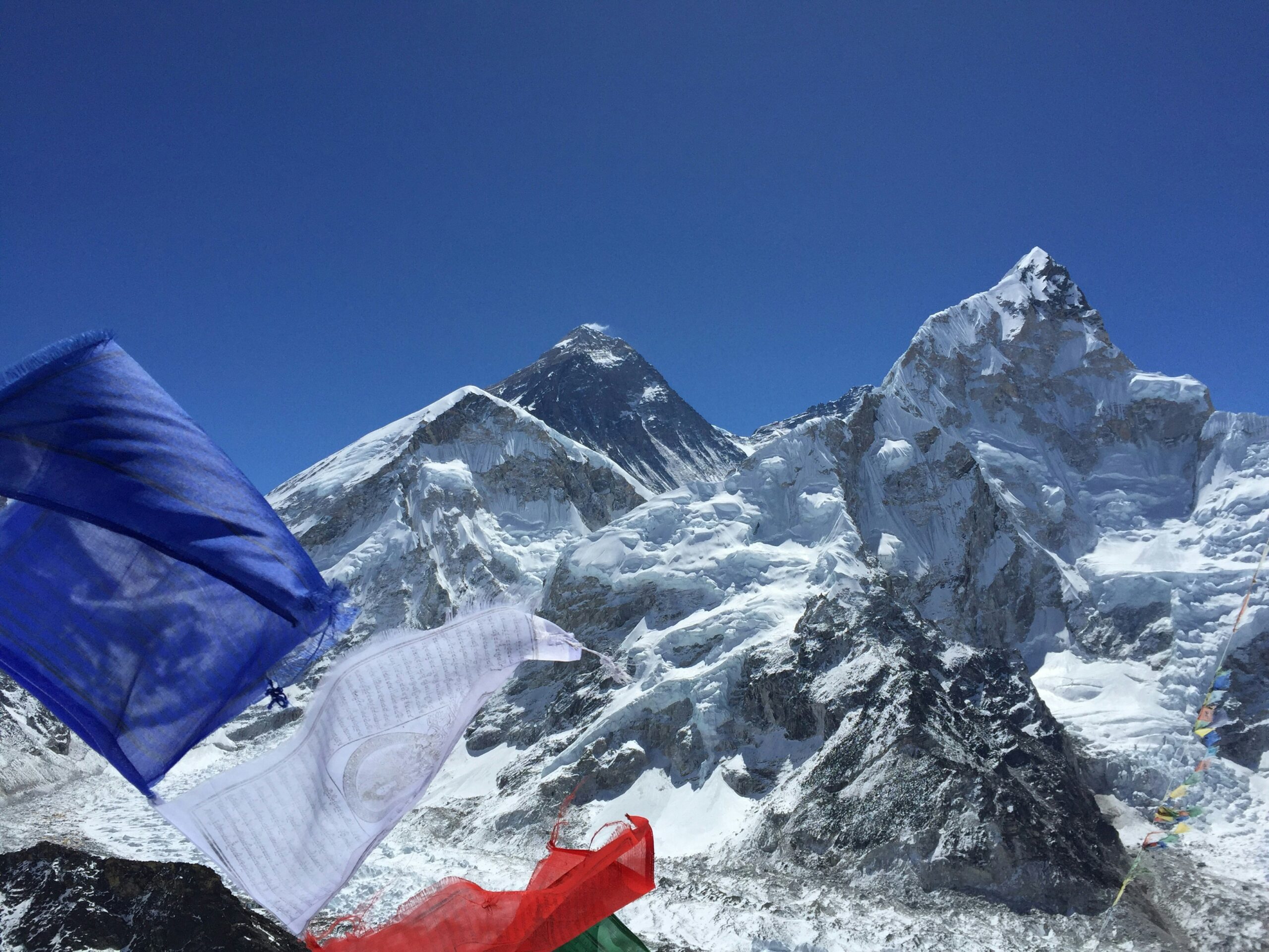
Was this helpful?
🏔Related guides
🧭Explore & compare
Global Summit Guide is an independent mountaineering resource founded in 2026. The team combines first-hand trekking and climbing experience with in-depth research and professional health and nutrition review to help climbers choose objectives, prepare properly, and stay safe.
Health, altitude, and nutrition content is reviewed by Taylor Ludlow (Registered Nurse) and Brigg Hoopes (Nutritionist).
What We Don't Know Yet
Mountain information changes quickly. This box explains the limits of what this page can responsibly promise.
- Weather, snowpack, avalanche risk, road access, and route conditions can change quickly and may be different on your climbing dates.
- Route conditions, trailhead access, crevasse exposure, stream crossings, and rescue access may vary from published planning guidance.
- Route conditions, snowpack, closures, and weather can change quickly after this page is updated.
- Permit rules, fees, quotas, and reservation windows may change between review cycles.
- Operator availability, pricing, guide ratios, and cancellation terms can change by season.
Verify current conditions with official land managers, guide services, local forecasts, and current route reports before booking or climbing.
Part of this Global Summit Guide cluster
Explore the complete Mountain Route Comparisons guide for more context, routes, planning links, and related resources.
Mountaineering, rock and ice climbing, glacier travel, and high-altitude activity are inherently dangerous and can result in serious injury or death. The information on Global Summit Guide is provided for general informational and educational purposes only and is not a substitute for professional instruction, qualified guiding, proper equipment, or your own judgment and experience.
Route conditions, weather, snowpack, permits, regulations, and hazards change constantly and may differ from what is described here. Details may be incomplete, out of date, or contain errors. Always verify current information with local authorities, certified guides, and official sources before making any decision in the mountains.
Nothing on this site is medical, legal, or financial advice. Our fitness, acclimatization, altitude, and nutrition content is general in nature; consult a qualified physician before beginning any strenuous exercise program or exposing yourself to high altitude.
You are solely responsible for your own safety and decisions. To the fullest extent permitted by law, Global Summit Guide and its team accept no liability for any loss, injury, damage, or expense arising from use of, or reliance on, this information. By using this site you acknowledge these risks and accept these terms.
Some links on this site may be affiliate links. If you buy through them we may earn a small commission at no extra cost to you; this never affects our recommendations.
Global Summit Guide recommendation path
Next Best Mountain to Research
Use these recommendations to continue the right planning path instead of stopping on one page.
Use current permit, weather, route, and operator information before booking or climbing.