
How to Read Peak Route Descriptions Like a Pro: Mastering Mountain Route Interpretation for Safe Summit Navigation
Reading peak route descriptions is a core skill for safe mountain travel. This guide breaks down how to interpret the details that affect planning and risk: route stats, hazards, navigation tools and community reports. You’ll learn to extract actionable information so you can choose routes, time your ascent, and prepare equipment with confidence. Alongside technique and judgement, good interpretation reduces surprises on approach, at the crux, and during descent. Treat route descriptions as working documents: update your plan as you gather recent reports, weather data and observations from local parties.
Reading Peak Route Descriptions
Route descriptions present structured information—elevation profiles, difficulty ratings and key landmarks. Learn to read these elements so you can plan pacing, gear and navigation. A clear description helps you predict the climb’s physical and mental demands. In many guides the description will also include estimated times for approach, ascent and descent; treat those times as guides, not guarantees, and allow extra time for variable terrain, group pace and short technical sections.
Understanding Route Details
Critical route details let you judge feasibility and safety. Elevation profiles show steepness and sustained gain. Hazard notes warn of risks like loose rock or unstable weather. Summit summaries describe commitment and exposure so you can match the route to your skills and objectives. When a route description notes sustained steep sections or long exposed ridgelines, plan shorter daily objectives, additional protection if available, and consider early starts to avoid afternoon weather.
If you want more background, Information Hub provides resources and expert insight you can use to make safer, better-informed decisions on the mountain. Use those resources to compare multiple descriptions of the same route—differences often reveal subjective judgment or seasonal issues that affect difficulty.
Recognizing Potential Hazards
Identifying hazards is essential. Expect changing weather, the possibility of altitude sickness, and the need for clear emergency protocols. Recognizing these risks ahead of time lets you prepare and respond more effectively during an ascent. Consider how objective hazards (rockfall, crevasses, avalanche paths) differ from subjective difficulties (fitness, route-finding), and plan mitigations for both.
Hazard identification has shifted from long field surveys to more advanced, faster methods over recent decades.
Mountain Hazard Identification & Management
Methods and techniques for the identification, monitoring and management of natural hazards in high mountain areas are listed and explained. Early approaches relied on intensive, time-consuming fieldwork and mapping, with primary dependence on interpreting landforms, sediments and vegetation as indicators of slope failures, rock falls, debris flows, floods and accelerated soil surface erosion. Over the past two decades both the need for—and the ability to—identify potential hazards accurately have increased.
Systems for hazards identification in high mountain areas: an example from the Kullu District,
Western Himalaya, E Saczuk, 2004
Using Navigation Tools
Navigation tools are central to following your chosen line. Use GPS devices, topographic maps and weather forecasts together. Practice them in different conditions so you can rely on their data when it matters. Build a routine: download offline maps, load key waypoints (trailheads, junctions, bivy spots and the summit), and verify bearings with a compass. Train to switch quickly between tools if one becomes unreliable.
The table shows how each tool provides specific data—position, terrain detail and weather—that supports safer, more effective route following. In practice, cross-check these sources: if the GPS indicates a track but the contour pattern on the topo map shows an impassable cliff, slow down and verify by sight or photograph. Keep spare batteries or a power bank; cold and frequent use can quickly deplete devices.
Integrating Community Insights
Community reports and trip notes provide up-to-date conditions and practical tips you won’t find in a static description. Use those accounts to adjust your plan based on recent experience and local knowledge, and contribute your own observations when you can. Prioritise recent trip reports for time-sensitive information like snow levels, newly exposed scree or damaged access routes. When reading trip notes, look for clear descriptions of where the party was on the route, what time they passed key landmarks, and any photos that corroborate the text.
When possible, contact the author of a trip report with specific questions—many climbers are willing to give small clarifications that can change a decision in the field. Keep a short note of reliable local contacts or guiding services who can confirm current approach conditions or permit updates.
What Are Peak Route Descriptions and Why Are They Essential for Climbers?
Peak route descriptions outline the technical challenges, terrain features and safety considerations of a climb. They let you assess whether a route matches your skill level and objectives and support better planning for a safer ascent. Good descriptions include approach notes, crux locations, typical snow or ice coverage, and descent options. Read each description as a checklist: what skills are required, where the hardest moves occur, and what escape routes exist if conditions change.
Defining Peak Route Descriptions: Key Concepts and Terminology
Key concepts include a route overview (a brief summary), difficulty ratings (the route’s grade) and technical pitches (sections requiring advanced skills or equipment). Knowing these terms helps you interpret descriptions accurately during planning. Identify the language that signals commitment—phrases such as “no easy retreat,” “exposed traverse,” or “route-finding complex” indicate higher risk and the need for stronger contingency planning.
How Understanding Route Descriptions Enhances Summit Planning and Safety
Understanding route descriptions helps you pick routes that suit your experience, anticipate challenges and prepare appropriate gear and contingency plans. That planning reduces risk and increases confidence on the climb. When you align time-of-day choices, group composition and gear to the description’s details you lower objective exposure and improve decision-making under stress.
How Do You Interpret Climbing Grades and Symbols in Route Descriptions?
Climbing grades and symbols standardize how difficulty and hazards are communicated. Learn the grading system used on a route so you can judge the challenge and decide if the climb is appropriate for you. Look for additional symbols or abbreviations that describe protection quality, rock condition, or mandatory gear—these often change how a grade feels in practice.
What Are the Common Climbing Grade Systems and Their Scales?
Common systems include the Yosemite Decimal System (YDS), the French grading system, and the V-scale for bouldering. Each uses its own scale to describe difficulty; identify which one applies to your route before you commit. If you regularly climb in areas that use different systems, build a quick reference conversion chart or mental mapping so you can assess difficulty at a glance when reading varied sources.
Which Symbols and Notations Are Used to Indicate Route Difficulty and Hazards?
Route symbols flag technical sections, exposure and specific gear needs. Familiarize yourself with common notations so the description gives a clear picture of what to expect on the ground. Notations may note fixed protection, loose rock, seasonal snow, or objective hazards; learning to read those at scale helps you prioritise what to pack and how to time the climb.
What Navigation Techniques Help You Read and Follow Summit Routes Accurately?
Strong navigation skills—reading map symbols, interpreting elevation profiles and planning lines—are essential for following summit routes accurately and safely. Develop a habit of pre-visualising the route: identify key turns, saddles and ridgelines on the map and mark them on your device so you know what to expect at each stage of the climb.
How to Use Maps, Diagrams, and GPS Tools for Route Finding
Combine topographic maps, route diagrams and GPS tracks to cross-check position and terrain. Practice reading contour lines and using GPS waypoints before relying on these tools in remote or technical terrain. Set intermediate waypoints for critical decision points (first bivy, crux approach, descent junction) and use those to measure progress as well as to orient if visibility drops.
When following a route diagram, translate drawn features into map features: saddles become contour saddles, scree slopes align with contour spacing, and small streams on the map often mark safe approach corridors. If the route description mentions vegetation boundaries or rock bands, mark those on your map to aid real-world identification.
What Are Best Practices for Identifying Landmarks and Route Features?
Use distinctive visual markers, changes in elevation and mapped features as reference points. Check your position frequently against your map or GPS to confirm you’re on the intended line. When visibility or terrain makes landmarks unreliable, slow down, take a bearing and use short backtracks to confirm the line rather than continuing on uncertain ground.
How Can You Integrate Safety Protocols and Gear Recommendations When Reading Routes?
Read every route description through a safety lens. Match gear, skills and escape options to the risks described, and ensure you have clear contingency plans for likely hazards. Prepare both equipment and human factors: pacing, rest breaks, role assignments (lead, navigator, communicator) and clear turnaround criteria.
Which Safety Considerations Should You Evaluate from Route Descriptions?
Assess factors such as exposure to weather, objective hazards and technical difficulty. Use that assessment to plan timing, team composition and emergency procedures for the climb. Consider whether the route requires extra safety equipment like helmets for rockfall, glacier gear, or a rope for exposed scrambling sections.
What Gear Is Recommended Based on Route Difficulty and Hazards?
Gear recommendations depend on the route’s difficulty and hazards. Use route notes to identify required technical kit and clothing needs, and weigh those against your experience when preparing equipment. Pack modular gear for flexibility: a lightweight emergency shelter, a repair kit, spare layers, and small items that can change a descent from precarious to manageable. Decide in advance who carries shared gear and build redundancy for critical items.
How Do You Plan Your Ascent Effectively Using Peak Route Descriptions?
Effective ascent planning follows a systematic approach: gather route data, compare it to your skills, and build contingencies for identified hazards before you set out. Translate descriptive elements into a timeline and decision points—where you will reassess weather, when to turn back if conditions worsen, and where safe bivy options exist.
What Are Step-by-Step Strategies for Trip Planning Based on Route Data?
Steps: collect route information and recent reports, evaluate your fitness and technical skills, then plan timing, gear and escape options. Review the plan with your team and adjust as new information appears. Add concrete checkpoints: planned start time, estimated time to the crux, planned retreat time if the crux is not reached safely, and a firm descent start time to avoid nightfall in technical terrain.
Include logistical planning—transport, permits, and a realistic plan for how to access last-minute weather updates. Practice transitions you expect on the route (putting on crampons, changing to heavier layers, short technical ropework) to avoid mistakes under fatigue.
How to Use Case Studies and Templates to Prepare for Your Climb
Study case examples and planning templates to identify common pitfalls and proven strategies. Apply those lessons to your own plan to reduce surprises on the mountain. Templates that list mandatory gear, team roles, key waypoints and emergency numbers help standardise planning and reduce overlooked items before leave.
What Are Common Challenges in Reading Peak Route Descriptions and How Can You Overcome Them?
Common issues include vague descriptions and unfamiliar symbols. Overcome these by seeking clarification from experienced climbers and consulting multiple sources to build a clearer picture. Keep a short glossary of terms and symbols used in your area so you can decode older guides or shorthand in trip reports quickly.
How to Interpret Ambiguous or Complex Route Information
When a description is unclear, cross-check it with maps, photos and trip reports. Learn standard symbols and terminology so you can resolve ambiguity before committing to a route. If ambiguity remains, treat the route as having higher uncertainty: lean toward simpler objectives, add margin to your time estimate, or plan additional reconnaissance before committing to complex sections.
What Resources and Tools Can Enhance Your Route Reading Skills?
Guidebooks, online forums and local climbers are reliable resources for improving route-reading. Combine several sources to verify conditions and fill gaps in a route description. Practice extracting repeated themes across accounts—if several reports mention the same loose band or tricky descent, assume it will be present on your visit.
Which Emerging Technologies Are Improving Peak Route Reading and Safety?
Digital route maps and GPS integration provide timely data that improves situational awareness and helps you adapt to changing conditions on the approach and ascent. New tools make it easier to overlay weather, recent tracks and satellite imagery so you can pre-identify problem areas before arrival.
How Are Digital Route Maps and GPS Integration Changing Navigation?
Digital maps and GPS offer accurate, real-time position and route data. Use them to cross-check your planned line and to make better-informed decisions while on the mountain. Learn how to export and share route files with your group; consistent waypoints reduce confusion and keep the whole team oriented during complex moves.
What Role Do Augmented Reality and Mobile Apps Play in Modern Mountaineering?
Augmented reality and mobile apps add interactive overlays and route-context information. They can help you visualise terrain features, identify landmarks and access community updates while navigating. Use AR cautiously: it’s a powerful aid in moderate visibility, but do not rely on it as your only means of navigation—always validate AR overlays against a map and physical features.
Frequently Asked Questions
What should I consider when choosing a climbing route based on peak route descriptions?
Match the route to your skill level, check the difficulty rating and note hazards listed in the description. Study the elevation profile to understand steep sections. Also factor in weather and season. Aligning your abilities with the route’s demands improves safety and enjoyment. Additionally, consider logistics such as access, required permits, and whether the route’s descent can be completed safely given your planned start time.
How can I effectively communicate with the climbing community for better route insights?
Join local forums, social media groups and meetups. Ask specific questions about recent conditions and share your trip details. Be open to feedback and contribute your own observations to build trust and useful trip reports. When asking for information, provide the date you plan to go, your intended line, and any constraints—this helps responders give directly applicable advice.
What are the best practices for using GPS devices while climbing?
Charge your device fully and download maps before you leave. Learn features like waypoint marking and route tracking, and check your position regularly against the planned line. Carry a map and compass as a backup for technical failures or battery loss. Practice recovering from a lost signal and carrying spare power sources; know how to switch units to conserve battery for critical navigation windows.
How can I prepare for unexpected weather changes during a climb?
Check the forecast before you go and monitor conditions during the climb. Carry waterproof layers, extra insulation and a reliable shelter. Learn the signs of deteriorating weather and keep a flexible plan that allows for retreat or alternative routes. Plan buffer days in your schedule when possible so that weather windows can be used safely rather than forcing risky moves on marginal days.
What role does physical fitness play in successfully navigating peak routes?
Fitness affects endurance, strength and recovery on steep or exposed terrain. Regular cardio, strength and flexibility training reduces fatigue and injury risk, letting you focus on navigation and safety during the climb. Train for the specific demands of the route—long approaches, sustained scrambling or technical moves—to build confidence and reduce decision fatigue on the mountain.
How can I assess the reliability of online climbing resources and trip reports?
Evaluate the source—established organisations and experienced climbers are more reliable. Look for multiple recent reports, check dates and cross-reference photos or GPS tracks. Engage in forums to test the credibility of specific accounts. Give more weight to reports that include photos with timestamps or GPS data, and treat single, undated accounts as anecdotal unless corroborated.
What are the benefits of using augmented reality apps for climbing navigation?
AR apps overlay route information on the landscape, showing location, route lines and nearby landmarks. They help visualise complex terrain and hazards, and they can integrate community updates for a richer, more useful navigation aid. Use AR to confirm features and to teach less-experienced partners how a route maps to the terrain, but always validate against map and compass readings before committing to technical sections.
Conclusion
Reading peak route descriptions well improves safety and confidence on the mountain. Use route details, hazard notes and navigation tools to make informed choices that match your skills and objectives. Tap community knowledge to fill gaps and refine plans. Apply these practices to plan safer, more enjoyable climbs. Finally, treat every outing as an opportunity to refine your interpretation skills—log what you learned about a route and feed that information back into the community so others benefit.
Related posts:
 Vinson Massif: Complete Guide to Climbing Antarctica’s Highest Peak
 10 Best Mountains to Climb for Beginners
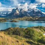 Patagonia Hiking: Guide to Trekking in Torres del Paine
 How Long Does It Take to Climb Kilimanjaro? Route-by-Route
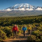 Kilimanjaro Climbing Guide: Routes, Costs, & Difficulty
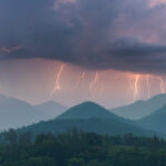 Mountain Weather: How to Read Forecasts and Stay Safe
Leave a Reply