
Comprehensive Alps Regional Planning: Routes, Logistics & Safety for Alpine Expeditions
By Travis Ludlow, Global Summit Guide
Planning an Alps expedition requires knowledge of the region’s specific challenges and practical steps. This guide focuses on route choice, logistics and safety protocols. You will learn how to select and navigate hiking routes, read difficulty ratings, plan transport and accommodation, prepare essential gear, and work with professional guides. We also cover environmental factors and how technology can support your preparation.
Use this guide as a structured checklist while you research and prepare. Start by defining objectives (day hikes, multi-day treks, technical climbs), then build timelines, budget estimates and contingency plans. Early decisions—season, group size, fitness levels—shape route options, permit needs and equipment lists. Updating the plan regularly as you approach departure ensures decisions reflect the latest conditions and operator availability.
How do I select and navigate the best Alps hiking routes?
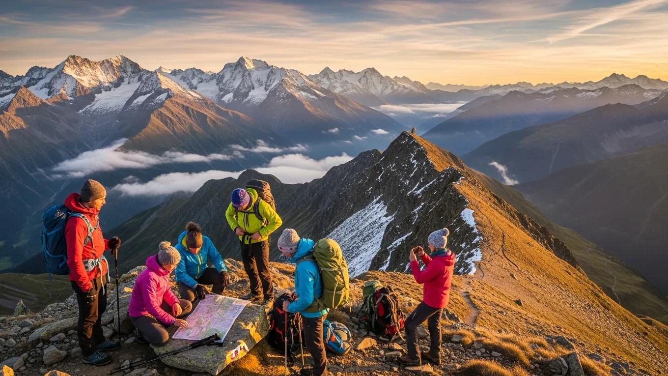
Choose routes by matching terrain, weather and your fitness. Check trail grade, elevation gain and technical sections before you go. Use GPS devices or hiking apps for navigation and cross-check with a paper map. Always review recent weather forecasts and trail reports before departure.
Interactive maps and annotated routes help you visualize the line, see elevation profiles and identify hazards. Use tools that show waypoints, water sources and shelter locations. Enable live updates where possible to receive recent trail-condition reports.
When selecting a route, follow a simple decision workflow: identify candidate routes that meet your objective, filter by technical difficulty and elevation, confirm seasonal access (snow and glacier presence), then check logistics for start and end points. For multi-day plans, build daily stage targets that account for daylight hours and terrain difficulty rather than only distance. Incorporate rest and acclimatisation days in your route timeline to reduce fatigue and altitude risk.
- Pre-selection checklist: objective, distance, elevation gain, technical grade, water and shelter availability, nearest emergency access.
- On-route navigation plan: primary GPS track, paper map & compass backup, predefined waypoints, and a decision point schedule for turnarounds or bailouts.
What are the key route types and difficulty ratings in the Alps?
The Alps host several route categories. Knowing the type helps set expectations and plan gear and time.
- Hiking Trails: Generally well-marked and suitable for all skill levels, these trails offer scenic views and moderate challenges.
- Trekking Routes: More demanding than standard hiking trails, trekking routes often involve longer distances and varied terrain, requiring a higher level of fitness.
- Climbing Routes: These routes are designed for experienced climbers and may include technical sections requiring specialized gear and skills.
Difficulty ratings run from easy to very difficult. Use the rating plus distance and elevation to assess whether a route matches your skills.
Beyond the broad categories above, consider sub-factors that influence perceived difficulty. Rocky or exposed ridgelines increase time and concentration requirements; loose scree slows progress and increases fatigue; glaciers and snowfields demand specific equipment and route-finding skills. Seasonal timing affects difficulty: late spring or early autumn can leave high passes with lingering snow, while late summer may expose more loose rock due to melt.
- Terrain modifiers: exposure, technical moves, objective hazards (rockfall, crevasses), and distance between shelters.
- Seasonal modifiers: persistent snowpack, glacier melt patterns, and daylight variation.
How can interactive maps and route annotations improve navigation?
Digital maps provide trail lines, elevation charts, points of interest and hazard markers. They make planning and on-route decisions faster and clearer.
- Semantic Annotations: These enhance the user experience by providing context-specific information, such as nearby water sources or rest areas.
- User-Generated Content: Many platforms allow hikers to share their experiences, offering insights into trail conditions and recommendations.
- Visual Aids: Interactive maps often include photos and videos, helping hikers visualize the terrain and prepare accordingly.
Use these resources to improve route planning, reduce navigation errors and anticipate logistical needs. mountain route comparisons
Practical tips when relying on digital tools: download offline maps and tracks before you leave mobile coverage, save multiple track files (primary and alternative), and keep a printable map copy in a waterproof sleeve. Record waypoints for critical locations—trail junctions, water sources and potential shelters. Manage power by carrying spare batteries or a power bank designed for outdoor use and by turning off non-essential connectivity while hiking.
- Backup strategy: Offline maps + paper map; primary GPS + phone as secondary; fully charged batteries + spares.
- Annotation practice: Mark bail-out routes, emergency rendezvous points, and estimated times between waypoints.
What essential logistics should I plan for an Alps expedition?
Logistics cover transport, lodging and permits. Plan each element to avoid delays and keep your schedule flexible for weather or route changes.
Which transport and accommodation options best support alpine trips?
When choosing transport and accommodation, weigh access, cost and timing. Select options that minimise transit time to trailheads and provide contingency plans.
Accommodation ranges from hotels and lodges to campsites and mountain huts. Book popular huts in advance and choose based on resupply needs, shelter and group size.
When arranging transport, create a transit timeline that aligns public transport timetables with your route start times. If relying on local buses or seasonal shuttle services, confirm timetables close to departure as schedules change seasonally. If driving, plan parking logistics at trailheads and consider vehicle shuttles when start and end points differ.
- Booking tips: reserve mountain huts early (peak season fills quickly), confirm check-in policies, and identify alternative lodging in nearby valleys.
- Resupply planning: note towns with shops and opening hours; plan food quantities for each stage with a reserve margin.
What permits and regulatory considerations are required for climbing in the Alps?
Many routes and protected areas have specific permit rules. Research local requirements early and obtain necessary permits before travel.
- Permit Requirements: Some areas may require climbing permits, especially for popular or protected routes.
- Regulatory Considerations: Familiarize yourself with local regulations regarding environmental protection and safety standards to ensure compliance during your expedition.
Clear logistics planning reduces the chance of fines, denied access or unnecessary delays on route.
Permit and access steps: identify the managing authority for the region or protected area, review online permit procedures and fees, note application lead times, and keep digital and printed copies of permits during travel. Some huts or refuges require advance booking and a deposit; check cancellation and no-show policies. Verify vehicle restrictions where certain mountain roads close seasonally or require special passes.
Which gear and safety protocols are critical for mountain climbing in the Alps?
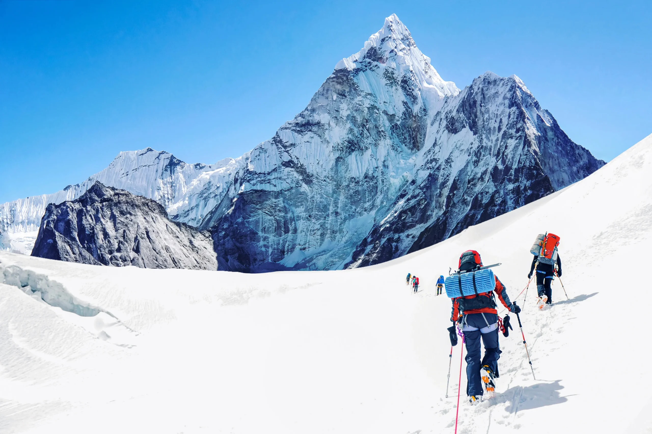
Correct equipment and consistent safety checks are essential. Gear influences your ability to manage technical sections, weather and emergencies.
What safety equipment is essential for alpine climbing?
Core safety items include a certified climbing harness, ice axe and crampons for snow and ice, and a helmet to protect from rockfall.
- Climbing Harness: Provides support and safety during ascents and descents.
- Ice Axe and Crampons: Crucial for navigating icy terrain and maintaining traction.
- Helmet: Protects against falling rocks and other hazards.
Buy reliable equipment, fit it properly and inspect it before each trip.
Build a comprehensive gear list around the route type and expected conditions. Clothing should follow a layering system: base layer for moisture management, insulating mid-layer, and a waterproof/breathable outer shell. Footwear must match terrain—stiffer boots for glacier travel or heavy scree, flexible footwear for light trails. Include a compact repair kit (cord, multi-tool, duct tape), a lightweight emergency shelter or bivvy, headlamp with spare batteries, and a refillable water system plus purification option. Prepare a personal kit and a group kit, where shared items (e.g., rope, ice screws, stove, group first-aid) are listed and assigned before departure.
- Clothing & footwear: layering system, spare socks, gaiters for scree/snow.
- Group equipment: rope, anchor slings, ascenders or prusiks if needed, multi-person shelter.
- Personal safety: whistle, mirror, personal locator beacon or satellite messenger for remote areas.
How do I prepare for altitude sickness and other alpine hazards?
High altitude can cause headaches, nausea and reduced performance. Plan acclimatisation days and recognize symptoms early.
- Acclimatization Strategies: Gradually ascend to higher altitudes to allow your body to adjust.
- Emergency Preparedness: Carry essential supplies, such as oxygen and first aid kits, to address potential health issues promptly.
Prepare an emergency plan, carry a first-aid kit and know descent routes. If symptoms worsen, descend immediately.
Recognise early symptoms of altitude-related illness—headache, nausea, sleep disturbance, and reduced exercise tolerance—and adopt a conservative approach if they appear. Schedule lower-intensity days after significant elevation gain and allow full rest days for acclimatisation. Hydration and good nutrition support acclimatisation. For other hazards, practice movement on exposed and loose terrain in training, rehearse ropework and crevasse rescue basics if glaciers are involved, and learn how to mitigate rockfall risk by spacing team members and moving deliberately when crossing exposed slopes.
- Emergency plan components: assigned leader, communication plan, nearest evacuation points, and designated meeting points in poor visibility.
- Medical kit: items to treat common alpine issues—blisters, sprains, hypothermia prevention—and clear instructions on when to evacuate for professional care.
How do professional operators and climbing guides enhance Alps expeditions?
Qualified operators and guides improve safety, route selection and logistics. They add local knowledge and structured emergency procedures.
What services and certifications should I look for in alpine guides?
Pick guides with recognised certifications, local route experience and clear safety procedures.
- Certified Training: Look for guides with recognized certifications, such as those from the International Federation of Mountain Guides Associations (IFMGA).
- Local Knowledge: Experienced guides possess valuable insights into the terrain, weather patterns, and potential hazards.
- Safety Protocols: Ensure that the guide follows established safety protocols and carries necessary equipment.
A qualified guide reduces risk, speeds decision-making and improves your learning on the mountain.
When evaluating operators, ask about group size limits, emergency insurance and evacuation procedures, guide-to-client ratios, recent route experience in the exact area you plan to visit, and whether guides provide technical training during the expedition. Request references or reviews from recent clients, and confirm that the operator maintains equipment standards and regular guide training. Ensure the operator can accommodate your objectives (e.g., skill development, summit attempts, photography-focused trips) and understands your group’s fitness and experience levels. mountains
- Questions to ask: lead guide experience on the route, contingency plans, equipment provided, cancellation and refund policies.
- Documentation: contracts, permits handled, and emergency contact lists.
How do operators support route navigation and safety management?
Operators deliver briefings, use monitoring tools for weather and trail status, and maintain emergency plans.
- Pre-Expedition Briefings: Informing climbers about the route, potential hazards, and safety measures.
- Real-Time Monitoring: Utilizing technology to track weather conditions and trail status, ensuring climbers are informed of any changes.
- Emergency Response Plans: Having established protocols in place to address emergencies effectively.
Their support helps you focus on the climb while they manage logistics and risk.
Operators can coordinate local transport, manage hut reservations, stage caches of fuel or food if allowed, and liaise with local rescue services when necessary. Their situational awareness—recent route conditions, shepherded local advice, and vetted weather sources—often compensates for gaps in individual planning. Confirm what is included in the operator package and what responsibilities remain with clients, such as personal equipment or travel to the meeting point.
What environmental and regulatory factors impact Alps regional planning?
Environmental protections and local regulations shape route access and acceptable behaviour. Plan to meet both safety and conservation requirements.
How does climate change affect alpine safety and route conditions?
Climate change increases weather variability and alters snow and glacier conditions. Expect faster melt, rockfall and new route hazards.
- Changing Weather Patterns: Increased unpredictability in weather can lead to sudden storms or temperature fluctuations.
- Increased Hazards: Melting glaciers and unstable snow conditions can create new dangers for climbers.
Account for changing conditions in route choice, timing and safety margins.
Adapt route selection to account for seasonal and longer-term changes. Routes that were safe in past decades may now feature unstable rock or receding snow that changes approach lines. When possible, consult recent trip reports or local guides for up-to-date route descriptions. Accept that some classic lines may require different techniques or timing to remain safe.
What are the key environmental protections and regulations for alpine expeditions?
Follow conservation rules such as Leave No Trace and local waste policies to protect habitats and maintain access.
- Leave No Trace Principles: Encouraging climbers to minimize their impact on the environment.
- Waste Management Regulations: Ensuring proper disposal of waste to protect local ecosystems.
Compliance preserves landscapes and avoids penalties.
Specific regulatory items to check: seasonal closures for wildlife breeding, designated camping zones, fire restrictions and human waste management rules for huts and high-use areas. In many locations, carrying out all non-biodegradable waste and properly storing food to avoid wildlife encounters are mandatory. Respect local signage and community rules to maintain good relations between visitors and local residents.
How can technology and recent case studies improve Alps expedition planning?
Use technology to improve planning, navigation and permit management. Verify digital data with local sources.
What emerging technologies support alpine safety and permit verification?
Tools like GPS units provide accurate positioning. Blockchain-based permit systems can verify authorisations where used.
- GPS Navigation Systems: Providing accurate location tracking and route guidance.
- Blockchain Applications: Ensuring secure and transparent permit verification processes.
Combine tech tools with traditional navigation and local briefings for robust planning.
Other useful technologies include satellite messengers or personal locator beacons for remote communication when mobile coverage is absent, and multi-function devices that combine GPS, altimeter and barometer readings to help interpret changing conditions. Always cross-check automated guidance with topographic maps and local advice to avoid over-reliance on any single data source. Keep firmware and map data up to date before departure.
What lessons do recent 2023 alpine expeditions provide for planners?
Recent expeditions show that flexible plans and local collaboration reduce risk and improve outcomes.
- Adaptability: The ability to adjust plans based on real-time conditions is crucial for safety.
- Community Engagement: Collaborating with local communities can provide valuable insights and support for expeditions.
Apply adaptability and community input to your planning to increase safety and efficiency.
Case observations underscore the benefits of building redundancy into itineraries—extra days for weather delays, alternative lower routes, and shared contingency funds. Partnerships with local guides and hut-keepers often unlock rapid updates on trail conditions, short-notice transport changes, and practical advice on water availability or shelter status. Emphasise communication: ensure family or colleagues know your revised plans so any emergency response is coordinated and informed.
How do I monitor and update my Alps expedition plans effectively?
Maintain an active plan that you update as conditions change. Assign responsibilities for monitoring weather and route reports.
Which tools and alerts provide real-time alpine weather and hazard updates?
Use interactive maps and reliable weather services to receive live updates on conditions and hazards.
- Interactive Maps: Offering live updates on trail conditions and weather forecasts.
- Weather Forecasting Tools: Providing accurate and timely information about changing weather patterns.
Regularly check these tools during the lead-up and while on route to stay ahead of hazards.
Create an information flow where one person monitors updates (a designated planner or leader) and communicates significant changes to the group. Use a simple notation system for changes (green = no change, amber = monitor, red = act) and set review intervals—daily for immediate pre-departure and twice daily while on longer treks. If operating with an external guide or operator, confirm how they will convey alerts and whether they will change plans on your behalf.
How often should I review and update routes, safety info, and operator listings?
Review routes, safety information and operator listings regularly. Track changes and update team plans.
- Conduct Reviews: At least once a month leading up to the expedition.
- Document Changes: Keep a record of any updates to routes or safety protocols.
Monthly reviews in the lead-up and immediate checks before departure keep plans current.
In the final two weeks, increase review cadence to weekly or every few days depending on weather volatility. Maintain a single source of truth for the plan—a shared document or checklist—so all team members reference the same latest version. Keep contact details for local authorities, hut managers and transport providers easily accessible in both digital and printed form.
What are the best practices for integrating semantic data and structured content in Alps planning?
Structured data improves how route, gear and safety details are organised and searched.
How does schema.org markup enhance alpine route and gear information?
Applying schema.org helps search engines and tools present route and gear data more clearly to users.
Use route and place-oriented schema types to mark up key attributes such as difficulty, elevation gain, and required permits. Structured markup enables richer search result snippets and better integration with mapping and planning tools, improving discoverability and clarity for users searching for route-specific guidance.
What multimodal content optimizations improve user understanding and engagement?
Use interactive maps and infographics to simplify complex information and aid decision-making.
- Incorporating Interactive Maps: Allowing users to visualize routes and conditions.
- Using Infographics: Presenting complex information in an easily digestible format.
They make planning faster and reduce misinterpretation of technical details.
Multimodal assets that combine annotated photos, short video clips of technical sections and simple elevation graphs help users form realistic expectations. For example, an annotated photo showing the line for a tricky ridge gives a clearer sense of exposure than a text description alone. Ensure multimedia includes captions and alt text to retain accessibility and search visibility.
Frequently Asked Questions
What should I consider when choosing the best time for an Alps expedition?
Pick timing based on weather, trail access and your objectives. Summer (June–September) generally offers the most stable conditions for hiking. Spring and autumn can reduce crowds but expect more variable weather. Always check local forecasts and recent trail reports before committing.
Also factor in hut opening dates, snowmelt timing for higher passes, and local festival or peak-season traffic. If seeking quiet routes, early summer shoulder periods often balance stable conditions with fewer visitors. For late-season objectives, plan for colder nights, shorter days and early returns to lower elevations.
How can I ensure my physical fitness is adequate for an Alps expedition?
Begin a training plan months before travel. Prioritise aerobic fitness, leg strength and flexibility. Include hikes with a loaded pack to simulate conditions, and train on similar terrain. If possible, practise at altitude or schedule gradual acclimatisation. Consult a coach for personalised guidance.
Progressive overload works well: increase weekly hiking distance and elevation gain gradually, include hill repeats for strength and stair or weighted step training for power. Add cross-training—cycling or swimming—to build aerobic base without excessive joint stress. Include practice days matching expected daily stage durations and weight carried to gauge pacing and nutrition needs.
What are the best practices for minimizing environmental impact during an expedition?
Minimize impact by following Leave No Trace: pack out waste, stay on marked paths and avoid wildlife disturbance. Use biodegradable products where allowed and keep noise low. Learn local species and rules to reduce unintended harm.
When camping, use durable surfaces for tents, avoid creating new fire rings, and use portable stoves where open fires are restricted. Dispose of human waste according to local regulations—some high-use areas require packing out waste or using designated facilities. Encourage team members to adopt consistent low-impact habits to reduce cumulative effects across trips.
How can I effectively communicate with my expedition team during the climb?
Agree on communication methods before the climb: radios, signals and check-in intervals. Assign a lead and set regular meeting points. Practice non-verbal signals and ensure everyone knows emergency procedures.
Establish clear expectations for pacing, rest stops and decision-making authority. For larger groups, split into smaller pairs with designated pair leaders and pre-agreed check-in intervals. Carry compact, standardized checklists for emergency steps so all members can reference the same procedures during stressful situations.
What role does nutrition play in preparing for an Alps expedition?
Fuel preparation with a balanced diet: carbohydrates for energy, protein for recovery and fats for endurance. On route, eat frequent small, high-energy snacks such as nuts and energy bars. Keep hydrated; carry extra water and note refill points.
Before the expedition, build calorie intake and macronutrient planning around training load to ensure energy stores and recovery are adequate. Practice nutrition strategies on training hikes to identify foods that sit well and supplies that are easy to access while moving. Include electrolyte sources to support hydration and consider easily prepared hot meals in colder conditions to support morale and warmth.
What are the common challenges faced during an Alps expedition, and how can I prepare for them?
Prepare for variable weather, altitude effects and technical terrain. Study route descriptions, monitor forecasts and include acclimatisation days. Train on similar terrain and carry gear for wet, cold and steep conditions. Plan escape routes and set conservative turnaround decisions.
Additional common challenges include late-season objective hazards (rockfall, melting snow bridges), transport cancellations, and hut overbooking. Build contingency time into itineraries, maintain reserve funds for unexpected costs, and keep flexible transport options where possible. Prioritise conservative decision-making: it is usually safer to turn back and attempt again than to press on into deteriorating conditions.
Conclusion
Effective planning gives you safer, more enjoyable Alps expeditions. Use the route, logistics and gear guidance in this guide and consult professional operators when needed. Start planning with up-to-date maps, clear checklists and confirmed permits.
Summary checklist: define objectives and season, shortlist routes and verify difficulty, confirm transport and accommodation, assemble and test gear, schedule acclimatisation, assign roles for monitoring and communication, and document emergency procedures. Revisit and revise the plan regularly as departure approaches and keep backup options ready.
Related posts:
 Vinson Massif: Complete Guide to Climbing Antarctica’s Highest Peak
 10 Best Mountains to Climb for Beginners
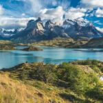 Patagonia Hiking: Guide to Trekking in Torres del Paine
 How Long Does It Take to Climb Kilimanjaro? Route-by-Route
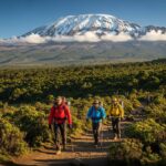 Kilimanjaro Climbing Guide: Routes, Costs, & Difficulty
 Mountain Weather: How to Read Forecasts and Stay Safe
Leave a Reply