web analytics

Tag: Vinson Massif

  • Mount Vinson Expedition Update 2026: Cost, ALE Logistics, Season & Route

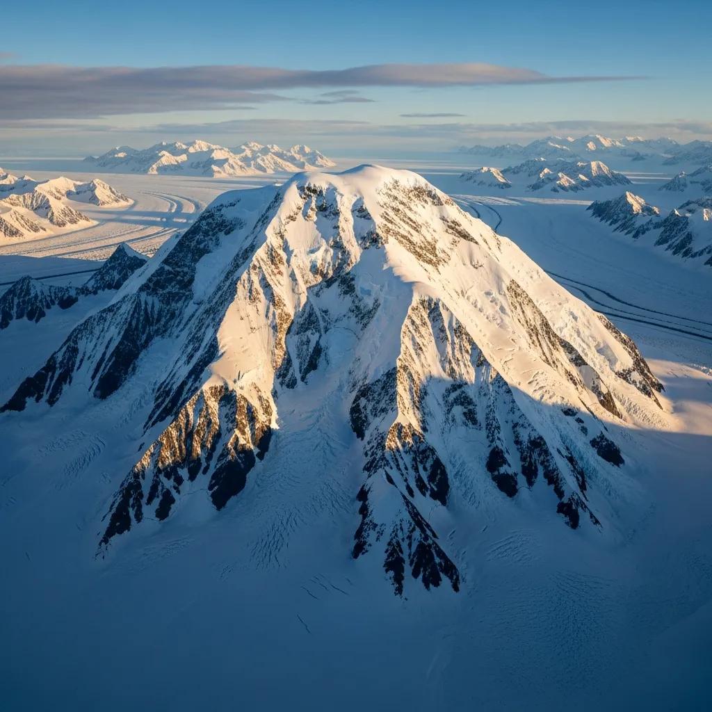
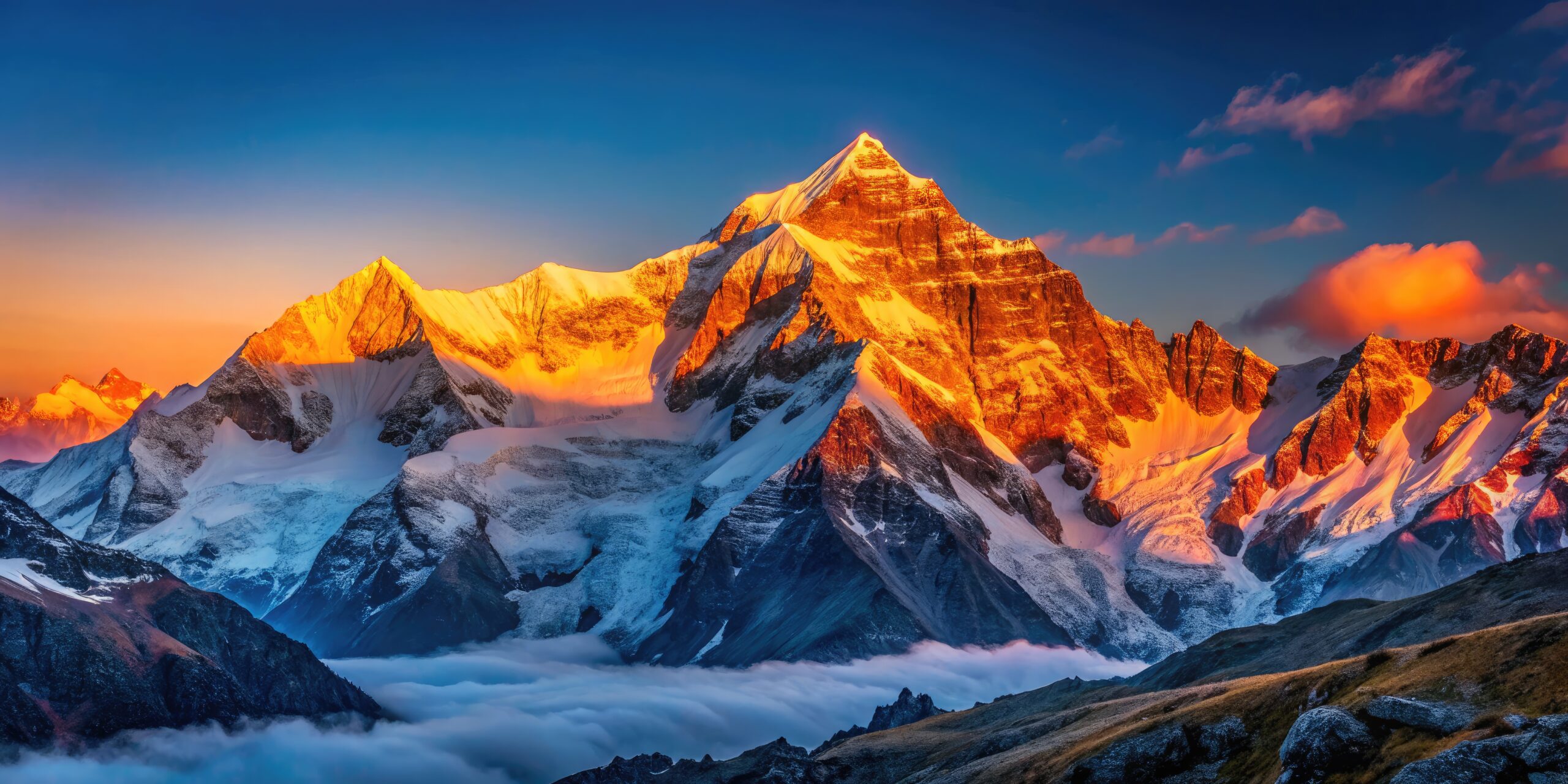
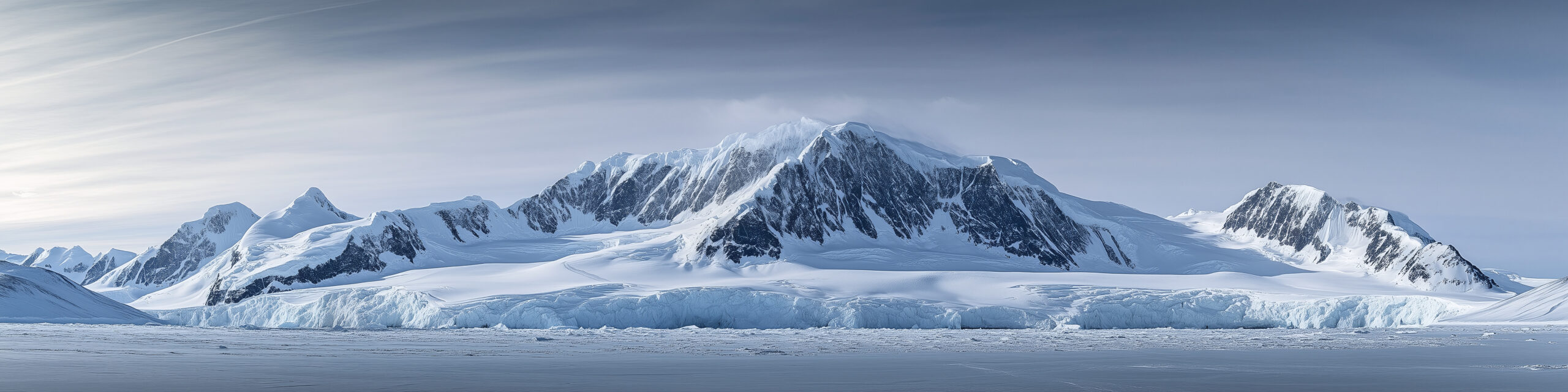
    Mount Vinson, the highest peak in Antarctica, rising from the ice of the Sentinel Range
    Mount Vinson is 4,892 m (16,050 ft), the highest peak in Antarctica. What gates it is logistics and cold, not technical difficulty.
    Expedition Updates · Antarctica

    Mount Vinson expedition update

    The most remote and most logistics-locked of the Seven Summits. This page tracks the December window, the ALE logistics reality, the real all-in cost, the Branscomb route, cold as the crux, and a go or no-go checklist. A single-mountain page in our Expedition Updates directory. Elevations in metres (feet).

    Current status Logistics-gated 4,892 m (16,050 ft)

    The climb is moderate. The logistics and the cold are the whole game.

    Vinson runs in the austral summer, roughly mid-November to late January, with most trips in December under 24-hour daylight. The Branscomb route is a non-technical glacier climb, and success rates are high when the weather cooperates.

    Two things define this mountain. Every expedition flies through one company, ALE, the only logistics provider on the continent, which sets a high price floor. And the cold, down to about -40 C (-40 F) even in summer, is what actually turns people back. Plan for the logistics and the cold, not the pitches.

    4,892 m

    Summit (16,050 ft)

    Highest in Antarctica, in the Sentinel Range of the Ellsworth Mountains.

    December

    Prime window

    Austral summer, mid-Nov to late Jan, under 24-hour daylight.

    $60k+

    Realistic all-in

    Among the most expensive Seven Summits, driven by logistics.

    Mount Vinson sits deep in the interior of Antarctica, about 1,200 km (750 miles) from the South Pole, and only a few hundred people attempt it in a year. It is usually one of the last of the Seven Summits climbers tackle, because reaching it is a bigger problem than climbing it. This page owns the current picture: the season, the logistics, the cost, and the permit rules. For elevation, history, and the full route breakdown, see our Mount Vinson climb guide.

    Season and status

    A short summer window, set by weather rather than a permit calendar.

    Vinson is climbable only in the austral summer, roughly mid-November to late January, when the sun never sets and temperatures are at their least severe. Most commercial expeditions run in December. There is no permit calendar to reserve against; instead the limiting factor is weather, and waiting at Union Glacier Camp for a flyable forecast to or from base camp is a normal part of the trip. Budget contingency days, because a fixed return flight is the enemy of a summit here.

    The ALE logistics reality

    The one fact that explains the price, the schedule, and everything else.

    Antarctic Logistics and Expeditions is the only logistics provider operating in this part of Antarctica, and every expedition depends on it. ALE runs the flights from Punta Arenas, Chile, to Union Glacier Camp on the blue-ice runway, and the ski-equipped aircraft on from there to Vinson Base Camp, and it built and maintains the camp infrastructure that makes climbing there possible at all. Guide operators run their own teams and guides, but they all move on ALE flights and through ALE camps.

    Why this matters to you. Because the logistics run through a single provider, the price floor is high and it does not move with shopping around. It also means schedules cluster in the same short window, and that a weather delay affecting ALE flights affects everyone at once. Understanding that ALE sits underneath every operator is the key to reading Vinson pricing and timelines honestly. Compare guide services on their guiding, ratios, and track record in our how to choose an operator guide, not on logistics they do not control.

    The real all-in cost

    The advertised fee is the start, not the total.

    Guide operators advertise the expedition fee, commonly in the range of $45,000 to $58,000, with one widely published 2026 price at $55,500. That figure already includes the ALE flights, which is most of why it is so high. But it is not the whole cost. Once the surrounding expenses are added, a realistic all-in figure lands closer to $60,000 to $75,000 or more.

    A realistic all-in Mount Vinson budget, per climber, in USD. Figures are approximate; confirm current pricing with your operator.
    CostTypical rangeNotes
    Guided expedition fee$45,000 to $58,000Includes the ALE flights from Punta Arenas to Union Glacier to base camp, guiding, and camp support.
    International flights to Punta Arenas$1,500 to $3,000Getting to the Chilean staging city, from wherever you start.
    Polar gear, if buying$3,000 to $6,000A -40 down suit, high-altitude boots, and the rest of an extreme-cold kit.
    Evacuation and expedition insurance$1,000 to $2,500Evacuation cover is mandatory for the flight service; standard travel policies do not qualify.
    Hotels, meals, contingency days$1,000 to $2,000Punta Arenas either side, plus the weather delays that are normal here.
    Guide and staff tips$1,000 to $2,500Customary on a guided expedition of this length.
    Realistic all-in$55,000 to $75,000+Among the most expensive of the Seven Summits.
    Where the money goes. Almost all of it is logistics, not guiding. See how Vinson compares against the other continental high points in our Seven Summits cost breakdown, and confirm that any policy you buy meets the mandatory evacuation-cover requirement in our mountaineering insurance guide.

    The route and difficulty

    Non-technical by Seven Summits standards, but not easy.

    The Branscomb (Shoulder) route

    The standard route climbs from Vinson Base Camp up the Branscomb Glacier through a series of camps, over slopes and a plateau to a final summit ridge, with some fixed lines on the steeper headwall. It is not technical climbing, but it demands solid mountaineering skills: self-arrest, roped glacier travel, and crevasse rescue, and climbers haul sleds on the lower glacier. Success rates are high when the weather allows, which is why the mountain rewards fitness, cold tolerance, and patience more than technical skill.

    Cold, the true crux

    The environment is the difficulty on this mountain.

    ⚠ The cold is what turns people back, not the terrain

    Temperatures on Vinson reach about -40 C (-40 F) even in the summer season, and wind drives the felt temperature far lower. In that environment, frostbite and cold injuries are the real hazard, and small mistakes with hands, feet, or face have outsized consequences.

    Cold management is the skill that matters most here: a -40-rated down suit, disciplined layering and vapor control, keeping water and batteries from freezing, and looking after your extremities relentlessly. Prepare for the cold as seriously as you would prepare for altitude on a higher peak. This page is educational and is not medical advice.

    Permits and Antarctic Treaty

    No park permit, but real obligations, and they vary by nationality.

    There is no national-park-style climbing permit for Vinson, but Antarctica is governed by the Antarctic Treaty and its environmental protocol, which impose strict rules: full self-sufficiency, minimal environmental impact, and removing all waste from the continent. On top of that, several countries require their own citizens to obtain authorization or a permit before travelling to Antarctica. The United Kingdom, for example, requires a permit under its Antarctic Act, while United States citizens notify the National Science Foundation. In practice your operator and ALE handle much of the compliance, but the obligation to check what your nationality requires rests with you.

    Weather and timing

    A live look at the coldest climb on the Seven Summits list.

    Vinson sits in the interior of Antarctica, where even summer conditions are extreme and weather can shut down flights and climbing for days. The live map below shows current conditions for the massif, set to temperature so the cold is visible; treat it as background, and rely on ALE and your guide team for the operational forecast that actually governs the climb.

    Live temperature and weather for the Mount Vinson area. Source: Windy.com. For how to read a mountain forecast, see our weather guide.
    Mount Vinson, in the Sentinel Range of the Ellsworth Mountains, deep in the Antarctic interior. Map: OpenStreetMap contributors.

    Go or no-go checklist

    Work through these before you commit money or dates.

    Before you book

    • Budget the real all-in – the expedition fee plus flights to Punta Arenas, polar gear, insurance, hotels, and tips, not the advertised number alone.
    • Confirm evacuation insurance – it is mandatory for the flight service, and standard travel policies do not qualify.
    • Check your nationality’s Antarctic rules – some countries require a permit or authorization to travel to Antarctica.
    • Build in contingency days – weather delays at Union Glacier are normal; a tight return flight costs summits.
    • Be honest about cold tolerance – this is a -40 C environment, and cold management is the real skill.
    • Have the mountaineering base – self-arrest, glacier travel, and crevasse rescue are expected before you arrive.

    Mount Vinson update FAQ

    The questions climbers ask most about cost, logistics, and the climb.

    How much does climbing Mount Vinson cost?

    The guided expedition fee alone runs roughly $45,000 to $58,000, with one widely published 2026 price at $55,500. Once you add international flights to Punta Arenas, polar gear, mandatory evacuation insurance, hotels, and tips, a realistic all-in figure lands closer to $60,000 to $75,000 or more. It is among the most expensive of the Seven Summits, and the cost sits in the logistics rather than the climbing.

    Why is Vinson so expensive?

    Because a single company, Antarctic Logistics and Expeditions, is the only logistics provider on the continent, and every expedition flies through it. ALE runs the flights from Punta Arenas to Union Glacier Camp and on to Vinson Base Camp on ski-equipped aircraft, and it built and maintains the infrastructure that makes climbing there possible. Guide operators are, in effect, reselling the same ALE logistics, which sets a high floor no amount of shopping around can move.

    When is the Mount Vinson climbing season?

    The austral summer, roughly mid-November to late January, when Antarctica has 24-hour daylight. Most commercial trips run in December. The window is set by weather and cold rather than a permit calendar, and delays waiting for a flyable forecast at Union Glacier are a normal part of the trip.

    How technical is the climb?

    The standard Branscomb, or Shoulder, route is a non-technical glacier climb: glaciers, slopes, a plateau, and a final ridge, with some fixed lines on the headwall. It still demands solid mountaineering skills, self-arrest, roped glacier travel, and crevasse rescue, and climbers haul sleds on the lower glacier. The difficulty is the environment, not the terrain.

    How cold does it get on Vinson?

    Temperatures reach about -40 C (-40 F) even in the summer season, and wind makes it feel far colder. Cold management is the real challenge: a -40-rated down suit, disciplined layering, protecting extremities, and avoiding frostbite and cold injuries matter more here than climbing difficulty. The extreme cold, not the route, is what turns most people back.

    Do I need a permit to climb Vinson?

    There is no park-style climbing permit, but Antarctic Treaty environmental rules apply, including strict self-sufficiency and removing all waste. Several countries also require their own citizens to obtain authorization or a permit before travelling to Antarctica, for example the United Kingdom under its Antarctic Act, while United States citizens notify the National Science Foundation. Your operator and ALE handle much of this, but confirm what your nationality requires.

    Can I climb Vinson independently?

    In practice, no. Access runs through ALE logistics, and Antarctic Treaty compliance and full self-sufficiency are mandatory. Effectively every climber goes either with a guide service or on an ALE-supported basis. The real decision is which operator, not whether to use the ALE system.

    How high is Mount Vinson and where is it?

    It stands at 4,892 m (16,050 ft) in the Sentinel Range of the Ellsworth Mountains, about 1,200 km (750 miles) from the South Pole. It is the highest peak in Antarctica and one of the Seven Summits, first climbed on December 18, 1966, and only a few hundred people attempt it each year.

    📋 How this update is built

    This page is compiled by Travis Ludlow, Founder and Head of Research at Global Summit Guide, from ALE logistics information, cross-checked 2026 operator pricing, and Antarctic Treaty guidance, with sources named below. It was reviewed for safety by Dawson Ludlow, our Climbing and Mountaineering Lead (Wilderness First Aid), whose highest first-hand summit is Kilimanjaro.

    Our team has not climbed Mount Vinson, so we report operator logistics and official guidance rather than personal experience, and we review this page before each austral summer season. Pricing and rules change, so treat every figure here as a starting point and confirm current costs, insurance requirements, and permit rules directly before committing.

    Planning a Vinson expedition?

    Start with the real numbers in our Seven Summits cost breakdown, compare guide services in the operator directory, and confirm your cover in our mountaineering insurance guide. Every climb stages through Punta Arenas, Chile, so for flights and hotels there, browse travel on Expedia.

    Disclosure: the Expedia link above is a sponsored affiliate link. We may earn a commission at no extra cost to you.

    Was this helpful?

    Yes
    No
    Thanks for your feedback!
  • The History of the Sentinel Range: Discovery, Antarctic Exploration & the First Ascent of Mount Vinson

    The Sentinel Range and Mount Vinson rising above the Antarctic ice sheet
    Antarctic history · Ellsworth Mountains · Polar exploration

    The History of the Sentinel Range: Antarctic Exploration and the First Ascent of Mount Vinson

    For most of recorded history, one of Earth’s greatest mountain ranges was absent from every map. The Sentinel Range entered human knowledge first as a distant line of peaks beneath an aircraft wing—and only three decades later as the setting for one of twentieth-century mountaineering’s most unusual first ascents.

    The short history

    The Sentinel Range was discovered from the air, understood from the ground, and opened by a ten-person expedition.

    Lincoln Ellsworth saw and named the northern Sentinel Range on November 23, 1935 during a trans-Antarctic flight in the Polar Star. He did not appear to see the highest southern peaks. Those were identified through the International Geophysical Year era of aerial reconnaissance, oversnow travel, surveying, and photography in 1958–1959.

    On December 18, 1966, Pete Schoening, Bill Long, Barry Corbet, and John Evans made the first ascent of Mount Vinson. The remaining six members of Nicholas Clinch’s American Antarctic Mountaineering Expedition followed on December 19 and 20. In a matter of weeks, the same expedition also made first ascents of other major Sentinel Range peaks.

    1935Range discovered
    1958Vinson identified
    1959Aerial mapping
    1966Vinson first ascent
    4,892 mMount Vinson today
    Geographic setting: The Sentinel Range forms the northern half of the Ellsworth Mountains in interior West Antarctica. The Heritage Range lies to the south, separated by the Minnesota Glacier.

    One of Earth’s last great geographic discoveries

    The range remained unknown not because it was small, but because Antarctica was vast enough to hide it.

    Standing beneath the Sentinel Range, it is hard to accept how recently these mountains entered recorded geography. The Alps had been crossed for trade and war for centuries. Surveyors had calculated the height of Everest in the nineteenth century. Expeditions had penetrated the Andes, Rockies, and Alaska Range. Yet a chain containing Antarctica’s highest mountain remained absent from maps until the 1930s.

    The explanation is scale. Antarctica covers roughly 14 million square kilometers, and its interior is sealed behind the Southern Ocean, coastal ice, enormous glaciers, and an ice sheet that erases ordinary landmarks. The Sentinel Range lies in West Antarctica, far from the coastal routes followed by ships and far from the best-known sledging corridors of the Heroic Age.

    Reaching the South Pole did not reveal every major feature of the continent. Roald Amundsen and Robert Falcon Scott approached the pole through different mountain gateways hundreds of kilometers from the Ellsworth Mountains. Ernest Shackleton’s proposed transcontinental line also belonged to another geographic problem. The interior was not one white room in which every feature could be seen. It was a continent large enough for entire mountain systems to remain beyond the horizon.

    Why the name “Sentinel” fitsEllsworth’s name captured the impression of the peaks standing like guards above the ice. The northern range presents long walls, sharp summits, and isolated massifs rising abruptly from glacier systems. It looks less like a gradual upland than a line of stone sentries.

    The airplane changed the map

    Antarctic exploration moved from the pace of a dog team to the reach of an aircraft.

    Before aviation, explorers learned Antarctica one hard mile at a time. Ships mapped coasts. Sledging parties crossed glaciers and plateaus. Surveyors fixed positions with instruments that depended on clear skies, stable observations, and patient calculation. Every new valley required weeks of travel and the transport of food, fuel, tents, and scientific equipment.

    An aircraft did not remove Antarctic risk. Early polar flying introduced new forms of it: engine failure over terrain without landing fields, uncertain fuel calculations, primitive weather information, whiteout, and navigation across a nearly featureless surface. What aviation changed was perspective. From altitude, a crew could identify a mountain front, follow a glacier, photograph several ranges, and cross hundreds of kilometers before a ground party had moved camp.

    The Sentinel Range belongs to that transition. It was not approached first by climbers or geologists. It was revealed through a cockpit window.

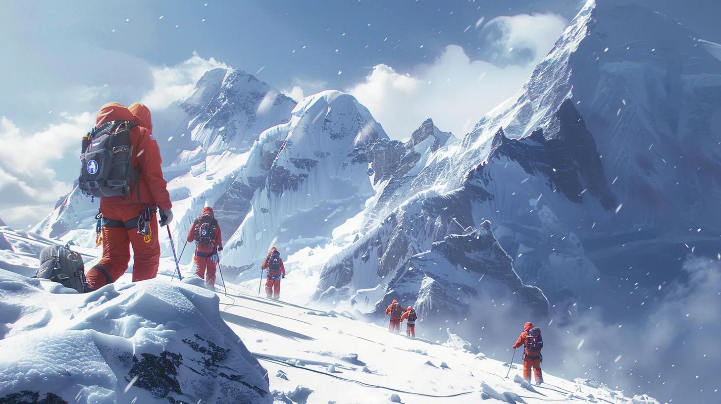
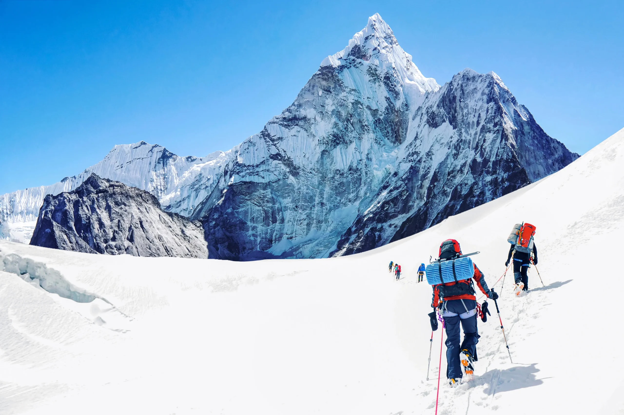
    Roped climbers moving through Antarctic ice formations near the Sentinel Range
    From blank map to climbing ground. Modern teams move through an environment that was unknown to outside geography until aerial exploration exposed the Ellsworth Mountains in the twentieth century.

    Lincoln Ellsworth and the flight of the Polar Star

    On November 23, 1935, a line of mountains appeared beneath one of polar aviation’s boldest crossings.

    Lincoln Ellsworth

    American explorer · polar aviator · geographic pioneer

    Ellsworth had already participated in Arctic aviation with Roald Amundsen before turning his attention south. His Antarctic objective was not a sightseeing flight. He wanted to cross a large section of the continent, record new terrain, and prove that aircraft could transform polar geography.

    Ellsworth and pilot Herbert Hollick-Kenyon departed Dundee Island near the Antarctic Peninsula in the single-engine Polar Star. Their intended trans-Antarctic flight aimed toward Admiral Richard Byrd’s Little America base on the Ross Ice Shelf. The journey was beset by uncertain weather, difficult navigation, forced landings, and eventually a loss of radio contact that made the outside world fear the men had disappeared.

    During the flight on November 23, Ellsworth saw the northern part of the mountain system now called the Ellsworth Mountains. USGS historical research records that he named the Sentinel Range and several visible features, including Mount Lymburner, Polarstar Peak, Mount Ulmer, and Mount Wyatt Earp. The names preserved people and equipment connected to the expedition: his pilot, his aircraft, his wife, and his expedition ship.

    The distinction matters: Ellsworth discovered the mountain system, but he apparently did not see its highest southern summits. Vinson Massif lies farther south in the Sentinel Range. The mountain that later became the continent’s highest known point would require another generation of exploration.

    A correction to a common oversimplificationIt is often said that Lincoln Ellsworth “discovered Mount Vinson” in 1935. More precisely, he discovered and named the northern Sentinel Range. The Vinson area was identified during later U.S. aerial and ground-survey work in the International Geophysical Year period.

    How the Ellsworth Mountains took shape on paper

    First came isolated names. The full structure of the range emerged through later survey work.

    The Ellsworth Mountains are now understood as two major segments: the Sentinel Range in the north and the Heritage Range in the south. The Minnesota Glacier separates them. That clean geographic description was not available to Ellsworth. From the air, through uncertain weather and limited time, he saw only part of a system whose dimensions, drainage, and highest points were still unknown.

    Later cartographers honored Ellsworth by applying his name to the larger mountain system. The choice recognized more than a single sighting. His flight changed the geographic problem. What had been blank space became a range requiring photographs, ground observations, rock samples, elevations, and formal names.

    NameWhat it identifiesHistorical origin
    Ellsworth MountainsThe full West Antarctic mountain systemNamed for Lincoln Ellsworth and his polar discoveries
    Sentinel RangeThe northern, higher segmentNamed by Ellsworth after his 1935 flight
    Heritage RangeThe southern segmentLater mapped and named through U.S. Antarctic survey programs
    Minnesota GlacierThe glacier separating the two segmentsNamed in connection with University of Minnesota geological work
    Vinson MassifThe broad high massif containing Mount VinsonNamed for U.S. Representative Carl G. Vinson

    The International Geophysical Year reaches the Ellsworth Mountains

    The next chapter belonged to scientists, surveyors, Navy air crews, and oversnow traverses.

    The International Geophysical Year of 1957–1958 brought an unprecedented concentration of scientific effort to Antarctica. Nations established stations, launched traverses, expanded aerial photography, measured ice, recorded weather and seismic activity, and turned enormous areas of uncertain geography into surveyable terrain.

    On January 12, 1958, an oversnow traverse led by geophysicist Charles R. Bentley saw the Ellsworth Mountains. The party visited two outlying nunataks, collected rock samples, and established positions for major peaks through ground surveying. The encounter was important because the range was no longer only an aerial impression. Scientists had reached its margins and begun tying the visible peaks to measured ground control.

    U.S. Navy aircraft also observed the high massif during this period. Vinson Massif was identified in January 1958, bringing the highest southern section of the Sentinel Range into formal geographic knowledge. Early elevation estimates changed as measurements improved, but the larger conclusion held: the Sentinel Range contained the highest ground in Antarctica.

    Why ground control matteredAerial photographs can show shape and relative position, but accurate topographic maps require known points. Surveyors established positions and elevations on the ground so photogrammetrists could convert overlapping images into measurable terrain.

    From trimetrogon photography to USGS maps

    By the early 1960s, the mountains had moved from scattered observations to usable topographic sheets.

    On December 14, 1959, U.S. Navy Squadron VX-6 photographed the Sentinel Range using trimetrogon aerial coverage. The system used three cameras: one pointing downward and two looking obliquely to either side. Together they captured broad terrain strips suited to mapping vast areas where ordinary ground survey networks were sparse.

    Combined with subsequent field observations, these photographs produced a series of 1:250,000-scale U.S. Geological Survey maps. The Newcomer Glacier, Nimitz Glacier, and Vinson Massif sheets were published in 1962. Additional photography of the Heritage Range in 1962 supported later Liberty Hills and Union Glacier sheets.

    Those maps changed what was possible. A mountain expedition could now discuss actual glaciers and passes rather than a vague white space. Geologists could design traverses. Pilots could relate landing possibilities to named terrain. Peaks could be compared, measured, and approached as part of a connected system.

    Nov. 23, 1935

    Lincoln Ellsworth discovers the northern Sentinel Range during the trans-Antarctic flight of the Polar Star.

    Jan. 12, 1958

    Charles Bentley’s IGY traverse sees the Ellsworth Mountains, visits outlying nunataks, collects rock, and establishes survey positions.

    Jan. 1958

    Vinson Massif is identified by U.S. aerial reconnaissance in the southern Sentinel Range.

    Dec. 14, 1959

    U.S. Navy VX-6 photographs the Sentinel Range with trimetrogon aerial coverage.

    1961–1962

    University of Minnesota geological fieldwork traverses much of the western Sentinel Range and parts of the Heritage Range.

    1962

    USGS topographic sheets are published for the Vinson Massif and neighboring glacier systems.

    Dec. 18, 1966

    The first four climbers reach Mount Vinson’s summit.

    Vinson: from unnamed high ground to Antarctica’s summit

    The continent’s highest peak was recognized only after the range itself had been surveyed.

    Vinson Massif was named for Carl G. Vinson, the long-serving U.S. representative from Georgia who supported funding for American Antarctic research. The naming followed a common Antarctic pattern: remote geographic features often honored the public officials, scientists, military personnel, pilots, and field workers who made exploration possible.

    For decades, “Vinson Massif” served as both the name of the broad mountain body and, informally, its highest point. Modern place-name usage distinguishes Mount Vinson, the 4,892-meter summit, from Vinson Massif, the larger elevated block around it. That distinction helps separate the precise summit from the whole mountain complex.

    The elevation also evolved with measurement. Early figures were higher. Better surveying, satellite geodesy, and GPS work eventually established the accepted elevation of 4,892 meters (16,050 feet). The changing number is not evidence that the mountain shrank. It records the history of improving instruments.

    A mountain can be “discovered” several timesFirst it is seen. Then it is photographed. Then its position is fixed. Then its height is measured. Then geologists interpret its rock. Then climbers find a route. Vinson passed through each stage within about three decades.

    The American Antarctic Mountaineering Expedition of 1966–1967

    Ten climbers arrived with Navy support, scientific objectives, and a plan larger than one summit.

    By the early 1960s, Mount Vinson had become the obvious unclimbed prize of the continent. Two groups within the American Alpine Club began seeking support for an expedition. The efforts eventually merged, and Nicholas Clinch was selected to lead what became the American Antarctic Mountaineering Expedition, commonly abbreviated AAME.

    The expedition was sponsored by the American Alpine Club and the National Geographic Society, with field support from the U.S. Navy and the National Science Foundation’s Antarctic program. That combination was essential. Private climbers could not simply book an aircraft into the Sentinel Range. The team depended on the polar aviation and logistics infrastructure of the U.S. Antarctic program.

    The ten members were:

    Expedition memberRole in the historical record
    Nicholas ClinchExpedition leader and organizer
    Barry CorbetFirst-ascent party; later first ascent of Mount Tyree with John Evans
    John EvansFirst-ascent party; geologist and later Mount Tyree first ascensionist
    Eiichi FukushimaExpedition climber; associated with the first ascent of Mount Shinn
    Charles HollisterScientist and mountaineer
    William “Bill” LongFirst-ascent party
    Brian MartsExpedition mountaineer
    Peter “Pete” SchoeningFirst-ascent party; renowned American climber
    Samuel SilversteinPhysician and mountaineer
    Richard WahlstromExpedition mountaineer

    The U.S. Navy transported the party first to McMurdo Station and then across the continent in a ski-equipped LC-130 Hercules. The aircraft delivered the team and its equipment into the Sentinel Range—a striking contrast with Ellsworth’s uncertain 1935 crossing. Aviation had progressed from discovery to sustained field support.

    The expedition’s objectives extended beyond planting a flag on the highest summit. The team intended to climb several of the range’s major peaks, collect observations, and demonstrate what organized mountaineering could accomplish in the Antarctic interior.

    December 18, 1966: the first ascent of Mount Vinson

    The summit was reached not by the expedition leader alone, but by a four-man team moving through the range’s first established climbing campaign.

    Pete Schoening, Bill Long, Barry Corbet, and John Evans reached the summit of Mount Vinson on December 18, 1966. The date places the ascent late in mountaineering history compared with the world’s other continental high points. Everest had been climbed in 1953. Denali’s first ascent dated to 1913. Aconcagua had been climbed in 1897. Vinson remained untouched until aircraft and institutional logistics made a serious attempt possible.

    The remaining expedition members did not stop below. Three more reached the summit on December 19, and the final three followed on December 20. All ten members stood on Antarctica’s highest mountain.

    The collective success says something about the expedition’s design. This was not a rushed dash by a small summit pair while others supported from below. It was a broad mountaineering program whose entire membership reached the primary objective.

    The first summit teamPete Schoening, Bill Long, Barry Corbet, and John Evans—December 18, 1966. Nicholas Clinch led the expedition, but the first four summiters should be named individually when recounting the ascent.

    The modern route, flight schedule, commercial camp structure, and equipment have changed profoundly. The historical meaning has not. The 1966 climbers proved that a major Antarctic range could support a sustained alpine expedition and that its highest summit was attainable through careful logistics and disciplined fieldwork.

    More than Vinson: a season of first ascents

    The expedition did not leave after the continental high point. It turned to the harder mountains around it.

    The American Antarctic Mountaineering Expedition made first ascents of six of Antarctica’s highest peaks. That broader record is often overshadowed by Vinson’s Seven Summits status. In mountaineering terms, however, the neighboring objectives gave the expedition much of its depth.

    Mount Shinn was climbed soon after Vinson. Mount Tyree—the second-highest mountain in Antarctica and a far more technical objective—was first climbed by John Evans and Barry Corbet in January 1967. Other summits added to an extraordinary season in which a team moved through a previously unclimbed high range and solved one route after another.

    This is one reason the 1966–1967 expedition deserves to be remembered as more than “the Vinson trip.” It was the opening survey of Sentinel Range mountaineering.

    Do not confuse elevation with difficultyMount Vinson became famous because it is the continental high point. Mount Tyree, only about 40 meters lower, is a much more serious technical climb. The first expedition’s move from Vinson to Tyree showed that its ambition extended beyond list completion.

    Explore the range’s broader climbing geography in the Antarctic peaks collection, which includes Mount Tyree, Mount Shinn, Mount Gardner, Mount Epperly, and other objectives beyond Vinson.

    What exploration revealed beneath the ice

    The Sentinel Range was not only a climbing discovery. Its rocks preserved a record of vanished seas, moving continents, and ancient life.

    Early geological teams found that the Ellsworth Mountains contain thick sequences of sedimentary and metamorphosed sedimentary rock. In the Vinson area, resistant quartz-rich sandstone and related rocks form steep ridges and summit crests. Fossils—including trilobites and younger Paleozoic material in the wider range—help geologists reconstruct environments that existed long before Antarctica became an ice-covered continent.

    The range also carries evidence relevant to continental drift. The orientation and history of the Ellsworth Mountains have been studied as part of West Antarctica’s complicated tectonic development. Rocks now locked in polar ice formed under conditions radically different from the modern climate and were displaced as the southern continents assembled and separated.

    For a climber, the landscape looks permanent: dark walls, blue ice, wind-carved snow. For a geologist, it is evidence of motion over hundreds of millions of years.

    The mountain is younger as a human idea than as a landformVinson entered maps in the twentieth century, but its rocks preserve a history hundreds of millions of years old. “Discovery” marks the beginning of outside documentation, not the beginning of the mountain.

    From state-supported exploration to modern expeditions

    The infrastructure changed. The continent’s control over every journey did not.

    After 1966, ascents remained rare because access was the dominant obstacle. The second ascent did not occur until years later. There was no regular commercial air bridge, no established Union Glacier camp, and no predictable schedule for private climbing teams.

    The development of private Antarctic logistics in the 1980s changed that pattern. Aircraft, blue-ice runway operations, ski-plane transfers, field communications, environmental systems, and established base camps allowed guided expeditions to reach Vinson on a regular seasonal basis. The mountain became the Antarctic member of the Seven Summits circuit.

    That modern access should not blur the historical sequence. Today’s climber stands on layers of work:

    Discovery

    Ellsworth’s aircraft reveals the northern range.

    Survey

    IGY traverses and Navy aircraft establish positions and collect photographs.

    Mapping

    USGS sheets turn photographs and ground control into usable topography.

    Field science

    Geologists traverse the range and interpret its rocks.

    Mountaineering

    The AAME makes the first ascents of Vinson and neighboring peaks.

    Commercial access

    Private polar aviation opens a regular seasonal path for modern climbers.

    The complete modern planning process belongs in the canonical Mount Vinson climbing guide. That page covers flights, the Branscomb Shoulder route, camps, skills, weather, gear, cost, and safety. This post stops where that planning guide begins.

    Why the Sentinel Range still matters

    The history is not finished simply because the highest peak has a boot track.

    The Sentinel Range remains important in three distinct ways.

    It records the transformation of polar exploration

    The range was discovered by an aircraft, mapped through military and scientific aviation, reached by oversnow traverses, and climbed with state-supported logistics. Its history compresses the twentieth-century evolution of Antarctic fieldwork into one place.

    It is a geological archive

    The exposed rock above the ice provides rare windows into West Antarctica’s deep history. Fossils, sedimentary layers, folds, and structural relationships help scientists reconstruct ancient environments and continental movement.

    It remains a serious alpine range

    Vinson is now a standardized guided objective, but the Sentinel Range is not “solved.” Peaks such as Tyree, Gardner, and Epperly retain technical seriousness, sparse visitation, and expedition-level consequences. Beyond the best-known lines, the range still holds the scale and remoteness that first defined it.

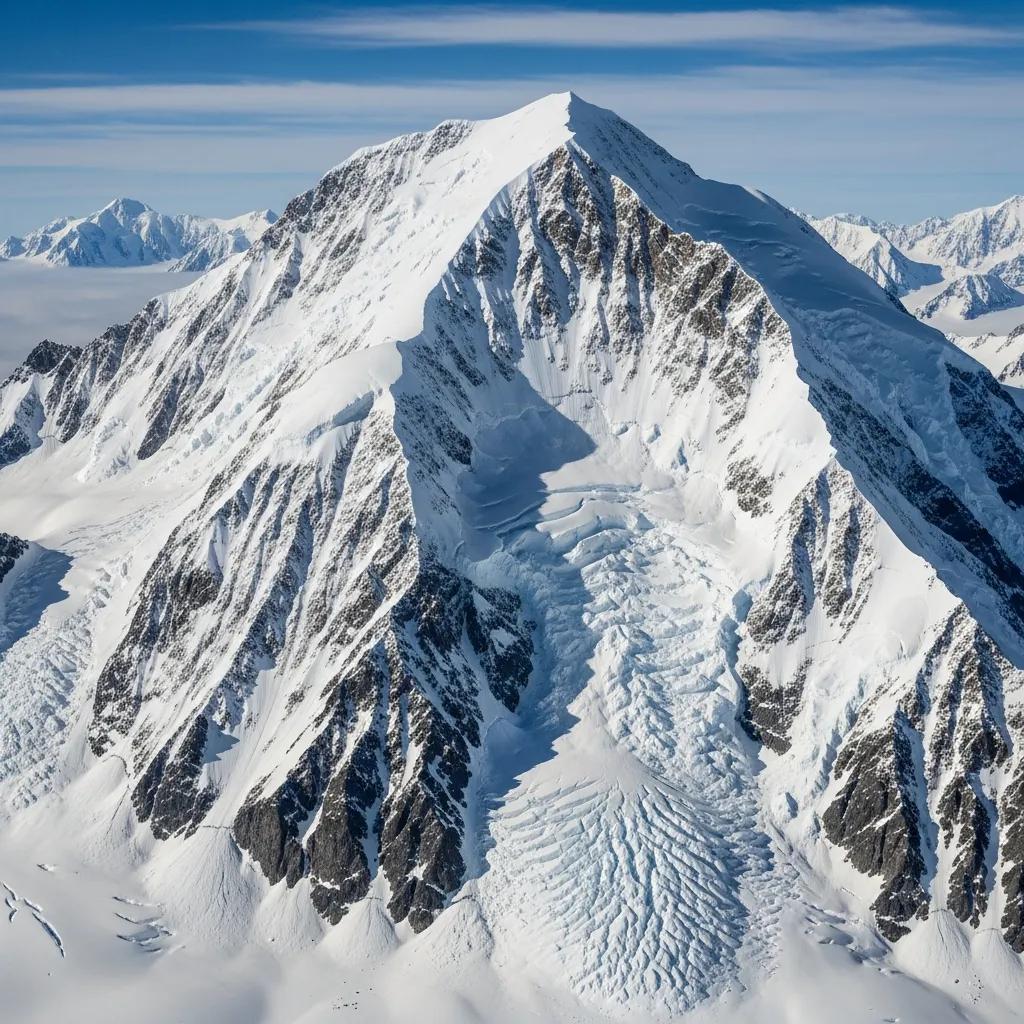
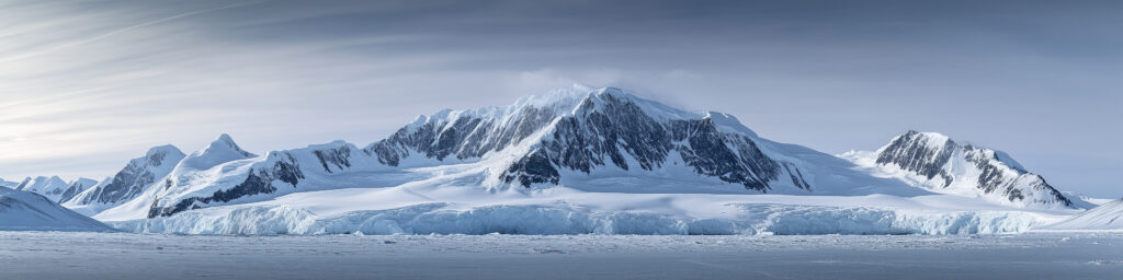
    Broad glaciated peaks of the Sentinel Range in interior Antarctica
    A range larger than one summit. Mount Vinson is the headline, but the Sentinel Range contains a dense concentration of Antarctica’s highest and most technically demanding peaks.

    Frequently asked questions

    Direct answers to the historical questions most often confused in short mountain summaries.

    Who discovered the Sentinel Range?

    Lincoln Ellsworth discovered the northern Sentinel Range on November 23, 1935, during his trans-Antarctic flight in the Polar Star. He named the range and several visible peaks.

    Did Lincoln Ellsworth discover Mount Vinson?

    Not in the precise sense. Ellsworth saw the northern Sentinel Range but apparently did not see the highest southern massifs. Vinson was identified through U.S. aerial and survey work during the International Geophysical Year era in 1958.

    When was the Sentinel Range first visited on the ground?

    An IGY oversnow traverse led by Charles R. Bentley reached outlying features of the Ellsworth Mountains in January 1958, collected rock samples, and established survey positions. Later geological teams worked extensively in the range.

    Who made the first ascent of Mount Vinson?

    Pete Schoening, Bill Long, Barry Corbet, and John Evans reached the summit on December 18, 1966. They were members of the ten-person American Antarctic Mountaineering Expedition led by Nicholas Clinch. Every expedition member summited by December 20.

    Why is the mountain named Vinson?

    Vinson Massif was named for U.S. Representative Carl G. Vinson of Georgia, who supported funding for American Antarctic research and exploration.

    Why are the Ellsworth Mountains divided into two ranges?

    The Sentinel Range forms the northern and higher segment, while the Heritage Range lies to the south. The Minnesota Glacier separates the two.

    Was Vinson the only mountain climbed by the 1966 expedition?

    No. The expedition made first ascents of six major Antarctic peaks, including Mount Vinson. Its members also opened important routes on neighboring mountains such as Mount Shinn and Mount Tyree.

    Why was Mount Vinson climbed so late?

    Access, not lack of climbing ability, was the central barrier. The mountain is deep in the Antarctic interior. A serious attempt required accurate maps, long-range ski aircraft, polar logistics, communications, and institutional support.

    Sources and historical method

    The chronology was checked against the USGS paper Craddock Massif and Vinson Massif Remeasured, which summarizes the discovery of the Ellsworth Mountains, the 1958 traverse, 1959 aerial photography, subsequent mapping, and early scientific work. The 1966 expedition roster and six-peak first-ascent record were checked against the American Alpine Club’s historical exhibit. First-ascent details were cross-checked with Antarctic Logistics & Expeditions and established expedition histories.

    Primary and institutional references: U.S. Geological Survey; American Alpine Club; U.S. Antarctic place-name records; Antarctic Logistics & Expeditions; International Association of Antarctica Tour Operators.

    Historical names and elevations can change as naming authorities refine definitions and survey technology improves. This article distinguishes Mount Vinson from Vinson Massif and uses the accepted modern elevation of 4,892 meters.

    Why we wrote this guide

    Mountains are more useful when they are understood as places rather than products. The Sentinel Range cannot be reduced to an expedition price and a summit itinerary. Its story belongs to pilots, surveyors, scientists, mapmakers, military air crews, and climbers who worked in sequence to reveal a range that had been invisible to the outside world. This post preserves that history while the separate Mount Vinson guide handles practical expedition planning.

    Travis Ludlow

    Founder & Head of Research, Global Summit Guide

    Travis develops research-based mountain resources from Nephi, Utah. Global Summit Guide separates history, geography, route planning, equipment, cost, and operator selection into distinct articles so each page can answer one job thoroughly without repeating the same mountain overview.

    Read the Global Summit Guide editorial approach →

    Ready to move from history to expedition planning?

    Follow the Sentinel Range story into the complete Mount Vinson guide, where modern aviation, camps, the standard route, weather, skills, equipment, cost, and safety are covered in detail.

    Plan a Mount Vinson climb Explore Antarctica’s peaks

    Was this helpful?

    Yes
    No
    Thanks for your feedback!
  • Vinson Massif: Complete Guide to Climbing Antarctica’s Highest Peak

    Vinson Massif: Complete Guide to Climbing Antarctica’s Highest Peak (2026) | Global Summit Guide
    Cluster 07 · Seven Summits · Updated April 2026

    Vinson Massif: Complete Guide to Climbing Antarctica’s Highest Peak

    The definitive 2026 guide to climbing Vinson Massif — Antarctica’s highest peak at 16,050 feet. The most remote of the Seven Summits, requiring specialized logistics via Punta Arenas, Chile and ALE’s Ilyushin IL-76 flights to Union Glacier Camp. Everything you need for the most expensive and logistically complex continental high point on Earth.

    16,050 ft
    Summit
    elevation
    16–22
    Expedition
    days
    ~60–70%
    Summit
    success
    $45K–60K
    Expedition
    cost
    Global Summit Guide A guide in Cluster 07 · Seven Summits View master hub →

    Vinson Massif is Antarctica’s highest peak, rising to 16,050 feet in the Sentinel Range of the Ellsworth Mountains — just 600 miles from the South Pole. It’s not the hardest Seven Summit technically, nor the highest, but it is the most remote, the most expensive, and logistically the most complex. There are no roads, no rescue helicopters, no base camp infrastructure beyond what is flown in each season by Antarctic Logistics & Expeditions (ALE) — the single operator that makes Vinson expeditions possible. Climbers fly to Punta Arenas, Chile, wait for weather, board a Russian Ilyushin IL-76 cargo jet, land on a blue-ice runway in Antarctica, and then climb in 24-hour daylight at temperatures that regularly drop to -50°F. This is the cluster finale — completing our Seven Summits coverage with the continent most climbers save for last.

    How this guide was built

    Route and logistics data verified against Antarctic Logistics & Expeditions (ALE) published information and operational briefings. Cost figures confirmed with Alpine Ascents International, Mountain Madness, International Mountain Guides, Adventure Consultants, and Jagged Globe (2026 rates). Historical first-ascent data from the American Alpine Club archives. Technical route details cross-checked with the American Alpine Journal reports and the climbing record from ALE’s seasonal reports. Reviewed by practicing Antarctic expedition guides with 2025 season experience. Fact-check date: April 19, 2026.

    Vinson Massif Overview: The Seventh Continent’s High Point

    Vinson Massif was only discovered in 1958 during aerial surveys — the last continental high point to be identified. Named after American congressman Carl Vinson for his support of Antarctic research, the mountain sits in the Sentinel Range of the Ellsworth Mountains, approximately 600 miles from the South Pole. The first ascent came in 1966 by an American Alpine Club expedition.

    Key Vinson Massif facts

    • Summit elevation: 16,050 feet (4,892 meters) — Antarctica’s highest
    • Prominence: 16,050 feet (rises from sea level)
    • Location: Sentinel Range, Ellsworth Mountains, West Antarctica
    • Distance from South Pole: ~600 miles
    • Coordinates: 78°31′30″S 85°37′02″W
    • First ascent: December 18, 1966 — American Alpine Club expedition led by Nicholas Clinch (Barry Corbet, John Evans, Bill Long, Pete Schoening, Sam Silverstein, Dick Wahlstrom)
    • Named for: Carl Vinson, US Congressman (1914-1965), supporter of Antarctic exploration funding
    • Climbing season: November through January (Antarctic summer)
    • Only commercial operator: Antarctic Logistics & Expeditions (ALE), headquartered in Punta Arenas, Chile
    • Annual climbers: ~150-250 per year
    • Summit success rate: ~60-70% for guided expeditions
    Why Vinson is the Seven Summits capstone

    Most climbers pursuing all Seven Summits save Vinson for last for several reasons. First, the cost — at $45,000-$60,000, Vinson represents 30-40% of the total Seven Summits budget. Second, logistics — ALE’s flight availability is limited and expensive. Third, experience — Vinson benefits from prior glaciated peak experience on Denali or Elbrus. Finally, the sense of accomplishment — completing the Seven Summits on Antarctica’s highest peak provides a fitting conclusion to the journey. See our Seven Summits guide for the full progression framework.


    The Standard Route: Branscomb Glacier / West Face

    Approximately 95% of Vinson climbers use the Branscomb Glacier / West Face route, the standard line established by ALE and used by all major guide services. The route progresses from Base Camp through Low Camp and High Camp to the summit via the West Face headwall and summit ridge.

    0
    Starting Point

    Vinson Base Camp

    On the Branscomb Glacier. Arrival via Twin Otter ski plane from Union Glacier Camp. Basic camp with group dining tent, communications tent. Typically 1-2 night stay to organize and acclimatize.

    7,000 ft
    Elevation
    1
    Day 8-9 of Expedition

    Low Camp

    5-6 miles up the Branscomb Glacier. Cache-and-carry method typical — cache gear day one, move day two. Acclimatization important. First real alpine camp experience of the expedition.

    9,200 ft
    Elevation
    2
    Day 10-13 of Expedition

    High Camp

    Below the West Face headwall. Final camp before summit. Weather often forces rest days here. Most serious cold-weather conditions of the expedition — summit push staged from here.

    12,400 ft
    Elevation
    Summit Day · 10-14 Hours

    Vinson Massif Summit

    From High Camp via the fixed-line headwall and summit ridge. Two false summits before the true summit. Temperature typically -30°F to -50°F. Wind common. 24-hour daylight means summit attempts can happen at any hour.

    16,050 ft
    Summit
    The West Face headwall and summit ridge

    The section between High Camp and the summit features the West Face headwall — a steep snow and ice slope fixed with ropes by early-season climbers each year. Climbers use ascenders (jumars) to ascend this section. Above the headwall, the long summit ridge extends to the true summit, passing two false summits that test climber psychology. The ridge is exposed with dramatic drops to either side, and summit-day winds can exceed 60 mph. Despite being non-technical, this section demands concentration, cold-weather tolerance, and careful pace management. Most summit-day retreats occur on this ridge, either from weather, exhaustion, or cold injury.


    Antarctic Logistics: The ALE System

    Vinson’s unique challenge isn’t climbing — it’s getting there. Antarctic Logistics & Expeditions (ALE) operates the only commercial access to interior Antarctica for mountaineers. Understanding their system is essential to planning a Vinson expedition.

    The ALE operation

    • Base of operations: Punta Arenas, Chile — southernmost major city on the South American continent.
    • Primary aircraft: Ilyushin IL-76 (Russian heavy-lift cargo aircraft) — flies climbers from Punta Arenas to Union Glacier Camp in Antarctica.
    • Flight distance: ~1,860 miles across the Southern Ocean and Drake Passage.
    • Flight duration: ~4.5 hours.
    • Landing site: Union Glacier Camp on a blue-ice runway at 79° South.
    • Union Glacier Camp: ALE’s main Antarctic base. Heated tent facilities, dining, communications, medical tent. Hub for Vinson climbers, South Pole traverses, and Antarctic researchers.
    • Final transport: Twin Otter ski plane from Union Glacier to Vinson Base Camp — ~1 hour flight.

    Why ALE is the only option

    • Antarctic Treaty restrictions limit commercial operations.
    • ALE holds operational permits and infrastructure investment ($millions annually).
    • Ilyushin IL-76 aircraft operations extremely expensive and specialized.
    • Blue-ice runway maintenance and meteorological systems require year-round logistics.
    • Twin Otter ski plane fleet and pilots dedicated to Antarctic operations.
    • Emergency response systems operated by ALE alone.
    Weather determines everything

    The single largest source of uncertainty in Vinson expeditions is weather delays at four different stages: (1) Ilyushin IL-76 flight from Punta Arenas to Union Glacier. (2) Twin Otter flight from Union Glacier to Vinson Base Camp. (3) Climbing conditions on the mountain. (4) Return flights both legs. Any of these can delay climbers 1-5 days. Most expeditions factor 3-5 weather days into their schedules, but rare major delays can push expeditions 28+ days. Budget expedition windows of 21-28 days minimum.


    Typical Vinson Expedition Timeline

    Most Vinson expeditions run 16-22 days total. Here’s what a typical 21-day timeline looks like:

    Days 1-2

    Travel to Punta Arenas

    International flights via Santiago, Chile to Punta Arenas. Total travel time 24-36 hours from North America or Europe. Check into hotel, rest, adjust to time zone.

    Day 3

    ALE Orientation

    Mandatory ALE briefing at Punta Arenas headquarters. Equipment inspection, safety protocols, environmental requirements. Guide service gear check.

    Days 4-5

    Weather Standby

    Wait for Ilyushin IL-76 flight authorization. Weather at Union Glacier must meet landing requirements. Most expeditions experience 1-2 days of standby.

    Day 6

    Fly to Antarctica

    Ilyushin IL-76 flight from Punta Arenas to Union Glacier Camp. 4.5 hours. Arrive Antarctica, orientation at Union Glacier, settle into heated tent accommodation.

    Day 7

    Twin Otter to Vinson Base Camp

    1-hour Twin Otter ski plane flight from Union Glacier to Vinson Base Camp at 7,000 ft. Establish camp, rest, begin acclimatization. Weather may delay flight 1-2 days.

    Days 8-9

    Move to Low Camp

    Cache-and-carry method: Day 8 cache gear at Low Camp (9,200 ft), return to Base Camp to sleep. Day 9 move to Low Camp with remaining gear.

    Days 10-12

    Move to High Camp

    Progressive moves from Low Camp to High Camp at 12,400 ft. Cache and move pattern. Rest and acclimatization days. Weather assessment for summit window.

    Day 13

    Rest Day at High Camp

    Acclimatization day at 12,400 ft. Weather monitoring. Summit day preparation. Most serious cold encountered here — extreme tent-based living.

    Day 14

    Summit Day

    10-14 hour summit day from High Camp. Via West Face headwall and summit ridge. Temperatures -30°F to -50°F. Return to High Camp for sleep.

    Days 15-16

    Descent to Base Camp

    Rapid descent from High Camp to Low Camp to Base Camp. Pack camp, prepare for flight out.

    Days 17-18

    Twin Otter and Union Glacier

    Twin Otter flight to Union Glacier Camp. Weather delays possible. Wait for Ilyushin flight schedule.

    Day 19

    Return to Punta Arenas

    Ilyushin IL-76 flight back to Punta Arenas, Chile (weather permitting). Celebration dinner, hotel rest.

    Days 20-21

    Travel Home

    Rest day in Punta Arenas. International flights home via Santiago.


    Vinson Cost Breakdown: 2026 Budget Planning

    Vinson is the most expensive Seven Summit — typically $45,000-$60,000 for a fully guided expedition. Understanding where the money goes helps plan realistically:

    Approach 1

    Fully Guided Expedition

    $52,000–$68,000
    • ALE + guide package$48,000–$58,000
    • International flights$1,500–$3,000
    • Personal gear$5,000–$8,000
    • Hotel Punta Arenas$300–$500
    • Insurance/evacuation$500–$1,500
    • Guide tips (~18%)$3,000–$5,000
    • Weather contingency$2,000–$4,000
    Approach 2

    Logistics-Only (Self-Guided)

    $42,000–$56,000
    • ALE logistics only$35,000–$45,000
    • International flights$1,500–$3,000
    • Personal gear (full)$5,000–$8,000
    • Hotel Punta Arenas$300–$500
    • Insurance/evacuation$500–$1,500
    • Group equipment$500–$1,500
    • Weather contingency$2,000–$4,000

    Why Vinson is so expensive

    • Antarctic Treaty compliance — Environmental requirements add significant overhead.
    • Ilyushin IL-76 operations — Extremely expensive cargo flight operations from Chile.
    • Union Glacier Camp — ALE builds and maintains entire facility annually.
    • Twin Otter ski plane logistics — Specialized pilots, equipment, fuel staging.
    • Emergency response — No rescue helicopters available; ALE handles all emergencies.
    • Short season — Operations compressed into 10-week November-January window.
    • Remote location — All supplies must be flown in; no road access anywhere.

    For comparison with other Seven Summits peaks, see our complete mountain climbing costs guide. Vinson is approximately 3-4x the cost of Denali ($12,000-$18,000) and 5-7x the cost of Aconcagua ($6,000-$9,000).


    Preparing for Vinson: Essential Prerequisites

    Prior climbing experience required

    • Glaciated peak experience: Denali, Elbrus, Mt. Rainier, or European alpine peaks essential.
    • Extended winter camping: Multiple nights at sub-zero temperatures.
    • Crevasse rescue proficiency: Roped team travel, self-rescue, team rescue techniques.
    • Fixed-line climbing: Use of ascender on fixed ropes.
    • At minimum: One prior Seven Summits peak (often Denali or Elbrus).

    Physical training (6-9 months before)

    • Aerobic base: 4-5 cardio sessions weekly. Maintain strong cardiovascular capacity.
    • Weighted pack hiking: Simulate expedition load (50-65 lbs).
    • Leg strength: Squats, lunges, step-ups with progressive weight.
    • Altitude exposure: Weekend trips to 10,000+ ft if possible. Hypoxic training tents.
    • Cold exposure: Practice extreme cold camping — Vinson’s -50°F conditions cannot be replicated, but cold tolerance can be built.
    • Gear testing: Use all expedition gear in cold weather before Antarctica.

    See our complete high altitude training program for detailed periodized training applicable to Vinson preparation.


    Vinson Massif FAQ: Your Common Questions Answered

    How much does it cost to climb Vinson Massif?

    Climbing Vinson Massif costs $45,000-$60,000 for a guided expedition — making it the most expensive of the Seven Summits. Complete 2026 cost breakdown: ALE logistics (mandatory): (1) Antarctic Logistics & Expeditions charges approximately $45,000-$50,000 for their standard Vinson expedition package. This is unavoidable — ALE operates the only commercial flights from Punta Arenas to Union Glacier Camp. (2) Package includes: Ilyushin IL-76 round trip flight Punta Arenas to Union Glacier, Union Glacier Camp accommodation, Twin Otter flight to Vinson Base Camp, guide services, all meals at Union Glacier, group gear. Major guide services partnering with ALE: (3) Alpine Ascents International: $48,000-$58,000. (4) Mountain Madness: $47,000-$55,000. (5) International Mountain Guides (IMG): $48,000-$56,000. (6) Adventure Consultants: $50,000-$58,000. (7) Jagged Globe: $48,000-$54,000. Additional costs: (8) International flight to Punta Arenas, Chile: $1,500-$3,000 from North America/Europe. (9) Pre/post expedition hotel in Punta Arenas: $300-$500. (10) Gear if buying new: $5,000-$8,000. (11) Personal insurance and evacuation coverage: $500-$1,500. (12) Tips for guides (15-20%): $3,000-$5,000. (13) Contingency budget for weather delays: Recommended $2,000-$4,000. Total realistic budget: (14) Mid-range: $52,000-$62,000 total. (15) Premium outfitter: $60,000-$72,000 total. (16) Budget-conscious: $48,000-$55,000 with gear rental. Why so expensive: (17) Antarctica has no infrastructure — ALE builds entire camp each season. (18) Ilyushin IL-76 flight operations extremely expensive. (19) Twin Otter ski planes require specialized pilots and fuel logistics. (20) Season limited to November-January (Antarctic summer). (21) Antarctic Treaty environmental requirements increase costs. Vinson is approximately 3-4x the cost of Denali ($12,000-$18,000) and 5-7x the cost of Aconcagua ($6,000-$9,000). Most Seven Summits aspirants save Vinson for last due to the expense. See our complete mountain climbing costs guide.

    How hard is Vinson Massif to climb?

    Vinson Massif is moderate in technical difficulty for a 16,050-foot peak, but the extreme cold, remoteness, and weather dependency make it more challenging than the elevation suggests. Difficulty factors: (1) Summit elevation: 16,050 ft (4,892 m) — lower than Aconcagua, Denali, or Everest. (2) Technical rating: Non-technical glacier climb. Roped travel required, crampons and ice axes essential. No rock climbing or roped technical sections in standard route. (3) Physical demand: Moderate. Total summit day distance ~12 miles round trip with 3,000-4,000 ft elevation gain. (4) Climate: Extreme cold. Summit temperatures -30°F to -50°F typical. Wind chill often much colder. (5) Wind: Summit winds routinely 30-60 mph, can exceed 80 mph in storms. (6) Remoteness: Most remote Seven Summit. Emergency evacuation takes days. No rescue helicopters. (7) Weather dependency: 1-5 day weather delays common. Ilyushin IL-76 cannot land in bad weather. (8) Technical skills required: Glacier travel, crevasse rescue, roped team climbing, extreme cold weather camping. (9) Success rate: Approximately 60-70% for guided expeditions — higher than Denali due to ALE’s established operation. Comparative difficulty: (10) Easier technically than Denali. (11) Easier than Aconcagua (shorter, less altitude). (12) Similar technical difficulty to Elbrus but much colder and more remote. (13) Harder than Kilimanjaro due to glacier terrain and cold. (14) Much easier than Everest technically. Why Vinson still demands respect: (15) Extreme cold makes every task harder — eating, drinking, gear management. (16) No infrastructure — no barrel huts, no cable cars, no rescue response. (17) Weather dictates everything — you wait for windows or fail. (18) Antarctic conditions test equipment and technique. (19) Crevasse hazards throughout route. (20) Summit day length: 10-14 hours at altitude in extreme cold. Preparation requirements: (21) Prior glaciated peak experience strongly recommended (Denali, Elbrus, Mt. Rainier, European alpine peaks). (22) Crevasse rescue proficiency. (23) Extended winter camping experience. (24) Excellent physical fitness — not the most demanding 7SS but still serious.

    How do you get to Vinson Massif?

    Getting to Vinson Massif requires a multi-stage journey: international flight to Punta Arenas, Chile, then a unique Ilyushin IL-76 charter flight to Antarctica’s Union Glacier Camp, then a Twin Otter ski plane to Vinson Base Camp. Complete journey breakdown: Stage 1: International to Punta Arenas (1) Fly to Santiago, Chile (SCL) — major international gateway. (2) Domestic flight Santiago to Punta Arenas (PUQ) — 3.5 hours. (3) Total travel time from North America/Europe: 24-36 hours. (4) Airlines serving Punta Arenas: LATAM, Sky Airline. Stage 2: Punta Arenas to Antarctica via ALE (5) Antarctic Logistics & Expeditions (ALE) operates the only commercial access to interior Antarctica. (6) ALE headquarters in Punta Arenas briefs all climbers on logistics, safety, environmental protocols. (7) 1-3 days weather delay typical before flight authorization. (8) Ilyushin IL-76 cargo/passenger aircraft — Russian heavy lift aircraft — flies climbers to Union Glacier. (9) Flight duration: ~4.5 hours over Drake Passage. (10) Lands on blue-ice runway at Union Glacier Camp (79° S, 2,800 ft elevation). Stage 3: Union Glacier to Vinson Base Camp (11) Union Glacier Camp is ALE’s main base, serving Vinson climbers and South Pole traverses. (12) Climbers overnight at Union Glacier, receive final briefings. (13) Twin Otter ski plane flights to Vinson Base Camp — ~1 hour. (14) Vinson Base Camp at 7,000 ft on Branscomb Glacier. (15) Weather can delay Twin Otter flights 1-3 days. Stage 4: Climbing Vinson (16) Standard 7-10 day climb from Base Camp. (17) Return to Base Camp after summit. (18) Twin Otter flight back to Union Glacier. Stage 5: Return to civilization (19) Ilyushin IL-76 flight Union Glacier to Punta Arenas. (20) Weather delays routinely add 2-5 days at either end. (21) International flights home from Punta Arenas via Santiago. Total round-trip time: (22) Minimum 14 days in good weather. (23) Typical 18-22 days with weather buffers. (24) Maximum 28+ days if multiple weather delays. This unique logistics chain is why Vinson costs $45,000-$60,000 — you’re paying for ALE’s entire Antarctic operation.

    When is the best time to climb Vinson Massif?

    The best time to climb Vinson Massif is November through January — Antarctica’s summer season, when 24-hour daylight and comparatively milder temperatures enable climbing. Monthly breakdown: (1) November: Early season. Colder temperatures, fewer expeditions, slightly less reliable weather. First ALE flights of season typically mid-November. (2) Early-mid December: Peak season. Warmest temperatures, most reliable weather windows, multiple expeditions running concurrently. Most popular month for commercial Vinson climbs. (3) Late December: Christmas/New Year season — still excellent but higher demand. (4) January: Prime climbing month. Best weather typically, long daylight, most commercial expeditions. (5) Late January: Season winding down. Cooling temperatures, last ALE flights approximately January 25. (6) February through October: No climbing — Antarctic winter. 24-hour darkness, extreme cold (-80°F+), no flights possible. Why the short window: (7) Antarctic summer provides 24-hour daylight — necessary for safe climbing and logistics. (8) Temperatures ‘only’ -30°F to -50°F at summit in summer vs. -80°F+ in winter. (9) ALE’s Ilyushin IL-76 flights require daylight and weather windows. (10) Union Glacier Camp operates only during this window. Daily conditions: (11) Summit temperature: -30°F to -50°F in summer. (12) Summit wind: 30-60 mph typical; can exceed 80 mph in storms. (13) Base camp temperature: -10°F to 10°F. (14) 24-hour daylight: Sun never sets in climbing season. (15) Summit days can be any time — climbers often start early afternoon to reach summit during ‘warmer’ part of night. Weather considerations: (16) Ilyushin flights depend on blue-ice runway conditions at Union Glacier. (17) Twin Otter flights depend on Vinson Base Camp conditions. (18) Weather delays can strand climbers 3-7 days at various points. (19) Budget 21-day expedition window minimum to accommodate delays.

    What is the standard route up Vinson Massif?

    The standard route up Vinson Massif is the Branscomb Glacier / West Face route, which approximately 95% of climbers use. Route overview: (1) Base Camp: Branscomb Glacier at 7,000 ft. (2) Low Camp: 9,200 ft — on the Branscomb Glacier. (3) High Camp: 12,400 ft — below the West Face. (4) Summit: 16,050 ft via the summit ridge. (5) Distance: Approximately 8 miles one way from Base Camp to summit. (6) Technical rating: Non-technical glacier climb. Crampons and ice axes essential. Roped travel throughout. (7) Fixed lines: Fixed on the steeper headwall between High Camp and summit. Route progression: (8) Base Camp to Low Camp: 5-6 miles on Branscomb Glacier. Gradual elevation gain. Typically cache-and-carry method. (9) Low Camp to High Camp: 4 miles with steeper section near the headwall. Establish high camp. (10) High Camp to Summit: 4 miles with the steepest terrain of the climb. Fixed lines on headwall. Long summit ridge to the top. Key features: (11) Branscomb Glacier: Main glacier approach, heavily crevassed in places. (12) The Headwall: 1,000 ft steep snow/ice section between High Camp and summit ridge. Often fixed with ropes by early-season teams. (13) Summit Ridge: Long, exposed ridge with dramatic views of the Sentinel Range. (14) False Summits: Two false summits before the true summit — psychologically challenging. Alternative routes (rarely climbed): (15) Wessbach Ridge: Technical ridge climb, seldom attempted commercially. (16) East Face: Steep ice and mixed terrain, expert-only. (17) North Ridge: Historical route from first ascent era. Modern climbing: Commercial Vinson expeditions use the Branscomb/West Face route exclusively.

    How long does it take to climb Vinson Massif?

    Vinson Massif expeditions typically take 16-22 days total, including travel to Punta Arenas, ALE logistics, Antarctic flights, the climb itself, and weather buffers. Typical 21-day timeline: Pre-expedition: (1) Day 1-2: Travel to Punta Arenas, Chile. Rest and acclimatization to time zone. (2) Day 3: ALE orientation and briefing. Equipment check. Weather assessment. (3) Day 4-5: Weather delay likely. Standby for Ilyushin IL-76 flight authorization. Antarctic travel: (4) Day 6: Ilyushin IL-76 flight to Union Glacier Camp (weather permitting). 4.5 hours. Arrive in Antarctica. Orientation at Union Glacier. (5) Day 7: Twin Otter ski plane to Vinson Base Camp (7,000 ft). Establish base camp. Weather may delay 1-2 days. Climbing phase: (6) Days 8-9: Move to Low Camp (9,200 ft). Cache-and-carry method. Acclimatization. (7) Days 10-12: Move to High Camp (12,400 ft). Cache gear and establish. Rest for acclimatization. (8) Day 13: Rest day at High Camp. Weather assessment. (9) Day 14: Summit day. 10-14 hours round trip to 16,050 ft summit via headwall and summit ridge. Return to High Camp. Descent: (10) Day 15: Descend High Camp to Low Camp. (11) Day 16: Descend Low Camp to Base Camp. Pack for departure. (12) Day 17: Twin Otter flight to Union Glacier. Weather delays possible. (13) Day 18: Rest at Union Glacier. Await Ilyushin flight. (14) Day 19: Ilyushin IL-76 flight back to Punta Arenas (weather permitting). (15) Day 20-21: Rest in Punta Arenas, international flights home. Factors affecting timeline: (16) Weather delays: Multiple delays possible at each flight stage. Add 1-5 days. (17) Summit windows: Most teams get 1-2 summit attempt opportunities. (18) Acclimatization: Individual response varies. (19) Fitness: Strong teams may complete in 16-17 days; slower teams 22-24 days. Most climbers book 21-day commercial expedition packages.

    Do you need a guide to climb Vinson Massif?

    Yes, functionally you need a guide to climb Vinson Massif — independent climbing is technically possible but impractical due to ALE’s monopoly on Antarctic logistics. Guide requirements: (1) ALE operates the only commercial flights to Union Glacier Camp. (2) ALE allows both guided and ‘logistics-only’ (self-guided) expeditions. (3) Logistics-only packages include transportation and Union Glacier camp but no climbing guides. (4) Logistics-only typically $35,000-$45,000 — saves roughly $10,000-$15,000 vs. guided. (5) Requires exceptional self-sufficiency and prior Antarctic/polar experience. Why most climbers use guides: (6) First Antarctic expedition — completely unique environment. (7) ALE logistics coordination is complex and best handled by operators. (8) Guides have season-specific route information. (9) Group gear and fixed line setup handled. (10) Emergency response and decision-making. (11) Weather interpretation and summit timing. (12) Approximately 90-95% of Vinson climbers use full-service guides. Major Vinson guide services: (13) Alpine Ascents International — One of largest Vinson operators, ~20 expeditions per season. (14) Mountain Madness — Established operator since 1980s. (15) International Mountain Guides (IMG) — Global expedition company. (16) Adventure Consultants — New Zealand-based premium operator. (17) Jagged Globe — UK-based operator. (18) Madison Mountaineering — Smaller premium outfitter. (19) RMI Expeditions — Expanding into Antarctica. For 95% of Vinson aspirants, guided expeditions are the only practical approach. The $10,000-$15,000 extra cost vs. logistics-only is reasonable insurance given the unique Antarctic environment and lack of rescue infrastructure.

    What gear do you need for Vinson Massif?

    Vinson Massif requires the most extreme cold-weather mountaineering gear of the Seven Summits, optimized for -50°F temperatures and Antarctic conditions. Complete gear checklist: Footwear: (1) Double plastic or modern insulated boots rated for -60°F — La Sportiva Olympus Mons, Scarpa Phantom 8000, or Millet Everest Summit. (2) Overboots for summit day. (3) Insulated camp booties (heated optional). (4) Vapor barrier socks. Clothing (extreme cold layering): (5) Base layer: Heavy merino wool long underwear. (6) Mid-insulation: Synthetic mid-weight puffy jacket and pants. (7) Heavy insulation: Expedition-weight down parka and down pants — rated for -40°F or colder. (8) Hard shell: Gore-Tex expedition suit or separates. (9) Softshell pants for lower-camp climbing. (10) Balaclava and neoprene face mask. (11) Expedition mitts (heavily insulated). (12) Liner gloves (2 pairs) and insulated gloves. (13) Neck gaiter. Technical gear: (14) 12-point steel crampons. (15) Mountaineering ice axe (60 cm). (16) Climbing harness with adjustable leg loops (for gloved hands). (17) Locking carabiners (4-6). (18) Ascender for fixed lines on headwall. (19) Prusik cords for crevasse rescue. (20) Ice screws (if carrying group gear). (21) Rope (group gear — typically 50m 8.5mm). Camping gear: (22) Expedition 4-season tent rated for hurricane-force winds. (23) -40°F to -50°F rated expedition sleeping bag. (24) Vapor barrier liner. (25) Full-length inflatable sleeping pad + closed-cell foam backup. (26) Snow pickets and snow anchors. Rental strategy: Most climbers buy rather than rent for Vinson — extreme cold-weather gear rarely rentable. ALE provides some group gear. Gear investment typically $5,000-$8,000 if buying new. Many items (down parka, sleeping bag, boots) usable for future Denali or Everest expeditions. See our complete mountain gear list.


    Authoritative Sources & Further Reading

    Content reflects authoritative Antarctic mountaineering sources:

    • Antarctic Logistics & Expeditions (ALE) — antarctic-logistics.com — Sole commercial operator
    • American Alpine Club — americanalpineclub.org — Historical first-ascent records and expedition archives
    • American Alpine Journal — Annual expedition reports from Vinson
    • Antarctic Treaty Secretariat — Environmental protocols and regulations
    • Nicholas Clinch, expedition reports from 1966 first ascent
    • US Antarctic Program (USAP) — Research and meteorological data
    • Guide services: Alpine Ascents International, Mountain Madness, International Mountain Guides, Adventure Consultants, Jagged Globe, Madison Mountaineering
    Published: March 3, 2026
    Last updated: April 19, 2026
    Next review: July 2026
    Part of the Global Summit Guide

    Back to the Master Hub

    This guide is one of 71 across 12 thematic clusters on Global Summit Guide. The master hub organizes every guide by experience tier, specific peak, skill area, and region.

    View the Hub →


    Was this helpful?

    Yes
    No
    Thanks for your feedback!
Language »