Kilimanjaro vs Aconcagua: Which 7-Summit Should You Climb First? (2026) | Global Summit Guide :root{–pine:#0a1929;–forest:#122a44;–gold:#d4913a;–gold-light:#f5e4c8;–denali-mid:#2e5986;–denali-light:#e8eef5;–ready:#2d6e4e;–caution:#b86a15;–danger:#a83a2b;–stone:#485460;–cream:#fafaf7;–mist:#dde5ee;–snow:#f4f6f9;–emerald:#1e8e7e;–kili:#c97a2b;–aconc:#3a6080}
*{margin:0;padding:0;box-sizing:border-box}
body{font-family:’Outfit’,-apple-system,sans-serif;font-weight:400;color:var(–pine);background:var(–cream);line-height:1.7;font-size:17px}
.container{max-width:1200px;margin:0 auto;padding:0 24px}
.hero{background:linear-gradient(135deg,var(–pine) 0%,var(–forest) 100%);color:#ffffff;padding:72px 0 56px;position:relative;overflow:hidden}
.hero::before{content:”;position:absolute;top:0;right:0;width:380px;height:100%;background:radial-gradient(circle at 70% 30%,rgba(212,145,58,0.15) 0%,transparent 60%)}
.eyebrow{font-size:13px;letter-spacing:3px;text-transform:uppercase;color:var(–gold);font-weight:600;margin-bottom:20px;display:inline-flex;align-items:center;gap:14px}
.eyebrow::before{content:”;width:42px;height:1px;background:var(–gold)}
h1{font-family:’DM Serif Display’,Georgia,serif;font-size:58px;line-height:1.08;font-weight:400;letter-spacing:-0.01em;margin-bottom:26px;max-width:900px;color:#ffffff}
h1 .italic{font-style:italic;color:var(–gold)}
.hero h1{color:#ffffff}.hero .eyebrow{color:var(–gold)}
.byline{display:grid;grid-template-columns:auto 1fr auto;gap:36px;align-items:center;padding-top:28px;border-top:1px solid rgba(255,255,255,0.15);max-width:900px;color:#ffffff}
.byline-item{display:flex;flex-direction:column;gap:2px}
.byline-label{font-size:11px;letter-spacing:2px;text-transform:uppercase;color:rgba(255,255,255,0.7);font-weight:500}
.byline-value{font-size:15px;color:#ffffff;font-weight:500}
.hero .byline-label{color:rgba(255,255,255,0.7)}.hero .byline-value{color:#ffffff}
.hero-stats{display:grid;grid-template-columns:repeat(4,1fr);gap:0;margin-top:48px;max-width:900px;border-top:1px solid rgba(255,255,255,0.1)}
.hero-stat{padding:24px 20px 0;border-right:1px solid rgba(255,255,255,0.1)}
.hero-stat:last-child{border-right:none}
.hero-stat-num{font-family:’DM Serif Display’,Georgia,serif;font-size:38px;color:var(–gold);font-style:italic;line-height:1;margin-bottom:4px}
.hero-stat-label{font-size:11px;letter-spacing:1.5px;text-transform:uppercase;color:rgba(255,255,255,0.75);font-weight:500}
.hero .hero-stat-num{color:var(–gold)}.hero .hero-stat-label{color:rgba(255,255,255,0.75)}
.hub-strip{background:var(–gold-light);padding:18px 0;border-bottom:1px solid rgba(10,25,41,0.08)}
.hub-strip-inner{display:flex;align-items:center;gap:20px;flex-wrap:wrap;font-size:15px}
.hub-star{color:var(–gold);font-size:20px}
.hub-strip-label{font-size:12px;letter-spacing:2px;text-transform:uppercase;color:var(–stone);font-weight:600}
.hub-strip-text{flex:1;min-width:220px;color:var(–pine)}
.hub-btn{background:var(–pine);color:#ffffff;padding:10px 22px;border-radius:4px;text-decoration:none;font-weight:600;font-size:14px;letter-spacing:0.5px;transition:background 0.2s}
.hub-btn:hover{background:var(–forest)}
.main{display:grid;grid-template-columns:1fr 300px;gap:56px;padding:64px 0 96px}
article{max-width:100%;min-width:0}
h2{font-family:’DM Serif Display’,Georgia,serif;font-size:38px;line-height:1.2;font-weight:400;color:var(–pine);margin:56px 0 22px;letter-spacing:-0.005em}
h2 .italic{font-style:italic;color:var(–gold)}
h2:first-child{margin-top:0}
h3{font-family:’DM Serif Display’,Georgia,serif;font-size:26px;line-height:1.3;font-weight:400;color:var(–pine);margin:36px 0 14px}
h4{font-size:17px;font-weight:600;color:var(–pine);margin:24px 0 10px;letter-spacing:0.2px}
p{margin-bottom:18px;color:#1f2e40}
article strong{font-weight:600;color:var(–pine)}article em{font-style:italic}
.lead{font-size:20px;line-height:1.55;color:#263849;font-weight:400;margin-bottom:28px;padding-bottom:28px;border-bottom:1px solid var(–mist)}
article ul,article ol{margin:0 0 20px 24px}
article li{margin-bottom:8px;color:#1f2e40}
article a{color:var(–denali-mid);text-decoration:underline;text-decoration-color:rgba(46,89,134,0.3);text-underline-offset:3px;transition:all 0.2s}
article a:hover{color:var(–gold);text-decoration-color:var(–gold)}
.callout{background:var(–denali-light);border-left:4px solid var(–denali-mid);padding:22px 26px;margin:28px 0;border-radius:0 6px 6px 0}
.callout-gold{background:var(–gold-light);border-left-color:var(–gold)}
.callout-title{font-weight:600;font-size:13px;letter-spacing:2px;text-transform:uppercase;color:var(–stone);margin-bottom:8px}
.callout p:last-child{margin-bottom:0}
.h2h-grid{display:grid;grid-template-columns:1fr auto 1fr;gap:0;margin:30px 0;background:#fff;border:1px solid var(–mist);border-radius:12px;overflow:hidden;box-shadow:0 1px 3px rgba(10,25,41,0.04)}
.h2h-side{padding:32px 30px}
.h2h-kili{background:linear-gradient(135deg,#fff8ee,#fff);border-right:1px solid var(–mist)}
.h2h-aconc{background:linear-gradient(135deg,#eef2f7,#fff)}
.h2h-vs{display:flex;align-items:center;justify-content:center;width:80px;background:var(–pine);color:var(–gold);font-family:’DM Serif Display’,Georgia,serif;font-style:italic;font-size:30px}
.h2h-label{font-size:10.5px;letter-spacing:2px;text-transform:uppercase;font-weight:600;margin-bottom:6px}
.h2h-kili .h2h-label{color:var(–kili)}.h2h-aconc .h2h-label{color:var(–aconc)}
.h2h-side h3{font-family:’DM Serif Display’,Georgia,serif;font-size:30px;font-weight:400;color:var(–pine);margin:0 0 4px;line-height:1.15}
.h2h-region{font-size:13px;color:var(–stone);margin-bottom:16px;font-style:italic}
.h2h-stats{display:grid;grid-template-columns:1fr 1fr;gap:10px 16px;margin-bottom:14px}
.h2h-stat-label{font-size:10.5px;letter-spacing:1.5px;text-transform:uppercase;color:var(–stone);font-weight:600}
.h2h-stat-val{font-family:’DM Serif Display’,Georgia,serif;font-style:italic;font-size:18px;color:var(–pine);font-weight:400;line-height:1.2}
.h2h-stat-val strong{font-style:normal;color:var(–gold);font-weight:500}
.h2h-tagline{font-size:14px;color:#2a3a4d;line-height:1.55;padding-top:14px;border-top:1px dashed var(–mist);margin:0}
.crit-card{background:#fff;border:1px solid var(–mist);border-radius:10px;padding:0;margin:22px 0;overflow:hidden;box-shadow:0 1px 3px rgba(10,25,41,0.04)}
.crit-header{background:linear-gradient(135deg,var(–pine),var(–forest));color:#fff;padding:18px 26px;display:grid;grid-template-columns:auto 1fr auto;gap:18px;align-items:center}
.crit-num{font-family:’DM Serif Display’,Georgia,serif;font-style:italic;font-size:30px;color:var(–gold);line-height:1}
.crit-title{font-family:’DM Serif Display’,Georgia,serif;font-size:22px;font-weight:400;color:#fff}
.crit-winner{background:rgba(212,145,58,0.2);color:var(–gold);font-size:11px;letter-spacing:1.5px;text-transform:uppercase;font-weight:600;padding:6px 14px;border-radius:4px;border:1px solid rgba(212,145,58,0.4)}
.crit-body{display:grid;grid-template-columns:1fr 1fr;gap:0}
.crit-side{padding:22px 26px}
.crit-kili{background:#fff8ee;border-right:1px solid var(–mist)}
.crit-aconc{background:#eef2f7}
.crit-side-name{font-size:11px;letter-spacing:2px;text-transform:uppercase;font-weight:600;margin-bottom:10px}
.crit-kili .crit-side-name{color:var(–kili)}.crit-aconc .crit-side-name{color:var(–aconc)}
.crit-side p{font-size:14.5px;color:#2a3a4d;margin:0;line-height:1.55}
.crit-verdict{padding:16px 26px;background:var(–gold-light);font-size:14px;color:#5a3510;border-top:1px solid rgba(212,145,58,0.25)}
.crit-verdict strong{color:#4a2a08;font-weight:600}
.matrix-card{background:#fff;border:1px solid var(–mist);border-radius:10px;padding:24px 28px;margin-bottom:14px;display:grid;grid-template-columns:1fr auto;gap:24px;align-items:center;box-shadow:0 1px 3px rgba(10,25,41,0.04);border-left:4px solid var(–mist)}
.matrix-card.pick-kili{border-left-color:var(–kili)}
.matrix-card.pick-aconc{border-left-color:var(–aconc)}
.matrix-card.pick-either{border-left-color:var(–ready)}
.matrix-q h4{font-family:’DM Serif Display’,Georgia,serif;font-size:20px;font-weight:400;color:var(–pine);margin:0 0 4px;line-height:1.3}
.matrix-q p{font-size:14px;color:#2a3a4d;margin:0;line-height:1.5}
.matrix-pick{font-family:’DM Serif Display’,Georgia,serif;font-style:italic;font-size:18px;padding:10px 18px;border-radius:6px;font-weight:400;white-space:nowrap}
.pick-kili .matrix-pick{background:#fff0db;color:#7a4510}
.pick-aconc .matrix-pick{background:#dde7f0;color:#1e3e60}
.pick-either .matrix-pick{background:#dceadc;color:#1e4a30}
.compare-table{width:100%;border-collapse:collapse;margin:24px 0;font-size:14.5px;background:#fff;border-radius:8px;overflow:hidden;box-shadow:0 1px 3px rgba(10,25,41,0.04)}
.compare-table th{background:var(–pine);color:var(–gold);padding:14px 16px;text-align:left;font-size:12px;letter-spacing:1.5px;text-transform:uppercase;font-weight:600}
.compare-table td{padding:14px 16px;border-bottom:1px solid var(–mist);color:#1f2e40;vertical-align:top}
.compare-table tr:last-child td{border-bottom:none}
.compare-table tr:nth-child(even) td{background:var(–snow)}
.compare-table td:first-child{font-weight:600;color:var(–pine)}
.verdict-block{background:linear-gradient(135deg,var(–pine),var(–forest));color:#fff;border-radius:12px;padding:38px 42px;margin:36px 0;position:relative;overflow:hidden}
.verdict-block::before{content:”;position:absolute;top:-50%;right:-10%;width:300px;height:200%;background:radial-gradient(circle,rgba(212,145,58,0.18),transparent 60%)}
.verdict-label{font-size:11px;letter-spacing:3px;text-transform:uppercase;color:var(–gold);font-weight:600;margin-bottom:10px;position:relative}
.verdict-block h3{font-family:’DM Serif Display’,Georgia,serif;font-size:30px;line-height:1.2;color:#fff;margin-bottom:14px;font-weight:400;position:relative}
.verdict-block h3 .italic{font-style:italic;color:var(–gold)}
.verdict-block p{color:rgba(255,255,255,0.88);font-size:16px;line-height:1.65;margin-bottom:12px;position:relative}
.verdict-block p:last-child{margin-bottom:0}
.links-grid{display:grid;grid-template-columns:1fr 1fr;gap:14px;margin:26px 0 40px}
.link-card{background:#fff;border:1px solid var(–mist);border-radius:8px;padding:18px 20px;text-decoration:none;color:var(–pine);transition:all 0.2s;display:block}
.link-card:hover{border-color:var(–gold);box-shadow:0 4px 14px rgba(212,145,58,0.18);transform:translateY(-1px)}
.link-card.hub{border-color:var(–gold);background:var(–gold-light)}
.link-card.hub::before{content:’★ ‘;color:var(–gold);font-weight:700}
.link-card-cat{font-size:10px;letter-spacing:2px;text-transform:uppercase;color:var(–stone);font-weight:600;margin-bottom:4px}
.link-card-title{font-family:’DM Serif Display’,Georgia,serif;font-size:17px;line-height:1.3;font-weight:400;color:var(–pine)}
.link-card.hub .link-card-title{font-style:italic}
.guide-cta{background:linear-gradient(135deg,var(–pine),var(–forest));color:#ffffff;padding:40px 44px;border-radius:10px;margin:40px 0;position:relative;overflow:hidden}
.guide-cta::before{content:”;position:absolute;top:-50%;right:-10%;width:300px;height:200%;background:radial-gradient(circle,rgba(212,145,58,0.2),transparent 60%)}
.guide-cta-label{font-size:11px;letter-spacing:3px;text-transform:uppercase;color:var(–gold);font-weight:600;margin-bottom:10px}
.guide-cta h3{font-family:’DM Serif Display’,Georgia,serif;font-size:28px;line-height:1.25;color:#ffffff;margin-bottom:12px;font-weight:400}
.guide-cta h3 .italic{font-style:italic;color:var(–gold)}
.guide-cta p{color:rgba(255,255,255,0.8);margin-bottom:20px;font-size:15.5px}
.guide-cta-btn{display:inline-block;background:var(–gold);color:var(–pine);padding:12px 28px;border-radius:4px;text-decoration:none;font-weight:600;font-size:14px;letter-spacing:0.5px;transition:all 0.2s}
.guide-cta-btn:hover{background:#e6a552;transform:translateY(-1px)}
.sidebar{min-width:0}.sidebar-sticky{position:sticky;top:24px}
.toc-box{background:#fff;border:1px solid var(–mist);border-radius:10px;padding:24px;margin-bottom:24px;box-shadow:0 1px 3px rgba(10,25,41,0.04)}
.toc-label{font-size:11px;letter-spacing:2px;text-transform:uppercase;color:var(–stone);font-weight:600;margin-bottom:12px}
.toc-box h4{font-family:’DM Serif Display’,Georgia,serif;font-size:18px;font-weight:400;margin:0 0 14px;color:var(–pine)}
.toc-list{list-style:none;margin:0;padding:0;counter-reset:toc}
.toc-list li{padding:7px 0;border-bottom:1px solid var(–snow);font-size:13.5px;counter-increment:toc}
.toc-list li::before{content:counter(toc,decimal-leading-zero);color:var(–gold);font-family:’DM Serif Display’,Georgia,serif;font-style:italic;margin-right:10px;font-size:14px}
.toc-list li:last-child{border-bottom:none}
.toc-list a{color:var(–pine);text-decoration:none}
.toc-list a:hover{color:var(–gold)}
.facts-box{background:var(–pine);color:#ffffff;border-radius:10px;padding:26px;margin-bottom:24px}
.facts-box .eyebrow{color:var(–gold);margin-bottom:16px;font-size:11px}
.facts-box h4{font-family:’DM Serif Display’,Georgia,serif;font-size:20px;color:#ffffff;font-weight:400;margin-bottom:14px}
.facts-list{list-style:none;margin:0;padding:0}
.facts-list li{padding:10px 0;border-bottom:1px solid rgba(255,255,255,0.1);font-size:13.5px;color:rgba(255,255,255,0.85)}
.facts-list li:last-child{border-bottom:none}
.facts-list strong{color:var(–gold);font-weight:600;display:block;margin-bottom:2px;font-size:11px;letter-spacing:1.5px;text-transform:uppercase}
.sidebar-cta{background:var(–gold-light);border:1px solid rgba(212,145,58,0.3);border-radius:10px;padding:24px}
.sidebar-cta-label{font-size:10px;letter-spacing:2px;text-transform:uppercase;color:var(–caution);font-weight:600;margin-bottom:10px}
.sidebar-cta h4{font-family:’DM Serif Display’,Georgia,serif;font-size:20px;font-weight:400;margin-bottom:10px;color:var(–pine);line-height:1.3}
.sidebar-cta p{font-size:13.5px;color:#4a3520;margin-bottom:14px}
.sidebar-cta a{display:inline-block;background:var(–pine);color:#ffffff;padding:10px 18px;border-radius:4px;text-decoration:none;font-weight:600;font-size:13px}
.sidebar-cta a:hover{background:var(–forest)}
.faq-section{background:var(–snow);padding:52px 0;margin-top:56px;border-top:1px solid var(–mist)}
.faq-section h2{margin-bottom:30px}
.faq-item{background:#fff;border:1px solid var(–mist);border-radius:8px;padding:24px 28px;margin-bottom:14px;box-shadow:0 1px 2px rgba(10,25,41,0.03)}
.faq-item h3{font-size:18px;font-family:’Outfit’,sans-serif;font-weight:600;color:var(–pine);margin:0 0 10px}
.faq-item p{font-size:15px;color:#2a3a4d;margin:0}
.meta-footer{padding:40px 0;background:var(–pine);color:rgba(255,255,255,0.6);font-size:13px;text-align:center}
.meta-footer a{color:var(–gold);text-decoration:none}
@media(max-width:960px){
h1{font-size:42px}h2{font-size:30px}h3{font-size:22px}
.main{grid-template-columns:1fr;gap:40px;padding:48px 0}
.hero-stats{grid-template-columns:repeat(2,1fr)}
.hero-stat:nth-child(2){border-right:none}
.hero-stat{border-bottom:1px solid rgba(255,255,255,0.1);padding:20px}
.byline{grid-template-columns:1fr;gap:14px}
.h2h-grid{grid-template-columns:1fr}.h2h-vs{width:100%;height:50px;font-size:22px}
.h2h-kili{border-right:none;border-bottom:1px solid var(–mist)}
.crit-header{grid-template-columns:auto 1fr;gap:14px}.crit-winner{grid-column:1/-1}
.crit-body{grid-template-columns:1fr}.crit-kili{border-right:none;border-bottom:1px solid var(–mist)}
.matrix-card{grid-template-columns:1fr;gap:14px}.matrix-pick{justify-self:start}
.links-grid{grid-template-columns:1fr}.sidebar-sticky{position:static}
} {“@context”:”https://schema.org”,”@type”:”Article”,”headline”:”Kilimanjaro vs Aconcagua: Which 7-Summit Should You Climb First? (2026)”,”description”:”Kilimanjaro vs Aconcagua compared: difficulty, cost, altitude, success rate, and which 7-Summit makes sense as your first or second high-altitude climb.”,”image”:”https://globalsummitguide.com/wp-content/uploads/kilimanjaro-vs-aconcagua-hero.jpg”,”author”:{“@type”:”Organization”,”name”:”Global Summit Guide Editorial Team”,”url”:”https://globalsummitguide.com/about/”},”publisher”:{“@type”:”Organization”,”name”:”Global Summit Guide”,”logo”:{“@type”:”ImageObject”,”url”:”https://globalsummitguide.com/wp-content/uploads/gsg-logo.png”}},”datePublished”:”2026-04-25T09:00:00+00:00″,”dateModified”:”2026-04-25T09:00:00+00:00″,”mainEntityOfPage”:{“@type”:”WebPage”,”@id”:”https://globalsummitguide.com/kilimanjaro-vs-aconcagua-which-7-summit-first/”}} {“@context”:”https://schema.org”,”@type”:”FAQPage”,”mainEntity”:[{“@type”:”Question”,”name”:”Should I climb Kilimanjaro or Aconcagua first?”,”acceptedAnswer”:{“@type”:”Answer”,”text”:”For nearly all climbers, Kilimanjaro should come first. It is a non-technical trek to 5,895m with no glacier travel, no rope work, no crampons or ice axe required, and a fully-supported logistics chain. Aconcagua is non-technical on its standard route but climbs to 6,961m, requires you to carry your own gear above base camp, demands real cold-weather mountaineering skills, and exposes climbers to weather windows that can shut the mountain down for days.”}},{“@type”:”Question”,”name”:”How much harder is Aconcagua than Kilimanjaro?”,”acceptedAnswer”:{“@type”:”Answer”,”text”:”Aconcagua is roughly 2-3 times harder than Kilimanjaro. The summit altitude is 1,066m higher, expedition length is 2-3x longer (16-21 days vs 7-9), summit success rates are about half (30-40% vs 85-90% on Lemosho), and climbers must be self-sufficient above base camp. Kilimanjaro’s difficulty comes almost entirely from altitude; Aconcagua adds expedition logistics, cold-weather survival, and load-carrying.”}},{“@type”:”Question”,”name”:”What’s the success rate difference between the two?”,”acceptedAnswer”:{“@type”:”Answer”,”text”:”On Kilimanjaro, success rates run 85-95% on long routes like Lemosho 8-day and 60-65% on the short Marangu route. On Aconcagua, success rates run 30-40% across all climbers and routes. The gap reflects Aconcagua’s higher altitude exposure, summit-day weather windows, and lack of porter support that means physical load-carrying compounds altitude fatigue.”}},{“@type”:”Question”,”name”:”Is Aconcagua technical?”,”acceptedAnswer”:{“@type”:”Answer”,”text”:”Aconcagua’s standard Normal Route is non-technical — no rope work, no glacier travel above 5,500m, no rock climbing. However, it requires real mountaineering competence: confident crampon use on snow slopes, ice axe self-arrest skills, cold-weather camp management at -25C and below, and judgment for high-altitude weather. The False Polish Glacier route adds glacier travel and rope skills.”}},{“@type”:”Question”,”name”:”How long does each climb take?”,”acceptedAnswer”:{“@type”:”Answer”,”text”:”Kilimanjaro climbs run 5-9 days on the mountain. Most quality operators use 7-8 day itineraries. Total trip from a North American departure: 10-14 days. Aconcagua expeditions run 16-21 days on the mountain — the standard Normal Route itinerary is 18-19 days. Total trip length: 21-26 days. The time commitment is the most underappreciated difference.”}},{“@type”:”Question”,”name”:”What does Kilimanjaro vs
Aconcagua cost?”,”acceptedAnswer”:{“@type”:”Answer”,”text”:”A guided Kilimanjaro climb runs $2,500-4,500 for the climb plus $300-500 in tipping. Aconcagua runs $5,500-9,500 guided plus $150-300 tipping and an $800-1,000 permit. Total trip cost lands at $4,500-6,500 for Kilimanjaro and $9,500-13,000 for Aconcagua. The cost gap comes from longer expedition length, more substantial gear, permit fees, and higher operator day-rates.”}},{“@type”:”Question”,”name”:”Can I skip Kilimanjaro and go straight to Aconcagua?”,”acceptedAnswer”:{“@type”:”Answer”,”text”:”You can, but most operators advise against it. Aconcagua’s 30-40% success rate punishes climbers who haven’t experienced multi-day exposure to altitude above 5,000m. Climbers who have summited Kilimanjaro know how their body responds to 5,500m sleeping altitude. If you skip Kilimanjaro, plan a serious altitude training trip (Cotopaxi,
Pico de Orizaba, or Mount Rainier) before Aconcagua.”}},{“@type”:”Question”,”name”:”Which has better scenery?”,”acceptedAnswer”:{“@type”:”Answer”,”text”:”Kilimanjaro wins on biodiversity — the Lemosho route passes through five distinct ecosystems in seven days. Aconcagua wins on raw mountain scale — climbers spend weeks within sight of 6,000m peaks across the Cordon del Plata range. Both offer summit views among the most striking in mountaineering. Most climbers say they would return to Kilimanjaro for the experience and to Aconcagua for the achievement.”}}]}
★ Part of the Master Guide This decision guide is part of our comprehensive mountaineering reference — browse all guides across 12 clusters from one hub. Visit the Hub → Kilimanjaro and Aconcagua sit next to each other on every 7-Summits aspirant’s planning list, and the decision between them is the most consequential one a first-time high-altitude climber makes. Get it right and you build experience that carries you through the rest of the 7-Summits. Get it wrong and you either walk away from a $10,000 expedition with nothing, or worse, get evacuated. This guide compares the two peaks across the seven criteria that actually drive the decision — difficulty, altitude, success rate, cost, time commitment, technical demand, and what you learn from each — and tells you which mountain fits your current experience level. It’s part of our comprehensive mountaineering reference, alongside our full Seven Summits guide.
The peaks at a glance: side-by-side
Peak 01
Kilimanjaro
Tanzania · Africa · Free-standing volcano
The introduction to high-altitude climbing. A trek with porter support, hot meals at every camp, and a deliberately-paced acclimatization profile.
VS
Peak 02
Aconcagua
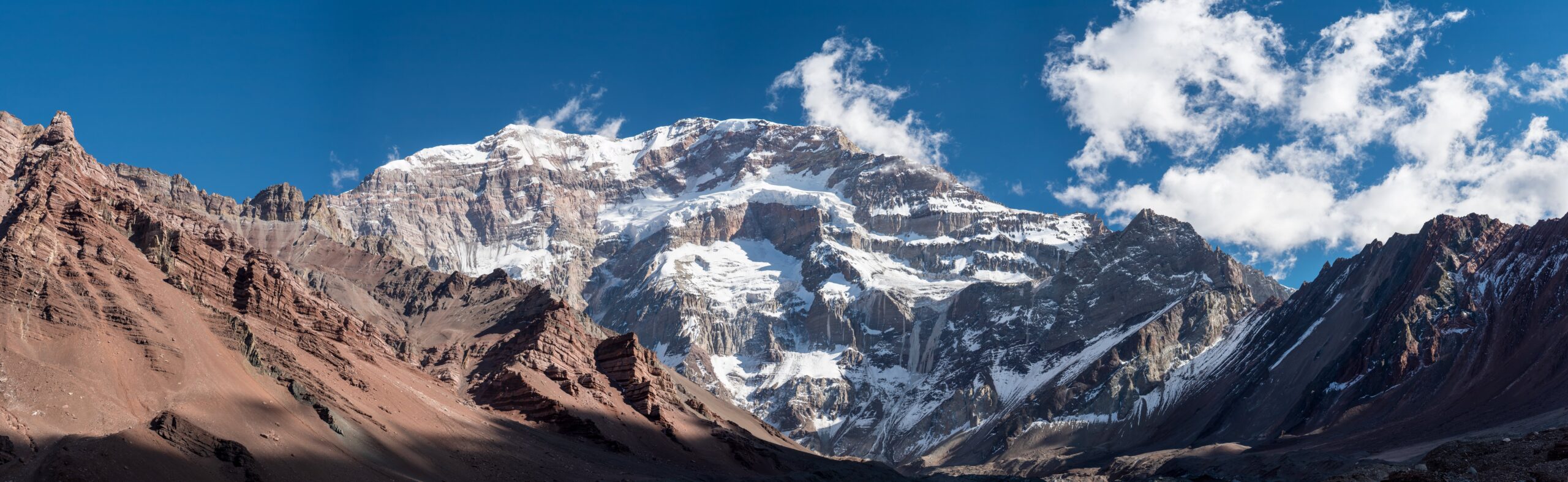
Argentina · Andes · Highest peak in Americas
Technical grade
Expedition
The test that decides whether you belong on bigger mountains. Self-supported above base camp, real cold-weather expedition skills required.
Seven criteria that decide the call
The difference between these two peaks isn’t summarized by a single number. It’s a constellation of practical factors that compound. Below, we work through the seven criteria that matter most, with a winner called for each. For climbers planning their full 7-Summits sequence, our master mountaineering hub covers every peak in the progression.
Kilimanjaro
Pure walking from trailhead to summit on every standard route. No rope work, no glacier travel, no crampons or ice axe required. The hardest physical movement on the entire mountain is the Barranco Wall scramble — a 90-minute hands-on section with no exposure consequences. Difficulty comes from altitude and summit-night cold, not technique.
Aconcagua
Non-technical on the Normal Route but expedition-level. Crampons mandatory above 5,500m on snow and ice slopes. Self-arrest skills required. Climbers carry 30-40 lb loads to upper camps in multiple rotations. Cold-weather camp management at −25°C and below is a survival skill, not a comfort issue. False Polish Glacier route adds glacier travel and rope skills.
Verdict: Kilimanjaro is fundamentally easier — the difficulty is altitude, not technique. Aconcagua adds physical load-carrying, cold-weather survival, and weather-window decision-making. Your gear setup matters more on Aconcagua, and our
crampons and ice axes guide covers the hardware difference.
Kilimanjaro
5,895m summit. Climbers spend 2-3 days above 4,000m and a single night at 4,673m before the summit push. Total time above 5,000m on summit day: 4-6 hours. Acute mountain sickness is the main physiological challenge; pulmonary or cerebral edema cases occur but are uncommon on slow-paced routes.
Aconcagua
6,961m summit. Climbers spend 5-6 days sleeping above 5,000m and 2-3 nights above 5,500m. Total time above 5,500m on a typical climb: 4-5 days. The body’s ability to compensate for altitude starts breaking down measurably above 5,800m, and Aconcagua’s high camp at 5,950m sits squarely in that zone. Pulmonary and cerebral edema cases are dramatically more common.
Verdict: Aconcagua imposes 2-3x the cumulative altitude exposure. The physiological demand isn’t just the summit altitude — it’s the days spent at altitudes that would be a peak experience on Kilimanjaro. Pre-trip altitude exposure matters far more for Aconcagua. See our
altitude acclimatization guide.
Kilimanjaro
85-95% on long routes (Lemosho 8-day, Northern Circuit). 65-75% on short routes (Marangu 5-day). Quality operators with 7-day or longer itineraries deliver consistent success because acclimatization is built into the route design and weather rarely shuts down the mountain.
Aconcagua
30-40% across all climbers and routes. Top operators improve to 50-60%, but the underlying mountain is far harder. Failure causes split roughly: 40% altitude-related (AMS, exhaustion, appetite collapse), 35% weather-window misses (storms shut the mountain), 25% physical or motivational breakdown.
Verdict: The success-rate gap is the single biggest data point in the comparison. Climbers booking Aconcagua should plan for the realistic possibility of not summiting. Climbers booking Kilimanjaro on a long route can plan as if summiting is the default outcome. To improve your Kilimanjaro odds, see our
Kilimanjaro mistakes that cost the summit guide.
Kilimanjaro
Guided climb $2,500-4,500. Tipping $300-500. International flights $1,200-1,800 from North America. Gear (rented or owned) $500-1,500. Pre/post hotels and meals $300-600. Total trip cost: $4,500-6,500.
Aconcagua
Guided climb $5,500-9,500. Tipping $150-300. Permit fee $800-1,000 USD (high season). International flights $1,400-2,200. Gear (substantially more required) $1,500-3,500. Pre/post hotels and meals $400-800. Total trip cost: $9,500-13,000.
Verdict: Aconcagua is roughly 2x the total trip cost. The gap comes from longer expedition length, higher gear requirements, mandatory permit fees, and the higher operator day-rate for technical guiding. We break this down further in our
hidden costs of Kilimanjaro guide.
Kilimanjaro
7-9 days on the mountain. 1-2 days each side for Moshi/Arusha logistics. Total trip 10-14 days. Easily fits inside two weeks of vacation, leaves room for safari extension, and works for working professionals with limited PTO budgets.
Aconcagua
16-21 days on the mountain. 2-3 days each side in Mendoza for permits and logistics. Total trip 21-26 days. The time commitment alone disqualifies many working professionals. Successful Aconcagua climbers either negotiate extended leave or take the trip during transitions between jobs.
Verdict: The time gap is the most under-discussed difference between these peaks. Aconcagua requires nearly four weeks away from work. For climbers with finite vacation budgets, this single factor often forces the decision toward Kilimanjaro.
Kilimanjaro
Porter and cook teams carry your duffel, pitch your tent, and prepare hot meals at every camp. Climbers carry only a daypack with water, snacks, and a layer. Mess tents are warm. Kitchen tents produce real food. The expedition runs as a guided trek, not a self-supported climb.
Aconcagua
Mules carry your gear to Plaza de Mulas (4,300m) base camp. Above base camp, you carry your own gear, set your own tent, and cook your own meals. Cold-weather expedition camping at altitude is a real skill. Climbers spend 10-14 days self-supported above 4,000m. This is the defining experience of Aconcagua.
Verdict: Kilimanjaro is fully supported throughout. Aconcagua is supported to base camp and self-supported from there. Climbers who haven’t camped at altitude before will find the Aconcagua expedition style a much steeper learning curve than they expect. Our
Kilimanjaro porter system history covers what makes Kili’s support model unique.
Kilimanjaro
How your body responds to altitude. Whether you tolerate cold-weather summit pushes. How to pace at altitude (pole pole). What the high-altitude appetite collapse feels like. Whether high-altitude climbing is something you actually want to keep doing. These lessons transfer cleanly to every bigger peak.
Aconcagua
Self-supported expedition camp life. Cold-weather camp management. Carrying loads at altitude. Multi-day weather-window decision-making. Mental endurance through 16-21 days of unbroken expedition life. These lessons transfer to Denali, the Himalayan trekking peaks, and the rest of the bigger 7-Summits.
Verdict: Kilimanjaro teaches whether you can tolerate altitude. Aconcagua teaches whether you can run a real expedition. Both lessons matter. The order matters too: Kilimanjaro first means Aconcagua becomes a meaningful test rather than a guess.
Quick-reference comparison across all factors
| Factor | Kilimanjaro | Aconcagua |
|---|
| Summit altitude | 5,895m (19,341 ft) | 6,961m (22,837 ft) |
| Days on mountain | 7-9 days | 16-21 days |
| Total trip length | 10-14 days | 21-26 days |
| Summit success rate | 85-95% (long routes) | 30-40% (all routes) |
| Technical grade | Trek (no technical skills) | Expedition (cold-weather skills) |
| Crampons / ice axe | Not required | Required above 5,500m |
| Glacier travel | None | Optional (False Polish route) |
| Porter support | Full (every day) | Mules to base camp only |
| Climber load above base | Daypack (5-10 lbs) | 30-40 lbs in rotations |
| Sleep altitude maximum | 4,673m (Barafu) | 5,950m (Camp Colera) |
| Summit night temp | -7°C to -20°C | -15°C to -30°C |
| Weather-window dependency | Low | High (storms close the mountain) |
| Permit fee | Included in climb cost | $800-1,000 USD separately |
| Total trip cost | $4,500-6,500 | $9,500-13,000 |
| Best for | First major high-altitude climb | Second or third 7-Summit |
Decision matrix: which one fits you?
Below, the most common climber profiles and which peak fits each. Read the description, find the match, and use the recommendation as a starting point.
You’ve never been above 4,000m
You’ve done some hiking, maybe a 14er or two, but you’ve never spent multiple days at altitude. Your altitude tolerance is unknown.
→ Kilimanjaro
You have 2 weeks of vacation, maximum
Time off is your binding constraint. You can’t take three full weeks for a single trip and still have leave for the rest of the year.
→ Kilimanjaro
Your budget is under $7,000
You want a serious mountain experience but you’re not in a position to spend $10,000+ on a single trip yet.
→ Kilimanjaro
You’ve already summited Kilimanjaro or similar
You know how your body handles 5,500m sleeping altitude. You handled cold summit nights without major issues. You’re ready for the next test.
→ Aconcagua
You’re chasing the 7-Summits and want to know if you belong
You want a real check on whether bigger objectives (Denali, Himalayan peaks) are realistic for you. You need a true expedition test.
→ Aconcagua
You have prior cold-weather camping experience
You’ve winter-camped, done multi-day backcountry trips, and managed cold-weather camp life. The expedition style won’t be the surprise.
→ Aconcagua
You have time, money, and want both eventually
If you’re going to do both anyway, Kilimanjaro first is the universal recommendation — but the Kili-Aconcagua sequence works in either order if you bring real prep.
→ Kili first, then Aconcagua
The standard 7-Summits progression
Most climbers tackling the 7-Summits sequence them as: Kilimanjaro → Elbrus → Aconcagua → Denali → Vinson → Kosciuszko/Carstensz → Everest. Kilimanjaro is universally the entry point. Aconcagua slots in as the third or fourth peak, after Elbrus has tested European logistics and basic glacier travel. Climbing Aconcagua before any other 7-Summit is doable but punishing — most climbers who try it cold turn around.
The training and preparation gap
Kilimanjaro and Aconcagua require fundamentally different training stacks. For Kilimanjaro, the bar is sustained cardio fitness — climbers who can hike 6-8 hours a day with a daypack at sea level will summit if they pace correctly and acclimatize. Our 12-week Kilimanjaro training plan covers the specific build-up. For the broader training, gear, and altitude context across all 7-Summits, see our master mountaineering hub.
For Aconcagua, the cardio bar rises and three new dimensions appear: load-carrying capability (sustained 30-40 lb pack work), altitude pre-exposure (ideally a peak above 4,500m within 12 months of the climb), and cold-weather camp competence. Our high-altitude training program covers the multi-month build for peaks like Aconcagua.
For climbers planning a Kilimanjaro-then-Aconcagua progression, the practical training gap is 6-12 months between climbs. That’s enough time to absorb Kilimanjaro lessons, build load-carrying capacity, and add altitude exposure on a training peak (Mount Rainier, Pico de Orizaba, Cotopaxi).
Gear and cost differences that compound
Kilimanjaro and Aconcagua share roughly 60% of their gear list — boots, layering system, sleeping bag, headlamp, trekking poles. The other 40% is where Aconcagua becomes meaningfully more expensive and complex.
- Sleeping bag: Kilimanjaro climbers use a 0°F (−18°C) bag. Aconcagua demands a −20°F (−29°C) expedition bag. The price gap is $300-500. See our sleeping bags for altitude guide.
- Boots: Kilimanjaro uses B1 or B2 leather/synthetic boots. Aconcagua needs B3 double boots — typically $700-900. Detailed in our mountaineering boots guide.
- Crampons and ice axe: Not required on Kilimanjaro. Required on Aconcagua. Add $300-500.
- Tent: Provided by the operator on Kilimanjaro. Often climber-supplied or shared on Aconcagua. A 4-season expedition tent runs $500-1,000.
- Layering system: Both peaks need full layering, but Aconcagua adds a heavy expedition parka rated for −30°C. Detailed in our layering systems guide.
The total gear premium for Aconcagua over Kilimanjaro typically runs $1,500-2,500 if buying new. For a complete head-to-toe gear list, see our complete mountain climbing gear list.
The honest answer for most climbers
★ Bottom Line
Kilimanjaro first, almost always
For 90% of climbers comparing these peaks, Kilimanjaro is the right first answer. It’s cheaper, shorter, more supported, far higher success rate, and teaches the altitude lessons that make every subsequent climb safer. Aconcagua becomes the right call only after you’ve demonstrated you tolerate altitude well, can handle cold-weather summit pushes, and have the time and budget for a 3-week expedition.
The 10% exception: climbers with strong cold-weather backcountry experience, prior high-altitude exposure (4,500m+), and the time and budget for a full expedition. Those climbers can skip Kilimanjaro and go directly to Aconcagua. But for everyone else, Kilimanjaro first builds the foundation that makes Aconcagua a meaningful test rather than a roll of the dice.
Continue your 7-Summits research
Kilimanjaro vs Aconcagua is the first decision in a longer sequence. If you’re planning to take both peaks on, these are the next guides to read:
★ Master Resource
Every guide, one navigation point
This Kilimanjaro vs Aconcagua decision guide is part of a comprehensive mountaineering reference covering gear, training, altitude, routes, peak-specific planning, and field reports across all 7-Summits and beyond. Our master hub indexes every guide in one place.
Browse the Complete Guide →Frequently asked questions about Kilimanjaro vs Aconcagua
Should I climb Kilimanjaro or Aconcagua first?
For nearly all climbers, Kilimanjaro should come first. It is a non-technical trek to 5,895m with no glacier travel, no rope work, no crampons or ice axe required, and a fully-supported logistics chain. Aconcagua climbs 1,066m higher, requires self-supported expedition camp life above base camp, demands real cold-weather skills, and exposes climbers to weather windows that can shut the mountain down for days.
How much harder is Aconcagua than Kilimanjaro?
Aconcagua is roughly 2-3 times harder than Kilimanjaro by most measures. The summit altitude is 1,066m higher, the expedition length is 2-3x longer (16-21 days vs 7-9), summit success rates are about half (30-40% vs 85-90% on Lemosho), and climbers must be self-sufficient above base camp. Kilimanjaro’s difficulty comes almost entirely from altitude; Aconcagua adds expedition logistics, cold-weather survival, and load-carrying.
What’s the success rate difference?
On Kilimanjaro, success rates run 85-95% on long routes and 60-65% on short routes. On Aconcagua, success rates run 30-40% across all climbers and routes. The gap reflects Aconcagua’s higher altitude exposure, summit-day weather windows, and lack of porter support that means physical load-carrying compounds altitude fatigue.
Is Aconcagua technical?
Aconcagua’s standard Normal Route is non-technical in the climbing sense — no rope work, no glacier travel above 5,500m, no rock climbing. However, it requires real mountaineering competence: confident crampon use on snow slopes, ice axe self-arrest skills, cold-weather camp management, and judgment for high-altitude weather. Climbers describe it as expedition-level non-technical.
How long does each climb take?
Kilimanjaro climbs run 5-9 days on the mountain depending on route, with most quality operators using 7-8 day itineraries. Total trip from a North American departure: 10-14 days. Aconcagua expeditions run 16-21 days on the mountain — the standard itinerary is 18-19 days. Total trip length: 21-26 days.
What does Kilimanjaro vs Aconcagua cost?
A guided Kilimanjaro climb runs $2,500-4,500 plus tipping, gear, and flights — total trip typically $4,500-6,500. Aconcagua runs $5,500-9,500 guided plus a separate $800-1,000 permit, more substantial gear, and longer flights — total trip typically $9,500-13,000. Aconcagua is roughly 2x the total cost.
Can I skip Kilimanjaro and go straight to Aconcagua?
You can, but most operators advise against it. Aconcagua’s 30-40% success rate punishes climbers who haven’t experienced multi-day exposure to altitude above 5,000m. If you skip Kilimanjaro, plan a serious altitude training trip (Cotopaxi, Pico de Orizaba, Mount Rainier) before Aconcagua to build the altitude data point that Kilimanjaro normally provides.
Which has better scenery?
Kilimanjaro wins on biodiversity — five distinct ecosystems in seven days. Aconcagua wins on raw mountain scale — climbers spend weeks within sight of 6,000m peaks across the Cordon del Plata range. Most climbers say they would return to Kilimanjaro for the experience and to Aconcagua for the achievement.
Thanks for your feedback!