
Last updated September 16, 2026

Best Satellite Communicators for Hiking & Climbing: 8 Options Compared
The satellite-safety market changed quickly. Garmin now has the inReach Mini 3 family, ZOLEO has replaced its original hardware with the ZL1500, Garmin has pushed full navigation into the GPSMAP H1i Plus, phones can reach emergency services by satellite, and modern personal locator beacons can even provide return-link confirmation. The right answer is no longer simply “buy an inReach.” It depends on whether you need messaging, independent hardware, navigation, no-subscription SOS, long battery life or just a backup to the phone you already carry.
What satellite communicator should most hikers buy?
For a climber or remote hiker who already navigates with a phone or separate GPS, our default recommendation remains the Garmin inReach Messenger Plus.
It is small, weighs about 4.1 oz, uses the Iridium network, supports interactive SOS and two-way text communication, and can transmit voice and photo messages through the Garmin Messenger app. Garmin specifies up to 600 hours in its 10-minute low-power messaging mode under favorable sky-view conditions.
But it is no longer the automatic choice for everyone.
The inReach Mini 3 is more attractive if you want a screen and physical independence without paying for the Plus model. The Mini 3 Plus makes sense when voice and richer communication from a compact device matter. The ZOLEO ZL1500 is the straightforward value alternative. The GPSMAP H1i Plus is for people who want one serious handheld for maps and communication. And a modern 406 MHz PLB remains compelling when the goal is pure emergency signaling with no monthly subscription.
Strong fit when your phone already handles mapping.
Color touchscreen and 350-hour tracking claim without paying for Plus media features.
Iridium, dedicated number and app-centered messaging.
406 MHz emergency beacon for users who do not need routine messaging.
Choose by use case before comparing specifications
Most buyers spend too much time comparing battery numbers before deciding what job the device actually needs to do.
Messenger first
Two-way check-ins, route-change messages and interactive SOS are more valuable than a full GPS screen for most backpackers.
Independent hardware
Cold, long summit days and complex emergencies favor a dedicated communicator that remains functional if the phone fails.
GPS + inReach
If your phone is not your primary map platform, a GPSMAP H1i Plus can combine serious navigation with satellite communication.
PLB
If you never plan to text or track and simply want a long-life distress beacon without a subscription, use a 406 MHz PLB.
Satellite communicator comparison matrix
Prices shown are manufacturer prices or current direct prices verified for this review. They can change.
| Option | System | Two-way | Standalone use | Navigation | Battery reference | Current price | Recurring plan | Best fit |
|---|---|---|---|---|---|---|---|---|
| Garmin inReach Messenger Plus | Iridium | Text + photo/voice capability | Basic messaging / SOS; richer features use app | Limited | Up to 600 hr at 10-min low-power messaging | $399.99 | Yes | Most hikers / climbers who map on phone |
| Garmin inReach Mini 3 | Iridium | Yes | Strong compact standalone interface | Course / basic map support | Up to 350 hr at 10-min tracking | $449.99 | Yes | Compact standalone value |
| Garmin inReach Mini 3 Plus | Iridium | Text + voice + photo capability | Strong | Course / app-assisted maps | Up to 350 hr low-power 10-min tracking | $499.99 | Yes | Climbers wanting richer communication |
| ZOLEO ZL1500 | Iridium | Yes | Check-in / SOS on hardware; messaging via app | No | 200+ hr stated standby/message-check use | $269 | Yes | Value two-way messenger |
| Garmin GPSMAP H1i Plus | Iridium | Text + photo + voice | Excellent | Full TopoActive maps + multi-band GNSS | Up to 145 hr multi-band GPS | $999.99 | Yes | One-device navigation + communication |
| ACR Bivy Stick | Iridium | Yes | Highly phone-app dependent | App based | Verify current model specification | Check current price | Yes | App-first Iridium alternative |
| RLS Personal Locator Beacon | Cospas-Sarsat / 406 MHz | No conversational messaging | Yes | No | Multi-year sealed battery; 24+ hr activation typical | Approx. $465+ | No | Pure emergency signaling |
| Satellite-enabled smartphone | Varies by manufacturer/carrier | Varies | Phone itself | Excellent phone mapping | Phone battery | Device already owned | Varies | Casual outings / backup layer |
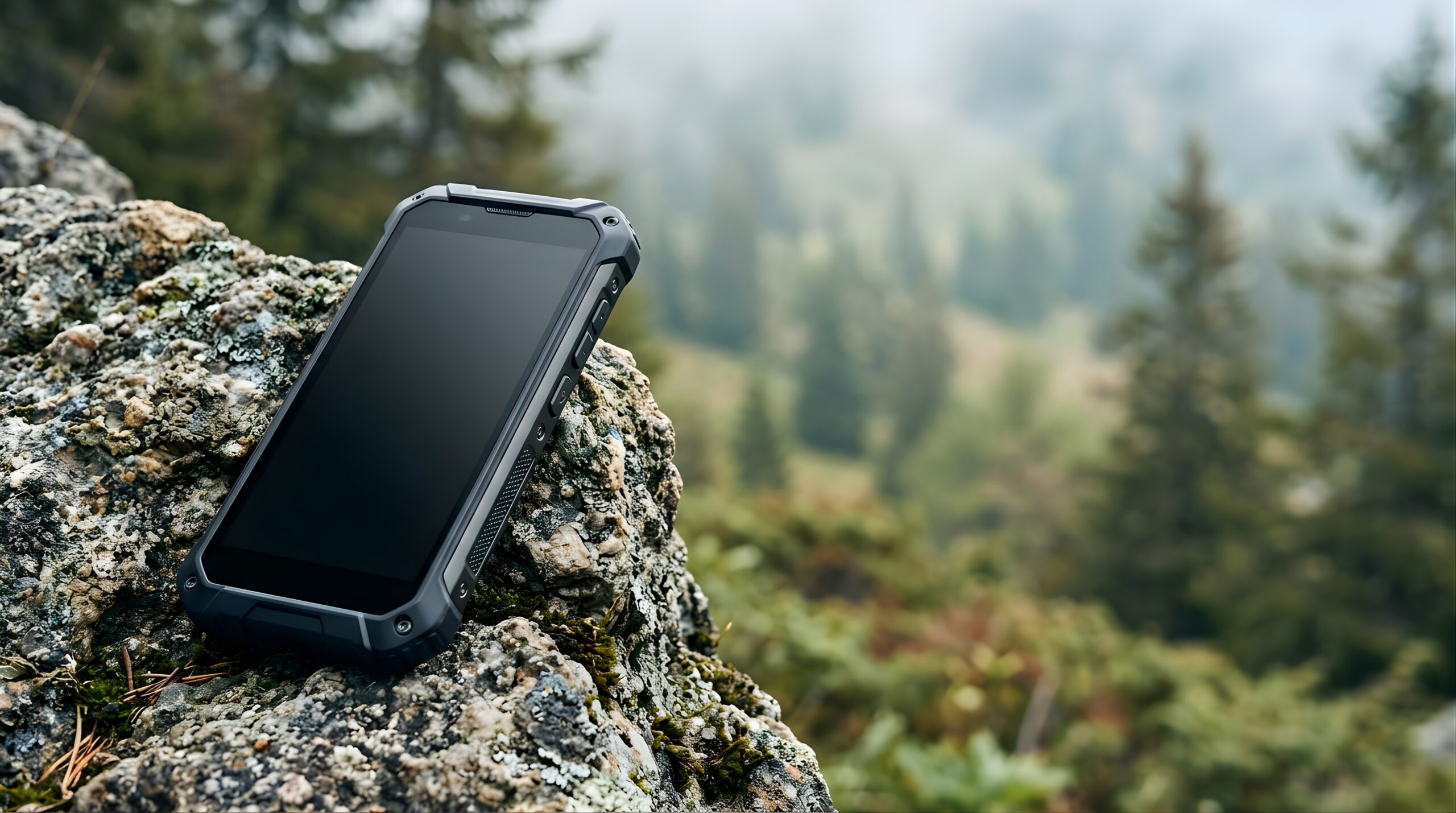
The best communicator is the one your group can actually operate under stress.
Pair it, activate it, send a test message, teach your partner where the SOS control is, confirm emergency contacts and practice getting a satellite connection before the trip. A $500 device that nobody knows how to use is weaker emergency equipment than a simpler system your whole team understands.
Eight satellite-communication options worth understanding
Awards below are editorial fit labels, not laboratory scores.
Garmin inReach Messenger Plus
The Messenger Plus makes the most sense when your phone already handles maps and you want the satellite device to specialize in communication.
Garmin gives it two-way text communication, interactive SOS, location sharing and photo/voice messaging capability through the Messenger app. At roughly 4.1 oz it remains small enough to keep attached to a shoulder strap or accessible pocket.
Why it works
- Compact and relatively light.
- Two-way interactive emergency communication.
- Long published battery endurance in low-power modes.
- Photo and voice messages can communicate complex situations better than a short text.
- Safety-charging feature can provide limited phone power.
Who should skip it
- Users who want full topo maps directly on the communicator.
- People who want zero monthly cost.
- Users who want the richest device-only interface without a phone.
- Someone whose only requirement is one emergency beacon activation.
Garmin inReach Mini 3
The Mini 3 is the important new middle choice in Garmin’s lineup. It adds a 1.9-inch color touchscreen, IP67 protection and a modern device interface without requiring the buyer to pay for all of the Mini 3 Plus communication features.
For climbers who want to read and operate the communicator itself rather than treating it primarily as a phone accessory, this may now be the most interesting value point in the inReach family.
Why it works
- Strong device-based interface.
- Compact enough for climbing harness or shoulder strap access.
- Color display is a major usability step beyond the Mini 2 generation.
- Up to 350-hour published 10-minute tracking life.
- Less expensive than the Mini 3 Plus.
Choose the Plus instead when
- You want voice messages.
- You value richer off-grid communication.
- The extra $50 is not meaningful in the overall gear budget.
Garmin inReach Mini 3 Plus
The Mini 3 Plus adds voice, text and photo communication capability to Garmin’s compact color-touchscreen format. It includes a built-in speaker and microphone and retains an interactive SOS connection to Garmin Response.
At about 4.42 oz, it remains a legitimate climbing device rather than becoming a large handheld navigator.
Best reasons to buy
- Compact independent screen.
- Voice can describe an emergency more efficiently than typing.
- Photo sharing can provide context outside cell coverage.
- Strong operating-temperature range for mountain use.
- Excellent battery-to-size ratio.
Reasons to save money
- You mainly send preset check-ins.
- You do not care about media messaging.
- Your phone remains your preferred message interface.
- A Messenger Plus or Mini 3 already covers your actual use case.
ZOLEO ZL1500
ZOLEO refreshed its communicator hardware with the ZL1500 in 2026. It remains an app-centered Iridium messenger built around two-way messaging, SOS, check-ins, location sharing and a dedicated ZOLEO phone number.
The new hardware is rated IP68 and MIL-STD 810G, weighs about 5.3 oz and carries a manufacturer battery reference of more than 200 hours under its specified message-check operating condition.
Why it works
- Significantly less hardware cost than current premium Garmins.
- Dedicated ZOLEO phone number helps contacts reach you consistently.
- Global two-way messaging through Iridium.
- Simple check-in and SOS controls remain on the physical device.
- Strong weather/dust/water protection.
Tradeoffs
- Full messaging experience remains phone dependent.
- No full standalone mapping.
- Heavier than the latest compact Garmins.
- Subscription economics still matter over several years.
Garmin GPSMAP H1i Plus
The H1i Plus is what to buy when you genuinely want one primary handheld for both navigation and communication. It moves well beyond the older GPSMAP 67i with a 3.5-inch hybrid touchscreen/button interface, TopoActive maps, multi-band GPS, downloadable imagery and inReach Plus communication.
It can exchange text, voice and photo messages and provides an interactive SOS. The cost and 10.2-ounce weight make no sense for someone who already loves phone mapping, but the feature set is fundamentally different from a compact messenger.
Who should buy it
- Expedition leaders who prefer dedicated handheld mapping.
- Users operating for days away from phone dependence.
- People who want satellite communication and serious navigation in one rugged unit.
- Search, field, hunting or remote-work users carrying a handheld anyway.
Who should not
- Ultralight hikers.
- Climbers happy with offline phone maps.
- Anyone buying only for emergency SOS.
- Users trying to minimize cost and pack complexity.
ACR Bivy Stick
The Bivy Stick remains an important non-Garmin Iridium alternative. It turns a smartphone into a two-way satellite messaging system and supports messaging, location sharing, weather and SOS.
Its strength is simplicity for users comfortable relying on the phone as the primary interface. Its weakness is the same: if you specifically want a rich independent on-device screen, the newer Mini 3 family is the stronger fit.
Strengths
- Iridium satellite network.
- Phone-based interface is familiar and easy to type on.
- Dedicated check-in and SOS capability.
- Useful alternative for buyers avoiding a Garmin ecosystem.
Check carefully
- Current hardware price.
- Current service-plan commitment.
- Message-credit structure.
- Phone battery strategy on long trips.
406 MHz PLB with Return Link Service
A personal locator beacon is not trying to compete with inReach messaging. It solves a narrower problem extremely well: send a dedicated emergency distress alert through the international Cospas-Sarsat rescue system.
Modern RLS-capable models improve on the traditional PLB by allowing the beacon to receive confirmation that the distress alert has reached the satellite rescue system. That is meaningful psychological and operational feedback, but it is still not a two-way text conversation with rescuers.
Why a PLB still matters
- No recurring subscription.
- Dedicated emergency purpose.
- Multi-year sealed-battery storage.
- Global government-supported distress network.
- RLS can confirm receipt on compatible modern beacons.
What you give up
- No normal check-in texting.
- No route-change messages.
- No conversational description of the emergency.
- No routine tracking for family.
- No weather forecasts.
Satellite-enabled smartphone
Phone satellite service is no longer a novelty. Apple’s iPhone 14 and later can use Emergency SOS via satellite in supported regions, and Messages via satellite is available in selected countries. Pixel models also support satellite SOS in supported markets, while carrier direct-to-cell services are expanding.
This is an enormous safety improvement for ordinary hikers. It also changes the buying question: a person doing short hikes may already own adequate backup communication.
Phone satellite makes sense when
- The outing is a day hike or low-commitment trip.
- The phone remains protected and charged.
- You have tested the satellite demo or emergency workflow.
- You understand the geographic service limitations.
- Your navigation and emergency communication do not rely on one nearly-dead battery.
Add a dedicated device when
- The trip is multi-day.
- Cold exposure can drain or disable the phone.
- The trip is remote enough that rescue can take many hours.
- The group needs routine two-way check-ins or tracking.
- You want a second independent emergency system.
Global coverage does not mean “works behind a ridge”
Network footprint and actual local sky visibility are separate questions.
Global network footprint
Iridium’s constellation provides worldwide network coverage, making it attractive for remote mountains, polar regions and international travel.
Terrain still blocks radio
Nearby mountains, canyon walls, structures and heavy vegetation can obscure the sky and reduce or interrupt the device’s ability to see a satellite.
Give the device sky and time
In a non-life-threatening situation, move to a safer location with broader sky view, orient the device as instructed and let the message transmit before assuming failure.
The device price is only half the buying decision
A $270 communicator with a service plan and a $450 communicator with another plan can reverse positions after several years of ownership.
Enabled · $7.99/month in the US
Garmin’s consumer Enabled plan keeps the device active for SOS and charges other messaging, tracking and weather functions on a pay-as-you-go basis.
Suspended is not Enabled
Do not tell readers that every suspended inReach has SOS. Garmin documents only limited exceptions for selected products. Enabled is the straightforward consumer state when you want the device continuously active for emergency use.
No monthly communication plan
The PLB model reverses the economics: higher hardware cost than some messengers, but no recurring satellite-service subscription for distress activation.
What happens after you press SOS?
The device starts the communication chain. It does not teleport a rescue team to your location.
The alert transmits
Your device sends the distress alert and location through its satellite system when it can establish the required link.
A coordination system receives it
Garmin inReach SOS routes to Garmin Response. ZOLEO and other services use their own emergency-response arrangements. PLBs enter the government-supported Cospas-Sarsat rescue chain.
Local rescue capability matters
The coordination center contacts the appropriate local authority, but weather, darkness, aviation limits, terrain and available teams determine what can actually happen.
Seven questions that choose the device for you
Answer these before comparing brands.
| Question | If yes | Device direction |
|---|---|---|
| Do you need to send routine messages from remote areas? | You need more than an emergency beacon. | Two-way messenger. |
| Do you want the device to work meaningfully without your phone? | Prioritize screen and device controls. | Mini 3 / Mini 3 Plus / H1i Plus. |
| Do you already love phone navigation? | Do not pay twice for maps. | Messenger Plus / ZOLEO / Bivy. |
| Do you want one rugged handheld for maps and satellite communication? | Weight and price are secondary. | GPSMAP H1i Plus. |
| Do you refuse monthly fees? | You are accepting emergency-only communication. | 406 MHz PLB. |
| Are most outings short day hikes? | Your existing phone may cover the emergency layer. | Test supported phone satellite first. |
| Will the trip expose the phone to cold, water or multi-day battery demand? | An independent device becomes more valuable. | Dedicated messenger or PLB. |
The communicator mistakes that matter more than brand choice
Good hardware can still become useless through poor preparation.
Not activating service
Verify account and subscription status before leaving home.
Never sending a test
Garmin specifically recommends verifying the subscription and testing service before use.
Burying it in the pack
Emergency hardware should be accessible after a fall or when one arm is injured.
Everyone depends on one phone
If that phone gets soaked, smashed or frozen, navigation and communication can disappear together.
Assuming SOS guarantees extraction
Weather and terrain can still delay responders for many hours.
Not teaching the partner
If you are unconscious, someone else needs to know how to activate the system.
How Global Summit Guide chose these devices
This is a research-led buyer’s guide, not a fabricated “we tested everything for six months” review.
1. Manufacturer verification
Current device status, price, weight, water rating, battery claims, messaging capability and network were checked against manufacturer materials.
2. Safety-system fit
We distinguish interactive satellite messengers, emergency-only PLBs, full navigation handhelds and satellite-enabled phones because they solve different problems.
3. Mountain use
Editorial preference considers pack weight, independent operation, cold-weather practicality, battery demands, glove use, phone dependence and rescue communication.
4. Real-world experience
Global Summit Guide’s team uses satellite messengers in backcountry and mountain settings. That experience informs the decision framework. We do not claim to have personally field-tested every current device on this list.
5. No pay-to-rank
Manufacturers cannot buy first place, a category award or inclusion. If affiliate links are used, the commercial relationship is separate from the recommendation process.
6. Update-sensitive fields
Device prices, service plans, phone satellite coverage and model availability change rapidly. Those fields receive a verification date instead of being presented as permanent facts.
Satellite communicator questions
The best answer depends on the trip and what communication you expect before an emergency occurs.
What is the best satellite communicator for most hikers?
We favor the Garmin inReach Messenger Plus for people who already navigate with a phone. It is compact, supports two-way Iridium communication and interactive SOS, and adds photo and voice messaging capability through the Garmin Messenger app.
Mini 3 or Mini 3 Plus?
Choose the Mini 3 when you want the new color-touchscreen form factor and strong battery life without paying for every richer communication feature. Choose Mini 3 Plus when voice and media communication are worth the additional cost.
Is ZOLEO still worth buying?
Yes. The current ZL1500 is a relevant lower-priced Iridium messenger for users who are comfortable using a phone app as the main messaging interface.
Is GPSMAP 67i still good?
Yes, but Garmin’s H1i Plus is now the more capable flagship navigation-plus-inReach product. Existing 67i owners do not suddenly need to replace a working device; new buyers wanting the top current handheld should compare the H1i Plus.
Does Iridium work in a canyon?
Not reliably in every canyon. Iridium has global network coverage, but steep terrain can block the device’s view of satellites. Transmission may improve when the user safely reaches a location with more open sky.
Can I just use an iPhone?
For some day hikers, yes. Supported iPhones can connect to satellite features in supported regions when cellular and Wi-Fi are unavailable. More serious backcountry users may still want a separate communicator because it provides independent battery, hardware and communication redundancy.
What is the best satellite device with no subscription?
A registered 406 MHz personal locator beacon is the main choice. Newer Return Link Service models can provide confirmation that the rescue system received the alert, but they remain emergency beacons rather than general two-way messengers.
Does suspended Garmin service still include SOS?
Do not assume it does. Garmin documents only limited exceptions for select products. Its consumer Enabled plan is the clear option for maintaining active SOS, currently $7.99 per month in the United States with other services billed separately.
Should every climber carry their own communicator?
Not necessarily, but redundancy becomes increasingly valuable as team size, route complexity and remoteness increase. A single device can disappear with one separated or injured person. Teams should explicitly decide who carries communication and what happens if that person is unavailable.
Can SOS guarantee helicopter rescue?
No. It can initiate an emergency response. Aircraft availability, weather, terrain, darkness, local infrastructure and jurisdiction determine whether a helicopter—or any responder—can actually reach you.
Current manufacturer and service sources
Product manufacturers own their device specifications. Satellite-network providers own coverage requirements. Rescue systems own their service behavior.
inReach Messenger Plus
Current price, dimensions, weight, battery modes, IPX7 rating and media-messaging capability.
Open Garmin source →inReach Mini 3
Current $449.99 price, 4.31 oz weight, color display and 350-hour tracking reference.
Open Garmin source →inReach Mini 3 Plus
Current price, 4.42 oz weight, IP67 rating, messaging and battery reference.
Open Garmin source →ZL1500
Current $269 US device price, 5.3 oz weight, IP68/MIL-STD 810G durability and 200+ hour battery reference.
Open ZOLEO source →GPSMAP H1i Plus
Current price, TopoActive maps, multi-band GNSS, IP67 rating, messaging and battery specification.
Open Garmin source →Bivy Stick
Iridium network, app-based two-way satellite messaging, location sharing, weather and SOS.
Open ACR source →Return Link PLBs
Current no-subscription personal-locator-beacon options with modern Return Link Service capability.
Open ACR →Consumer inReach plans
Enabled versus Suspend, $7.99 US Enabled pricing, SOS availability and pay-as-you-go terms.
Open Garmin Support →Emergency SOS via satellite
Supported-device behavior, sky-view requirements and emergency-satellite workflow.
Open Apple Support →A communicator is only one part of the emergency system
Build the navigation, trip-plan and weather skills around the device so the SOS button remains the backup rather than the plan.
Was this helpful?
Global Summit Guide is an independent mountaineering resource founded in 2026. The team combines first-hand trekking and climbing experience with in-depth research and professional health and nutrition review to help climbers choose objectives, prepare properly, and stay safe.
Health, altitude, and nutrition content is reviewed by Taylor Ludlow (Registered Nurse) and Brigg Hoopes (Nutritionist).
What We Don't Know Yet
Mountain information changes quickly. This box explains the limits of what this page can responsibly promise.
- Weather, snowpack, avalanche risk, road access, and route conditions can change quickly and may be different on your climbing dates.
- Total trip cost can change with flights, lodging, guide pricing, permits, gear rentals, transportation, and exchange rates.
- Gear requirements can change by season, route variation, weather window, personal cold tolerance, and guide-service requirements.
- Comparisons simplify complex decisions; the better mountain depends on current conditions, skills, timing, budget, and risk tolerance.
Verify current conditions with official land managers, guide services, local forecasts, and current route reports before booking or climbing.
Mountaineering, rock and ice climbing, glacier travel, and high-altitude activity are inherently dangerous and can result in serious injury or death. The information on Global Summit Guide is provided for general informational and educational purposes only and is not a substitute for professional instruction, qualified guiding, proper equipment, or your own judgment and experience.
Route conditions, weather, snowpack, permits, regulations, and hazards change constantly and may differ from what is described here. Details may be incomplete, out of date, or contain errors. Always verify current information with local authorities, certified guides, and official sources before making any decision in the mountains.
Nothing on this site is medical, legal, or financial advice. Our fitness, acclimatization, altitude, and nutrition content is general in nature; consult a qualified physician before beginning any strenuous exercise program or exposing yourself to high altitude.
You are solely responsible for your own safety and decisions. To the fullest extent permitted by law, Global Summit Guide and its team accept no liability for any loss, injury, damage, or expense arising from use of, or reliance on, this information. By using this site you acknowledge these risks and accept these terms.
Some links on this site may be affiliate links. If you buy through them we may earn a small commission at no extra cost to you; this never affects our recommendations.
Global Summit Guide recommendation path
Next Best Mountain to Research
Use these recommendations to continue the right planning path instead of stopping on one page.
Use current permit, weather, route, and operator information before booking or climbing.