web analytics

Category: 8,000m Peaks

  • Top 50 Technical Mountaineering Objectives 2026: Ranked by Alpine Grade Across 6 Regions — Curated List with Real Difficulty Criteria

    { “@context”: “https://schema.org”, “@type”: “Article”, “headline”: “Top 50 Technical Mountaineering Objectives 2026: Ranked by Alpine Grade Across 6 Regions — Curated List with Real Difficulty Criteria”, “description”: “The definitive 2026 ranking of the world’s 50 most technical mountaineering objectives — organized by region with verified alpine grades (F through ED), specific route descriptions, and concrete criteria explaining what makes each climb technical. Unlike generic ‘hardest mountains’ lists that combine fame, fatality rates, and altitude, this ranking applies consistent technical criteria: sustained alpine grade above AD, specific technical sections requiring advanced skills (mixed climbing, ice climbing, big wall climbing, alpine ice), and demonstrable route difficulty. Covers the legendary objectives: Cerro Torre, Eiger North Face, Latok I North Ridge, Gasherbrum IV, Masherbrum, the Ogre (Baintha Brakk), K2, Nanga Parbat Rupal Face, plus 42 more across the Greater Ranges, Alps, Patagonia, Alaska, Andes, and lesser-known objectives. Decision frameworks help climbers identify the right progression path from intermediate alpine experience through career-defining test pieces.”, “image”: “https://globalsummitguide.com/wp-content/uploads/2026/03/climbers-wearing-mountaineering-boots-on-rocky-terrain-highlighting-footwear-for-aconcagua-expeditions-16e4199f-ed7d-441c-84b8-a098a80b92f2.jpg”, “author”: {“@type”: “Organization”, “name”: “Global Summit Guide Editorial Team”}, “publisher”: {“@type”: “Organization”, “name”: “Global Summit Guide”}, “datePublished”: “2026-05-25”, “dateModified”: “2026-05-25” } { “@context”: “https://schema.org”, “@type”: “FAQPage”, “mainEntity”: [ {“@type”: “Question”, “name”: “What makes a mountaineering objective ‘technical’?”, “acceptedAnswer”: {“@type”: “Answer”, “text”: “A technical mountaineering objective requires advanced climbing skills and specialized equipment beyond basic glacier travel. Specifically, technical climbing involves sustained sections of alpine grade AD (Assez Difficile) or harder according to the standard French alpine grading system. The criteria include continuous use of ropes, harnesses, helmets, ice axes, and crampons, with technical climbing techniques required throughout most of the route. Generally, technical objectives involve one or more of these elements: mixed climbing (combining rock and ice), steep ice climbing above 60 degrees, big wall climbing with multiple pitches of vertical or overhanging terrain, sustained rock climbing on alpine rock walls, and complex route-finding through serac fields or icefalls. Notably, technical climbing differs from non-technical mountaineering where well-defined trails and basic glacier walking dominate the experience. A peak like Kilimanjaro reaches 5,895m but isn’t technical because the standard route requires only hiking skills. Generally, peaks like Cerro Torre at just 3,128m qualify as extremely technical because the entire route demands rock and ice climbing skills.”}}, {“@type”: “Question”, “name”: “What alpine grading system ranks technical climbs?”, “acceptedAnswer”: {“@type”: “Answer”, “text”: “The French Alpine Grading system provides the standard scale for technical mountaineering objectives. The grades progress from easy to extreme: F (Facile / Easy) involves easy glacier travel with some rock scrambling, often climbable without ropes except on glacier sections. Generally, PD (Peu Difficile / Little Difficult) requires technical climbing sections and glaciers of higher difficulty plus some short steep terrain. Then AD (Assez Difficile / Fairly Difficult) demands physically demanding climbing for experienced alpine climbers with steep exposed climbing sections or snow/ice slopes over 50 degrees. Additionally, D (Difficile / Difficult) involves sustained rock climbing, ice climbing, or snow travel requiring huge commitment. Next, TD (Très Difficile / Very Difficult) means highly technical climbs with long distances, remote locations, and hard multi-pitch climbing. Finally, ED (Extrêmement Difficile / Extremely Difficult) represents the most difficult climbs in the world with continuous difficulties. Notably, ED is further subdivided into ED1, ED2, ED3, ED4 for the most extreme objectives. Specifically, this guide focuses on peaks with sustained sections at AD grade or harder.”}}, {“@type”: “Question”, “name”: “What is the hardest technical mountain in the world?”, “acceptedAnswer”: {“@type”: “Answer”, “text”: “There’s genuine debate among elite alpinists about which mountain represents the hardest technical objective. Notably, K2 climber Steve Swenson has suggested that Gasherbrum IV is probably harder than K2, and that some of the Latok Peaks may be the hardest in the world. Generally, the leading contenders include Latok I North Ridge in the Karakoram (Pakistan) where decades of attempts by world-class alpinists failed to complete this 2,400m route until the 2018 line by Hayden Kennedy’s team, Cerro Torre in Patagonia (Argentina/Chile) considered by Reinhold Messner as ‘a shriek turned to stone’ combining technical rock climbing with sustained ice climbing, Gasherbrum IV in Pakistan whose West Face represents one of the most technical routes ever climbed at 8000m altitude, and Masherbrum NE Face remaining an unclimbed crown jewel objective. Specifically, comparison is difficult because peaks present different challenges. K2 is about 2.5 times higher than Cerro Torre with thin air and avalanche danger, while Cerro Torre is more technically demanding but lacks altitude problems. Generally, the consensus identifies a small cluster of objectives in the Karakoram, Patagonia, and Alaska as the world’s hardest technical mountains.”}}, {“@type”: “Question”, “name”: “How is this list different from ‘hardest mountains’ lists?”, “acceptedAnswer”: {“@type”: “Answer”, “text”: “Most ‘hardest mountains’ lists conflate technical difficulty with fame, fatality rates, altitude, and accessibility. Notably, this Top 50 ranking applies consistent technical criteria specifically. Generally, the ranking criteria include: sustained alpine grade AD or harder verified through climber reports, specific technical sections documented in route descriptions, multi-discipline climbing requirements (mixed, ice, rock, alpine), historical first ascent significance demonstrating technical breakthrough, and accessibility to expert climbers (excluding objectives so remote they remain effectively unclimbed). Specifically, the Top 50 includes some peaks not typically appearing on ‘hardest’ lists because they’re less famous despite extreme technical difficulty. Notably, lesser-known objectives like Trango Tower Eternal Flame route, the Walker Spur on Grandes Jorasses, or Mount Robson Emperor Face appear because of objective technical merit rather than public reputation. Generally, fame-based lists overweight peaks like Everest where the standard route is technically moderate but the altitude and commercial fame creates perceived difficulty. The technical objective approach instead focuses on what climbing skills the route actually demands.”}}, {“@type”: “Question”, “name”: “Do I need to climb all 50 peaks on this list?”, “acceptedAnswer”: {“@type”: “Answer”, “text”: “No — the Top 50 list serves as a curated reference of significant technical objectives rather than a checklist for completion. Generally, the world’s most prolific elite alpinists complete perhaps 15-25 objectives from this caliber over decades of climbing. Notably, lifetime climbing goals should match individual skill level, available time, and personal interests rather than attempting comprehensive completion. Specifically, the decision frameworks in this guide help climbers identify which 3-8 objectives match their current level and aspirations. Generally, the progression path for serious alpinists typically follows: build skills on AD-grade alpine routes (Eiger Mittelegi Ridge, Aiguille Verte, Piz Bernina Biancograt), advance to D-grade objectives (Walker Spur, Matterhorn Hörnli Ridge, Mont Blanc Royal Traverse), then move to TD objectives (Cassin Ridge on Denali, Bonatti Pillar on Petit Dru), and only attempt ED objectives after demonstrating mastery on the harder TD-grade routes. Notably, many climbers find lifelong satisfaction climbing the AD-D range without ever attempting the ED extremes. Specifically, the 50 objectives represent a survey of what’s possible at the highest levels rather than a required pilgrimage.”}} ] } .tto-page { font-family: ‘Outfit’, sans-serif; color: #122a44; line-height: 1.65; max-width: 1200px; margin: 0 auto; padding: 0; } .tto-page h1, .tto-page h2, .tto-page h3, .tto-page h4 { font-family: ‘DM Serif Display’, serif; font-weight: 400; color: #0a1929; line-height: 1.15; } .tto-page p { font-size: 1.02rem; margin-bottom: 1.1em; } .tto-page a { color: #2e5986; text-decoration: none; border-bottom: 1px solid rgba(46,89,134,0.3); } .tto-page a:hover { color: #d4913a; border-bottom-color: #d4913a; } .tto-hero { position: relative; min-height: 580px; background: linear-gradient(135deg, rgba(10,25,41,0.85) 0%, rgba(18,42,68,0.75) 100%), url(‘https://globalsummitguide.com/wp-content/uploads/2026/03/climbers-wearing-mountaineering-boots-on-rocky-terrain-highlighting-footwear-for-aconcagua-expeditions-16e4199f-ed7d-441c-84b8-a098a80b92f2.jpg’); background-size: cover; background-position: center; color: #f5e4c8; padding: 70px 40px; display: flex; flex-direction: column; justify-content: center; overflow: hidden; } .tto-hero::before { content: ”; position: absolute; top: -100px; right: -100px; width: 400px; height: 400px; background: radial-gradient(circle, rgba(212,145,58,0.35) 0%, transparent 70%); pointer-events: none; } .tto-hero-content { max-width: 900px; position: relative; z-index: 2; } .tto-hero-breadcrumb { font-size: 0.85rem; color: rgba(245,228,200,0.7); margin-bottom: 14px; letter-spacing: 1px; text-transform: uppercase; } .tto-hero-breadcrumb a { color: rgba(245,228,200,0.85); border-bottom: none; } .tto-hero h1 { font-size: 3.4rem; color: #f5e4c8; margin: 0 0 20px; line-height: 1.05; } .tto-hero h1 em { color: #d4913a; font-style: italic; } .tto-hero-tagline { font-size: 1.15rem; color: rgba(245,228,200,0.92); margin-bottom: 32px; max-width: 760px; } .tto-stat-grid { display: grid; grid-template-columns: repeat(4, 1fr); gap: 20px; margin-top: 24px; } .tto-stat { background: rgba(245,228,200,0.08); border: 1px solid rgba(212,145,58,0.3); border-radius: 8px; padding: 18px 16px; backdrop-filter: blur(4px); } .tto-stat-num { font-family: ‘DM Serif Display’, serif; font-size: 1.9rem; color: #d4913a; line-height: 1; margin-bottom: 6px; } .tto-stat-label { font-size: 0.78rem; color: rgba(245,228,200,0.85); text-transform: uppercase; letter-spacing: 0.8px; } .tto-hub-strip { background: #122a44; color: rgba(245,228,200,0.85); padding: 14px 40px; font-size: 0.86rem; text-align: center; } .tto-hub-strip a { color: #d4913a; border-bottom: none; } .tto-hub-strip a:hover { color: #f5e4c8; } .tto-main { display: grid; grid-template-columns: 1fr 280px; gap: 50px; padding: 60px 40px; } .tto-content h2 { font-size: 2.2rem; margin-top: 60px; margin-bottom: 20px; padding-bottom: 12px; border-bottom: 2px solid #d4913a; } .tto-content h2:first-child { margin-top: 0; } .tto-content h2 em { color: #d4913a; font-style: italic; } .tto-content h3 { font-size: 1.5rem; margin-top: 32px; margin-bottom: 14px; color: #0a1929; } .tto-content h4 { font-size: 1.2rem; margin-top: 24px; margin-bottom: 10px; color: #122a44; } .tto-sidebar { font-size: 0.92rem; } .tto-sidebar-card { background: #f8f4ec; border-radius: 10px; padding: 22px; margin-bottom: 22px; position: sticky; top: 20px; } .tto-sidebar-card h4 { margin: 0 0 14px; font-size: 1.1rem; color: #0a1929; border-bottom: 1px solid #d4c8a8; padding-bottom: 8px; } .tto-sidebar-card ul { margin: 0; padding-left: 18px; } .tto-sidebar-card li { margin-bottom: 6px; font-size: 0.88rem; } .tto-sidebar-facts { background: #0a1929; color: #f5e4c8; border-radius: 10px; padding: 22px; margin-bottom: 22px; } .tto-sidebar-facts h4 { color: #d4913a; margin: 0 0 14px; font-size: 1rem; border-bottom: 1px solid rgba(212,145,58,0.3); padding-bottom: 8px; } .tto-sidebar-facts dl { margin: 0; } .tto-sidebar-facts dt { color: rgba(245,228,200,0.7); font-size: 0.78rem; text-transform: uppercase; letter-spacing: 0.5px; margin-top: 10px; } .tto-sidebar-facts dd { margin: 2px 0 0; font-size: 0.95rem; color: #f5e4c8; } .tto-table { width: 100%; border-collapse: collapse; margin: 24px 0; font-size: 0.92rem; } .tto-table th { background: #0a1929; color: #f5e4c8; padding: 12px 14px; text-align: left; font-weight: 500; font-size: 0.82rem; letter-spacing: 0.5px; text-transform: uppercase; } .tto-table td { padding: 11px 14px; border-bottom: 1px solid #e8e2d4; vertical-align: top; } .tto-table tr:nth-child(even) td { background: #fbf7ef; } .tto-callout-info { background: #e8f0f7; border-left: 4px solid #2e5986; padding: 18px 22px; border-radius: 6px; margin: 24px 0; } .tto-callout-info strong { color: #2e5986; } .tto-callout-warning { background: #fdf3e8; border-left: 4px solid #b86a15; padding: 18px 22px; border-radius: 6px; margin: 24px 0; } .tto-callout-warning strong { color: #b86a15; } .tto-callout-danger { background: #fde8e3; border-left: 4px solid #a83a2b; padding: 18px 22px; border-radius: 6px; margin: 24px 0; } .tto-callout-danger strong { color: #a83a2b; } .tto-peak-card { background: #f8f4ec; border-radius: 12px; padding: 24px; margin: 20px 0; border-left: 5px solid #d4913a; } .tto-peak-card h3 { color: #0a1929; margin-top: 0; margin-bottom: 6px; font-size: 1.4rem; } .tto-peak-rank { display: inline-block; background: #0a1929; color: #d4913a; padding: 3px 10px; border-radius: 4px; font-family: ‘DM Serif Display’, serif; font-size: 0.85rem; margin-right: 8px; vertical-align: middle; } .tto-peak-meta { color: #b86a15; font-weight: 600; font-size: 0.88rem; margin-bottom: 14px; } .tto-peak-card p { font-size: 0.95rem; margin-bottom: 0.8em; } .tto-peak-specs { display: grid; grid-template-columns: repeat(4, 1fr); gap: 8px; margin: 14px 0 0; padding-top: 12px; border-top: 1px solid #d4c8a8; } .tto-spec { background: #ffffff; padding: 8px 10px; border-radius: 4px; border: 1px solid #e8e2d4; } .tto-spec-label { font-size: 0.65rem; color: #8b7a4e; text-transform: uppercase; letter-spacing: 0.3px; margin-bottom: 2px; } .tto-spec-val { font-family: ‘DM Serif Display’, serif; font-size: 0.92rem; color: #0a1929; } .tto-feature-img { margin: 32px 0; border-radius: 10px; overflow: hidden; box-shadow: 0 4px 20px rgba(10,25,41,0.12); } .tto-feature-img img { width: 100%; display: block; } .tto-feature-img figcaption { padding: 12px 18px; background: #f8f4ec; font-size: 0.85rem; color: #5a4f30; font-style: italic; } .tto-faq { margin: 30px 0; } .tto-faq-item { background: #f8f4ec; border-radius: 8px; margin-bottom: 12px; padding: 0; } .tto-faq-item summary { padding: 18px 24px; cursor: pointer; font-family: ‘DM Serif Display’, serif; font-size: 1.1rem; color: #0a1929; list-style: none; } .tto-faq-item summary::after { content: ‘+’; float: right; color: #d4913a; font-size: 1.4rem; line-height: 0.8; } .tto-faq-item[open] summary::after { content: ‘−’; } .tto-faq-item div { padding: 0 24px 20px; font-size: 0.95rem; } .tto-related { background: #f8f4ec; padding: 26px; border-radius: 10px; margin: 30px 0; } .tto-related h4 { margin-top: 0; margin-bottom: 16px; color: #0a1929; } .tto-related ul { margin: 0; padding-left: 20px; } .tto-related li { margin-bottom: 8px; font-size: 0.95rem; } .tto-sources { background: #fbf7ef; border: 1px solid #e8d8ad; padding: 22px 26px; border-radius: 8px; margin: 30px 0; font-size: 0.9rem; } .tto-sources h4 { margin-top: 0; color: #5a4f30; } .tto-sources ul { margin: 0; padding-left: 20px; } .tto-sources li { margin-bottom: 6px; } .tto-updated-banner { background: #d4913a; color: #0a1929; padding: 12px 24px; border-radius: 6px; font-weight: 600; text-align: center; font-size: 0.95rem; margin: 24px 0; } .tto-region-block { background: linear-gradient(135deg, #122a44 0%, #1e3a5f 100%); color: #f5e4c8; padding: 28px; border-radius: 10px; margin: 28px 0; } .tto-region-block h3 { color: #d4913a; margin-top: 0; } .tto-region-block p { color: rgba(245,228,200,0.92); } .tto-decision-block { background: #fbf7ef; border: 2px solid #d4913a; padding: 24px; border-radius: 10px; margin: 28px 0; } .tto-decision-block h4 { margin-top: 0; color: #b86a15; } .tto-decision-row { display: grid; grid-template-columns: 200px 1fr; gap: 16px; padding: 10px 0; border-bottom: 1px solid #e8d8ad; } .tto-decision-row:last-child { border-bottom: none; } .tto-decision-level { color: #0a1929; font-weight: 600; font-family: ‘DM Serif Display’, serif; font-size: 1rem; } .tto-decision-targets { color: #5a4f30; font-size: 0.93rem; } .tto-decision-targets strong { color: #0a1929; } .tto-final-cta { background: linear-gradient(135deg, #122a44 0%, #1e3a5f 100%); color: #f5e4c8; padding: 36px 32px; border-radius: 12px; margin: 40px 0 0; text-align: center; } .tto-final-cta h3 { color: #d4913a; margin: 0 0 12px; font-size: 1.6rem; } .tto-final-cta p { color: rgba(245,228,200,0.9); font-size: 1rem; margin: 0 0 22px; max-width: 600px; margin-left: auto; margin-right: auto; line-height: 1.6; } .tto-cta-button { display: inline-block; background: #d4913a; color: #0a1929; padding: 14px 28px; border-radius: 6px; font-weight: 600; text-decoration: none; border: none !important; font-size: 1rem; } .tto-cta-button:hover { background: #f5e4c8; color: #0a1929; } @media (max-width: 900px) { .tto-main { grid-template-columns: 1fr; padding: 40px 20px; } .tto-hero { padding: 40px 20px; min-height: auto; } .tto-hero h1 { font-size: 2.2rem; } .tto-stat-grid { grid-template-columns: repeat(2, 1fr); } .tto-peak-specs { grid-template-columns: repeat(2, 1fr); } .tto-decision-row { grid-template-columns: 1fr; } .tto-sidebar-card { position: static; } }
    Home · Mountain Lists · Top 50 Technical Mountaineering Objectives

    Top 50 Technical Mountaineering Objectives 2026: Ranked by Alpine Grade Across 6 Regions — Curated List with Real Difficulty Criteria

    Most “hardest mountains” lists combine fame, fatality rates, altitude, and accessibility into a single ranking. The result produces inconsistent rankings that overweight peaks like Everest. The Everest standard route is technically moderate despite the mountain’s fame. This Top 50 ranking instead applies consistent technical criteria. First, sustained alpine grade AD (Assez Difficile) or harder. Then specific technical sections documented in route descriptions. Also, multi-discipline climbing requirements combining mixed, ice, rock, and alpine techniques. Finally, demonstrable difficulty according to elite climber consensus. Notably, the ranking covers six geographic regions — Greater Ranges (Karakoram and Himalaya), Patagonia, Alaska, the Alps, the Andes, and lesser-known objectives. Generally, this guide differs from general “hardest” lists by focusing specifically on what technical climbing skills each route actually demands, rather than fame or perceived difficulty. The decision frameworks help climbers identify which 3-8 objectives match their current experience level and progression path.

    50
    Technical Objectives
    6
    Geographic Regions
    AD-ED4
    Alpine Grade Range
    5 levels
    Decision Frameworks
    Curated Listicle · Alpine Grade Ranked · 6 World Regions · Real Curation Logic · 10 Hardest Mountains (companion) →
    Last updated May 25, 2026 — verified 2026 route conditions, recent first ascents and notable repeats, current alpine grades according to consensus references, including recent breakthroughs on Latok I, K2 winter ascents, and Karakoram big walls

    The world of technical mountaineering features a relatively small number of objectives that elite climbers consider truly significant. Notably, the Top 50 represents a curated survey of these significant peaks and routes rather than an exhaustive catalog. Generally, three challenges complicate any ranking. First, technical difficulty differs from popular reputation. Peaks like Everest appear on “hardest” lists despite technically moderate standard routes. The altitude and commercial fame drive their inclusion rather than climbing skill required. Second, technical objectives often involve specific routes on mountains rather than the mountain itself — the Eiger has both moderate routes and the legendary Nordwand. Third, alpine grades vary by source, with consensus emerging slowly through climber reports and guidebook references.

    This ranking applies consistent criteria to identify what genuinely qualifies as a Top 50 technical objective. Generally, the curation logic includes five criteria. First, sustained alpine grade AD or harder verified through multiple climber reports. Then specific technical sections documented in route descriptions and first ascent reports. Also, multi-discipline climbing requirements (mixed, ice, rock, alpine snow/ice). Additionally, historical first ascent significance demonstrating technical breakthrough rather than just exploration. Finally, accessibility to expert climbers rather than effectively unclimbed objectives. Notably, the result excludes some famous peaks (Kilimanjaro, Mauna Kea, Mount Kosciuszko) that lack technical character. Specifically, the result includes some less-famous objectives (Trango Tower, Mount Robson Emperor Face, Walker Spur on Grandes Jorasses) that deserve recognition based on technical merit.

    The guide answers what serious alpinists actually need. Which technical objectives represent the consensus “hardest” picks among elite climbers? What alpine grades distinguish AD from D, D from TD, and TD from ED objectives? How do peaks rank within each geographic region? Which objectives suit climbers at each experience level from intermediate alpine through career-defining test pieces? Notably, we’ll cover concrete route details: specific alpine grades, key technical features, first ascent significance, and what makes each route technically distinctive. Generally, climbers shouldn’t view the Top 50 as a completion checklist — the world’s most prolific elite alpinists complete perhaps 15-25 objectives from this caliber over decades of climbing.

    Ranking Methodology & Curation Criteria

    The Top 50 ranking applies five specific criteria consistently across all entries. Generally, peaks must meet multiple criteria rather than just one — a peak famous for altitude alone wouldn’t qualify without technical merit. Notably, these criteria distinguish technical objectives from peaks famous for other reasons.

    Criterion 1: Sustained Alpine Grade AD or Harder

    The French Alpine Grading system provides the foundation. Specifically, the grades progress from easy to extreme. F (Facile / Easy) involves easy glacier travel with some rock scrambling — often climbable without ropes except on glacier sections. Then PD (Peu Difficile / Little Difficult) requires technical climbing sections and glaciers of higher difficulty plus some short steep terrain. Additionally, AD (Assez Difficile / Fairly Difficult) demands physically demanding climbing for experienced alpine climbers with steep exposed sections or snow/ice slopes over 50°. Generally, D (Difficile / Difficult) involves sustained rock climbing, ice climbing, or snow travel requiring huge commitment. Then TD (Très Difficile / Very Difficult) means highly technical climbs with long distances, remote locations, and hard multi-pitch climbing. Finally, ED (Extrêmement Difficile / Extremely Difficult) represents the most difficult climbs in the world with continuous difficulties, further subdivided into ED1, ED2, ED3, and ED4.

    Criterion 2: Multi-Discipline Climbing Requirements

    Technical objectives typically demand multiple climbing disciplines. Generally, qualifying objectives require some combination of skills. First, mixed climbing combines rock and ice on the same pitches. Then there’s pure ice climbing on steep alpine ice or water ice formations. Additionally, big wall climbing involves vertical or overhanging terrain across multiple pitches. Also, sustained alpine rock climbing demands skill on mountain rock walls. In addition, alpine snow and ice climbing happens on slopes over 50°. Finally, complex route-finding navigates serac fields or icefalls. Notably, peaks requiring just one discipline (pure rock climbing at low altitude, for example) typically don’t qualify as alpine objectives even if technically difficult.

    Criterion 3: Multi-Day Commitment

    Technical alpine objectives generally involve multi-day commitments rather than single-day routes. Specifically, qualifying objectives typically require six elements. First, base camp establishment for days or weeks. Then multiple high camps on the route. Also, glacier approaches taking days. Additionally, sustained climbing days of 12+ hours. Plus weather-window flexibility built into the schedule. Finally, self-sufficient expedition capability. Generally, single-day routes that don’t require this commitment level fall into rock climbing or technical scrambling categories rather than alpine mountaineering.

    Criterion 4: First Ascent or Repeat Significance

    Each Top 50 entry includes routes with documented historical significance. Notably, first ascent dates often reflect when technical mountaineering reached the level needed. Specifically, key milestones span the century. First, the 1865 first ascent of Matterhorn marked an early Alpine breakthrough. Then in 1938, the first ascent of Eiger North Face represented a major advance in mixed climbing. Additionally, the 1953 first ascent of Everest pushed altitude possibilities. Later, the 1970s and 1980s saw Latok and Cerro Torre first ascents establishing modern technical alpinism. Finally, the 2000s-2020s brought repeat ascents on previously thought “impossible” objectives. Generally, the first ascent context distinguishes serious technical objectives from peaks where the standard route lacks technical character.

    Criterion 5: Accessibility to Expert Climbers

    Top 50 objectives must be technically achievable by elite climbers, however demanding. Generally, some theoretical objectives remain effectively unclimbed despite high-profile attempts. Notably, Masherbrum’s Northeast Face represents the most famous unclimbed “crown jewel” objective in alpinism — included in the survey but acknowledged as remaining open. Specifically, the inclusion criteria require either successful ascent by elite climbers, partial ascent providing route knowledge, or multiple credible attempts demonstrating the route is approachable. Generally, effectively impossible objectives don’t earn ranking despite their technical merit.

    Why this list differs from generic “hardest mountains” rankings. Generally, most “hardest mountains” lists conflate technical difficulty with fame, fatality rates, altitude, and accessibility. Notably, this approach produces inconsistent rankings. Some lists overweight altitude — Everest appears as #1 despite a technically moderate standard route. Others overweight fame — Matterhorn ranks high despite the Hörnli Ridge being moderate AD-grade. Specifically, the Top 50 instead focuses on technical climbing skills the route actually demands. Generally, fame-based lists also undervalue lesser-known objectives where world-class alpinists test themselves. Notably, peaks like Trango Tower, Mount Robson Emperor Face, or the Walker Spur on Grandes Jorasses deserve recognition for technical merit but rarely appear on general “hardest” lists. Specifically, this ranking includes 8 such “underappreciated” objectives where technical difficulty exceeds public reputation. Conversely, peaks like Kilimanjaro and Mount Kosciuszko don’t qualify despite their inclusion on other popular lists — the standard routes lack technical character regardless of altitude or fame.
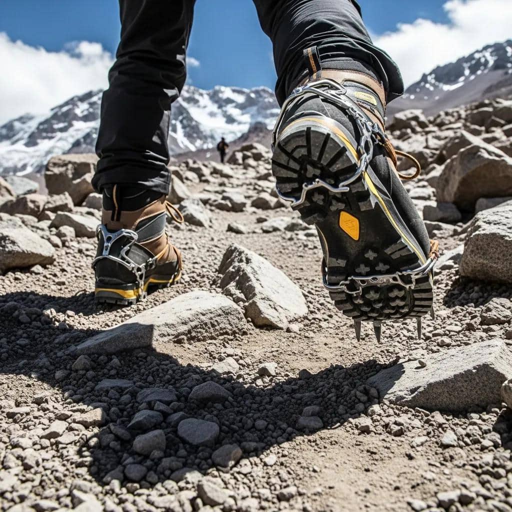
    Technical mountaineering climbers wearing high altitude boots on rocky alpine terrain showing the gear and skills required for the world top 50 technical objectives including ice climbing mixed climbing big wall objectives 2026
    Technical mountaineering demands specialized gear and skills well beyond general hiking — including stiff B2/B3 mountaineering boots, technical crampons, ice tools, helmets, harnesses, and the multi-discipline climbing capability needed for the world’s hardest objectives. The Top 50 ranking applies consistent alpine grading criteria to identify which mountains genuinely qualify as technical objectives — distinguishing routes that demand advanced climbing skills from peaks famous for altitude or commercial fame alone.

    Decision Framework by Experience Level

    The Top 50 includes objectives spanning a wide difficulty range. Generally, climbers should match objectives to current skill level rather than aspirational goals. Notably, attempting objectives beyond current capability creates genuine danger and often results in retreat or rescue.

    Recommended Objectives by Experience Level

    Intermediate Alpine
    (AD grade prepared)
    Best starting objectives: Mont Blanc Royal Traverse, Matterhorn Hörnli Ridge, Piz Bernina Biancograt, Aiguille Verte, Lyskamm Traverse, Mt. Cook Linda Glacier. Notably, these objectives at AD-D grade provide career foundation experience. Generally, climbers should master several AD-grade alpine routes before progressing to higher grades.
    Advanced Alpine
    (D grade competent)
    Career-building objectives: Eiger Mittelegi Ridge, Walker Spur on Grandes Jorasses, Aconcagua Polish Glacier, Denali West Buttress, Pisco-Vallunaraju traverses, Aiguille de la Brenva. Generally, the D-grade level represents serious commitment to alpine climbing as a primary discipline. Notably, completing 5+ D-grade routes prepares climbers for occasional TD-grade attempts.
    Expert Alpine
    (TD grade experienced)
    Test piece objectives: Cassin Ridge on Denali, Bonatti Pillar on Petit Dru, Ama Dablam Southwest Ridge, Cerro Torre Standard Route, Alpamayo French Direct, Cordillera Blanca technical peaks. Notably, the TD grade demands sustained excellence across multiple climbing disciplines. Generally, climbers reach this level after 8-12 years of progressive alpine experience.
    Elite Alpine
    (ED grade capable)
    Career-defining objectives: Eiger Nordwand (North Face), Cerro Torre Compressor Route, Mt. Robson Emperor Face, Trango Tower Eternal Flame, K2 Cesen Route, Annapurna South Face direct lines. Specifically, the ED grade represents world-class alpine climbing capability. Generally, fewer than 1,000 climbers worldwide operate at this level confidently.
    World-Class Alpine
    (ED2-ED4 expert)
    Cutting-edge objectives: Latok I North Ridge complete, Gasherbrum IV West Face, Nanga Parbat Rupal Face, K2 winter ascent, Masherbrum Northeast Face (still unclimbed). Notably, these objectives represent the absolute pinnacle of technical alpine climbing. Generally, fewer than 50 climbers worldwide attempt this level seriously.

    Region 1: Greater Ranges (Karakoram & Himalaya) — 14 Objectives

    The Greater Ranges contain the world’s highest peaks and many of the most technical climbing objectives. Generally, the Karakoram in particular features extreme technical objectives because of the combination of altitude (often above 7,000m) and steep granite walls or sustained mixed climbing terrain. Notably, the Himalaya proper contains both 8000m peaks (where altitude dominates) and 6000-7000m technical objectives where pure climbing difficulty matters more.

    Karakoram & Himalaya Significance

    Generally, the Greater Ranges represent the natural home of elite technical alpinism. The combination of altitude, weather severity, remote logistics, and extreme technical terrain creates objectives unmatched elsewhere. Notably, the Karakoram contains four of the world’s hardest peaks: K2, Gasherbrum IV, Latok I, and Masherbrum. Specifically, the Himalaya provides both pure altitude objectives (Everest, Cho Oyu) and technical objectives (Ama Dablam, Jannu, Annapurna South Face).

    #1Latok I North Ridge — Pakistan

    7,145m · ED4 · The Holy Grail · Multi-decade attempts · Karakoram

    Latok I North Ridge represents what many elite alpinists consider the hardest technical objective in the world. Notably, the 2,400m route saw decades of failed attempts by world-class teams before Hayden Kennedy’s team’s partial ascent in 2018. Generally, the route combines extreme technical difficulty with extreme remoteness, severe weather, and limited rescue options. Specifically, Steve Swenson — who has climbed K2 and reached high on Gasherbrum IV — suggests Latok I may be the hardest mountain in the world.

    Grade
    ED4
    Country
    Pakistan
    Range
    Karakoram
    Style
    Alpine mixed

    #2Gasherbrum IV West Face — Pakistan

    7,925m · ED4 · “The Shining Wall” · 1985 first ascent · Karakoram

    Gasherbrum IV’s West Face stands as one of the most technical routes ever climbed at 8000m altitude. Notably, the 1985 Polish first ascent by Voytek Kurtyka and Robert Schauer represented breakthrough technical climbing in the Greater Ranges. Generally, Steve Swenson has suggested Gasherbrum IV is probably harder than K2. Specifically, the West Face combines sustained mixed climbing on a 2,500m wall with altitude challenges of an 8000m attempt. This fusion of technical difficulty and altitude matches few objectives.

    Grade
    ED4
    Country
    Pakistan
    Wall
    2,500m
    First ascent
    1985

    #3K2 Cesen Route — Pakistan

    8,611m · ED2 · “Savage Mountain” · Most technical 8000er · Karakoram

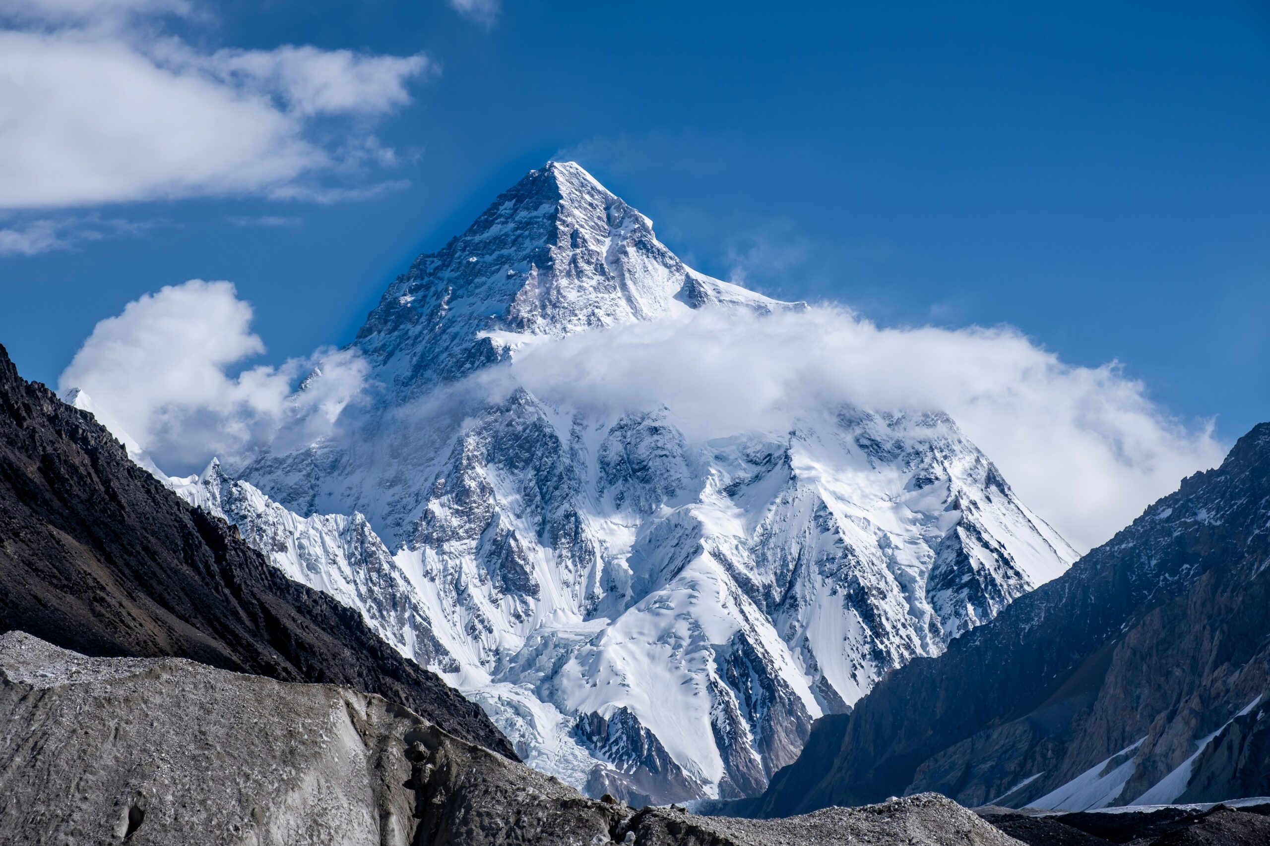
    K2 represents the most technical of the fourteen 8000m peaks. Generally, the Cesen Route (Basque Route) provides the most direct line on the mountain, while the standard Abruzzi Ridge offers another serious objective. Notably, K2’s combination of steep technical climbing throughout the entire route, severe weather windows, and the highest fatality rate among 8000ers earns its “Savage Mountain” reputation. Specifically, the climbing involves sustained ice and mixed climbing above 7,000m, the famous Black Pyramid rock section, the Bottleneck couloir below the summit, and serac danger throughout.

    Grade
    ED2
    Country
    Pakistan
    Rank
    2nd highest
    Fatality
    ~24%

    #4Masherbrum Northeast Face — Pakistan

    7,821m · UNCLIMBED · “Crown Jewel of Alpinism” · Karakoram

    Masherbrum’s Northeast Face remains the most famous unclimbed objective in alpinism. Notably, the face has resisted multiple expert attempts. Generally, the combination of 3,500m of vertical relief, sustained extreme technical climbing, serac danger, and limited weather windows creates an objective beyond current capabilities. Specifically, climbers like David Lama, Hansjörg Auer, and Jess Roskelley have made notable attempts. The face represents the contemporary equivalent of what the Eiger Nordwand was in the 1930s — a recognized “impossibility” that future generations may eventually solve.

    Grade
    Unclimbed
    Country
    Pakistan
    Wall height
    3,500m
    Status
    Open project

    #5Nanga Parbat Rupal Face — Pakistan

    8,126m · ED3 · Biggest face on Earth · 4,600m vertical · Karakoram

    Nanga Parbat’s Rupal Face represents the largest mountain face on Earth — 4,600m of vertical relief from base to summit. Notably, the 1970 first ascent by the Messner brothers ended in tragedy with Günther Messner’s death. Generally, the route involves sustained mixed climbing through technical terrain at extreme altitude. Specifically, the Rupal Face has seen multiple variations and direct lines climbed since the original ascent. The 2009 first winter ascent attempts (eventually successful in 2016 on the Diamir Face) demonstrated continued evolution of technical climbing at this scale.

    Grade
    ED3
    Country
    Pakistan
    Face height
    4,600m
    First ascent
    1970

    #6Trango Tower Eternal Flame — Pakistan

    6,286m · ED2 · Granite big wall · 1,300m vertical · Karakoram

    Trango Tower’s Eternal Flame route stands as one of the most famous big wall objectives in the Karakoram. Notably, the route involves sustained granite big wall climbing at altitude — 1,300m of vertical climbing on the world-class granite of the Trango Group. Generally, the route requires multi-day climbing with portaledge bivouacs and combines free climbing with aid sections. Specifically, the first ascent by Wolfgang Güllich’s team in 1989 represented breakthrough big wall climbing at altitude.

    Grade
    ED2
    Country
    Pakistan
    Wall
    1,300m granite
    Style
    Big wall

    #7Baintha Brakk (The Ogre) — Pakistan

    7,285m · ED3 · Famous 1977 first ascent · Sustained mixed · Karakoram

    Baintha Brakk — known as “The Ogre” — represents one of the legendary objectives of modern alpinism. Notably, Chris Bonington and Doug Scott’s 1977 first ascent involved a famous epic descent after Scott broke both legs in a fall. Generally, the mountain remained unrepeated for 24 years until the 2001 second ascent. Specifically, the standard route involves sustained mixed climbing through technical terrain with multiple difficult pitches. The Bonington-Scott climb’s brutal descent has become one of the most famous mountaineering survival stories of all time.

    Grade
    ED3
    Country
    Pakistan
    First ascent
    1977
    Style
    Mixed alpine

    #8Jannu (Kumbhakarna) — Nepal

    7,710m · ED3 · “Hardest 7000er” · Sustained technical · Himalaya

    Jannu in eastern Nepal earned the reputation as “the hardest 7000er” through decades of technical attempts. Notably, the Northwest Face features extreme mixed climbing with multiple severe technical sections. Generally, the 1962 first ascent by Lionel Terray’s French team established the mountain’s significance. Specifically, the standard north face line and the more recent direttisima routes combine altitude (above 7,500m sustained climbing) with extreme technical difficulty. The 2025 first ascent of the central north face by Aleš Češen and Luka Stražar’s team represented modern breakthrough alpinism.

    Grade
    ED3
    Country
    Nepal
    First ascent
    1962
    Style
    North face

    #9Annapurna I South Face — Nepal

    8,091m · ED3 · 3,000m face · 1970 Bonington · Himalaya

    Annapurna I’s South Face — climbed by Chris Bonington’s team in 1970 — represented breakthrough alpinism on an 8000m peak. Notably, the 3,000m face requires sustained mixed climbing through avalanche-prone terrain. Generally, the route remains one of the most respected ED-grade lines on any 8000er. Specifically, the South Face features serac danger, technical mixed climbing pitches, and the high altitude exposure typical of 8000m climbing. The 1970 first ascent established that direct lines on 8000m faces were feasible — opening the era of modern technical climbing at altitude.

    Grade
    ED3
    Country
    Nepal
    Face height
    3,000m
    First ascent
    1970

    #10Cholatse North Face — Nepal

    6,440m · ED2 · Sustained ice/mixed · Khumbu · Himalaya

    Cholatse in the Khumbu region offers excellent technical objectives despite modest altitude. Notably, the North Face combines sustained ice climbing with mixed sections on a steep alpine face. Generally, the peak provides a technical objective that doesn’t require permits for full 7000m+ peaks. Specifically, the 1982 first ascent established the mountain’s significance. Repeat attempts have created multiple variations. These include direct lines and the popular Northeast Face route used by serious technical climbers.

    Grade
    ED2
    Country
    Nepal
    Region
    Khumbu
    Style
    Ice/mixed

    #11Ama Dablam Southwest Ridge — Nepal

    6,812m · TD/ED1 · Famous Khumbu skyline · Himalaya

    Ama Dablam represents the most recognizable technical peak in the Khumbu — the famous skyline visible from Everest Base Camp. Notably, the Southwest Ridge serves as the standard route, involving sustained mixed climbing with iconic features including the Yellow Tower and Mushroom Ridge. Generally, the peak is technically accessible to advanced climbers but requires real alpine competence. Specifically, the climbing involves fixed ropes on key sections, technical mixed climbing through the Yellow Tower, and the famous Mushroom Ridge crux below the summit.

    Grade
    TD/ED1
    Country
    Nepal
    Crux
    Yellow Tower
    Region
    Khumbu

    #12Thalay Sagar — India

    6,904m · ED3 · Granite spire · Garhwal Himalaya

    Thalay Sagar in India’s Garhwal Himalaya represents one of the most striking granite peaks in the Greater Ranges. Notably, the steep granite walls require sustained big wall climbing combined with alpine ice and snow. Generally, the peak has seen multiple cutting-edge attempts and ascents through the decades since the 1979 first ascent. Specifically, the North Face direct lines remain among the most demanding objectives in Indian Himalaya — combining technical rock climbing with high-altitude alpine commitment.

    Grade
    ED3
    Country
    India
    Range
    Garhwal
    Style
    Granite + ice

    #13Changabang West Face — India

    6,864m · ED4 · “Shining Mountain” · 1976 Boardman-Tasker · Garhwal

    Changabang’s West Face represents one of the most legendary alpine objectives in the Indian Himalaya. Notably, the 1976 first ascent by Pete Boardman and Joe Tasker took 25 days in alpine style on the 1,600m granite wall. Generally, the climb represented a breakthrough in commitment and technical climbing. Specifically, recent ascents including the 2022 second ascent after 46 years (Joll, Ladiges, Scholes) demonstrate the route’s enduring difficulty. The Indian government’s Nanda Devi Sanctuary closure (1982-1996) restricted access for many years, contributing to the mountain’s mystique.

    Grade
    ED4
    Country
    India
    Wall
    1,600m granite
    First ascent
    1976

    #14Meru Central Shark’s Fin — India

    6,310m · ED3 · 2011 Anker-Chin-Ozturk · Famous documentary · Garhwal

    Meru’s Shark’s Fin route gained worldwide fame through the 2015 Jimmy Chin documentary “Meru” which won the Sundance Audience Award. Notably, the 2011 first ascent by Conrad Anker, Jimmy Chin, and Renan Ozturk required multiple attempts over years. Generally, the route involves sustained big wall climbing combined with alpine objective hazards including weather and altitude. Specifically, the route features the famous “Shark’s Fin” — a massive overhanging granite feature requiring sustained aid and free climbing techniques.

    Grade
    ED3
    Country
    India
    Famous
    Meru documentary
    First ascent
    2011

    Region 2: Patagonia — 5 Objectives

    Patagonia represents the most technically demanding climbing relative to altitude. Generally, the peaks remain modest by Himalayan standards (Cerro Torre at 3,128m) but the technical climbing equals or exceeds anything in the Greater Ranges. Notably, the combination of granite spires, sustained ice climbing, severe weather, and short weather windows creates objectives that demand absolute technical mastery.

    Patagonia Climbing Significance

    Generally, Patagonia tests pure technical climbing skill without the altitude problems of the Greater Ranges. The compact climbing zones around El Chaltén (Argentina) and Torres del Paine (Chile) contain granite peaks of legendary difficulty. Notably, the short weather windows often last only 24-72 hours — requiring climbers to move efficiently when conditions allow. Specifically, the rime ice and gusting Patagonian winds create unique technical challenges that don’t exist elsewhere in similar concentration.

    #15Cerro Torre Compressor Route — Argentina/Chile

    3,128m · ED3 · “A shriek turned to stone” · Granite + ice spire · Patagonia

    Cerro Torre stands as one of the most technically demanding peaks in the world despite modest altitude. Notably, Reinhold Messner called it “a shriek turned to stone.” Generally, the original 1959 Cesare Maestri claim has been controversial. Maestri’s partner died on descent. Then in 1970, Maestri’s compressor route involved hundreds of placed bolts. Specifically, the bolt removal in 2012 by Jason Kruk and Hayden Kennedy restored the route to its original technical character. The mountain combines sustained granite climbing with severe ice and weather — climbing styles switching between rock and ice throughout the route.

    Grade
    ED3
    Country
    Argentina/Chile
    Height
    3,128m
    Style
    Mixed granite/ice

    #16Fitz Roy Compressor / Casarotto Route — Argentina

    3,405m · ED2 · Massive granite spire · El Chaltén · Patagonia

    Fitz Roy (also called Cerro Chaltén) features multiple cutting-edge routes on its massive granite walls. Notably, the Casarotto Route and other classic lines represent serious big wall climbing in extreme Patagonian conditions. Generally, the mountain offers more route options than Cerro Torre, but the climbing remains demanding throughout. Specifically, the famous Fitz Roy Skyline traverse climbs all peaks in the Fitz Roy chain in single push. This route has become a legendary objective combining multiple Top 50 peaks in committing single climbs.

    Grade
    ED2
    Country
    Argentina
    Region
    El Chaltén
    Style
    Granite big wall

    #17Torre Egger — Argentina/Chile

    2,850m · ED3 · Cerro Torre’s smaller sibling · Patagonia

    Torre Egger is named after Toni Egger who died on the disputed 1959 Cerro Torre ascent. The spire represents one of the most technical objectives in the Cerro Torre group. Notably, the spire features sustained mixed climbing with sections of rime ice and granite. Generally, the peak is often climbed in conjunction with traverses of the entire Cerro Torre group. Specifically, the modern alpine-style ascents of the complete traverse (Cerro Standhardt + Punta Herrón + Torre Egger + Cerro Torre) represent some of the most committing climbs ever completed.

    Grade
    ED3
    Country
    Argentina/Chile
    Group
    Cerro Torre
    Style
    Granite + rime

    #18Cerro Standhardt — Argentina

    2,800m · TD/ED1 · Compact granite spire · El Chaltén · Patagonia

    Cerro Standhardt provides another iconic spire in the Cerro Torre group. Notably, the peak offers somewhat more accessible technical climbing than the larger Cerro Torre and Torre Egger objectives. Generally, the standard route involves sustained granite climbing with ice sections. Specifically, the peak often serves as a “warm-up” for climbers approaching the harder Cerro Torre objectives, though “warm-up” is relative — the climbing remains technically demanding throughout.

    Grade
    TD/ED1
    Country
    Argentina
    Region
    El Chaltén
    Style
    Granite

    #19Torres del Paine Central Tower — Chile

    2,460m · ED2 · 1,000m granite wall · Big wall · Patagonia

    The Central Tower of Paine in Chilean Patagonia represents big wall granite climbing at scale. Notably, the South Face features a 1,000m vertical granite wall climbed by various cutting-edge routes. Generally, the 1963 first ascent by Don Whillans and Chris Bonington established the mountain’s significance. Specifically, modern free climbing routes including the famous “Riders on the Storm” represent demanding alpine big wall objectives globally. The climbing combines sustained free climbing with legendary Patagonian weather.

    Grade
    ED2
    Country
    Chile
    Wall
    1,000m
    First ascent
    1963

    Region 3: Alaska — 5 Objectives

    Alaska contains some of the most technically demanding objectives in North America. Generally, the combination of latitude (subarctic conditions), altitude (Denali at 6,190m feels like a 7000m peak), and self-sufficient logistics creates climbing experiences unique to the region. Notably, the Alaska Range, Saint Elias Range, and the Cordillera Talkeetna contain numerous Top 50 caliber objectives.

    Alaska Range Significance

    Generally, Alaska tests cold weather alpine climbing skills more than any other region. The subarctic latitude means peaks of 6,000m operate in the temperature range of much higher Himalayan peaks. Notably, climbers must be completely self-sufficient — no fixed ropes, no Sherpa support, no high camps established by operators. Specifically, the Alaska Range climbing season is short (typically May-June) and weather windows can extend or contract dramatically.

    #20Denali Cassin Ridge — Alaska, USA

    6,190m · TD+ · 1961 Cassin · Mixed alpine route · Alaska Range

    The Cassin Ridge on Denali represents one of the most committing technical objectives in North America. Notably, Riccardo Cassin and team established the route in 1961 — pioneering alpine-style climbing on Denali. Generally, the route involves sustained mixed climbing with technical pitches throughout. Specifically, the climbing combines several elements. First, steep ice and technical mixed sections. Then standard altitude challenges of Denali. Additionally, temperatures drop below -30°C even in mid-summer. Also, weather windows require fast efficient climbing. Finally, the multi-day commitment defines any Denali objective.

    Grade
    TD+
    Country
    USA
    First ascent
    1961
    Style
    Mixed alpine

    #21Mount Huntington West Face — Alaska, USA

    3,731m · ED2 · 1964 Terray · Alaska’s “Most Beautiful” · Alaska Range

    Mount Huntington is often called “the most beautiful peak in Alaska” — a steep granite peak resembling Cerro Torre or the Aiguilles of Chamonix. Notably, Lionel Terray’s 1964 French team made the first ascent via the Northwest Ridge. Generally, the more demanding West Face routes (Bibler-Klewin “The Phantom Wall” and other lines) represent ED-grade alpine objectives. Specifically, the technical climbing combines steep ice, mixed climbing, and granite — all on a peak under 4,000m where the climbing matters more than the altitude.

    Grade
    ED2
    Country
    USA
    Region
    Alaska Range
    First ascent
    1964

    #22Moose’s Tooth — Alaska, USA

    3,150m · ED2 · “Ham and Eggs” famous ice route · Alaska Range

    Moose’s Tooth in the Ruth Gorge area features sustained ice climbing on routes including the famous “Ham and Eggs” couloir. Notably, the routes combine 1,500m+ of sustained ice climbing with mixed sections. Generally, the area contains multiple Top 50 caliber objectives within close proximity. Specifically, the climbing involves several challenges. First, alpine ice grades up to AI4-5. Then mixed climbing on the upper sections. Additionally, standard Alaska Range cold weather challenges. Finally, approach difficulty, weather windows, and self-sufficient base camp operations.

    Grade
    ED2
    Country
    USA
    Region
    Ruth Gorge
    Style
    Ice/mixed

    #23Mount Hunter North Buttress — Alaska, USA

    4,442m · ED2 · “Begguya” · Sustained alpine objective · Alaska Range

    Mount Hunter (Begguya in Athabaskan) features multiple cutting-edge alpine routes on its North Buttress and other aspects. Notably, the routes combine sustained ice climbing with mixed sections in the cold Alaska Range environment. Generally, the peak provides serious commitment for ED-grade climbers without requiring the high-altitude objectives elsewhere. Specifically, classic routes including the Moonflower Buttress represent respected ice climbing objectives in Alaska. The climbing combines steep alpine ice with mixed sections. Multi-day committing climbing defines these routes.

    Grade
    ED2
    Country
    USA
    Native name
    Begguya
    Style
    Alpine ice/mixed

    #24Mount Saint Elias South Ridge — Canada/USA

    5,489m · TD+ · 5,500m vertical from sea level · Alaska/Yukon

    Mount Saint Elias rises 5,500m directly from sea level — one of the greatest vertical rises on Earth. Notably, the mountain straddles the Alaska-Yukon border. Generally, the South Ridge represents a sustained alpine route with extreme weather exposure and complex logistics. Specifically, the 1897 first ascent by the Duke of the Abruzzi’s team established the peak’s significance. Modern repeats remain rare because of the difficult logistics and technical commitment required.

    Grade
    TD+
    Country
    USA/Canada
    Vertical rise
    5,500m
    First ascent
    1897

    Region 4: The Alps — 10 Objectives

    The Alps contain the longest tradition of technical climbing of any range. Notably, alpine grading itself was developed and refined in the Alps over a century. Generally, the range features more accessible technical objectives than the Greater Ranges — meaning climbers can attempt Top 50 caliber routes without expedition-style logistics. Specifically, the Alps provide career-building objectives at every alpine grade.

    Alps Climbing Tradition

    Generally, the Alps invented technical mountaineering as a discipline. The Golden Age of Alpinism in the 1850s-1860s established first ascents on the major peaks, while the 1930s saw breakthrough mixed climbing on the great north faces. Notably, the modern era continues to see cutting-edge routes — particularly winter ascents and direttisima routes on classic faces. Specifically, the Alpine cable car infrastructure and hut system make these objectives more accessible than equivalent objectives in remote ranges.

    #25Eiger Nordwand (North Face) — Switzerland

    3,967m · ED1 · “Mordwand” (Murder Wall) · 60+ deaths · Bernese Alps

    The Eiger North Face — known as the Nordwand or “Mordwand” (Murder Wall) — represents the most legendary technical objective in the Alps. Notably, more than 60 climbers have died attempting the route. Generally, the 1938 first ascent by Anderl Heckmair’s team represented a major advance in mixed climbing. Specifically, the 1,800m north face features sustained mixed climbing, rockfall danger, rapid weather changes, and famously difficult route-finding. Modern fast ascents in good conditions take 6-12 hours, but the wall remains genuinely dangerous because of objective hazards.

    Grade
    ED1
    Country
    Switzerland
    Face height
    1,800m
    First ascent
    1938

    #26Grandes Jorasses Walker Spur — France/Italy

    4,208m · ED1 · 1938 Cassin · Mont Blanc Massif · Mixed/ice

    The Walker Spur on Grandes Jorasses ranks as one of the great north face routes in the Alps. Notably, Riccardo Cassin’s 1938 first ascent established the line. Generally, the 1,200m route combines sustained mixed climbing with sections of pure ice. Specifically, the route features iconic pitches including the Rebuffat crack, the Black Slabs, and the upper mixed terrain — all in committing high-altitude alpine environment. The route remains a benchmark test piece for advanced alpine climbers attempting their first major ED-grade objective.

    Grade
    ED1
    Country
    France/Italy
    Route length
    1,200m
    First ascent
    1938

    #27Matterhorn North Face — Switzerland/Italy

    4,478m · ED1 · 1931 Schmid Brothers · Pennine Alps

    The Matterhorn’s North Face represents one of the three great north faces of the Alps (with Eiger and Grandes Jorasses). Notably, Franz and Toni Schmid made the first ascent in 1931. Generally, the standard Hörnli Ridge is moderate AD-grade, but the North Face features sustained mixed climbing on shaded terrain. Specifically, the 1,200m face involves snow, ice, and mixed sections with significant rockfall danger. Generally, the North Face climbing differs dramatically from the popular Hörnli Ridge — much more technical, much more committing, and far less frequently attempted.

    Grade
    ED1
    Country
    Switzerland/Italy
    Face height
    1,200m
    First ascent
    1931

    #28Petit Dru Bonatti Pillar — France

    3,733m · TD+/ED1 · 1955 Bonatti solo · Granite big wall · Mont Blanc

    Petit Dru’s Bonatti Pillar represents one of the most famous solo achievements in alpinism. Notably, Walter Bonatti made the solo first ascent in 1955 over six days — a legendary climbing achievement. Generally, the granite pillar offers sustained big wall climbing on quality granite. Specifically, multiple rockfall events have changed the route conditions significantly since the 1955 ascent. The Petit Dru area has seen multiple cutting-edge routes through the decades, all benefiting from the Chamonix base infrastructure and cable car access.

    Grade
    TD+/ED1
    Country
    France
    First ascent
    1955 (solo)
    Style
    Granite

    #29Piz Badile NE Face — Switzerland

    3,308m · TD · 1937 Cassin · Granite wall · Bergell

    Piz Badile’s Northeast Face represents one of the iconic granite climbs in the Alps. Notably, Riccardo Cassin’s 1937 first ascent established the line through 800m of sustained granite climbing. Generally, the climb provides one of the best TD-grade big wall objectives in the Alps. Specifically, the climbing features iconic crack systems, slab sections, and exposed positions throughout. The route serves as a classic progression objective for climbers building toward harder big wall climbs elsewhere — including the Patagonia and Karakoram big walls.

    Grade
    TD
    Country
    Switzerland
    Wall
    800m granite
    First ascent
    1937

    #30Civetta Northwest Face — Italy

    3,220m · TD+ · 1925 Solleder · Dolomites limestone wall

    Civetta’s Northwest Face represents the iconic Dolomites big wall climbing. Notably, Emil Solleder’s 1925 first ascent up the Solleder route established the line through 1,100m of sustained limestone climbing. Generally, the wall features iconic Dolomites characteristics including yellow limestone, sustained vertical climbing, and complex route-finding. Specifically, multiple variations and direct lines have been climbed in the decades since 1925 — making Civetta one of the most thoroughly explored big walls in the Dolomites. The climb earned the nickname “Solleder” for the route, and is widely considered essential for serious Dolomites climbers.

    Grade
    TD+
    Country
    Italy
    Wall
    1,100m limestone
    First ascent
    1925

    #31Tre Cime di Lavaredo North Face — Italy

    2,999m · TD+ · 1933 Comici · Iconic Dolomites · Limestone

    The Tre Cime (Three Peaks) of Lavaredo feature among the most iconic Dolomites climbing. Notably, Emilio Comici’s 1933 first ascent of the Cima Grande North Face established direct-line climbing as a Dolomites style. Generally, the three faces offer multiple Top 50 caliber routes including the Comici route, the Cassin route on the Cima Ovest, and various direct variations. Specifically, the limestone walls feature sustained vertical climbing on iconic terrain — well-photographed and well-traveled but no less technically demanding for that.

    Grade
    TD+
    Country
    Italy
    Iconic year
    1933
    Style
    Vertical limestone

    #32Mont Blanc Royal Traverse — France/Italy

    4,810m · TD · Three Monts traverse · Mont Blanc Massif

    The Mont Blanc Royal Traverse represents one of the great long alpine traverses in the Alps. Notably, the route climbs Mont Blanc du Tacul, Mont Maudit, and Mont Blanc in succession. Generally, the traverse involves sustained AD-D grade climbing with serious commitment to a long day or two-day push. Specifically, the route covers extensive distance at altitude, requiring efficient movement through complex glaciated terrain. This route provides a “graduation” objective for climbers progressing from intermediate to advanced alpine experience.

    Grade
    TD
    Country
    France/Italy
    Length
    3 summits
    Style
    Long traverse

    #33Aiguille de la Brenva — Italy

    4,304m · TD+ · 1933 Brenva Spur · Mont Blanc Italian side

    The Brenva Spur on Mont Blanc’s Italian side represents a classic long alpine route. Notably, the line was pioneered by Graham Brown’s team in the 1933 Brenva ascent. Generally, the route involves sustained mixed climbing with significant objective hazards from seracs on the upper sections. Specifically, the climb requires efficient movement through committing terrain — the upper sections cannot easily be retreated from because of the route configuration. This route serves as one of the great Italian-side Mont Blanc objectives.

    Grade
    TD+
    Country
    Italy
    Region
    Mont Blanc
    First ascent
    1933

    #34Aiguille Verte Couturier Couloir — France

    4,122m · D+/TD- · Sustained ice · Chamonix · Mont Blanc Massif

    The Couturier Couloir on Aiguille Verte represents one of the most respected ice climbing objectives in the Mont Blanc Massif. Notably, the 1,100m couloir features sustained alpine ice with gradients up to 55°. Generally, the route serves as a classic D+/TD- objective for climbers progressing toward harder alpine ice routes. Specifically, the climb involves sustained ice climbing on a steep gully, technical sections requiring solid ice tool placements, and the standard Mont Blanc Massif weather and snow conditions concerns.

    Grade
    D+/TD-
    Country
    France
    Couloir
    1,100m ice
    Gradient
    Up to 55°

    Region 5: Andes — 8 Objectives

    The Andes contain technical objectives spanning Bolivia, Peru, Ecuador, Chile, and Argentina. Notably, the Cordillera Blanca in Peru contains the highest concentration of technical alpine climbing in South America. Generally, the range features both extreme altitude objectives (Aconcagua at 6,961m) and pure technical climbing on lower peaks (Alpamayo, Huascarán technical routes).

    Andes Climbing Significance

    Generally, the Andes provide technical objectives at altitudes intermediate between Alps and Himalaya. Notably, the Cordillera Blanca in Peru contains 17 peaks above 6,000m within a 130km mountain corridor — concentrating technical climbing in a compact area. Specifically, the climbing style emphasizes ice and snow climbing more than the rock-dominated Patagonia or the mixed climbing of the Alps. Additionally, the dry climate during the climbing season (May-August) provides more reliable conditions than the variable Patagonian weather.

    #35Alpamayo French Direct — Peru

    5,947m · TD+ · “Most beautiful mountain” · Cordillera Blanca

    Alpamayo is often called the most beautiful mountain in the world — a perfect ice pyramid in Peru’s Cordillera Blanca. Notably, the French Direct route on the Southwest Face features sustained alpine ice with multiple technical sections. Generally, the climbing involves five fluted ice ribs with gradients up to 70°. Specifically, the route serves as a benchmark TD+ objective for climbers progressing toward harder South American objectives. The peak appears as the visual inspiration for the North Face logo.

    Grade
    TD+
    Country
    Peru
    Range
    Cordillera Blanca
    Gradient
    Up to 70°

    #36Aconcagua Polish Glacier Direct — Argentina

    6,961m · D+/TD- · Highest in Americas · Cordillera de los Andes

    The Polish Glacier Direct on Aconcagua represents the technical alternative to the standard Normal Route. Notably, the route involves sustained ice climbing on the East face glacier. Generally, the route grades D+/TD- with technical sections requiring solid ice climbing skills. Specifically, the climbing involves a 1,000m+ glacier with technical bands, crevasse navigation, and the standard altitude challenges of climbing above 6,000m. The Polish Glacier Direct provides the most technical of the standard Aconcagua routes — though serious technical routes on the South Face represent significantly harder objectives.

    Grade
    D+/TD-
    Country
    Argentina
    Summit
    6,961m
    Route
    East glacier

    #37Aconcagua South Face — Argentina

    6,961m · ED2 · 3,000m face · Pioneered 1954 · Patagonia adjacent

    Aconcagua’s South Face represents the most demanding aspect of the Western Hemisphere’s highest peak. Notably, the 3,000m face features sustained mixed climbing with significant objective hazards including rockfall. Generally, the 1954 first ascent established the line — and modern repeats remain rare. Specifically, the climbing combines technical mixed sections with the altitude challenges of operating above 6,500m. The face provides a serious commitment objective for ED-grade climbers seeking high-altitude technical climbing in South America.

    Grade
    ED2
    Country
    Argentina
    Face
    3,000m
    First ascent
    1954

    #38Huascarán North Face — Peru

    6,768m · TD+ · Highest in Peru · Cordillera Blanca

    Huascarán represents the highest peak in Peru and the highest tropical mountain in the world. Notably, the standard route is moderate, but technical routes on the North Face represent serious TD+ objectives. Generally, the climbing involves sustained ice climbing through complex glaciated terrain. Specifically, the upper sections feature significant objective hazards including serac collapse and avalanche-prone slopes. The 1970 Yungay disaster illustrates the genuine hazards of climbing in this area. An avalanche from Huascarán’s north face killed 20,000+ people in the valley below.

    Grade
    TD+
    Country
    Peru
    Summit
    6,768m
    Range
    Cordillera Blanca

    #39Cordillera Huayhuash Siula Grande — Peru

    6,344m · TD+ · “Touching the Void” mountain · Andean ice

    Siula Grande gained worldwide fame through Joe Simpson’s book and film “Touching the Void” — documenting the 1985 first ascent and Simpson’s miraculous survival after falling into a crevasse. Notably, the West Face represents the route of Simpson and Simon Yates’ first ascent. Generally, the Cordillera Huayhuash contains multiple technical peaks including Yerupaja and the Jirishanca. Specifically, the area provides excellent technical objectives at moderate altitude with the legendary Peruvian Andean ice climbing conditions.

    Grade
    TD+
    Country
    Peru
    Famous
    Touching the Void
    Style
    Andean ice

    #40Cordillera Huayhuash Yerupajá — Peru

    6,635m · TD+ · “Butcher” reputation · Steep Andean ice

    Yerupajá earned the nickname “El Carnicero” (The Butcher) because of its forbidding technical character. Notably, the peak features sustained steep ice climbing on multiple aspects. Generally, the 1950 first ascent by an American team established the standard route. Specifically, the climbing involves significant sustained ice with gradients up to 60° on the standard route. The peak represents one of the more demanding Cordillera Huayhuash objectives — combining altitude with technical ice climbing.

    Grade
    TD+
    Country
    Peru
    Summit
    6,635m
    Nickname
    “El Carnicero”

    #41Pumasillo — Peru

    6,070m · TD · Cordillera Vilcabamba · Andean ice

    Pumasillo in the Cordillera Vilcabamba represents a technical objective in a less-traveled Peruvian range. Notably, the peak features steep ice climbing through sustained terrain. Generally, the 1957 first ascent established the standard line. Specifically, the climb provides serious technical climbing without the crowds of the more popular Cordillera Blanca peaks. The 6,070m summit involves multiple high camps and sustained ice climbing on the upper sections.

    Grade
    TD
    Country
    Peru
    Range
    Vilcabamba
    First ascent
    1957

    #42Illimani South Face — Bolivia

    6,438m · TD+ · Above La Paz · Bolivian Andes

    Illimani’s South Face represents the technical alternative to the standard Normal Route used by most Aconcagua-style climbers. Notably, the face features sustained mixed climbing with technical sections. Generally, the climbing combines altitude challenges with technical alpine difficulty. Specifically, the mountain rises directly above La Paz — providing one of the most striking urban-adjacent climbing experiences in the world. The South Face climbing involves serious commitment with limited rescue options compared to the popular Normal Route.

    Grade
    TD+
    Country
    Bolivia
    Summit
    6,438m
    View
    Above La Paz

    Region 6: Lesser-Known Objectives — 8 Underappreciated Peaks

    The final region covers technical objectives that elite climbers value highly but rarely appear on general “hardest” lists. Notably, these peaks demonstrate that significant technical climbing exists outside the famous concentration zones. Generally, the inclusion criteria emphasize technical merit verified through climber reports rather than public reputation.

    Why Lesser-Known Objectives Matter

    Generally, elite alpinists often prefer less-famous objectives because they avoid crowds, offer first ascent or repeat opportunities, and provide pure climbing experiences without commercial infrastructure. Notably, peaks in less-traveled ranges like the New Zealand Southern Alps, Norwegian Stetind, Tien Shan, Caucasus, and Antarctica deserve recognition. Specifically, this section highlights 8 objectives where technical difficulty exceeds public reputation — providing alternative goals for climbers wanting to escape the commercial circuits.

    #43Mount Robson Emperor Face — Canada

    3,954m · ED2 · “Wapta Icefield giant” · Canadian Rockies

    Mount Robson’s Emperor Face represents one of the most demanding objectives in the Canadian Rockies. Notably, the face features sustained mixed climbing with significant objective hazards. Generally, the standard route on Robson is moderate, but the Emperor Face climbing requires advanced skills throughout 2,500m of vertical relief. Specifically, multiple winter ascents have demonstrated the route remains a benchmark Canadian Rockies test piece. The peak provides serious commitment for climbers preparing for harder objectives in remote ranges.

    Grade
    ED2
    Country
    Canada
    Face
    2,500m vertical
    Range
    Canadian Rockies

    #44Aoraki/Mount Cook Caroline Face — New Zealand

    3,724m · TD+ · NZ Southern Alps · Sustained mixed

    Aoraki/Mount Cook features multiple technical objectives despite modest altitude. Notably, the Caroline Face represents the most challenging aspect of New Zealand’s highest peak. Generally, the 1,500m face combines mixed climbing with serious objective hazards including avalanche and rockfall. Specifically, recent winter ascents have established new lines on the face. The peak provides excellent technical climbing in a sub-Antarctic environment — climbers experience cold weather conditions similar to higher peaks in less remote settings.

    Grade
    TD+
    Country
    New Zealand
    Native name
    Aoraki
    Face
    1,500m

    #45Mount Tutoko — New Zealand

    2,723m · TD · Fjordland granite · Coastal alpine

    Mount Tutoko in New Zealand’s Fjordland National Park represents technical climbing in a unique environment. Notably, the granite mountain rises directly from the rainforest and coast. Generally, the technical climbing combines sustained granite climbing with the standard New Zealand sub-Antarctic weather conditions. Specifically, the modest altitude (2,723m) belies the technical difficulty — the climbing involves serious commitment with limited rescue options in the remote Fjordland environment.

    Grade
    TD
    Country
    New Zealand
    Park
    Fjordland
    Style
    Granite

    #46Stetind — Norway

    1,392m · TD · “Hardest peak in Norway” · Granite obelisk

    Stetind is Norway’s national mountain — a granite obelisk rising 1,392m from the Atlantic Ocean. Notably, the modest altitude belies significant technical difficulty. Generally, the standard route involves sustained granite climbing on sea-level approached terrain. Specifically, the climb features iconic exposure and serious commitment despite the modest absolute height. The peak represents what elite climbers value: pure climbing skill rather than altitude challenges.

    Grade
    TD
    Country
    Norway
    Height
    1,392m
    Style
    Granite obelisk

    #47Khan Tengri North Ridge — Kazakhstan/Kyrgyzstan

    7,010m · TD+ · “Marble Mountain” · Tien Shan

    Khan Tengri (Lord of the Sky) in the Tien Shan range represents Central Asia’s most technical 7000er. Notably, the marble-veined granite gives the peak its distinctive appearance. Generally, the North Ridge route involves sustained alpine climbing with technical sections. Specifically, the climbing combines altitude challenges (genuine 7000m climbing) with mixed terrain throughout. The route serves as a Top 50 caliber objective in a range that doesn’t see Western climbers as frequently as the Himalaya or Karakoram.

    Grade
    TD+
    Country
    Kazakhstan/Kyrgyzstan
    Summit
    7,010m
    Range
    Tien Shan

    #48Mount Belukha — Russia (Altai)

    4,506m · TD · Sacred Altai peak · Siberian alpine

    Mount Belukha represents the highest peak in the Altai mountains of Siberia. Notably, the peak holds sacred status in local Altai culture. Generally, technical routes on the North Face involve sustained ice climbing with mixed sections. Specifically, the climbing combines remote Siberian conditions with technical alpine difficulty. The peak serves as Russia’s most significant alpine objective outside the Caucasus.

    Grade
    TD
    Country
    Russia
    Range
    Altai
    Status
    Sacred peak

    #49Mount Vinson South Face — Antarctica

    4,892m · TD · Antarctic continent · Sentinel Range

    Mount Vinson’s South Face represents the technical alternative to the standard West Face route. Notably, the climbing involves sustained mixed climbing at extreme polar latitudes. Generally, the logistics are brutally expensive ($35,000-50,000 for guided expeditions) due to the Antarctic Logistics Expeditions monopoly. Specifically, the technical climbing combines moderate alpine grades with the extreme cold and remote logistics of Antarctica. The peak qualifies for the Top 50 more through logistical commitment than pure technical difficulty.

    Grade
    TD
    Country
    Antarctica
    Summit
    4,892m
    Cost
    $35K-50K

    #50Mount Ushba North Face — Georgia

    4,710m · TD+ · “Caucasian Matterhorn” · Sustained ice/mixed

    Mount Ushba in the Georgian Caucasus represents the “Caucasian Matterhorn” — a distinctively twin-peaked mountain demanding sustained technical climbing. Notably, the North Face features sustained ice and mixed climbing through approximately 1,000m of vertical relief. Generally, the peak provides excellent technical climbing in a range that receives few Western climbers. Specifically, the climbing combines moderate altitude (4,710m) with high technical difficulty on the steep north faces. The peak qualifies as a true Top 50 objective for climbers willing to venture beyond famous ranges.

    Grade
    TD+
    Country
    Georgia
    Range
    Caucasus
    Face
    1,000m
    Top 50 technical mountaineering objectives gear requirements showing boots crampons ice tools for alpine climbing Karakoram Himalaya Patagonia Alaska Alps Andes 2026 ranking
    The Top 50 technical objectives span six geographic regions with consistent alpine grading criteria. Generally, the ranking emphasizes climbing skills required over fame or fatality rates — Greater Ranges peaks dominate the most technical positions, with Patagonia, Alaska, Alps, Andes, and lesser-known objectives providing alternative progression paths. Notably, ED-grade objectives concentrate in Pakistan (Karakoram), Patagonia, and Alaska, while TD-grade objectives appear across all regions.

    Top 50 Summary Tables by Region and Grade

    Summary references help climbers identify objectives matching specific criteria. Generally, the tables group peaks by region and grade for quick reference. Notably, this format allows climbers to compare options at their target grade level across different geographic regions.

    Summary by Region

    RegionPeaksGrade RangeBest Known Objectives
    Greater Ranges (Karakoram/Himalaya)14TD+ to ED4Latok I, Gasherbrum IV, K2, Masherbrum, Nanga Parbat, Trango Tower, The Ogre, Jannu
    Patagonia5TD/ED1 to ED3Cerro Torre, Fitz Roy, Torre Egger, Cerro Standhardt, Torres del Paine
    Alaska5TD+ to ED2Denali Cassin Ridge, Mt. Huntington, Moose’s Tooth, Mt. Hunter, Mt. Saint Elias
    The Alps10D+/TD- to ED1Eiger Nordwand, Walker Spur, Matterhorn N. Face, Petit Dru, Piz Badile, Civetta
    The Andes8TD to ED2Alpamayo, Aconcagua S. Face, Huascarán, Siula Grande, Yerupajá, Illimani
    Lesser-Known8TD to ED2Mt. Robson, Mt. Cook, Stetind, Khan Tengri, Mt. Vinson, Mt. Ushba
    TOTAL50D+ to ED4Six regions, consistent technical criteria

    Summary by Alpine Grade

    GradeCountNotable Examples
    D+/TD- (Advanced Alpine)~5Aiguille Verte Couturier, Aconcagua Polish Glacier
    TD (Expert Alpine)~10Mt. Saint Elias, Mt. Cook, Stetind, Mt. Vinson, Mt. Belukha
    TD+ (Expert Alpine)~13Denali Cassin, Alpamayo, Huascarán, Khan Tengri, Mt. Ushba
    ED1 (Elite Alpine)~7Eiger Nordwand, Walker Spur, Matterhorn N. Face, Ama Dablam
    ED2 (Elite Alpine)~10K2, Trango Tower, Mt. Huntington, Fitz Roy, Aconcagua S. Face
    ED3 (World-Class)~4Cerro Torre, Torre Egger, Annapurna S. Face, Jannu, Thalay Sagar
    ED4 (Absolute Elite)~3Latok I, Gasherbrum IV, Changabang W. Face
    Unclimbed~1Masherbrum NE Face
    Technical mountaineering progression path from intermediate alpine through expert ED grade objectives showing the career path from Mont Blanc Aiguille Verte through Walker Spur Eiger Nordwand Cerro Torre Latok 2026 ranking criteria
    The progression path through Top 50 technical objectives. Notably, climbers should master multiple AD-grade routes before progressing to D-grade, several D-grade before TD-grade, and demonstrate excellence at TD before attempting ED-grade objectives. Generally, this progression takes 10-20 years for serious alpine climbers — the world’s most prolific elite alpinists complete perhaps 15-25 objectives from this Top 50 caliber over decades of climbing.

    Frequently Asked Questions About Technical Mountaineering Objectives

    What makes a mountaineering objective ‘technical’?

    A technical mountaineering objective requires advanced climbing skills and specialized equipment beyond basic glacier travel. Specifically, technical climbing involves sustained sections of alpine grade AD (Assez Difficile) or harder according to the standard French alpine grading system. The criteria include continuous use of ropes, harnesses, helmets, ice axes, and crampons, with technical climbing techniques required throughout most of the route. Generally, technical objectives involve several disciplines. First, mixed climbing combines rock and ice. Then steep ice climbing above 60 degrees. Also, big wall climbing across multiple pitches of vertical or overhanging terrain. Additionally, sustained rock climbing on alpine rock walls. Finally, complex route-finding through serac fields or icefalls. A peak like Kilimanjaro reaches 5,895m but isn’t technical because the standard route requires only hiking skills.

    What alpine grading system ranks technical climbs?

    The French Alpine Grading system provides the standard scale for technical mountaineering objectives. The grades progress from easy to extreme: F (Facile / Easy) involves easy glacier travel with some rock scrambling. PD (Peu Difficile / Little Difficult) requires technical climbing sections and glaciers of higher difficulty plus some short steep terrain. AD (Assez Difficile / Fairly Difficult) demands physically demanding climbing for experienced alpine climbers with steep exposed sections or snow/ice slopes over 50 degrees. D (Difficile / Difficult) involves sustained rock climbing, ice climbing, or snow travel requiring huge commitment. TD (Très Difficile / Very Difficult) means highly technical climbs with long distances, remote locations, and hard multi-pitch climbing. ED (Extrêmement Difficile / Extremely Difficult) represents the most difficult climbs in the world, further subdivided into ED1, ED2, ED3, and ED4.

    What is the hardest technical mountain in the world?

    There’s genuine debate among elite alpinists about which mountain represents the hardest technical objective. K2 climber Steve Swenson has suggested that Gasherbrum IV is probably harder than K2, and that some of the Latok Peaks may be the hardest in the world. Several leading contenders emerge. First, Latok I North Ridge in the Karakoram resisted decades of attempts by world-class alpinists until Hayden Kennedy’s team’s 2018 line. Then there’s Cerro Torre in Patagonia, which Reinhold Messner called “a shriek turned to stone.” Additionally, Gasherbrum IV features a West Face among the most technical routes ever climbed at 8000m altitude. Finally, Masherbrum NE Face remains an unclimbed crown jewel objective. K2 is about 2.5 times higher than Cerro Torre with thin air and avalanche danger, while Cerro Torre is more technically demanding but lacks altitude problems.

    How is this list different from ‘hardest mountains’ lists?

    Most “hardest mountains” lists conflate technical difficulty with fame, fatality rates, altitude, and accessibility. This Top 50 ranking applies consistent technical criteria specifically. The ranking criteria span five areas. First, sustained alpine grade AD or harder verified through climber reports. Then specific technical sections documented in route descriptions. Also, multi-discipline climbing requirements covering mixed, ice, rock, and alpine. Additionally, historical first ascent significance demonstrating technical breakthrough. Finally, accessibility to expert climbers (excluding objectives so remote they remain effectively unclimbed). The Top 50 includes some peaks not typically appearing on “hardest” lists because they’re less famous despite extreme technical difficulty. Lesser-known objectives like Trango Tower Eternal Flame route, the Walker Spur on Grandes Jorasses, or Mount Robson Emperor Face appear because of objective technical merit rather than public reputation.

    Do I need to climb all 50 peaks on this list?

    No — the Top 50 list serves as a curated reference of significant technical objectives rather than a checklist for completion. The world’s most prolific elite alpinists complete perhaps 15-25 objectives from this caliber over decades of climbing. Lifetime climbing goals should match individual skill level, available time, and personal interests rather than attempting comprehensive completion. The decision frameworks in this guide help climbers identify which 3-8 objectives match their current level and aspirations. The progression path for serious alpinists follows four stages. First, build skills on AD-grade alpine routes. Then advance to D-grade objectives. Next, move to TD objectives. Finally, attempt ED objectives only after demonstrating mastery on harder TD-grade routes. Many climbers find lifelong satisfaction climbing the AD-D range without ever attempting the ED extremes.

    Which region has the most technical objectives?

    The Greater Ranges (Karakoram and Himalaya) contain the most Top 50 objectives with 14 entries spanning grades from TD+ to ED4. The region features the world’s most extreme objectives including Latok I, Gasherbrum IV, K2, and Masherbrum. Pakistan’s Karakoram contains a particularly high concentration of extreme objectives — combining altitude, technical difficulty, and remote logistics that create unique challenges. The Alps follow with 10 entries spanning D+/TD- to ED1, providing accessible technical climbing tradition. The Andes feature 8 objectives. Patagonia has 5 (small region but concentrated technical difficulty). Alaska also has 5 entries. Lesser-Known Objectives round out the list with 8 entries from various ranges.

    What experience do I need before attempting Top 50 objectives?

    Top 50 objectives require extensive alpine climbing experience before any attempt. Generally, the experience progression involves three phases. First, intermediate alpine climbing on AD-grade routes (Mont Blanc Royal Traverse, Matterhorn Hörnli Ridge, Piz Bernina Biancograt) builds foundation over several seasons. Then climbers progress to advanced alpine D-grade routes (Eiger Mittelegi Ridge, Walker Spur, Aconcagua Polish Glacier) for additional seasons. Finally, expert alpine TD-grade routes (Cassin Ridge on Denali, Bonatti Pillar on Petit Dru) prepare climbers for ED objectives. Specifically, climbers should never attempt ED-grade Top 50 objectives without completing several TD-grade climbs first. The progression typically takes 10-20 years of serious alpine climbing — there are no shortcuts to the skill development required for the hardest objectives. Climbing schools and certified mountain guides provide essential mentorship throughout the progression.

    Are unclimbed objectives included on the list?

    The list includes one famous unclimbed objective: Masherbrum’s Northeast Face (Pakistan) at #4. This face represents the most famous unclimbed objective in current alpinism. Multiple expert attempts include David Lama, Hansjörg Auer, and Jess Roskelley. None have completed the route successfully. The face features 3,500m of vertical relief with sustained extreme technical climbing, serac danger, and limited weather windows. Generally, the ranking includes Masherbrum’s NE Face for one reason. The face represents the contemporary equivalent of what the Eiger Nordwand was in the 1930s. Future generations may eventually solve this recognized objective. Other unclimbed faces exist but lack the focused attempts and partial knowledge that make Masherbrum’s NE Face the iconic “open project” of modern alpinism.

    How do I find guides for technical objectives?

    Top 50 technical objectives require certified mountain guides for all but expert climbers operating independently. Generally, the IFMGA (International Federation of Mountain Guides Associations) certifies mountain guides at the highest international level. Specifically, qualified guides for technical objectives include AMGA (American) certified mountain guides, ACMG (Canadian) certified mountain guides, and various European federations. For Himalayan and Karakoram objectives, established expedition operators like International Mountain Guides, Mountain Madness, Alpine Ascents International, and Madison Mountaineering offer guided technical climbs. The cost varies dramatically by objective — guided technical climbs on Top 50 objectives typically run $15,000-100,000+ depending on the peak and support level required. Climbers should verify guide certifications and recent technical climb experience before committing to expensive expeditions.

    Has the ranking changed in recent years?

    Yes — the Top 50 ranking evolves as new ascents establish or change the difficulty understanding of specific routes. Notably, recent developments include several major ascents. First, the 2018 partial ascent of Latok I North Ridge by Hayden Kennedy’s team changed the route from “unclimbed” to “extreme but possible.” Additionally, winter ascents of major 8000ers have established new difficulty benchmarks. Then in 2022, a second ascent of Changabang West Face after 46 years confirmed the route’s enduring difficulty. Finally, ongoing repeats of major routes establish consistent grading, and recent winter ascents in Patagonia and Alaska establish new test pieces. Specifically, the ranking reflects modern climber consensus rather than purely historical records. Some routes have seen their grades adjusted upward or downward. The changes reflect accumulated climber reports. Generally, the absolute hardest objectives (Latok I, Gasherbrum IV, Masherbrum NE Face) remain stable at the top of the ranking.

    Top 50 Technical Objectives Related Resources

    Sources & Further Reading

    • Uphill Athlete — “The 10 Hardest Mountains to Climb” route descriptions
    • Mountain House — “11 of the Hardest Mountains to Climb Around the World”
    • Altezza Travel — “Top 12 Hardest and Most Dangerous Mountains to Climb”
    • Namas Adventure — Alpine grading system documentation
    • Steve Swenson — K2 and Gasherbrum IV climbing memoirs
    • Reinhold Messner — Cerro Torre commentary and Patagonia climbing history
    • Chris Bonington — “The Ogre: Biography of a Mountain” (Bonington 2017)
    • Joe Simpson — “Touching the Void” Siula Grande account
    • Jimmy Chin — “Meru” 2015 documentary on the Shark’s Fin route
    • American Alpine Journal — Annual climbing reports across all regions
    • Alpinist Magazine — Cutting-edge alpine climbing documentation
    • The Mountaineers — “Freedom of the Hills” technical climbing reference
    • Documentary sources: “North Face” (2008), “Meru” (2015), “Touching the Void” (2003), “K2: Touching the Sky” (2015)

    Last updated: May 25, 2026. Next scheduled update: January 2027 (verify recent first ascents, route condition changes, and notable technical breakthroughs).

    Ready to Plan Your First Top 50 Objective?

    The Top 50 represents technical objectives spanning every alpine experience level. Generally, the right starting objective depends on current skill level and progression path. The 10 Hardest Mountains companion guide provides additional context on famous peaks, while the specific mountain guides linked above provide detailed planning information for individual objectives.

    10 Hardest Mountains (companion) →
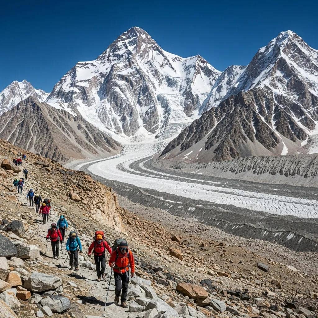
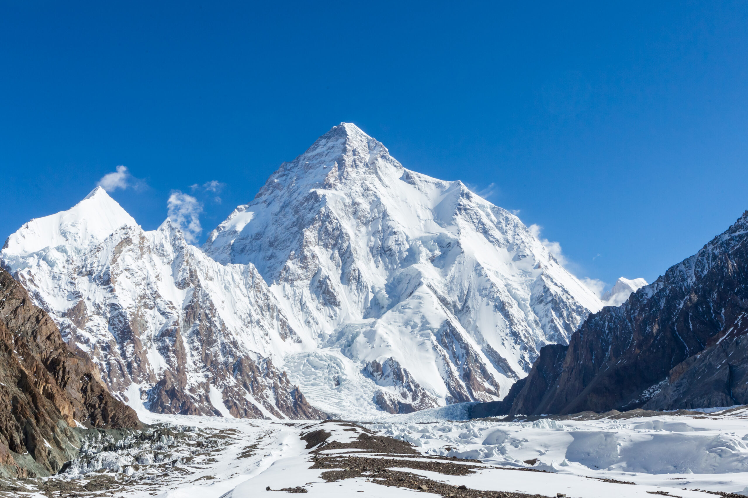
    Was this helpful?

    Yes
    No
    Thanks for your feedback!
  • K2 Base Camp Trek: Cost, Route & 22-Day Itinerary

    Trekkers approaching K2 Base Camp through the Karakoram mountains of Pakistan
    Pakistan · Karakoram · Baltoro Glacier · Concordia · K2 Base Camp

    K2 Base Camp Trek Guide: Route, Itinerary, Cost & Planning

    For most trekkers, the best first choice is the classic K2 Base Camp out-and-back route through Askole, Paiju, Baltoro Glacier and Concordia. Choose Gondogoro La only if you specifically want the harder traverse and have the experience, operator support and conditions for snow, ice and fixed-rope travel.

    20–22 days typicalJuly–August primeCamping trekNo K2 climbing required
    8,611 mK2 summit above you
    ~5,150 mBase Camp elevation
    20–22 daysTypical door-to-door
    $1.8K–$3K+Many local 2026 groups
    1 harder optionGondogoro La traverse
    The direct answer

    What Is the K2 Base Camp Trek Really Like?

    The K2 Base Camp trek is a remote, strenuous, high-altitude camping journey through Pakistan’s Karakoram. The traditional approach runs from Skardu toward Askole, then follows the Braldu Valley to Paiju, crosses the Baltoro Glacier to Concordia, and continues toward Broad Peak and K2 Base Camp.

    It is not a technical ascent of K2. The challenge is the combination of rough moraine, glacier travel, repeated 6–9 hour days, nights in tents, altitude around 5,000 metres, weather exposure and limited bailout options.

    Best first choiceOut-and-back
    Best harder optionGondogoro La
    GatewaySkardu
    Trail startAskole
    Scenic climaxConcordia
    Prime seasonJuly–August
    Do not confuse the classic trek with Gondogoro La. The standard K2 Base Camp trek can be completed without crossing the pass. Gondogoro La adds a very different level of snow, ice, fixed-rope and weather exposure and should be treated as a separate route decision.
    The main trip decision

    Classic K2 Base Camp or Gondogoro La?

    OptionTypical formatTechnical demandBest for
    Classic out-and-backAskole → Baltoro → Concordia → K2 BC → return same wayStrenuous trekkingMost first-time K2 trekkers
    Gondogoro La traverseK2 BC → Ali Camp → Gondogoro La → HusheSnow/ice, fixed ropes, crampon/axe competence depending conditionsExperienced trekkers wanting a harder circuit
    Concordia-focused tripReach Concordia, with K2 BC side trip when conditions/time allowStrenuous trekkingTrekkers prioritizing scenery and schedule flexibility

    My default recommendation: choose the classic out-and-back unless the pass itself is one of your trip goals. The classic route already gives you the Baltoro Glacier, Concordia, Broad Peak and K2 Base Camp without turning the trip into a semi-technical high pass crossing.

    K2 and Karakoram mountain terrain above the Baltoro region of Pakistan
    Why this trek is different

    The Route Gets Wilder as You Get Higher.

    Unlike a teahouse trek, the Baltoro journey becomes more remote each day. Camps, porters, food systems, toilets and weather margin are part of the expedition—not side details.

    A realistic planning framework

    Example 20–22 Day K2 Base Camp Itinerary

    Exact camps vary by operator, conditions and acclimatization needs.

    DayTypical stageWhat matters
    1–2IslamabadArrival, briefing, permit/logistics check
    3Islamabad → SkarduFly when operating; road contingency if weather disrupts flights
    4–5SkarduGear, acclimatization, final supplies, jeep logistics
    6Skardu → Askole / trail gatewayLong 4WD access day
    7Askole → Jhola / Korofon zoneHot lower valley, first camp
    8Jhola → PaijuLong day toward the Baltoro
    9Paiju rest/acclimatizationUseful before committing to glacier days
    10Paiju → KhoburtseEnter Baltoro Glacier terrain
    11Khoburtse → UrdukasStrong views, rough moraine
    12Urdukas → Goro IIMore sustained glacier travel
    13Goro II → ConcordiaMajor scenic milestone
    14Concordia rest / weatherAcclimatization and flexibility
    15Concordia → Broad Peak BC / K2 BC zoneCloser K2 access
    16K2 Base Camp visitTrip high point; weather dependent
    17–20Return via BaltoroReverse route toward Askole
    21–22Skardu / Islamabad bufferWeather and transport margin
    Do not book a tight international connection after Skardu. Weather can disrupt mountain flights, and road fallbacks add substantial time. Buffer days are part of a sensible itinerary, not wasted days.
    Karakoram season

    Best Time to Trek to K2 Base Camp

    WindowWhat to expectVerdict
    Mid-JuneEarly season, more snow/ice uncertainty, cooler nightsPossible but less forgiving
    JulyPeak trekking and expedition seasonBest overall month
    AugustStill strong, warmer lower valleys, weather can varyExcellent option
    Early SeptemberQuieter, colder nights, shorter windowGood with margin
    Outside main seasonSnow and pass access become bigger issuesSpecialist planning only

    The broad trekking window is usually mid-June through mid-September, with July the most popular month. For Gondogoro La, the weather and snow state of the pass matter even more than the calendar.

    Getting to the trail

    Islamabad → Skardu → Askole

    The trek is not just the Baltoro Glacier. Access is part of the trip. International teams generally assemble in Islamabad, then travel to Skardu, the main gateway to the Karakoram. From Skardu, a long jeep journey continues toward Askole, the traditional final village before the wilderness approach.

    Step 1

    Islamabad

    International arrival, briefing, permits and contingency days.

    Step 2

    Skardu

    Final major town for hotels, equipment checks, supplies and porter/crew logistics.

    Step 3

    Askole

    Traditional trekking gateway before the Braldu and Baltoro wilderness.

    Step 4

    Baltoro Glacier

    Once you enter the glacier system, camps and logistics become fully expedition-style.

    Karakoram mountain and glacier terrain near K2 in Pakistan
    The visual climax

    Concordia Is More Than a Camp.

    It is the junction of major glaciers and one of the great high-mountain viewpoints of the Karakoram. For many trekkers, Concordia is as memorable as the final visit to K2 Base Camp.

    2026 market reality

    How Much Does the K2 Base Camp Trek Cost?

    There is no single “correct” price because operators bundle very different levels of leadership, hotels, porterage, domestic travel, insurance and contingency support.

    Package style2026 planning rangeWhat to check
    Pakistan-based group departure~US$1,800–$3,000Permits, hotels, domestic flight/road, porter weight, tips, insurance
    Gondogoro La groupOften modestly higherPass crew, fixed-rope support, rescue arrangements
    Premium Western-led programCan exceed US$9,000Western leader, small group, hotels, flights, support and contingencies

    For 2026, Pakistan-based operators advertise Base Camp departures around the high-$1,000s to high-$2,000s, while Adventure Consultants lists a 22-day program from US$9,500. The lesson is not that one is “right”; it is that the inclusion list matters as much as the sticker price.

    Compare

    Domestic flights

    Is Islamabad–Skardu included, and what happens if the flight is cancelled?

    Compare

    Porter allowance

    How much personal gear can be carried, and what counts as excess?

    Compare

    Hotels + meals

    Which nights and meals are included before and after the trek?

    Compare

    Rescue + insurance

    What is operator support versus what must your own policy cover?

    Altitude progression

    How High Does the K2 Base Camp Trek Go?

    K2 Base Camp is around 5,150 metres / 16,900 feet, and Concordia sits lower at roughly 4,600 metres. The important point is not just the maximum altitude—it is that you spend multiple nights high while continuing to move across rough glacier terrain.

    Altitude is individual. A prior successful high-altitude trek is useful evidence of experience, not a guarantee. The itinerary should include staged ascent and enough flexibility to stop, rest or descend when symptoms require it.
    The biggest difference from Nepal

    Camping, Food & Porter Support

    K2 Base Camp is a camping expedition. There is no continuous teahouse network like the Everest Base Camp route in Nepal. Most guided groups use trekking crews, cooks, porters, sleeping tents, dining tents and toilet systems.

    SystemWhat to verify before booking
    Sleeping tentShared vs single supplement, tent quality, sleeping-mat inclusion
    PorteragePersonal weight allowance and duffel limit
    MealsTrail meals, snacks, dietary accommodation, water treatment
    ToiletsToilet tent and waste-management practices
    PowerCharging availability, solar backup, power bank strategy
    CommunicationsSatellite device / emergency communication carried by team
    Optional harder exit

    What Changes if You Cross Gondogoro La?

    Gondogoro La turns the trip from a difficult trek into a much more committing high-pass journey. Instead of returning down the Baltoro, the traverse crosses toward the Hushe Valley.

    Terrain

    Snow + ice

    The crossing can require crampons, ice axe and fixed-rope movement depending on conditions.

    Timing

    Very early start

    Operators commonly use a midnight or pre-dawn start for the pass.

    Weather

    Pass can close

    Your itinerary needs a fallback plan if snow or weather makes the pass unsafe.

    Best fit

    Experienced trekkers

    Choose it because you want the traverse, not because you dislike retracing the Baltoro.

    Illustrated K2 Base Camp trekking itinerary through the Baltoro Glacier and Concordia
    Route logic

    The Trek Is a Chain of Logistics, Not One Long Trail.

    International arrival, Skardu weather, jeep access, porter organization, glacier camps, acclimatization and return transport all affect whether the itinerary works.

    Fitness decision

    How Fit Do You Need to Be?

    You do not need climbing fitness, but you do need expedition trekking durability: repeated 6–9 hour days, rough footing, pack carry, long descents, cold mornings and enough reserve to keep functioning after a poor night in a tent.

    Build

    Long uphill days

    Train for duration and sustained climbing rather than short intense workouts alone.

    Build

    Back-to-back effort

    The trek is cumulative; one strong day is not enough.

    Build

    Rough-footing tolerance

    Moraine and glacier surfaces require more concentration than smooth trails.

    Build

    Camping resilience

    Sleep, appetite and recovery become performance factors at altitude.

    Trip checklist

    Before You Book

    QuestionWhat a good answer should clarify
    Classic or Gondogoro La?Your exact route and fallback plan
    How many buffer days?Skardu flight and weather disruption strategy
    Who arranges permits?Operator responsibility and documents needed from you
    What is included?Hotels, domestic flights, jeeps, meals, porters, tips, permits
    What insurance is required?High-altitude trekking and evacuation terms
    What is the porter allowance?Duffel weight and personal carry expectations
    What happens if the pass closes?Essential for Gondogoro La itineraries
    What is the group size?Pace, leadership, camp logistics and support ratio
    Compare before deciding

    K2 Base Camp vs Everest Base Camp

    FactorK2 Base CampEverest Base Camp
    AccommodationCamping expeditionTeahouses/lodges
    Trail surfaceRough moraine + glacierMore developed trekking trail
    RemotenessVery highHigh but more infrastructure
    LogisticsOperator/porter/camp systemMuch easier village-based support
    Altitude~5,150 m K2 BC5,364 m EBC
    Best fitExperienced trekker wanting expedition-style wildernessFirst major Himalayan trek for many hikers
    Compare Everest Base Camp
    Methodology

    How This Guide Was Built

    Route and gateway descriptions were cross-checked against the Gilgit-Baltistan tourism department’s K2 access description, which identifies Skardu as the gateway and the traditional route through Askole, Paiju, Urdukas, Goro and Concordia before Broad Peak and K2 Base Camp.

    Season framing was cross-checked against current trekking guidance that places the general window from mid-June to mid-September, with July the most popular month. Cost ranges were built from multiple 2026 operator listings rather than a single quote.

    Removed from the previous version: unsupported universal “success rate” claims, definitive statements calling Baltoro the world’s longest non-polar glacier, and broad climbing content that does not belong on a trek-planning page.

    FAQ

    K2 Base Camp Trek FAQ

    How long is the K2 Base Camp trek?

    Most international itineraries run about 20–22 days door to door, including Islamabad, Skardu, acclimatization and weather margin.

    What is the best time to go?

    Mid-June to mid-September is the main window; July is generally the most popular month and July–August is the strongest overall period.

    How hard is it?

    Strenuous rather than technical: rough glacier terrain, long days, altitude, camping and remoteness create the difficulty.

    Do I need a guide?

    Foreign trekkers normally use a licensed Pakistani operator/guide because permits and regulated-zone logistics are part of the trip.

    How much does it cost?

    Many Pakistan-based 2026 group trips list around US$1,800–$3,000, while premium Western-led programs can exceed US$9,000.

    Is Gondogoro La included?

    Only on specific traverse itineraries. The classic K2 Base Camp trek can return via the Baltoro without crossing the pass.

    Where does the trek start?

    International itineraries typically begin in Islamabad, continue to Skardu, then travel by jeep toward Askole.

    Is it harder than Everest Base Camp?

    For many trekkers, yes, because K2 Base Camp is more remote, uses camping and involves rougher glacier and moraine terrain.

    The planning rule

    Choose the Route Before You Choose the Operator.

    Decide whether you want classic K2 Base Camp or the Gondogoro La traverse first. Then compare operators by the exact itinerary, inclusions, porter system, buffer days and contingency plan—not by price alone.

    Great Long-Distance Walks · The Karakoram

    The K2 Base Camp Trek & the World’s Great Walks

    The trek up the Baltoro Glacier to the foot of K2 is one of the great long-distance walks on Earth – kin to the pilgrimage routes and iconic treks that draw walkers across the world. Explore them below.

    Current planning update · September 2026 K2 Base Camp · Baltoro · Concordia

    The trek itself is only half the plan. Permits, registration, Skardu transport and the return route matter too.

    The classic K2 Base Camp trek remains the best default for most trekkers: Skardu to Askole, then Paiju, the Baltoro Glacier, Concordia, Broad Peak Base Camp and K2 Base Camp before returning the same way. The harder Gondogoro La traverse is a separate decision because it adds steep snow, crampon travel, fixed ropes and objective hazard.

    For 2026–27 planning, the biggest gap is not another itinerary table. It is understanding what must be arranged before the trek starts: a reputable registered operator, the correct trekking permissions, foreign-national registration, transport contingency and insurance that remains valid for the permitted route.

    Current official planning rule: Gilgit-Baltistan Tourism says K2 Base Camp permits and fees are normally handled by the tour operator. UK travel guidance says all foreign nationals must register with local authorities when visiting Gilgit-Baltistan, and that trekking or mountaineering permission can take up to two months. Do not treat permit processing as a last-week task.

    GB Tourism: K2 UK: Gilgit-Baltistan risks

    Location & route context

    Where is K2 Base Camp?

    The trek begins far southwest of K2 and progressively enters the Karakoram through the Braldu and Baltoro systems. Skardu is the regional gateway; Askole is the traditional final village before the wilderness trek.

    Marker shows the K2 Base Camp / upper Godwin-Austen Glacier area for geographic orientation. The approach begins much farther west through Askole and the Baltoro Glacier. Map data © OpenStreetMap contributors. Open larger map →
    Regional gatewaySkarduFlights and road connections from Islamabad; schedules can change with weather.
    Trail gatewayAskoleTraditional final village before the Braldu–Baltoro wilderness.
    Core glacierBaltoroThe expedition-style camping route leads toward Concordia.
    Scenic junctionConcordiaMajor glacier junction and central Karakoram viewpoint.
    Base-camp zone~5,050–5,150 mPublished operators and guides use slightly different camp-elevation conventions.
    Permits, registration & operator check

    What foreign trekkers should verify before paying the balance

    The important distinction is between what the operator normally handles and what you still need to confirm has actually been completed.

    Operator registration

    Use a reputable registered company.

    Gilgit-Baltistan maintains a registered-tour-operator system, and current Tourism Department guidance discourages unauthorized expedition travel. Ask for the operator’s current registration or licence details rather than relying only on a website.

    Trekking permission

    Make the operator own the permit process.

    Official GB Tourism guidance says permits and fees are normally handled by the tour operator. Ask what documents they need from you and the date the application will be submitted.

    Foreign registration

    Gilgit-Baltistan has an additional registration step.

    Current UK guidance says all foreign nationals must register with local authorities while visiting Gilgit-Baltistan. Your operator should explain when and where that happens.

    Insurance

    Permit status can affect coverage.

    UK guidance explicitly warns that insurance validity may be affected if you do not have the correct permits. Confirm altitude, trekking, evacuation, political disruption and route coverage in writing.

    Skardu contingency

    Do not build the trip around one mountain flight.

    Skardu flight schedules can change at short notice. A good itinerary protects international connections with buffer days and has a realistic road contingency.

    Group travel

    This is not a good independent-trek experiment.

    Official GB Tourism recommends group travel because of remoteness and weather, while UK guidance advises reputable agencies, established routes and not trekking alone.

    Classic route vs Gondogoro La

    The return route changes the technical category of the trip

    Gilgit-Baltistan Tourism’s own Gondogoro Pass description is much stronger than calling it simply “the scenic harder option.”

    DecisionClassic out-and-backGondogoro La traverse
    ReturnReverse Baltoro route toward AskoleCross pass and descend toward Hushe
    Technical categoryStrenuous high-altitude trekkingHigh-pass snow/ice travel with technical systems
    Official pass elevationNot applicable5,585 m per GB Tourism
    Slope / terrainMoraine, glacier surface, rough trailOfficial description notes snow slopes up to ~50°
    EquipmentNormal expedition-trekking equipmentCrampons; fixed-rope sections may be required
    Objective hazardAltitude, weather, glacier/moraine travelAdd avalanche and rockfall exposure on steep pass terrain
    Best first choiceMost trekkersExperienced teams
    Do not buy the Gondogoro itinerary just to avoid retracing your steps. GB Tourism describes terrain that can require crampons and hundreds of metres of fixed rope, with avalanche and rockfall hazard. If those systems are outside your experience, the classic return is the stronger itinerary—not the lesser one.

    Official Gondogoro Pass description

    Current premium-market benchmark

    What does a fully supported K2 Base Camp trek cost now?

    The existing guide correctly shows that local Pakistan-based and premium Western-led programs are different products. A current 2027 listing confirms that gap remains large.

    ExamplePublished tripPublished priceWhat it demonstrates
    Adventure Consultants22 days · K2 Base Camp + Gondogoro LaUS$9,500 for 7+ people; US$10,500 for 5–6Premium Western-led/support model remains far above local group-market pricing.
    Gilgit-Baltistan TourismK2 trek destination guidanceNo universal package priceOfficial duration guidance is roughly 14–20 days depending on route; operator inclusions drive the final trip price.
    Price-comparison rule: compare the route first. Adventure Consultants’ current itinerary includes Gondogoro La, two nights at K2 Base Camp, Western pre-trip support and a 22-day program. It should not be compared directly with a lower-cost classic Baltoro out-and-back package unless the inclusions and route are made equivalent.

    Adventure Consultants current program

    Transport & security margin

    The trek can be ready while the access chain is not

    Page-one K2 Base Camp content should explain not just the beautiful glacier route but the real operational weak points before and after it.

    Skardu flights

    Build at least one meaningful buffer into the return.

    UK travel guidance says Gilgit and Skardu flight schedules may be unreliable and can change at short notice. A road fallback is much slower, and weather can also affect mountain roads. Avoid a same-day Skardu-to-international-flight connection.

    Road routing

    Do not assume every Islamabad–Skardu road option is equally advisable.

    Current UK guidance advises against all travel on part of the Karakoram Highway between Mansehra and Chilas. Your operator’s flight-cancellation plan should specify the actual route they intend to use and reflect current travel advice.

    Remote security

    Local advice matters once you leave major towns.

    Gilgit-Baltistan’s remote mountain terrain is difficult to police. Current UK guidance recommends local security advice, reputable trekking agencies, established routes and group travel.

    Evacuation reality

    Insurance is not the same as immediate rescue access.

    Weather, terrain and communications can delay assistance. Ask what emergency communication the team carries, who makes an evacuation decision, and what costs must be authorized through your insurer.

    2026–27 practical FAQ

    K2 Base Camp permits, route choice & current logistics

    These answers extend the main guide with the current regulatory and transport questions that most affect booking.

    Do foreign trekkers need a permit for the K2 Base Camp trek?

    Gilgit-Baltistan Tourism says permits and fees are normally handled by the tour operator. UK travel guidance also says foreign nationals must register with local authorities in Gilgit-Baltistan and that trekking or mountaineering permits may be required, with processing potentially taking up to two months.

    Should I book classic K2 Base Camp or Gondogoro La?

    The classic out-and-back route is the better default for most first-time trekkers. Gondogoro La adds steep snow and ice, crampon use, fixed ropes and avalanche or rockfall exposure, so choose it because you specifically want the harder traverse and have the appropriate support and experience.

    How high is Gondogoro La?

    The Gilgit-Baltistan Tourism Department lists Gondogoro Pass at 5,585 metres. Its official description notes steep snow slopes up to about 50 degrees, crampon use and sections that may require fixed ropes.

    How much does a premium K2 Base Camp trek cost?

    Adventure Consultants currently lists its July 2027 K2 Base Camp trek from US$9,500 per person for seven or more participants and US$10,500 for groups of five or six. Lower-cost Pakistan-based group products can differ substantially in leadership, hotels, flights, porter systems, route and contingencies.

    What should I know about travel to Gilgit-Baltistan?

    Skardu flights can change at short notice, mountain roads can be affected by weather, and remote areas are difficult to police. Foreign nationals must register locally. Current UK advice recommends reputable trekking agencies, established routes and group travel rather than trekking alone.

    How long should I allow for the K2 Base Camp trek?

    Gilgit-Baltistan Tourism describes the destination as roughly 14–20 days depending on route. International itineraries commonly expand to around 20–22 days after Islamabad, Skardu, acclimatization and transport buffers are added.

    Was this helpful?

    Yes
    No
    Thanks for your feedback!
  • Everest Base Camp Trek: Itinerary, Cost & Complete Guide

    Mount Everest viewed from Kala Patthar above the Everest Base Camp trail
    Nepal · Khumbu · Sagarmatha National Park · World Treks

    Everest Base Camp Trek: Itinerary, Cost & Complete Guide

    The Everest Base Camp trek climbs from Lukla through Namche Bazaar, Tengboche, Dingboche and the upper Khumbu to Everest Base Camp at 5,364 metres. It requires no technical climbing in normal trekking-season conditions, but altitude makes the 12–14 day journey far more serious than its distance suggests. This guide covers the itinerary, current permits, cost, Lukla flights, acclimatization, difficulty, best season, teahouses, training and gear.

    ≈130 km / 80 mi round trip 5,364 m Base Camp 12–14 days Teahouse trek Current permit rules checked
    The direct answer

    How Hard Is the Everest Base Camp Trek?

    Everest Base Camp is a strenuous high-altitude trek, not a technical climb. The classic route is roughly 130 km / 80 miles round trip from Lukla and normally takes 12–14 days. Everest Base Camp itself is about 5,364 m / 17,598 ft. Most itineraries also include Kala Patthar at roughly 5,545 m or higher depending on the exact viewpoint because it provides the classic panorama toward Everest. The trail does not normally require ropes, crampons or glacier travel, but the sleeping elevations above 4,000 metres make conservative acclimatization essential.

    Current planning reality

    Nepal Tourism Board currently lists the Everest Base Camp Trek among routes requiring a licensed trekking guide and a trekking-agency-issued TIMS card. Foreign trekkers also encounter the Sagarmatha National Park entry system and Khumbu Pasang Lhamu Rural Municipality Trek-Card. Peak-season Lukla flights may operate through Manthali/Ramechhap rather than Kathmandu, so confirm the departure airport shortly before travel.

    Base Camp 5,364 m 17,598 ft on the moraine beside the Khumbu Glacier.
    Typical trek 12–14 days Long enough to build two major acclimatization stops into the ascent.
    Distance ≈130 km About 80 miles round trip; exact distance changes with side hikes and lodging.
    Main challenge Altitude The trail is hiking terrain; reduced oxygen is what changes the experience.
    Lukla → Base Camp → Lukla

    Everest Base Camp Trek Route Map.

    The route climbs the Dudh Koshi Valley to Namche Bazaar, turns deeper into the Khumbu through Tengboche and Dingboche, then follows the glacial valley past Lobuche to Gorak Shep, Everest Base Camp and Kala Patthar.

    Schematic orientation only—not a navigation track. Trail alignments, bridges and local conditions change. Follow current maps and guide instructions on the trek.
    The classic acclimatized route

    Everest Base Camp 12-Day Trek Itinerary.

    Nepal Tourism Board describes the normal EBC journey as approximately two weeks. The itinerary below protects acclimatization days at both Namche and Dingboche rather than trying to win time by sleeping higher too quickly.

    DayRouteSleepApprox. elevationPurpose
    1Fly to Lukla → PhakdingPhakding2,610 mShort first walking day after the flight.
    2Phakding → Namche BazaarNamche3,440 mEnter Sagarmatha National Park and make the first major altitude gain.
    3Namche acclimatization hikeNamche3,440 mHike higher during the day, return lower to sleep.
    4Namche → TengbocheTengboche / Deboche≈3,860 mCross forested ridges to the monastery zone with Ama Dablam views.
    5Tengboche → DingbocheDingboche4,410 mLeave the dense forest and enter the high Khumbu.
    6Dingboche acclimatization hikeDingboche4,410 mSecond major acclimatization day before sleeping near 5,000 m.
    7Dingboche → LobucheLobuche≈4,940 mPass the Thukla memorials and move into glacial terrain.
    8Lobuche → Gorak Shep → Everest Base CampGorak Shep5,164 mReach Base Camp at 5,364 m, then return to Gorak Shep to sleep.
    9Kala Patthar → PherichePheriche≈4,240 mOptional high viewpoint, then a major descent to thicker air.
    10Pheriche → Namche BazaarNamche3,440 mLong descent through the central Khumbu.
    11Namche → LuklaLukla2,860 mFinal full walking day.
    12Fly from LuklaKathmandu / onward≈1,400 m KathmanduWeather-dependent exit from the Khumbu.

    Add weather buffer outside the 12-day route.

    Do not schedule an inflexible international departure immediately after the planned Lukla flight. Weather can delay fixed-wing operations, and current Ramechhap road logistics can add additional travel complexity. A stronger Nepal itinerary protects at least one or two contingency days.

    Lukla and Tenzing Hillary Airport in Nepal at the start of the Everest Base Camp trek
    2,860 m · gateway to Everest

    The Trek Usually Begins With the Lukla Flight.

    Tenzing-Hillary Airport turns a long approach through the lower Solu into a short flight followed by immediate mountain travel. Its short runway and mountain weather make schedule flexibility important, but the flight is only the gateway—the altitude problem begins after you start walking.

    Photo: Vyacheslav Argenberg · Wikimedia Commons · CC BY 4.0
    The trek’s real difficulty

    Everest Base Camp Is an Acclimatization Problem.

    Walking fitness helps you move efficiently, but fitness does not protect you from acute mountain sickness. The itinerary has to control sleeping altitude even when your legs feel strong enough to keep climbing.

    First checkpoint

    Namche Bazaar

    Sleeping at 3,440 m after arriving from Lukla is a major physiological step. A second night here gives the body time before the route climbs higher.

    Second checkpoint

    Dingboche

    At 4,410 m, a second acclimatization day creates valuable time before sleeping at Lobuche and Gorak Shep.

    Safety rule

    Symptoms Override the Schedule

    Do not ascend to a higher sleeping altitude while symptoms of altitude illness are worsening. Severe symptoms require urgent descent and medical assessment.

    Namche Bazaar viewed from the Everest View acclimatization trail
    Namche Bazaar · 3,440 m

    The Most Productive Day on the Trek May Be the Day You Do Not Move Forward.

    The Namche acclimatization day is not a wasted day. Hiking higher toward Khumjung or Everest View and returning to Namche to sleep gives your body an altitude stimulus without immediately raising the sleeping elevation again.

    Photo: Rohit Sharma · Wikimedia Commons · CC BY-SA 4.0
    Strenuous trekking · non-technical route

    How Difficult Is Everest Base Camp?

    The standard EBC trail does not require technical climbing skills in normal trekking-season conditions. The difficulty comes from altitude, repeated walking days, rough trail, cold, sleep disruption and the cumulative fatigue of living above 4,000 metres.

    Technical terrain

    Low

    The normal trail uses established paths, stone steps and suspension bridges. You do not enter the Khumbu Icefall or climb on the Everest expedition route.

    Endurance

    Moderate–High

    Expect repeated five-to-seven-hour hiking days and a substantial amount of climbing and descending over nearly two weeks.

    Altitude

    Very High

    The final nights occur above 4,900 metres, where even normal walking can feel slow and sleep quality commonly deteriorates.

    Cold

    Season Dependent

    Higher villages can be well below freezing overnight even during normal spring and autumn trekking seasons.

    Pack weight

    Controllable

    Porter support can dramatically reduce daily load, but you should still train with the daypack you will carry yourself.

    Main mistake

    Going Too Fast

    A compressed itinerary can turn excellent fitness into a liability if it encourages faster ascent than your acclimatization allows.

    Tengboche Monastery in Nepal's Khumbu region on the Everest Base Camp trek
    Tengboche · Khumbu culture

    The EBC Route Is More Than the Destination.

    The approach passes Buddhist monasteries, mani walls, prayer wheels and Sherpa communities long before it reaches the glacial world around Base Camp. Tengboche sits at one of the cultural and scenic centers of the route with Everest, Lhotse and Ama Dablam surrounding the valley.

    Current official planning requirements

    Everest Base Camp Permits, TIMS and Guide Rules.

    The administrative system is easier to understand when the three different charges are separated rather than all being called “permits.”

    Sagarmatha National Park

    NPR 3,000

    Nepal Tourism Board currently lists the foreign visitor entry fee for Sagarmatha National Park at NPR 3,000 per person per entry. The EBC trail enters the park above Monjo.

    Khumbu municipality

    NPR 3,000

    Khumbu Pasang Lhamu Rural Municipality currently lists its Trek-Card fee at NPR 3,000 for visitors from countries outside SAARC and China. SAARC and Chinese visitors are listed at NPR 2,000.

    TIMS

    NPR 2,000

    Nepal Tourism Board currently lists EBC among the routes requiring a trekking-agency-issued TIMS card and licensed trekking guide. The listed non-SAARC TIMS charge is NPR 2,000.

    Use the current Nepal Tourism Board rule, not an old blog post.

    The official NTB page presently names Everest Base Camp specifically under its guide-and-TIMS requirement. Regulations and local implementation can change, so verify the rule with NTB and your registered trekking agency immediately before travel.

    The logistical wildcard

    Your Lukla Flight May Start in Ramechhap, Not Kathmandu.

    Lukla is the standard air gateway for EBC, but peak-season airport congestion changes how many itineraries actually begin.

    • Summit Air currently identifies Manthali Airport in Ramechhap as a high-season gateway for Lukla.
    • Manthali normally requires a road transfer from Kathmandu.
    • Road conditions can materially change transfer time.
    • Current fall-2026 itineraries from some operators have required an overnight in Manthali because of road disruption.
    • Flight schedules remain highly weather-dependent.

    Confirm three things shortly before departure: which airport your flight uses, when the ground transfer leaves, and how many contingency days your international itinerary protects.

    Aircraft and runway at Lukla Airport in Nepal Lukla is the normal EBC gateway, but the departure airport used to reach it can change with season and operations.
    Compare inclusions before comparing prices

    How Much Does the Everest Base Camp Trek Cost?

    There is no single correct EBC price. Current programs span from local guided teahouse trips to high-service international expeditions with helicopters and upgraded lodging.

    Local guided example ≈$1.4K–$1.8K

    Current local-operator group pricing can sit in this range when standard teahouses and local support are used.

    Fuller local package ≈$2.5K–$3K

    More inclusive Kathmandu, meal, porter and lodging packages move toward this level.

    Premium international ≈$4.9K–$6.5K

    Major expedition companies charge substantially more for leadership, staffing and premium logistics.

    Luxury $10K+

    Helicopters, luxury lodges and high-end expedition service can push the trip well beyond ordinary trekking budgets.

    The cheapest quoted trip is not necessarily the cheapest complete trip.

    Before comparing operators, check whether the price includes Lukla flights, Ramechhap transfers, TIMS, park and municipal fees, guide, porter, meals, Kathmandu hotel nights, airport transfers, insurance support, emergency oxygen, tips and contingency arrangements. A low headline price with major exclusions can cost more after the trek begins.

    Ama Dablam viewed from Dingboche on the Everest Base Camp route
    Dingboche · 4,410 m

    The Second Acclimatization Stop Comes With One of the Khumbu’s Great Views.

    Dingboche sits beneath Ama Dablam in open high-country terrain. By this point the trees are mostly behind you, nights are colder and altitude begins to dictate pace far more than fitness does.

    Photo: Kaibak · Wikimedia Commons · CC BY-SA 4.0
    Spring vs autumn

    Best Time for the Everest Base Camp Trek.

    Nepal Tourism Board identifies spring and autumn as the primary trekking seasons for Everest. Each has a different advantage.

    PeriodConditionsCrowdsWhat makes it attractiveMain trade-off
    MarchCold but improvingModerateEarly spring, quieter than AprilSnow and cold remain possible high on route
    AprilPrime springHighRhododendrons lower down; Everest expedition season developsBusy trail and lodges
    MayWarmer, pre-monsoonModerate–highEverest climbing season at Base CampCloud and afternoon weather become more common
    June–AugustMonsoonLowGreen lower valleysRain, cloud and more difficult flight reliability
    SeptemberTransition out of monsoonBuildingStart of autumn trekking seasonEarly September can retain monsoon influence
    OctoberPrime autumnVery highGenerally excellent mountain visibility and full servicesPeak demand and crowded teahouses
    NovemberClearer and colderModeratingStrong visibility with fewer trekkers later in monthCold nights increase sharply
    December–FebruaryWinterLowQuiet trail and often clear winter skiesSevere cold, snow and reduced services
    No camping required

    Teahouses, Food, Water and Charging.

    One reason EBC is accessible as a first Himalayan trek is the dense teahouse system. Beds and cooked meals are available throughout the normal route, but comfort decreases and prices rise as supplies move farther from the road network.

    Accommodation

    Simple Teahouse Rooms

    Expect basic twin rooms on standard itineraries. Bathrooms, showers and heated common rooms vary enormously by village and lodge level.

    Food

    Eat Enough

    Dal bhat, noodles, soups, potatoes, rice, eggs and simple Western dishes are widely available. Appetite often falls as altitude rises even though caloric need remains high.

    Water

    Treat Rather Than Depend on Bottles

    A reliable purification method reduces plastic waste and gives more flexibility than depending entirely on purchased bottled water.

    Electricity

    Expect Paid Charging

    Power becomes more limited and expensive higher on the route. Carry a power bank and keep batteries warm.

    Connectivity

    Useful, Not Guaranteed

    Wi-Fi and mobile service exist in parts of the Khumbu but should not be treated as an emergency communication system.

    Cash

    Carry Nepalese Rupees

    Higher villages are not where you want to discover that an electronic payment system or ATM is unavailable.

    Everest Base Camp and the Khumbu Glacier viewed from Kala Patthar
    Everest Base Camp · 5,364 m

    Base Camp Is the Destination—but Not the Best Everest View.

    Everest Base Camp places you beside the Khumbu Glacier and beneath the Khumbu Icefall, inside the landscape used by South Col expeditions. The summit of Everest itself is largely obscured from the trekking Base Camp area by the surrounding terrain. For the classic Everest panorama, climb Kala Patthar if your health and conditions allow.

    Photo: Goutam1962 · Wikimedia Commons · CC BY-SA
    The viewpoint above Gorak Shep

    Kala Patthar Is Often the Visual High Point of the Trek.

    Kala Patthar rises on the south side of Pumori above Gorak Shep. It opens a close panorama toward Everest, Nuptse, Changtse and the upper Khumbu Glacier.

    The elevation deserves a little honesty. Roughly 5,545 m remains widely cited for the normal viewpoint, while higher GPS readings around 5,643–5,644 m have been recorded farther up the rocky ridge. The practical implication is unchanged: you are hiking well above 5,000 metres.

    • Non-technical trail in normal trekking-season conditions.
    • Steep climbing immediately above Gorak Shep.
    • Cold and wind can be severe around sunrise.
    • Skip the climb if altitude symptoms or weather argue for descent.
    Mount Everest and Khumbu Glacier viewed from Kala Patthar Mount Everest from Kala Patthar · Matheus Hobold Sovernigo · Wikimedia Commons.
    Train for the work, not the altitude

    How to Train for Everest Base Camp.

    You cannot create altitude immunity in the gym, but you can arrive with enough aerobic fitness and leg durability that ordinary hiking does not consume the recovery capacity your body needs for acclimatization.

    Aerobic base

    Long, Easy Volume

    Build the ability to move comfortably for hours without turning every climb into a high-intensity effort.

    Vertical fitness

    Climb Repeatedly

    Use hills, stairs or an inclined treadmill to create the sustained climbing that flat-road fitness misses.

    Leg durability

    Train the Descent

    Downhill fatigue can be as limiting as climbing. Build quadriceps and connective-tissue tolerance gradually.

    Back-to-back work

    Two Days in a Row

    The EBC challenge is recovery. Consecutive hiking days reveal readiness better than one heroic weekend workout.

    Pack

    Use the Real Load

    Train with the daypack weight you expect to carry, even if a porter handles the larger duffel.

    Taper

    Arrive Recovered

    The last training week should not be an attempt to gain fitness. Begin the trek healthy rather than carrying fatigue into Lukla.

    Teahouse trek · genuine high-altitude weather

    What to Pack for Everest Base Camp.

    You do not need expedition climbing equipment for the normal route, but you do need a layering system capable of handling freezing nights, wind and long exposure above 4,000 metres.

    Feet

    Tested Hiking Footwear

    Use footwear already proven over long days. EBC is a poor place to discover a pressure point in new boots.

    Insulation

    Warm Down Layer

    A substantial insulating jacket becomes increasingly useful at Dingboche, Lobuche, Gorak Shep and Kala Patthar.

    Weather shell

    Waterproof + Windproof

    Carry a proper shell even in seasons known for clearer weather.

    Sleeping

    Cold-Rated Sleeping Bag

    Teahouse rooms are not necessarily heated. Choose a sleeping system suitable for expected nighttime conditions.

    Sun

    UV Protection

    Sunglasses, sunscreen, lip protection and a brimmed hat matter more as altitude and reflected light increase.

    Walking

    Trekking Poles

    Useful for long stone staircases, uneven moraine and repeated descents on tired legs.

    Mount Everest panorama from Kala Patthar in Nepal
    The final reward

    Everest Appears Best After You Leave Base Camp.

    Kala Patthar places the summit of Everest above the Khumbu Glacier and beside Nuptse in a way Base Camp cannot. The extra climb is optional; successful acclimatization and a safe descent are not.

    Direct search answers

    Everest Base Camp Trek FAQ.

    The planning questions that matter most before you book flights or choose an operator.

    How long is the Everest Base Camp trek?

    The classic Lukla-to-Everest-Base-Camp-and-return route is approximately 130 kilometres / 80 miles, although exact mileage varies with acclimatization hikes, accommodation and optional viewpoints.

    How many days does the Everest Base Camp trek take?

    Most standard itineraries take approximately 12–14 days from Lukla back to Lukla. Additional contingency days are wise because flights serving Lukla are weather-dependent.

    How high is Everest Base Camp?

    Everest Base Camp on the Nepal side is approximately 5,364 metres / 17,598 feet above sea level.

    What is the highest point on the normal EBC trek?

    Many itineraries include Kala Patthar above Gorak Shep. Approximately 5,545 metres is widely cited for the common viewpoint, while GPS measurements farther up the ridge have produced readings around 5,643–5,644 metres.

    Can you see the summit of Everest from Base Camp?

    The summit is largely obscured from the trekking Base Camp area by surrounding terrain. Kala Patthar is the classic nearby trekking viewpoint for a clear Everest panorama.

    Do you need climbing experience for Everest Base Camp?

    No technical climbing experience is normally required for the standard trek in normal trekking-season conditions. Strong hiking fitness, conservative acclimatization and appropriate mountain-weather judgment are more important.

    Do you need a guide for Everest Base Camp?

    Nepal Tourism Board currently lists Everest Base Camp among the trekking routes requiring a licensed trekking guide and trekking-agency-issued TIMS card. Verify the current rule before travel because regulations can change.

    What permits and fees are required for Everest Base Camp?

    Current official sources list Sagarmatha National Park entry, the Khumbu Pasang Lhamu Rural Municipality Trek-Card and TIMS among the relevant systems. For most foreign visitors, the currently published amounts are NPR 3,000 for the national park, NPR 3,000 for the local Trek-Card and NPR 2,000 for TIMS.

    What is the best time to trek to Everest Base Camp?

    Spring and autumn are the primary trekking seasons. March through May and late September through November generally provide the strongest combination of trail access, teahouse operation and mountain weather, with October typically among the busiest periods.

    How much does the Everest Base Camp trek cost?

    Current guided programs vary widely. Local standard programs may begin around the mid-$1,000s, while more inclusive local trips can approach $3,000. Premium international expedition companies can charge roughly $5,000–$6,500 or more, while luxury programs can exceed $10,000. Compare inclusions rather than headline price alone.

    Do Lukla flights leave from Kathmandu?

    Sometimes. During high-demand trekking periods many Lukla flights operate from Manthali Airport in Ramechhap rather than Kathmandu. The exact operational pattern can change, so confirm the departure airport and ground transfer shortly before travel.

    Where do you sleep on the EBC trek?

    The standard route uses teahouse lodges in villages such as Phakding, Namche Bazaar, Tengboche or Deboche, Dingboche, Lobuche and Gorak Shep. Camping is not required on the normal trekking itinerary.

    Can a beginner trek to Everest Base Camp?

    A fit first-time Himalayan trekker can complete EBC with adequate preparation, a conservative itinerary and proper support. It should not be treated as a casual beginner hike because the route sleeps above 5,000 metres and altitude response is unpredictable.

    How should you train for Everest Base Camp?

    Prioritize aerobic endurance, uphill walking, downhill leg strength and back-to-back hiking days. Train with the daypack you expect to carry. Fitness helps manage the workload but does not prevent altitude sickness.

    Is Everest Base Camp harder than Kilimanjaro?

    The challenges are different. EBC is longer and requires more consecutive trekking days, while Kilimanjaro climbs to a higher final altitude over a shorter period and culminates in a major summit day. Acclimatization strategy is critical on both.

    The most important EBC planning rule

    Do Not Try to Beat the Altitude.

    The walking distance is manageable. The trail is established. Teahouses remove the need for camping. None of that changes the fact that the final nights are spent at extreme trekking elevations. Protect the Namche and Dingboche acclimatization days, keep Lukla contingency time in the schedule and be willing to descend when symptoms say the itinerary is moving faster than your body.

    Great Long-Distance Walks · The Himalaya

    A Modern Pilgrimage to the Foot of Everest

    For many, the walk to Everest Base Camp – past ancient monasteries like Tengboche – is a pilgrimage in all but name. Explore the great pilgrimage trails and Himalayan sacred routes below.

    Was this helpful?

    Yes
    No
    Thanks for your feedback!
Language »