
Last updated October 4, 2026
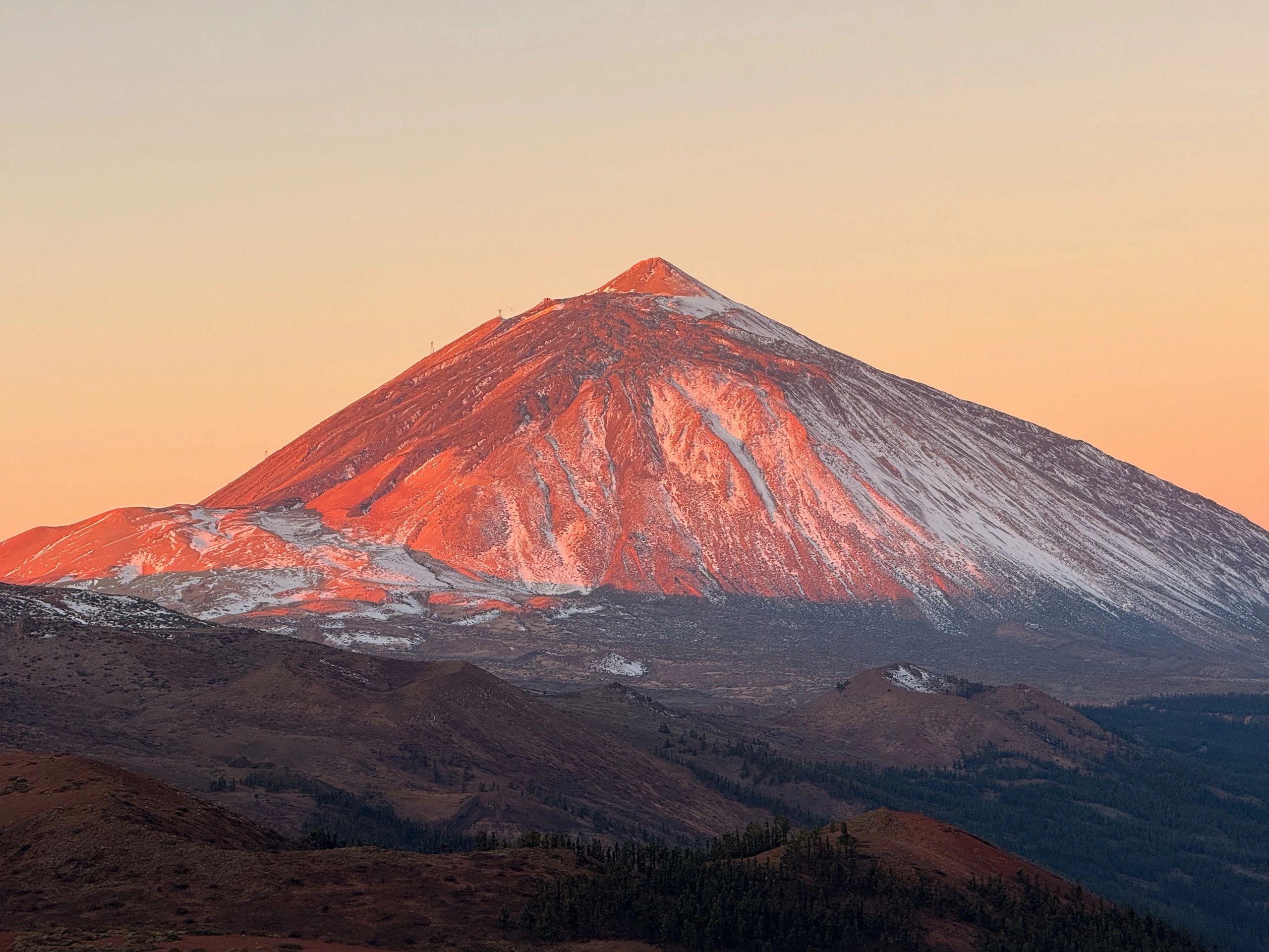
Mount Teide Difficulty & Safety: How Hard Is the Hike?
Mount Teide can be a short high-altitude summit walk after riding the cable car or a demanding full ascent on foot. In normal dry conditions it is not a technical climb, but altitude, wind, winter ice, loose volcanic terrain and controlled high-mountain access make it more serious than Tenerife’s tourist infrastructure suggests.
Teide Is Usually Nontechnical—but a Full Ascent Is a Serious High-Mountain Hike.
The cable-car-assisted summit and the full Montaña Blanca ascent should not receive the same difficulty rating.
From La Rambleta near the upper cable-car station, the final PNT 10 Telesforo Bravo trail is short but steep and begins at roughly 3,550 meters. The walking distance is limited, but rapid altitude exposure can make even a short climb feel unexpectedly hard.
The full ascent via PNT 07 Montaña Blanca is different: prolonged uphill hiking, substantial elevation gain, exposed volcanic terrain, altitude and a long descent make it a demanding mountain day even though ropes are not normally required in dry summer conditions.
How Hard Is Mount Teide?
The answer changes dramatically depending on whether you ride to La Rambleta, climb PNT 07 on foot, descend toward Pico Viejo or encounter snow and ice.
| Teide plan | Physical difficulty | Technical difficulty | Main problem | Best for |
|---|---|---|---|---|
| Cable car + PNT 10 summit | Lower | Normal hiking in dry conditions | Rapid exposure above 3,500 m, steep final trail, wind and cold | Fit walkers wanting the shortest summit option |
| PNT 07 Montaña Blanca + PNT 10 | High | High-mountain hiking in normal dry conditions | Sustained ascent, altitude, loose volcanic terrain and long descent | Experienced hikers wanting the complete ascent |
| Pico Viejo / PNT 09 itinerary | High | High-mountain hiking | Distance, loose lava, route commitment and descent fatigue | Strong hikers seeking a longer volcanic traverse |
| Snow or ice conditions | Variable | Can become mountaineering terrain | Traction, sliding risk, route closures and winter equipment | Only climbers prepared for the live conditions and current rules |
For exact route combinations, distances and how PNT 07, PNT 09 and PNT 10 connect, use the dedicated Mount Teide Routes guide .

Short Distance. Serious Altitude.
PNT 10 Telesforo Bravo begins high on the volcano. That makes the summit accessible to many ordinary hikers in dry conditions, but it also means a visitor arriving by cable car has had almost no time to adapt before climbing toward 3,715 meters.
The Cable Car and the Full Hiking Route Create Two Different Mountains
La Rambleta, the true summit, Montaña Blanca and Pico Viejo are close geographically, but using different parts of the upper trail network changes the effort and risk.
What Makes Mount Teide Dangerous?
In dry summer conditions the danger usually comes from ordinary mountain problems stacking together—not technical climbing.
Rapid elevation gain
Visitors can move from Tenerife’s coast to more than 3,500 meters in a few hours. Fitness does not guarantee that someone will feel comfortable at altitude.
Wind and cold
Conditions on Teide’s upper slopes can be dramatically colder and windier than coastal Tenerife. Wind can also disrupt cable-car operation.
Loose volcanic surfaces
Pumice, lava fragments and unstable ground can make descent slow and tiring, particularly after the full Montaña Blanca ascent.
Snow and ice
A dry-weather hiking route can become a traction and mountaineering problem after snowfall or freeze-thaw cycles.
Sun and dehydration
The upper volcano has little shade. High UV, dry air and exertion can dehydrate hikers faster than the cool summit temperature suggests.
Cable-car dependency
A visitor who assumes the lift will always operate may suddenly face a much more demanding descent than planned.
2026 Rules Affect the Safety Plan—but This Is Not the Permit Page
The access system now treats Teide’s upper trails more like controlled high-mountain routes than unrestricted tourist footpaths.
Summit access is controlled
Telesforo Bravo requires a separate reservation for the final summit segment. Reservations are now handled through Tenerife ON.
The full ascent is regulated
The controlled Montaña Blanca–La Rambleta section requires its own reservation. That authorization does not automatically include the summit.
Some access windows carry fees
Since January 2026, public fees can apply to PNT 07 and PNT 10 depending on visitor profile, day and time band. Check the live system rather than relying on a static fee.

Tourist Infrastructure Changes Access—not Mountain Physics.
The cable car makes 3,500-meter terrain unusually easy to reach. It does not make the air denser, the wind warmer or icy volcanic rock less slippery.
The Cable Car Creates an Unusual Altitude Problem
A person can sleep near sea level, drive into Teide National Park and arrive around 3,555 meters very quickly. That speed—not merely the summit number—is what makes altitude planning relevant.
Fastest altitude exposure
The walking is limited, but the body has had little time to adjust before the final climb toward 3,715 meters.
More gradual—but much harder
Walking from Montaña Blanca spreads the elevation gain over more hours but adds substantial physical workload and a longer exposure period.
Sleeping high changes the problem
An overnight itinerary changes both the acclimatization profile and the permit structure. It should not be treated as automatically safer simply because it is slower.
The separate Mount Teide Acclimatization guide covers staged sleeping altitude, cable-car exposure and Altavista in more detail.
Snow and Ice Can Change Teide From Hiking to Mountaineering
This is the biggest reason not to give Teide one fixed difficulty rating.
Hiking footwear, high-mountain clothing, water and normal mountain judgment are the main requirements. Technical climbing equipment is not normally needed.
Footing becomes less predictable and normal volcanic-rock steps can become hazardous. Authorities may restrict access before the mountain looks dramatic from below.
Access can close or be limited to appropriately equipped and qualified users. Winter conditions can require crampons, ice axe and the competence to use them.
For seasonal context, use the Mount Teide Weather & Best Season guide .
Teide’s Regulated Trails Now Have a Minimum Equipment Standard
Control personnel can require visitors to show specified equipment before entering regulated high-mountain sections.
Carry the Mountain Kit—Even If You Plan to Ride Down
The current official PNT 07 access signage includes the following minimum equipment. Live requirements and winter rules take priority.
For the broader packing strategy rather than only the legal minimum, use the Mount Teide Gear List .
Do Not Make Your Safety Plan Depend on a Guaranteed Ride Down
Teide’s cable car is a transportation system in a high-mountain environment. Wind, weather or technical issues can affect operation.
Know your legal descent option
If you could end up descending on foot, know which regulated trail you would use, whether you hold the required authorization and whether your equipment and fitness match the descent.
Assume the cable car will solve fatigue
A hiker who reaches La Rambleta exhausted and under-equipped has little margin if cable-car operation is interrupted.
How Fit Do You Need to Be for Mount Teide?
Fitness requirements depend far more on the ascent plan than on the summit itself.
Moderate hiking fitness
The final walking distance is short, but stairs and steep volcanic trail at altitude can feel surprisingly strenuous.
Strong hiking fitness
Be comfortable with several hours of continuous climbing, loose terrain and a long mountain day where the summit is only part of the effort.
Experience matters as much as fitness
Additional route commitment, poor surfaces or winter conditions increase the value of navigation skill, high-mountain experience and conservative judgment.
If the full ascent will be your first long high-altitude day, use the Complete Mountaineering Training Guide to build uphill endurance rather than relying on general gym fitness.
Mount Teide Go / No-Go Check
A safe Teide decision is mostly about matching the route you booked with the mountain that actually exists that morning.
Is the exact PNT trail open, and does your reservation cover the route you actually plan to use?
Are summit wind, temperature, visibility and precipitation within the limits of your experience and equipment?
Is the trail dry, icy or snow-covered? A dry-weather plan is not automatically valid after freezing conditions.
Do you have the mandatory equipment and any additional winter equipment required for current conditions?
Are you feeling normal enough to continue, or are symptoms worsening as you climb? The summit is optional; descent is always part of the plan.
If the cable car stops operating, do you have a legal, physically realistic and adequately equipped descent plan?
If you are unsure whether your current hiking experience matches the full Teide ascent, use the Mountain Readiness Assessment before choosing the route.
Which Teide Option Fits You?
There is no prize for choosing the longest route. Match the objective to the experience you actually want.
Best for travelers who want Spain’s highest summit without turning the day into a major endurance hike. Altitude and weather still require preparation.
Best for strong hikers who want Teide as a real mountain ascent rather than a summit visit and are comfortable with a long, exposed high-altitude day.
Useful when winter conditions, route unfamiliarity, permit coordination or individual confidence make local support valuable.
The correct choice when the trail is closed, winter equipment requirements exceed your skill, weather is deteriorating or your altitude response is concerning.
If you want professional help, compare the Mount Teide guide companies .
Mount Teide Difficulty & Safety FAQ
These answers distinguish the short cable-car-assisted summit from the full hike.
Is Mount Teide difficult to climb?
In normal dry conditions, Teide’s standard summit access is hiking rather than technical climbing. The cable-car-assisted summit is relatively short, while the full Montaña Blanca ascent is a demanding high-mountain hike because of sustained elevation gain, altitude, volcanic terrain and exposure.
Is Mount Teide safe for beginners?
A fit beginner can often manage the cable-car-assisted summit in good dry conditions if access requirements are met and altitude is tolerated. The full ascent is better suited to experienced hikers comfortable with long mountain days and changing conditions.
Do you need climbing experience for Mount Teide?
Not normally for the dry-weather summit trail from La Rambleta. The full ascent benefits from high-mountain hiking experience. Snow and ice can change the route into a winter mountaineering objective requiring additional equipment and skill.
Can you get altitude sickness on Mount Teide?
Yes. Teide reaches 3,715 meters, and the cable car can take visitors very rapidly to roughly 3,555 meters. Anyone developing worsening altitude-related symptoms should stop ascending and descend rather than continuing solely to reach the summit.
Is the Teide cable-car summit walk easy?
It is much easier physically than climbing the whole mountain, but “short” is a better description than “easy.” The final path is steep, high and exposed to wind, cold and altitude.
Do I need a permit to climb Mount Teide?
The final PNT 10 Telesforo Bravo summit trail requires a reservation. PNT 07 Montaña Blanca–La Rambleta and several other upper-mountain trails are also regulated. The reservations are not interchangeable, so check the dedicated permits guide and Tenerife ON for your exact itinerary.
Is Mount Teide dangerous in winter?
Winter can introduce snow, ice, strong wind and temporary trail closures. Authorities can impose additional winter-equipment requirements or restrict access. A route that is ordinary hiking when dry may require mountaineering skills when frozen.
What happens if the Teide cable car closes?
Weather or technical conditions can interrupt service. Do not assume a cable-car ascent guarantees a cable-car descent. Any foot descent must comply with the applicable trail reservation and equipment requirements.
What is the biggest Mount Teide safety mistake?
Treating accessibility as proof that the mountain is low-risk. Teide remains a 3,715-meter high-mountain environment even when a cable car makes the summit area easy to reach.
Plan the Rest of Your Mount Teide Climb
This page owns difficulty and safety. Use the dedicated child guides for routes, permits, weather, altitude strategy and equipment.
Official Sources to Recheck Before the Hike
Trail status and upper-mountain access can change rapidly after snow, high wind, emergency measures or management updates.

A Short Teide Summit and a Full Teide Ascent Are Not the Same Day.
Choose the route first. Then match your fitness, altitude strategy, mandatory equipment and permits to that route. The right objective is the one you can complete conservatively under the conditions that actually exist.
Was this helpful?
🏔Related safety data
🧭Explore & compare
Global Summit Guide is an independent mountaineering resource founded in 2026. The team combines first-hand trekking and climbing experience with in-depth research and professional health and nutrition review to help climbers choose objectives, prepare properly, and stay safe.
Health, altitude, and nutrition content is reviewed by Taylor Ludlow (Registered Nurse) and Brigg Hoopes (Nutritionist).
What We Don't Know Yet
Mountain information changes quickly. This box explains the limits of what this page can responsibly promise.
- Visa, passport, vaccination, border, insurance, and local transportation rules may change before your trip.
- Route conditions, snowpack, closures, and weather can change quickly after this page is updated.
- Permit rules, fees, quotas, and reservation windows may change between review cycles.
- Operator availability, pricing, guide ratios, and cancellation terms can change by season.
- Your fitness, altitude response, risk tolerance, and experience level may change what is safe or realistic.
Verify current conditions with official land managers, guide services, local forecasts, and current route reports before booking or climbing.
Mountaineering, rock and ice climbing, glacier travel, and high-altitude activity are inherently dangerous and can result in serious injury or death. The information on Global Summit Guide is provided for general informational and educational purposes only and is not a substitute for professional instruction, qualified guiding, proper equipment, or your own judgment and experience.
Route conditions, weather, snowpack, permits, regulations, and hazards change constantly and may differ from what is described here. Details may be incomplete, out of date, or contain errors. Always verify current information with local authorities, certified guides, and official sources before making any decision in the mountains.
Nothing on this site is medical, legal, or financial advice. Our fitness, acclimatization, altitude, and nutrition content is general in nature; consult a qualified physician before beginning any strenuous exercise program or exposing yourself to high altitude.
You are solely responsible for your own safety and decisions. To the fullest extent permitted by law, Global Summit Guide and its team accept no liability for any loss, injury, damage, or expense arising from use of, or reliance on, this information. By using this site you acknowledge these risks and accept these terms.
Some links on this site may be affiliate links. If you buy through them we may earn a small commission at no extra cost to you; this never affects our recommendations.
Global Summit Guide recommendation path
Next Best Mountain to Research
Use these recommendations to continue the right planning path instead of stopping on one page.
Use current permit, weather, route, and operator information before booking or climbing.
Explore Travel Options for Your Destination
Once your mountain, dates and route are taking shape, compare flights, hotels and other travel options that fit the trip.
Affiliate link. We may earn a commission at no additional cost to you.