
web analytics

Tag: Mount Vinson

  • Mount Vinson Expedition Update 2026: Cost, ALE Logistics, Season & Route

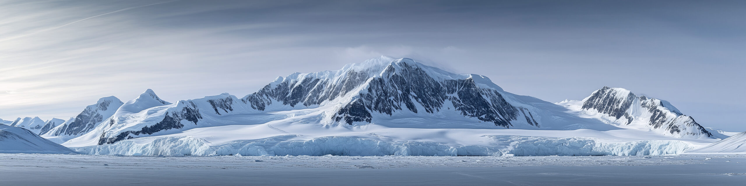
    Mount Vinson and the Sentinel Range in Antarctica
    2026–27 season · ALE price checked September 3 · upcoming departures

    Mount Vinson Expedition Update 2026

    The 2026–27 Vinson season has not started yet. Antarctic Logistics & Expeditions currently lists its guided Mount Vinson climb at $57,900 for 12 days, with departures beginning November 26, 2026 and running through January 10, 2027. The standard Branscomb Shoulder Route remains the normal line, but the most unusual part of Vinson is still access: every commercial trip depends on the Antarctic interior logistics system staged through Punta Arenas and Union Glacier.

    ALE current price checked departure dates checked authorization wording corrected main climb guide kept separate
    4,892 mMount Vinson
    $57,900ALE current list price
    12 daysALE itinerary
    Nov 26first 2026 departure
    45°published snow slope
    Current answer

    What Is the Mount Vinson Status for the 2026–27 Season?

    The upcoming commercial season is scheduled and bookable. ALE currently shows five departures for the 2026–27 austral summer: November 26, December 7, December 18 and December 30, 2026, plus January 10, 2027.

    ALE’s current direct guided product is $57,900 and 12 days. The trip starts with the flight from Punta Arenas to Union Glacier, then moves to Vinson Base Camp before the climb through Low Camp and High Camp.

    The published standard route remains the Branscomb Shoulder Route: glacier travel, snow-covered slopes up to about 45 degrees, an exposed high plateau and the summit ridge.

    Because the season has not begun as of September 3, this is a planning-status update, not a report of current snow surface, fixed-line condition or summit-day weather. Those operational details will only become meaningful once the season is underway.

    Season statusUpcoming
    Current price$57,900
    Published duration12 days
    Access gatewayPunta Arenas
    Antarctic hubUnion Glacier
    Standard routeBranscomb Shoulder
    Price correction: the previous version used a broad $45,000–$58,000 guided-fee range. ALE’s own current guided Vinson product is now listed at $57,900. This page uses the current ALE number and leaves multi-operator pricing to the dedicated Vinson cost guide.
    Current ALE schedule

    Mount Vinson 2026–27 Departure Dates

    These are the dates ALE currently publishes for its guided Mount Vinson trip. Availability can change after this page is checked.

    Nov 26, 2026Available when checked
    Dec 7, 2026Available when checked
    Dec 18, 2026Available when checked
    Dec 30, 2026Available when checked
    Jan 10, 2027Available when checked
    Why the page says 2026–27: Antarctica’s climbing season crosses the calendar year. The January 10, 2027 departure belongs to the same austral-summer operating season as the November and December 2026 trips.
    The access chain

    How ALE Logistics Actually Work

    ALE currently describes itself as the only operator with access to Mount Vinson. That is the defensible version of the logistics story.

    01 · Chile

    Punta Arenas

    The commercial staging city. ALE’s current trip includes airport transfers in Punta Arenas and the round-trip Antarctica flight, but not commercial flights to Chile or Punta Arenas hotels/meals.

    02 · Antarctica

    Union Glacier

    The interior logistics hub and first Antarctic stop on ALE’s 12-day itinerary.

    03 · Mountain

    Vinson Base Camp

    The itinerary moves from Union Glacier to Vinson Base Camp, where climbers acclimate to Antarctic conditions and review skills.

    04 · Climb

    Low Camp → High Camp

    The climbing itinerary then moves via the Branscomb Glacier to Low Camp, High Camp and the summit before returning to Base Camp and Union Glacier.

    Wording correction: the prior version called ALE the only logistics provider on the entire continent. ALE itself currently makes the narrower claim that it is the only operator with access to Mount Vinson. That is the wording used here.
    Current published price

    Mount Vinson Cost: Start With $57,900, Then Add the Exclusions

    This page does not try to maintain a second multi-operator cost database. It uses ALE’s current direct product as the live reference point.

    ALE direct guided product

    $57,900

    Current published price for ALE’s 12-day guided Mount Vinson climb.

    That number already includes the expensive Antarctica flight and on-continent expedition services listed by ALE. Your true trip budget will still be higher because several important costs sit outside the product price.

    For guide-company comparisons and a full budget model, use the dedicated Vinson Massif Cost Guide.

    List price$57,900
    Duration12 days
    Antarctica flightIncluded
    Chile hotelExcluded
    Personal gearExcluded
    InsuranceExcluded
    Read the product before comparing operators

    What the Current ALE Price Includes—and What It Does Not

    ItemStatusCurrent ALE wording / planning implication
    Punta Arenas airport transfersIncludedIncluded within Punta Arenas for the ALE program.
    Round-trip flight to AntarcticaIncludedThe high-cost air access from Punta Arenas is part of the guided trip price.
    Antarctic meals + tented accommodationIncludedApplies to the Antarctica portion of the trip.
    Antarctic guides + lecturersIncludedIncluded in ALE’s current direct guided product.
    Checked luggageIncludedUp to 55 lb / 25 kg plus skis under current published terms.
    Commercial flights to Punta ArenasExcludedBudget separately from your home airport.
    Punta Arenas hotels + mealsExcludedPlan staging accommodation and food before/after Antarctica.
    Personal equipment + clothingExcludedPolar mountaineering gear can materially increase the total trip budget.
    Expenses caused by delaysExcludedKeep a cash and schedule reserve for weather-related disruption.
    InsuranceExcludedMedical, evacuation and other insurance are not included in ALE’s list price.
    Satellite-phone chargesExcludedCommunication usage is separate.
    Budgeting rule: do not call $57,900 your “all-in Vinson cost.” It is the current ALE guided-product price. Add international travel, Chile staging, equipment, insurance and your own delay reserve before deciding whether the trip fits your budget.
    Route snapshot, not a second route guide

    The 12-Day Branscomb Shoulder Itinerary

    ALE currently describes the standard route as gentle glacier travel, snow slopes up to about 45 degrees, an exposed high plateau and a summit ridge.

    1
    Day 1Fly to Union Glacier and settle into the Antarctic base.
    2
    Days 2–3Move to Vinson Base Camp, meet the team, acclimate and review skills.
    3
    Days 4–5Base Camp to Low Camp via the Branscomb Glacier.
    4
    Day 6Low Camp to High Camp.
    5
    Days 7–8High Camp to the Mount Vinson summit.
    6
    Days 9–12Descend, return to Union Glacier and fly back to Chile.
    For actual route planning: use the complete Mount Vinson climbing guide and Vinson route comparison. This update page only keeps enough route detail to explain the current ALE itinerary.
    The environmental difficulty

    Cold and Weather Still Matter More Than the Elevation Number Suggests

    Vinson is lower than several other Seven Summits, but its polar environment changes the consequences of ordinary expedition problems.

    Cold

    Prepare for -40°F / -40°C

    ALE’s Vinson Base Camp information tells climbers to prepare for temperatures down to approximately -40°F (-40°C) and possible severe storms higher on the mountain.

    That does not mean every summit day reaches -40. It means the clothing, hand, foot, sleep and emergency systems need to tolerate a true polar worst-case environment.

    Weather

    The Schedule Is a Framework, Not a Guaranteed Clock

    ALE publishes a 12-day itinerary, but Antarctic aviation and mountain movement remain weather-sensitive. Its published exclusions specifically include expenses incurred because of delays.

    Build financial and calendar margin beyond the printed itinerary rather than booking a fragile connection immediately after the expected return.

    How to read mountain weather →

    Authorization, not a park permit window

    Do You Need a Permit to Climb Mount Vinson?

    The old version oversimplified the U.S. process. Antarctic regulation works through treaty obligations implemented by individual countries.

    The broad rule

    No Single Antarctic-Wide Vinson Permit

    There is no one Antarctic park office selling an individual Mount Vinson climbing permit. Tourism and non-governmental expeditions operate under the Antarctic Treaty system, the Environmental Protocol and national implementing laws.

    Organizers may need environmental review, advance notification, contingency planning and other authorization depending on the country responsible for the expedition.

    Organized commercial climber

    Your Operator Usually Handles the Expedition Authorization

    For most passengers on organized Antarctic trips, the practical question is whether the expedition organizer has completed the required authorization and advance-notification process—not whether you personally buy a summit permit.

    Nationality-specific rules can still apply, so confirm with the operator and the competent authority for your citizenship.

    U.S. traveler

    Private Trips vs Organized Trips

    The U.S. State Department says U.S. tourists planning a private Antarctic trip must notify the Department of State at least three months in advance. For a reputable organized trip, tourists can usually expect the expedition organizer to handle advance notification, but State recommends confirming that it has done so.

    U.S.-based nongovernmental operators also have Antarctic environmental-assessment obligations administered through EPA regulations.

    UK example

    Operator Authorization Can Cover the Passenger

    UK guidance says a passenger on an organized Antarctic visit is unlikely to need an individual permit because the tour operator would usually arrange it. An expedition authorized in writing by another Antarctic Treaty contracting party may also fall outside a separate UK permit requirement.

    Use this as an example of why the answer depends on expedition organization and nationality.

    Correction from the prior version: U.S. citizens do not simply “notify NSF.” For tourist/private-expedition advance-notification questions, current U.S. travel guidance points to the Department of State, while EPA regulates environmental assessment for U.S.-linked nongovernmental operators.
    Before paying a deposit

    Mount Vinson 2026–27 Booking Checklist

    QuestionWhy it mattersWhere to verify
    Is my preferred departure still available?ALE availability can change after this page is checked.ALE current Mount Vinson page.
    What exactly is my operator price?An outside guide company may package ALE access differently.Written operator quote + Vinson cost guide.
    What is excluded from the price?Chile staging, gear, insurance and delays can materially raise the total.Operator inclusions/exclusions.
    What insurance is required?ALE currently excludes insurance; your operator may specify minimum evacuation/medical coverage.ALE + operator written requirements.
    What is my luggage allowance?ALE currently publishes 25 kg checked luggage plus skis in the guided-product inclusions.ALE current trip terms.
    What technical skills must I arrive with?Vinson is a glacier expedition, not a beginner trekking route.Guide/operator prerequisites + main Vinson guide.
    Who is handling Antarctic authorization?National rules and expedition organization determine the process.Operator + citizenship authority.
    How much schedule reserve do I have?Weather can affect Antarctic flights and climbing days.Your flight plan and work/family commitments.
    Current source hierarchy

    Where to Check Mount Vinson Before You Book

    Current price + departures

    Antarctic Logistics & Expeditions

    The primary source for the $57,900 guided product, 12-day itinerary, current departure dates, route summary and current inclusions/exclusions.

    Check ALE Mount Vinson →
    Access system

    ALE Company Information

    ALE currently describes itself as the only operator with access to Mount Vinson.

    Check ALE company →
    Antarctic rules

    Antarctic Treaty System

    Use for tourism guidelines, environmental principles and the framework governing non-governmental activities in Antarctica.

    Check Antarctic Treaty tourism rules →
    Nationality-specific rules

    Your National Competent Authority

    U.S. travelers should check State Department/EPA guidance; UK travelers should check current FCDO Antarctic permit guidance. Other nationalities should use their own Antarctic authority.

    U.S. Antarctica guidance →
    Current planning answers

    Mount Vinson 2026 FAQ

    How much does Mount Vinson cost in 2026?

    ALE currently lists its guided Mount Vinson trip at $57,900 for 12 days. That is not an all-in personal trip cost because commercial travel to Punta Arenas, Chile accommodation and meals, personal equipment, insurance, delay expenses and other listed items are excluded.

    When are the 2026 Mount Vinson departures?

    ALE currently lists November 26, December 7, December 18 and December 30, 2026, plus January 10, 2027. All five were shown available when checked September 3, 2026.

    How long is the ALE Mount Vinson expedition?

    ALE currently publishes a 12-day itinerary from the flight to Union Glacier through the Vinson climb and return to Chile.

    What route does ALE use?

    The Branscomb Shoulder Route. ALE describes gentle glacier terrain, snow-covered slopes up to about 45 degrees, an exposed high plateau and the summit ridge.

    Is ALE the only way to access Mount Vinson?

    ALE currently describes itself as the only operator with access to Mount Vinson. Other guide companies can sell and guide Vinson expeditions, but their Antarctic interior access relies on the ALE logistics system.

    What does the $57,900 include?

    ALE currently includes Punta Arenas airport transfers, round-trip flight to Antarctica, Antarctic meals and tented accommodation, Antarctic guides and lecturers, a celebration/certificate and checked luggage up to 25 kg plus skis.

    What is not included?

    Commercial flights to and from Punta Arenas, transfers outside Punta Arenas, meals and accommodation in Punta Arenas, personal equipment and clothing, delay expenses, excess luggage, satellite-phone charges and insurance are among ALE’s current exclusions.

    Do I need a permit to climb Mount Vinson?

    There is no single Antarctic-wide park-style Vinson climbing permit purchased by every climber. Expeditions operate under Antarctic Treaty environmental rules and national implementing law. On organized commercial trips, the operator usually handles expedition authorization and notification, but travelers should confirm nationality-specific requirements.

    How cold is Mount Vinson?

    ALE says climbers should prepare for temperatures down to approximately -40°F (-40°C) and possible severe storms higher on the mountain.

    Where does the expedition start?

    The commercial staging point is Punta Arenas, Chile. ALE’s itinerary then flies to Union Glacier before moving to Vinson Base Camp.

    September 2026 planning status

    The Next Vinson Season Starts November 26.

    The current reference point is clear: ALE lists a $57,900 guided climb, a 12-day itinerary and five departures across the 2026–27 austral summer. Before paying, verify live availability, the exact inclusions in your operator contract, insurance, Antarctic authorization and enough financial and calendar margin for weather disruption.

    Was this helpful?

    Yes
    No
    Thanks for your feedback!
  • The History of the Sentinel Range: Discovery, Antarctic Exploration & the First Ascent of Mount Vinson

    The Sentinel Range and Mount Vinson rising above the Antarctic ice sheet
    Antarctic history · Ellsworth Mountains · Polar exploration

    The History of the Sentinel Range: Antarctic Exploration and the First Ascent of Mount Vinson

    For most of recorded history, one of Earth’s greatest mountain ranges was absent from every map. The Sentinel Range entered human knowledge first as a distant line of peaks beneath an aircraft wing—and only three decades later as the setting for one of twentieth-century mountaineering’s most unusual first ascents.

    The short history

    The Sentinel Range was discovered from the air, understood from the ground, and opened by a ten-person expedition.

    Lincoln Ellsworth saw and named the northern Sentinel Range on November 23, 1935 during a trans-Antarctic flight in the Polar Star. He did not appear to see the highest southern peaks. Those were identified through the International Geophysical Year era of aerial reconnaissance, oversnow travel, surveying, and photography in 1958–1959.

    On December 18, 1966, Pete Schoening, Bill Long, Barry Corbet, and John Evans made the first ascent of Mount Vinson. The remaining six members of Nicholas Clinch’s American Antarctic Mountaineering Expedition followed on December 19 and 20. In a matter of weeks, the same expedition also made first ascents of other major Sentinel Range peaks.

    1935Range discovered
    1958Vinson identified
    1959Aerial mapping
    1966Vinson first ascent
    4,892 mMount Vinson today
    Geographic setting: The Sentinel Range forms the northern half of the Ellsworth Mountains in interior West Antarctica. The Heritage Range lies to the south, separated by the Minnesota Glacier.

    One of Earth’s last great geographic discoveries

    The range remained unknown not because it was small, but because Antarctica was vast enough to hide it.

    Standing beneath the Sentinel Range, it is hard to accept how recently these mountains entered recorded geography. The Alps had been crossed for trade and war for centuries. Surveyors had calculated the height of Everest in the nineteenth century. Expeditions had penetrated the Andes, Rockies, and Alaska Range. Yet a chain containing Antarctica’s highest mountain remained absent from maps until the 1930s.

    The explanation is scale. Antarctica covers roughly 14 million square kilometers, and its interior is sealed behind the Southern Ocean, coastal ice, enormous glaciers, and an ice sheet that erases ordinary landmarks. The Sentinel Range lies in West Antarctica, far from the coastal routes followed by ships and far from the best-known sledging corridors of the Heroic Age.

    Reaching the South Pole did not reveal every major feature of the continent. Roald Amundsen and Robert Falcon Scott approached the pole through different mountain gateways hundreds of kilometers from the Ellsworth Mountains. Ernest Shackleton’s proposed transcontinental line also belonged to another geographic problem. The interior was not one white room in which every feature could be seen. It was a continent large enough for entire mountain systems to remain beyond the horizon.

    Why the name “Sentinel” fitsEllsworth’s name captured the impression of the peaks standing like guards above the ice. The northern range presents long walls, sharp summits, and isolated massifs rising abruptly from glacier systems. It looks less like a gradual upland than a line of stone sentries.

    The airplane changed the map

    Antarctic exploration moved from the pace of a dog team to the reach of an aircraft.

    Before aviation, explorers learned Antarctica one hard mile at a time. Ships mapped coasts. Sledging parties crossed glaciers and plateaus. Surveyors fixed positions with instruments that depended on clear skies, stable observations, and patient calculation. Every new valley required weeks of travel and the transport of food, fuel, tents, and scientific equipment.

    An aircraft did not remove Antarctic risk. Early polar flying introduced new forms of it: engine failure over terrain without landing fields, uncertain fuel calculations, primitive weather information, whiteout, and navigation across a nearly featureless surface. What aviation changed was perspective. From altitude, a crew could identify a mountain front, follow a glacier, photograph several ranges, and cross hundreds of kilometers before a ground party had moved camp.

    The Sentinel Range belongs to that transition. It was not approached first by climbers or geologists. It was revealed through a cockpit window.

    Roped climbers moving through Antarctic ice formations near the Sentinel Range
    From blank map to climbing ground. Modern teams move through an environment that was unknown to outside geography until aerial exploration exposed the Ellsworth Mountains in the twentieth century.

    Lincoln Ellsworth and the flight of the Polar Star

    On November 23, 1935, a line of mountains appeared beneath one of polar aviation’s boldest crossings.

    Lincoln Ellsworth

    American explorer · polar aviator · geographic pioneer

    Ellsworth had already participated in Arctic aviation with Roald Amundsen before turning his attention south. His Antarctic objective was not a sightseeing flight. He wanted to cross a large section of the continent, record new terrain, and prove that aircraft could transform polar geography.

    Ellsworth and pilot Herbert Hollick-Kenyon departed Dundee Island near the Antarctic Peninsula in the single-engine Polar Star. Their intended trans-Antarctic flight aimed toward Admiral Richard Byrd’s Little America base on the Ross Ice Shelf. The journey was beset by uncertain weather, difficult navigation, forced landings, and eventually a loss of radio contact that made the outside world fear the men had disappeared.

    During the flight on November 23, Ellsworth saw the northern part of the mountain system now called the Ellsworth Mountains. USGS historical research records that he named the Sentinel Range and several visible features, including Mount Lymburner, Polarstar Peak, Mount Ulmer, and Mount Wyatt Earp. The names preserved people and equipment connected to the expedition: his pilot, his aircraft, his wife, and his expedition ship.

    The distinction matters: Ellsworth discovered the mountain system, but he apparently did not see its highest southern summits. Vinson Massif lies farther south in the Sentinel Range. The mountain that later became the continent’s highest known point would require another generation of exploration.

    A correction to a common oversimplificationIt is often said that Lincoln Ellsworth “discovered Mount Vinson” in 1935. More precisely, he discovered and named the northern Sentinel Range. The Vinson area was identified during later U.S. aerial and ground-survey work in the International Geophysical Year period.

    How the Ellsworth Mountains took shape on paper

    First came isolated names. The full structure of the range emerged through later survey work.

    The Ellsworth Mountains are now understood as two major segments: the Sentinel Range in the north and the Heritage Range in the south. The Minnesota Glacier separates them. That clean geographic description was not available to Ellsworth. From the air, through uncertain weather and limited time, he saw only part of a system whose dimensions, drainage, and highest points were still unknown.

    Later cartographers honored Ellsworth by applying his name to the larger mountain system. The choice recognized more than a single sighting. His flight changed the geographic problem. What had been blank space became a range requiring photographs, ground observations, rock samples, elevations, and formal names.

    NameWhat it identifiesHistorical origin
    Ellsworth MountainsThe full West Antarctic mountain systemNamed for Lincoln Ellsworth and his polar discoveries
    Sentinel RangeThe northern, higher segmentNamed by Ellsworth after his 1935 flight
    Heritage RangeThe southern segmentLater mapped and named through U.S. Antarctic survey programs
    Minnesota GlacierThe glacier separating the two segmentsNamed in connection with University of Minnesota geological work
    Vinson MassifThe broad high massif containing Mount VinsonNamed for U.S. Representative Carl G. Vinson

    The International Geophysical Year reaches the Ellsworth Mountains

    The next chapter belonged to scientists, surveyors, Navy air crews, and oversnow traverses.

    The International Geophysical Year of 1957–1958 brought an unprecedented concentration of scientific effort to Antarctica. Nations established stations, launched traverses, expanded aerial photography, measured ice, recorded weather and seismic activity, and turned enormous areas of uncertain geography into surveyable terrain.

    On January 12, 1958, an oversnow traverse led by geophysicist Charles R. Bentley saw the Ellsworth Mountains. The party visited two outlying nunataks, collected rock samples, and established positions for major peaks through ground surveying. The encounter was important because the range was no longer only an aerial impression. Scientists had reached its margins and begun tying the visible peaks to measured ground control.

    U.S. Navy aircraft also observed the high massif during this period. Vinson Massif was identified in January 1958, bringing the highest southern section of the Sentinel Range into formal geographic knowledge. Early elevation estimates changed as measurements improved, but the larger conclusion held: the Sentinel Range contained the highest ground in Antarctica.

    Why ground control matteredAerial photographs can show shape and relative position, but accurate topographic maps require known points. Surveyors established positions and elevations on the ground so photogrammetrists could convert overlapping images into measurable terrain.

    From trimetrogon photography to USGS maps

    By the early 1960s, the mountains had moved from scattered observations to usable topographic sheets.

    On December 14, 1959, U.S. Navy Squadron VX-6 photographed the Sentinel Range using trimetrogon aerial coverage. The system used three cameras: one pointing downward and two looking obliquely to either side. Together they captured broad terrain strips suited to mapping vast areas where ordinary ground survey networks were sparse.

    Combined with subsequent field observations, these photographs produced a series of 1:250,000-scale U.S. Geological Survey maps. The Newcomer Glacier, Nimitz Glacier, and Vinson Massif sheets were published in 1962. Additional photography of the Heritage Range in 1962 supported later Liberty Hills and Union Glacier sheets.

    Those maps changed what was possible. A mountain expedition could now discuss actual glaciers and passes rather than a vague white space. Geologists could design traverses. Pilots could relate landing possibilities to named terrain. Peaks could be compared, measured, and approached as part of a connected system.

    Nov. 23, 1935

    Lincoln Ellsworth discovers the northern Sentinel Range during the trans-Antarctic flight of the Polar Star.

    Jan. 12, 1958

    Charles Bentley’s IGY traverse sees the Ellsworth Mountains, visits outlying nunataks, collects rock, and establishes survey positions.

    Jan. 1958

    Vinson Massif is identified by U.S. aerial reconnaissance in the southern Sentinel Range.

    Dec. 14, 1959

    U.S. Navy VX-6 photographs the Sentinel Range with trimetrogon aerial coverage.

    1961–1962

    University of Minnesota geological fieldwork traverses much of the western Sentinel Range and parts of the Heritage Range.

    1962

    USGS topographic sheets are published for the Vinson Massif and neighboring glacier systems.

    Dec. 18, 1966

    The first four climbers reach Mount Vinson’s summit.

    Vinson: from unnamed high ground to Antarctica’s summit

    The continent’s highest peak was recognized only after the range itself had been surveyed.

    Vinson Massif was named for Carl G. Vinson, the long-serving U.S. representative from Georgia who supported funding for American Antarctic research. The naming followed a common Antarctic pattern: remote geographic features often honored the public officials, scientists, military personnel, pilots, and field workers who made exploration possible.

    For decades, “Vinson Massif” served as both the name of the broad mountain body and, informally, its highest point. Modern place-name usage distinguishes Mount Vinson, the 4,892-meter summit, from Vinson Massif, the larger elevated block around it. That distinction helps separate the precise summit from the whole mountain complex.

    The elevation also evolved with measurement. Early figures were higher. Better surveying, satellite geodesy, and GPS work eventually established the accepted elevation of 4,892 meters (16,050 feet). The changing number is not evidence that the mountain shrank. It records the history of improving instruments.

    A mountain can be “discovered” several timesFirst it is seen. Then it is photographed. Then its position is fixed. Then its height is measured. Then geologists interpret its rock. Then climbers find a route. Vinson passed through each stage within about three decades.

    The American Antarctic Mountaineering Expedition of 1966–1967

    Ten climbers arrived with Navy support, scientific objectives, and a plan larger than one summit.

    By the early 1960s, Mount Vinson had become the obvious unclimbed prize of the continent. Two groups within the American Alpine Club began seeking support for an expedition. The efforts eventually merged, and Nicholas Clinch was selected to lead what became the American Antarctic Mountaineering Expedition, commonly abbreviated AAME.

    The expedition was sponsored by the American Alpine Club and the National Geographic Society, with field support from the U.S. Navy and the National Science Foundation’s Antarctic program. That combination was essential. Private climbers could not simply book an aircraft into the Sentinel Range. The team depended on the polar aviation and logistics infrastructure of the U.S. Antarctic program.

    The ten members were:

    Expedition memberRole in the historical record
    Nicholas ClinchExpedition leader and organizer
    Barry CorbetFirst-ascent party; later first ascent of Mount Tyree with John Evans
    John EvansFirst-ascent party; geologist and later Mount Tyree first ascensionist
    Eiichi FukushimaExpedition climber; associated with the first ascent of Mount Shinn
    Charles HollisterScientist and mountaineer
    William “Bill” LongFirst-ascent party
    Brian MartsExpedition mountaineer
    Peter “Pete” SchoeningFirst-ascent party; renowned American climber
    Samuel SilversteinPhysician and mountaineer
    Richard WahlstromExpedition mountaineer

    The U.S. Navy transported the party first to McMurdo Station and then across the continent in a ski-equipped LC-130 Hercules. The aircraft delivered the team and its equipment into the Sentinel Range—a striking contrast with Ellsworth’s uncertain 1935 crossing. Aviation had progressed from discovery to sustained field support.

    The expedition’s objectives extended beyond planting a flag on the highest summit. The team intended to climb several of the range’s major peaks, collect observations, and demonstrate what organized mountaineering could accomplish in the Antarctic interior.

    December 18, 1966: the first ascent of Mount Vinson

    The summit was reached not by the expedition leader alone, but by a four-man team moving through the range’s first established climbing campaign.

    Pete Schoening, Bill Long, Barry Corbet, and John Evans reached the summit of Mount Vinson on December 18, 1966. The date places the ascent late in mountaineering history compared with the world’s other continental high points. Everest had been climbed in 1953. Denali’s first ascent dated to 1913. Aconcagua had been climbed in 1897. Vinson remained untouched until aircraft and institutional logistics made a serious attempt possible.

    The remaining expedition members did not stop below. Three more reached the summit on December 19, and the final three followed on December 20. All ten members stood on Antarctica’s highest mountain.

    The collective success says something about the expedition’s design. This was not a rushed dash by a small summit pair while others supported from below. It was a broad mountaineering program whose entire membership reached the primary objective.

    The first summit teamPete Schoening, Bill Long, Barry Corbet, and John Evans—December 18, 1966. Nicholas Clinch led the expedition, but the first four summiters should be named individually when recounting the ascent.

    The modern route, flight schedule, commercial camp structure, and equipment have changed profoundly. The historical meaning has not. The 1966 climbers proved that a major Antarctic range could support a sustained alpine expedition and that its highest summit was attainable through careful logistics and disciplined fieldwork.

    More than Vinson: a season of first ascents

    The expedition did not leave after the continental high point. It turned to the harder mountains around it.

    The American Antarctic Mountaineering Expedition made first ascents of six of Antarctica’s highest peaks. That broader record is often overshadowed by Vinson’s Seven Summits status. In mountaineering terms, however, the neighboring objectives gave the expedition much of its depth.

    Mount Shinn was climbed soon after Vinson. Mount Tyree—the second-highest mountain in Antarctica and a far more technical objective—was first climbed by John Evans and Barry Corbet in January 1967. Other summits added to an extraordinary season in which a team moved through a previously unclimbed high range and solved one route after another.

    This is one reason the 1966–1967 expedition deserves to be remembered as more than “the Vinson trip.” It was the opening survey of Sentinel Range mountaineering.

    Do not confuse elevation with difficultyMount Vinson became famous because it is the continental high point. Mount Tyree, only about 40 meters lower, is a much more serious technical climb. The first expedition’s move from Vinson to Tyree showed that its ambition extended beyond list completion.

    Explore the range’s broader climbing geography in the Antarctic peaks collection, which includes Mount Tyree, Mount Shinn, Mount Gardner, Mount Epperly, and other objectives beyond Vinson.

    What exploration revealed beneath the ice

    The Sentinel Range was not only a climbing discovery. Its rocks preserved a record of vanished seas, moving continents, and ancient life.

    Early geological teams found that the Ellsworth Mountains contain thick sequences of sedimentary and metamorphosed sedimentary rock. In the Vinson area, resistant quartz-rich sandstone and related rocks form steep ridges and summit crests. Fossils—including trilobites and younger Paleozoic material in the wider range—help geologists reconstruct environments that existed long before Antarctica became an ice-covered continent.

    The range also carries evidence relevant to continental drift. The orientation and history of the Ellsworth Mountains have been studied as part of West Antarctica’s complicated tectonic development. Rocks now locked in polar ice formed under conditions radically different from the modern climate and were displaced as the southern continents assembled and separated.

    For a climber, the landscape looks permanent: dark walls, blue ice, wind-carved snow. For a geologist, it is evidence of motion over hundreds of millions of years.

    The mountain is younger as a human idea than as a landformVinson entered maps in the twentieth century, but its rocks preserve a history hundreds of millions of years old. “Discovery” marks the beginning of outside documentation, not the beginning of the mountain.

    From state-supported exploration to modern expeditions

    The infrastructure changed. The continent’s control over every journey did not.

    After 1966, ascents remained rare because access was the dominant obstacle. The second ascent did not occur until years later. There was no regular commercial air bridge, no established Union Glacier camp, and no predictable schedule for private climbing teams.

    The development of private Antarctic logistics in the 1980s changed that pattern. Aircraft, blue-ice runway operations, ski-plane transfers, field communications, environmental systems, and established base camps allowed guided expeditions to reach Vinson on a regular seasonal basis. The mountain became the Antarctic member of the Seven Summits circuit.

    That modern access should not blur the historical sequence. Today’s climber stands on layers of work:

    Discovery

    Ellsworth’s aircraft reveals the northern range.

    Survey

    IGY traverses and Navy aircraft establish positions and collect photographs.

    Mapping

    USGS sheets turn photographs and ground control into usable topography.

    Field science

    Geologists traverse the range and interpret its rocks.

    Mountaineering

    The AAME makes the first ascents of Vinson and neighboring peaks.

    Commercial access

    Private polar aviation opens a regular seasonal path for modern climbers.

    The complete modern planning process belongs in the canonical Mount Vinson climbing guide. That page covers flights, the Branscomb Shoulder route, camps, skills, weather, gear, cost, and safety. This post stops where that planning guide begins.

    Why the Sentinel Range still matters

    The history is not finished simply because the highest peak has a boot track.

    The Sentinel Range remains important in three distinct ways.

    It records the transformation of polar exploration

    The range was discovered by an aircraft, mapped through military and scientific aviation, reached by oversnow traverses, and climbed with state-supported logistics. Its history compresses the twentieth-century evolution of Antarctic fieldwork into one place.

    It is a geological archive

    The exposed rock above the ice provides rare windows into West Antarctica’s deep history. Fossils, sedimentary layers, folds, and structural relationships help scientists reconstruct ancient environments and continental movement.

    It remains a serious alpine range

    Vinson is now a standardized guided objective, but the Sentinel Range is not “solved.” Peaks such as Tyree, Gardner, and Epperly retain technical seriousness, sparse visitation, and expedition-level consequences. Beyond the best-known lines, the range still holds the scale and remoteness that first defined it.

    Broad glaciated peaks of the Sentinel Range in interior Antarctica
    A range larger than one summit. Mount Vinson is the headline, but the Sentinel Range contains a dense concentration of Antarctica’s highest and most technically demanding peaks.

    Frequently asked questions

    Direct answers to the historical questions most often confused in short mountain summaries.

    Who discovered the Sentinel Range?

    Lincoln Ellsworth discovered the northern Sentinel Range on November 23, 1935, during his trans-Antarctic flight in the Polar Star. He named the range and several visible peaks.

    Did Lincoln Ellsworth discover Mount Vinson?

    Not in the precise sense. Ellsworth saw the northern Sentinel Range but apparently did not see the highest southern massifs. Vinson was identified through U.S. aerial and survey work during the International Geophysical Year era in 1958.

    When was the Sentinel Range first visited on the ground?

    An IGY oversnow traverse led by Charles R. Bentley reached outlying features of the Ellsworth Mountains in January 1958, collected rock samples, and established survey positions. Later geological teams worked extensively in the range.

    Who made the first ascent of Mount Vinson?

    Pete Schoening, Bill Long, Barry Corbet, and John Evans reached the summit on December 18, 1966. They were members of the ten-person American Antarctic Mountaineering Expedition led by Nicholas Clinch. Every expedition member summited by December 20.

    Why is the mountain named Vinson?

    Vinson Massif was named for U.S. Representative Carl G. Vinson of Georgia, who supported funding for American Antarctic research and exploration.

    Why are the Ellsworth Mountains divided into two ranges?

    The Sentinel Range forms the northern and higher segment, while the Heritage Range lies to the south. The Minnesota Glacier separates the two.

    Was Vinson the only mountain climbed by the 1966 expedition?

    No. The expedition made first ascents of six major Antarctic peaks, including Mount Vinson. Its members also opened important routes on neighboring mountains such as Mount Shinn and Mount Tyree.

    Why was Mount Vinson climbed so late?

    Access, not lack of climbing ability, was the central barrier. The mountain is deep in the Antarctic interior. A serious attempt required accurate maps, long-range ski aircraft, polar logistics, communications, and institutional support.

    Sources and historical method

    The chronology was checked against the USGS paper Craddock Massif and Vinson Massif Remeasured, which summarizes the discovery of the Ellsworth Mountains, the 1958 traverse, 1959 aerial photography, subsequent mapping, and early scientific work. The 1966 expedition roster and six-peak first-ascent record were checked against the American Alpine Club’s historical exhibit. First-ascent details were cross-checked with Antarctic Logistics & Expeditions and established expedition histories.

    Primary and institutional references: U.S. Geological Survey; American Alpine Club; U.S. Antarctic place-name records; Antarctic Logistics & Expeditions; International Association of Antarctica Tour Operators.

    Historical names and elevations can change as naming authorities refine definitions and survey technology improves. This article distinguishes Mount Vinson from Vinson Massif and uses the accepted modern elevation of 4,892 meters.

    Why we wrote this guide

    Mountains are more useful when they are understood as places rather than products. The Sentinel Range cannot be reduced to an expedition price and a summit itinerary. Its story belongs to pilots, surveyors, scientists, mapmakers, military air crews, and climbers who worked in sequence to reveal a range that had been invisible to the outside world. This post preserves that history while the separate Mount Vinson guide handles practical expedition planning.

    Travis Ludlow

    Founder & Head of Research, Global Summit Guide

    Travis develops research-based mountain resources from Nephi, Utah. Global Summit Guide separates history, geography, route planning, equipment, cost, and operator selection into distinct articles so each page can answer one job thoroughly without repeating the same mountain overview.

    Read the Global Summit Guide editorial approach →

    Ready to move from history to expedition planning?

    Follow the Sentinel Range story into the complete Mount Vinson guide, where modern aviation, camps, the standard route, weather, skills, equipment, cost, and safety are covered in detail.

    Plan a Mount Vinson climb Explore Antarctica’s peaks
    Antarctica · The Sentinel Range

    History of the Sentinel Range & Antarctic Climbing

    The Sentinel Range holds Antarctica’s highest peaks. Explore the modern objectives and the polar collection below.

    Was this helpful?

    Yes
    No
    Thanks for your feedback!
  • Climbing Mount Vinson: The Ultimate Antarctic Adventure

    Mountaineering in Antarctica: A Guide to the Frozen Continent’s Peaks

    By Travis Ludlow, Global Summit Guide

    Mountaineering in Antarctica presents a unique blend of breathtaking beauty and formidable challenges. This guide aims to equip adventurers with essential knowledge about climbing the frozen continent’s peaks, including preparation, safety, and the best routes. As climbers face extreme weather conditions and rugged terrains, understanding the intricacies of Antarctic mountaineering becomes crucial. This article will delve into the essential preparation steps, safety considerations, and equipment recommendations necessary for a successful expedition. Additionally, we will explore the key mountain ranges, the logistics of planning an expedition, and the latest trends in Antarctic mountaineering.

    Comprehensive Guide to Mountaineering in Antarctica

    Mountaineering in Antarctica is characterized by its extreme conditions and stunning landscapes. Climbers must navigate unpredictable weather, icy terrains, and high altitudes, making thorough preparation essential. The continent is home to some of the world’s highest peaks, including Mount Vinson, which stands at 16,050 feet. Understanding the unique challenges of Antarctic mountaineering, such as acclimatization and route selection, is vital for a successful climb. This guide will provide insights into the necessary steps to prepare for an expedition, ensuring climbers are well-equipped to tackle the frozen wilderness.

    Essential Preparation
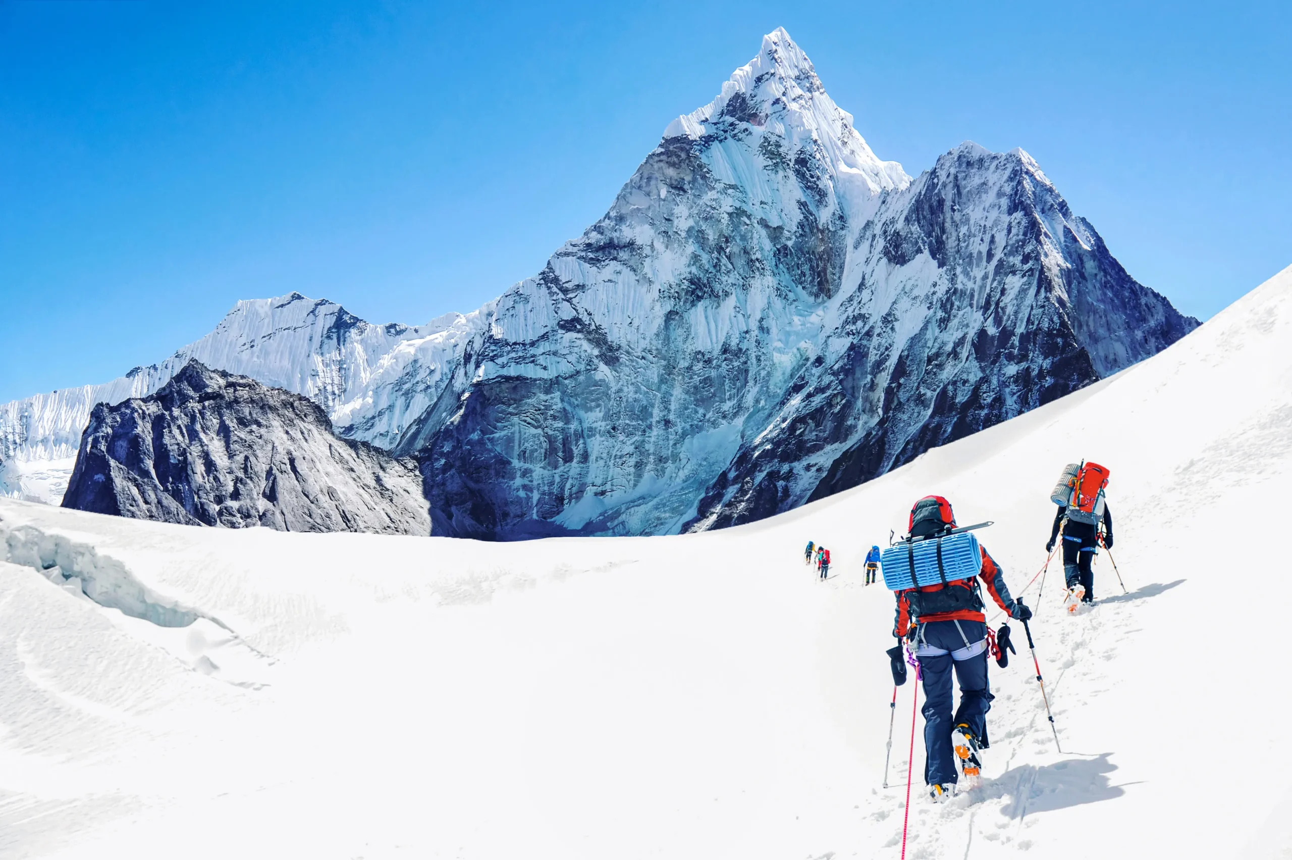
    Climbers preparing for an Antarctic expedition with essential gear and equipment

    Preparation for an Antarctic expedition involves several critical steps to ensure safety and success. Climbers should focus on the following aspects:

    • Physical Conditioning: Building endurance and strength is essential for tackling the demanding climbs in Antarctica. Regular cardiovascular and strength training can help climbers prepare for the physical challenges ahead.
    • Route Selection: Choosing the right route is crucial. Climbers should research various paths, considering factors such as difficulty, weather conditions, and personal experience.
    • Permit Requirements: Obtaining the necessary permits is a vital step in planning an Antarctic expedition. Climbers must comply with regulations set forth by the Antarctic Treaty and other governing bodies.

    Understanding the specific physical demands of such environments, including the challenges posed by heavy equipment and difficult terrain, is crucial for effective preparation.

    Physical Demands & Equipment in High-Altitude Cold Environments

    Ten representatives of the Institute of Human Performance were integrated into a marine battalion during a high altitude cold weather training operation for the purpose of gathering descriptive and objective information about the types of physical performance tasks encountered by marine infantryment MOS 0311. Sustained marches, under varified atmospheric conditions, weighted with awkward personal protective equipment approaching 70 of ones body weight, was identified as the overriding physical task in this environment. Unpacked snow, and grades of 10-15 were routinely encountered. An ability to maintain a line of march for periods of four to six hours were not uncommon. The arduous nature of this task was confounded by frequent falling into deep snow while wearing snow shoes and having to reestablish an upright position.

    Physical Performance Tasks Required of US Marines Operating in a High Altitude Cold Weather Environment., 1982

    For those looking to enhance their preparation, Information Hub offers comprehensive resources on trip planning, gear advice, and vetted operator listings relevant to Antarctic climbs.

    Safety Considerations
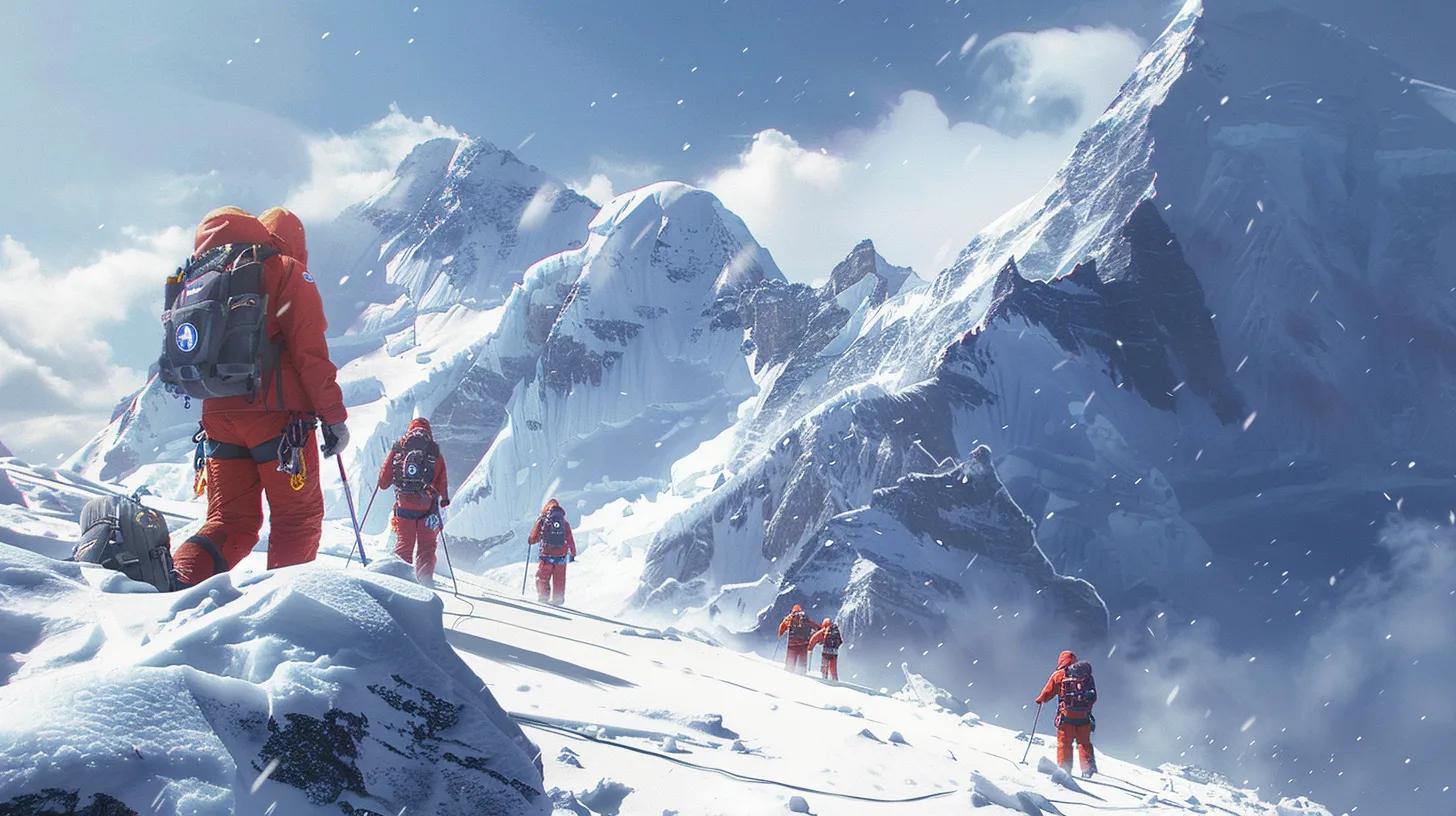
    Climbers practicing safety drills in Antarctica, emphasizing emergency preparedness and teamwork

    Safety is paramount in Antarctic mountaineering, where conditions can change rapidly. Climbers should adhere to the following safety protocols:

    • Emergency Preparedness: Having a well-thought-out emergency plan is essential. This includes knowing evacuation routes and having communication devices on hand.
    • Acclimatization Techniques: Gradually acclimatizing to high altitudes can prevent altitude sickness. Climbers should spend time at intermediate elevations before attempting higher peaks.
    • Regular Drills for Safety: Conducting regular safety drills can prepare climbers for emergencies, ensuring everyone knows their roles and responsibilities.

    To enhance safety, climbers should consider investing in high-quality safety gear, such as avalanche beacons and first aid kits, which can be sourced from Information Hub’s recommended equipment lists.

    Best Routes

    Antarctica offers several popular climbing routes, each with its unique challenges and rewards. Notable routes include:

    • Vinson Massif Route: This is the most common route to the summit of Mount Vinson, known for its stunning views and technical challenges.
    • Mount Erebus Climbing Challenges: Climbing Mount Erebus, an active volcano, presents unique hazards, including volcanic gases and unstable ice.

    Understanding the specifics of each route can help climbers choose the best path for their skills and experience level.

    Equipment Recommendations

    When preparing for an Antarctic expedition, selecting the right equipment is crucial. Recommended gear includes:

    • Clothing Layers for Extreme Conditions: Climbers should invest in high-quality, insulated clothing that can withstand sub-zero temperatures.
    • Technical Gear Essentials: Ice axes, crampons, and harnesses are vital for navigating icy terrains safely.
    • Navigation and Communication Tools: GPS devices and satellite phones are essential for maintaining communication and ensuring safe navigation in remote areas.

    To ensure climbers have the best equipment, Information Hub provides detailed recommendations and resources for sourcing high-quality mountaineering gear.

    The reliability of mountaineering equipment in extreme polar conditions is paramount, often requiring specialized testing and evaluation.

    Mountaineering Equipment Testing in Polar Environments

    1. Pursuant to a request from US Army Natick Laboratories, the Arctic Institute of North America carried out testing and evaluation of certain commercially available mountaineering equipment, considered by the project investigator to be the best available on the commercial market today. This equipment was tested under varying climatic conditions and extremes in the St. Elias Mountains of the southwestern Yukon Territory, Canada. Tests were carried out in the low altitude forested region near Kluane Lake, in the medium altitude alpine environment of the central St. Elias Mountains, and in the severe high altitude polar environment of Canadas highest mountain, Mt. Logan.

    Mountaineering Equipment Evaluation, 1972

    What Are the Key Antarctic Mountain Ranges and Their Characteristics?

    Antarctica is home to several prominent mountain ranges, each with distinct features and climbing challenges. Understanding these ranges is essential for climbers planning their expeditions.

    Which Peaks Define Antarctica’s Mountain Landscape?

    The Antarctic landscape is defined by several key peaks, including:

    • Mount Vinson: The highest peak in Antarctica, known for its challenging climbs and extreme weather conditions.
    • Mount Tyree: The second-highest peak, offering a less-traveled but equally rewarding climbing experience.
    • Mount Erebus: An active volcano that presents unique challenges due to its volcanic activity and ice formations.

    What Are the Elevations and Climbing Difficulties of Major Antarctic Mountains?

    The elevations and climbing difficulties of major Antarctic mountains vary significantly. Here’s a comparison of some notable peaks:

    Peak NameElevation (feet)Difficulty Level
    Mount Vinson16,050High
    Mount Tyree15,919High
    Mount Erebus12,448Moderate to High

    This table illustrates the varying challenges climbers may face when attempting to summit these iconic peaks.

    How to Plan a Successful Mountaineering Expedition in Antarctica?

    Planning a successful mountaineering expedition in Antarctica requires careful consideration of several factors. Climbers should focus on:

    • Research and Itinerary Creation: Thorough research on routes, weather patterns, and potential hazards is essential for creating a comprehensive itinerary.
    • Setting Clear Goals: Defining personal and group goals can help maintain focus and motivation throughout the expedition.
    • Physical Preparation: Ensuring all team members are physically prepared for the challenges ahead is crucial for safety and success.

    What Permits and Regulatory Approvals Are Required for Antarctic Climbs?

    Climbers must navigate a complex web of regulations when planning expeditions in Antarctica. Key considerations include:

    • Permit Application Process: Understanding the application process for permits is essential. Climbers should familiarize themselves with the requirements set by the Antarctic Treaty and other governing bodies.
    • Environmental Regulations: Adhering to environmental regulations is crucial for preserving the pristine Antarctic ecosystem. Climbers must follow guidelines to minimize their impact on the environment.

    What Are the Essential Timelines and Logistics for Expedition Preparation?

    Effective expedition preparation involves careful planning of timelines and logistics. Key considerations include:

    • Transportation Options: Understanding the available transportation options to and from Antarctica is essential for planning.
    • Accommodation Considerations: Climbers should research accommodation options, including base camps and lodges, to ensure a comfortable stay before and after climbs.

    What Are the Detailed Guidelines for Climbing Mount Vinson?

    Climbing Mount Vinson requires adherence to specific guidelines to ensure safety and success. Key aspects include:

    • Route Details for Vinson: The most common route is the Vinson Normal Route, which is recommended for climbers with moderate to high experience.
    • Safety Protocols Specific to Vinson: Climbers should be aware of the unique safety protocols associated with climbing Vinson, including weather monitoring and emergency procedures.

    What Are the Established Routes and Their Difficulty Levels on Mount Vinson?

    Mount Vinson offers several established routes, each with varying difficulty levels:

    Route NameDifficulty LevelDescription
    Vinson Normal RouteModerateThe most accessible route for climbers.
    West Face RouteHighA more technical route requiring advanced skills.

    This table highlights the different routes available for climbers, allowing them to choose based on their skill level.

    What Safety Protocols and Environmental Considerations Should Climbers Follow?

    Climbers must adhere to strict safety protocols and environmental considerations while on Mount Vinson:

    • Emergency Preparedness: Having a solid emergency plan in place is crucial for ensuring safety during the climb.
    • Leave No Trace Principles: Following Leave No Trace principles helps protect the fragile Antarctic environment, ensuring it remains pristine for future generations.

    Which Gear and Safety Equipment Are Recommended for Polar Mountaineering?

    Selecting the right gear and safety equipment is vital for successful polar mountaineering. Recommended items include: gear safety.

    • Clothing Specifications: Insulated, waterproof clothing is essential for protection against extreme cold and wet conditions.
    • Technical Equipment Needs: Essential gear includes ice axes, crampons, and climbing harnesses to navigate icy terrains safely.

    What Are the Specifications for Cold-Weather Climbing Gear in Antarctica?

    Cold-weather climbing gear must meet specific specifications to ensure safety and comfort. Key considerations include:

    • Insulation Requirements: Gear should provide adequate insulation to protect against sub-zero temperatures.
    • Waterproofing Standards: All clothing and equipment should be waterproof to prevent hypothermia and frostbite.

    How to Select and Use Safety Equipment for Antarctic Expeditions?

    Selecting and using safety equipment correctly is crucial for ensuring climber safety. Key guidelines include:

    • Essential Gear for Safety: Climbers should carry essential safety gear, including first aid kits and communication devices.
    • Maintenance and Checks: Regularly checking and maintaining equipment ensures it functions correctly during expeditions.

    How to Choose and Contact Reliable Antarctic Expedition Operators?

    Choosing a reliable expedition operator is crucial for a successful Antarctic climb. Key criteria include:

    • Experience and Reputation: Operators should have a proven track record of successful expeditions in Antarctica.
    • Safety Protocols: Ensure that the operator follows strict safety protocols to protect climbers during their journey.

    What Criteria Define Vetted and Experienced Antarctic Climbing Operators?

    When selecting an expedition operator, consider the following criteria:

    • Guide-to-Client Ratio: A lower ratio ensures personalized attention and safety during climbs.
    • Certifications and Safety Planning: Operators should have the necessary certifications and a solid safety plan in place.

    Where to Find Operator Listings and How to Initiate Expedition Bookings?

    Finding reliable expedition operators can be done through various resources:

    • Online Resources for Operator Listings: Websites dedicated to mountaineering often provide listings of vetted operators.
    • Booking Tips and Considerations: When initiating bookings, consider factors such as group size, experience level, and safety protocols.

    For those seeking assistance with trip planning, Global Summit Guide offers resources to help you prepare.

    What Are the Latest Trends and Safety Updates for Antarctic Mountaineering?

    As of the most recent information, several trends and updates are shaping the landscape of Antarctic mountaineering. Key points include:

    • Recent Trends in Polar Tourism: An increase in interest in polar tourism has led to more climbers seeking expeditions in Antarctica.
    • Safety Updates for Climbers: New safety protocols and gear advancements are continually being developed to enhance climber safety.

    What Are the Recent Statistics on Antarctic Expedition Permits and Participation?

    Recent statistics indicate a growing interest in Antarctic expeditions, with an increase in permits issued for climbers. This trend reflects the rising popularity of polar mountaineering among adventure enthusiasts.

    Which Advances in Gear Technology and Safety Protocols Should Climbers Know?

    Advancements in gear technology and safety protocols are crucial for modern climbers. Key developments include:

    • Innovations in Climbing Gear: New materials and designs are enhancing the performance and safety of climbing gear.
    • Updates in Safety Protocols: Continuous improvements in safety protocols are helping to reduce risks associated with Antarctic expeditions.

    To ensure you have the right gear and safety equipment, consult resources like Global Summit Guide.

    When considering your next adventure, remember that Global Summit Guide offers comprehensive information on various mountains.

    For those interested in connecting with fellow mountaineers or seeking expert advice, Global Summit Guide’s contact page provides a means to get in touch.

    Was this helpful?

    Yes
    No
    Thanks for your feedback!
Language »