
web analytics

Tag: Denali

  • Denali West Buttress Conditions 2026: NPS Permits, Camps, Weather Windows & Recent Climber Reports

    Home · Mountains · Denali · West Buttress Conditions

    Denali West Buttress Conditions 2026: NPS Permits, Camps, Weather Windows & Recent Climber Reports

    Everything you need to know about climbing North America’s highest peak via the West Buttress route in the active 2026 season. NPS permit costs, camp progression from Kahiltna Glacier base camp to 14 Camp and High Camp, current weather windows, recent ranger station reports, and 2026 regulations for the standard route used by 90% of Denali climbers.

    20,310 ft
    Summit Elevation (6,190m)
    May 1
    2026 Season Active
    $450
    2026 NPS Permit (Adult)
    18-24
    Expedition Days (Typical)
    2026 Climbing Season Active May 1 – July 15 · NPS Permit $450 Adult / $350 Under 24 · 60-Day Pre-Registration Required · West Buttress Standard Route · Denali Full Guide →
    Last updated May 24, 2026 — verified for the active 2026 climbing season (May 1 – July 15)

    If you’re planning to climb Denali via the West Buttress this season, you need to understand the current state of the mountain. The 2026 season is currently active. NPS rangers are in their high camps. Several patrols are working the Kahiltna Glacier and the 14,200-foot camp. Climbers are flying in daily from Talkeetna. The peak window opens now and runs through late June. This page covers everything from current NPS permit costs to camp-by-camp conditions, weather patterns, and what climbers should know before flying onto the Kahiltna.

    The 2026 Denali season runs May 1 through approximately July 15. Peak conditions on the West Buttress fall between mid-May and late June, when daylight reaches 20+ hours, temperatures are warmest by Alaska Range standards, and stable high-pressure systems produce the most reliable summit windows. NPS registration for the 2026 season opened January 1, 2026, with the mandatory 60-day pre-registration period enforced strictly. Climbers without permits cannot fly into the Kahiltna Glacier base camp.

    The West Buttress is the standard route on Denali, used by approximately 90% of climbers. The route is technically moderate by world mountaineering standards but the cold, altitude, and self-sufficient logistics make it genuinely difficult. Climbers haul approximately 100-120 pounds of gear, food, and fuel for the entire expedition. The route uses six camps from base camp at 7,200 feet to High Camp at 17,200 feet, with the summit at 20,310 feet (6,190 m).

    Denali West Buttress Live Conditions Snapshot

    Here’s the current state of the West Buttress route as of May 24, 2026, verified against NPS field reports, Talkeetna Ranger Station updates, and recent climber communications.

    2026 Season Status — Updated May 24, 2026

    Climbing Season
    Active. May 1 – July 15, 2026. Peak conditions mid-May to late June. NPS rangers patrolling 14 Camp and 17 Camp.
    Active
    NPS Permit Fee 2026
    $450 USD adults (25+) / $350 USD climbers 24 and under. Plus $15 park entrance fee. Combined total $465 adult.
    Required
    60-Day Pre-Registration
    Mandatory. Two-step process: Pay.gov fee payment + email Special Use Permit application. Non-refundable after Feb 15.
    Required
    Walter Harper Ranger Station
    Mandatory pre-climb orientation in Talkeetna. Climbers pick up Clean Mountain Can (CMC) and receive current conditions briefing.
    Operating
    Bush Plane Access
    K2 Aviation, Talkeetna Air Taxi, Sheldon Air Service flying climbers to Kahiltna Glacier (7,200 ft). Weather-dependent.
    Active
    14 Camp (14,200 ft)
    NPS ranger camp established. Medical tent operational. Standard waypoint for acclimatization. Cell coverage limited but functional.
    Operational
    Fixed Lines (Headwall)
    Installed annually between 14 Camp and 16,200-foot ridge. Critical infrastructure. Verify status with NPS rangers at 14 Camp.
    Installed
    17 Camp / High Camp (17,200 ft)
    Wind-exposed launch point for summit day. Temperatures -30 to 0°F. Most exposed camp on the route.
    Open
    CMC Waste Management
    Mandatory. All climbers issued Clean Mountain Cans at Talkeetna. Human waste packed out from all camps above 14,200 ft.
    Required
    Solo Climbing
    Permitted but strongly discouraged by NPS. Solo climbers face additional scrutiny and required experience verification.
    Discouraged

    Daily NPS updates during the season. The Walter Harper Talkeetna Ranger Station maintains an automated statistics phone line at (907) 733-9127 with current registration numbers and climbing statistics. NPS Field Reports publish updates from patrol rangers at 14 Camp and the high camps. MountainWeather.com aggregates the 7K and 14K weather station telemetry, NWS Denali Climbing Forecasts, and FAA webcam feeds. Climbers should monitor all three sources before flying into the Kahiltna and again before any summit attempt.

    Denali Location & Kahiltna Glacier Live Weather

    Denali sits in the Alaska Range, approximately 150 miles north of Anchorage and 100 miles west of Fairbanks. The West Buttress route begins at the Kahiltna Glacier Base Camp (7,200 ft), reached only by bush plane from Talkeetna (358 ft). Summit coordinates: 63.0692°N, 151.0070°W. The mountain straddles Denali National Park and Preserve, a 6-million-acre wilderness larger than the state of New Hampshire.

    Talkeetna Temp
    Loading…
    Wind
    Conditions
    Tomorrow

    Live weather data from Open-Meteo at Talkeetna (358 ft / 109m), the bush-plane departure point. Kahiltna Glacier (7,200 ft) typically runs 20-30°F colder than Talkeetna. Summit-day temperatures at 20,310 ft average -30 to -40°F with wind chill below -60°F not uncommon. Always cross-reference with the NPS Denali Climbing Forecast and MountainWeather.com before flying in.

    Denali West Buttress At a Glance

    Summit elevation20,310 ft (6,190 m) — North America’s highest peak; one of the Seven Summits
    LocationDenali National Park and Preserve, Alaska Range, Alaska, USA
    Coordinates63.0692°N, 151.0070°W
    RouteWest Buttress — standard route, ~90% of all Denali climbers
    Technical gradeAlaska Grade 2; moderate glacier and snow climbing with sustained altitude and cold exposure
    Total distance~13 miles horizontal; 13,500 ft vertical gain from base camp to summit
    Camps6: Base Camp 7,200 ft → 7,800 → 9,500 → 11,000 → 14,200 (14 Camp) → 17,200 (High Camp) → Summit
    2026 climbing seasonMay 1 – July 15, 2026 (peak: mid-May to late June)
    NPS permit fee 2026$450 USD adults (25+) / $350 USD climbers 24 and under
    Park entrance fee$15 USD per person, valid 7 days
    Combined 2026 fees$465 USD adult / $365 USD under 24
    Registration deadline60 days before climb start; non-refundable after Feb 15
    Expedition length18-24 days from Talkeetna to summit and back
    ApproachTalkeetna → Kahiltna Glacier via bush plane (K2 Aviation, Talkeetna Air Taxi, Sheldon Air Service)
    2026 guided cost$12,900-$19,000 USD (NPS-authorized concessions only)
    Authorized guide concessions7 federally-licensed companies on Denali
    Summit success rate~50% average (range: 28-60%+ by season and weather)
    Guided success rate55-70% typical; better than independent climber average
    Summit-day temperatures-30 to -40°F with wind chill below -60°F not uncommon
    Critical hazardsCrevasses on Kahiltna, Windy Corner, Headwall fixed lines, Autobahn, Denali Pass, Summit Ridge
    Waste managementClean Mountain Cans (CMCs) mandatory; all waste packed out
    Self-sufficient~100-120 lbs of gear, food, fuel per climber for the expedition
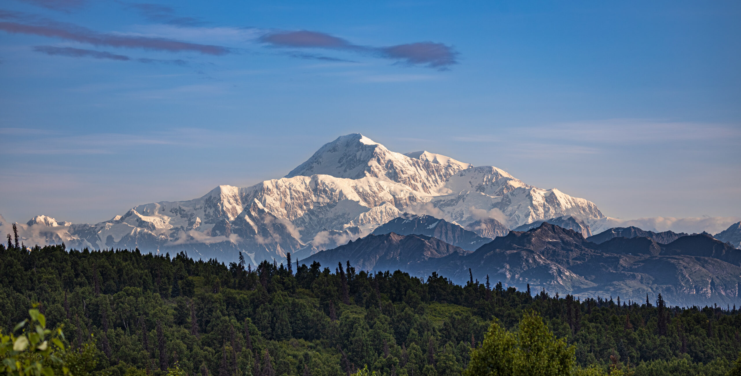
    Denali West Buttress route showing the 20310 foot summit of North America highest peak with Kahiltna Glacier base camp and the climbing route through 14 Camp and High Camp during the active 2026 season
    Denali’s West Buttress route — the standard path used by approximately 90% of climbers attempting North America’s highest peak. The route covers 13 miles horizontal and 13,500 feet of vertical gain through six camps from Kahiltna Glacier Base Camp at 7,200 ft to High Camp at 17,200 ft. The 2026 climbing season is currently active from May 1 through July 15.

    The West Buttress Camp Progression: 7,200 ft to Summit

    The West Buttress uses six camps over 13 miles of horizontal distance, gaining 13,500 vertical feet from the Kahiltna Glacier base camp to the summit. Most expeditions use a carry-and-cache pattern — moving gear progressively higher while climbers acclimatize, sleeping low and carrying high. Here’s the standard camp-by-camp breakdown for the 2026 season.

    CampElevationDistance from BCTypical StayKey Feature
    Base Camp7,200 ft (2,195 m)0 mi1-2 nightsBush plane landing on Kahiltna Glacier
    Camp 1 (Ski Hill)7,800 ft (2,378 m)~4 mi1 nightBase of Ski Hill climb; sled hauling
    Camp 2 (Kahiltna Pass)9,500 ft (2,896 m)~5 mi0-1 night (often skipped)Base of Kahiltna Pass climb
    Camp 3 (Motorcycle Hill)11,000 ft (3,353 m)~7 mi1-2 nightsLast camp before upper mountain
    14 Camp (Genet Basin)14,200 ft (4,328 m)~9 mi4-7 nightsNPS ranger camp + medical tent
    17 Camp (High Camp)17,200 ft (5,242 m)~11 mi1-3 nightsSummit launching point; wind-exposed
    Summit20,310 ft (6,190 m)~13 miSummit day onlyAutobahn → Denali Pass → Summit Ridge

    Below: detailed camp-by-camp breakdown with what to expect at each stop.

    Base Camp — Kahiltna Glacier

    7,200 ft (2,195 m) · ~2-3 days here at start

    The Kahiltna Glacier Base Camp sits at 7,200 feet at the base of the southwest fork of the Kahiltna. Bush planes from Talkeetna (K2 Aviation, Talkeetna Air Taxi, Sheldon Air Service) land here on skis. The base camp has a small NPS ranger presence and a base camp manager who coordinates incoming and outgoing flights. Climbers cache equipment, organize sleds, and prepare for the haul up the glacier. Most teams spend 1-2 nights here before starting the climb. Weather at base camp can shift rapidly — incoming flights are weather-dependent and can delay arrivals by days.

    Camp 1 — Ski Hill

    7,800 ft (2,378 m) · ~4 miles from Base Camp

    Camp 1 sits at the base of “Ski Hill,” a steeper section of the Kahiltna Glacier. The hike from Base Camp follows the southeast fork down to the main Kahiltna Glacier and then up — paradoxically, you lose 1,000 feet from base camp before climbing back up to Camp 1. Climbers haul approximately 60 pounds per person on sleds plus 40-50 pounds in packs. Crevasse risk is high in this section; teams travel roped up at all times.

    Camp 2 — Kahiltna Pass Base

    9,500 ft (2,896 m) · ~5 miles from Base Camp

    Camp 2 sits at the base of Kahiltna Pass, the major climb to the upper mountain. Some teams skip this camp and continue directly to Camp 3 at 11,000 feet. The decision depends on team strength and acclimatization needs. Crevasse risk remains high. Weather windows for this section are reliable in May-June.

    Camp 3 — Motorcycle Hill

    11,000 ft (3,353 m) · ~7 miles from Base Camp

    Camp 3 sits at 11,000 feet just above the steep “Motorcycle Hill” climb. This is the last camp before the major terrain change to the upper mountain. Climbers cache food and equipment here for the descent. Most teams spend 1-2 nights at Camp 3 for acclimatization before continuing. The view from Camp 3 toward Mount Foraker and the Kahiltna becomes one of the route’s iconic visual moments.

    Camp 4 — 14 Camp (Genet Basin)

    14,200 ft (4,328 m) · ~9 miles from Base Camp · NPS ranger camp

    The 14,200-foot camp — commonly called “14 Camp” or “Genet Basin” — is the main acclimatization camp on Denali. The NPS Talkeetna rangers establish a patrol camp here each season with a medical tent, weather station, and emergency communications. Climbers typically spend 4-7 days here for acclimatization, weather waits, and equipment preparation for the upper mountain. 14 Camp has a small wall of snow blocks around individual tent sites for wind protection. Cell coverage is limited but functional with the right networks. Temperatures at 14 Camp range from -20 to 10°F during the climbing season.

    The Headwall & Fixed Lines

    14,200 ft → 16,200 ft · Fixed ropes installed annually

    The Headwall is the steep section between 14 Camp and the West Buttress ridge at 16,200 feet. NPS rangers install fixed ropes here at the start of each season for safety. This is the most technical section of the West Buttress route — 40-45 degree snow and ice with significant exposure. Climbers clip into the fixed lines with ascenders for protection. The Headwall typically takes 4-6 hours to climb from 14 Camp. Most teams do a carry day to High Camp first, then move and sleep at High Camp on a subsequent day.

    Camp 5 — 17 Camp / High Camp

    17,200 ft (5,242 m) · ~11 miles from Base Camp · Summit launching point

    The 17,200-foot camp is the highest established camp on the West Buttress route. Climbers typically spend 1-3 nights here before summit day, waiting for a weather window. High Camp is significantly more wind-exposed than 14 Camp, with sustained winds frequently above 40 mph. Temperatures range from -30 to 0°F. Tent placements are bounded by snow walls for wind protection. Most teams launch their summit attempt from High Camp at 04:00-06:00 depending on weather forecasts.

    Summit Day — Autobahn, Denali Pass, Summit Ridge

    17,200 ft → 20,310 ft · 3,110 ft gain on summit day

    Summit day from High Camp covers several distinct sections. First, the “Autobahn” — a 40-degree slope traverse from 17,200 to 18,200 feet that has been the site of multiple historical fatalities due to climbers sliding on hard snow without crampons engaged. Next, Denali Pass at 18,200 feet, the saddle between the South and North summits of Denali. From Denali Pass, the route ascends gradually to the Football Field at 19,500 feet, then up the final Summit Ridge to the South Summit (the true summit) at 20,310 feet. Total summit day is typically 10-14 hours round trip.

    Denali West Buttress Headwall fixed lines climbing from 14 Camp at 14200 feet to the West Buttress ridge at 16200 feet showing the steep snow and ice section during 2026 climbing season
    The Headwall fixed lines — the most technical section of the West Buttress route. NPS rangers install fixed ropes between 14 Camp (14,200 ft) and the West Buttress ridge (16,200 ft) at the start of each season. Climbers clip into the fixed lines with ascenders for safety on the 40-45 degree snow and ice slope. The Headwall typically takes 4-6 hours to climb from 14 Camp.

    Critical Hazards on the West Buttress

    Despite being the standard route, the West Buttress has multiple dangerous sections that contribute to Denali’s overall fatality history. Climbers should understand each before attempting the route.

    HazardElevationRisk LevelPrimary DangerMitigation
    Kahiltna Crevasses7,200-11,000 ftHighHidden crevasse fallsRope team travel; crevasse rescue gear
    Windy Corner12,500-13,500 ftHigh60+ mph winds; frostbiteCross in morning calm before afternoon winds
    Headwall Fixed Lines14,200-16,200 ftModerateFalls on 40-45° snow/iceProper ascender technique; back up fixed rope
    The Autobahn17,200-18,200 ftCriticalFatal slides on hard snowCrampons engaged; ice axe self-arrest ready
    Denali Pass18,200 ftCritical100+ mph storm windsWeather window discipline; turn back early
    Football Field19,500 ftHighWhiteout disorientationGPS waypoints; team navigation protocols
    Summit Ridge19,500-20,310 ftHighCornice exposure; fallsStay climber’s right of corniced edge
    Frostbite (all camps)14,200+ ftCriticalTissue loss on hands/feetVapor barrier liners; expedition mittens; hand warmers

    Kahiltna Glacier Crevasses

    The Kahiltna Glacier has extensive crevasse fields, particularly in the lower sections between Base Camp and Camp 3. Climbers must travel roped up at all times on the glacier. Late-season climbers (late June, July) face more open crevasses as snow bridges deteriorate from warming temperatures. The 2025 season saw two crevasse rescue events on the Kahiltna; the patterns continue in 2026.

    Windy Corner

    Windy Corner is a notorious wind-channel section between 12,500 and 13,500 feet on the climb from Camp 3 to 14 Camp. Wind speeds frequently exceed 60 mph here, and the section has limited shelter. Climbers traversing Windy Corner in bad weather face exposure that has caused multiple frostbite injuries in recent seasons. Most teams aim to cross Windy Corner in early morning calm before afternoon winds build.

    The Headwall & Fixed Lines

    The Headwall fixed ropes are critical safety infrastructure but require active management. Climbers must clip ascenders correctly, manage rope drag, and avoid creating bottlenecks. The 2025 season saw several falls on the Headwall, most without serious injury due to the fixed line catch. Always back up the fixed rope when conditions allow.

    The Autobahn

    The Autobahn is the traverse from 17,200 to 18,200 feet, named for the dangerous “fast slide” potential. The route crosses a 40-degree snow slope with significant exposure below. Climbers must keep crampons engaged and ice axe in proper self-arrest position. Multiple Denali fatalities have occurred here when climbers slipped on hard wind-packed snow. The section is short — typically 30-45 minutes — but demands focus throughout.

    Denali Pass and the Football Field

    Denali Pass at 18,200 feet sits in a wind tunnel between the South and North summits. Wind speeds here can reach 100+ mph in storm conditions. Multiple climbers have died at or near Denali Pass when caught in unexpected weather changes. The Football Field at 19,500 feet is a broad snow plateau where teams typically pause before the final summit ridge. Weather decisions made here are critical — climbers who continue in marginal weather face descent challenges as conditions deteriorate.

    Summit Ridge

    The final Summit Ridge from the Football Field to the South Summit is exposed on both sides with significant drop-offs. The ridge is typically corniced, requiring careful navigation to stay on the safe (climber’s right) side. Wind exposure here is severe — even on calm summit days, sustained winds of 30-50 mph are common. The final 200-300 feet to the summit demand focus and quick movement.

    Frostbite is the most common Denali injury. The combination of severe cold (-30 to -40°F summit day), high wind, and the inability to safely remove gloves at altitude makes frostbite the leading injury on Denali. The NPS reports frostbite cases nearly every season — most on hands and feet during summit day or descent. Vapor barrier liners in boots, expedition mittens (not gloves) above 14 Camp, and chemical hand warmers as backup are essential. Multiple climbers have lost fingers or toes to Denali frostbite. This is a real risk, not a theoretical one.

    2026 NPS Permits & Registration

    Denali permits are issued by the National Park Service through a strict 60-day pre-registration system. Here’s the current 2026 process.

    2026 Permit Costs

    FeeAdult (25+)Climbers 24 & Under
    Mountaineering Special Use Fee$450 USD$350 USD
    Denali NP Entrance Fee$15 USD$15 USD
    Combined 2026 total$465 USD$365 USD

    Two-Step Registration Process

    The 2026 registration is a two-step process per the current NPS protocol:

    1. Pay.gov fee payment: Pay the Mountaineering Special Use Fee through the official Pay.gov website. The fee is non-refundable after February 15 of your climbing year.
    2. Special Use Permit Application: Submit the Application for Special Use Permit via email to the Talkeetna Ranger Station, including detailed climbing experience, proposed route, group member information, and emergency contacts.

    Both steps must be completed at least 60 days before your intended climb start date. The 60-day rule is strict — climbers attempting to register inside the 60-day window are typically declined. The pre-registration period exists so NPS mountaineering rangers can review applications, contact climbers for any clarifications, and ensure all climbers are properly prepared before they fly into the Kahiltna.

    Walter Harper Talkeetna Ranger Station

    All Denali climbers must check in at the Walter Harper Talkeetna Ranger Station before flying in. The station is named after Walter Harper, the first person to reach the summit of Denali in 1913. Climbers receive a pre-climb orientation, current conditions briefing, and their Clean Mountain Can (CMC) for waste management. The orientation typically takes 30-60 minutes and covers route-specific hazards, current weather patterns, and emergency protocols.

    Guided vs. Independent Climbing

    The NPS authorizes seven mountain guide concessions for Denali. Guided expeditions handle the entire registration and logistics process, including fee payment, permit submission, and pre-climb orientation. Independent climbers complete all steps themselves but pay the same fees. The 2026 guided expedition costs run $12,900-$19,000 USD for the standard 18-24 day West Buttress program. Major operators include RMI Expeditions, International Mountain Guides (IMG), Alpine Ascents International, Mountain Trip, and Mountain Madness.

    Denali Talkeetna bush plane K2 Aviation flight over the Alaska Range delivering 2026 climbers to Kahiltna Glacier base camp at 7200 feet for the West Buttress route ascent
    Bush plane access to Denali — the only way onto the West Buttress route. K2 Aviation, Talkeetna Air Taxi, and Sheldon Air Service fly climbers from Talkeetna (358 ft) to the Kahiltna Glacier base camp (7,200 ft) in approximately 45 minutes. Flights are weather-dependent — climbers should plan 1-3 days of buffer in Talkeetna for flight delays, particularly early in the May season when storms commonly ground bush planes.

    2026 Climbing Season Month-by-Month Conditions

    PeriodConditionsDaylightClimber VolumeBest For
    Late AprilCold; firm snow; minimal crevasses; some rangers arriving~17 hoursMinimal (~50 on mountain)Experienced cold-weather climbers; quiet route
    Early MayStable cold; building climber volume; rangers establish camps~18 hoursBuilding (~200)Cold-tolerant climbers; first season window
    Mid-MayPeak window opens; warmer days; reliable weather~19 hoursHeavy (~400-600)Most climbers; established weather patterns
    Late May – Early JunePrime conditions; longest daylight; warmer camps~20+ hoursMaximum (~600-800)Standard guided expedition window
    Mid-JunePeak window continuing; warmer base camp~20+ hoursMaximum (~600-800)Optimal balance of conditions and crowds
    Late June – Early JulyCrevasses opening; warmer weather; reduced firm snow~20 hoursHeavy (~400-500)Late-season climbers willing to accept softer conditions
    Mid-JulySeason closing; rangers departing; significant crevasses~19 hoursReducing (~100-200)End of season; experienced teams only

    Late May – Mid June 2026: The Sweet Spot

    The May 25 – June 15 window represents the optimal Denali climbing conditions. Daylight reaches its maximum (20+ hours of usable light), temperatures are warmest by Alaska Range standards, weather windows open more frequently than at any other point in the season, and the trail through 14 Camp is well-established by NPS rangers and earlier climbers. Most major guided expeditions schedule departures in this window.

    Mid-June – Early July 2026: Late Window

    Late June and early July offer continued strong conditions but with developing concerns. Crevasses on the lower Kahiltna Glacier open as snow bridges weaken. Temperatures warm enough to make heavy expedition clothing uncomfortable on the lower mountain. The headwall fixed lines see significant wear. NPS ranger patrols begin transitioning out of 14 Camp by July 5-10.

    Mid-July: Season Closing

    By mid-July, the climbing season is effectively over. Most operators have completed their final summit windows. NPS ranger camps are being dismantled. Climbers attempting July ascents face deteriorating snow conditions, increased crevasse exposure, and reduced infrastructure. The official permitting season extends through July 15, but very few climbers attempt summits in the final two weeks.

    Recent Denali Trip Reports & NPS Ranger Updates

    NPS rangers publish field reports throughout the Denali climbing season. These provide ground-truth context for climbers planning trips. Here’s a synthesis of recent patterns relevant to 2026 planning.

    2025 Season Summary

    The 2025 Denali climbing season ran from April 28 (first NPS patrol assembling) through July 12. Total registered climbers: approximately 1,100. Summit success rate for the season: approximately 52%, slightly above the long-term average. The May 24 – June 10 window produced the highest concentration of summits, with several reliable weather windows of 24-72 hours each.

    2025 Ranger Reports — Key Patterns

    • Early May 2025: First NPS West Buttress patrol assembled in Talkeetna on April 28. Rangers reported variable snow conditions with crusts on solar slopes and dry cold snow on north faces.
    • Mid-May 2025: Fixed lines on the Headwall installed by NPS patrols. Trail through Kahiltna established. Crevasse bridges intact.
    • Late May 2025: Upper mountain reported “busy” with approximately 100 climbers ascending to High Camp on multiple days. Fixed line steps improving with use.
    • June 2025: Multiple weather windows produced strong summit numbers. Several frostbite incidents reported on summit day, particularly hands and toes.
    • July 2025: Season winding down. Final NPS patrols departing 14 Camp. Crevasses on Kahiltna opening significantly.

    2026 Pre-Season Observations

    The 2026 NPS season opened with rangers arriving in Talkeetna in late April. The first West Buttress patrol assembled in early May with rangers and VIPs (Volunteers in Park) packing for their upcoming climb. Initial flights to the Kahiltna Glacier began in early May as weather permitted. Climbers booked for early-May start dates faced typical weather delays in Talkeetna; one to three days of waiting for flyable conditions is standard.

    Independent Climber Notes from 2025

    • Cell coverage at 14 Camp: Limited but functional on Verizon and AT&T. Useful for non-emergency communication.
    • Garmin InReach: The standard satellite communicator on Denali. Battery life is the limiting factor at cold temperatures — keep devices warm in inner pockets.
    • Bush plane reliability: K2 Aviation, Talkeetna Air Taxi, and Sheldon Air Service are the primary operators. All three are reliable when weather allows. Plan 1-3 days of buffer in Talkeetna for flight delays.
    • Food caching: Climbers cache food and fuel at each camp for the descent. Cache locations should be marked clearly with wands and GPS coordinates.
    • Equipment failures: The cold breaks gear that performs fine in lower-altitude conditions. Test stoves, sleeping bags, and fuel systems in cold conditions before traveling to Alaska.
    Denali 14 Camp at 14200 feet showing the NPS ranger station Genet Basin tent platforms snow walls and climbers acclimatizing during 2026 climbing season on the West Buttress route
    14 Camp at 14,200 ft (Genet Basin) — the main acclimatization camp on Denali’s West Buttress route. The NPS Talkeetna rangers maintain a patrol camp here with a medical tent, weather station, and emergency communications. Climbers typically spend 4-7 days at 14 Camp acclimatizing before pushing to High Camp at 17,200 ft.

    Required Gear for 2026 Denali West Buttress

    Denali demands the most extensive personal equipment list of any standard climbing route on Earth. Cold, altitude, and self-sufficient logistics make every gear choice consequential. Most guided operators provide group equipment (tents, stoves, ropes); climbers bring their own personal gear.

    Footwear

    ItemSpec / ExampleNotes
    Double mountaineering bootsLa Sportiva G2 SM, Scarpa Phantom 8000, Millet Everest Summit GTX-40°F rated; built-in gaiter
    OverbootsForty Below or similarWarmth multiplier for summit day
    Crampons12-point steelSemi-automatic or step-in binding
    Camp bootiesInsulated down bootiesFor camp evenings
    Expedition socksWool or wool-synthetic blend5-6 pairs minimum
    Liner socksThin syntheticBlister prevention
    Vapor barrier linersRBH Designs or similarReduces sweat → frostbite

    Clothing System

    LayerItemRating / Notes
    BaseTop and bottom (merino or synthetic)2-3 sets
    MidFleece or wool topMid-weight
    Active insulationSynthetic insulated jacket (Patagonia DAS Parka)Working layer for climbing
    Heavy insulationDown parka800-fill, -40°F minimum
    Insulated pantsDown pantsCamp and summit day
    Hardshell jacketGore-Tex ProGenerous cut for layering
    Hardshell pantsFull side-zipFor crampon transitions
    Soft shell pantsSchoeller or similarLower mountain wear
    Hat / balaclava / buffWool or syntheticFrostbite protection
    Gloves (3 pairs)Liner + insulated + expedition mittensMittens -40°F rated
    Chemical warmersHand + toe warmers10-15 pairs minimum

    Technical Equipment

    ItemSpecPurpose
    Ice axe60-70cm general mountaineeringSelf-arrest; cramponing
    Climbing harnessAdjustable leg loopsRope team travel
    HelmetClimbing-ratedRequired on the route
    Ascenders / jumarsPetzl Ascension or similarHeadwall fixed lines
    Trekking polesAdjustable, 3-sectionGlacier travel
    Climbing rope60m half rope per teamUsually group equipment
    Carabiners5-6 locking + 5-6 non-lockingAnchor + rope work
    Prusik cord6mm × 2 lengthsCrevasse self-rescue
    Slings / runners3-4 60cm + 2-3 120cmAnchor building
    Belay deviceATC-Guide or similarRope work
    Snow pickets24″ aluminum2-3 per team (shared)

    Hauling, Camp & Sleeping

    ItemSpecNotes
    Pulk / sledParis Expedition or customFor 60+ lb hauls on lower glacier
    Sled riggingRope + carabiners + drag strapsAttaches sled to harness
    Expedition backpack90-100LUpper mountain (above 14 Camp)
    4-season tentThe North Face VE-25 or similarUsually group equipment
    Sleeping bag-40°F rated (WM Puma, FF Snowy Owl)800+ fill down
    Sleeping pads (2)Closed-cell foam + inflatable insulatedCritical insulation from ground
    StoveWhite gas (MSR XGK EX)Group equipment
    Fuel~0.5 liters per person per dayPlan for 9-12L per climber
    Snow shovel + sawAluminum shovel; collapsible sawBuilding wind walls
    Water bottles (3L total)Insulated NalgenesBladder hoses freeze unreliably
    Wide-mouth pee bottle1L NalgeneTent use during cold nights

    Personal Safety & Required NPS Equipment

    ItemSpecNotes
    Clean Mountain Can (CMC)Issued at Talkeetna Ranger StationNPS mandatory waste pack-out
    Biodegradable bagsProvided with CMCNPS issued
    Headlamp + spare batteriesLithium batteries for cold2 spare battery sets minimum
    Glacier glasses (Cat 4)+ backup pairUV at altitude is severe
    GogglesStorm-ratedWhiteout + summit ridge
    Sunscreen + lip balmSPF 50+ with SPF lip balmReapply throughout day
    First aid kitBlister care, ibuprofen, electrolytes, AMS medsCustomize to team needs
    Diamox / acetazolamide250mg twice daily (typical)Discuss with doctor
    Satellite communicatorGarmin InReach or sat phoneCell signal limited above BC
    NPS Permit + Park Entrance receiptPrint + digital copiesVerify at base camp
    Travel insuranceHigh-altitude rescue coverageHeli-evac coverage essential
    Cash (USD)$200-500Tips, fuel surcharges, emergencies
    Denali expedition gear and equipment laid out at Kahiltna Glacier Base Camp 7200 feet including pulk sleds expedition tents climbing harnesses crampons ice axes and Clean Mountain Cans for the 2026 West Buttress climbing season
    Denali expedition gear staged at Kahiltna Glacier Base Camp (7,200 ft). Climbers haul approximately 100-120 pounds of gear, food, and fuel for the entire 18-24 day expedition. Group equipment (tents, stoves, ropes) is typically split among team members. The pulk sled is essential for the lower-glacier hauls before climbers transition to backpack-only loads above 14 Camp.

    2026 Booking Strategy

    Denali expeditions have a unique booking timeline driven by the 60-day NPS pre-registration rule and the limited authorized guide concessions.

    For Remaining 2026 Season (May-July)

    If you haven’t booked yet for the 2026 season, your options are limited:

    • May 2026 departures: Likely fully booked with authorized guide concessions. NPS 60-day rule eliminates last-minute registrations.
    • Early June 2026: Limited availability with some guide services. Independent climbers can still register if exactly 60 days from start date.
    • Late June 2026: Some availability remaining. Late-season conditions but still within climbing window.
    • Early July 2026: End-of-season departures available. Higher weather risk; reduced infrastructure.

    For 2027 Booking

    Climbers planning 2027 Denali expeditions should:

    • July-September 2026: Research authorized guide concessions, compare itineraries and pricing
    • October 2026: Make initial bookings with deposits to guide services
    • January 2027: NPS registration opens January 1; complete Pay.gov fee payment
    • February 2027: Submit Special Use Permit application; non-refundable after Feb 15
    • March 2027: Complete training requirements; verify gear; book travel to Anchorage
    • May 2027: Travel to Talkeetna for orientation and climb

    The 7 Authorized Guide Concessions

    NPS authorizes seven mountain guide companies to operate on Denali. Climbers wanting guided expeditions must use one of these. The standard list includes RMI Expeditions, International Mountain Guides (IMG), Alpine Ascents International, Mountain Trip, Mountain Madness, NOLS, and AAI/American Alpine Institute. Each operates under specific NPS permits with established itineraries and guide ratios. Independent climbers can climb without a guide service but handle all logistics themselves.

    Denali summit day climbing the Autobahn traverse from High Camp 17200 feet toward Denali Pass with crampons ice axe and expedition gear in -30 degree temperatures during 2026 season
    Summit day on Denali — the Autobahn traverse from High Camp (17,200 ft) toward Denali Pass at 18,200 ft. The 40-degree snow slope has been the site of multiple historical fatalities when climbers slipped without crampons properly engaged. Summit-day temperatures average -30 to -40°F with wind chill below -60°F not uncommon during the 2026 climbing season.

    Frequently Asked Questions About Denali West Buttress Conditions

    When is the 2026 Denali climbing season?

    The 2026 Denali climbing season is currently active, running from approximately May 1 through July 15, 2026. Peak conditions on the West Buttress route fall between mid-May and late June, when daylight is maximum (up to 20+ hours), temperatures are warmest by Alaska Range standards, and stable high-pressure systems produce the most reliable summit windows. NPS registration for the 2026 season opened January 1, 2026, with climbers required to register at least 60 days before their planned start date.

    How much does the Denali permit cost in 2026?

    The 2026 Denali mountaineering permit costs $450 USD for climbers aged 25 and older, or $350 USD for climbers aged 24 and younger. This is the NPS Mountaineering Special Use Fee paid through Pay.gov when you register. Additionally, the Denali National Park entrance fee is $15 per person, valid for 7 days. Combined fees total $465 for adult climbers in 2026. The fee is non-refundable after February 15 of your climbing year. Guided expedition prices range from $12,900 to $19,000 USD for the standard 18-24 day West Buttress program.

    What is the camp progression on the Denali West Buttress route?

    The Denali West Buttress route uses six camps over approximately 13 miles of horizontal distance and 13,500 feet of vertical gain. Camp 1 is the Kahiltna Glacier Base Camp at 7,200 feet, reached by bush plane from Talkeetna. The standard progression then runs to Camp 2 at 7,800 feet (Ski Hill), Camp 3 at 9,500 feet, Camp 4 at 11,000 feet, Camp 5 at 14,200 feet (commonly called 14 Camp), and Camp 6 at 17,200 feet (High Camp). The summit at 20,310 feet sits 3,110 feet above High Camp via the Autobahn, Denali Pass, and Summit Ridge.

    What are current Denali West Buttress weather conditions?

    Base camp temperatures in late May range from -10 to 25°F. The 14,200-foot camp typically runs -20 to 10°F. The 17,200-foot High Camp ranges from -30 to 0°F with significant wind. Summit-day temperatures average -30 to -40°F with wind chill below -60°F not uncommon. Weather windows on Denali open every 5-10 days during the climbing season, lasting 24-72 hours each. The NPS posts daily weather observations from 7K and 14K weather stations. Climbers should have 5-7 days of weather buffer built into their itinerary.

    What is the Denali summit success rate?

    The long-term average across all Denali climbers is approximately 50%, but individual seasons range from 28% (poor weather years) to over 60% (excellent weather years). Guided expeditions typically achieve higher success rates of 55-70% due to experienced leaders, established camp infrastructure, and better weather decision-making. Independent climbers average 35-45% success. The biggest factors in summit success are weather windows, acclimatization quality, and team fitness. Compressed 14-16 day attempts produce lower summit rates than the standard 18-24 day expeditions.

    How long does a Denali expedition take?

    A standard Denali West Buttress expedition runs 18-24 days from Talkeetna to summit and back. Bush flight from Talkeetna to Kahiltna Glacier base camp takes 1-2 days due to weather windows. The climb itself uses a carry-and-cache pattern: 2-4 days from base camp to 14 Camp, 4-7 days at 14 Camp for acclimatization, 1-2 days to High Camp, 1-3 days at High Camp waiting for weather, summit day, and 2-4 days descent back to base camp. Some experienced climbers complete the route in 14-16 days, but this compresses acclimatization and reduces success rates.

    Can I climb Denali without a guide in 2026?

    Yes, independent climbing is permitted on Denali. Unlike some peaks where solo or unguided climbing is banned, Denali allows independent climbers. However, you must complete the full NPS registration process (60-day advance, Pay.gov fee payment, Special Use Permit application), attend the Walter Harper Talkeetna Ranger Station orientation, and follow all NPS regulations including CMC waste management. Solo climbers face additional scrutiny and may need to demonstrate prior high-altitude experience. The NPS strongly discourages solo climbing due to the rescue and self-rescue challenges. Most climbers travel in teams of 2-4 minimum.

    What is the most dangerous part of the West Buttress route?

    Multiple sections of the West Buttress have caused fatalities. The Autobahn — the 40-degree snow traverse from 17,200 to 18,200 feet — has been the site of multiple climber slides resulting in deaths. Denali Pass and the Football Field at 18,200-19,500 feet sit in a wind tunnel where multiple climbers have died caught in unexpected storms. The Kahiltna Glacier crevasses cause injuries throughout the season. The Headwall fixed lines see falls but rarely fatalities. Frostbite is the most common Denali injury due to summit-day cold. Statistically, the Autobahn and Denali Pass area produce the most fatalities per climber-day exposed.

    What fitness do I need to climb Denali?

    Denali demands more sustained fitness than virtually any other guided peak. The standard benchmark: capable of carrying 60-100 pounds for 8-10 hours per day for multiple consecutive days, with strong recovery overnight. Aerobic capacity should support sustained effort at altitude. Most climbers train for 6-12 months before Denali with heavy backpack hikes, weighted stair climbing, and progressive endurance work. Beyond aerobic fitness, climbers need cold tolerance, mental resilience for sustained discomfort, and prior glacier travel experience. Most guide services require climbers to demonstrate prior high-altitude experience (Mount Rainier, Aconcagua, or equivalent) before accepting Denali clients.

    Where do I fly into for Denali?

    The primary airport is Ted Stevens Anchorage International Airport (ANC). From Anchorage, climbers typically drive 2 hours north to Talkeetna, where the Walter Harper Talkeetna Ranger Station and bush plane operators are located. Some climbers fly from Anchorage to Talkeetna via small aircraft instead of driving. From Talkeetna, bush planes operated by K2 Aviation, Talkeetna Air Taxi, and Sheldon Air Service fly climbers to the Kahiltna Glacier base camp at 7,200 feet. The bush plane flight takes approximately 45 minutes and is the only access to the West Buttress route.

    Denali Planning Resources

    Sources & Further Reading

    • National Park Service — Denali National Park & Preserve mountaineering page (nps.gov/dena)
    • Walter Harper Talkeetna Ranger Station — official 2026 climbing registration and conditions
    • Pay.gov — Denali Climbing Registration Form
    • NPS Denali Dispatches — 2025 season field reports and ranger updates
    • Mountain Trip — 2026 pre-trip information and NPS fee documentation
    • RMI Expeditions — Denali permitting regulations and 2025-2026 program details
    • International Mountain Guides (IMGD) — 2026 NPS fee structure and West Buttress program
    • Explore-Share — Denali climbing facts, routes, climate, equipment overview
    • U.S. Highpoint Guide — Denali camp progression and route details
    • Ian Taylor Trekking — 2026 24-day Denali expedition program
    • MesoWest — 7K and 14K weather station telemetry
    • National Weather Service Denali Climbing Forecast
    • MountainWeather.com — Denali weather aggregator
    • FAA webcams — Kahiltna Glacier visibility monitoring
    • Wikipedia — Denali, West Buttress route references

    Last updated: May 24, 2026. Next scheduled update: June 30, 2026 (mid-season conditions verification).

    Planning a 2026 Denali Expedition?

    For the full Denali expedition guide including training plans, complete gear lists, cost breakdowns, and route comparisons, see our pillar guide.

    Read the Full Denali Guide →

    Was this helpful?

    Yes
    No
    Thanks for your feedback!
  • The Greatest Mountains in the USA Ranked: 20 American Peaks Climbers Should Know

    Sunset over forested American mountain ridges, representing the range of USA climbing objectives from Alaska to the Appalachians
    🇺🇸 USA · Climber’s Ranking · Denali to Rainier to Whitney · 2026 Guide

    The Greatest Mountains in the USA Ranked: 20 American Peaks Climbers Should Know

    The United States is one of the few countries where a climber can progress from first summit hikes to glacier travel, alpine rock, expedition camping, severe weather, and Alaska Range mountaineering without leaving the country. This ranking explains the peaks that matter most — not only the tallest, but the mountains that shape American climbing.

    ◆ How to use this guide

    Use the ranking to choose your next American mountain by goal. If you want your first big hiking summit, start with Whitney, Elbert, or a moderate Colorado 14er. If you want glacier skills, build through Hood, Baker, Shasta, and Rainier. If you want expedition climbing, the path eventually points toward Denali and the Alaska Range.

    ⚡ The Quick Answer

    The greatest mountain in the USA for climbers is Denali because it combines the highest elevation in North America, major glacier expedition logistics, high-latitude cold, severe weather, and a true multi-week commitment.

    The best training mountain is Mount Rainier. It is the standard American glacier classroom before Denali, Aconcagua, and bigger international expeditions. The best first high summit is Mount Whitney for fit hikers who want the highest point in the lower 48 without technical climbing.

    20,310 ft
    Denali · USA high point
    14,505 ft
    Whitney · lower 48 high point
    96
    US 14ers
    6+
    Major mountain systems

    How the Ranking Works

    “Greatest” is not the same thing as tallest. If the list were only elevation, Alaska would dominate almost every position. If it were only popularity, drive-up and tourist peaks would crowd out serious climbing objectives. This ranking weighs the mountains that define American climbing culture and teach transferable mountain skills.

    Ranking factorWhy it mattersPeaks that score high
    Climbing significanceDoes the mountain shape American mountaineering?Denali, Rainier, Grand Teton, El Capitan
    Height & prominenceDoes it dominate its region?Denali, Whitney, Rainier, Saint Elias
    Skill developmentDoes it teach useful climbing skills?Rainier, Hood, Baker, Shasta, Grand Teton
    Objective hazardDoes it demand real judgment?Denali, Rainier, Washington, Saint Elias
    Cultural recognitionIs the mountain iconic beyond climbers?Rainier, Whitney, Grand Teton, Half Dome, Pikes Peak
    Progression valueDoes it prepare climbers for bigger objectives?Hood, Baker, Shasta, Rainier, Denali
    The ranking in one sentenceDenali is the crown. Rainier is the classroom. Whitney is the gateway. Grand Teton is the alpine-rock icon. Hood, Longs, Washington, Shasta, Saint Elias, and Foraker complete the range from accessible mountaineering to elite expedition climbing.

    The Top 10 Greatest USA Mountains Ranked

    #1 · The crown

    Denali — Alaska

    Elevation
    20,310 ft
    Range
    Alaska Range
    Style
    Expedition glacier
    Season
    May–early July

    Denali is the highest peak in the United States, the highest peak in North America, and the most important American expedition mountain. It is not merely taller than the rest of the country — it is colder, more remote, more self-sufficient, and more physically demanding than the standard objectives below it.

    The standard West Buttress route is not highly technical by elite Alaska standards, but it demands glacier travel, sled hauling, heavy packs, snow camping, crevasse awareness, fixed-line movement, and disciplined weather patience over a three-week itinerary. For American climbers, Denali is the great divider between weekend mountaineering and expedition mountaineering.

    Best for: experienced glacier climbers ready for a major expedition. Start with the Denali climbing guide, then compare Rainier vs Denali and the Denali progression plan.

    #2 · The proving ground

    Mount Rainier — Washington

    Elevation
    14,410 ft
    Range
    Cascades
    Style
    Glacier climb
    Season
    May–Sep

    Mount Rainier is the most important training mountain in American mountaineering. It has the visibility of an icon, the glacier systems of a serious alpine objective, and the access that lets thousands of climbers test themselves on rope-team terrain every year.

    Rainier teaches the skills that transfer directly to Denali and beyond: cramponing, self-arrest, roped glacier travel, crevasse risk, heavy-pack movement, early alpine starts, and the discipline to turn around when weather or route conditions deteriorate. It is beautiful, accessible, and serious — a rare combination.

    Best for: aspiring mountaineers building toward Denali, Aconcagua, or international expeditions. See the Mount Rainier guide, what to climb before Rainier, and best peaks after Rainier.

    Mount Rainier rising above Washington forests, the standard American glacier training mountain
    Mount Rainier is the American glacier classroom. Its beauty makes it famous; its crevasses, weather, heavy packs, and route conditions make it useful preparation for larger peaks.
    #3 · The lower 48 high point

    Mount Whitney — California

    Elevation
    14,505 ft
    Range
    Sierra Nevada
    Style
    High-altitude hike
    Season
    Jul–Sep

    Mount Whitney is the highest mountain in the contiguous United States and the great California gateway to altitude. The standard trail is not a technical climb, but the mountain still demands fitness, acclimatization, weather awareness, and a permit.

    Whitney’s greatness is access to height. A fit hiker can stand on the lower-48 high point by walking rather than roped climbing, while more advanced climbers can move to the Mountaineers Route, East Buttress, or surrounding Sierra alpine objectives.

    Best for: fit hikers seeking a first serious high summit. Compare Mount Whitney vs Mount Rainier and Half Dome vs Mount Whitney.

    #4 · The alpine-rock icon

    The Grand Teton — Wyoming

    Elevation
    13,775 ft
    Range
    Tetons
    Style
    Alpine rock
    Season
    Jul–Sep

    The Grand Teton is one of the most visually powerful mountains in North America: a clean granite pyramid rising above Jackson Hole. The standard Owen-Spalding route is not a simple hike; it involves exposed scrambling and a short technical section. The Exum Ridge adds one of America’s classic moderate alpine rock climbs.

    Best for: climbers who want exposure, scrambling, and classic alpine-rock character without Alaska-scale expedition logistics.

    #5 · The accessible snow classroom

    Mount Hood — Oregon

    Elevation
    11,249 ft
    Range
    Cascades
    Style
    Snow climb
    Season
    May–July

    Mount Hood is one of the most accessible serious snow climbs in the United States. It is close to Portland, starts high from Timberline, and gives climbers real crampon-and-ice-axe terrain without requiring a long expedition.

    Its accessibility is also the trap: many accidents happen when climbers underestimate descent conditions, warming snow, icefall, rockfall, or a route that feels straightforward on the way up and less forgiving when tired.

    Best for: early mountaineering skill building before Rainier. Strengthen the skills with microspikes vs crampons and how to use an ice axe.

    #6 · Colorado’s serious classic

    Longs Peak — Colorado

    Elevation
    14,259 ft
    Range
    Front Range
    Style
    Class 3 scramble
    Season
    Jul–Sep

    Longs Peak is the most famous 14er in Rocky Mountain National Park and one of the most serious standard-route experiences in Colorado. The Keyhole Route includes the Ledges, Trough, Narrows, and Homestretch — a progression of exposed terrain where weather, fatigue, route-finding, and altitude matter.

    Best for: hikers moving from walk-up 14ers toward exposed scrambling. Build context in the Colorado 14ers guide.

    Colorado high mountain terrain representing the 14ers and Rocky Mountain peak-bagging tradition
    Colorado gives American climbers a complete altitude classroom. The 14ers range from simple walk-ups to loose, exposed, dangerous scrambles that teach judgment before larger objectives.
    #7 · The weather mountain

    Mount Washington — New Hampshire

    Elevation
    6,288 ft
    Range
    Presidentials
    Style
    Weather alpine
    Season
    Summer / winter

    Mount Washington proves that elevation alone does not define danger. At barely over 6,000 feet, it has some of the harshest and most unpredictable mountain weather in the country. The summit’s 1934 wind record became part of American mountain history, and winter conditions can feel Arctic despite the modest altitude.

    Best for: East Coast hikers and winter climbers who want serious weather lessons without western elevation.

    #8 · California’s snow volcano

    Mount Shasta — California

    Elevation
    14,179 ft
    Range
    Cascades
    Style
    Snow climb
    Season
    May–July

    Mount Shasta is one of the best first serious snow climbs in the United States. Avalanche Gulch gives fit climbers a big day or two-day climb with crampons, ice axe, snow travel, and altitude — but usually without the complex glacier system that defines Rainier.

    Best for: climbers preparing for Rainier or a bigger Cascade progression. See Mount Shasta vs Mount Rainier.

    Mount Shasta above an alpine lake, representing California’s classic Cascade snow-climb objective
    Mount Shasta is often the bridge between hiking and mountaineering. It is big, high, snowy, and serious enough to teach early starts, snow conditions, and descent discipline.
    #9 · The remote giant

    Mount Saint Elias — Alaska / Yukon

    Elevation
    18,008 ft
    Range
    Saint Elias
    Style
    Remote expedition
    Season
    Alaska window

    Mount Saint Elias is one of the wildest major peaks in North America. It rises from near sea level to 18,000 feet in a spectacular coastal wall of ice, weather, and remoteness. It is not a common climber’s objective; that scarcity is part of the seriousness.

    Best for: advanced expedition climbers beyond Denali who want a remote, storm-prone, committing objective.

    #10 · The advanced Alaska test

    Mount Foraker — Alaska

    Elevation
    17,400 ft
    Range
    Alaska Range
    Style
    Technical alpine
    Season
    May–June

    Foraker is Denali’s neighbor, but not Denali’s understudy. Its standard routes are more technical, less traveled, and more committing than Denali’s West Buttress. For elite American alpinists, Foraker represents the step beyond the famous summit.

    Best for: advanced Alaska Range climbers with Denali-level experience and stronger technical alpine skills.

    The Next 10 Iconic American Peaks Worth Knowing

    The top 10 carry the strongest all-around climbing significance. The next 10 complete the American mountain picture: big-wall history, famous skyline peaks, state high points, and accessible summits that bring millions of people into mountain culture.

    RankPeakStateWhy it mattersBest for
    11El CapitanCaliforniaThe defining American big wallTechnical rock climbers
    12Half DomeCaliforniaThe Yosemite hiking-and-climbing iconPermit-based adventure hikers
    13Mount BakerWashingtonThe best glacier-training peak before RainierFirst rope-team climbs
    14Mount AdamsWashingtonA big Cascade snow climb with less glacier complexityShasta/Rainier prep
    15Mount ElbertColoradoHighest peak in Colorado and the RockiesFirst 14er / state high point
    16Pikes PeakColoradoAmerica’s most visited high summitAccessible altitude
    17Mauna KeaHawaiiTallest mountain on Earth from base to summitVolcanic high point context
    18Mount KatahdinMaineAppalachian Trail northern terminus and Knife Edge classicExposed scrambling
    19Humphreys PeakArizonaArizona high point and high desert altitude objectiveSouthwest hikers
    20Kings PeakUtahUtah high point and Uinta backpacking objectiveMulti-day wilderness hiking

    USA Mountain Map & Weather

    American mountain planning is weather planning. Denali requires expedition-level forecast windows, Rainier and the Cascades depend on snow bridges and maritime storms, Whitney and the Sierra demand lightning awareness, Colorado 14ers reward pre-dawn starts, and Mount Washington can deliver winter-like conditions in shoulder seasons.

    🗺 Interactive Map — Major USA Mountain Regions

    Centered on the United States. The major climbing regions stretch from the Alaska Range and Pacific Northwest Cascades to the Sierra Nevada, Rockies, Tetons, White Mountains, Appalachians, and island volcanoes of Hawaii.

    🌤 USA Mountain Weather — Live Windy Overview

    Windy overview centered on the United States with Mount Rainier marked as the default detail point. Use the map to compare wind, precipitation, temperature, and storm flow across the western ranges, Alaska, and the Northeast before clicking into peak-specific forecasts.

    Weather rule for US mountainsStart earlier than feels necessary, especially in Colorado, the Sierra, the Cascades, and the Tetons. Afternoon lightning, soft snow, rockfall, and route deterioration are often time-of-day problems. On the serious peaks, the descent is the real test.

    Best USA Mountain by Goal

    Most climbers do not need a generic “best mountain.” They need the best mountain for the skill they are trying to build next.

    First high summit

    Mount Whitney

    Highest in the lower 48, non-technical by the standard trail, but long enough and high enough to feel serious.

    First 14er

    Mount Elbert

    A strong Colorado starting point for altitude, pacing, early starts, and Rocky Mountain weather.

    First snow climb

    Mount Hood or Shasta

    Both teach crampon and ice-axe judgment, with Shasta usually the bigger wilderness-feeling climb.

    First glacier climb

    Mount Baker

    The most common first rope-team glacier classroom before Rainier.

    Denali prep

    Mount Rainier

    The best American bridge from weekend climbing to expedition objectives.

    Major expedition

    Denali

    The American crown and the peak that proves expedition readiness.

    USA Mountains by Region

    The strength of American mountaineering is regional variety. A climber can build a deep skill portfolio by moving between ranges rather than repeating the same kind of peak.

    RegionClimbing characterSignature peaksBest season
    Alaska RangeExpedition glacier climbing, cold, remotenessDenali, Foraker, Hunter, Mooses ToothMay–early July
    Cascade RangeGlaciated volcanoes, snow travel, rope teamsRainier, Baker, Hood, Adams, ShastaMay–July
    Sierra NevadaGranite peaks, long approaches, alpine rockWhitney, Russell, Muir, Half Dome, El CapitanJuly–September
    Rocky Mountains14ers, scrambling, altitude, thunderstormsElbert, Longs, Pikes, Maroon Bells, CapitolJuly–September
    Teton RangeExposed alpine rock and classic ridgesGrand Teton, Middle Teton, Mount OwenJuly–September
    White MountainsSevere weather at modest elevationMount Washington, Adams, Jefferson, MadisonSummer / winter
    Utah Wasatch & UintasAccessible training hikes and backpacking high pointsKings Peak, Timpanogos, Nebo, Lone PeakJuly–September
    Hawaii volcanoesVolcanic high points and island altitudeMauna Kea, Mauna Loa, HaleakalaYear-round with weather checks
    A heavily glaciated Cascade volcano above Pacific Northwest forest, representing Rainier-style mountaineering
    The Cascades are America’s glacier classroom. Mount Baker, Mount Hood, Mount Adams, Mount Shasta, and Mount Rainier create the most useful progression for climbers who eventually want Denali.

    A Practical American Climbing Progression

    The smartest way to use this list is not to chase the biggest name first. Build the next skill, then the next mountain. A safe progression usually looks like this:

    StageObjective typeGood US peaksSkill gained
    1Fitness hiking and altitudeWhitney, Elbert, Pikes, Kings PeakPacing, altitude, long days
    2Intro snow travelSt. Helens, Adams, Shasta, HoodCrampons, ice axe, snow timing
    3Roped glacier travelBaker, Rainier, OlympusRope teams, crevasse risk, glacier movement
    4Major glacier objectiveRainier, Shasta harder routes, Baker north-side routesHeavy packs, camps, weather patience
    5Expedition preparationRainier repeat, Alaska prep course, winter skillsCold systems, self-sufficiency
    6Major expeditionDenali West ButtressThree-week expedition competence
    7Advanced alpineForaker, Saint Elias, Hunter, technical TetonsAdvanced risk and technical judgment
    Best internal pathFor a complete step-by-step plan, start with what to climb before Rainier, move into the Rainier progression plan, then use the Denali progression plan when expedition climbing becomes realistic.

    Cost & Season Framework for USA Peaks

    American peaks are often cheaper than international equivalents, but the cost range is wide. A permit-based day hike is not the same kind of budget as a guided Rainier program or a Denali expedition.

    Trip typeTypical cost rangeExample peaksNotes
    Self-guided high hike$100–$500Whitney, Elbert, Kings PeakPermits, fuel, lodging, food, gear gaps
    Colorado 14er weekend$200–$700Elbert, Bierstadt, LongsHigher if flying in or staying near resorts
    Intro guided snow climb$800–$1,800Hood, Shasta, BakerUsually 2–3 days with instruction
    Guided glacier climb$1,800–$3,500Rainier, Grand TetonCommon entry point for serious climbers
    Major US expedition$9,000–$25,000+DenaliDepends heavily on guided vs independent style
    Elite remote expedition$15,000–$30,000+Saint Elias, advanced AlaskaFlights, pilots, logistics, weather buffers
    RegionBest windowPrimary issue
    Alaska RangeMay–early JulyCold, storms, glacier travel, expedition duration
    CascadesMay–JulySnow condition, crevasse bridges, rockfall later in season
    Colorado 14ersJuly–SeptemberAfternoon thunderstorms and loose rock
    Sierra NevadaJuly–SeptemberPermits, altitude, lightning, lingering snow
    TetonsJuly–SeptemberDry rock, lightning, exposure, route-finding
    White MountainsJune–September / Jan–MarExtreme weather and rapid temperature swings

    Methodology: How We Ranked These Peaks

    Our ranking method

    This list weighs climbing significance more heavily than tourist popularity. A mountain earns a high rank when it changes what a climber can do next, represents a major American mountain system, or carries a history that shaped US climbing culture.

    • Height and prominence: Denali, Whitney, Rainier, Saint Elias, and Elbert matter because of how strongly they dominate their regions.
    • Skill transfer: Rainier, Baker, Hood, Shasta, and the Grand Teton teach skills that transfer to bigger climbs.
    • Objective hazard: Denali, Rainier, Washington, Saint Elias, Foraker, and Longs demand weather, terrain, and turnaround judgment.
    • Historical and cultural weight: Denali, Rainier, Whitney, Grand Teton, Half Dome, El Capitan, Pikes Peak, and Mount Washington are known far beyond specialist climbers.
    • Progression value: The list is built to help readers move from hiking to snow climbing to glacier travel to expedition mountaineering without choosing an objective too early.

    Greatest Mountains in the USA FAQ

    What is the greatest mountain in the USA?

    For climbers, Denali is the greatest mountain in the United States. It is the highest peak in North America, the highest in the USA, and the country’s premier expedition mountaineering objective. It demands glacier travel, high-latitude cold management, crevasse awareness, fixed-line movement, heavy loads, and multi-week expedition judgment.

    What is the best mountain to climb first in the USA?

    For non-technical hikers, Mount Whitney, Mount Elbert, Pikes Peak, and easier Colorado 14ers are good first major mountain goals. For aspiring mountaineers, start with St. Helens, Adams, Hood, Shasta, or a guided Baker course before moving toward Rainier.

    What is the hardest mountain to climb in the United States?

    Denali is the hardest mainstream objective because of its altitude, cold, expedition duration, glacier travel, heavy packs, and weather. For more advanced technical climbers, Foraker, Saint Elias, Mount Hunter, and Alaska Range technical routes may be harder than Denali’s standard West Buttress.

    What is the most famous mountain in America?

    Denali, Mount Rainier, Mount Whitney, Grand Teton, Mount Hood, Mount Washington, Pikes Peak, Half Dome, El Capitan, and Mauna Kea are among the most famous mountains or mountain objectives in America. Climbers tend to place Denali and Rainier at the top because of their role in mountaineering progression.

    Which US mountain is best preparation for Denali?

    Mount Rainier is the best standard preparation peak for Denali. It teaches roped glacier travel, crampon movement, crevasse awareness, heavy packs, alpine starts, camp systems, and weather decisions. Most climbers should also build through Mount Baker, Mount Hood, Mount Adams, Mount Shasta, or an alpine course first.

    When is the best season to climb mountains in the USA?

    It depends on the region. Denali and the Alaska Range are usually May to early July. Cascade volcanoes are often best from May through July. Colorado 14ers and Sierra Nevada peaks are usually July through September. The White Mountains are summer hiking objectives but also serious winter mountaineering training grounds from January through March.

    About Global Summit Guide

    Travis Ludlow — Editor · Reviewed by Dawson Ludlow, Safety & Altitude

    Global Summit Guide is an independent mountain planning resource based in Nephi, Utah. Our USA coverage helps climbers move from first high hikes to glaciated peaks, route comparisons, operator research, weather planning, and expedition progression.

    For corrections, updated permit information, or operator feedback, contact info@globalsummitguide.com.

    Choose the mountain that builds the next skill

    The greatest American mountain for you is not always the biggest one. Start with the skill you need next — altitude, snow, glacier travel, rock exposure, weather judgment, or expedition self-sufficiency — then choose the peak that teaches it honestly.

    USA mountain master guide → Denali progression → Colorado 14ers →

    Start with Crestone Peak.

    Was this helpful?

    Yes
    No
    Thanks for your feedback!
  • Aconcagua vs Denali vs Rainier: the North American expedition progression compared

    Aconcagua vs Denali vs Rainier: The North American Expedition Progression Compared | Global Summit Guide
    Mountain Comparisons / Americas

    Aconcagua vs Denali vs Rainier: the North American expedition progression compared

    4,392 m
    Rainier (entry)
    6,190 m
    Denali
    6,961 m
    Aconcagua
    3 peaks
    2-5 year progression
    Part of the Americas progression series This three-way comparison consolidates our Aconcagua vs Denali and Rainier vs Denali deep dives, plus the broader Seven Summits framework. Aconcagua vs Denali →

    If you climb in North America and you are building toward big mountains, three peaks define the standard progression: Mount Rainier, Denali, and Aconcagua. Each represents a distinct step in expedition mountaineering — Rainier as the introduction to real glaciated expedition climbing, Denali as the cold-weather Alaska Range giant, Aconcagua as the high-altitude South American crown. This is the direct three-way comparison: difficulty, altitude, training, cost, and the natural order most climbers follow. For deeper single-comparison detail see our Aconcagua vs Denali and Rainier vs Denali guides.

    The three-way head-to-head at a glance

    Mount Rainier

    The Foundation Peak
    Elevation4,392 m
    LocationWashington, USA
    Standard routeDisappointment Cleaver
    Technical gradeF+ / PD-
    Trip duration2-3 days
    Primary challengeGlacier travel intro
    Cold exposureModerate
    Self-supported?No, day-trip style
    Guided cost$1,500-3,000
    Success rate~50%

    Denali

    The Expedition Peak
    Elevation6,190 m
    LocationAlaska, USA
    Standard routeWest Buttress
    Technical gradeAD-
    Trip duration17-21 days
    Primary challengeCold + logistics
    Cold exposureExtreme (-40°F)
    Self-supported?Yes, sled hauling
    Guided cost$8,000-13,000
    Success rate~50%

    Aconcagua

    The Altitude Peak
    Elevation6,961 m
    LocationArgentina
    Standard routeNormal Route
    Technical gradeF (non-technical)
    Trip duration18-21 days
    Primary challengeAltitude + wind
    Cold exposureModerate-high
    Self-supported?Mules to base camp
    Guided cost$5,000-9,000
    Success rate~40%
    The 30-second answer

    Rainier first, Denali or Aconcagua next, finish with whichever is left.

    Rainier is non-negotiable as the starting point — it builds the glacier and rope-team skills the other two require. Whether you climb Denali or Aconcagua second comes down to whether you prefer cold-weather expedition logistics (Denali) or pure high-altitude exposure (Aconcagua).

    The natural progression in three steps

    1

    Mount Rainier — the foundation

    4,392 m · 2-3 day trip · ~$2,000 guided · Year 1

    Rainier is where you learn whether expedition mountaineering is actually for you. The standard Disappointment Cleaver route teaches glacier travel, rope team work, crampon technique on steep snow, and the discipline of moving in the dark from a high camp. The summit day is short by expedition standards (8-12 hours round trip from Camp Muir), but the technical fundamentals you build here are the foundation everything else relies on. The full route framework is in our Rainier progression plan.

    2

    Denali (or Aconcagua) — the major expedition

    6,190 m · 17-21 days · ~$10,000 guided · Year 2-3

    Step two is your first true expedition. Most American climbers go to Denali next because the cold weather and self-supported expedition style build skills that translate directly to Himalayan objectives. Climbers who want pure altitude experience without the cold often choose Aconcagua second instead. Either order works. Denali teaches sled-hauling logistics, multi-week high-camp life, and cold-weather management. The full framework is in our Denali progression plan and our Denali route comparison.

    3

    Aconcagua — the altitude crown

    6,961 m · 18-21 days · ~$7,000 guided · Year 3-5

    Step three is the highest peak in the Americas and the standard 7 Summits South America objective. Aconcagua is non-technical (no ropes required on the Normal Route), but the altitude is the test. At 6,961 m, the summit day is performed in air with less than half the oxygen of sea level. The route is well-established but the weather window and altitude tolerance determine success. The full route framework is in our Aconcagua season guide and the cost framework is in our Aconcagua permits and cost guide.

    The honest order question

    The Denali-or-Aconcagua-second question depends on what you find harder. Climbers who do not handle cold well prefer Aconcagua second (warmer, simpler logistics). Climbers who do not handle altitude well prefer Denali second (lower, but extreme cold). There is no universal right answer — both orders produce successful 7 Summits aspirants.

    Aconcagua vs Denali head-to-head

    This is the comparison that drives most of the actual decision-making, since these two peaks fill the “biggest North/South American mountain” slot in most climbers’ plans. The full deep dive on this single comparison is in our Aconcagua vs Denali comparison — here is the summary:

    DimensionAconcaguaDenaliHarder
    Elevation6,961 m6,190 mAconcagua
    Technical gradeF (non-technical)AD-Denali
    Cold exposure-10 to -20 °F summit-20 to -40 °F sustainedDenali
    Wind exposureSevere (Vientos Blancos)Severe (Arctic systems)Tie
    Self-support logisticsMules carry to base campYou carry everythingDenali
    Total weight carried~30 lbs after base camp~60-80 lbs in sled+packDenali
    Altitude oxygen~45% of sea level~50% of sea levelAconcagua
    Trip cost$5,000-9,000 guided$8,000-13,000 guidedDenali (more $)
    Permit cost$800-1,000$415Aconcagua (more $)
    Bush plane required?NoYes (Talkeetna to base)Denali logistics
    Death rate~0.1%~0.3%Denali
    Overall difficultyAltitude-drivenCold + logistics + altitudeDenali (most agree)

    Most experienced climbers rate Denali harder than Aconcagua despite Aconcagua’s higher elevation, primarily because Denali stacks more challenges: extreme cold, self-supported logistics, technical sections, AND altitude. Aconcagua is essentially a single challenge — altitude — without the cold or technical or logistics complexity. That said, Aconcagua’s higher absolute elevation (770 m higher) means the summit-day oxygen reality is meaningfully worse, and climbers who do not adapt well to altitude can find Aconcagua brutally hard regardless of its simpler logistics.

    Denali vs Rainier head-to-head

    This is the comparison that determines whether you are ready for expedition mountaineering. The full single-comparison detail is in our Rainier vs Denali guide:

    DimensionRainierDenaliGap
    Elevation4,392 m6,190 m+1,798 m
    Technical gradeF+ / PD-AD-2 tiers harder
    Trip duration2-3 days17-21 days~7-10x longer
    Cold exposureModerate, +20 to 0 °FExtreme, -20 to -40 °F40-60 °F colder
    Self-support styleNone (day trip)Full expeditionCategorical shift
    Weight carried~30-40 lbs pack~60-80 lbs sled+pack~2x weight
    Glacier complexity1 major (Emmons/Ingraham)2 major (Kahiltna/Muldrow)More crevasse hazard
    Bush plane / logisticsDrive inBush plane to base campMajor logistics step
    Cost$1,500-3,000 guided$8,000-13,000 guided4-5x more
    Prior peaks requiredNone (entry level)Rainier or equivalentMajor skills jump
    Difficulty gapTraining peakMajor expeditionRoughly 2-3 tiers

    The gap between Rainier and Denali is the largest single jump in the standard North American progression. Climbers who attempt Denali without Rainier-level prior experience have meaningfully lower success rates and higher injury rates. Most Denali guide services either require or strongly recommend Rainier (or equivalent peaks like Mount Hood at full winter capability, Mount Baker via more difficult routes, or the Bolivian high peaks) as a prerequisite. Skipping Rainier is rarely worth the risk.

    Rainier vs Aconcagua head-to-head

    The third pair is less commonly discussed but matters when climbers consider the Rainier-to-Aconcagua jump that some choose over the Rainier-Denali-Aconcagua sequence:

    DimensionRainierAconcaguaGap
    Elevation4,392 m6,961 m+2,569 m
    Altitude categoryVery high (4,000-5,500 m)Extreme (5,500-8,000 m)Major altitude jump
    Technical gradeF+ / PD-F (non-technical)Aconcagua easier technically
    Trip duration2-3 days18-21 days~7x longer
    Cold exposureModerateModerate-high, very windyAconcagua colder + windier
    Logistics complexityDrive to trailheadInternational travel, permits, mulesAconcagua significantly more complex
    Cost$1,500-3,000$5,000-9,000~3x more
    Glacier travelYes, technical trainingLimited, mostly walkingAconcagua easier on snow
    Wind exposureModerateSevere (Vientos Blancos)Aconcagua much worse
    Overall comparisonTechnical trainingAltitude enduranceDifferent challenges entirely

    Rainier and Aconcagua test almost entirely different skills. Rainier is technical glacier climbing on a moderate-altitude peak. Aconcagua is non-technical walking-and-camping at extreme altitude. The jump from Rainier to Aconcagua skips the Denali expedition-style step, which means some skills (cold weather expedition logistics, sled hauling, multi-week camp life) get learned for the first time on Aconcagua rather than on Denali. Some climbers do make this jump successfully, but the expedition-experience gap shows.

    The full cost across all three

    Expense categoryRainierDenaliAconcagua
    Permit / park fee$50 climbing fee$415 special use$800-1,000 peak season
    Guide service (typical)$1,500-2,500$8,000-13,000$5,000-9,000
    Guide ratio1:3 typical1:2 typical1:3 typical
    Transportation to peak$50 in gas$700 bush plane$1,200-2,000 flights to Argentina
    Pre-trip lodging$200$400$500-800
    Food (expedition)Included in guidedIncluded in guidedIncluded in guided
    Gear (if needed)$500-1,500$2,000-5,000 expedition kit$1,500-3,000
    Insurance$200$500-800$400-700
    Total all-in (guided)$2,500-5,000$12,000-20,000$8,500-14,500
    Total all-in (self-guided)$1,000-2,000$5,000-8,000$3,500-6,000

    Costs scale roughly with difficulty: Rainier is the cheapest by a wide margin, Aconcagua is mid-range, Denali is the most expensive. The Denali premium comes from the bush plane logistics, the longer expedition duration, the more elaborate gear requirements, and the higher guide ratios required for safety. Climbers building toward all three should budget roughly $25,000-40,000 for the full guided progression, or $10,000-15,000 self-guided with strong prior experience. The broader cost context for South American expeditions is in our Aconcagua cost guide.

    When to climb each peak

    PeakPrimary seasonPeak windowAvoid
    Mount RainierLate May – early SeptemberLate June – JulyLate September onward
    DenaliMid-May – early JulyLate May – mid JuneAugust onward (cold returns fast)
    AconcaguaDecember – FebruaryMid-December – early FebruaryMarch onward (winter returns)

    A useful detail for climbers planning all three: the seasons don’t overlap. Rainier and Denali are northern hemisphere summer peaks. Aconcagua is a southern hemisphere summer peak, which means December-February in the southern hemisphere. This means a climber can theoretically climb Rainier in June, fly to Alaska for Denali in late May (skipping the typical sequence to use one window), and then attempt Aconcagua the following December — all within a 6-month period. Most climbers do not move this fast, but the seasonal alignment makes it possible. The Cascade Volcanoes seasonal context is in our Cascade Volcanoes collection.

    Where these three fit in the Seven Summits

    Two of these three peaks are formal Seven Summits objectives. Aconcagua is the South American 7 Summits peak (highest in South America at 6,961 m). Denali is the North American 7 Summits peak (highest in North America at 6,190 m). Mount Rainier is not a Seven Summits peak — Mount Whitney at 4,418 m is technically slightly higher in the continental US, but neither makes the global 7 Summits list. Rainier earns its place in this comparison because it is the universally recognized training peak for the Americas expedition tier.

    For climbers pursuing the full Seven Summits, the typical sequence:

    1. Kilimanjaro (5,895 m) — Africa, the gateway high-altitude peak (non-technical, well-established commercial route).
    2. Aconcagua (6,961 m) — South America, the first major altitude test.
    3. Elbrus (5,642 m) — Europe, glaciated but moderate, often combined with Caucasus exposure. Framework in our Elbrus progression plan.
    4. Denali (6,190 m) — North America, the expedition skills test.
    5. Everest (8,849 m) — Asia, the altitude apex.
    6. Vinson (4,892 m) — Antarctica, cold and remote.
    7. Carstensz Pyramid or Kosciuszko (4,884 m / 2,228 m) — Oceania, depending on which list you follow.

    Aconcagua and Denali are typically attempted in years 2-4 of a Seven Summits campaign, after Kilimanjaro builds the altitude foundation and before Everest. Rainier sits earlier as the training peak that determines whether you should commit to the broader plan. The full framework is in our Seven Summits collection.

    Which to climb first honest decision framework

    If you can only climb one of these three this year

    Climb Rainier. No exceptions. Rainier teaches the skills you need for the others. Climbing Denali or Aconcagua without Rainier-equivalent prior experience is a meaningful step up in risk for the reward of skipping a single 2-3 day trip. The math does not work.

    If you have completed Rainier (or an equivalent peak — Hood, Baker, or Boliviano high peaks at full skill level), the second-peak decision comes down to a few honest self-assessments:

    Pick Denali second if you…

    • Want to build toward Himalayan expeditions where cold and self-supported logistics matter.
    • Have already done multi-week wilderness trips and are comfortable with that style of expedition.
    • Live in North America and prefer minimizing international travel costs.
    • Have shown you handle altitude reasonably well (no AMS issues on Rainier or other peaks at 4,000+ m).
    • Are physically very fit — Denali rewards strength and endurance more than Aconcagua does.

    Pick Aconcagua second if you…

    • Want the highest altitude experience available without going to the Himalaya.
    • Prefer single-challenge climbs (altitude) over multi-challenge climbs (cold + logistics + altitude).
    • Have a tighter budget — Aconcagua is meaningfully cheaper than Denali.
    • Have the southern hemisphere summer (December-February) window available.
    • Are uncertain about expedition skills and want pure altitude experience first.
    The order most climbers actually follow

    Looking at the population of climbers who complete all three, the most common order is Rainier → Aconcagua → Denali. Aconcagua second teaches altitude. Denali third uses the cold-weather expedition skills as the capstone before potential Himalayan objectives. The reverse order (Rainier → Denali → Aconcagua) is equally valid but less common.

    Where these three lead in the broader progression

    Climbers who complete the Rainier-Denali-Aconcagua progression have the foundation for nearly any non-Himalayan objective in the world and a real platform for considering Himalayan expedition climbing. The natural next steps after completing all three:

    • Mount Vinson (4,892 m, Antarctica) — the 7 Summits Antarctica peak, similar logistics to Denali but in a more extreme setting.
    • Cho Oyu (8,188 m, Tibet/Nepal) — the standard introductory 8,000-meter peak. Most accessible eight-thousander.
    • Manaslu (8,163 m, Nepal) — the alternative entry-level 8,000-meter peak.
    • Everest (8,849 m, Nepal/Tibet) — the altitude apex of the Seven Summits.
    • Technical Alaska Range peaks — Mt Hunter, Mt Foraker, the harder routes on Denali itself.

    The fitness and skills built across Rainier, Denali, and Aconcagua are foundational rather than complete preparation for the Himalayan eight-thousanders. Climbers progressing to 8,000-meter peaks typically add several intermediate altitude objectives (Bolivian high peaks, Andean 6,000-meter peaks, or Nepalese trekking peaks like Mera or Island Peak) between Aconcagua and Cho Oyu. The full 8,000-meter framework is in our 14 Eight-Thousanders collection.

    ★ Single-Comparison Deep Dives

    For the specific two-peak comparisons

    The full detail on each individual comparison — route specifics, training plans, and decision frameworks.

    Aconcagua vs Denali →

    The bottom line on the three-way progression

    Mount Rainier, Denali, and Aconcagua form the standard expedition mountaineering progression for North American climbers. Rainier is the technical foundation — non-negotiable as the entry point. Denali is the cold-weather expedition test. Aconcagua is the high-altitude endurance crown. Most climbers complete all three across 2-5 years, in the order Rainier → Aconcagua → Denali or Rainier → Denali → Aconcagua depending on personal preferences and trip windows. The total cost runs $25,000-40,000 guided or $10,000-15,000 self-guided for serious climbers with prior experience. Whichever order you choose, the progression builds the platform for nearly any non-Himalayan objective in the world. The single-comparison deep dives sit in our Aconcagua vs Denali guide and our Rainier vs Denali guide, with the broader framework in our Seven Summits collection.

    Frequently asked questions

    Is Aconcagua harder than Denali?

    Aconcagua and Denali are roughly comparable in difficulty but in different ways. Aconcagua is significantly higher (6,961 m vs 6,190 m) and the altitude is the primary challenge — the standard Normal Route is non-technical. Denali is lower but technically more demanding, involves expedition-style logistics (you carry and bury your own loads, no porters), and exposes climbers to extreme cold and weather in the Alaska Range. Most experienced climbers find Denali harder despite the lower elevation because the cold, weather, and self-supported expedition style add cumulative difficulty that the altitude on Aconcagua does not fully match.

    Is Denali harder than Rainier?

    Yes, Denali is significantly harder than Mount Rainier in every dimension that matters for expedition mountaineering. Denali is higher (6,190 m vs 4,392 m), colder (sustained -20 to -40 F at altitude), longer (17-21 day expedition vs 2-3 day climb), and requires self-supported logistics including hauling sleds and carrying multiple weeks of food and fuel. Rainier is the standard training peak for Denali aspirants — you should be able to climb Rainier confidently before attempting Denali. The difficulty gap is roughly 2-3 tiers.

    Should I climb Rainier before Denali?

    Yes, climbing Rainier before Denali is the standard expedition progression and is strongly recommended. Rainier teaches the foundational skills Denali requires: glacier travel in rope teams, crampon and ice axe technique on steep snow, multi-day high-camp logistics, cold weather management, and confidence on real glaciated terrain. Most Denali guide services either require or strongly recommend Rainier (or an equivalent peak) as a prerequisite. Climbing Denali without prior Rainier or equivalent experience dramatically increases your risk of failure or worse.

    What is the natural progression from Rainier to Denali to Aconcagua?

    The standard expedition mountaineering progression for North American climbers builds from Rainier (4,392 m) as the introduction to glaciated expedition climbing, to Denali (6,190 m) as the first major expedition with extreme cold and self-supported logistics, and finally to Aconcagua (6,961 m) as a high-altitude objective. Some climbers reverse the Denali and Aconcagua order, treating Aconcagua as the altitude introduction before Denali. Either order works but the Rainier-first step is essentially mandatory for serious aspirants of the higher peaks.

    Which is colder, Denali or Aconcagua?

    Denali is dramatically colder than Aconcagua. Denali’s high latitude (63 degrees north) and Alaska Range location produce sustained temperatures of minus 20 to minus 40 Fahrenheit at altitude, with wind chill commonly reaching minus 60 to minus 80. Aconcagua sits at 33 degrees south latitude in subtropical Argentina, with summit-day temperatures typically minus 10 to minus 20 Fahrenheit. The cold management on Denali is a primary expedition challenge in a way it is not on Aconcagua. Denali frostbite incidents are common; Aconcagua frostbite is less frequent.

    What is the cheapest way to climb all three?

    For self-guided strong climbers, the total cost ranges from approximately 15,000 to 25,000 USD for all three peaks combined (guide-free, gear amortized, basic logistics). For guided climbs, the total ranges from approximately 25,000 to 45,000 USD for all three. Rainier guided climbs cost 1,500 to 3,000 USD, Aconcagua 5,000 to 9,000 USD, and Denali 8,000 to 13,000 USD. The Aconcagua permit alone is 800 to 1,000 USD during peak season. Denali has lower permit fees but much higher logistics costs due to the bush plane flight to base camp and longer expedition duration.

    How long does it take to climb each mountain?

    Mount Rainier is typically climbed as a 2 to 3 day trip from the trailhead. Aconcagua expeditions run 18 to 21 days including acclimatization on the standard Normal Route. Denali expeditions run 17 to 21 days from Anchorage to summit and return. For a climber completing all three, expect 6 to 8 weeks of actual expedition time spread across several years, plus the travel time, training time, and gear preparation between each climb.

    Was this helpful?

    Yes
    No
    Thanks for your feedback!
  • Mastering Denali: Your Complete Mountaineering Guide

    The Complete Guide to Climbing Denali: Routes, Permits, and Preparation

    By Travis Ludlow, Global Summit Guide

    Climbing Denali, the highest peak in North America, is a formidable challenge that attracts mountaineers from around the globe. This comprehensive guide will equip you with essential knowledge about the various routes, necessary permits, and preparation strategies required for a successful ascent. Many climbers face difficulties in navigating the complexities of Denali’s terrain and the bureaucratic requirements for permits. By understanding the intricacies of climbing Denali, you can enhance your chances of a safe and successful expedition. This article will cover the main climbing routes, the permits needed, preparation strategies, safety considerations, and more to ensure you are well-prepared for your adventure.

    Comprehensive Guide to Climbing Denali

    This guide serves as a detailed resource for climbers looking to summit Denali. It encompasses vital information about the mountain’s routes, the permits required, and the preparation necessary for a successful climb. Whether you are a seasoned mountaineer or a novice adventurer, this guide aims to provide insights that will help you navigate the challenges of climbing Denali. The information is structured to address the key aspects of your expedition, ensuring you have a clear understanding of what to expect.

    Main Climbing Routes
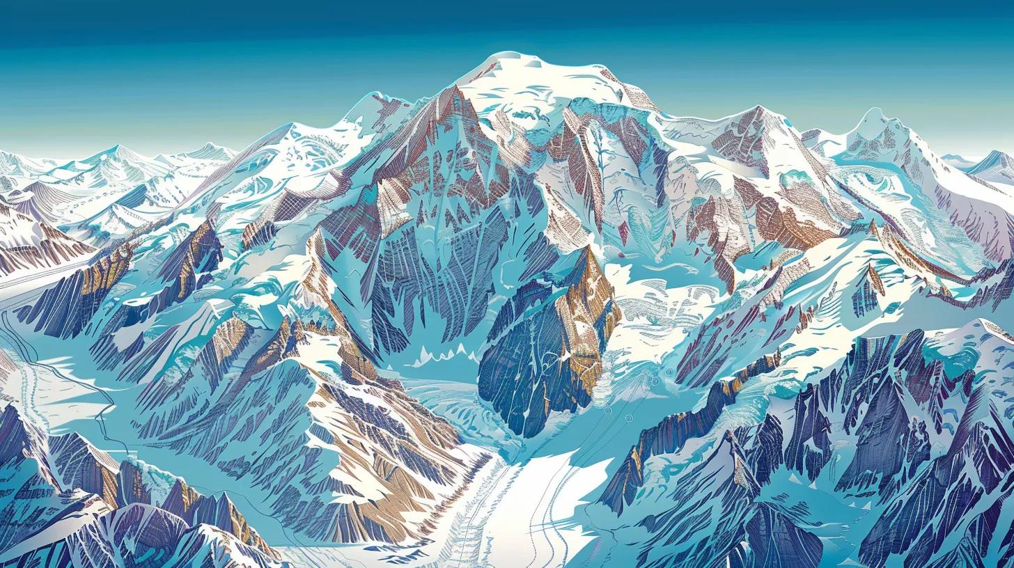
    Illustrative map of Denali's climbing routes, showcasing West Buttress, Muldrow, and Cassin paths

    Denali offers several routes, each with its unique challenges and characteristics. Understanding these routes is crucial for selecting the best path for your climbing experience.

    West Buttress Route

    The West Buttress Route is the most popular and frequently climbed path to the summit of Denali. This route is known for its relatively straightforward ascent, making it accessible for climbers with moderate experience. The climb typically takes around 14 to 21 days, depending on weather conditions and climber acclimatization. However, climbers should be prepared for significant altitude and weather challenges, including crevasses and high winds.

    Muldrow Route

    The Muldrow Route is less traveled and offers a more remote experience. This route requires advanced mountaineering skills due to its technical sections and navigation challenges. Climbers can expect to spend approximately 10 to 16 days on this route, which features stunning views but also demands a higher level of self-sufficiency and route-finding ability.

    Cassin Route

    The Cassin Route is one of the most technical and challenging paths on Denali, suitable for experienced climbers. This route features steep ice and rock sections, requiring advanced climbing techniques and equipment. The ascent typically takes around 10 to 14 days, and climbers must be prepared for extreme weather conditions and potential hazards.

    Necessary Permits

    Climbing Denali requires specific permits to ensure safety and environmental protection. Understanding the permit process is essential for a successful expedition.

    • Denali Climbing Permit: Required for all climbers attempting to summit Denali.
    • Backcountry Permit: Necessary for camping in backcountry areas.
    • Special Use Permit: Required for commercial guiding services or special events.

    Obtaining these permits involves an application process that includes fees and deadlines. It is crucial to plan ahead and ensure all necessary permits are secured before your expedition.

    Preparation Strategies
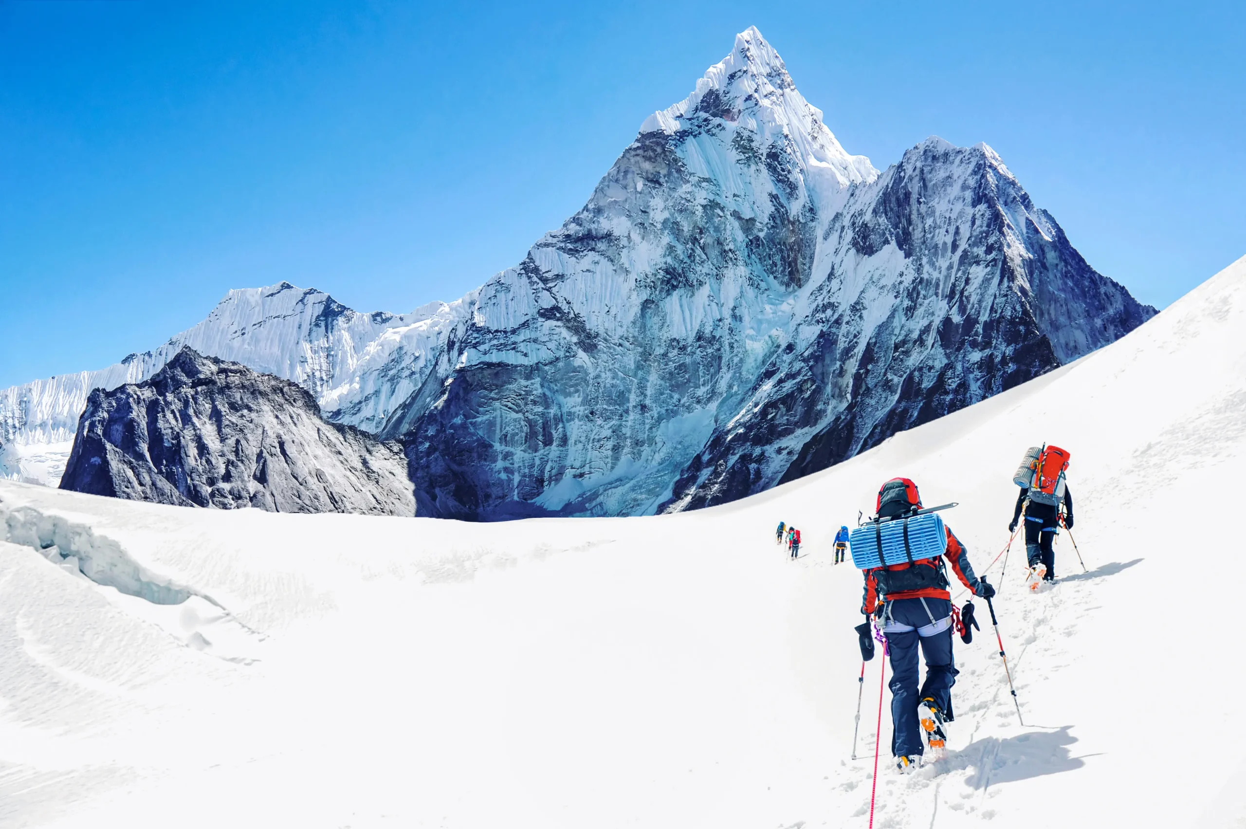
    Climbers training for Denali expedition, showcasing physical preparation and determination

    Preparing for a Denali expedition involves both physical training and logistical planning. Here are some key strategies to consider:

    • Physical Training: Engage in a rigorous training regimen that includes cardiovascular exercises, strength training, and endurance activities. Focus on building leg strength and aerobic capacity to handle the demands of high-altitude climbing.
    • Gear Preparation: Invest in high-quality gear suitable for extreme conditions. Essential items include mountaineering boots, crampons, ice axes, and appropriate clothing layers to protect against cold and wind.
    • Emergency Preparedness: Familiarize yourself with emergency protocols and carry essential safety equipment, such as a first aid kit, communication devices, and navigation tools.

    Safety Considerations

    Safety is paramount when climbing Denali. Climbers must adhere to regulations and implement effective communication strategies within their teams. Key safety measures include:

    • Regulations to Follow: Abide by all park regulations and guidelines to minimize environmental impact and ensure safety.
    • Team Communication: Establish clear communication protocols among team members to enhance coordination and decision-making during the climb.
    • Risk Mitigation Strategies: Be aware of potential hazards, such as avalanches and crevasses, and develop contingency plans to address these risks.

    What Are the Main Denali Climbing Routes and Their Challenges?

    The main climbing routes on Denali include the West Buttress, Muldrow, and Cassin routes. Each presents unique challenges, from technical climbing on the Cassin Route to the more accessible West Buttress. Understanding these challenges is crucial for selecting the appropriate route based on your skill level and experience.

    How Does the West Buttress Route Compare to Other Paths?

    The West Buttress Route is favored for its relative ease compared to the Muldrow and Cassin routes. While it still poses significant challenges, such as altitude and weather, it is generally more manageable for climbers with moderate experience. In contrast, the Muldrow Route requires advanced navigation skills, and the Cassin Route demands technical climbing expertise.

    What Are the Characteristics of the Muldrow Glacier Route?

    The Muldrow Glacier Route is characterized by its remote setting and technical challenges. Climbers must navigate complex terrain and be prepared for self-sufficiency. This route offers stunning views but requires a higher level of skill and experience compared to the West Buttress Route.

    How Do You Obtain and Manage Denali Climbing Permits?

    Obtaining Denali climbing permits involves a structured application process. Climbers must submit their applications well in advance, paying attention to deadlines and fees. Managing these permits effectively is crucial for ensuring compliance with park regulations and a smooth climbing experience.

    What Is the Official Permit Application Process?

    The official permit application process includes submitting an application form, paying the required fees, and providing details about your climbing plans. It is essential to follow the guidelines provided by the National Park Service to ensure your application is processed without delays.

    What Are the Permit Requirements and Restrictions?

    Permit requirements include providing information about your climbing team, planned route, and expected duration of the climb. Restrictions may apply based on the time of year and the number of climbers allowed on specific routes.

    How Should You Prepare Physically and Logistically for a Denali Expedition?

    Preparing for a Denali expedition requires a comprehensive approach that includes both physical training and logistical planning. Climbers should focus on building endurance and strength while also ensuring they have the necessary gear and supplies for their journey.

    What Training Regimens Best Prevent Altitude Sickness?

    Training regimens should include acclimatization hikes at high altitudes to help your body adjust to lower oxygen levels. Gradually increasing your elevation during training can significantly reduce the risk of altitude sickness during the climb.

    How to Plan Base Camp Logistics and Expedition Duration?

    Planning base camp logistics involves determining the best locations for setting up camps along your route. Consider factors such as water sources, shelter from the elements, and proximity to climbing routes when selecting your base camp sites.

    What Gear and Safety Protocols Are Essential for Climbing Denali?

    Essential gear for climbing Denali includes high-quality mountaineering equipment, clothing layers, and safety gear. Safety protocols should be established to address potential hazards and ensure effective communication among team members. intermediate climbing guide

    What Safety Measures Mitigate Risks on Denali?

    Safety measures include adhering to park regulations, maintaining clear communication, and being aware of environmental conditions. Regularly assessing risks and adjusting plans accordingly can help mitigate potential dangers during the climb.

    How Do Weather and Environmental Conditions Affect Denali Climbing?

    Weather and environmental conditions play a significant role in the success of Denali climbs. Climbers must be prepared for rapidly changing weather patterns and understand how these conditions can impact their ascent.

    What Are Typical Weather Patterns and Their Impact on Expeditions?

    Typical weather patterns on Denali include extreme cold, high winds, and sudden storms. These conditions can significantly affect climbing schedules and safety, making it essential for climbers to monitor forecasts and be prepared for changes.

    How Is Climate Change Influencing Climbing Windows and Safety?

    Climate change is altering weather patterns and glacial conditions on Denali, potentially impacting climbing windows and safety. Climbers should stay informed about these changes and adjust their plans accordingly to ensure a safe expedition.

    Recent research provides specific insights into how Denali’s weather patterns are evolving, offering valuable context for climbers.

    Denali Weather & Climate: Climbing Season Trends

    An overview of climatological and meteorological conditions and their seasonal variability in the Denali summit region is presented, based on the NCEP–NCAR reanalysis 1 dataset for the 1948–2018 period. The number of very cold days (<−35°C) during the climbing season (April–July) has decreased by approximately a day per decade. The number of very windy days (≥20 m s−1) during the climbing season also shows a decreasing trend for the majority of the time series.

    The mountain weather and climate of Denali, Alaska—

    An overview, L Hartl, 1948

    What Are the Options for Guided Denali Expeditions and Professional Support?

    For those seeking additional support, guided Denali expeditions offer a structured approach to climbing the mountain. Professional guides provide expertise and assistance, enhancing the overall experience for climbers.

    How to Choose a Certified Denali Expedition Operator?

    When selecting a certified Denali expedition operator, consider factors such as experience, safety records, and client reviews. A reputable operator will have a proven track record of successful climbs and a commitment to safety.

    What Are the Benefits of Guided Climbs Versus Independent Ascents?

    Guided climbs offer several advantages, including expert guidance, logistical support, and enhanced safety measures. Independent ascents provide a sense of adventure and self-sufficiency but require a higher level of preparation and experience.

    To ensure a successful climb, consider using trip planning resources to help organize your expedition.

    Many climbers find that gear and safety are paramount for a successful and safe ascent. Proper equipment and knowledge can significantly reduce risks.

    For those interested in exploring other peaks, mountain guides can provide valuable insights and support.

    Climbing Denali requires careful planning and preparation. If you need assistance, consider reaching out through our contact page for expert advice.

    Was this helpful?

    Yes
    No
    Thanks for your feedback!
  • Language »