
Last updated September 10, 2026
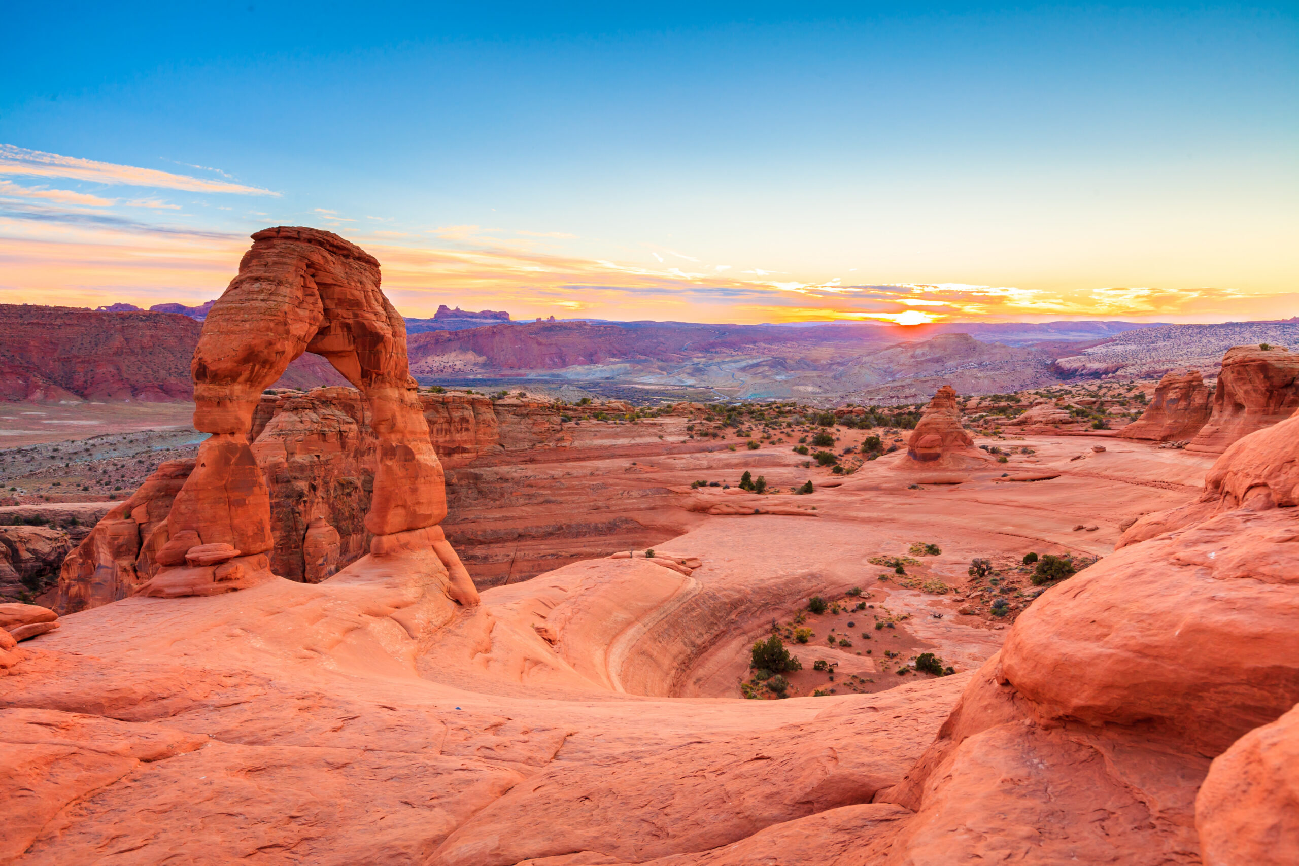
Delicate Arch Hiking Guide: Trail, Parking, Heat & Best Time
For most visitors, sunrise is the smartest time to hike Delicate Arch. You get cooler temperatures, easier parking and fewer people. Sunset gives the classic warm light—but it is also the busiest time, and you will hike back in the dark. The full trail starts at Wolfe Ranch and climbs exposed slickrock with almost no shade.
Is Delicate Arch Worth the Hike?
Yes—especially if this is your first visit to Arches. Delicate Arch is the park’s signature hike because the trail gives you the full Moab desert experience: Wolfe Ranch history, Ute petroglyphs, a long slickrock climb, open desert views and the arch itself appearing only at the end.
The main planning mistake is treating the route like an easy three-mile walk. NPS rates it strenuous because of heat, exposed slickrock, steady climbing, little shade and a narrow ledge near the arch.
Delicate Arch Trail Step by Step
| Section | What to expect | Planning note |
|---|---|---|
| Wolfe Ranch | Trailhead, historic cabin, toilets | No drinking water |
| Petroglyph spur | Short detour to Ute rock imagery | Worth adding on first visit |
| Lower trail | Dirt path and gradual climbing | Easy warm-up |
| Slickrock slab | Long exposed sandstone ascent | Follow cairns / markers carefully |
| Final ledge | Narrow rock ledge for ~200 yards | Can be icy in winter |
| Delicate Arch bowl | Arch appears suddenly at the end | Busy near sunset |
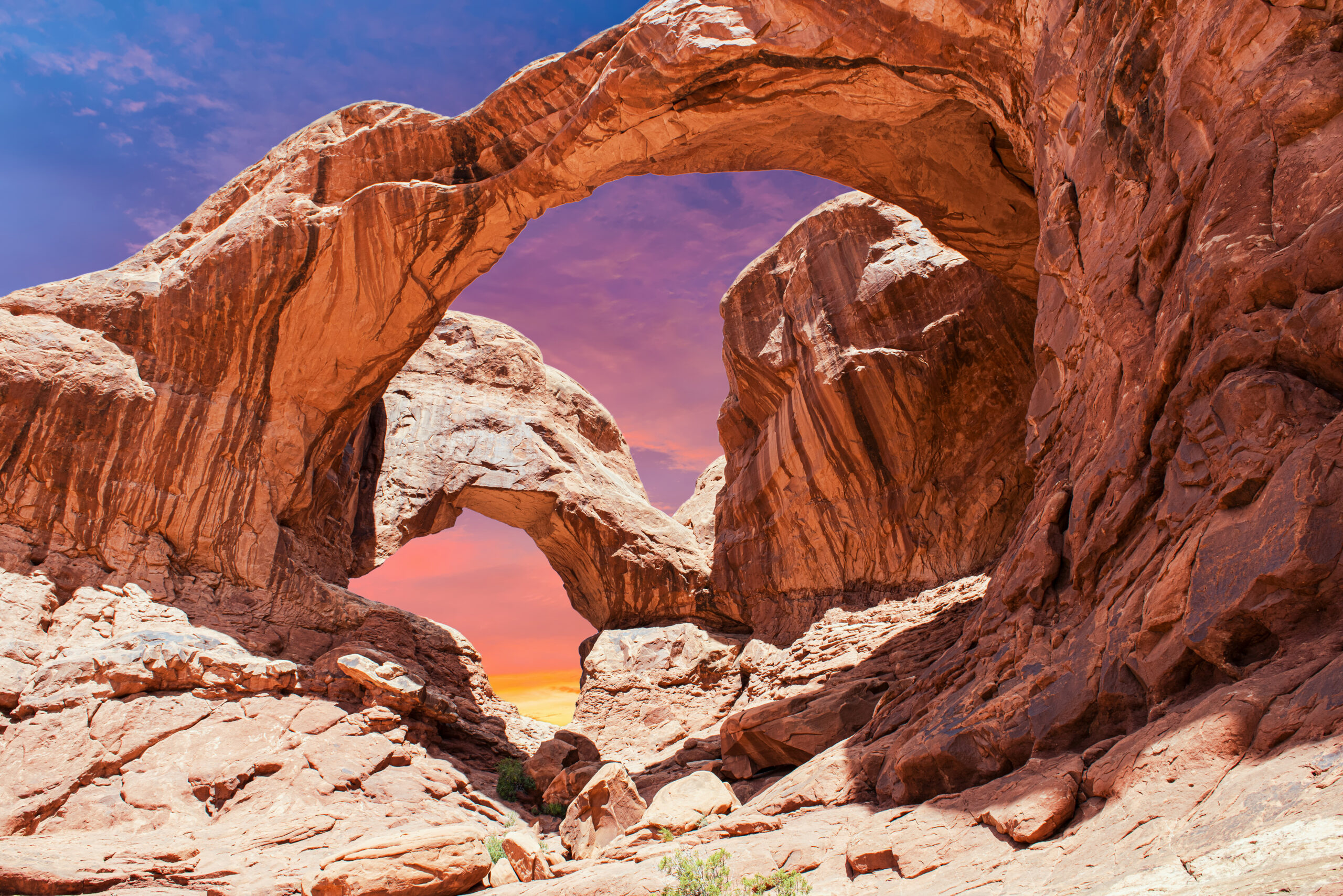
You Do Not See Delicate Arch Until the End.
The trail spends most of its mileage on open desert and slickrock. The final turn onto the ledge is what makes the first full view of the arch feel much larger than the mileage suggests.
Where Do You Park for Delicate Arch?
The full hike starts at the Wolfe Ranch parking lot, about 13 miles from the Arches entrance. NPS lists 157 total spaces, including oversized spaces, but that does not mean parking is easy all day.
Sunset is the pressure point. NPS notes that hundreds of people can gather at Delicate Arch at sunset, and the Wolfe Ranch lot can fill on busy days. If you have a fixed sunset plan, give yourself a large parking margin rather than timing arrival to the minute.
Early Morning
Arriving early solves heat and parking at the same time.
Sunset Window
Parking and trail traffic both rise sharply.
Do Not Wait in Roadways
If a lot is full, NPS says move on and try again later rather than blocking traffic.
Not the Same Hike
Lower/Upper Delicate Arch Viewpoints give distant views but do not replace the full Wolfe Ranch trail.
Sunrise vs Sunset at Delicate Arch
| Time | Advantages | Tradeoffs |
|---|---|---|
| Sunrise | Cooler, easier parking, fewer hikers | Classic sunset glow is absent |
| Early morning | Best balance for most hikers | Still need early alarm / drive |
| Midday | Potentially fewer photography crowds | Worst heat; not recommended in summer |
| Sunset | Classic warm light and atmosphere | Biggest crowds, parking pressure, dark return |
My default recommendation: sunrise or early morning. Sunset is worth it when photography and atmosphere matter more than solitude, but you should carry a headlamp for every person and expect a crowded arch bowl.
How Hard Is the Delicate Arch Hike?
| Factor | What it means |
|---|---|
| Distance | Only 3 miles RT, but distance understates the effort |
| Climbing | About 538 ft of elevation change |
| Surface | Extended open slickrock ascent |
| Shade | Essentially none |
| Exposure | Final narrow ledge may bother hikers uncomfortable with heights |
| Navigation | Cairns / trail markers matter on open slickrock |
For a fit hiker in cool weather, the route feels moderate. In 95°F+ heat, with poor hydration or during an icy winter morning, the same three miles can feel much harder.
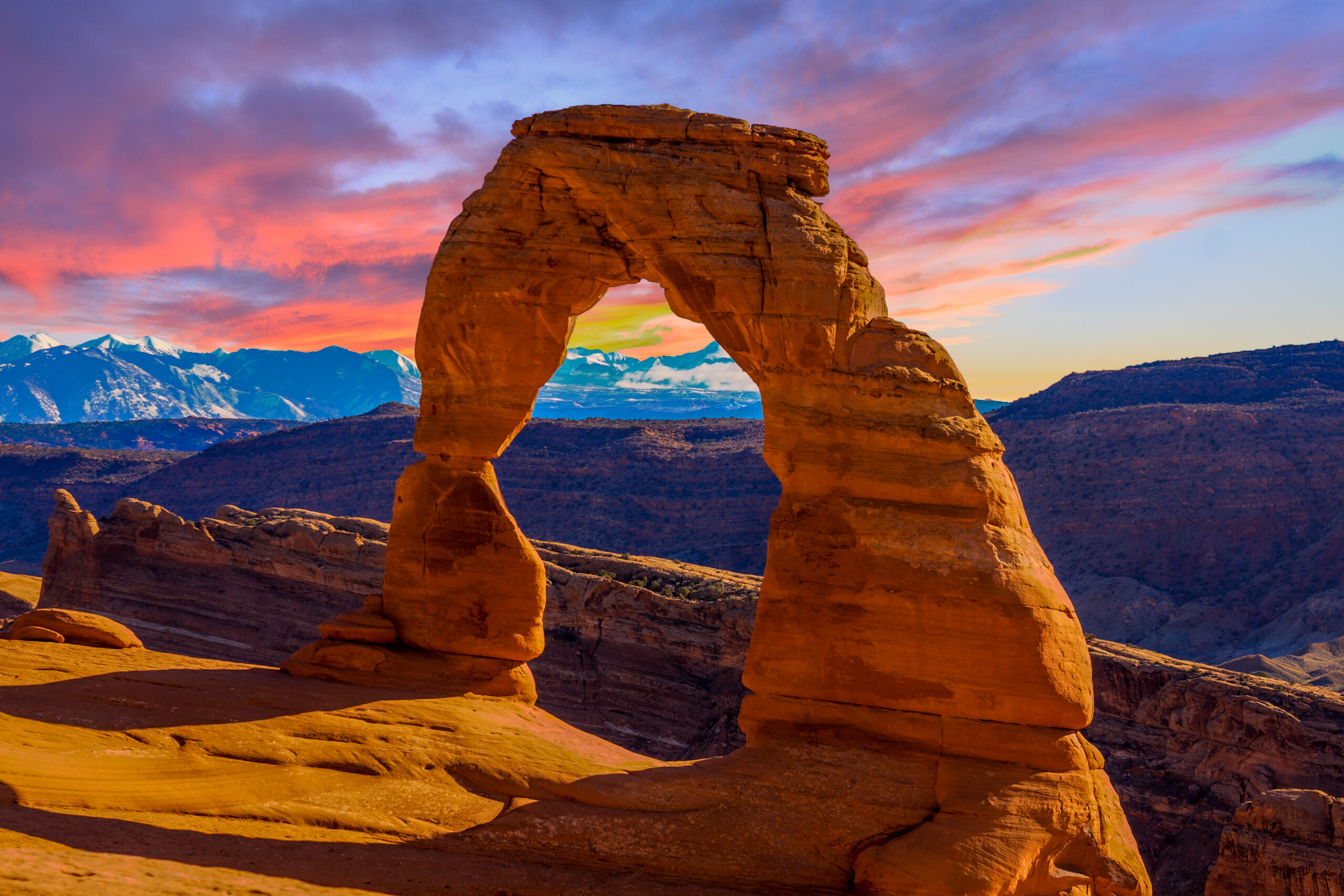
The Weather Changes the Difficulty More Than the Mileage Does.
Three miles in cool spring air is not the same hike as three miles of exposed slickrock in July heat.
Heat, Water & Sun Exposure
There is no drinking water at Wolfe Ranch. NPS recommends carrying at least 2 quarts / 2 liters per person. That should be treated as a floor, not a guarantee that you will be comfortable on a hot summer afternoon.
Go Before the Heat
Early morning is the simplest safety improvement you can make.
Carry It From Moab
Do not arrive expecting a refill at Wolfe Ranch.
No Shade Strategy
Hat, sunscreen and breathable coverage matter because the route crosses open slickrock.
Heat Counts as a Condition
If someone is fading before the main slickrock climb, turning around is the correct decision.
Can You Hike Delicate Arch in Winter?
Yes, but the main issue changes from heat to traction. The final rock ledge is frequently icy in winter, and snow or frozen moisture on slickrock can make the route much more serious than normal.
NPS recommends carrying traction devices for icy conditions. If the final ledge is glazed or you are uncomfortable with the exposure, turn around rather than treating the arch as mandatory.
How to Build Delicate Arch Into an Arches Day
| Timing | Plan |
|---|---|
| Sunrise | Delicate Arch full hike |
| Late morning | Windows + Double Arch short walks |
| Midday | Visitor center, scenic drive, lunch / heat break |
| Late afternoon | Short viewpoint or Park Avenue depending temperature |
If Delicate Arch is your sunset hike, reverse the day: use easy trails in the morning, take a long midday heat break, then arrive at Wolfe Ranch with extra parking margin and carry headlamps for the return.
Delicate Arch Hiking FAQ
How long is the Delicate Arch hike?
3 miles round trip and usually 2–3 hours.
How much elevation gain?
NPS lists about 538 feet of elevation change on the full Wolfe Ranch route.
Where do I park?
Wolfe Ranch, about 13 miles from the park entrance. NPS lists 157 spaces.
Sunrise or sunset?
Sunrise for cooler temperatures, easier parking and smaller crowds. Sunset for classic warm light, but expect far more people.
Is it hard?
NPS rates it strenuous because of slickrock climbing, exposure, no shade and the final narrow ledge.
Is there water at Wolfe Ranch?
No. Carry at least 2 quarts / 2 liters per person.
Can I hike it in winter?
Yes, but icy slickrock and the final ledge may require traction devices.
Do I need a reservation in 2026?
No Delicate Arch trail reservation is required, and Arches has no advanced timed-entry requirement in 2026.
Beat the Heat and the Parking Lot at the Same Time.
For most hikers, an early start is the best decision on the page. It makes the same trail cooler, quieter and easier to access.
Arches: Plan the Whole Climb
Permits, routes, difficulty, weather and logistics all decide the day. Start with the main guide, then go deeper below.
Was this helpful?
Global Summit Guide is an independent mountaineering resource founded in 2026. The team combines first-hand trekking and climbing experience with in-depth research and professional health and nutrition review to help climbers choose objectives, prepare properly, and stay safe.
Health, altitude, and nutrition content is reviewed by Taylor Ludlow (Registered Nurse) and Brigg Hoopes (Nutritionist).
What We Don't Know Yet
Mountain information changes quickly. This box explains the limits of what this page can responsibly promise.
- Visa, passport, vaccination, border, insurance, and local transportation rules may change before your trip.
- Route conditions, snowpack, closures, and weather can change quickly after this page is updated.
- Permit rules, fees, quotas, and reservation windows may change between review cycles.
- Operator availability, pricing, guide ratios, and cancellation terms can change by season.
- Your fitness, altitude response, risk tolerance, and experience level may change what is safe or realistic.
Verify current conditions with official land managers, guide services, local forecasts, and current route reports before booking or climbing.
Mountaineering, rock and ice climbing, glacier travel, and high-altitude activity are inherently dangerous and can result in serious injury or death. The information on Global Summit Guide is provided for general informational and educational purposes only and is not a substitute for professional instruction, qualified guiding, proper equipment, or your own judgment and experience.
Route conditions, weather, snowpack, permits, regulations, and hazards change constantly and may differ from what is described here. Details may be incomplete, out of date, or contain errors. Always verify current information with local authorities, certified guides, and official sources before making any decision in the mountains.
Nothing on this site is medical, legal, or financial advice. Our fitness, acclimatization, altitude, and nutrition content is general in nature; consult a qualified physician before beginning any strenuous exercise program or exposing yourself to high altitude.
You are solely responsible for your own safety and decisions. To the fullest extent permitted by law, Global Summit Guide and its team accept no liability for any loss, injury, damage, or expense arising from use of, or reliance on, this information. By using this site you acknowledge these risks and accept these terms.
Some links on this site may be affiliate links. If you buy through them we may earn a small commission at no extra cost to you; this never affects our recommendations.
Global Summit Guide recommendation path
Next Best Mountain to Research
Use these recommendations to continue the right planning path instead of stopping on one page.
Use current permit, weather, route, and operator information before booking or climbing.
Search Flights, Hotels & Rental Cars
Have the mountain or destination picked? Use Expedia to compare the flights, lodging and rental cars that fit your actual trip dates. For mountain travel, consider arriving early enough for delays and adding a buffer night after the climb before a fixed flight home.
Compare current flight, hotel and car options.
Affiliate disclosure: Global Summit Guide may earn a commission if you book through this link, at no additional cost to you.