Global Summit Guide logo featuring mountain imagery, symbolizing hiking and mountaineering resources for trip planning and safety.

Category: Comparisons

  • Mount Baker vs Mount Rainier: Which Should You Climb First?

    Snow-covered Mount Baker in Washington Glaciated Mount Rainier in Washington
    Home› Comparisons› Mount Baker vs Mount Rainier
    Washington glacier progression · current 2026 permits & pricing

    Mount Baker vs Mount Rainier: Which Should You Climb First?

    Mount Baker and Mount Rainier are both serious glaciated volcanoes, but they play different roles in a climber’s progression. Baker is usually the cleaner first glacier classroom. Rainier adds more altitude, more vertical gain, larger glacier systems, higher permit complexity and a substantially bigger summit day. A guided beginner can start on either—but an independent climber should not use Rainier as the place to learn glacier systems for the first time.

    NPS 2026 Rainier fees verified Current Baker route data checked No invented summit-success odds
    Baker: Anabmap · CC BY-SA 4.0 · Rainier: Stan Shebs · CC BY-SA 3.0
    10,781 ftMount Baker
    14,410 ftMount Rainier
    ~7,200–7,500 ftBaker gain
    ~9,000 ftRainier gain
    $1,200Baker guide example
    $82Rainier climbing fee
    The direct answer

    Which Should Climbers Tackle First: Mount Baker or Rainier?

    Mount Baker is usually the better first independent glacier objective. The Easton Glacier and Coleman-Deming routes teach rope-team movement, crampon use, crevasse awareness, snow camping and glacier pacing at 10,781 feet rather than 14,410 feet. That leaves more mental and physical margin for learning.

    Mount Rainier is the bigger total objective. The standard Disappointment Cleaver climb starts near 5,400 feet at Paradise and gains roughly 9,000 vertical feet to Columbia Crest. It adds higher altitude, larger crevasses, more complex route changes, steeper upper-mountain terrain and a formal National Park Service climbing-registration system.

    But “Baker must come first” is too absolute. International Mountain Guides explicitly describes both Baker’s Easton Glacier and Rainier’s Disappointment Cleaver as novice routes within its instructional guided programs. A highly fit beginner who chooses a legitimate guide service can therefore make Rainier a first glacier climb. The distinction is guided instruction versus independent competence.

    Best first independent glacier climbMount Baker
    Bigger altitude objectiveMount Rainier
    Guided novice pathwayEither can work
    Build toward DenaliBaker → Rainier is a strong sequence
    Do not convert this progression into a fake probability. Climbing Baker first does not convert Rainier into a reliable personalized summit probability. Baker can improve glacier skills, systems familiarity and pacing, but Rainier outcomes still depend on weather, current glacier conditions, fitness, altitude response, team performance and turnaround decisions.
    Side-by-side answer

    Mount Baker vs Mount Rainier at a glance

    The standard-route comparison matters most. Advanced routes on both mountains can be dramatically harder than the routes described here.

    FactorMount BakerMount RainierPlanning meaning
    Elevation10,781 ft / 3,286 m14,410 ft / 4,392 mRainier adds a major altitude variable.
    Standard beginner routesEaston Glacier; Coleman-DemingDisappointment Cleaver via Camp MuirAll require real glacier systems.
    Approx. route distanceEaston ~15 mi; Coleman-Deming ~11 miMore than 10 mi on standard summit routes; exact glacier line changesMileage alone understates Rainier’s scale.
    Total ascent~7,500 ft Easton; ~7,175 ft Coleman-Deming~9,000 ft from ParadiseRainier requires more vertical and higher-altitude work.
    Typical guided duration3 days on IMG Easton example3½ days on IMG DC exampleSimilar calendar length; different physical scale.
    Glacier characterExcellent instructional glacier terrainLarger, more complex active glacier systemBaker gives more learning margin.
    Upper-route cruxRoman Wall on Easton/Coleman-Deming finishChanging DC / upper glacier route above ~11,500 ftBoth change by season; Rainier is more committing.
    Climbing feeNo Rainier-style summit fee; verify USFS trailhead/pass rules$82 per climber in 2026Rainier has a formal climbing fee and registration system.
    Overnight permitVerify route-specific Mount Baker Wilderness/camping rules$12 pp/night wilderness permit + applicable $6 reservation feeRainier logistics are more structured.
    Current guided price example$1,200 IMG Easton, 3 days$2,995 peak / $2,595 non-peak IMG DC, 3½ daysRainier generally costs materially more.
    Best progression roleFirst true glacier classroomMajor glacier expeditionBaker → Rainier is the cleaner independent progression.
    Location & geographic context

    Where are Mount Baker and Mount Rainier?

    Both are Washington Cascade volcanoes, but they occupy very different parts of the state. Baker is near the Canadian border; Rainier rises south of the Seattle–Tacoma region.

    Regional orientation only—not route navigation. Pin positions are approximate geographic overlays. Map data © OpenStreetMap contributors.
    Mount BakerNorth Cascades volcanoNear the Canadian border; standard access varies between south-side Easton and north-side Coleman-Deming trailheads.
    Mount RainierSouth-central WashingtonAbout 65 miles southeast of the Seattle–Tacoma metropolitan area according to NPS.
    Same state, different logisticsTwo separate tripsBaker uses U.S. Forest Service access; Rainier is inside Mount Rainier National Park.
    Training sequenceEasy to combine in one seasonCommercial seven-day Baker–Rainier seminars demonstrate the geographic and training logic of the pairing.
    Mount Baker summit seen through a glacier crevasse
    Why Baker is such a useful first glacier mountain

    The glacier is not scenery—it is the skill system.

    Easton and Coleman-Deming are genuine roped glacier climbs. Climbers still need to understand spacing, crevasse awareness, crampon movement, ice-axe use, rope-team communication and rescue systems. The advantage is not that Baker removes glacier hazard. It is that the standard routes provide those lessons at lower altitude and smaller overall scale than Rainier.

    Mount Baker from a crevasse · Muddymorn · CC BY-SA 3.0.
    Difficulty comparison

    Rainier is the larger standard-route objective—but Baker is not a walk-up

    Both mountains require glacier judgment. Rainier adds more altitude, vertical gain and upper-mountain complexity.

    Mount Baker
    Easton / Coleman-Deming

    American Alpine Institute lists Easton at roughly 15 miles round trip with 7,500 feet of gain and Coleman-Deming at roughly 11 miles with 7,175 feet of gain. Easton is especially well suited to first-time glacier travelers; Coleman-Deming offers more crevasse and serac character.

    • Lower summit altitude reduces one major variable.
    • Real crevasse navigation and rope-team travel.
    • Roman Wall adds a steeper upper-mountain finish.
    • Excellent environment for learning systems deliberately.
    Mount Rainier
    Disappointment Cleaver

    Rainier rises 14,410 feet and requires roughly 9,000 vertical feet from Paradise to the summit. NPS route briefs emphasize that the glacier line changes as crevasses open and can push climbers near icefall or rockfall exposure. The upper mountain is not a static trail.

    • Substantially higher altitude.
    • Larger active glacier environment.
    • Longer exposure to objective hazards.
    • High-camp logistics and a consequential descent.
    Important route distinction: this comparison uses Baker’s standard Easton/Coleman-Deming routes and Rainier’s standard Disappointment Cleaver route. Baker’s North Ridge or Coleman Headwall can be more technically difficult than the DC. Mountain difficulty belongs to a route—not just a summit name.
    Standard-route anatomy

    What the climbing actually feels like

    Both routes start with hiking and camping, then change into roped glacier movement before the final summit terrain.

    StageMount Baker — EastonMount Rainier — Disappointment Cleaver
    ApproachSchreiber’s Meadow → Park Butte / Railroad Grade → Sandy Camp areaParadise → Muir Snowfield → Camp Muir
    Glacier entryRoped Easton Glacier travel from campCowlitz Glacier, Cathedral Gap and Ingraham / DC system
    Route findingCrevasses dictate the line; broad glacier generally supports instructionUpper route is actively reconstructed around crevasses and objective hazards
    Steep finishRoman Wall can approach steep snow/ice angles and may be firmCleaver and upper glacier terrain; exact line varies by season
    Summit environmentBroad summit plateau at 10,781 ftCrater rim and Columbia Crest at 14,410 ft
    Descent problemReverse long glacier route as surfaces softenReverse complex glacier terrain while more hypoxic and fatigued
    South side of Mount Baker showing its glaciers and upper mountain

    Baker’s glacier classroom

    The mountain carries large active glaciers despite its lower elevation. That is exactly why it works so well as a skill-building objective. Walter Siegmund · CC BY-SA 3.0.

    Nisqually Glacier on Mount Rainier

    Rainier’s scale is visible from below

    Rainier is the most glaciated peak in the contiguous United States. The standard DC route uses different glaciers, but Nisqually illustrates the mountain’s overall ice scale. Walter Siegmund · CC BY-SA 3.0.

    Skills comparison

    What Baker teaches—and what Rainier assumes or intensifies

    A guide service can teach beginner systems on either mountain. Independent teams need a very different baseline.

    Rope-team travel

    Core skill on both mountains

    Spacing, communication, pace and arrest response belong to both objectives. Baker provides a lower-altitude environment for learning how a glacier team functions before adding Rainier’s bigger scale.

    Crevasse rescue

    Knowledge is not competence

    Independent climbers should have practiced arrest, anchors, load transfer and haul systems hands-on. Reading a rescue article or watching a video does not prepare a rope team to improvise under stress.

    Crampons & axe

    Basic technique must become automatic

    Both standard routes require efficient crampon movement and ice-axe handling. Rainier gives less margin for clumsy transitions once fatigue and altitude accumulate.

    Navigation

    Tracks are not a route plan

    Cloud, snow, darkness and moving crevasses can erase the visual cues used on ascent. Rainier’s NPS route briefs specifically emphasize route-finding problems in heavily crevassed terrain.

    Camp systems

    Comfort affects summit-day performance

    Wind, cold, hydration, food and sleep management matter on both. Rainier often asks climbers to make a very large summit push after limited high-camp recovery.

    Turnaround judgment

    The transferable skill that matters most

    Baker is useful training only if the climber learns to evaluate pace, weather, route condition and team function—not merely collects a summit before attempting Rainier.

    Guided beginner nuance: IMG currently describes both Easton Glacier and Disappointment Cleaver as novice routes within instructional programs. That does not mean an unguided beginner should step onto either glacier without training. Guided instruction changes the support system, supervision and decision ownership.
    Climbers practicing ice climbing on Mount Rainier
    Training is part of the objective

    A Rainier summit is not evidence that every glacier skill was learned.

    A guided climber can safely participate while the guides own many route-finding and rescue decisions. Climbers who want to become independent should judge progression by the systems they can perform reliably—not simply by whether they stood on a summit.

    Ice climbing on Rainier · Erik Charlton · CC BY 2.0.
    Fitness & altitude

    Rainier adds a different kind of fatigue

    Baker is strenuous. Rainier combines strenuous movement with substantially greater hypoxic stress.

    Mount Baker

    Long summit day, lower altitude ceiling

    IMG describes Easton summit day as roughly 10 hours round trip from camp. AAI places the route around 7,500 total vertical feet from trailhead to summit. Climbers still need strong uphill endurance, pack-carrying capacity and enough reserve to descend safely.

    At 10,781 feet, Baker can still produce altitude symptoms, but it does not expose the climber to the same 12,000–14,000-foot work zone that dominates Rainier’s upper mountain.

    Mount Rainier

    More vertical at substantially higher altitude

    NPS describes summit routes as more than 9,000 vertical feet and more than 10 miles. The standard climb divides that work across approach and summit days, but summit morning occurs after sleeping high and then moving for hours in thin air.

    Fitness therefore has to be durable rather than explosive: climb efficiently with a pack, recover at camp, move through the night and preserve enough concentration for a long technical descent.

    Use Baker as an assessment, not a certificate. If Baker exposes weak pack fitness, poor foot care, slow rope transitions, anxiety around crevasses or inadequate recovery, fix those problems before Rainier. A summit does not cancel the lessons the climb revealed.
    2026 permit systems

    Rainier is much more administratively structured

    The two peaks sit under different land managers. Do not transfer Rainier rules to Baker—or vice versa.

    RequirementMount BakerMount Rainier
    Land managerMount Baker-Snoqualmie National Forest / Mount Baker WildernessMount Rainier National Park
    Separate climbing feeNo Rainier-style federal summit fee on standard Baker climbs$82 per person per climb in 2026
    Climbing registrationVerify current USFS route/trailhead requirementsRequired; NPS says registration remains required after fee payment
    Overnight campingFollow current Mount Baker Wilderness and site-specific camping rulesWilderness permit required
    2026 overnight feeVerify current trailhead/pass/camping requirements$12 per person per night + applicable $6 reservation fee
    Commercial guidingGuide company must hold applicable USFS authorizationOnly NPS-authorized concession/CUA guide services may operate
    Before departure: check the specific Baker trailhead, road and recreation-pass status with the Forest Service. For Rainier, verify the climbing fee, wilderness reservation, ranger-station registration procedure and current route/camp status with NPS. Permit rules can change after publication.
    Current guided-price examples

    Baker is also the lower-cost training investment

    These are dated examples from one guide company, not universal market prices. Compare inclusions and instruction—not just the headline number.

    ProgramPublished 2026 priceLengthClient : guideWhat it shows
    IMG Mount Baker Easton Glacier$1,2003 days3:1Lower-cost entry to guided glacier instruction and summit experience.
    IMG Mount Rainier DC$2,995 peak / $2,595 non-peak3½ days2:1Higher guide ratio and larger objective substantially increase cost.
    IMG Baker + Rainier Seminar$3,7957 days3:1 Baker / 2:1 RainierPurpose-built progression: train on Baker, then apply systems on Rainier.

    Guide prices checked September 2026 and are subject to change. Rainier park fees, personal equipment, travel, lodging before/after the climb and insurance may be separate depending on the program.

    Season & route evolution

    Both are summer glacier mountains—but “summer” is not one condition

    Glacier routes change as snow bridges thin, crevasses widen and exposed ice or rock increases.

    Late spring

    More snow coverage

    Routes may be more direct, but weather can be less settled and avalanche or new-snow concerns can remain. Snow bridges may hide crevasses rather than eliminate them.

    Early to mid-summer

    Primary standard-route window

    Most guided Baker and Rainier standard-route schedules cluster here. Route infrastructure and bootpack traffic may be well established, but objective hazards remain.

    Late summer

    Crevasse complexity increases

    Glaciers open, bridges weaken and routes can become longer or more circuitous. Baker and Rainier both require current route reports rather than reliance on an old GPX track.

    Route condition outranks calendar. NPS explicitly notes that Rainier’s upper route changes as crevasses evolve. Baker’s Easton and Coleman-Deming lines also change through the season. Choose dates with an operator or experienced team based on the current route—not merely historical averages.
    Decision framework

    Which should you climb first?

    The useful answer depends on support model and what you want to learn—not a universal “winner.”

    Choose Baker first when

    You want to build glacier competence.

    • You plan to climb Rainier independently later.
    • You want hands-on time with rope teams and crevasse systems.
    • You prefer learning below 11,000 feet before adding major altitude.
    • You want a lower-cost first guided glacier program.
    • You are building toward a larger progression such as Rainier → Denali.
    Choose Rainier first when

    You have the fitness and a legitimate instructional support system.

    • You are joining a guide program designed for first-time glacier climbers.
    • Your mountain fitness is already strong and tested.
    • You understand that the guide team will own many technical decisions.
    • Your immediate goal is the Rainier experience rather than independent glacier leadership.
    • You are comfortable paying more for a larger guided objective.
    Step 1

    Snow mountain

    Adams, St. Helens or equivalent: pacing, snow movement, early starts and weather discipline.

    Step 2

    Glacier instruction

    Hands-on rope travel, crampons, ice axe, anchors and crevasse rescue with a qualified instructor.

    Step 3

    Mount Baker

    Apply the systems on Easton or Coleman-Deming and learn what still breaks down when tired.

    Step 4

    Mount Rainier

    Add altitude, larger glacier systems, heavier logistics and a more consequential summit day.

    This is a progression framework, not a gatekeeping rule. Guided climbers can compress the sequence because professional instruction and route leadership change the support model. Independent teams should be much more conservative about what skills are already functional before stepping onto Rainier.
    Mount Rainier's heavily glaciated upper mountain from the west
    Why Rainier belongs later in an independent progression

    The mountain combines systems that Baker lets you learn separately.

    Rainier is not simply “Baker but taller.” The higher altitude, bigger vertical gain, denser glacier system, formal high-camp structure and changing upper route all interact. That combination is what makes Baker such useful preparation: it reduces one layer of complexity while the climber learns the glacier fundamentals.

    Mount Rainier from west · Stan Shebs · CC BY-SA 3.0.
    Summit odds & misleading percentages

    Why this page does not publish a Baker-vs-Rainier “success rate”

    A percentage is useful only when its population, dates, support model and counting rules are explicit.

    Different populations

    Guided clients are not all climbers.

    A guide-company summit percentage may describe screened clients on selected dates. It cannot automatically be compared with a park-wide number that includes independent parties.

    Different years

    Glacier seasons are not interchangeable.

    Route construction, weather, wildfire smoke, snowpack and crevasse geometry can make one season unusually favorable or unusually difficult.

    Different definitions

    “Attempt” can begin in different places.

    Some datasets count registered climbers, others summit-day departures, booked clients or people who reached high camp. Without one denominator, ranking the mountains by success rate creates false precision.

    Better question: does your team have enough fitness, glacier competence, weather margin and route-condition margin for the mountain in front of you? Baker experience can improve those inputs. It cannot convert them into a reliable personal Rainier percentage.
    Sources & verification

    What owns the current facts

    Official NPS pages own Rainier fee and permit rules. Current guide and route sources provide standard-route dimensions and dated program examples.

    NPS Disappointment Cleaver route brief

    Used for the route-change, crevasse, icefall, rockfall and upper-glacier context. The exact climbing line changes each season and current ranger/guide observations outrank a static route description.

    Disappointment Cleaver route brief

    American Alpine Institute — Mount Baker

    Current route summary used for Easton and Coleman-Deming distance, elevation gain, typical duration and beginner-route context.

    AAI Baker route comparison

    International Mountain Guides — Baker

    Current 2026 Easton Glacier program lists $1,200, three days and 3:1 client-guide ratio. IMG describes Easton and Coleman-Deming as novice routes suitable for beginners within its guided programs.

    International Mountain Guides — Rainier

    Current 2026 Disappointment Cleaver example lists $2,995 peak season / $2,595 non-peak, 3½ days and 2:1 client-guide ratio.

    IMG Rainier DC program

    IMG Baker–Rainier seminar

    The current seven-day $3,795 program is evidence for the progression logic—not for a summit guarantee. It teaches glacier travel and rescue on Baker before applying the systems on Rainier.

    IMG Baker–Rainier seminar

    Search-intent answers

    Mount Baker vs Mount Rainier FAQ

    The visible answers below match the FAQ schema.

    Should I climb Mount Baker or Mount Rainier first?

    For most climbers building independent glacier competence, Mount Baker is the cleaner first step. Its standard routes teach real rope-team glacier travel at lower altitude and smaller scale. A very fit beginner can also climb Rainier first inside a legitimate instructional guided program, so Baker is not an absolute prerequisite.

    Which is harder, Mount Baker or Mount Rainier?

    Rainier is the larger standard-route objective. It is 3,629 feet higher, requires roughly 9,000 vertical feet from Paradise and operates in a larger, more complex glacier environment. Baker still requires genuine glacier skills, and advanced Baker routes such as the North Ridge can be technically harder than Rainier’s DC.

    Is Mount Baker good training for Mount Rainier?

    Yes. Easton and Coleman-Deming are widely used to teach glacier travel, cramponing, rope-team systems and crevasse rescue. IMG’s current Baker–Rainier seminar explicitly uses Baker as the training and warm-up phase before moving to Rainier.

    Can a beginner climb Mount Rainier?

    A very fit beginner can climb Rainier through a legitimate instructional guided program. An independent Rainier team should already be competent in glacier travel, crevasse rescue, crampon and ice-axe use, navigation, weather decisions and expedition camping.

    How much does it cost to climb Baker versus Rainier?

    As current 2026 IMG examples, a three-day Baker Easton Glacier climb is $1,200. A 3½-day Rainier Disappointment Cleaver climb is $2,995 in peak season and $2,595 outside peak season. Rainier also carries the NPS climbing fee and wilderness permit costs.

    What permits are required for Mount Rainier?

    In 2026 the NPS climbing fee is $82 per climber. Climbers must also register. During the summer climbing season a wilderness permit is required; the current fee is $12 per person per night plus the applicable $6 Recreation.gov reservation fee.

    Does Mount Baker require a climbing permit?

    Baker does not use Rainier’s separate federal summit-fee system. Verify current Mount Baker-Snoqualmie National Forest trailhead recreation-pass, road, camping and Mount Baker Wilderness rules for the specific route and date before departure.

    Which Baker route is best before Rainier?

    The Easton Glacier is the cleanest first instructional route because it offers broad moderate glacier terrain before the Roman Wall finish. Coleman-Deming is also a classic novice glacier route and exposes climbers to more crevasse and serac scenery. Either can build useful Rainier skills when paired with real instruction.

    The progression in one sentence

    Baker is where most independent climbers should learn the system; Rainier is where they combine it at larger scale.

    If your goal is glacier competence, choose Baker first and treat the summit as secondary to the skills. If your goal is a guided Rainier experience and your fitness is already strong, a legitimate instructional guide program can make Rainier an appropriate first glacier climb. The right choice depends on what you want to be able to do after the trip—not simply which summit is higher.

    Build Your Washington Climbing Progression
    Continue the Washington glacier progression

    Baker, Rainier, glacier skills & next-step comparisons

    This page owns the Baker-vs-Rainier decision. Use the pages below for each mountain’s complete plan, current permits, glacier systems and the larger Cascade progression.

    Mount Baker parentMount Baker Climbing GuideRoutes, season, access, skills and complete planning for Washington’s best first major glacier classroom. Mount Rainier parentMount Rainier Climbing GuideComplete route, altitude, camp, permit, weather and expedition planning for Washington’s highest peak. Washington parentBest Mountains to Climb in WashingtonBuild the full state progression from St. Helens and Adams through Baker, Shuksan, Rainier and advanced alpine objectives. Rainier routesMount Rainier Routes GuideCompare Disappointment Cleaver, Emmons-Winthrop, Kautz, Liberty Ridge and the skill jump between them. Guide comparisonMount Rainier Guide CompaniesCompare current NPS concession guide services, prices, ratios, programs and support models. Core glacier skillGlacier Travel BasicsUnderstand crevasses, rope teams, spacing, terrain and why hands-on instruction must come before independent glacier travel. Core glacier skillCrevasse Rescue BasicsLearn the arrest → stabilize → anchor → transfer → rescue framework, then practice it with qualified instruction. Readiness toolMountain Readiness AssessmentCheck physical, technical, altitude, mental and logistics gaps against the route you actually plan to climb. Weather planningMountain Weather for ClimbersTurn wind, cloud, precipitation, freezing level and route condition into a go / hold / descend decision. ComparisonMount Whitney vs Mount RainierSee why similar summit elevation can hide completely different endurance, glacier and technical requirements. Cascade progressionMount Hood vs Mount AdamsCompare the snow-climbing steps that commonly come before Baker and Rainier glacier objectives. Cascade comparisonMount Shasta vs Mount HoodCompare expedition-style snow climbing with steeper, more compressed technical volcano climbing.

    The data: success rates, climbers, and what they reveal

    ~75%
    Baker guided success rate
    Baker guided programs typically report 70-85% summit success depending on season and weather window
    Source: Northwest Alpine Guides, American Alpine Institute
    ~48%
    Rainier summit success
    10,762 attempts, 5,135 summits in 2018 — the most recent fully published NPS data
    Source: National Park Service climbing statistics
    ~$1,300
    Baker guided 2-day cost
    Northwest Alpine Guides 2026 pricing for Coleman-Deming or Easton Glacier 2-day program
    Source: Northwest Alpine Guides 2026 schedule
    ~$2,500
    Rainier guided 3-day cost
    Major operators (RMI, IMG, Alpine Ascents) charge $2,250-$2,995 for standard Disappointment Cleaver programs
    Source: 2026 guide service pricing

    The gap in success rates tells the story. Baker’s 75% success rate is roughly 50% better than Rainier’s 48% rate. That difference isn’t because Baker is “easy” — it’s because Baker’s lower altitude, shorter summit day, and more forgiving terrain make weather windows wider and turnaround pressure lower. Climbers who get pinned down by a storm on Rainier often fail to summit at all; climbers in the same conditions on Baker can often still complete the climb.

    This is the structural insight that makes Baker the right first-glaciated-peak choice: you learn the skills you’d need on Rainier, but you summit more reliably while you learn them.

    Mount Baker deep-dive: the Coleman-Deming route in detail

    The route in stages

    The Coleman-Deming route from Heliotrope Ridge to the summit moves through four distinct terrain bands:

    1. Heliotrope Ridge trailhead to Hogsback Camp (3,700–6,200 ft). A well-maintained trail climbs through old-growth Pacific Northwest forest, crosses Kulshan Creek at around 2 miles, breaks out of the trees at roughly 5,400 feet, and ascends a final moraine into Hogsback Camp at the edge of the Coleman Glacier. Most climbers reach Hogsback Camp in 3-4 hours with a 35-45 lb pack. Campsites are scattered between 6,000 and 6,200 feet along the glacier’s edge.
    2. Hogsback Camp onto the Coleman Glacier (6,200–8,500 ft). Above the moraine, the route ropes up and enters real glacier terrain. The Coleman Glacier has substantial crevasse fields, and rope team travel is mandatory from this point. The route winds northeast across the glacier, climbing moderately on 20-30 degree snow. Most climbers practice rope team movement, crevasse rescue setup, and pacing on the Coleman Glacier the afternoon before summit day.
    3. Colfax Col and the Black Buttes traverse (8,500–10,000 ft). The route climbs to Colfax Col — the saddle between the Black Buttes formation and Mount Baker’s main summit cone. Climbers skirt the Black Buttes (a complex of volcanic spires) at safe distance to avoid rockfall and avalanche risk from the Buttes themselves. From Colfax Col the route turns east-northeast and crosses onto the upper Deming Glacier.
    4. The Roman Wall and summit plateau (10,000–10,781 ft). The technical crux: a sustained 30-35 degree snow slope known as the Roman Wall climbs roughly 700-800 vertical feet to the summit plateau. Conditions vary year to year — some seasons offer firm consolidated snow ideal for crampon technique; other seasons present icy or rotten sections requiring more care. Above the Roman Wall, the broad summit plateau leads to the true summit at Grant Peak. The summit is actually the rim of an ice-filled volcanic crater roughly 1,300 feet deep.

    Mount Baker permits and access (2026)

    Baker’s permit system is among the simplest in the Cascades — there is no climbing-specific permit:

    • Northwest Forest Pass: Required for parking at the Heliotrope Ridge trailhead. $5 per day or $30 annual. Available at the Glacier Public Service Center, REI, or online.
    • Wilderness Permit: Free, self-issued at the trailhead. Required for all entries into the Mount Baker Wilderness.
    • Pack-out human waste: Required. Most climbers use blue bags or WAG bags. No bags provided at the trailhead — bring your own.
    • Group size limit: 12 climbers maximum in the wilderness.

    Access to the Heliotrope Ridge trailhead is via State Highway 542 east from Bellingham. Forest Road 39 (Glacier Creek Road) is the access route from SR-542. The road is susceptible to washouts and may not fully clear of snow until mid-June in heavy snow years. Climbers attempting Baker in May or early June should check current road conditions via the Mount Baker Snoqualmie National Forest website.

    ▲
    Baker is still a real glaciated mountain

    “Beginner-friendly” doesn’t mean “safe to take lightly.” Mount Baker has substantial crevasse fields on both the Coleman and Easton Glaciers. The Mountaineers note that “there are many crevasses on this climb” and that the start of the Coleman Glacier can be tricky to discern — many parties have inadvertently roped up too late, only to encounter the first crevasse minutes later.

    The Black Buttes section presents avalanche and rockfall hazard. Climbers must keep enough distance from the Buttes to avoid debris coming down from above. The Roman Wall itself is steep enough that a slide-arrest scenario is non-trivial. Baker is the easier of the two mountains compared in this article — but it is not, in any way, a casual hike. Real glacier travel skills are required.

    Mount Baker guide services

    Mount Baker is one of the most-guided peaks in the lower 48, with multiple established services offering programs from 2 to 6 days:

    • American Alpine Institute (AAI) — Bellingham-based, runs both Coleman-Deming and Easton Glacier programs. The 3-day instructional climb is the canonical first glaciated mountaineering experience for many Pacific Northwest climbers.
    • Northwest Alpine Guides — 2-day Coleman-Deming or Easton Glacier programs at $1,300. Adapts route choice based on conditions. Intermediate pace requires prior mountaineering experience (5,000+ ft single-day gain).
    • Mountain Madness — Multi-day Baker programs including skills instruction and summit attempts.
    • Northwest Mountain School — IFMGA-licensed guides, custom and scheduled programs.
    • Blackbird Mountain Guides — North Cascades-based, runs Coleman-Deming and Easton programs.
    • Skyline Mountain Guides — 3-day Coleman-Deming program with built-in skills instruction.
    • Edgeworks Outdoor — 3-day programs on Coleman-Deming, Easton, and North Ridge variants.

    Typical 3-day program cost: $700-$1,500 per person depending on group size and program structure. Most 3-day programs explicitly target first-time mountaineers and include instruction in crampons, ice axe self-arrest, rope team travel, and crevasse rescue setup. The 3-day programs report meaningfully higher success rates than 2-day programs because they build in skill instruction and acclimatization time.

    The Coleman–Deming Route is a perfect first big mountain climb for climbers looking to elevate their mountaineering experience! The route involves glacier travel, rope team movement, and use of crampons and ice axe—all taught and reinforced by our Skyline Team.

    Skyline Mountain Guides — 2026 Mount Baker Coleman-Deming program

    Mount Rainier deep-dive: the Disappointment Cleaver route in detail

    The route in stages

    The Disappointment Cleaver route is structurally different from Baker — longer, higher, with technical sections that demand more of climbers:

    1. Paradise to Camp Muir (5,400–10,080 ft). The 4-6 hour ascent from Paradise to Camp Muir via the Muir Snowfield. The route gains 4,680 feet in 4.5 miles — a sustained but moderate slope. Camp Muir is a permanent high camp with stone shelters, guide-service tents, and ranger station. Most climbers arrive in early afternoon, prepare gear, eat, and try to sleep by 6 p.m. for a midnight summit start.
    2. Camp Muir to Ingraham Flats (10,080–11,000 ft). The summit attempt begins between midnight and 1 a.m. Climbers cross the Cowlitz Glacier to Cathedral Gap, traverse along the Ingraham Glacier, and reach Ingraham Flats at roughly 11,000 ft. This section involves the first real exposure to active crevasse terrain and serac fall potential from the Ingraham Icefall above.
    3. The Disappointment Cleaver proper (11,000–12,300 ft). The Cleaver is a rocky ridge that climbers ascend to bypass the most heavily crevassed section of the Ingraham Glacier. The Cleaver presents real rockfall hazard — climbers wear helmets and move efficiently. The Cleaver itself is exposed scrambling on rock, often with rope team protection. The name comes from early climbers who reached the top of the Cleaver and felt “disappointed” to realize how much climbing remained above.
    4. Upper mountain to summit (12,300–14,410 ft). Above the Cleaver, the route returns to the Ingraham Glacier and ascends 2,100 feet of moderate glacier on the upper mountain. Crevasses become more frequent and route-finding becomes critical. In some seasons fixed ladders are placed across larger crevasses by guide services. The summit crater rim is reached at Columbia Crest — Rainier’s true high point at 14,410 ft.

    Mount Rainier permits and access (2026)

    Rainier’s permit system is the most regulated of any peak in this comparison cluster:

    • Climbing Cost Recovery Fee: $63 per climber per calendar year. Required for all travel above 10,000 ft or onto any glacier. Funds high-camp rangers and waste management.
    • Wilderness Permit: Required for overnight stays. Managed through Recreation.gov with roughly two-thirds available for advance reservation (May 1 to the first federal holiday in October) and one-third walk-up only.
    • Park Entrance Fee: $30 per vehicle (or America the Beautiful annual pass).
    • Pack out human waste: Required above Camp Muir. Blue bags provided.

    Most climbers access via the Paradise trailhead, accessible year-round from the Nisqually entrance on the south side of Mount Rainier National Park. See our Mount Whitney vs Mount Rainier comparison for full Rainier route and permit detail.

    Mount Rainier guide services

    Four major operators hold Mount Rainier concession permits:

    • RMI Expeditions (Rainier Mountaineering, Inc.) — The largest Rainier operator. Multiple program lengths. 3-day Disappointment Cleaver: $2,250-$2,995.
    • International Mountain Guides (IMG) — Park-concession holder with multi-day instructional programs.
    • Alpine Ascents International (AAI Seattle) — Premier guided programs. Includes the Rainier Seminar (training-and-climb) for first-time mountaineers.
    • Mount Rainier Alpine Guides — Smaller operator with personalized programs.

    All four require either prior glacier mountaineering experience (often Baker is the cited example) or completion of a pre-climb seminar. This is the structural reason Baker fits so naturally as the prerequisite climb — it directly satisfies the experience requirement that Rainier operators look for.

    Glacier recession and what it means for both peaks

    Both Mount Baker and Mount Rainier are heavily affected by climate-driven glacier recession. See Investigation 12: Glacier recession and the future of mountaineering routes for the broader picture across Cascade volcanoes.

    On Mount Baker, the Coleman Glacier has receded measurably over the past three decades, with new crevasse fields opening and the lower glacier toe retreating further uphill each season. The route’s standard line through the Coleman has shifted multiple times as new crevasses opened. The bergschrund at the base of the Roman Wall is now wider and more challenging in late season than it was historically.

    On Mount Rainier, the impact is more severe. Multiple Rainier glaciers (Nisqually, Cowlitz, Emmons-Winthrop) have receded substantially, with documented changes in crevasse patterns season over season. The Ingraham Icefall has become increasingly active. Some routes that were once climbable are now considered too dangerous in most seasons. Recent years have seen success rates vary wildly month-to-month — Alpine Ascents International reports a range from 45% to 90% across different months in 2024-2025 based on conditions.

    The practical effect for both peaks: route conditions matter more than they used to. Guide services adapt their route choice based on current conditions. Independent climbers must research recent trip reports and current conditions before committing. The “standard route” is increasingly a moving target rather than a fixed line up the mountain.
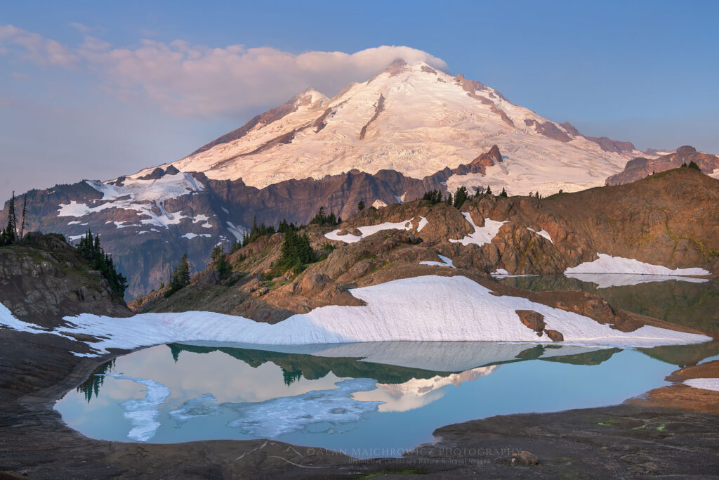
    Mount Baker reflected in Goat Lake on Ptarmigan Ridge, Washington's North Cascades.
    Mount Baker seen from Goat Lake on Ptarmigan Ridge, Mount Baker Wilderness. North Cascades Washington

    The skills gap: what each mountain actually demands

    Mount Baker’s skill demands

    • Multi-day camping commitment: Carrying a 35-45 lb pack to high camp at 6,000-7,000 ft. Setting up tents, melting snow for water, cooking meals at altitude
    • Aerobic endurance: 7,400 feet of elevation gain across roughly 12.5 miles round trip. The summit day itself involves 4,500-5,000 ft of climbing with a light pack from high camp
    • Basic to intermediate crampon technique: French technique, flat-footing, and front-pointing on the Roman Wall’s 30-35 degree snow
    • Self-arrest reflexes: Important particularly on the Roman Wall where a slide could run out
    • Rope team movement: 3-person rope teams are standard. Climbers must maintain proper spacing, manage the rope, and stop progress immediately when a teammate has issues
    • Crevasse rescue setup: Z-pulley system, prusik ascending, partner extraction — taught in 3-day programs, expected from independent climbers
    • Mild altitude tolerance: 10,781 ft is high enough that some climbers feel mild altitude effects (shortness of breath, fatigue), but rarely causes serious AMS

    Mount Rainier’s skill demands

    • Everything Baker requires, plus:
    • Advanced glacier travel: Reading more complex crevasse patterns, navigating around or across crevasses that change daily, recognizing weakening snow bridges
    • Confident crevasse rescue under pressure: Practiced repeatedly until reflexive — the consequences of a fall into a crevasse on Rainier are more severe than on Baker
    • Faster alpine pacing: Maintaining 1,000 ft/hour on the upper mountain at 12,000+ feet — a meaningfully harder pace than Baker’s summit day
    • Significant altitude tolerance: 14,410 ft causes real altitude effects in most climbers. AMS symptoms must be managed without compromising pace
    • Heavier pack carrying: 45-55 lb packs to Camp Muir on Day 1; 10-15 lb summit packs on Day 2
    • Rockfall awareness on the Cleaver: Helmet protocol, moving efficiently through exposed sections, recognizing daily/seasonal rockfall patterns
    • Weather decision-making at higher consequence: Turning around at 13,000 feet is harder than turning around at 9,000 feet — both because of physical investment and because the weather window that opened the climb may not return

    The fundamental insight: Baker teaches all the foundational skills. Rainier demands those same skills, applied faster, at higher altitude, with less margin for error. Climbing Baker first lets you build the skills in a lower-consequence environment, then bring them to Rainier already absorbed into muscle memory. This is why every major guide service explicitly recommends Baker before Rainier — it’s not a marketing structure, it’s a curriculum.

    Cost comparison: Baker is meaningfully cheaper

    Mount Baker costs

    • Northwest Forest Pass: $5/day or $30/year
    • Wilderness permit: free
    • Pre-climb lodging in Bellingham or Glacier: $80-$200
    • Camping gear (if not owned): variable; can rent locally
    • Food, gas, transit: $80-$150
    • Total unguided per person: $150-$400
    • Guided 2-day climb: $1,300 (Northwest Alpine Guides)
    • Guided 3-day climb: $700-$1,500 (AAI, Mountain Madness, Blackbird, Skyline)

    Mount Rainier costs

    • NPS climbing cost recovery fee: $63 per year
    • Wilderness permit: included with guide programs
    • Park entrance fee: $30
    • Pre/post-climb lodging in Ashford or Seattle: $200-$400
    • Food/gas/transit: $100-$200
    • Tip for guides (~10% of program): $225-$300
    • Total unguided per person: $300-$600 plus gear
    • Guided 3-day climb: $2,250-$2,995 (RMI, IMG, Alpine Ascents)
    • Guided 4+ day seminar climb: $3,200-$4,500 (Alpine Ascents Rainier Seminar)

    The cost gap is substantial: Rainier guided is roughly 2x the cost of Baker guided. For climbers building a multi-year progression, this matters — climbing Baker first lets you invest a smaller amount to test your interest, build skills, and assess your fitness before committing to the higher-cost Rainier program. For full Rainier cost breakdown, see our Mount Whitney vs Mount Rainier comparison. See Investigation 18: What’s in a mountain guide’s pack for the gear list that covers both peaks.

    The honest verdict: when each is the right choice

    For 90% of climbers, the answer is clear: Baker first, Rainier second. But there are specific scenarios where the order varies.

    Pick Mount Baker first if

    You’re new to glaciated mountaineering and want a real first experience
    Baker
    You’re building toward Rainier or Denali as your major objective
    Baker
    You want to test your fitness and altitude tolerance before committing $2,500+ to Rainier
    Baker
    You have a budget under $1,500 for a guided experience
    Baker
    You want to maximize summit probability — Baker’s 70-85% rate is meaningfully higher than Rainier’s 48%
    Baker

    Pick Mount Rainier first if

    You have prior glacier mountaineering experience from Alaska, the Alps, or another major range
    Rainier
    You’re preparing for Denali or 7,000m+ peaks on a compressed timeline
    Rainier
    You have $2,500-$4,000 budgeted and accept the lower summit probability
    Rainier
    You’re committed to a 4+ day Rainier seminar climb that builds in skills instruction
    Rainier
    You specifically want the 14,000-foot benchmark over the glacier-skills benchmark
    Rainier

    The recommended sequence (Year 1 to Year 3)

    For climbers building a multi-year glaciated mountaineering progression, the canonical sequence is:

    1. Year 1, summer: Mount Baker via Coleman-Deming Glacier (3-day guided program). Build foundational glacier skills, rope team experience, crampon technique.
    2. Year 2, June-July: Mount Rainier via Disappointment Cleaver (3-4 day guided program). Apply Baker skills on bigger, more committing terrain.
    3. Year 2 or 3, winter: Glacier skills clinic, ice climbing course, or rescue practice to deepen the technical base.
    4. Year 3+: Independent Rainier climbs, then progression to international objectives — Aconcagua, Denali, 6,000m peaks (see Investigation 06: Your first big mountain for the next-step progression).
    ▲
    The “I’ll skip Baker and just climb Rainier” trap

    Each year, hundreds of climbers attempt Rainier without prior glacier experience, betting that the guide service will teach them what they need to know on the climb itself. This is the largest single contributor to Rainier’s 48% summit success rate. Climbers without prior glacier skills consistently underperform on Rainier compared to those who built skills on Baker first.

    The independent-climber success rate on Rainier is ~44% — meaningfully lower than guided. The guided rate of ~60% reflects climbers who arrived with some prior experience plus the structured instruction of the guided program. If you want to maximize your odds of summiting Rainier, climb Baker first. This isn’t gatekeeping — it’s the structural advice from every major guide service in the region.

    Best month to climb each: side-by-side

    For the full framework, see Investigation 19: Best month to climb each mountain.

    MonthMount BakerMount Rainier
    JanuaryWinter ski mountaineering onlyWinter mountaineering only
    FebruaryWinter ski mountaineering onlyWinter mountaineering only
    MarchAdvanced ski mountaineeringAdvanced winter conditions
    AprilRoad still closed in many yearsSpring conditions; advanced only
    MayGood — depending on road opening; deep snowMarginal — spring conditions
    JuneExcellent — peak season beginsGood — early season conditions
    JulyExcellent — peak conditionsExcellent — peak season
    AugustGood — exposed crevasses; route-finding harderExcellent — stable conditions
    SeptemberFair — variable conditions; weather windows shorterGood — early month; deteriorating late
    OctoberMarginal — fall storms beginningMarginal — winter conditions returning
    NovemberWinter conditionsWinter mountaineering only
    DecemberWinter ski mountaineering onlyWinter mountaineering only

    Quick-reference comparison

    FactorMount BakerMount Rainier
    Elevation10,781 ft14,410 ft
    LocationNorth Cascades, WashingtonCentral Cascades, Washington
    Standard routeColeman-Deming GlacierDisappointment Cleaver
    Route gradeBeginner-intermediate glaciatedIntermediate-advanced glaciated
    Round trip distance~12.5 miles~14.5 miles
    Elevation gain~7,400 ft~9,000 ft
    Days required2-3 days2-4 days
    Technical demandsGlacier travel, rope team, basic crampon/axeAdvanced glacier travel, complex crevasse rescue, fast pacing at altitude
    Annual climbers~5,000-7,000~10,000 attempts
    Summit success rate~70-85% (guided)~48% overall
    Permit cost$5 parking (no climbing fee)$63 climbing fee + wilderness
    Cost (unguided)$150-$400 per person$300-$600 per person plus gear
    Cost (guided)$700-$1,500 (3-day)$2,250-$2,995 (3-day)
    Best seasonJune-JulyLate June-early September
    Best forFirst glaciated climb / Rainier prepIntermediate-advanced glaciated objective

    Frequently Asked Questions

    Is Mount Baker harder than Mount Rainier?

    No. Mount Rainier is meaningfully harder than Mount Baker. Rainier is 3,629 feet taller, has more crevasses, more objective hazard, longer summit-day distance, and demands more advanced glacier travel skills.

    Baker is widely considered the premier Rainier training peak precisely because it offers real glaciated mountaineering on more forgiving terrain. Most major guide services explicitly recommend climbing Baker before Rainier.

    Should I climb Baker before Rainier?

    Yes, in almost all cases. Baker is the canonical Rainier preparation climb. It teaches the same fundamental skills — rope team travel, crevasse rescue, crampon and ice axe technique, altitude exposure, glacier reading — on shorter, less consequential terrain.

    The Mount Baker Coleman-Deming route is rated as a beginner-friendly glacier climb; Rainier’s Disappointment Cleaver is intermediate-to-advanced. Building Baker into your progression substantially increases Rainier success rates.

    How much does it cost to climb Mount Baker vs Mount Rainier?

    Baker unguided: $5 Northwest Forest Pass for parking, plus food, gas, and lodging. Total under $400 typically.

    Baker guided: $700-$1,500 for a 2-3 day program with American Alpine Institute, Northwest Alpine Guides, Mountain Madness, or others.

    Rainier unguided: $63 NPS climbing fee plus wilderness permit. Total under $600 plus gear.

    Rainier guided: $2,250-$2,995 for a 3-day program with RMI, IMG, or Alpine Ascents.

    Rainier guided is roughly 2x the cost of Baker guided.

    How long does each climb take?

    Mount Baker: 2-3 days for most climbers via the Coleman-Deming route, with high camp at 6,000-7,000 feet. The 2-day program is intermediate-pace and requires prior mountaineering experience. The 3-day program builds in skills instruction.

    Mount Rainier: 2-3 days minimum on the Disappointment Cleaver route, with high camp at Camp Muir (10,080 ft). Many programs run 4 days to include skills instruction and weather contingency.

    Is Mount Baker a beginner-friendly climb?

    Yes, when guided. Mount Baker’s Coleman-Deming and Easton Glacier routes are widely considered the most beginner-friendly true glaciated climbs in the lower 48.

    Major guide services run multi-day programs for first-time mountaineers with built-in instruction in glacier travel, crevasse rescue, and rope team movement. Mount Baker is genuinely accessible to fit beginners with no prior mountaineering experience, provided they go guided.

    What is Mount Baker’s success rate?

    Mount Baker guided programs typically report 70-85% summit success rates, varying by season and weather window. This is meaningfully higher than Mount Rainier’s 48% historical average.

    The higher Baker success rate reflects both lower technical demands and shorter overall commitment — bad weather windows close out Rainier climbs more often than they shut down Baker attempts.

    When is the best time to climb Mount Baker?

    May through September, with peak conditions typically in June and July. Earlier in the season the routes are fully snow-covered with stable crevasse bridges. By late summer, crevasses become more exposed and route-finding gets more complex.

    The road to the Heliotrope Ridge trailhead may not fully open until mid-June in heavy snow years. Most guided programs run June through August.

    What gear do I need for both climbs?

    The technical gear list is nearly identical: mountaineering boots, crampons, ice axe, climbing harness, helmet, rope (provided by guide services), prusiks and rescue gear, glacier glasses, multi-layer clothing system.

    For both peaks: tent, 0-20°F sleeping bag, sleeping pad, stove and fuel, food for 2-3 days, and a 60-70L pack. Mount Rainier additionally requires more cold-weather layering due to higher altitude and longer summit day exposure.

    Most guide services rent the technical gear (crampons, ice axe, harness, helmet) for both peaks at similar prices. See Investigation 18: What’s in a mountain guide’s pack for the detailed gear list both guides carry.

    What to read next

    Sources and Verification

    This comparison was built from primary sources including:

    • U.S. Forest Service, Mt. Baker-Snoqualmie National Forest — Baker access and wilderness regulations
    • U.S. National Park Service, Mount Rainier — climbing statistics and permit framework
    • Recreation.gov — 2026 permit pricing for both peaks
    • American Alpine Institute (AAI) — Mount Baker route descriptions and guided program details
    • Northwest Alpine Guides — 2026 Baker program pricing and guidance
    • The Mountaineers — Mount Baker Coleman-Deming route trip reports and route grades
    • SummitPost — Mount Baker route descriptions and historical climbing data
    • Skyline Mountain Guides — 2026 Coleman-Deming program structure
    • Blackbird Mountain Guides — How to Climb Mt. Baker analysis (August 2025)
    • Edgeworks Outdoor — Mount Baker route difficulty grading
    • RMI Expeditions — Mount Rainier climbing program information
    • International Mountain Guides (IMG) — Rainier program pricing and structure
    • Alpine Ascents International — 2026 Rainier program and success rate analysis
    • AllTrails — Mount Baker Coleman-Deming and Mount Rainier route details

    Published June 8, 2026 · Next scheduled review: November 2026 after the 2026 climbing season

    Subscribe to the Mountain Planning Brief

    Get notified when each new mountain comparison publishes. One email per release. No marketing.

    Subscribe →
    Was this helpful?

    Yes
    No
    Thanks for your feedback!
  • Mount Shasta vs Mount Hood: Which Is Harder & Which First?

    Cascade comparison · standard routes

    Mount Shasta vs Mount Hood: Which Is Harder to Climb?

    Mount Shasta is the bigger altitude and endurance problem. Mount Hood is the shorter climb with the steeper, more concentrated technical finish. Compare the standard routes, permits, skills, season and progression value before choosing your next Cascade volcano.

    Official permit rules checked Sep. 16, 2026 USGS elevations Standard-route comparison
    14,163 ftShasta · USGS
    11,240 ftHood · USGS
    ~7,000 ftShasta route gain
    ~5,300 ftHood route gain
    $25Shasta 3-day pass
    $20Hood 3-day permit
    The direct answer

    Shasta is harder in scale. Hood is harder in concentrated technical terrain.

    If you compare only the standard routes, there is no useful one-word winner. Mount Shasta’s Avalanche Gulch is higher, longer and normally a larger two-day endurance objective. It adds roughly 7,000 vertical feet from Bunny Flat, sustained snow travel, high camp logistics and much more time above 10,000 feet.

    Mount Hood’s South Side is shorter, but the upper mountain is steeper and less forgiving. Above Crater Rock the route can involve hard snow or ice, the Hogsback, a bergschrund, fumarole holes, rock and ice fall, and a steep finish through the Old Chute or Pearly Gates.

    For a climber building toward bigger expeditions, Shasta tests endurance, altitude and camp systems. For a climber building technical snow confidence, Hood tests movement quality and decision-making on steeper terrain.

    Bigger physical dayMount Shasta
    Steeper cruxMount Hood
    Typical formatShasta: 2 days
    Typical formatHood: 1 long day
    Altitude exposureShasta
    Upper-route consequenceHood
    Conditions override every comparison on this page. A firm, well-filled Hood can be more straightforward than an icy or melted-out year. A consolidated Avalanche Gulch can be a very different climb from the same route after rockfall becomes dominant. Check the official condition sources immediately before either climb.
    Side by side

    Mount Shasta vs Mount Hood at a glance

    The table compares the normal first-choice routes in favorable spring or early-summer conditions: Avalanche Gulch on Shasta and the South Side on Hood.

    FactorMount ShastaMount HoodWhy it matters
    USGS elevation14,163 ft / 4,317 m11,240 ft / 3,426 mShasta adds substantially more altitude exposure.
    Standard routeAvalanche GulchSouth Side · Old Chute / Pearly Gates areaBoth are snow-mountaineering routes, not hiking trails.
    StartBunny Flat · about 6,900–6,950 ftTimberline Lodge · about 6,000 ftShasta begins higher but still has much more total vertical.
    Approx. gain~7,000–7,300 ft~5,300 ftShasta is the larger endurance objective.
    Typical format2 days common; 1-day pushes exist8–14 hours car-to-car is commonShasta adds camp logistics; Hood compresses decisions into one push.
    Technical characterSustained moderate snow; steepens near Red BanksSteeper upper snow/ice; bergschrund and crater terrainHood’s technical difficulty is concentrated high.
    Primary altitude issueSummit above 14,000 ftSummit near 11,240 ftAltitude is much more likely to shape pacing on Shasta.
    Primary hazard patternAvalanche, rockfall, weather, navigation, long descentRock/ice fall, steep sliding falls, bergschrund, fumaroles, weatherThe hazard mix is different—not simply more or less dangerous.
    Permit$25 / 3-day Summit Pass above 10,000 ft + free wilderness permit$20 / 3-day climbing permit above 9,500 ftNeither standard permit is a quota lottery.
    Typical prime windowMay–early/mid July, snowpack dependentLate Apr–June, conditions dependentBoth are usually better on consolidated snow than after melt-out.
    Best training valueAltitude, endurance, camp systems, long descentSteep-snow technique, exposure, timing, downclimbingChoose the mountain that tests the capability you need next.
    Bunny Flat trailhead beneath Mount Shasta in snow

    Shasta starts at Bunny Flat

    Bunny Flat is the standard Avalanche Gulch access. There are restrooms, but do not plan on potable trailhead water; Horse Camp has seasonal water higher on the route. Photo: Mount Shasta Avalanche Center.

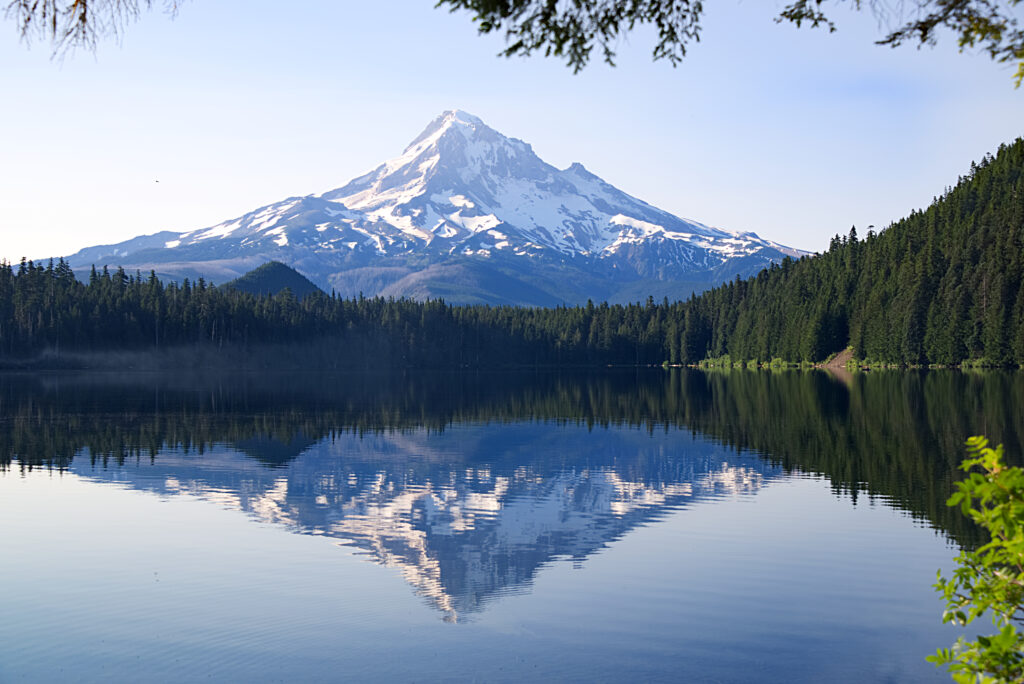
    Snow-capped Mount Hood reflected in a calm lake, Cascade volcano climbing comparison

    Hood starts at Timberline

    The South Side leaves the Timberline area around 6,000 feet and climbs directly into the upper mountain. The approach is shorter; the finish is steeper.

    Climbers approaching snow terrain on Mount Shasta
    Difficulty is multidimensional

    The question is not “which mountain wins?” It is “which problem are you prepared to solve?”

    Shasta magnifies the consequences of fatigue, altitude and a long descent. Hood magnifies the consequences of poor crampon technique, weak downclimbing, bad timing and hesitation on steeper upper terrain. A climber can be well prepared for one and poorly prepared for the other.

    West Face, Mount Shasta · Boulab · CC BY-SA 3.0 via Wikimedia Commons.
    Mount Shasta · Avalanche Gulch

    Why Shasta feels like a small expedition

    The standard route is not normally a pitched technical climb in good conditions, but its scale creates a serious mountaineering day.

    01 · approach & camp

    Bunny Flat to Horse Camp / Helen Lake

    Most two-day parties climb from Bunny Flat through forest, pass Horse Camp and continue toward a high camp around Helen Lake. That means carrying overnight equipment, food, fuel and a sleep system rather than simply moving light from the car.

    Horse Camp can have seasonal water. Higher camps usually require melting snow. The ability to manage hydration, cold, tent setup and recovery becomes part of the climb.

    02 · sustained snow

    Helen Lake to the Red Banks

    The route steepens through Avalanche Gulch. Firm snow makes crampon footwork and ice-axe control non-negotiable; warming conditions increase wet-snow and rockfall concerns. The Red Banks are a major decision point because the best line changes with snow coverage.

    This section is where “non-technical” can become a dangerous label. A sliding fall, rockfall or poor route choice can still have serious consequences.

    03 · altitude

    Misery Hill changes the pace

    Above the Red Banks, the terrain may look less technical while the physiology gets harder. Shasta rises above 14,000 feet, and climbers who were comfortable at camp can slow dramatically above 12,000–13,000 feet.

    The summit plateau can also become a navigation problem in poor visibility. Preserve mental energy for finding the correct descent line.

    04 · descent

    The mountain is not finished at the summit

    A large fraction of Shasta’s seriousness comes from how much mountain remains after turning around or summiting. Snow softens, rocks loosen, attention drops and dehydration accumulates. A late descent can be more hazardous than the climb up.

    That is why Shasta is valuable training for bigger objectives: it forces climbers to manage effort across a full mountain cycle rather than a single crux.

    Mountaineer climbing snowy terrain on Mount Shasta

    Shasta rewards efficient movement

    The route is long enough that inefficient cramponing, poor pacing and overpacking compound over thousands of vertical feet. Photo: Mount Shasta Avalanche Center.

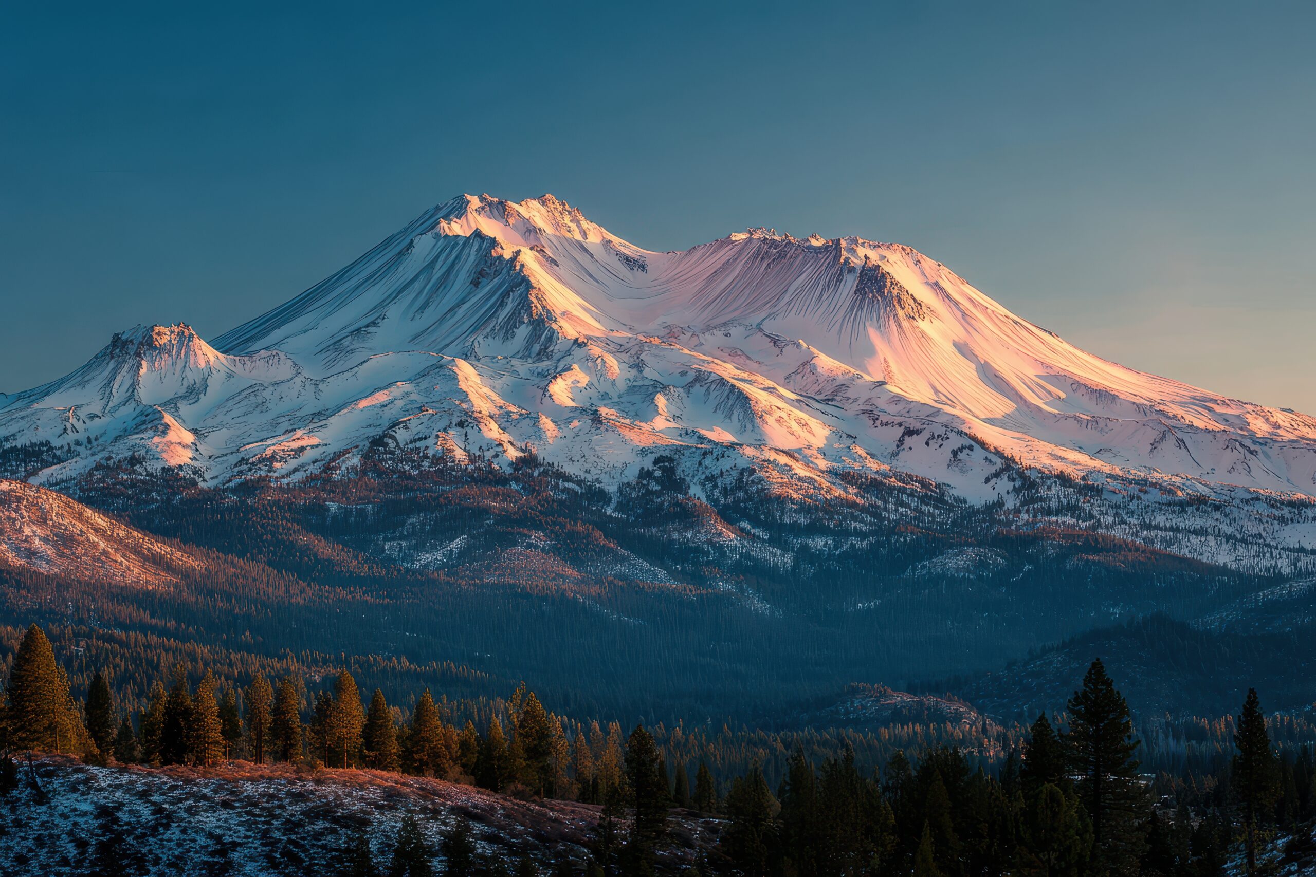
    Snow-covered Mount Shasta at sunrise

    Altitude changes the climb

    Shasta’s greatest difference from Hood is not visual size—it is how long the climber must keep functioning as elevation, cold and fatigue accumulate.

    Climbing party ascending near Crater Rock on Mount Hood
    Mount Hood · South Side

    Hood is shorter—but its upper 1,000 feet control the day.

    The lower South Side can feel deceptively straightforward. The character changes around Crater Rock: fumaroles, the Hogsback, the bergschrund and the summit chutes compress the mountain’s most consequential climbing into a relatively small vertical band.

    Historic climbing party near Crater Rock · Wikimedia Commons / Oregon State University Special Collections. Check file page for reuse terms.
    Route anatomy

    Timberline to the summit: where Hood changes character

    Exact lines move with snow and glacier conditions. This is a conceptual route sequence, not a navigation topo.

    ~6,000′
    Timberline Lodge

    Register, carry the required permit, obtain the current free uphill travel pass, and use the designated climbers’ route through the ski area.

    Paperwork + alpine start
    ~8,500′
    Palmer snowfield

    Steady snow climbing past ski infrastructure. The terrain is usually much less technical than the upper mountain.

    Pacing + conditions
    ~9,500′
    Triangle Moraine

    This is approximately the climbing-permit elevation line. Above here the route moves fully into the upper-mountain problem set.

    Permit line
    ~10,400′
    Crater Rock / Devil’s Kitchen

    Fumarole terrain, rock and ice fall exposure, and changing snow conditions become central to route decisions.

    Hazard concentration
    ~10,600′
    Hogsback + bergschrund

    A narrow snow ridge leads toward the final chutes. The Hogsback position and bergschrund opening vary by season.

    Exposure + route choice
    11,240′
    Old Chute / Pearly Gates → summit

    Steep snow or ice, often around the 35–45° range depending on line and conditions. The descent through this terrain is part of the crux.

    Steep climbing + descent
    Do not choose a chute from an old trip report. The safer line can change as the bergschrund opens, the Pearly Gates ice up, the Hogsback shifts and rockfall increases. Use the current Forest Service climbing report and on-mountain judgment.
    The skills gap

    What each mountain actually asks you to know

    Owning crampons and an ice axe is not the same thing as having the movement skills to use them when tired, cold and exposed.

    Mount Shasta

    Endurance + snow-mountaineering systems

    • Move efficiently for thousands of vertical feet on snow.
    • Use crampons without catching points as fatigue builds.
    • Use an ice axe for balance and practiced self-arrest.
    • Recognize avalanche and rockfall problems.
    • Camp high, melt snow and manage cold overnight.
    • Pace yourself above 10,000–14,000 feet.
    • Navigate the upper mountain if visibility disappears.
    • Protect enough energy and attention for a long descent.
    Mount Hood

    Steep-snow movement + consequence management

    • Front-point and flat-foot confidently on firm snow.
    • Downclimb steep snow facing in when conditions require it.
    • Move deliberately around a bergschrund and narrow features.
    • Understand why a rope can help in some systems and create risk in others.
    • Manage exposure beneath rock and ice fall zones.
    • Keep moving through fumarole terrain rather than lingering.
    • Use turnaround time to protect the descent before warming.
    • Navigate back toward Timberline in deteriorating visibility.
    1

    First-ever crampon day?

    Neither summit should be the classroom for learning from zero. Take a snow-skills course or use a guide first.

    2

    Good snow skills, limited altitude?

    Shasta may expose the larger gap: pace, high camp recovery and sustained work near 14,000 feet.

    3

    Strong endurance, weak steep-snow confidence?

    Hood may expose the larger gap because the descent requires the same technical control as the climb.

    Permits & access

    Both systems are simple—but they are not identical

    Fees and access rules can change. These are the rules verified for this rebuild on September 16, 2026.

    RequirementMount ShastaMount Hood
    Main climbing permitSummit Pass required above 10,000 ft for climbers age 16+Climbing Permit required above 9,500 ft
    3-day price$25$20
    Annual price$30 calendar-year pass$50 annual permit
    Quota?No normal advance climbing quota for Avalanche GulchNo; Recreation.gov says permits cannot sell out
    Wilderness permitSeparate free wilderness permit requiredWilderness rules apply; follow current South Side registration process
    Extra access itemNone comparable to a ski-area uphill passFree Timberline Uphill Travel Pass currently required through ski-area terrain
    Winter parkingCheck current road/trailhead restrictionsOregon Sno-Park permit required at Timberline Nov. 1–Apr. 30
    Human wastePack-out systemBlue/WAG bag pack-out required
    Shasta access correction

    Do not count on drinking water at Bunny Flat.

    The trailhead has restrooms and permit access, but plan to arrive with water. Seasonal water is available at Horse Camp in normal operating periods, and higher camps generally require snow melting or a carried supply.

    Hood access correction

    The climbing permit is not the only pass.

    The main South Side route crosses Timberline ski-area terrain. Recreation.gov and Timberline currently require the climbing permit above 9,500 feet plus a free Timberline Uphill Travel Pass for uphill travel through the ski area.

    Mazamas climbers ascending the Hogsback on Mount Hood
    Timing is part of the route

    Both peaks are usually better snow climbs before they become loose summer mountains.

    Shasta’s Avalanche Gulch often deteriorates as snow disappears and rockfall increases. Hood’s crater and summit chutes also become more hazardous as the upper mountain melts out. A calendar date is never a substitute for current snow coverage, overnight freeze, avalanche information and rockfall conditions.

    Mazamas on the Hogsback · Wikimedia Commons. Check source file for reuse terms.
    Season comparison

    Spring snow is the advantage—not a nuisance

    The exact window moves each year. Treat these as planning tendencies, then replace them with current conditions before departure.

    PeriodMount ShastaMount HoodPlanning read
    Winter–MarchSerious winter mountaineering; storm and avalanche problems can dominateWinter conditions; avalanche and severe-weather judgment requiredAdvanced
    AprilCan begin shaping up; still storm- and avalanche-dependentSouth Side window can begin in favorable yearsVariable
    May–JuneCore Avalanche Gulch target in many yearsCore South Side target in many yearsPrimary target
    Early JulyCan remain good with enough snow; rockfall trend risingIncreasing melt, bergschrund and rockfall concernsConditions first
    Late summer–fallAvalanche Gulch often loose and rockfall-proneSouth Side often poor for first-time summit attemptsNot default window
    Decision framework

    Which one fits your next step?

    This is not a ranking. Match the mountain to the capability you want to test and the skills you already possess.

    Shasta may fit better if…

    You need a bigger endurance and altitude test

    • You already have basic snow travel and self-arrest competence.
    • You want to learn how a high camp changes pacing and recovery.
    • You are building toward Rainier, Aconcagua or other longer expeditions.
    • You want sustained snow climbing without making a steep upper chute the main objective.
    • You can carry a multi-day pack and still protect your descent.
    Hood may fit better if…

    You need a steep-snow technique test

    • You are already comfortable in crampons on firm, steep snow.
    • You can downclimb facing in without learning the technique on the summit chute.
    • You want a one-day alpine objective with concentrated upper-mountain consequence.
    • You are training for steeper snow, couloir or alpine climbing objectives.
    • You can make conservative decisions around crowds, warming and route changes.
    Guided changes the equation. A professionally guided climb can make either mountain an instructional objective because the program can include snow-skills training, movement coaching and route decisions. Unguided readiness should be judged much more strictly.
    Capability-based progression

    What should come before—and after—these volcanoes?

    There is no universal ladder. Choose the next mountain by the skill gap it solves.

    Before Shasta

    Snow skills + big uphill days

    Arrive already able to use crampons and an axe, and with enough hiking fitness that a 5,000–7,000 vertical-foot objective is not your first test of endurance.

    Before Hood

    Steep-snow confidence

    Add controlled front-pointing, traversing, self-belay and downclimbing. Hood’s summit chute is not the place to discover that a climber cannot descend 40° snow.

    After either

    Build the missing system

    Baker can add true crevassed-glacier rope-team travel. Rainier adds glacier complexity plus altitude and high-camp systems. Aconcagua adds much more altitude and expedition duration.

    A
    Hiking base

    Long mountain days, vertical gain, pack fitness, navigation and conservative turnaround habits.

    Foundation
    B
    Snow skills course

    Crampons, axe, self-arrest, steep-snow movement, avalanche awareness and winter/spring decision-making.

    Skill gate
    C
    Shasta or Hood

    Choose Shasta for scale/altitude or Hood for concentrated steep-snow consequence—provided the relevant skills already exist.

    Apply skills
    D
    Baker / Rainier / larger objectives

    Add rope-team glacier travel, crevasse rescue, larger expedition systems or greater altitude depending on the goal.

    Next capability
    Methodology & verification

    What this comparison treats as stable—and what must be rechecked

    Route character changes slowly. Snowpack, bergschrunds, rockfall, road status and permit administration can change quickly.

    Elevation note

    Mount Shasta and Mount Hood both have multiple elevation numbers in climbing literature. The current USGS volcano profiles list Shasta at 14,163 feet and Hood at 11,240 feet. Global Summit Guide’s dedicated climbing pages explain why climbers commonly encounter approximately 14,179 and 11,249 feet instead. The few feet of difference do not change route planning.

    What to verify the week you climb

    • Snow coverage and overnight freeze
    • Avalanche forecast or recent avalanche problems
    • Rock and ice fall reports
    • Visibility and summit wind
    • Hood bergschrund and chute condition
    • Shasta Red Banks / Avalanche Gulch condition
    • Road, parking and trailhead status
    • Current permit and pass instructions
    Frequently asked questions

    Mount Shasta vs Mount Hood FAQ

    Short answers to the questions most climbers ask before choosing between these two Cascade volcanoes.

    Is Mount Shasta harder than Mount Hood?

    Not in every dimension. Shasta is higher, longer and usually the larger endurance and altitude objective. Hood’s standard South Side is shorter, but its upper mountain concentrates steeper snow, exposure, a bergschrund, fumarole terrain and more technical movement. The climber’s background and the conditions determine which feels harder.

    Which should I climb first?

    If you already have basic crampon, ice-axe and self-arrest skills but want a first large snow-mountaineering objective, Shasta is often the more forgiving classroom in good conditions. Hood is a better fit after steep-snow movement and controlled downclimbing are familiar. Guided instruction can change that order.

    How much higher is Mount Shasta than Mount Hood?

    Using current USGS volcano-profile elevations, Mount Shasta is 14,163 feet and Mount Hood is 11,240 feet—a difference of about 2,923 feet. Climbing literature often uses slightly different summit elevations for both peaks.

    Which has more elevation gain?

    Avalanche Gulch on Shasta gains roughly 7,000 to 7,300 vertical feet from Bunny Flat. Hood’s South Side gains about 5,300 feet from Timberline Lodge. Shasta therefore requires substantially more total climbing, even though Hood’s upper slopes are steeper.

    Which mountain is more technical?

    On the standard routes, Hood generally has the more technical crux. The upper South Side can require confident movement on 35–45° snow or ice, careful navigation around the bergschrund and controlled downclimbing. Shasta’s Avalanche Gulch is typically less technical in ideal conditions but much longer and higher.

    Do I need a rope on Mount Shasta or Mount Hood?

    The answer depends on route, conditions and team systems. Many competent parties climb Shasta’s Avalanche Gulch without being roped in favorable conditions. On Hood, teams may use a rope or protection on the upper mountain, but poor rope technique can create additional hazard. A rope should be carried because the team knows exactly how and why it will be used—not because the mountain’s name appears on a checklist.

    When is the best time to climb?

    May and June are the strongest overlap for many years. Avalanche Gulch can stay good into early or mid-July when snowpack supports it. Hood’s South Side often peaks from late April through June. Snow coverage, freeze-thaw quality, avalanche problems, bergschrund development and rockfall matter more than the calendar.

    Can beginners climb either mountain?

    Both can be appropriate early mountaineering objectives with training and conservative conditions, but neither should be treated as a first-ever crampon lesson. A strong hiker still needs snow-movement, self-arrest, weather, route and turnaround skills. First-time climbers should strongly consider a qualified instructional program or guide.

    Choose the mountain that teaches the skill you need next.

    Mount Shasta and Mount Hood are not interchangeable versions of the same Cascade climb. Shasta stretches the day upward and outward—more altitude, more vertical and often a camp. Hood compresses the difficulty into a shorter window where movement quality and timing matter enormously. Build the missing capability, then choose the objective.

    Compare more mountains

    The skills gap: what each mountain actually demands

    Mount Shasta’s skill demands

    • Multi-day commitment: Carrying a 35-50 lb pack with tent, sleeping bag, stove, food, and water purification for 2-3 days. Setting up camp at 10,400 ft after a 3,500 ft climb with full pack
    • Sustained aerobic endurance: 7,300 feet of elevation gain across a full climb, with most of the gain happening above 8,000 ft where the air is thinner
    • Solid crampon technique: French technique, flat-footing, and front-pointing on snow ranging from 25° to 40° depending on conditions
    • Self-arrest mastery: Particularly important above Helen Lake where a fall on hard snow can run out for hundreds of feet
    • Altitude tolerance: 14,179 ft is high enough to cause significant AMS in unacclimatized climbers. The standard 2-day climb compresses acclimatization into a single sleep at 10,400 ft
    • Avalanche awareness: Reading slope angles, recognizing dangerous snow conditions, knowing when to turn around
    • Navigation in whiteouts: Shasta’s summit plateau is large and featureless. Climbers regularly descend the wrong side of the mountain when clouds form during the descent. “It happens every year, and can result in lengthy SAR missions” per the Mount Shasta Avalanche Center.

    Mount Hood’s skill demands

    • Confident steep-snow technique: Front-pointing on 40-50° snow, ice axe self-belay, ability to maintain composure on exposed terrain
    • Self-arrest reflexes: A fall on the Pearly Gates or Old Chute progresses to terminal velocity within seconds. Self-arrest must be reflexive, not learned
    • Glacier hazard recognition: Reading the Hogsback’s annual changes, identifying bergschrund cracks, avoiding fumarole-adjacent terrain
    • Fast alpine pacing: The route is short, but speed is essential — afternoon rockfall on the upper mountain has killed climbers descending late
    • Weather decision-making: Hood’s weather changes in minutes; a clear summit at 6 a.m. can become a whiteout by 9 a.m.
    • Alpine start discipline: Midnight or 1 a.m. starts are non-negotiable. Climbers who start at “normal hours” often end up in dangerous descending conditions

    The structural difference: Mount Shasta teaches expedition-style mountaineering — carrying weight, managing camps, pacing across days, dealing with altitude. Mount Hood teaches alpine-style mountaineering — moving fast and light, climbing technical sections decisively, descending before conditions deteriorate. Climbers building toward Rainier, Aconcagua, Denali, or any expedition objective should climb Shasta first. Climbers building toward technical alpine routes (Mt. Stuart, Eiger Ridge, alpine rock objectives) get more transferable lessons from Hood.

    Cost comparison: similar permits, different total commitment

    Mount Shasta costs

    • Summit Pass: $25 (3-day) or $30 (annual)
    • Wilderness permit: free
    • Parking at Bunny Flat: free
    • Pre-climb lodging in Mount Shasta City: $100-$250
    • Camping gear (if not owned): variable; can rent locally
    • Food, gas, and water for 2-3 days: $80-$150
    • Total unguided per person: $200-$500
    • Guided 3-day climb: $700-$1,500 (International Alpine Guides, Shasta Mountain Guides, SMI)
    • Guided 2-day climb: $500-$1,000 (lower success rate)

    Mount Hood costs

    • Climbing Permit: $20 (3-day) or $50 (annual)
    • Wilderness permit: included with climbing permit
    • Parking at Timberline: free with climbing permit
    • Sno-Park permit (Nov-Apr): $25/day or ~$50/season
    • Pre-climb lodging in Portland or Government Camp: $100-$250
    • Food and gas: $50-$100
    • Total unguided per person: $150-$400
    • Guided one-day climb: $400-$700 (Timberline Mountain Guides, KAF Adventures)
    • Mazamas club climb: $78 (members only)

    Total costs are roughly similar between the two peaks for unguided climbers. Guided costs differ substantially: Shasta’s 3-day commitment makes guided programs 2-3x the cost of a Hood guided climb. For climbers on a budget, Hood guided is cheaper; for climbers prioritizing skill-building and acclimatization, Shasta’s longer guided program delivers more learning per dollar. See our guide-pack investigation for the gear list that covers both peaks.

    The honest verdict: when each is the right choice

    Both peaks are excellent objectives. The right choice depends on what you’re training for, where you live, and how much time you have.

    Pick Mount Shasta first if

    You’re building toward expedition objectives (Rainier, Aconcagua, Denali)
    Shasta
    You want to learn multi-day mountaineering on a forgiving objective
    Shasta
    You want a true 14er summit experience without leaving California
    Shasta
    You have 2-3 days to commit and prefer endurance over technical exposure
    Shasta
    You want to test altitude tolerance on a peak above 14,000 ft
    Shasta

    Pick Mount Hood first if

    You’re training for technical alpine objectives (Mt. Stuart, alpine rock, Eiger Ridge)
    Hood
    You’re Portland-based and want a one-day climb close to home
    Hood
    You have only one day available for the climb
    Hood
    You already have steep-snow experience and want to add a classic objective
    Hood
    You want to ski or snowboard from the summit (Hood is the classic Pacific Northwest summit ski)
    Hood

    The “do both” sequence

    For climbers building a Pacific Northwest progression, the canonical sequence is:

    1. Year 1, late spring: Mount St. Helens (8,366 ft) for a non-glaciated introduction to Cascade volcano climbing.
    2. Year 1, summer: Mount Adams via South Spur (12,281 ft) or Mount Shasta via Avalanche Gulch. Both teach big-mountain climbing on forgiving terrain.
    3. Year 2, May-June: Mount Hood via South Side, ideally guided or with a strong partner. Apply the snow skills learned on Adams or Shasta to steeper terrain.
    4. Year 2 or 3: Mount Baker glacier skills course, then Mount Rainier (see our Mount Whitney vs Mount Rainier comparison for the Rainier comparison and the next step).
    ▲
    Both peaks reward the unglamorous skills

    First-time mountaineers on both Shasta and Hood tend to over-prepare for the technical sections (crampons, ice axe, harness) and under-prepare for the unglamorous skills that actually determine success: pacing, hydration, calorie intake, and the ability to make a hard decision about turning around.

    Both peaks have specific moments where the right decision is to descend without summiting. On Shasta: weather closing in above the Red Banks, AMS symptoms developing, group falling behind a turnaround time. On Hood: bergschrund opening up at the Hogsback, conditions deteriorating on the Pearly Gates, party slowing significantly. “Be willing to turn around if you’re not feeling it. Pick good partners. Don’t get summit fever!” per the Mount Shasta Avalanche Center. The same applies to Hood.

    Best month to climb each: side-by-side

    For the full framework, see Investigation 19: Best month to climb each mountain.

    MonthMount ShastaMount Hood
    JanuaryWinter mountaineering; high avalanche riskWinter mountaineering only
    FebruaryWinter mountaineering; high avalanche riskWinter mountaineering only
    MarchAdvanced winter conditions; long days returningWinter conditions; advanced only
    AprilExcellent — consolidated snow, ski potentialExcellent — consolidated snow, low rockfall
    MayExcellent — peak conditions for most climbersExcellent — peak season begins
    JuneExcellent — peak conditionsExcellent — peak season
    JulyGood — early July still snow-covered; late July rockfall increasesGood — late season; afternoon rockfall increasing
    AugustMarginal — scree and rockfall throughoutMarginal — significant rockfall on upper route
    SeptemberDifficult — limited snow, exposed screeDifficult — technical conditions; most parties avoid
    OctoberFall storms beginning; early snow possibleWinter conditions returning
    NovemberWinter mountaineering onlyWinter mountaineering only
    DecemberWinter mountaineering onlyWinter mountaineering only

    Quick-reference comparison

    FactorMount ShastaMount Hood
    Elevation14,179 ft11,249 ft
    LocationNorthern CaliforniaOregon, Cascades
    Standard routeAvalanche GulchSouth Side / Hogsback
    Route gradeSnow climb (Grade I-II)Technical snow (PD/Grade II)
    Round trip distance~11 miles~6 miles
    Elevation gain~7,300 ft~5,400 ft
    Days required2-3 days typical1 day
    Technical demandsMulti-day camping, sustained snow climbingShort steep snow chute, fast pacing
    Required gearCrampons, ice axe, helmet, tent, sleeping bagCrampons, ice axe, helmet, daypack
    Annual climbers~5,000-10,000~10,000
    Permit cost$25 (3-day) or $30 (annual)$20 (3-day) or $50 (annual)
    Cost (unguided)$200-$500 per person$150-$400 per person
    Cost (guided)$700-$1,500 (3-day)$400-$700 (1 day)
    Best seasonApril-early JulyApril-early July
    CrowdingHeavy on summer weekendsVery crowded (Memorial Day-July)
    Best forExpedition-style trainingTechnical snow training

    Frequently Asked Questions

    Is Mount Shasta harder than Mount Hood?

    Yes, overall. Mount Shasta is meaningfully harder than Mount Hood despite Shasta’s standard route being technically easier than Hood’s.

    Shasta demands 7,300 feet of elevation gain over 11 miles round trip and typically requires a multi-day commitment with overnight camping. Hood gains 5,400 feet over 6 miles in a single day. Shasta tests endurance, altitude, and route-finding; Hood tests steep-snow technique. Different mountains, different lessons — but Shasta’s overall difficulty is higher because of the scale of commitment required.

    Which should I climb first, Shasta or Hood?

    Climb Mount Shasta first if you’re building toward big-mountain objectives like Rainier, Aconcagua, or Denali. Shasta’s structure, scale, and required commitment more closely mirrors what those bigger peaks demand.

    Climb Mount Hood first if you’re training for technical alpine routes (Mt. Stuart, alpine rock, the Eiger Ridge) or if you live in Portland and want a one-day climb close to home. Hood teaches steep-snow technique; Shasta teaches expedition-style climbing.

    How much does it cost to climb Shasta vs Hood?

    Shasta unguided: $25 for a 3-day summit pass, plus parking, food, and lodging. Total under $500 typically.

    Shasta guided: $700-$1,500 for a 2-4 day program with International Alpine Guides, Shasta Mountain Guides, or SMI.

    Hood unguided: $20 for a 3-day climbing permit, plus parking. Total under $400 typically.

    Hood guided: $400-$700 for a one-day climb with Timberline Mountain Guides or KAF Adventures.

    Shasta’s longer commitment makes guided programs 2-3x the cost of Hood guided.

    How long does each climb take?

    Mount Shasta: 2-3 days for most climbers via the Avalanche Gulch route, with an overnight at Helen Lake (10,400 ft). Strong fit climbers can do it as a 1-day push in 16-20 hours, but this is uncommon and increases risk.

    Mount Hood: 8-12 hours round trip from Timberline Lodge as a single-day climb. Most climbers start at midnight or 1 a.m. for an alpine start.

    Are Shasta and Hood beginner mountains?

    Shasta is genuinely beginner-friendly when guided. Major guide services (International Alpine Guides, Shasta Mountain Guides, Sierra Mountaineering International) explicitly run programs for first-time mountaineers, with built-in skills instruction in crampons, ice axe self-arrest, and rope team travel.

    Hood is not a beginner mountain despite its reputation as a “walk-up.” Hood’s technical sections (Hogsback, Pearly Gates) demand confident steep-snow technique that beginners shouldn’t be learning on the route itself. Hood should be climbed after building skills on Adams, St. Helens, or Shasta.

    When is the best time to climb each?

    Mount Shasta: April through July is the prime season, with peak conditions typically in May and June. Earlier in the season the route is fully snow-covered which is generally safer for descent. By August the lower mountain melts out, exposing loose scree and increasing rockfall hazard.

    Mount Hood: late April through early July, with the best window typically May-June. After mid-July the South Side route becomes hazardous due to rockfall on the upper mountain.

    Both peaks require pre-dawn alpine starts in the summer climbing season.

    What gear do I need for Shasta vs Hood?

    Both peaks require crampons, ice axe, mountaineering boots, helmet, and the ability to self-arrest.

    Shasta additionally requires multi-day camping equipment: tent, sleeping bag rated to 20°F or colder, sleeping pad, stove and fuel, food for 2-3 days, water purification or snow-melting capability, and a larger backpack (60-70L).

    Hood is a single-day climb requiring only summit-day essentials in a daypack: water, food, layers, headlamp, basic first aid.

    Both routes can require rope and harness in certain conditions; check current conditions before climbing. Avalanche gear (beacon, probe, shovel) is recommended for both peaks in early season.

    Can I ski or snowboard down from the summit?

    Mount Shasta: Yes — Shasta is one of the classic Pacific Northwest ski descents. The Avalanche Gulch route descends easily, and several variations (Casaval Ridge, Bolam Glacier) offer skiable terrain. Fletcher Hoyt and four others made the first ski descent of Shasta in 1947 via Avalanche Gulch.

    Mount Hood: Yes — experienced skiers and snowboarders regularly descend from the summit, typically using the Old Chute variation rather than the Pearly Gates. The Palmer Glacier offers excellent skiing on the lower mountain. Many climbers ski the Palmer descent only and downclimb the technical sections.

    What to read next

    Sources and Verification

    This comparison was built from primary sources including:

    • U.S. Forest Service, Shasta-Trinity National Forest — Mount Shasta climbing regulations and access
    • U.S. Forest Service, Mt. Hood National Forest — Mount Hood permits and conditions
    • Mount Shasta Avalanche Center — Avalanche advisory, climbing regulations, hazard analysis
    • Recreation.gov — 2026 permit pricing for both peaks
    • SummitPost — Avalanche Gulch and Mt. Hood South Side route descriptions
    • The Mountaineers — Mount Shasta Avalanche Gulch trip reports and route grades
    • AllTrails — Mount Shasta via Avalanche Gulch route details
    • International Alpine Guides — 2026 Shasta program guidance and success rate analysis
    • Shasta Mountain Guides — Mount Shasta guided program information
    • Timberline Mountain Guides — Mount Hood guided program information
    • Mazamas — Mount Hood climb operations and member access
    • U.S. Highpoint Guide — Mount Hood permit and fumarole hazard documentation
    • She Dreams of Alpine — 2026 beginner’s guide to climbing Mount Shasta
    • Backcountry Sights — Avalanche Gulch route description and trip report

    Published June 1, 2026 · Next scheduled review: November 2026 after the 2026 climbing season

    Subscribe to the Mountain Planning Brief

    Get notified when each new mountain comparison publishes. One email per release. No marketing.

    Subscribe →
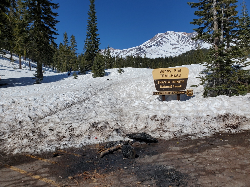
    Was this helpful?

    Yes
    No
    Thanks for your feedback!
  • Mount Hood vs Mount Adams: Which Is Harder to Climb?

    Mountain Comparisons · 2026 Guide

    Mount Hood vs Mount Adams: The Pacific Northwest Volcano Showdown

    Mount Adams sits at 12,281 feet in southern Washington. Mount Hood rises to 11,249 feet just across the Columbia River in Oregon. Adams is taller. Adams is bigger by volume — the second-largest volcano in the contiguous United States by bulk. Adams looks, on every metric, like the harder mountain. It isn’t. Hood’s South Side route packs more technical difficulty per vertical foot than almost any other walk-up volcano in the Cascades, and its short approach masks a steep upper mountain that produces multiple fatalities every climbing season. The right answer to “Hood or Adams first?” runs counter to the obvious one.

    ▲
    The Verdict

    For most climbers, the answer is Adams first, Hood second — Adams teaches snow travel and altitude exposure on forgiving terrain; Hood demands those skills already in place on terrain that punishes mistakes.

    Oregon · Cascades

    Mount Hood

    Oregon’s tallest peak. Short approach, steep upper mountain. The most-climbed glaciated peak in North America after Fuji.

    Elevation11,249 ft
    Round trip~6 miles
    Elevation gain~5,400 ft
    Typical time8–12 hr
    Technical?Yes (steep snow)
    Annual climbers~10,000
    Permit cost$20 (3-day)
    Best seasonApr–early Jul
    Washington · Cascades

    Mount Adams

    Washington’s second-highest peak. The Cascades’ largest volcano by bulk. Long, non-technical snow scramble.

    Elevation12,281 ft
    Round trip~12–14 miles
    Elevation gain~6,700 ft
    Typical time12–16 hr (or 2 days)
    Technical?No (Grade I scramble)
    Annual climbers~5,000–6,000
    Permit cost$15–25
    Best seasonMay–September

    Same range, same volcanic origin, opposite climbing experiences

    Mount Hood and Mount Adams sit just 60 miles apart on opposite sides of the Columbia River Gorge. Both are stratovolcanoes. Both are part of the Cascade Volcanic Arc. Both are climbed by similar gear — boots, crampons, ice axe, helmet. Both can be done in a single day by fit climbers. The visual silhouettes are nearly interchangeable in postcards.

    Then the climbing starts and the two mountains separate completely.

    Mount Hood’s standard route — the South Side via Hogsback and Pearly Gates — is short: less than 6 miles round trip from Timberline Lodge at 5,800 feet to the 11,249-foot summit. The first half of the climb is a moderate snow slope up the Palmer Glacier. The second half — above Crater Rock around 10,500 feet — turns steep, narrow, and exposed. The Hogsback is a knife-edge snow ridge separating two sets of active fumaroles (Devil’s Kitchen and the Hot Rocks). Above the Hogsback, the Pearly Gates section is a 40-50 degree snow chute requiring confident front-pointing and ice axe technique. A fall here typically results in a long sliding fall through the Hot Rocks fumaroles and into Devil’s Kitchen — terrain where multiple climbers have died.

    Mount Adams’s standard route — the South Spur (also called South Climb) — is long: 12-14 miles round trip from Cold Springs trailhead at 5,600 feet to the 12,281-foot summit. The entire route is a sustained snow slope at moderate angle. The Mountaineers grades it “Grade I, moderate snow slopes.” Northwest Mountain School describes it as “basically non-technical.” There are no exposed sections, no narrow ridges, no steep chutes. The challenge is endurance: 6,700 feet of elevation gain over a long day.

    ◆
    Why Hood’s accident statistics don’t match its reputation

    Mount Hood is consistently listed among the most-climbed glaciated peaks in North America. The SummitPost mountaineering reference describes it as “#2 in the world behind Japan’s Fuji-san” by climber traffic. That popularity is precisely what makes it dangerous. The U.S. Forest Service notes the route’s “relatively low altitude, easy approach, and short hiking/climbing distance makes it much more popular among less experienced climbers. These climbers, lacking experience, and severe weather, which can move in quickly, account for most accidents.”

    The result: Hood produces more rescues and fatalities per year than Adams despite being shorter, having a cheaper permit, and being closer to Portland. The danger isn’t the mountain — it’s the gap between the mountain’s reputation as an “easy walk-up” and the actual technical demands of its upper terrain.

    The data: why Hood looks easier and isn’t

    ~6 mi
    Mount Hood round trip
    Less than 3 miles from Timberline to summit — the shortest standard route on any major Cascade volcano
    Source: SummitPost, Mt. Hood South Side route
    ~12 mi
    Mount Adams round trip
    12-14 miles from Cold Springs trailhead — more than double Hood’s distance
    Source: The Mountaineers, Adams South Spur
    5,400 ft
    Hood elevation gain
    From Timberline Lodge (5,800 ft) to summit (11,249 ft) — gained in under 3 trail miles
    Source: U.S. Forest Service climbing data
    6,700 ft
    Adams elevation gain
    From Cold Springs trailhead (5,600 ft) to summit (12,281 ft) — spread over 6-7 trail miles
    Source: WTA, Adams South Climb route

    The numbers tell the trick: Hood gains 5,400 vertical feet in under 3 trail miles. Adams gains 6,700 vertical feet across 6-7 trail miles. Hood is half the distance with 80% of the elevation — the average slope angle on Hood is roughly twice as steep as Adams.

    That’s why Hood feels harder despite being shorter, and why the Forest Service notes its high accident rate. Steep terrain doesn’t forgive technique errors the way long moderate slopes do. A stumble on Adams’s lower-angle snow becomes a self-arrest exercise. A stumble on Hood’s Pearly Gates becomes a 1,000-foot sliding fall.

    Mount Hood deep-dive: the South Side route in detail

    The route in stages

    The South Side route from Timberline Lodge to the summit runs through four distinct terrain stages, each with different demands:

    1. Palmer Glacier (5,800–8,500 ft). A moderate, wide snow slope alongside the Palmer ski lift. The first 2,700 feet of elevation gain happen here. Snowcat or skier traffic is common. This section is the “easy” part of the climb that gives Hood its walk-up reputation.
    2. Triangle Moraine and the approach to Crater Rock (8,500–10,000 ft). Snow continues but the slope steepens. Climbers passing through here begin to feel the altitude and the wind exposure. Most camping climbers stake out the Triangle Moraine area between 8,800 and 9,400 feet.
    3. The Hogsback (10,500–11,000 ft). The narrow snow ridge between Devil’s Kitchen and Hot Rocks fumaroles. Active sulfur fumaroles flank both sides of the route. Climbers have died from gas asphyxiation in oxygen-depleted zones near the fumaroles, and from sliding falls into the rocks below. The Hogsback shifts position annually as the underlying glacier changes — some seasons it offers a wide, comfortable platform; other seasons it narrows to a few feet wide with steep drops on both sides.
    4. The Pearly Gates / Old Chute (11,000–11,249 ft). A 40-50 degree snow chute through rocks. The Pearly Gates variation is the more direct line; the Old Chute is wider and more often used when the Pearly Gates is icy or blocked. This is the technical crux of the climb. Most experienced climbers solo this section; many parties belay it. A few hundred vertical feet of fall potential.

    Mount Hood permit and access (2026)

    Mount Hood permitting changed substantially in 2024 with the introduction of a mandatory climbing permit for any travel above 9,500 feet. As of 2026:

    • Mt. Hood Climbing Permit: Required for any travel above 9,500 ft elevation. 3-day permit: $20. Annual permit: $50. Available on Recreation.gov anytime before the climb. No quota — permits cannot sell out.
    • Wilderness Permit: Required year-round on south side routes. The 3-day climbing permit counts as the wilderness permit. Annual permit holders must complete a separate online wilderness permit.
    • Sno-Park Permit: Required November 1 through April 30 at Timberline parking lots and other sno-parks. $25/day or ~$50/season.
    • WAG bag: Free at the Climbers’ Cave at Timberline Lodge. Mandatory for human waste — no exceptions.

    The Climbers’ Cave at Timberline Lodge is open 24/7 year-round and has self-issue wilderness permits, blue bags, the climber registration form, and current condition reports. Most climbers register here, sign the climb log, and start up between midnight and 2:00 a.m. for an alpine start to reach the summit at sunrise and descend before afternoon rockfall makes the upper mountain dangerous.

    ⚠
    The fumarole gas hazard is real and underdiscussed

    Mount Hood’s Devil’s Kitchen and Hot Rocks fumaroles emit hydrogen sulfide and other gases that can create oxygen-depleted zones along the Hogsback. Lingering in fumarole areas — especially in low-wind conditions when the gas pools — has caused fatal asphyxiation. The U.S. Highpoint Guide notes: “The fumaroles emit gases that can create oxygen-depleted zones, posing a risk of asphyxiation. It is advisable to avoid lingering in these areas.” Most climbers move through the Hogsback quickly; sitting down to rest near the fumaroles can be fatal.

    Mount Hood guide services

    Two guide services hold commercial permits for Mount Hood South Side climbs:

    • Timberline Mountain Guides — based at Timberline Lodge. One-day guided climbs typically $400-$600. Group climbs and private programs available.
    • KAF Adventures — Pacific Northwest mountaineering instruction and guided climbs. Multi-day programs include skill instruction.

    The Mazamas, a Portland-based climbing club, also runs Mount Hood climbs for $78 per member trip — substantially cheaper but requires Mazama membership and is structured as a club climb rather than a guide service.

    Mount Adams deep-dive: the South Spur route in detail

    The route in stages

    The South Spur route from Cold Springs trailhead is structurally simpler than Hood’s South Side, though substantially longer:

    1. Forest approach (5,600–7,000 ft). The first 2-3 miles climb through forest on the old Bird Creek Trail and the Round-the-Mountain Trail. Snow-covered in early season; bare dirt in late summer. Easy walking with a moderate pack.
    2. Suksdorf Ridge / Crescent Glacier approach (7,000–9,000 ft). Above timberline, the route opens up onto the south-facing snowfields. The Crescent Glacier is now significantly receded and the route mostly crosses scree and snow patches in late summer.
    3. Lunch Counter (9,200–9,400 ft). A broad bench around 9,281 feet where most two-day climbers camp. Water can sometimes be filtered from melt streams; otherwise melt snow. Excellent views and protected campsites.
    4. Piker’s Peak — the false summit (10,000–11,650 ft). The steeper section of the climb. From Lunch Counter, climbers ascend a sustained snow slope to Piker’s Peak, the cruel false summit at 11,657 ft. From Piker’s, you can see the true summit another half-mile away and several hundred feet higher. The realization that you’re not done is famously demoralizing.
    5. True summit (11,657–12,281 ft). A flatter snow plateau leads to the actual summit. Sometimes a tracked-out highway of climbers in mid-season; sometimes deserted. Views to Hood, Rainier, St. Helens, and Baker on clear days.

    Mount Adams permit and access (2026)

    Adams permitting is simpler than Hood’s but requires advance purchase since the ranger station has limited hours:

    • Mount Adams Climbing Activity Pass: Required for travel above 7,000 ft from May 1 to September 30. Available on Recreation.gov. Cost: $15-$25 depending on weekday vs. weekend. Not sold at the ranger station in person — purchase before arriving in Trout Lake.
    • Northwest Forest Pass: Required for parking at Cold Springs Campground year-round. Daily or annual options available.
    • Wilderness Permit: Free, self-issued at the South Climb Trailhead.
    • WAG bag: Mandatory for human waste above 7,000 ft. Available free at the Mount Adams Ranger Station front porch (24-hour self-serve).
    • Sno-Park Permit: Required November 1 through April 30 at Pineside and SnowKing sno-parks (used when Cold Springs road is snowed in). $25/day or ~$50/season plus $2 admin fee.

    The road to Cold Springs Campground is unmaintained and snow-bound from roughly November through late June. Most climbers wait for the road to clear (typically late June or July) before driving to the standard trailhead. In winter and early spring, climbers ski or snowshoe in from the lower sno-parks — adding several miles of approach.

    Mount Adams guide services

    A handful of approved commercial operators run guided climbs on Mount Adams. Key constraint: commercial operators cannot guide the South Climb, North Ridge, or Adams Glacier on trips requiring an overnight stay on Friday, Saturday, or Sunday per Forest Service permit conditions. Most guide services run 2-day midweek programs.

    • Northwest Mountain School (IFMGA / AMGA certified) — 2-day South Spur programs. Custom dates available for groups of 3+.
    • Timberline Mountain Guides — runs select Adams programs in addition to Hood.
    • Various smaller operators — confirm current authorization with the Mount Adams Ranger District.

    Typical guided 2-day program cost: $400-$900 per person depending on group size and ratio.

    South Spur is the easiest way to climb Mt. Adams. The hike to the Lunch Counter takes most groups 5 or 6 hours and has a few short steep sections, but is basically non-technical.

    Northwest Mountain School — Mt. Adams guide service guidance, 2026
    Snow-capped Mount Adams towering over autumn foliage and evergreen forest, Cascade volcano climbing guide.

    The skills gap: what each mountain actually demands

    Mount Hood’s skill demands

    • Confident steep-snow technique: Front-pointing on 40-50 degree snow, ice axe self-belay, ability to maintain composure on exposed terrain
    • Self-arrest mastery: A fall on the Pearly Gates or Old Chute progresses to terminal velocity within seconds. Self-arrest must be reflexive, not learned
    • Glacier hazard recognition: Reading the Hogsback’s annual changes, identifying bergschrund cracks, avoiding fumarole-adjacent terrain
    • Fast alpine pacing: The route is short, but speed is essential — afternoon rockfall on the upper mountain has killed climbers descending late
    • Weather decision-making: Hood’s weather changes in minutes; a clear summit at 6 a.m. can become a whiteout by 9 a.m.
    • Alpine start discipline: Midnight or 1 a.m. starts are non-negotiable for summer climbs. Climbers who start at “normal hours” often end up in dangerous descending conditions

    Mount Adams’s skill demands

    • Sustained aerobic endurance: 12-16 hours of continuous climbing for a single-day push, or two long days for the two-day variant. The mountain rewards engine more than technique
    • Basic crampon and ice axe technique: Flat-footing, French technique, basic self-arrest. The slope angles are forgiving enough to allow learning on the mountain
    • Heavy-pack carrying: For two-day climbers, 35-45 lb packs up to Lunch Counter
    • Altitude tolerance: 12,281 feet is high enough to cause AMS in unacclimatized climbers, particularly on a fast single-day push
    • Long-day pacing: The South Spur is mostly a slog. Climbers who burn out at Lunch Counter rarely summit
    • Route-finding through scree: In late season, the upper mountain has exposed scree fields that hide the trail. Confident navigation matters

    The structural difference: Mount Hood teaches you to climb steep technical snow. Mount Adams teaches you to climb a big mountain. Neither is inherently better — they’re different lessons. For climbers building toward Rainier, Aconcagua, Denali, or expedition objectives, Adams’s “big mountain” lesson is more directly transferable. Hood’s “steep snow” lesson matters more for objectives like Mount Stuart, the Eiger Ridge, or technical alpine routes.

    Cost comparison: both significantly cheaper than Rainier

    Mount Hood costs

    • 3-day climbing permit: $20
    • Wilderness permit: included with climbing permit
    • Sno-Park permit (Nov-Apr): $25/day or ~$50/season
    • Timberline Lodge parking: free with climbing permit
    • Pre-climb lodging (Portland or Government Camp): $100-$250
    • Food and gas: $50-$100
    • Total unguided per person: $150-$400
    • Guided one-day climb: $400-$700 (Timberline Mountain Guides, KAF Adventures)
    • Mazamas club climb: $78 (members only)

    Mount Adams costs

    • Climbing Activity Pass: $15-$25
    • Northwest Forest Pass parking: $5/day or $30/year
    • Wilderness permit: free, self-issued
    • Pre-climb lodging (Trout Lake or Hood River): $100-$250
    • Food, gas, transit (more remote): $80-$150
    • Total unguided per person: $200-$450
    • Guided 2-day climb: $400-$900 (Northwest Mountain School, others)

    Both peaks are substantially cheaper than Mount Rainier ($2,250-$2,995 guided). This makes them excellent training grounds for climbers building toward bigger objectives without the Rainier commitment. See our guide-pack investigation for the gear list that works across all three Cascade volcanoes.

    The honest verdict: when each is the right choice

    Both peaks are excellent Pacific Northwest objectives. The right choice depends on what you’re training for and where your current skills are.

    Pick Mount Adams first if

    You’re building toward bigger mountaineering objectives (Rainier, Aconcagua, Denali)
    Adams
    You want to learn snow travel on forgiving terrain
    Adams
    You prefer endurance over technical exposure
    Adams
    You want a quieter, less crowded climbing experience
    Adams
    You’re willing to drive farther and commit a full weekend to the climb
    Adams

    Pick Mount Hood first if

    You have prior steep-snow or technical alpine experience
    Hood
    You’re training for technical objectives (Mt. Stuart, Eiger Ridge, alpine rock)
    Hood
    You’re Portland-based and want a one-day climb without a long approach
    Hood
    You’re hiring a certified guide who will manage the technical sections for you
    Hood
    You want to ski or snowboard from the summit (Hood’s slopes ski better than Adams’s)
    Hood

    The “do both” sequence

    For climbers building a Pacific Northwest progression, the canonical sequence is:

    1. Year 1, late spring: Mount St. Helens (8,366 ft) for a non-glaciated introduction to Cascade volcano climbing.
    2. Year 1, summer: Mount Adams via South Spur. Learn snow travel and altitude exposure. Two-day climb with Lunch Counter camp.
    3. Year 2, May-June: Mount Hood via South Side, ideally guided or with a strong partner. Apply the snow skills learned on Adams to steeper terrain.
    4. Year 2 or 3: Mount Baker glacier skills course, then Mount Rainier (see our Mount Whitney vs Mount Rainier comparison for what comes next).
    ▲
    Don’t skip Adams to climb Hood first

    The most common Pacific Northwest mountaineering mistake is climbers attempting Hood as their first “real volcano” because it’s closest to Portland and looks like a walk-up. Hood’s accident rate isn’t random — it’s the predictable result of inexperienced climbers attempting steep technical terrain on a short, accessible route. Adams’s longer drive and bigger commitment filter out underprepared climbers, which is why Adams produces far fewer rescues despite seeing similar-quality terrain at lower angles. Build the skills on Adams; apply them on Hood.

    Glacier recession and the climbing season

    Both Hood and Adams have experienced significant glacier recession over the past two decades, with measurable impacts on the climbing experience. See our investigation on glacier recession and mountaineering routes for the broader picture.

    On Hood, the Hogsback shifts position annually as the underlying Coalman Glacier changes. The bergschrund — the crack between the moving glacier and the upper snow — opens earlier each season and remains open longer. Several recent seasons have required climbers to circumvent open bergschrunds via alternate variations, adding technical difficulty to a climb that historically just followed the Hogsback straight up.

    On Adams, the Crescent Glacier (encountered on the lower South Spur route) has receded so dramatically that the route now crosses mostly rock and scree where snow travel used to be the norm. The South Climb has shifted from a “snow climb” to a “snow-and-scree mix” depending on season. The upper mountain still holds snow but the lower mountain is increasingly dry by August.

    For both mountains, the practical effect is the same: climb early in the season for the best snow conditions. Late April through early July for Hood; May through early August for Adams. After that, both routes degrade as the snow melts out and rockfall becomes a problem.

    Best month to climb each: a comparison

    See our complete best-month-each-mountain framework for the season-by-season approach we use across all major peaks.

    MonthMount HoodMount Adams
    JanuaryWinter mountaineering onlySkis or snowshoes from sno-park; long approach
    FebruaryWinter mountaineering onlySkis or snowshoes from sno-park; long approach
    MarchWinter conditions; advanced onlyLong ski tour; advanced only
    AprilExcellent — consolidated snow, low rockfallRoad still snowed in; ski tour from below
    MayExcellent — peak season beginsGood — depending on road opening
    JuneExcellent — peak seasonExcellent — best balance of snow and access
    JulyGood — late season; afternoon rockfall increasingExcellent — long days, generally stable
    AugustMarginal — significant rockfall on upper routeGood — but scree on upper mountain
    SeptemberDifficult — most parties avoid; technical conditionsFair — weather windows shorten
    OctoberWinter conditions returningMarginal — fall weather; possible early snow
    NovemberWinter mountaineering onlyWinter mountaineering only
    DecemberWinter mountaineering onlyWinter mountaineering only

    Quick-reference comparison

    FactorMount HoodMount Adams
    Elevation11,249 ft12,281 ft
    LocationOregon, CascadesWashington, Cascades
    Standard routeSouth Side / HogsbackSouth Spur / South Climb
    Route gradeTechnical snow (PD/Grade II)Snow scramble (Grade I)
    Round trip distance~6 miles~12-14 miles
    Elevation gain~5,400 ft~6,700 ft
    Days required1 day1 long day or 2 days
    Technical skillsSteep snow, self-arrest, glacier hazard recognitionBasic crampon/ice axe technique
    Required gearCrampons, ice axe, helmet, optional ropeCrampons or microspikes, ice axe, helmet
    Annual climbers~10,000~5,000-6,000
    Permit cost$20 (3-day) or $50 (annual)$15-$25 per climb
    Cost (unguided)$150-$400 per person$200-$450 per person
    Cost (guided)$400-$700 (1 day)$400-$900 (2 days)
    Best seasonApril-early JulyMay-September
    CrowdingVery crowded (Memorial Day-July)Moderate
    Best forTechnical snow trainingBig-mountain endurance training

    Frequently Asked Questions

    Is Mount Hood harder than Mount Adams?

    Yes. Mount Hood is technically harder than Mount Adams despite being 1,032 feet shorter. Hood’s South Side route includes the steep, exposed Hogsback and Pearly Gates section that requires confident crampon and ice axe technique, often with fixed rope or self-belay at the bergschrund.

    Adams’s South Spur route is a long but largely non-technical snow scramble — Grade I per most guide services. Adams demands more endurance; Hood demands more skill.

    Which should I climb first, Hood or Adams?

    Climb Mount Adams first if you’re building toward technical mountaineering. Adams is the better skill-building objective: longer day, more elevation gain, higher altitude exposure, and lower technical demands.

    Climb Mount Hood first only if you have prior glacier or steep-snow experience and can commit to the technical sections of the Hogsback. Hood’s combination of short approach, fast-changing weather, and inexperienced crowds produces a disproportionate number of accidents each year.

    How much does it cost to climb Hood vs Adams?

    Hood unguided: $20 for a 3-day climbing permit (or $50 annual), plus parking and lodging. Total under $400 typically.

    Hood guided: $400-$700 for a one-day climb with Timberline Mountain Guides or KAF Adventures.

    Adams unguided: $15-$25 Climbing Activity Pass plus parking and lodging. Total under $450.

    Adams guided: $400-$900 for a 2-day program with Northwest Mountain School or other approved operators.

    Both peaks are significantly cheaper than Mount Rainier guided programs ($2,250-$2,995).

    How long does each climb take?

    Mount Hood: 8-12 hours round trip from Timberline Lodge for fit climbers on the South Side route. Most climbers start at midnight or 1 a.m. to reach the summit at sunrise and descend before afternoon rockfall.

    Mount Adams: 1-day push or 2-day climb. Single push from Cold Springs is 12-16 hours for fit climbers. Two-day climbers camp at Lunch Counter (9,281 ft) and summit on Day 2.

    Are Hood and Adams beginner mountains?

    Adams is genuinely beginner-friendly with a guide — it teaches snow travel, crampon and ice axe basics, and altitude exposure without committing to technical terrain. A first-time climber with reasonable fitness can summit Adams with a guide.

    Hood is not a beginner mountain despite its reputation. Hood is described as “one of the most climbed glaciated peaks in North America” but its accident statistics reflect that many of those climbers are underprepared for the steep upper sections. The Pearly Gates and Hogsback are not “walk-up” terrain.

    When is the best time to climb each?

    Mount Hood: late April through mid-July. Earlier in the season the snow is consolidated and rockfall is minimal; by August the South Side route becomes hazardous from melted-out rockfall.

    Mount Adams: May through September. Earlier season offers better snow for the descent ski/glissade; late summer offers more stable weather but exposed scree on the upper mountain.

    Both peaks should be climbed pre-dawn to avoid afternoon weather and thermal instability.

    Do I need crampons and an ice axe for either climb?

    Yes for both. Mount Hood requires crampons, ice axe, helmet, and the ability to self-arrest on hard snow. The Hogsback and Pearly Gates section commonly sees fall consequence of 1,000+ vertical feet.

    Mount Adams requires crampons or microspikes (depending on conditions) and an ice axe for the upper mountain above Lunch Counter. Adams’s lower angles forgive technique errors that would be fatal on Hood.

    Can I ski or snowboard down from the summit?

    Mount Hood: Yes — experienced skiers and snowboarders regularly descend from the summit, typically using the Old Chute variation rather than the Pearly Gates. This requires advanced skiing skills on 40+ degree terrain. Many climbers ski the Palmer Glacier descent only and downclimb the technical sections.

    Mount Adams: Yes — Adams is widely considered one of the best ski descents in the Cascades. The South Spur and Southwest Chutes both offer 6,000+ vertical feet of skiable terrain on moderate to steep slopes. Spring corn skiing is the classic Adams experience.

    What to read next

    Sources and Verification

    This comparison was built from primary sources including:

    • U.S. Forest Service, Mt. Hood National Forest — Mount Hood climbing permits and access
    • U.S. Forest Service, Gifford Pinchot National Forest — Mount Adams climbing conditions
    • Recreation.gov — 2026 permit costs and access for both peaks
    • SummitPost — Mount Hood South Side route description and historical traffic data
    • The Mountaineers — Mount Adams South Spur route grade and itinerary
    • Washington Trails Association — Mount Adams South Climb description
    • Northwest Mountain School — 2026 Adams guide service guidance and pricing
    • Timberline Mountain Guides — Mount Hood guided program information
    • Mazamas — Mount Hood climb operations and member access
    • Mountain Shop — Mount Hood route dangers analysis
    • U.S. Highpoint Guide — Mount Hood permit and fumarole hazard documentation
    • Eyehike — Mount Adams logistics, road access, and sno-park information
    • WanderlustHiker — both peaks’ beginner guides and route stages

    Published May 25, 2026 · Next scheduled review: November 2026 after the 2026 climbing season

    Subscribe to the Mountain Planning Brief

    Get notified when each new mountain comparison publishes. One email per release. No marketing.

    Subscribe →
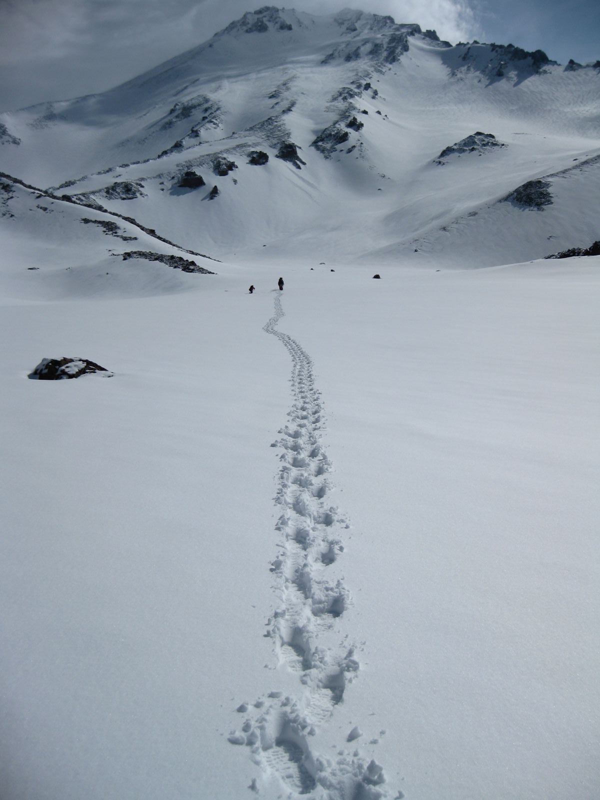
    Was this helpful?

    Yes
    No
    Thanks for your feedback!
  • Mount Whitney vs Mount Rainier: Hike vs Glacier Climb

    Mount Whitney and the Sierra Nevada above the Eastern Sierra Mount Whitney · 14,505 ft
    Mount Rainier rising above Washington with glaciers on the upper mountain Mount Rainier · 14,410 ft
    Mountain Comparison · California vs Washington · Updated 2026

    Mount Whitney vs Mount Rainier: Difficulty, Skills and Which to Climb First

    Whitney and Rainier reach nearly the same altitude, but they are not comparable climbs. Whitney is a long high-altitude hike on a trail in normal summer conditions. Rainier is a glaciated mountaineering expedition involving rope teams, crampons, crevasses, heavier loads and objective hazards. This comparison explains which is harder physically, which is harder technically, how each permit system works, what skills transfer, and the responsible progression from Whitney to Rainier.

    Two 14,000-foot peaks, two completely different objectives. Mount Whitney is a Sierra endurance and altitude test; Mount Rainier is a Cascade glacier climb.
    The direct answer

    Rainier is much harder overall. Whitney is still a serious one-day endurance and altitude test.

    Technical difficulty: Rainier by a wide margin. Objective hazard: Rainier. Total vertical and equipment demand: Rainier. Single-day hiking endurance: closer than many climbers expect, because Whitney compresses roughly 22 miles and more than 6,100 feet of ascent into one continuous effort.

    For most nontechnical hikers, the responsible sequence is Whitney first, formal snow and glacier instruction second, Mount Baker or an equivalent glacier-training climb third, and Rainier fourth. A successful Whitney climb demonstrates useful fitness and altitude tolerance; it does not demonstrate Rainier’s required technical competence.

    95 ftSummit difference
    22 miWhitney round trip
    ~9,000 ftRainier total ascent
    $15 + $6Whitney permit fees
    $82Rainier climbing fee
    2–4 daysTypical Rainier program

    Plan either mountain from the complete guide library

    Use the comparison to choose the correct objective, then move into the mountain-specific route, permit, weather, safety and acclimatization guides.

    The complete comparison scorecard

    The similar summit elevations hide major differences in route style, objective hazard, technical skill, logistics and cost.

    CategoryMount WhitneyMount RainierVerdict
    Summit elevation14,505 ft / 4,421 m14,410 ft / 4,392 mEssentially equal
    Standard routeMount Whitney TrailDisappointment Cleaver via Camp MuirDifferent sports
    Route styleMaintained hiking trail when snow-freeRoped glacier travel, snow, ice and mixed terrainRainier harder
    Round-trip distanceApproximately 22 milesApproximately 14–15 milesWhitney longer
    Total ascentMore than 6,100 ft from Whitney PortalApproximately 9,000 ft from ParadiseRainier harder
    Typical duration10–14 hour day hike or 2–3 day backpack2–4 days, depending on program and routeRainier more involved
    Technical skillsNone on a snow-free Main TrailCrampons, ice axe, rope team and glacier competenceRainier harder
    Objective hazardAltitude, exposure to weather, seasonal snow and long descentCrevasses, snow bridges, icefall, rockfall and glacier changeRainier harder
    Permit modelCompetitive reservation and lottery systemClimbing fee plus overnight wilderness reservationWhitney harder to book
    Guide required?No on the Main TrailNo legally, but strongly recommended without full glacier competenceRainier needs more support
    Typical direct fees$15 per person + $6 reservation$82 climbing fee + $12/person/night + $6 reservationRainier costs more
    Best general windowMid-July to mid-September for a snow-free trailLate May through July for many standard guided climbsDifferent seasonal windows
    Best first objectiveStrong hikers entering altitude climbingClimbers ready for a first major glacier climbWhitney first for most

    Which mountain is actually harder?

    The answer changes slightly depending on whether the question is about technical skill, danger, total effort or one-day endurance.

    Technical difficulty

    Rope, crampon and glacier skills

    Rainier

    Whitney’s summer Main Trail is walking. Rainier requires efficient movement on a rope team, crampon technique, ice-axe competence and glacier judgment.

    Objective hazard

    Hazards not fully controlled by fitness

    Rainier

    Crevasses, weak snow bridges, serac exposure, rockfall and shifting route lines make Rainier a materially more hazardous mountain.

    Total expedition demand

    Vertical, load and recovery

    Rainier

    Rainier starts lower, gains more elevation, requires heavier equipment and often asks climbers to make the summit push after limited sleep at Camp Muir.

    Single-day hiking endurance

    Continuous time on feet

    Closer than expected

    Whitney’s 22-mile day can be exhausting. It is less technical but can require more continuous hiking time than a climber expects after looking only at elevation.

    The clearest answer. Rainier is the harder mountain. Whitney can still be the harder single hiking day for someone who moves slowly, arrives poorly acclimatized or underestimates the 22-mile round trip. A comparison that says “Rainier is harder” without explaining this distinction misses why experienced Rainier climbers still take Whitney seriously.

    How will Whitney feel after climbing Rainier?

    This is the practical question behind many comparison searches: if Rainier went well, what should you expect on Whitney?

    Whitney should feel easier in these ways

    • No roped glacier travel on the snow-free Main Trail.
    • No crevasse-rescue system, harness or glacier rack.
    • Lighter pack and simpler footwear.
    • Lower objective hazard in normal summer conditions.
    • More straightforward navigation on the standard route.
    • No multi-day expedition camp system.

    Whitney can still surprise you in these ways

    • The full day may run 12–14 hours or longer.
    • The 22-mile distance creates cumulative foot and knee fatigue.
    • Much of the upper route is above 12,000 feet.
    • Dry Sierra air increases hydration demands.
    • Afternoon lightning can impose a hard turnaround schedule.
    • A same-day drive from low elevation can produce avoidable AMS.

    A climber who completed Rainier with strong reserves should normally find Whitney’s summer Main Trail technically simple and logistically light. That does not make Whitney a recovery hike. Rainier experience removes the glacier problem; it does not remove the distance, altitude or need to descend another 11 miles after the summit.

    Season changes the answer. The comparison assumes a snow-free Mount Whitney Trail. Early-season snow, ice on the switchbacks or a Mountaineer’s Route ascent changes Whitney from a long trail hike into a mountaineering or scrambling objective. Compare current conditions, not only mountain names.

    Does Whitney prepare you for Rainier?

    Yes for several physical and altitude skills. No for the technical systems that make Rainier a glacier climb.

    Skill or capacity
    Whitney tests it?
    Needed on Rainier?
    Long-day aerobic endurance
    Yes
    Yes
    Pacing above 12,000 ft
    Yes
    Yes
    Fueling and hydration under fatigue
    Yes
    Yes
    Early alpine start
    Yes
    Yes
    Long downhill durability
    Yes
    Yes
    Crampon technique
    No in summer
    Yes
    Ice-axe use and self-arrest
    No in summer
    Yes
    Roped glacier travel
    No
    Yes
    Crevasse rescue
    No
    Yes
    Moving efficiently with a heavier alpine pack
    Partly
    Yes
    Objective-hazard judgment
    Some weather exposure
    Much more important

    The correct conclusion is not “Whitney does not help.” Whitney is a valuable diagnostic climb. It reveals how you respond to altitude, whether your fueling works after ten hours, whether your feet and knees tolerate a long descent, and whether you can turn around when a schedule or symptom requires it. The missing bridge is technical instruction.

    A strong progression. Complete Whitney comfortably, take a formal snow and glacier course, climb one or more preparation peaks before Rainier, then attempt Rainier with a guide or a fully competent independent team. Whitney is the fitness and altitude checkpoint—not the final technical prerequisite.

    Elevation and effort profiles

    The summit elevations are almost equal. The starting elevations and the way the work is distributed are not.

    Mount Whitney
    6,100+ ft gain
    Whitney Portal ~8,360 ft → summit 14,505 ft · often one continuous day
    Mount Rainier
    ~9,000 ft gain
    Paradise ~5,400 ft → Camp Muir → summit 14,410 ft · multi-day glacier climb

    Whitney Portal begins almost 3,000 feet higher than Paradise. That difference explains why Whitney reaches a slightly higher summit while requiring substantially less total climbing. Rainier’s standard climb divides the ascent between the approach to Camp Muir and the overnight summit push, but the summit day occurs while wearing glacier equipment, often after only a few hours of sleep.

    Route and skill comparison

    The standard routes belong to different categories. Comparing only mileage or summit elevation hides the essential distinction.

    Mount Whitney Trail

    Whitney Portal → Trail Camp → Trail Crest → Summit. Approximately 22 miles round trip with more than 6,100 feet of ascent. In normal snow-free conditions, the route is a maintained Class 1–2 trail with no technical climbing.

    Main challenge: distance, altitude, pacing, hydration and the long return to Whitney Portal.

    Compare all Mount Whitney routes →

    Disappointment Cleaver

    Paradise → Camp Muir → Cowlitz Glacier → Ingraham Flats → Disappointment Cleaver → Columbia Crest. The exact glacier line changes as crevasses and snow bridges evolve.

    Main challenge: sustained glacier movement, technical systems, objective hazards, heavier loads and a long summit descent.

    Compare all Mount Rainier routes →

    Do not compare off-season Whitney with summer Whitney. Snow and ice can transform the Whitney Trail’s upper switchbacks and traverses. The Mountaineer’s Route is a separate Class 3 objective with route-finding and seasonal snow hazards. This page compares the standard snow-free Whitney Trail with Rainier’s standard glaciated route.

    Permits and access systems

    Whitney is generally easier to climb but harder to secure on a preferred summer date. Rainier is more expensive and administratively layered, but not governed by a comparable summit lottery.

    Permit itemMount WhitneyMount Rainier
    Permit requiredRequired year-round for day or overnight use in the Whitney Zone.Climbers must pay the climbing fee and register; overnight camping requires a wilderness permit.
    Core fee$15 per person entering the Whitney Zone.$82 per person per climb in 2026.
    Reservation fee$6 per permit reservation.$6 per wilderness reservation trip.
    Overnight chargeNo additional charge per night beyond permit fees.$12 per person per night; ages 15 and younger are free.
    Allocation systemLottery for the popular day-use and Whitney Trail overnight permit types; cancellations and later releases may become available.Camp inventory through Recreation.gov plus walk-up availability; climbers also register in person.
    Route-specific issueNorth Fork permits cover the Mountaineer’s Route and are not the same as the Whitney Trail overnight permit.The route and camps must fit current glacier conditions and available wilderness inventory.
    Main planning riskWinning the date you want.Securing camps, paying all fees and adapting to current route conditions.
    Current official fee summary. The U.S. Forest Service lists Whitney Zone reservations at $6 per permit plus $15 per person. The National Park Service lists Rainier’s 2026 climbing fee at $82 per person per climb, with overnight wilderness reservations at $12 per person per night plus $6 per trip. Always verify fees before booking because both agencies can revise schedules.

    Cost and logistics

    The permit difference is small compared with the difference in gear, instruction and guide-service costs.

    Cost categoryMount WhitneyMount Rainier
    Independent direct fees$15/person + $6 reservation, before travel and lodging.$82/person/climb + wilderness permit fees, before park travel and equipment.
    Typical guided optionOptional; day programs often begin in the hundreds of dollars, with overnight or technical routes costing more.Standard multi-day guided programs commonly cost in the low-to-mid $2,000s or more.
    Technical equipmentNormal hiking equipment in snow-free summer conditions.Mountaineering boots, crampons, ice axe, helmet, harness, carabiners, glacier layers and group rescue equipment.
    Travel baseLone Pine / Whitney Portal, California.Ashford / Paradise or White River, Washington.
    ContingencyUsually one or two flexible days for weather, road or permit changes.More valuable because glacier weather and route conditions can cancel or delay a summit attempt.
    First-time totalCan remain a relatively low-cost US highpoint trip.Often several thousand dollars when guiding, rental, travel and contingency are included.

    The cost difference reflects more than prestige. Rainier requires a commercial or independent safety system capable of managing glacier terrain. Whitney’s standard summer route can be completed with the equipment an experienced day hiker already owns. Climbers comparing guide prices should also compare instructional time, guide ratio, rental inclusions and weather policies—not only the advertised trip fee.

    Weather, snow and best season

    Whitney’s primary seasonal decision is whether the trail is snow-free. Rainier’s decision includes snow bridges, crevasse evolution, wind, precipitation and glacier-route viability.

    Whitney: Sierra summer strategy

    • Mid-July through mid-September often provides the clearest nontechnical Main Trail conditions.
    • Afternoon lightning can make an early start and summit turnaround time essential.
    • Spring and early summer snow can cover the switchbacks and change equipment needs.
    • Dry air, sun exposure and limited water high on the route increase hydration demands.

    Full Whitney weather guide →

    Rainier: glacier-window strategy

    • Late spring and early summer often provide better snow coverage over glacier features.
    • Later summer can bring larger crevasses, exposed ice and increased rockfall.
    • Upper-mountain wind and cloud can be severe while lower elevations remain pleasant.
    • The route itself can move during the season as the glacier changes.

    Full Rainier weather guide →

    Altitude and acclimatization

    A 95-foot summit difference is physiologically meaningless. The ascent schedule and starting altitude matter much more.

    Both summits are high enough to produce acute mountain sickness. Whitney Portal begins around 8,360 feet, so the standard route starts high and rises steadily to 14,505 feet. Paradise begins around 5,400 feet, and many Rainier climbers move to Camp Muir at 10,080 feet on the first climbing day before sleeping briefly and beginning the summit push.

    Altitude factorWhitneyRainier
    Starting elevationHigh trailhead near 8,360 ft.Paradise near 5,400 ft on the DC route.
    Sleeping strategyDay hikers may sleep low unless they deliberately stage in the Eastern Sierra.Most standard programs sleep at or near 10,000 ft before the summit push.
    Common mistakeDriving from sea level and beginning a 22-mile summit day immediately.Assuming a single night at Camp Muir creates full acclimatization.
    Better preparationSpend one or two nights at moderate altitude and complete an acclimatization hike.Arrive with prior altitude exposure and strong fitness; consider a longer instructional itinerary.
    Medical responseDo not ascend with worsening altitude symptoms. Descend for severe symptoms, confusion, ataxia, breathing difficulty at rest or rapid deterioration.

    Use the Whitney acclimatization guide, the Rainier acclimatization guide and the site’s general acclimatization framework to build an ascent plan appropriate to your travel origin and medical history.

    Training and gear differences

    Whitney rewards hiking volume and downhill durability. Rainier requires those qualities plus uphill load carriage and technical efficiency.

    Preparation areaWhitney emphasisRainier emphasis
    Aerobic baseLong hikes and sustained Zone 2 work.Same base, with greater weekly vertical and pack work.
    Key workout12–18 mile mountain day with 4,000–5,000 ft of gain.Back-to-back steep days carrying an alpine pack, followed by a long summit simulation.
    Downhill durabilityEssential for the 11-mile return from the summit.Essential after the summit push while still moving through glacier terrain.
    Technical practiceNot required on a snow-free Main Trail.Cramponing, self-arrest, rope-team movement, fixed lines where used and crevasse rescue.
    FootwearTrail shoes or hiking boots suited to conditions.Crampon-compatible mountaineering boots.
    Typical packDay-hiking load or backpacking load.Heavier glacier and overnight equipment.
    The best Rainier readiness test is not a treadmill number. A climber should demonstrate long-day fitness, downhill durability and the ability to learn and execute glacier systems under fatigue. Use Whitney as one physical benchmark, then add a formal glacier course and a preparation mountain.

    Which should you climb first?

    The right answer depends on your current skill set—not ambition, age or which summit looks more impressive.

    Choose Whitney first when…

    • You are a strong hiker but have no glacier experience.
    • You want to test altitude above 14,000 feet.
    • You can handle a 12–14 hour hiking day.
    • You want a lower-cost independent objective.
    • You are building toward technical mountaineering gradually.

    Choose Rainier now when…

    • You already have strong mountain fitness.
    • You have formal glacier skills or are joining a guided instructional program.
    • You are comfortable with crampons, an ice axe and rope systems.
    • You understand that weather or route conditions may end the climb.
    • Your larger goal is glacier or expedition mountaineering.
    When neither mountain is the right next step. Delay both if you have not yet completed long mountain days, have uncontrolled medical issues, cannot recognize or respond to altitude symptoms, or lack the fitness to descend safely after a turnaround. Build on local peaks before using a permit or guided trip as your deadline.

    The responsible Whitney-to-Rainier progression

    A four-stage path closes the gap between high-altitude hiking and glaciated mountaineering.

    1

    Complete Whitney well

    Finish with stable pacing, controlled altitude symptoms, working nutrition and enough reserve for the descent.

    2

    Learn snow systems

    Take formal instruction in crampons, ice axe, self-arrest, rope travel and crevasse rescue.

    3

    Climb a training glacier

    Use Mount Baker or an equivalent objective to apply the skills in real terrain before Rainier.

    4

    Attempt Rainier

    Choose a guided program or a fully competent independent team, then preserve enough schedule flexibility for weather.

    The detailed preparation ladder is in What to Climb Before Mount Rainier. After Rainier, continue with the best peaks after Mount Rainier, where objectives such as Aconcagua, Denali and international glacier peaks become part of a realistic longer-term plan.

    If your goal is Rainier within one year. Schedule Whitney early enough that it functions as an assessment rather than a final rehearsal. Leave time afterward to fix weaknesses, learn glacier systems and complete at least one snow or glacier training climb.

    Mount Whitney vs Mount Rainier FAQ

    Direct answers to the comparison questions climbers ask most often.

    Which is harder, Mount Whitney or Mount Rainier?

    Rainier is decisively harder overall because it adds glacier travel, technical equipment, objective hazards and roughly 3,000 more feet of total ascent. Whitney remains a demanding high-altitude endurance hike.

    Which is harder physically?

    Rainier usually requires greater total capacity. Whitney can be a comparable one-day endurance challenge because the standard route places 22 miles into one continuous effort.

    Which should a beginner climb first?

    A fit beginner should normally choose Whitney in snow-free summer conditions. Rainier is appropriate only through a guided instructional pathway or after the climber develops glacier competence.

    Does Whitney qualify you for Rainier?

    No. It provides evidence of endurance, altitude response and pacing. It does not provide the technical systems or glacier judgment required for an independent Rainier climb.

    Will Whitney feel easy after Rainier?

    It should feel technically easy, but the distance, altitude and long descent can still make it a serious day. Treat it as a separate endurance objective rather than a lesser version of Rainier.

    How much are the permits in 2026?

    Whitney costs $15 per person plus a $6 reservation fee. Rainier’s climbing fee is $82 per person per climb, with overnight wilderness permits costing $12 per person per night plus $6 per trip.

    Do both mountains have similar altitude risk?

    Yes, because the summits are almost the same elevation. The ascent schedule, travel from low elevation, sleeping altitude and personal susceptibility create more meaningful differences than 95 feet.

    Can Whitney be technical?

    Yes. Snow or ice on the Main Trail and any ascent of the Mountaineer’s Route can require mountaineering or scrambling skills. The nontechnical comparison applies only to normal snow-free Main Trail conditions.

    Can I climb both in the same year?

    Yes. A logical order is Whitney in summer, glacier instruction and a preparation climb, then Rainier if sufficient time remains for technical development and recovery. Do not place the climbs so close together that Whitney weaknesses cannot be corrected.

    What comes after Rainier?

    Depending on your goals, common next steps include more technical Cascade routes, Aconcagua for expedition altitude, or Denali after substantial glacier and cold-weather preparation.

    Sources, definitions and methodology

    • Mount Whitney route and permit data: U.S. Forest Service, Inyo National Forest. The official Mount Whitney page describes the 22-mile day route and 12–14 hour expectation; the wilderness permit page lists the $6 reservation fee and $15 Whitney Zone fee.
    • Mount Rainier fees and permit data: National Park Service. The 2026 climbing fee is $82 per person per climb; wilderness permits are $12 per person per night plus $6 per trip.
    • Rainier success data: The NPS recorded 10,762 climbers and 5,135 successful summits in 2018. The agency marks successful-summit totals after 2018 as no longer collected. This page therefore does not describe 48% as a current annual rate.
    • Whitney success: No official summit-completion database directly comparable with Rainier’s historic NPS data was identified. Permit success, trail starts and summit success are not interchangeable.
    • Difficulty method: The comparison separates technical difficulty, objective hazard, total expedition demand and single-day endurance rather than producing one unsupported universal score.
    • Conditions: Snow, wildfire, road access, glacier route lines and weather change. Confirm conditions with the responsible federal agency immediately before travel.

    Travis Ludlow

    Editor & Head of Research · Global Summit Guide

    Travis develops Global Summit Guide’s mountain-comparison and progression frameworks from official route records, permit systems, guide-service itineraries and climber reports. The goal of this comparison is not to make either mountain sound easy; it is to distinguish a high-altitude trail objective from a glacier climb so readers choose the correct preparation path.

    Safety and route framing reviewed by Dawson Ludlow. Altitude and medical framing reviewed by Taylor Ludlow, RN.

    Choose the climb that matches your current skills

    Use Whitney to test altitude and endurance. Use glacier instruction and preparation peaks to close the technical gap. Attempt Rainier when your fitness, skills, team and schedule all support the objective—not simply because both summits are about 14,400 feet.

    Plan Mount Whitney Build Toward Rainier
    Safety disclaimer. Mountaineering, snow travel, high-altitude hiking and glacier climbing can cause serious injury or death. This researched comparison is for planning and education, not a substitute for current agency information, professional instruction, medical advice or qualified guiding. Verify route conditions, permits, weather and equipment requirements before every climb.
    Whitney vs Rainier · simplest answer

    Similar Summit Elevation. Completely Different Mountain Problems.

    Mount Rainier is substantially harder overall. Mount Whitney’s Main Trail is a very long, high-altitude hike in normal snow-free summer conditions. Rainier’s standard summit routes are glaciated mountaineering climbs.

    Whitney asks whether you can keep walking efficiently at altitude for a very long day. Rainier adds roped glacier travel, crampons, ice-axe technique, crevasse hazard, heavier equipment, high camps and more complex weather and turnaround decisions.

    That makes Whitney an excellent progression mountain—but a Whitney summit is evidence of fitness, not proof of Rainier readiness.

    Whitney normal route Hiking
    Rainier normal routes Glacier climb
    2026 Whitney permit $15 pp
    2026 Rainier climb fee $82 pp
    Whitney → Rainier progression

    What a Strong Whitney Climb Proves—and What It Does Not

    This is the most useful way to treat Whitney if Rainier is the larger goal.

    Whitney can demonstrate

    Useful Rainier Foundations

    • Long-day aerobic endurance
    • Early-start discipline
    • Fueling and hydration over many hours
    • Movement above 14,000 feet
    • Personal response to altitude
    • Pacing on sustained elevation gain
    • Ability to descend while tired
    • Clothing and weather-management habits
    Whitney does not demonstrate

    The Skills Rainier Adds

    • Roped glacier travel
    • Crevasse awareness and rescue systems
    • Crampon efficiency on sustained snow and ice
    • Ice-axe use and self-arrest competence
    • Rope-team pacing and communication
    • Movement through changing glacier terrain
    • High-camp mountaineering systems
    • Managing objective glacial hazards
    The ideal result on Whitney: finish a strong summit day knowing that endurance and altitude were under control. Then build the technical glacier skills separately before treating Rainier as the logical next summit.
    Which one should you climb?

    Choose Whitney or Rainier Based on the Problem You Need Next

    Elevation alone is a poor way to choose between them.

    If this describes you…Better objectiveWhy
    Strong hiker but no mountaineering experienceMount Whitney It tests altitude and endurance without requiring glacier systems in normal summer trail conditions.
    You want your first 14,000-foot summitMount Whitney The standard trail provides a straightforward introduction to high-altitude pacing.
    You have already completed long high-altitude hikes comfortablyTechnical training first More hiking may not address the main gap between Whitney and Rainier.
    You have glacier training plus strong mountain fitnessMount Rainier Rainier now adds the technical and objective-hazard layer you have prepared to manage.
    You plan to climb Rainier with an instructional guided programRainier may be appropriate A guided instructional climb can teach systems, but it does not remove the need for excellent fitness and preparation.
    You struggled badly with altitude or endurance on WhitneyDo not escalate yet Fix the limiting factor before adding glaciers, heavier equipment and a more committing summit day.
    2026 logistics

    The Permit Systems Show How Different the Two Objectives Are

    Both mountains require planning, but Rainier’s system reflects an actual technical climbing operation rather than a trail quota alone.

    Planning itemMount WhitneyMount Rainier
    Primary permit / fee Whitney Zone recreation fee: $15 per person 2026 climbing fee: $82 per person per climb
    Reservation fee $6 per permit reservation $6 Recreation.gov fee when reserving wilderness camps
    Overnight camp fee Covered through the applicable Whitney wilderness permit system 2026 wilderness permit: $12 per person per night
    Lottery / quota Whitney permits are heavily quota-controlled through the annual lottery and reservation system. High-camp availability and climbing registration are part of the summit logistics.
    In-person climbing registration Follow the issued Whitney permit instructions. Rainier climbing parties must still register in person with the park after paying the climbing fee.
    For future seasons: fees can change. Use the dedicated permit pages for current numbers rather than treating this 2026 comparison as a permanent fee schedule.
    Continue the progression

    Go From the Comparison to the Exact Mountain Plan

    This page should own the Whitney-versus-Rainier decision. Route, permit, weather and mountain-specific risk questions belong on the dedicated supporting guides.

    Comparison update · October 4, 2026: clarified the central search-intent distinction—Whitney is primarily a high-altitude hiking challenge on its snow-free standard route, while Rainier is a glaciated mountaineering objective—and added a progression framework explaining what a Whitney summit does and does not demonstrate about Rainier readiness.

    Was this helpful?

    Yes
    No
    Thanks for your feedback!
Language »