
Last updated July 15, 2026
Mount Kenya Routes: Every Trail to Point Lenana and the Technical Peaks
Mount Kenya is really two mountains: a non-technical trek to Point Lenana on four walking routes, and serious rock climbing on Batian and Nelion. This guide compares every route, shows the camps and days on each, and gives the one combination most climbers should choose.
Sirimon up, Chogoria down – for almost every trekker.
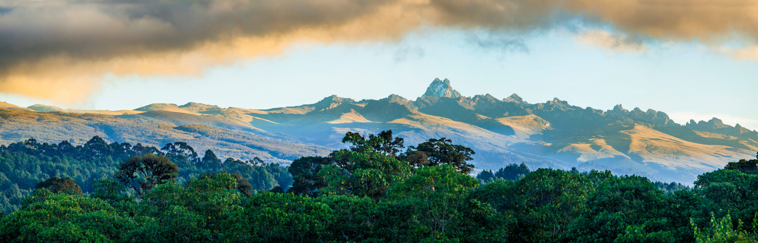
Most people “climbing Mount Kenya” are trekking to Point Lenana (4,985 m), the non-technical third summit, on one of four walking routes. The Sirimon-Chogoria traverse over 5-6 days is the best all-round choice: gentle acclimatisation up the drier Sirimon side, the mountain’s finest scenery down Chogoria, and the highest summit success (around 85-90%).
The true summits, Batian (5,199 m) and Nelion (5,188 m), are technical rock climbs in a different league, reached from the Austrian Hut with ropes, a specialist guide, and multi-pitch experience. A KWS permit and a licensed guide are mandatory on every route.
Where the mountain is
On the equator in central Kenya, about 150 km north of Nairobi, inside Mount Kenya National Park (a UNESCO World Heritage Site). The routes fan out from four sides.
Find Hotels, Flights & Trips for the World’s Best Hiking Destinations
The Global Summit Guide Travel Shop on Expedia — curated for outdoor adventurers, mountaineers, and serious hikers. Patagonia to the Alps. Nepal to the Rockies. Curated lodging for every region we cover.
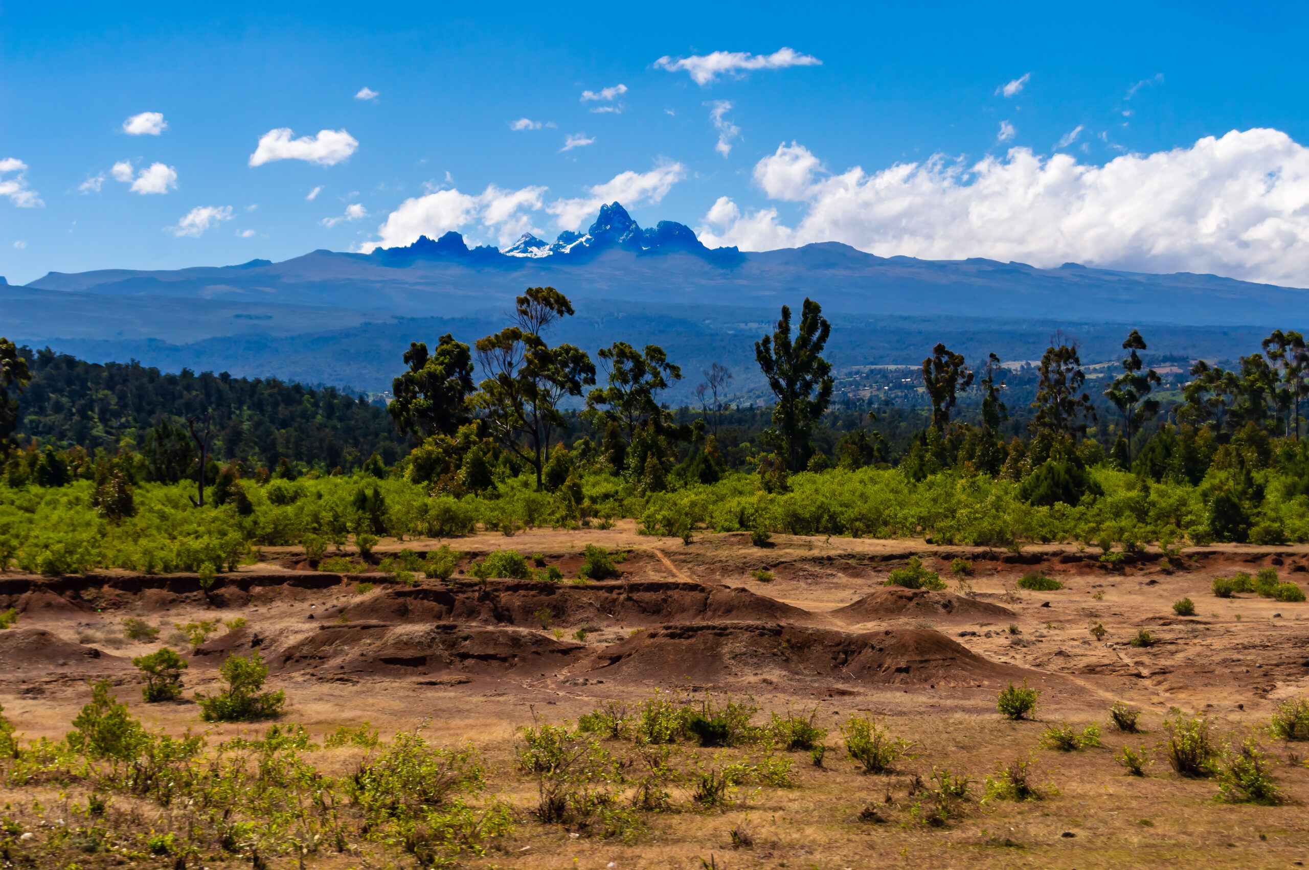
Explore Travel Shop on Expedia →Most climbers fly into Nairobi and drive 3-4 hours to a trailhead town: Nanyuki for the Sirimon and western routes, or Chogoria for the eastern route. As you climb, the mountain passes through five ecological zones, from rainforest and bamboo up through giant-heather moorland to alpine rock and shrinking glaciers. The lower slopes hold elephants and buffalo, which is why an armed park ranger walks with every group on the first days.
Current mountain conditions
A live 7-day outlook modelled for the Mount Kenya summit area. The mountain makes its own weather, so read this as a planning aid, not a summit forecast.
Mount Kenya summit area · 7-day outlook
The three summits: which one are you climbing?
This is the decision that sets everything else. Two of the three summits are rock climbs; one is a walk.
| Summit | Height | Type | Who it is for |
|---|---|---|---|
| Point Lenana | 4,985 m (16,355 ft) | Non-technical trek; steep pre-dawn final push on scree | Fit trekkers – the target for roughly 14,000-16,000 visitors a year |
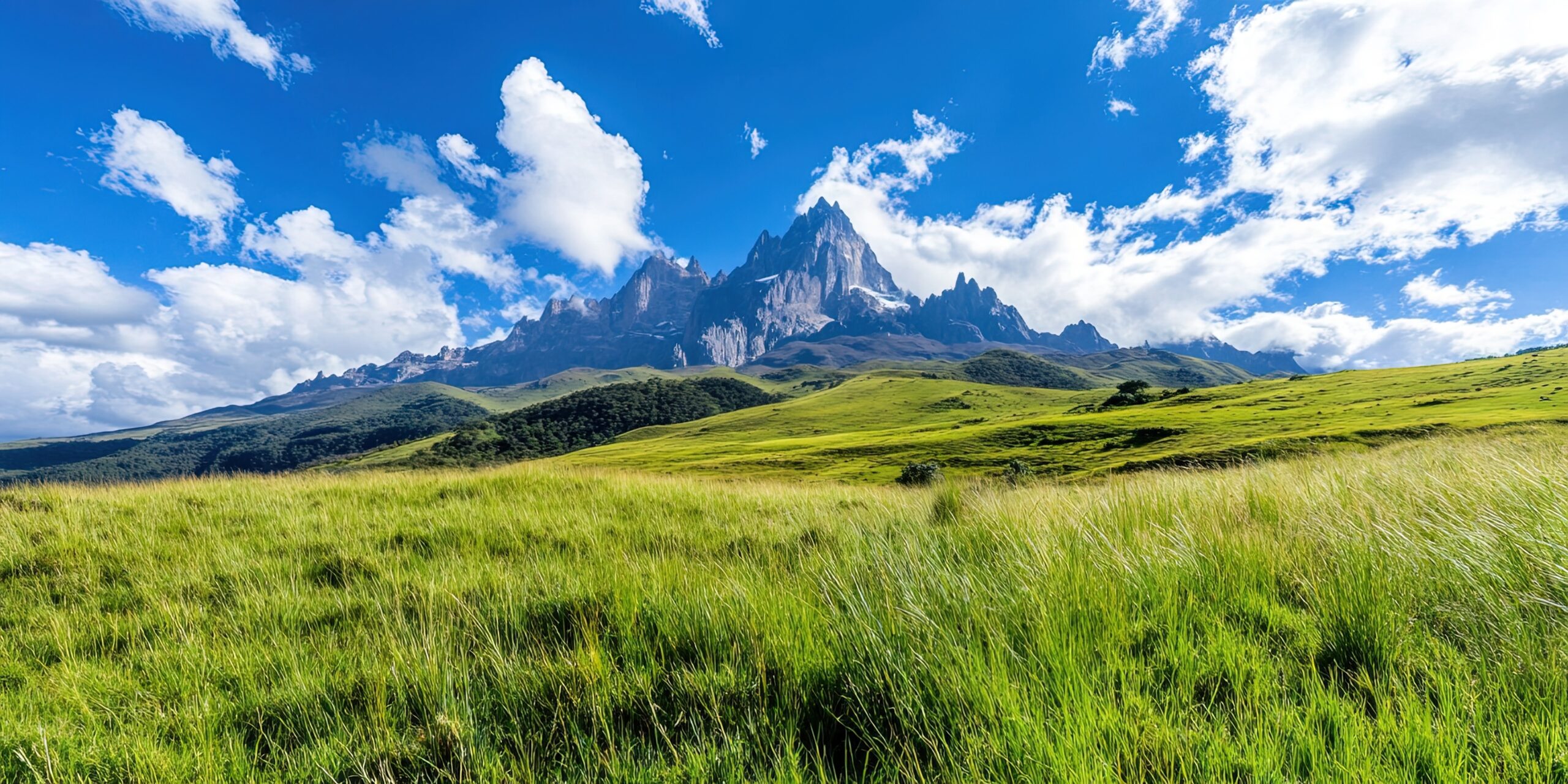
| Nelion | 5,188 m (17,021 ft) | Technical rock; South-East Face ~UIAA IV, ~18-20 pitches | Experienced climbers with a specialist guide (~200-300 a year attempt the peaks) |
| Batian (true summit) | 5,199 m (17,057 ft) | Technical rock; usually via Nelion + the Gates of Mist traverse | Alpine rock climbers – only around 50 reach it a year |
If you are a trekker, Point Lenana is your summit, and a superb one, with a sunrise panorama of the twin rock peaks, the equatorial glaciers, and the plains far below. Batian and Nelion need ropes, harnesses, rock protection, and a licensed mountaineering guide, on a 6-8 day expedition based from the Austrian Hut (~4,800 m) or Shipton’s Camp (~4,200 m). The rest of this page treats the two worlds separately: the four trekking routes to Point Lenana, then the technical lines.
The four trekking routes compared
Each of the four standard routes reaches Point Lenana from a different side, with its own character, acclimatisation profile, and scenery.
| Route | Side | Days | Character | Best for |
|---|---|---|---|---|
| Sirimon | North | 4-5 | Most gradual; steady gain; driest side | Best acclimatisation – the recommended ascent |
| Chogoria | East | 4-5 | Most scenic; Gorges Valley, Lake Michaelson, Hall Tarns | Scenery; usually used as the descent |
| Naro Moru | West | 3-4 | Fastest and steepest; the boggy “Vertical Bog” | Speed; a quick descent option |
| Burguret | Southwest | 5-6 | Wild bush travel; least crowded; route-finding | Experienced trekkers who want solitude |
Beyond these four, the lesser Timau, Meru, Kamweti and Ithanguni routes are quieter and wilder but need special Kenya Wildlife Service permission and are best arranged through an operator. Most climbers do not go up and down the same route – the classic approach combines two, which is covered further down.
Sirimon Route – the standard recommendation
The north-side route with the gentlest profile and the best acclimatisation. If you climb only one route, make it this one.
Sirimon Route
- The most gradual of the four routes, which gives the best acclimatisation and the highest single-route success.
- Climbs through montane forest and bamboo, then opens into the wide Mackinder Valley with its giant lobelia and groundsel.
- Sits on the drier, rain-shadow side of the mountain, making it the most reliable choice in the shoulder months.
- Shipton’s Camp (4,200 m) is the launch point both for the Point Lenana push and for technical climbers heading to the peaks.
- Most operators use Sirimon for the ascent and pair it with a Chogoria descent for the full traverse.
Chogoria Route – the most scenic
The eastern approach through the most dramatic landscape on the mountain. Long, and usually walked downhill.
Chogoria Route
- The most beautiful route in Kenya, passing the Nithi Falls, Lake Ellis, Hall Tarns, and the glacier-cradled Lake Michaelson.
- The Gorges Valley section is the scenic highlight of the whole massif.
- Slightly wetter than Sirimon, since the eastern slopes catch more cloud, but the scenery repays it.
- A jeep track runs from Chogoria town to the gate, shortening the forest walking.
- Because it is a long descent day past the tarns, Chogoria is the standard way down after a Sirimon ascent.
Naro Moru Route – the fastest
The quick, direct western route. Efficient, but the fast height gain is a real altitude risk.
Naro Moru Route
- The fastest and most direct route to Point Lenana, and historically the busiest, with a staffed gate and huts.
- Includes the infamous “Vertical Bog,” a steep, waterlogged stretch of tussock grass that is exhausting when wet.
- The compressed timeline gives the least acclimatisation and the highest rate of altitude sickness of the main routes.
- Passes the historic Mau Mau caves in the forest at the base of the mountain.
- Best used as a quick descent, or by climbers who have already acclimatised – not ideal as a first-time ascent.
Burguret & the lesser routes
For experienced trekkers who value solitude over infrastructure.
Burguret Route
- The least-trafficked standard route, offering a real wilderness experience with almost no crowds.
- Involves bush travel and route-finding through thick forest low down, where guides sometimes clear the path.
- The longer profile gives excellent acclimatisation, and it is often combined with a Chogoria descent.
- Camps by lava cliffs with views of Batian and Nelion from the Burguret Valley.
The remaining lines – Timau (north), Meru (northeast), Kamweti (south) and Ithanguni (east) – draw only a small share of climbers, have no staffed gates, and require special KWS permission plus a ranger for wildlife. They are trips for people who already know the mountain.
The best combination & day-by-day itinerary
Most climbers ascend one route and descend another. The Sirimon-Chogoria traverse is the one to beat.
| Combination | Days | Why choose it |
|---|---|---|
| Sirimon ↑ / Chogoria ↓ | 5-6 | The best all-round trek: gentle acclimatisation up Sirimon, the finest scenery down Chogoria, highest success (~85-90%) |
| Sirimon ↑ / Naro Moru ↓ | 5 | A faster loop: good acclimatisation up, quick descent down; less scenic than Chogoria |
| Naro Moru ↑↓ | 3-4 | The fastest option, but the steep gain raises altitude-sickness risk; for the time-pressed and well-prepared only |
Here is the classic 5-day Sirimon-up, Chogoria-down traverse, the itinerary most operators run and the one with the best odds of standing on Point Lenana at sunrise.
| Day | Stage | Elevation | Time |
|---|---|---|---|
| Day 1 | Sirimon Gate to Old Moses Camp | 2,650 → 3,300 m | 3-4 h (~9 km) |
| Day 2 | Old Moses to Shipton’s Camp via the Mackinder Valley | 3,300 → 4,200 m | 6-7 h (~14 km) |
| Day 3 | Acclimatisation day at Shipton’s (hike to Hausburg Tarn / Lower Simba Col) | 4,200 m | Half day |
| Day 4 | Summit day: Shipton’s → Point Lenana → descend to Minto’s Hut | 4,200 → 4,985 → 4,200 m | 8-10 h |
| Day 5 | Descent: Minto’s Hut to Chogoria Gate | 4,200 → 2,950 m | 6-8 h (~22 km) |
The technical routes: Batian & Nelion
A different mountain entirely. These are multi-pitch rock climbs for experienced alpinists with a specialist guide.
The two true summits sit just 140 m apart, separated by the exposed notch known as the Gates of Mist. The normal line on Nelion is the South-East Face, around UIAA IV over roughly 18-20 pitches, first climbed by Eric Shipton and Percy Wyn-Harris in 1929, and usually started from the Austrian Hut (~4,800 m) above the Lewis Glacier. Nelion is often climbed in a long day, with the tiny Howell Hut bivouac on its summit – the highest shelter in Africa – used by those continuing to Batian.
Batian, the true summit, is most often reached by climbing Nelion first, sleeping at the Howell Hut, then traversing the Gates of Mist the next morning, which adds 3-4 hours and depends heavily on how much ice is in the gap. A full technical expedition runs 6-8 days including acclimatisation, and only a few hundred climbers attempt the peaks each year, against the tens of thousands who trek Point Lenana.
Which route should you choose?
Match the route to your goal, your days, and your acclimatisation – not to a difficulty label.
First Mount Kenya trek
Sirimon up, Chogoria down, over 5-6 days with an acclimatisation night at Shipton’s. Best odds, best scenery, gentlest profile.
Short on time
Sirimon up, Naro Moru down in 5 days, or Naro Moru both ways in 3-4 if you are already acclimatised. Accept the higher altitude risk.
Want solitude
Burguret up, Chogoria down. Wild, quiet, excellent acclimatisation, and a real wilderness feel – for experienced trekkers.
Here for the summits
Batian and/or Nelion from the Austrian Hut with a specialist guide, on a 6-8 day expedition. Bring multi-pitch rock experience.
If you are weighing Mount Kenya against its taller neighbour, or thinking about it as a first big African peak, our first-big-mountain comparison and the Kilimanjaro vs Mount Kenya guide both help place it. Many climbers use Point Lenana as acclimatisation before Kilimanjaro.
Permits, guides & season
The non-negotiables, kept short – the full detail lives on the guide and weather pages.
Mount Kenya sits inside a national park, so a Kenya Wildlife Service permit and park fees are required, and a licensed local guide is mandatory on every route – independent unguided climbing is not allowed. An armed ranger accompanies groups through the wildlife zones on the lower slopes. Non-resident park entry runs about $70 per 24 hours, plus camping or hut fees, a guide at roughly $25-40 per day, and optional porters. A self-arranged Point Lenana trek lands around $400-800; a full-service guided trip roughly $800-2,500. The lesser routes need extra KWS permission.
The two dry seasons are the windows: January to February and August to September, with the long rains (April-June) and short rains (November) best avoided. July-October is the busiest stretch and best for rock on Batian; January-March suits Nelion. For a month-by-month breakdown see the dedicated weather & best season page, and to compare operators, the Mount Kenya operators guide.
Planning the trip
Use the Global Summit Guide Expedia shop to compare flights to Nairobi and lodging around Nanyuki or Chogoria. Park permits, guides, rangers, and huts are arranged through your licensed Kenyan operator, not through a travel booking.
Affiliate disclosure: Global Summit Guide may earn a commission when you book through this link, at no additional cost to you. It never affects our recommendations.
Shop Kenya Travel on ExpediaMount Kenya routes FAQ
Direct answers to the route questions climbers actually search.
What is the best route up Mount Kenya?
The Sirimon-Chogoria traverse: up the gradual, drier Sirimon Route for acclimatisation, down the scenic Chogoria Route past Lake Michaelson. Over 5-6 days it gives the highest success (~85-90%) and both sides of the mountain. Sirimon alone is the best single route.
How many routes does Mount Kenya have?
Four trekking routes to Point Lenana – Sirimon, Chogoria, Naro Moru and Burguret – plus four rarely used lines (Timau, Meru, Kamweti, Ithanguni) that need special KWS permission. Batian and Nelion are separate technical rock climbs.
Which route is fastest?
Naro Moru, at 3-4 days, is the fastest and steepest, with the “Vertical Bog.” It gives the least acclimatisation and the highest altitude-sickness risk, so it is best as a descent or for already-acclimatised climbers.
Which route is most scenic?
Chogoria, on the east – the Gorges Valley, Lake Ellis, Hall Tarns and Lake Michaelson. It is a long descent day, which is why most climbers walk it downhill after ascending Sirimon.
Do you need a guide and permit?
Yes, on every route. A KWS permit and park fees are required, a licensed guide is mandatory, and an armed ranger accompanies groups through the wildlife zones. Independent unguided climbing is not permitted.
What are the routes on Batian and Nelion?
Nelion’s normal line is the South-East Face (~UIAA IV, ~18-20 pitches) from the Austrian Hut; Batian is usually reached via Nelion and the Gates of Mist traverse. Both need multi-pitch rock skills and a specialist guide.
Research & uncertainty
Global Summit Guide has not climbed Mount Kenya. This route guide is compiled from Kenya Wildlife Service guidance, the Mountain Club of Kenya, licensed Kenyan operators, and established trekking references, cross-checked against our own Mount Kenya climbing guide. Camp elevations, distances, grades, and fees vary by source and season, and KWS fees changed in late 2025, so confirm current permit costs and route conditions with your operator and KWS before booking. Point Lenana is a trek, but altitude is a real hazard on every route.
Pick your route, then plan the climb
The route is the first decision; season, cost, and permits follow. Use the full guide for the complete plan, and the weather page to lock in your window.
Open the Mount Kenya Guide Best Time to ClimbWas this helpful?
🏔Related guides
🧭Explore & compare
Global Summit Guide is an independent mountaineering resource founded in 2026. The team combines first-hand trekking and climbing experience with in-depth research and professional health and nutrition review to help climbers choose objectives, prepare properly, and stay safe.
Health, altitude, and nutrition content is reviewed by Taylor Ludlow (Registered Nurse) and Brigg Hoopes (Nutritionist).
What We Don't Know Yet
Mountain information changes quickly. This box explains the limits of what this page can responsibly promise.
- Route conditions, trailhead access, crevasse exposure, stream crossings, and rescue access may vary from published planning guidance.
- Comparisons simplify complex decisions; the better mountain depends on current conditions, skills, timing, budget, and risk tolerance.
- Visa, passport, vaccination, border, insurance, and local transportation rules may change before your trip.
Verify current conditions with official land managers, guide services, local forecasts, and current route reports before booking or climbing.
Part of this Global Summit Guide cluster
Explore the complete Mountains guide for more context, routes, planning links, and related resources.
Mountaineering, rock and ice climbing, glacier travel, and high-altitude activity are inherently dangerous and can result in serious injury or death. The information on Global Summit Guide is provided for general informational and educational purposes only and is not a substitute for professional instruction, qualified guiding, proper equipment, or your own judgment and experience.
Route conditions, weather, snowpack, permits, regulations, and hazards change constantly and may differ from what is described here. Details may be incomplete, out of date, or contain errors. Always verify current information with local authorities, certified guides, and official sources before making any decision in the mountains.
Nothing on this site is medical, legal, or financial advice. Our fitness, acclimatization, altitude, and nutrition content is general in nature; consult a qualified physician before beginning any strenuous exercise program or exposing yourself to high altitude.
You are solely responsible for your own safety and decisions. To the fullest extent permitted by law, Global Summit Guide and its team accept no liability for any loss, injury, damage, or expense arising from use of, or reliance on, this information. By using this site you acknowledge these risks and accept these terms.
Some links on this site may be affiliate links. If you buy through them we may earn a small commission at no extra cost to you; this never affects our recommendations.
Global Summit Guide recommendation path
Next Best Mountain to Research
Use these recommendations to continue the right planning path instead of stopping on one page.
Use current permit, weather, route, and operator information before booking or climbing.